Overview
|
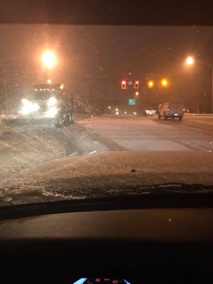
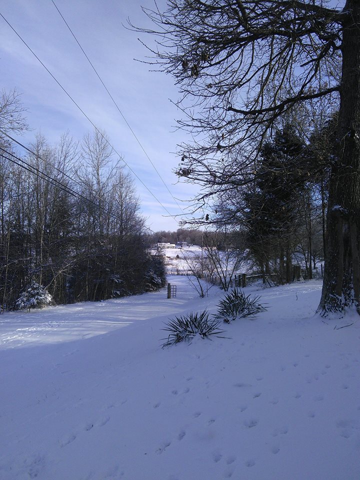
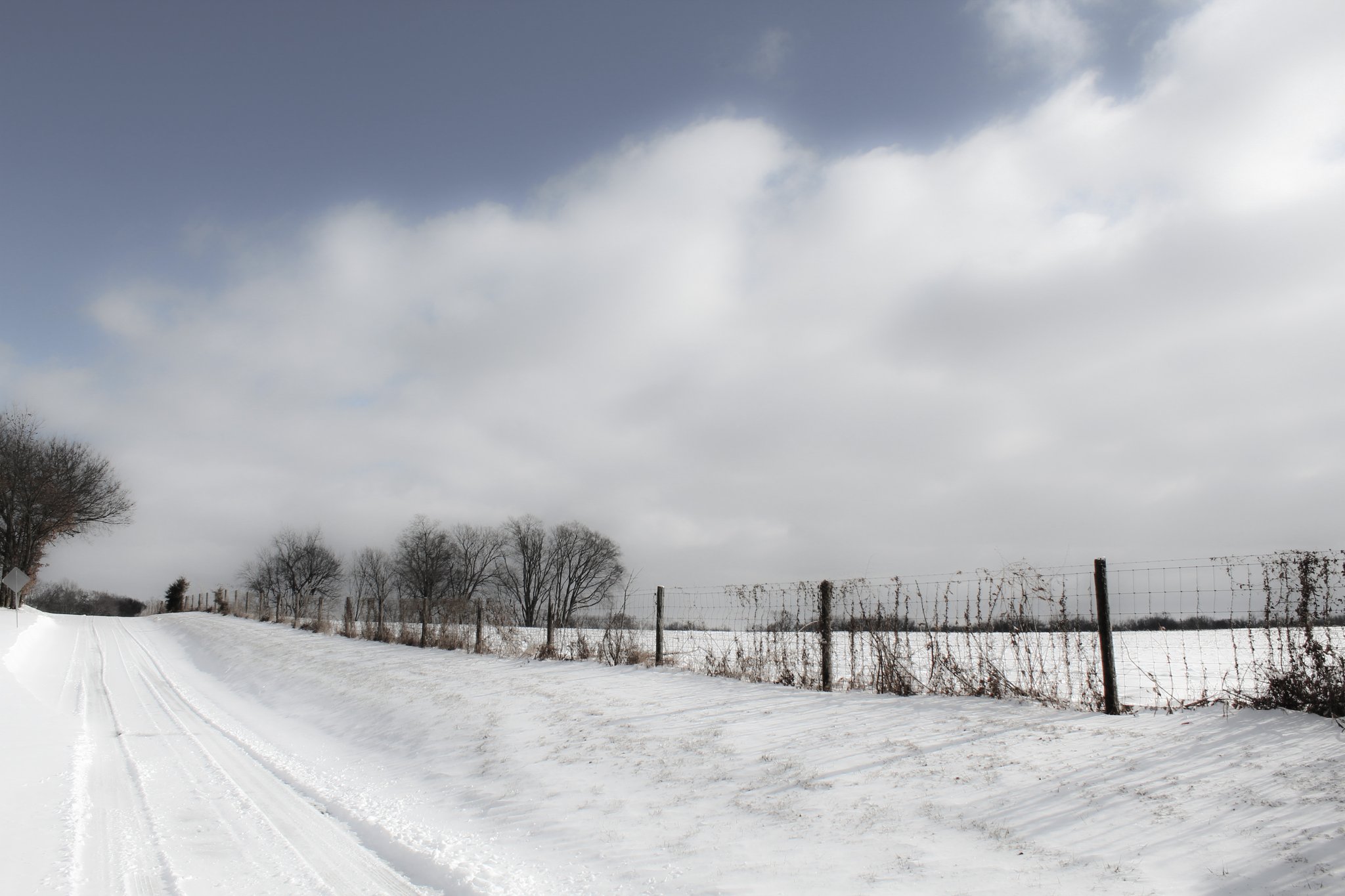
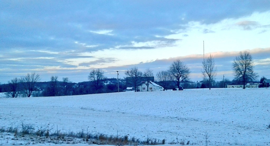
A winter storm swept through Kentucky and southern Indiana on Friday, January 12, 2018, bringing a little bit of everything: rain, freezing rain, sleet, snow, and gusty winds. Icing ranged from very little up to a quarter inch in spots. Snowfall amounts ranged from 1-6 inches across the area, generally highest west of I-65. Travel conditions were significantly impacted, especially Friday afternoon through Friday night. This weather system began as moderate rainfall for all of central Kentucky and southern Indiana Thursday into Thursday night. On Friday, as cooler air slowly pushed in from the west, the rain changed over to a wintry mix and eventually to all snow. The heaviest icing ended up on the western fringe of the I-65 corridor. Ice accumulations up to 0.20-0.25 inches occurred from the Russellville and Bowling Green areas up through western Jefferson County and into southern Indiana. Although some lost power, fortunately there were no major, long-duration power outages. The snow and ice made for very difficult travel conditions, especially later in the day on Friday. Numerous multiple-vehicle accidents occurred. As the snow wound down early Saturday, overnight low temperatures plunged into the teens. |
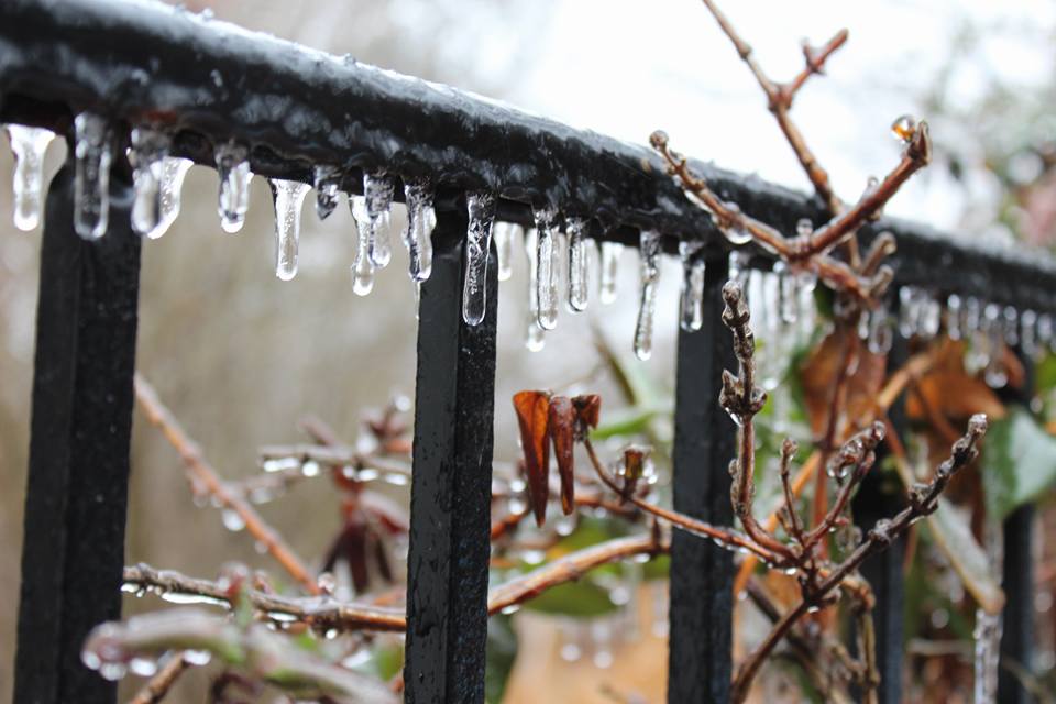
Ice in Fairdale. Photo courtesy Kerrie Ann Bal. |
Snow/Ice
Below are storm total snowfall and ice accumulations.
.png)
Photos & Video:
Ice & Snow Photos
 |
 |
 |
 |
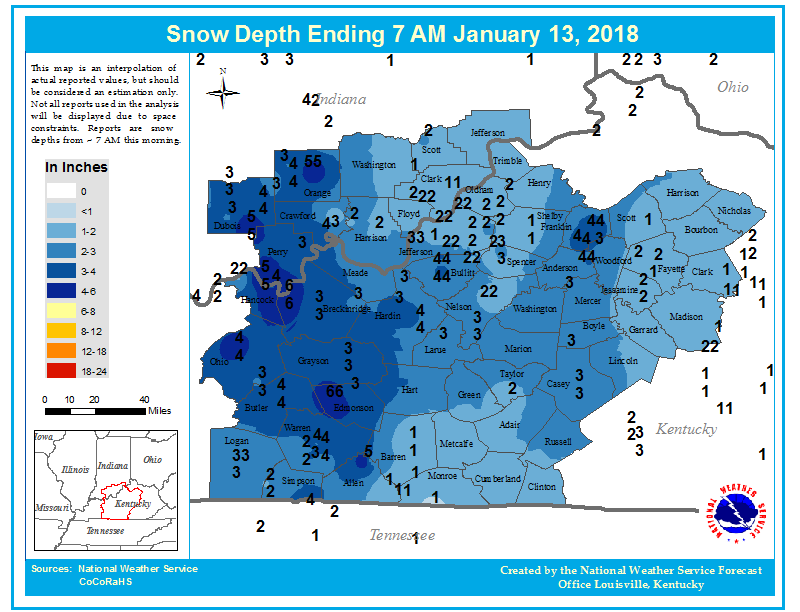
| A quarter-inch of ice accumulated on tree branches in Scottsville. Photo courtesy Jeremy Byrn |
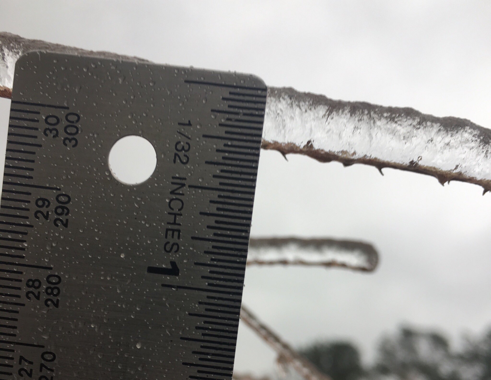
Ice accumulation on vehicles at NWS Louisville. |
Snow coming down in Fort Knox. Photo courtesy Keri Westfall |
Snowy roads in Frankfort. Photo courtesy Jason Winn |
 |
 |
 |
 |
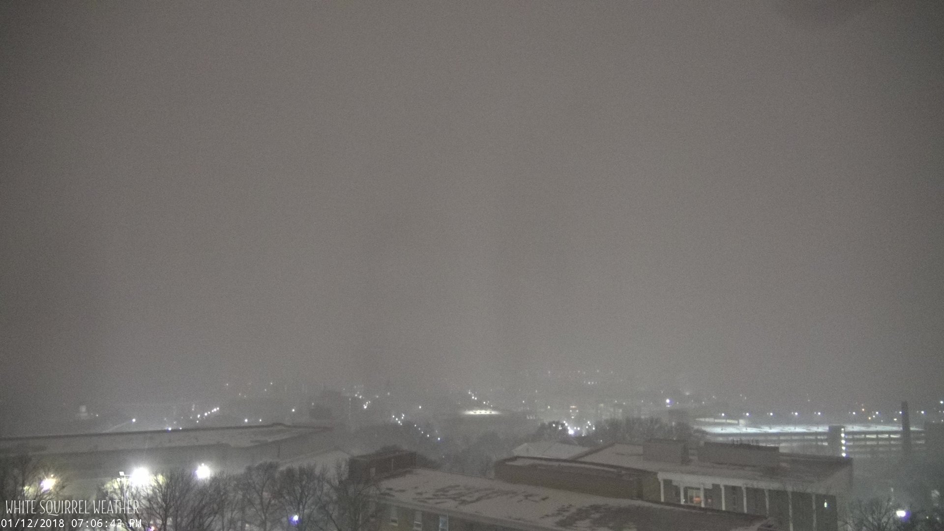
| Snowy webcam image taken at Western Kentucky University Photo courtesy White Squirrel Weather |
Brandenburg snow. Photo courtesy Bonnie Ford |
Warren County snow. Photo courtesy Chris Allen |
Near Leitchfield. Photo courtesy Dustin Knight |
Storm Reports
PRELIMINARY LOCAL STORM REPORT...SUMMARY
NATIONAL WEATHER SERVICE LOUISVILLE KY
333 PM EST SAT JAN 13 2018

..TIME...   ...EVENT...      ...CITY LOCATION...     ...LAT.LON...
..DATE...   ....MAG....      ..COUNTY LOCATION..ST.. ...SOURCE....
            ..REMARKS..

0237 PM     SNOW             1 SE BUFFALO            37.51N 85.69W
01/13/2018  M3.7 INCH        LARUE              KY   TRAINED SPOTTER


0213 PM     SNOW             CARLISLE                38.31N 84.04W
01/13/2018  E2.0 INCH        NICHOLAS           KY   LAW ENFORCEMENT

            ESTIMATED STORM TOTAL SNOWFALL.

1000 AM     SNOW             1 ESE BOWLING GREEN     36.96N 86.42W
01/13/2018  M3.6 INCH        WARREN             KY   OFFICIAL NWS OBS

            TOTAL SNOWFALL FOR BWG THROUGH 9 AM CST.

1000 AM     SNOW             SHELBYVILLE             38.22N 85.23W
01/13/2018  M1.3 INCH        SHELBY             KY   PUBLIC


0917 AM     SNOW             2 NW LYNDON             38.29N 85.61W
01/13/2018  M1.0 INCH        JEFFERSON          KY   NWS EMPLOYEE

            1.0" ON THE GROUND, 1.5" ON ELEVATED
            SURFACES. 0.1" ICE UNDER THE SNOW.

0916 AM     SNOW             HARDINSBURG             37.78N 86.46W
01/13/2018  M3.4 INCH        BRECKINRIDGE       KY   BROADCAST MEDIA


0827 AM     SNOW             4 SSE BUCKNER           38.33N 85.41W
01/13/2018  M1.5 INCH        OLDHAM             KY   PUBLIC

            0.1" OF ICE UNDER THE SNOW.

0803 AM     SNOW             NICHOLASVILLE           37.88N 84.58W
01/13/2018  E1.5 INCH        JESSAMINE          KY   PUBLIC


0751 AM     SNOW             2 NW NEW HOPE           37.66N 85.54W
01/13/2018  M3.0 INCH        NELSON             KY   TRAINED SPOTTER


0717 AM     SNOW             1 ENE LAWRENCEBURG      38.04N 84.88W
01/13/2018  M3.5 INCH        ANDERSON           KY   PUBLIC


0130 AM     SNOW             2 W ELK CREEK           38.10N 85.40W
01/13/2018  M2.5 INCH        SPENCER            KY   NWS EMPLOYEE

            NWS EMPLOYEE MEASURED 2.5 INCHES OF SNOW.

1130 PM     SNOW             7 WNW BROWNSVILLE       37.23N 86.34W
01/12/2018  M5.8 INCH        EDMONSON           KY   PUBLIC

            5.8 INCHES OF SNOW ON TOP OF A QUARTER INCH
            OF ICE.

1130 PM     FREEZING RAIN    MARTINSBURG             38.45N 86.03W
01/12/2018  E0.20 INCH       WASHINGTON         IN   CO-OP OBSERVER


1121 PM     FREEZING RAIN    4 SSE BUCKNER           38.33N 85.41W
01/12/2018  E0.10 INCH       OLDHAM             KY   PUBLIC


1115 PM     SNOW             JEFFERSONTOWN           38.21N 85.57W
01/12/2018  E2.0 INCH        JEFFERSON          KY   PUBLIC


1115 PM     SNOW             2 NNE HILLVIEW          38.10N 85.67W
01/12/2018  M2.3 INCH        JEFFERSON          KY   BROADCAST MEDIA

            SOME DRIFTS UP TO 4-5".

1107 PM     SNOW             ELIZABETHTOWN           37.70N 85.87W
01/12/2018  M3.8 INCH        HARDIN             KY   PUBLIC


1100 PM     SNOW             4 NNE ALTON             38.13N 84.91W
01/12/2018  E3.5 INCH        FRANKLIN           KY   PUBLIC


1100 PM     SNOW             2 WNW FORKS OF ELKHORN  38.22N 84.83W
01/12/2018  M3.6 INCH        FRANKLIN           KY   PUBLIC


1100 PM     SNOW             4 NNE ALTON             38.13N 84.91W
01/12/2018  M3.5 INCH        FRANKLIN           KY   PUBLIC

            CORRECTS PREVIOUS SNOW REPORT FROM 4 NNE
            ALTON.

1030 PM     SNOW             BOWLING GREEN           36.98N 86.45W
01/12/2018  M2.9 INCH        WARREN             KY   PUBLIC


1030 PM     SNOW             1 WNW LIBERTY           37.32N 84.95W
01/12/2018  E3.0 INCH        CASEY              KY   PUBLIC


1030 PM     FREEZING RAIN    1 WNW LIBERTY           37.32N 84.95W
01/12/2018  E0.25 INCH       CASEY              KY   PUBLIC

            .

1030 PM     SNOW             1 NNW SHEPHERDSVILLE    37.99N 85.72W
01/12/2018  E3.5 INCH        BULLITT            KY   PUBLIC


1030 PM     SNOW             1 WNW LAWRENCEBURG      38.04N 84.91W
01/12/2018  E3.0 INCH        ANDERSON           KY   PUBLIC


1020 PM     SNOW             1 WNW AKERSVILLE        36.66N 85.95W
01/12/2018  M1.0 INCH        ALLEN              KY   TRAINED SPOTTER


1020 PM     SNOW             1 SE CHARLESTOWN        38.44N 85.66W
01/12/2018  E1.0 INCH        CLARK              IN   PUBLIC


1015 PM     SNOW             2 NNE ABERDEEN          37.27N 86.68W
01/12/2018  M3.9 INCH        BUTLER             KY   EMERGENCY MNGR

            1/8" TO 1/4" OF ICE UNDER SNOW.

1010 PM     SNOW             SHIVELY                 38.20N 85.82W
01/12/2018  E2.0 INCH        JEFFERSON          KY   PUBLIC


1005 PM     SNOW             FERN CREEK              38.16N 85.59W
01/12/2018  E1.0 INCH        JEFFERSON          KY   PUBLIC


0955 PM     SNOW             4 E MIDDLETOWN          38.24N 85.45W
01/12/2018  M2.5 INCH        JEFFERSON          KY   TRAINED SPOTTER

            0.1" OF ICE UNDER SNOW.

0955 PM     SNOW             CLOVERPORT              37.84N 86.63W
01/12/2018  E5.5 INCH        BRECKINRIDGE       KY   PUBLIC


0955 PM     SNOW             1 SE ELIZABETHTOWN      37.69N 85.86W
01/12/2018  M1.1 INCH        HARDIN             KY   TRAINED SPOTTER


0955 PM     SNOW             1 S BROOKS              38.06N 85.72W
01/12/2018  E3.5 INCH        BULLITT            KY   PUBLIC


0950 PM     SNOW             1 ESE BARDSTOWN         37.81N 85.45W
01/12/2018  M1.5 INCH        NELSON             KY   PUBLIC


0945 PM     SNOW             2 S SAINT JOSEPH        38.36N 85.81W
01/12/2018  M2.0 INCH        FLOYD              IN   TRAINED SPOTTER

            0.25" OF ICE UNDER THE SNOW.

0945 PM     SNOW             1 NW VALLEY STATION     38.12N 85.87W
01/12/2018  M2.5 INCH        JEFFERSON          KY   TRAINED SPOTTER

            0.73" OF SNOW FELL IN THE PAST 60 MIN.

0945 PM     FREEZING RAIN    2 S SAINT JOSEPH        38.36N 85.81W
01/12/2018  E0.25 INCH       FLOYD              IN   TRAINED SPOTTER


0940 PM     FREEZING RAIN    4 NW LIBERTY            37.36N 84.99W
01/12/2018  E0.10 INCH       CASEY              KY   TRAINED SPOTTER


0940 PM     SNOW             4 NW LIBERTY            37.36N 84.99W
01/12/2018  M0.5 INCH        CASEY              KY   TRAINED SPOTTER

            0.1" OF ICE UNDER THE SNOW.

0916 PM     SNOW             2 N ALTON               38.11N 84.93W
01/12/2018  M1.5 INCH        FRANKLIN           KY   TRAINED SPOTTER


0910 PM     SNOW             LAWRENCEBURG            38.04N 84.90W
01/12/2018  M2.0 INCH        ANDERSON           KY   PUBLIC

            REPORTED AT LAWRENCEBURG, KY.

0905 PM     SNOW             3 NNE BEDA              37.54N 86.92W
01/12/2018  M4.3 INCH        OHIO               KY   TRAINED SPOTTER

            4" OF SNOW WITH 0.25" OF SLEET UNDER IT.

0905 PM     SNOW             3 NNW RICH POND         36.94N 86.51W
01/12/2018  M2.3 INCH        WARREN             KY   PUBLIC

            NEAR WBKO TV STATION.

0900 PM     SNOW             PAOLI                   38.56N 86.47W
01/12/2018  M5.0 INCH        ORANGE             IN   BROADCAST MEDIA

            REPORTED AT PAOLI, IN.

0856 PM     SNOW             1 WNW TELL CITY         37.95N 86.77W
01/12/2018  M5.0 INCH        PERRY              IN   PUBLIC

            REPORTED AT TELL CITY.

0855 PM     SNOW             1 NNE RUSSELLVILLE      36.86N 86.89W
01/12/2018  M2.5 INCH        LOGAN              KY   COCORAHS

            0.25" OF ICE WITH 0.5" OF SLEET ON TOP. 2"
            OF SNOW ON TOP OF THE SLEET AND ICE.

0850 PM     SNOW             LA GRANGE               38.41N 85.38W
01/12/2018  M1.0 INCH        OLDHAM             KY   PUBLIC

            REPORTED AT LA GRANGE, KY.

0845 PM     SNOW             SHEPHERDSVILLE          37.99N 85.72W
01/12/2018  E2.0 INCH        BULLITT            KY   PUBLIC

            REPORTED NEAR SHEPHERDSVILLE, KY.

0840 PM     SNOW             PEWEE VALLEY            38.31N 85.49W
01/12/2018  M1.5 INCH        OLDHAM             KY   PUBLIC

            REPORTED AT PEEWEE VALLEY.

0835 PM     SNOW             LEITCHFIELD             37.48N 86.29W
01/12/2018  M3.4 INCH        GRAYSON            KY   PUBLIC

            REPORTED AT LEITCHFIELD.

0830 PM     SNOW             MOUNT WASHINGTON        38.05N 85.55W
01/12/2018  E2.0 INCH        BULLITT            KY   PUBLIC

            ESTIMATED SNOWFALL REPORT NEAR MT.
            WASHINGTON, KY.

0830 PM     SNOW             3 SE CORINTH            36.75N 86.74W
01/12/2018  E2.0 INCH        SIMPSON            KY   PUBLIC

            REPORTED AT MIDDLETON, KY.

0815 PM     SNOW             FRENCH LICK             38.55N 86.61W
01/12/2018  E4.0 INCH        ORANGE             IN   PUBLIC

            ESTIMATED SNOWFALL REPORT.

0810 PM     SNOW             2 S PROSPECT            38.32N 85.60W
01/12/2018  E1.5 INCH        JEFFERSON          KY   PUBLIC

            ESTIMATED SNOWFALL REPORT.

0805 PM     SNOW             CLARKSON                37.49N 86.22W
01/12/2018  M1.0 INCH        GRAYSON            KY   TRAINED SPOTTER

            1" OF SNOW ON TOP OF 0.1" OF ICE.

0805 PM     SNOW             2 NE LOUISVILLE         38.24N 85.71W
01/12/2018  E2.0 INCH        JEFFERSON          KY   PUBLIC

            ESTIMATED SNOW REPORT NEAR CHEROKEE PARK.

0805 PM     SNOW             CLARKSON                37.49N 86.23W
01/12/2018  M1.0 INCH        GRAYSON            KY   TRAINED SPOTTER

            1" OF SNOW ON TOP OF 0.1" OF ICE.

0745 PM     SNOW             1 E SHIVELY             38.20N 85.79W
01/12/2018  E0.5 INCH        JEFFERSON          KY   PUBLIC

            ESTIMATED SNOWFALL REPORT.

0735 PM     SNOW             1 SE GLASGOW            36.99N 85.91W
01/12/2018  M0.6 INCH        BARREN             KY   PUBLIC

            REPORTED AT GLASGOW, KY.

0720 PM     SNOW             1 ENE CROMWELL          37.34N 86.79W
01/12/2018  M3.0 INCH        OHIO               KY   PUBLIC

            REPORTED AT CROMWELL, KY.

0700 PM     SNOW             PILOT KNOB              38.29N 86.35W
01/12/2018  E1.3 INCH        CRAWFORD           IN   PUBLIC

            SNOW IS ON TOP OF 1/16" OF ICE.

0645 PM     SNOW             CORYDON                 38.21N 86.12W
01/12/2018  E1.0 INCH        HARRISON           IN   PUBLIC

            ESTIMATED SNOWFALL REPORT.

0619 PM     SNOW             RUSSELLVILLE            36.85N 86.89W
01/12/2018  M1.0 INCH        LOGAN              KY   PUBLIC

            1" OF SNOW AND 0.5" OF SLEET REPORTED ON TOP
            OF EARLIER GLAZE OF 0.25" ICE.

0615 PM     SNOW             MEMPHIS                 38.49N 85.76W
01/12/2018  M0.6 INCH        CLARK              IN   PUBLIC

            REPORTED AT MEMPHIS, IN.

0600 PM     SNOW             1 NE FERDINAND          38.24N 86.85W
01/12/2018  E5.0 INCH        DUBOIS             IN   PUBLIC

            ESTIMATED SNOW REPORT JUST NORTHEAST OF
            FERDINAND, IN.

0555 PM     SNOW             LEWISPORT               37.94N 86.90W
01/12/2018  E2.0 INCH        HANCOCK            KY   PUBLIC

            REPORTED AT LEWISPORT.

0545 PM     SNOW             2 SSE GUSTON            37.86N 86.20W
01/12/2018  E1.0 INCH        MEADE              KY   PUBLIC

            ABOUT 1" OF SNOW ON THE GROUND NEAR 60 AND
            1238.

0455 PM     SNOW             1 SE ELIZABETHTOWN      37.69N 85.86W
01/12/2018  E0.5 INCH        HARDIN             KY   PUBLIC

            REPORTED AT ELIZABETHTOWN, KY.

0445 PM     SNOW             HILLHAM                 38.51N 86.70W
01/12/2018  E2.3 INCH        DUBOIS             IN   PUBLIC

            REPORTED AT HILLHAM, IN.

0445 PM     SNOW             CELESTINE               38.39N 86.78W
01/12/2018  E4.0 INCH        DUBOIS             IN   EMERGENCY MNGR

            SOME SLEET INCLUDED IN DEPTH.

0445 PM     SNOW             PORTERSVILLE            38.50N 86.98W
01/12/2018  M3.3 INCH        DUBOIS             IN   EMERGENCY MNGR

            3" SNOW REPORTED ON TOP OF 0.25" SLEET.

0430 PM     SNOW             1 SE WICKLIFFE          38.35N 86.62W
01/12/2018  E2.0 INCH        CRAWFORD           IN   BROADCAST MEDIA

            ESTIMATED SNOWFALL ON STATE ROAD 145 JUST
            SOUTH OF PATOKA LAKE IN CRAWFORD COUNTY.

0415 PM     FREEZING RAIN    1 NNW BOWLING GREEN     36.99N 86.45W
01/12/2018  M0.20 INCH       WARREN             KY   BROADCAST MEDIA

            MEASURED BY METEOROLOGY STAFF ON WKU CAMPUS.

0345 PM     FREEZING RAIN    SCOTTSVILLE             36.75N 86.20W
01/12/2018  M0.25 INCH       ALLEN              KY   PUBLIC

            PIC VIA SOCIAL MEDIA.
 |
Media use of NWS Web News Stories is encouraged! Please acknowledge the NWS as the source of any news information accessed from this site. |
|


 Weather Story
 Weather Map
 Local Radar