Overview
|
A line of strong to severe thunderstorms rolled through southern Indiana and central Kentucky during the afternoon hours of December 31st, 2018. In addition to strong straight line wind gusts that caused sporadic tree damage in the region, a brief, small EF-1 tornado touched down in Harrison County, IN, and caused structural damage to several buildings, as well as uprooting and snapping trees. |
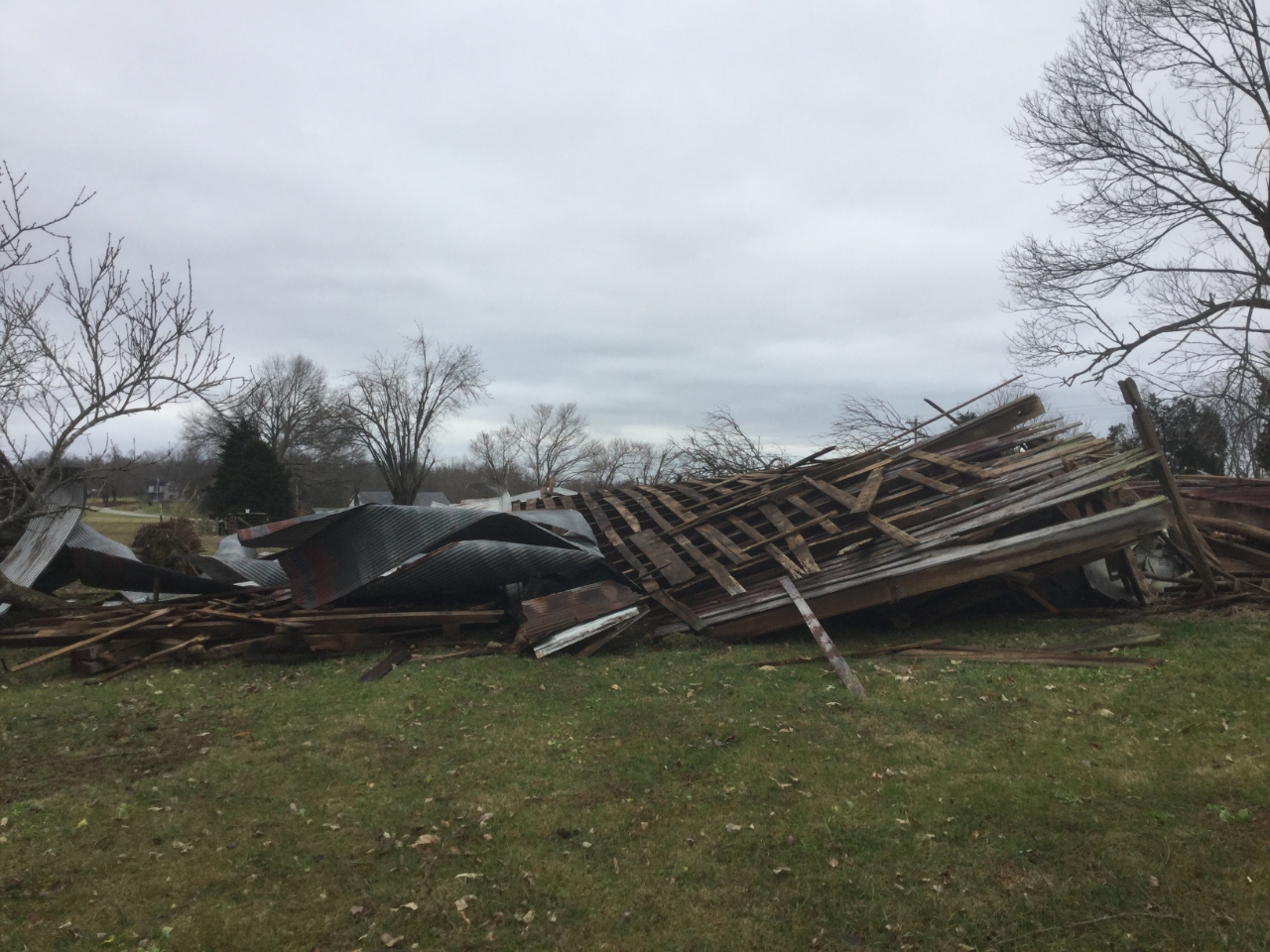 Barn damage near Dogwood from an EF-1 tornado in Harrison County, Indiana. |
Tornadoes:
|
|
||||||||||
|
||||||||||
|
Tornado - Near Dogwood, IN
Track Map 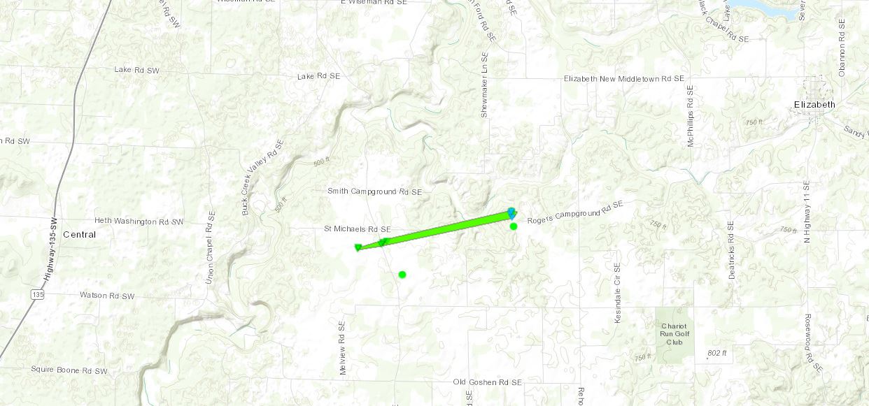 
|
||||||||||||||||
The Enhanced Fujita (EF) Scale classifies tornadoes into the following categories:
| EF0 Weak 65-85 mph |
EF1 Moderate 86-110 mph |
EF2 Significant 111-135 mph |
EF3 Severe 136-165 mph |
EF4 Extreme 166-200 mph |
EF5 Catastrophic 200+ mph |
 |
|||||
Photos & Video
Header
 |
 |
|
 |
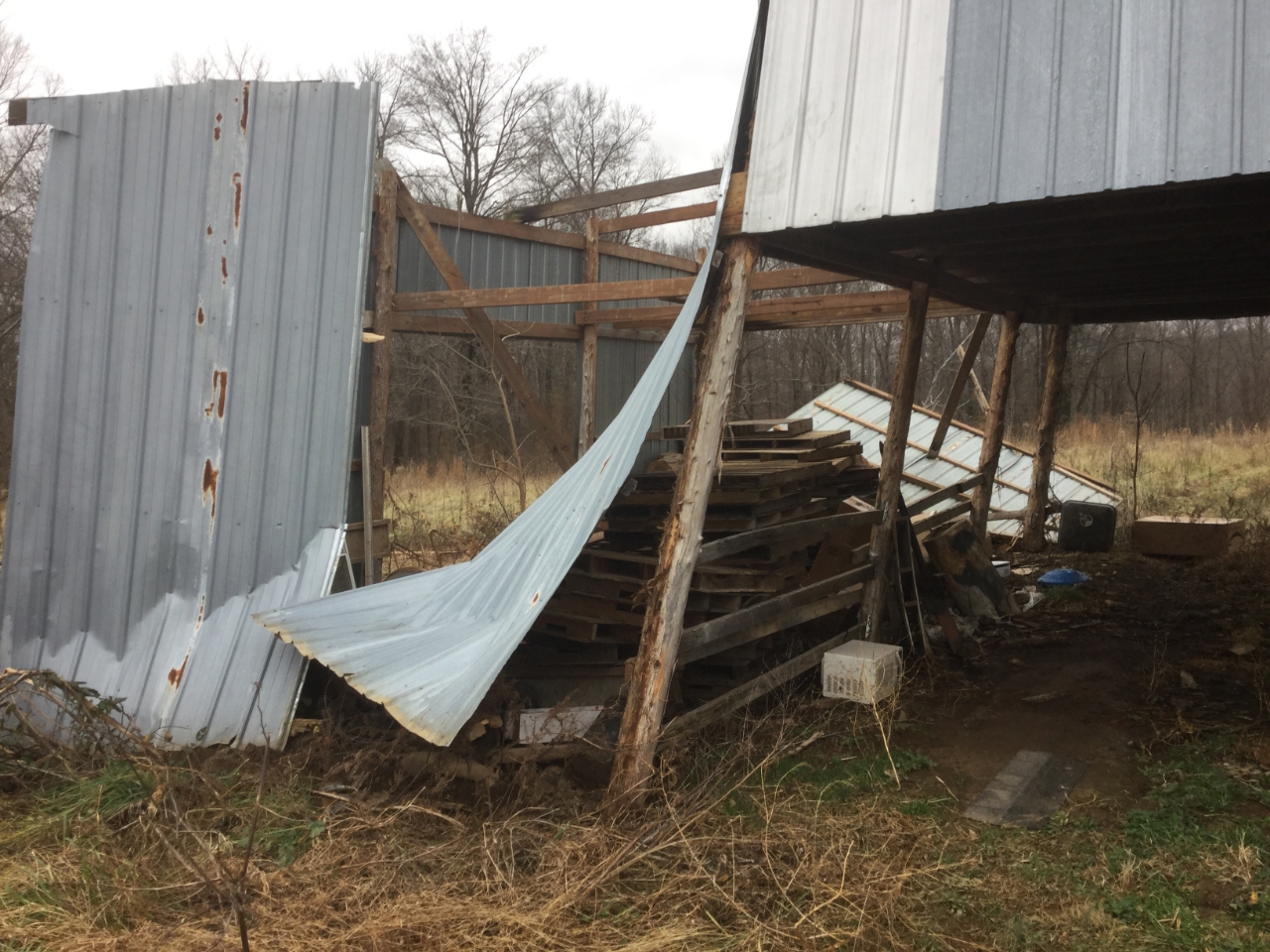
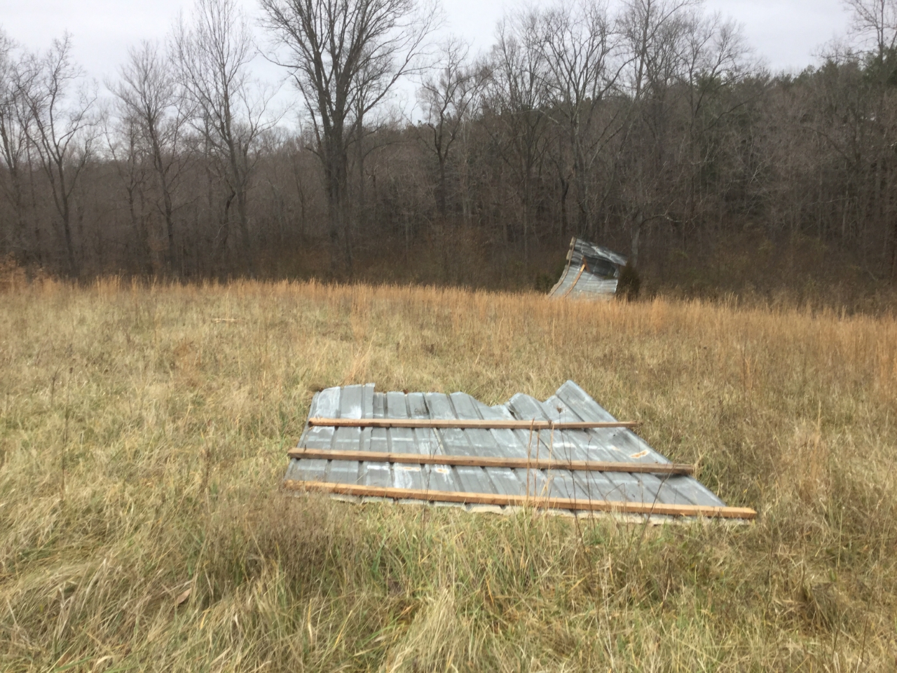
| Tornado damage to a barn east of Dogwood, IN. | Debris from a barn tossed into a field from a tornado east of Dogwood, IN. | Tornado damage to a barn near Dogwood, IN. | Straight line wind damage to a barn near Mauckport, Indiana. |
Radar
Header
 |
 |
 |
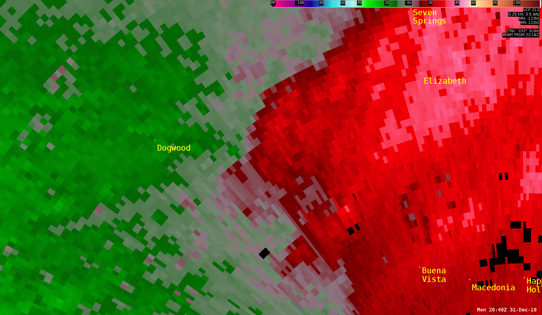 |
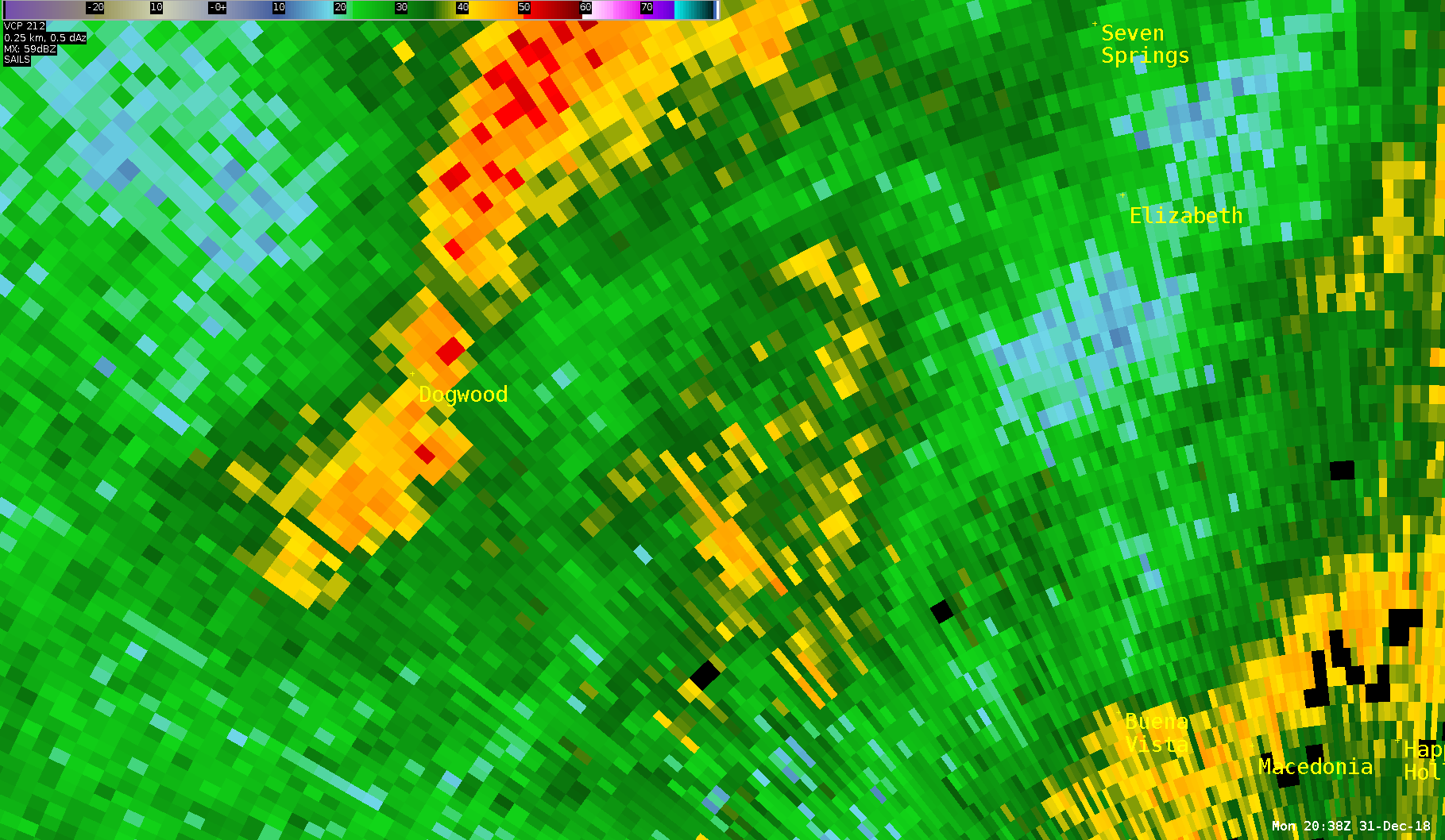
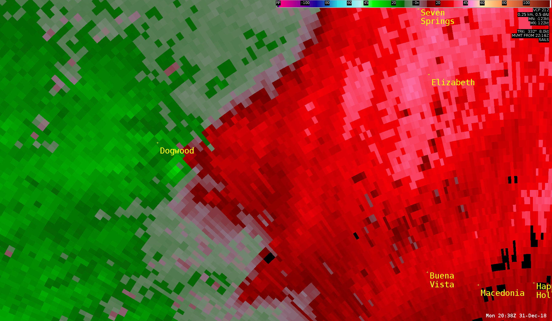
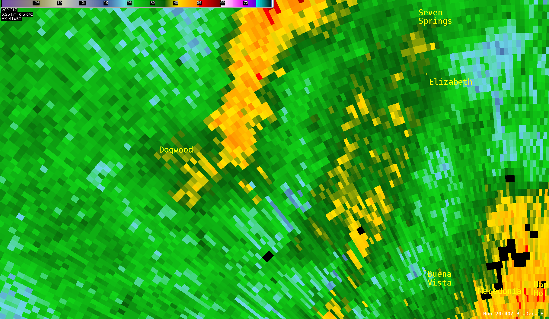
| KLVX Reflectivity at 3:38pm EST when the tornado touches down near Dogwood, IN. | KLVX Velocity at 3:38pm EST when the tornado touches down near Dogwood, IN. | KLVX Reflectivity at 3:40pm EST as the tornado begins to dissipate Dogwood, IN. | KLVX Velocity at 3:40pm EST as the tornado touches down in Dogwood, IN. |
Storm Reports
..TIME...   ...EVENT...      ...CITY LOCATION...     ...LAT.LON...
..DATE...   ....MAG....      ..COUNTY LOCATION..ST.. ...SOURCE....
            ..REMARKS..

0255 PM     TSTM WND DMG     CLOVERPORT              37.83N 86.63W
12/31/2018                   BRECKINRIDGE       KY   911 CALL CENTER

            TREES DOWN.

0305 PM     TSTM WND GST     1 WSW WOODBURY          37.18N 86.66W
12/31/2018  M53 MPH          BUTLER             KY   MESONET

            53 MPH GUST RECORDED AT KYMESONET SITE IN
            BUTLER COUNTY.

0305 PM     TSTM WND GST     ENGLISH                 38.33N 86.46W
12/31/2018  E50 MPH          CRAWFORD           IN   TRAINED SPOTTER

            REPORTED AT ENGLISH, INDIANA.

0307 PM     TSTM WND DMG     1 ESE STEPHENSPORT      37.91N 86.52W
12/31/2018                   BRECKINRIDGE       KY   911 CALL CENTER

            TREES DOWN.

0315 PM     TSTM WND GST     3 E HARTFORD            37.45N 86.84W
12/31/2018  M50 MPH          OHIO               KY   MESONET

            50 MPH GUST RECORDED AT KYMESONET SITE.

0320 PM     TSTM WND DMG     1 E PAYNEVILLE          37.98N 86.30W
12/31/2018                   MEADE              KY   911 CALL CENTER

            TREE DOWN ON SACKLER ROAD NEAR PAYNEVILLE,
            IN.

0327 PM     TSTM WND DMG     1 WSW SWEEDEN           37.24N 86.30W
12/31/2018                   EDMONSON           KY   911 CALL CENTER

            1 TREE DOWN COMPLETELY BLOCKING P LINDSEY
            ROAD AND ANOTHER TREE DOWN BLOCKING POPLAR
            SPRINGS ROAD. BOTH IN SWEEDEN AREA. TIME
            ESTIMATED FROM RADAR.

0338 PM     TORNADO          DOGWOOD                 38.10N 86.09W
12/31/2018                   HARRISON           IN   NWS STORM SURVEY

            AN EF-1 TORNADO TOUCHED DOWN NEAR DOGWOOD,
            IN DESTROYING MULTIPLE TREES, DAMAGING
            MULTIPLE BARNS/OUTBUILDINGS, AND DAMAGING A
            MARTIN HOUSE AND CHICKEN HOUSE ALONG ITS 2.2
            MILE PATH. MAX WIND SPEED WAS 100 MPH WITH
            MAX PATH WIDTH 140 YARDS.

0346 PM     TSTM WND DMG     1 NNE BOWLING GREEN     36.99N 86.43W
12/31/2018                   WARREN             KY   PUBLIC

            MORE THAN 4000 CUSTOMERS REPORTED WITHOUT
            POWER IN WARREN COUNTY.

0414 PM     TSTM WND DMG     1 E ELK CREEK           38.10N 85.35W
12/31/2018                   SPENCER            KY   911 CALL CENTER

            TREE DOWN BLOCKING ROADWAY ON NORMANDY RD
            NEAR TAYLORSVILLE KY.

0425 PM     TSTM WND GST     3 SW SIMPSONVILLE       38.19N 85.40W
12/31/2018  M53 MPH          SHELBY             KY   MESONET

            53 MPH GUST RECORDED AT KYMESONET SITE NEAR
            FINCHVILLE (SHELBY CO).
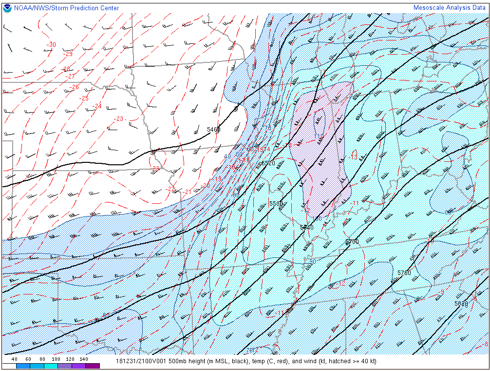
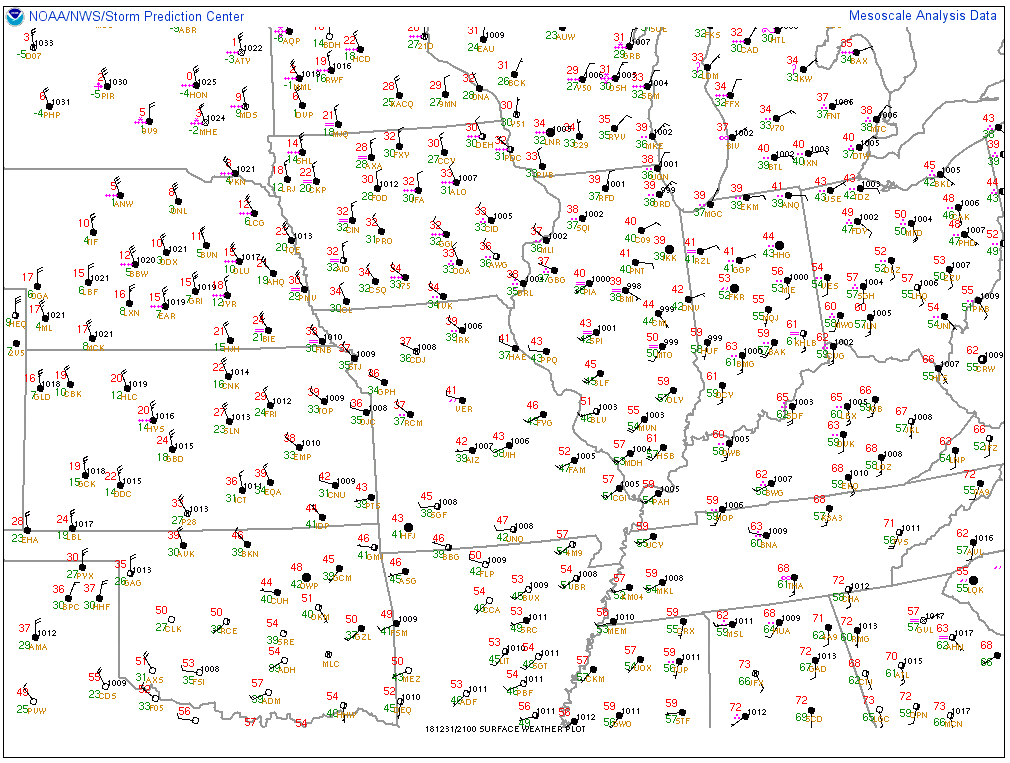
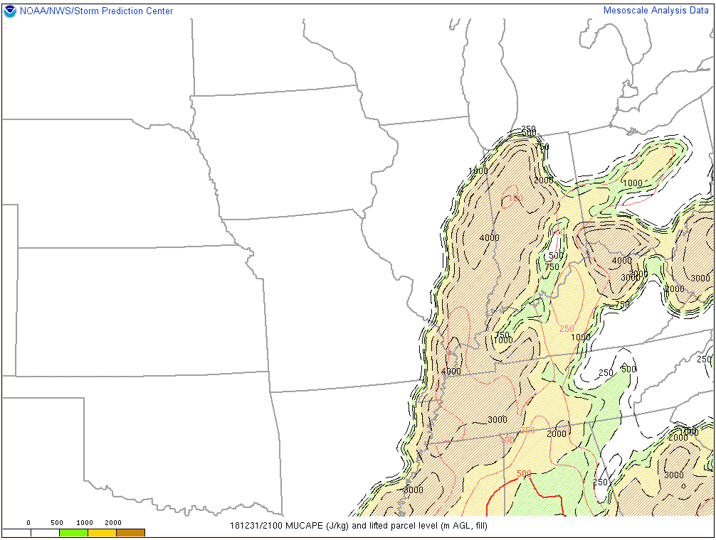
Environment
Insert synoptic summary.
 |
 |
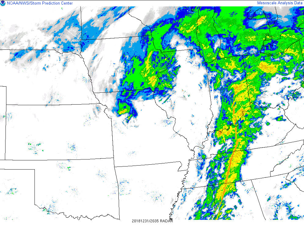 |
| Figure 1: 500mb Model Analysis (21z) | Figure 2: Surface Observations (21z) | Figure 3: Regional Radars (2030z) |
 |
 |
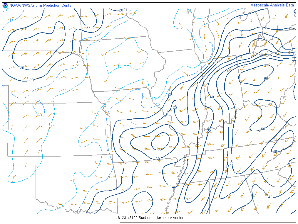 |
| Figure 4: MUCAPE/LPL Height (21z) | Figure 5: Effective Bulk Shear (21z) | Figure 6: 0-1km Shear Vector (21z) |
 |
Media use of NWS Web News Stories is encouraged! Please acknowledge the NWS as the source of any news information accessed from this site. |
|


 Weather Story
 Weather Map
 Local Radar