Overview
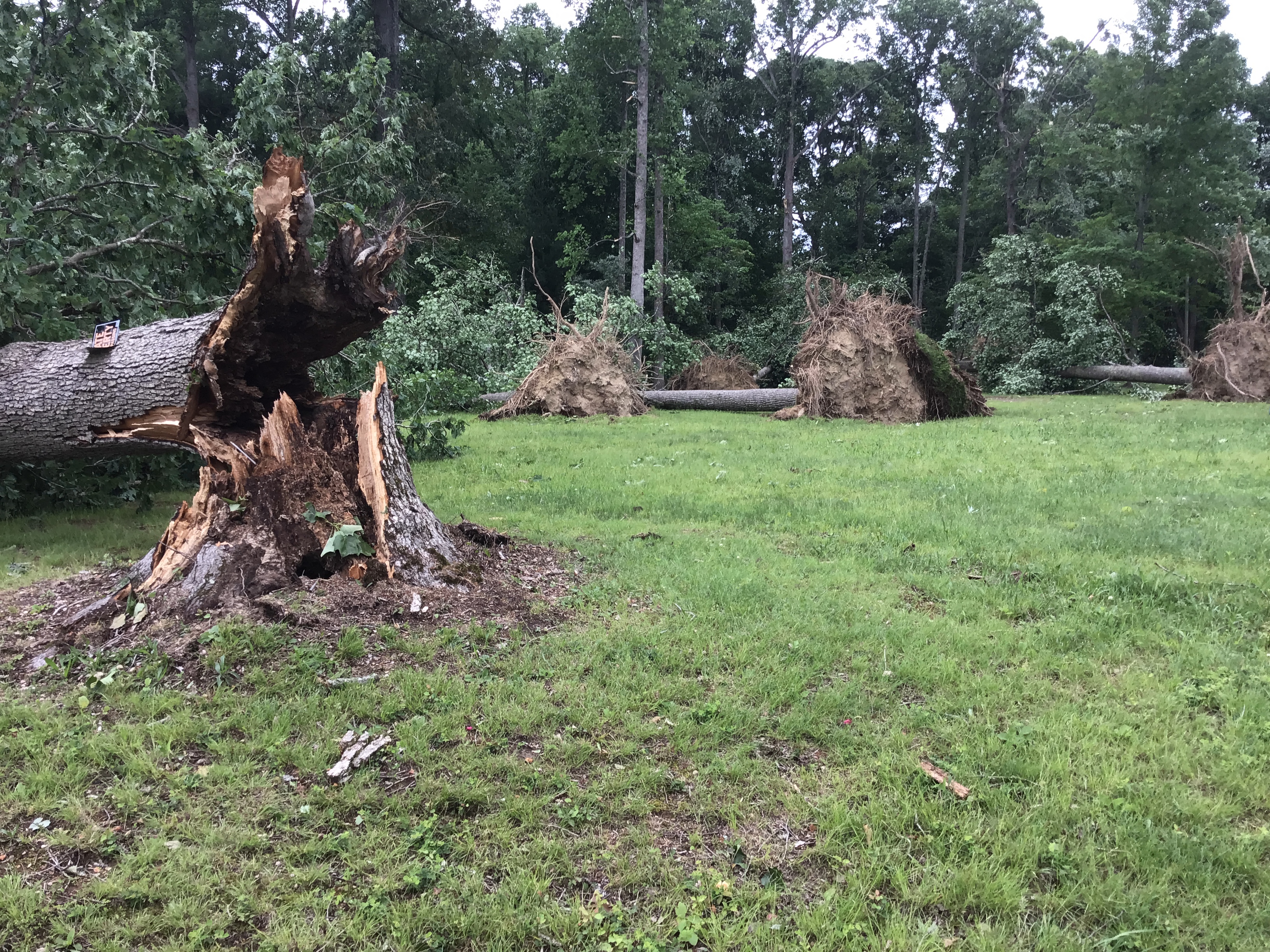
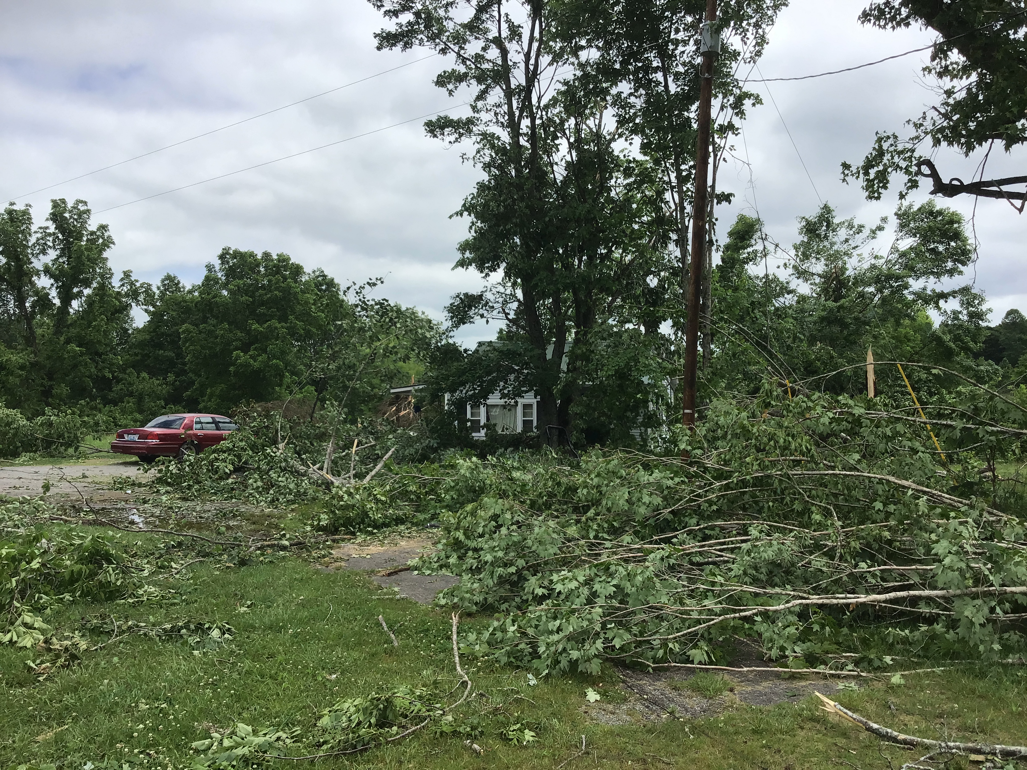
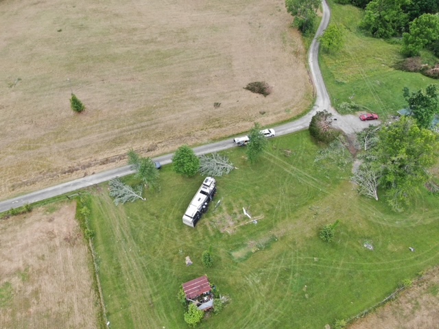
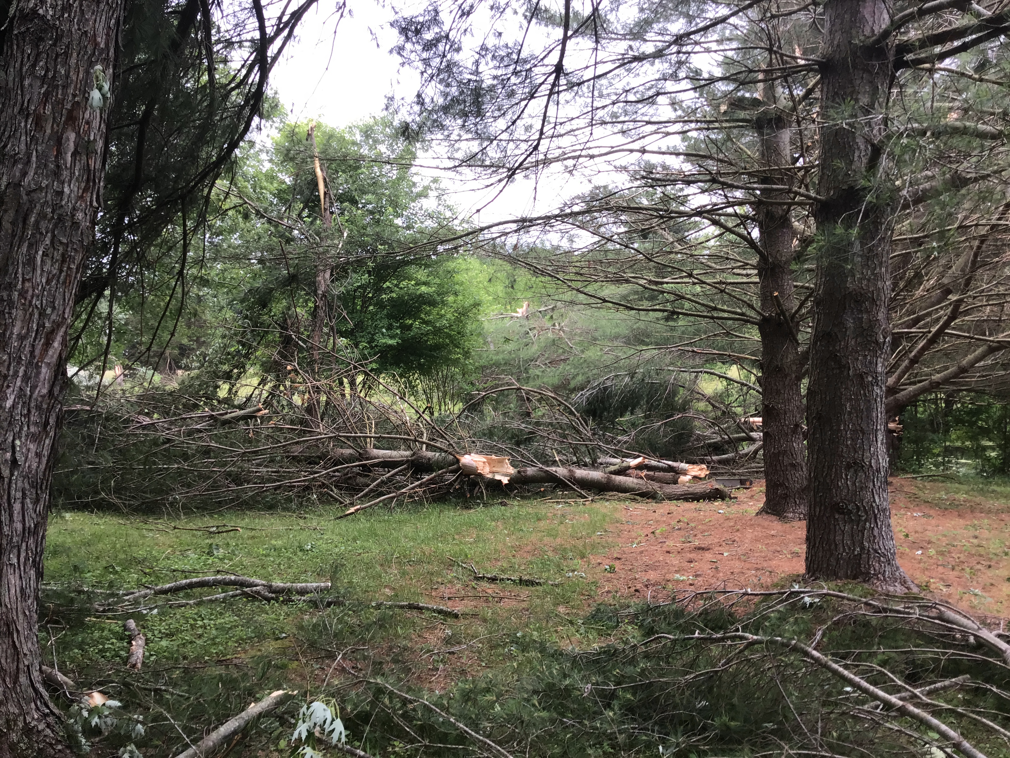
Strong to severe thunderstorms impacted portions of central Kentucky on Thursday, May 26, 2022. A concentrated area of damage occurred in Adair County where a microburst with winds up to 85mph downed many trees. Sporadic damage continued northeastward through central Kentucky with these storms the remainder of the afternoon.
Microburst:
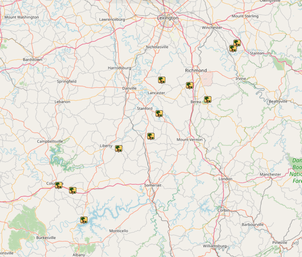
Interactive Damage Survey Map - Zoom in and click the points to see damage information and pictures. All damage points are preliminary at this time. Performance of this map may be slow due to heavy internet traffic. **Zoom in to see very small, brief tornadoes.**

|
Severe Thunderstorm Winds
|
||||||||||||||
Photos & Video
Header
 |
 |
 |
 |
| Trees uprooted near Russell Springs Road (NWS Louisville) |
Tree branches snapped near Wheat Road (NWS Louisville) |
Trees snapped near Raines Road (NWS Louisville) |
Tree branches snapped near Gentry Mill Road (NWS Louisville) |
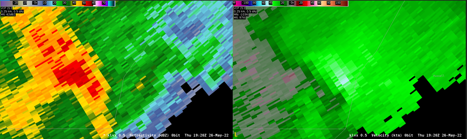
Radar
Header
 |
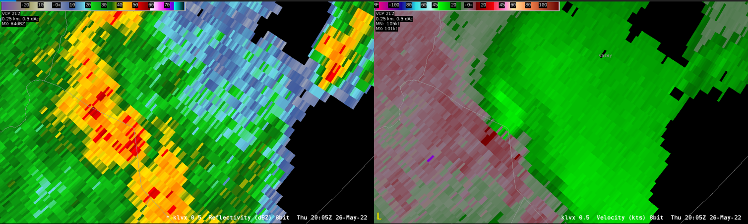 |
| Radar over Adair County (Reflectivity on left, velocity on right). | Radar over Casey/Adair County border (Reflectivity on left, velocity on right). |
Storm Reports
Local Storm Reports from the afternoon of May 26, 2022. Tree damage extended across several counties, but the most concentrated/severe areas of damage were across Adair County where the storm damage survey was conducted.
PRELIMINARY LOCAL STORM REPORT
NATIONAL WEATHER SERVICE LOUISVILLE KY
723 PM EDT SAT MAY 28 2022

..TIME...   ...EVENT...      ...CITY LOCATION...     ...LAT.LON...
..DATE...   ....MAG....      ..COUNTY LOCATION..ST.. ...SOURCE....
            ..REMARKS..

0337 PM     TSTM WND DMG     3 N MONTPELIER          37.05N 85.19W
05/26/2022                   ADAIR              KY   NWS STORM SURVEY

            THUNDERSTORM WIND DAMAGE ALONG A FOUR AND A
            HALF MILE LONG PATH SOUTHEAST AND EAST OF
            COLUMBIA. ESTIMATED PEAK GUST ALONG THE PATH
            OF 85 MPH. MOSTLY TREE DAMAGE...ISOLATED
            STRUCTURAL DAMAGE.

0346 PM     TSTM WND DMG     2 S FREEDOM             36.89N 85.10W
05/26/2022                   RUSSELL            KY   911 CALL CENTER

            REPORTS OF POWER LINE DOWN AT THE STATE PARK
            ENTRANCE.

0428 PM     TSTM WND DMG     4 SSW YOSEMITE          37.30N 84.85W
05/26/2022                   CASEY              KY   911 CALL CENTER

            REPORTS OF TREES DOWN.

0438 PM     TSTM WND DMG     4 NE WAYNESBURG         37.37N 84.62W
05/26/2022                   LINCOLN            KY   911 CALL CENTER

            REPORTS OF TREES DOWN.

0453 PM     TSTM WND DMG     2 S PREACHERSVILLE      37.50N 84.56W
05/26/2022                   LINCOLN            KY   EMERGENCY MNGR

            LINCOLN COUNTY EMERGENCY MANAGER REPORTED
            TREES DOWN AND SHINGLE DAMAGE NEAR US 150
            AND BOONE ROAD.

0502 PM     TSTM WND DMG     2 NW MCCREARY           37.69N 84.54W
05/26/2022                   GARRARD            KY   911 CALL CENTER

            REPORTS OF TREES DOWN.

0516 PM     TSTM WND DMG     4 E KIRKSVILLE          37.66N 84.34W
05/26/2022                   MADISON            KY   EMERGENCY MNGR

            EMERGENCY MANAGER REPORTS TREE DOWN ON
            PEYTONTOWN ROAD. TIME ESTIMATED FROM RADAR.

0519 PM     TSTM WND DMG     2 N BIG HILL            37.58N 84.21W
05/26/2022                   MADISON            KY   EMERGENCY MNGR

            EMERGENCY MANAGER REPORTS TREES DOWN IN THE
            PILOT KNOB AREA. TIME ESTIMATED FROM RADAR.

0545 PM     TSTM WND DMG     1 SE TRAPP              37.87N 84.03W
05/26/2022                   CLARK              KY   911 CALL CENTER

            A TREE WAS REPORTED DOWN ON LOG LICK ROAD TO
            COUNTY DISPATCH. TIME ESTIMATED FROM RADAR.

0551 PM     TSTM WND DMG     3 ENE TRAPP             37.90N 84.00W
05/26/2022                   CLARK              KY   911 CALL CENTER

            A TREE WAS REPORTED DOWN TO LOCAL DISPATCH.

1022 PM     TSTM WND DMG     2 N JEFFERSONVILLE      38.33N 85.72W
05/26/2022                   CLARK              IN   PUBLIC

            MULTIPLE TREES DOWN IN MALLARD RUN
            SUBDIVISION.
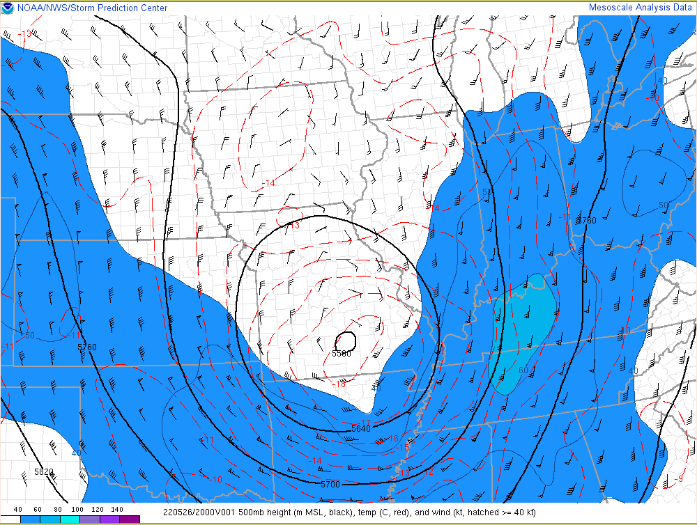
Environment
Insert synoptic summary.
 |
 |
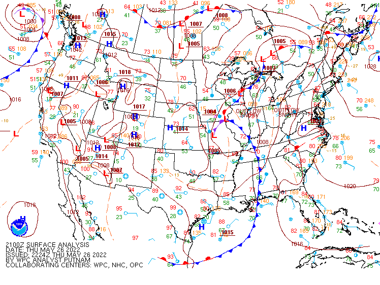 |
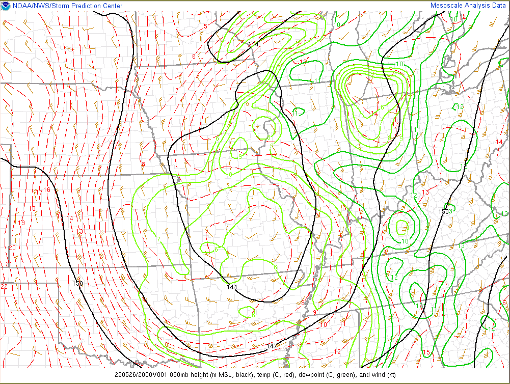
| Figure 1: 500mb Analysis at 26.20z | Figure 2: 850mb Analysis at 26.20z | Figure 3: Surface analysis at 26.21z |
Near-storm environment summary.
 |
 |
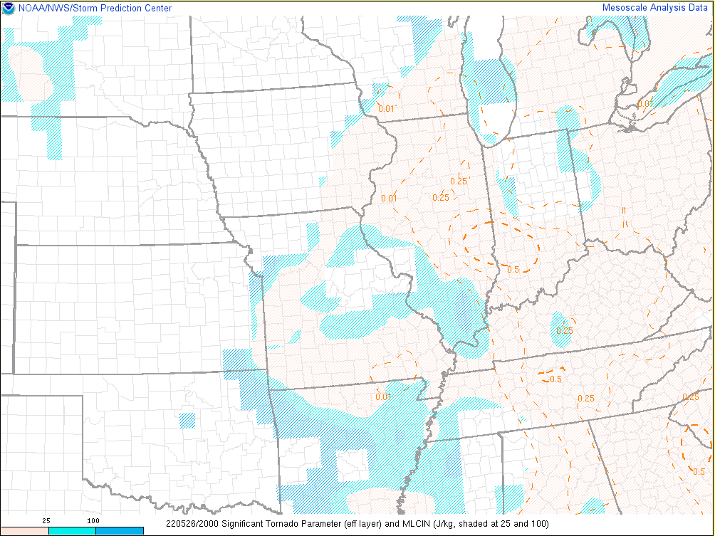 |
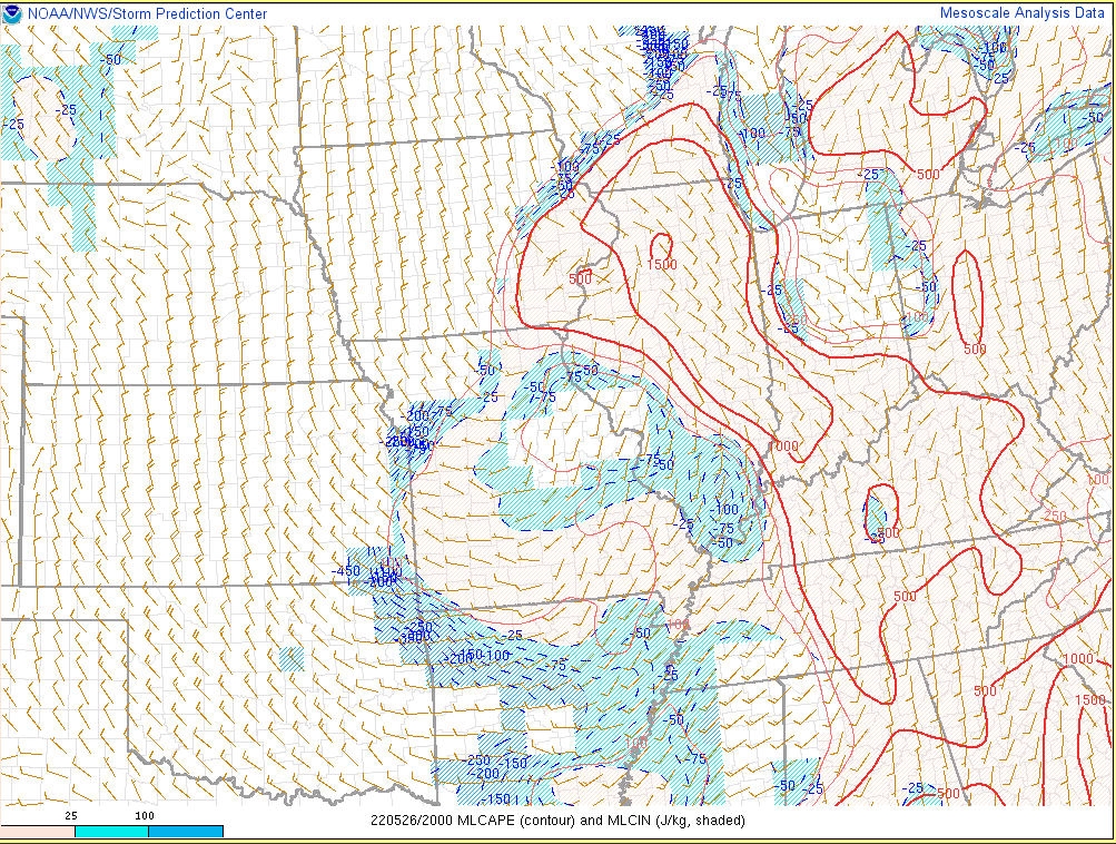
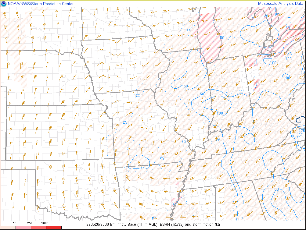
| Figure 4: MLCAPE at 26.20z | Figure 5: Effective SRH at 26.20z | Figure 6: Sig-Tor Parameter at 26.20z |
Additional environmental data.
 |
 |
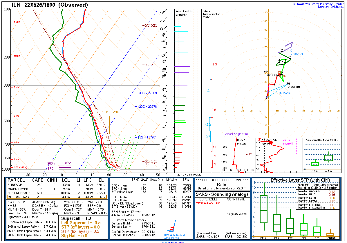 |
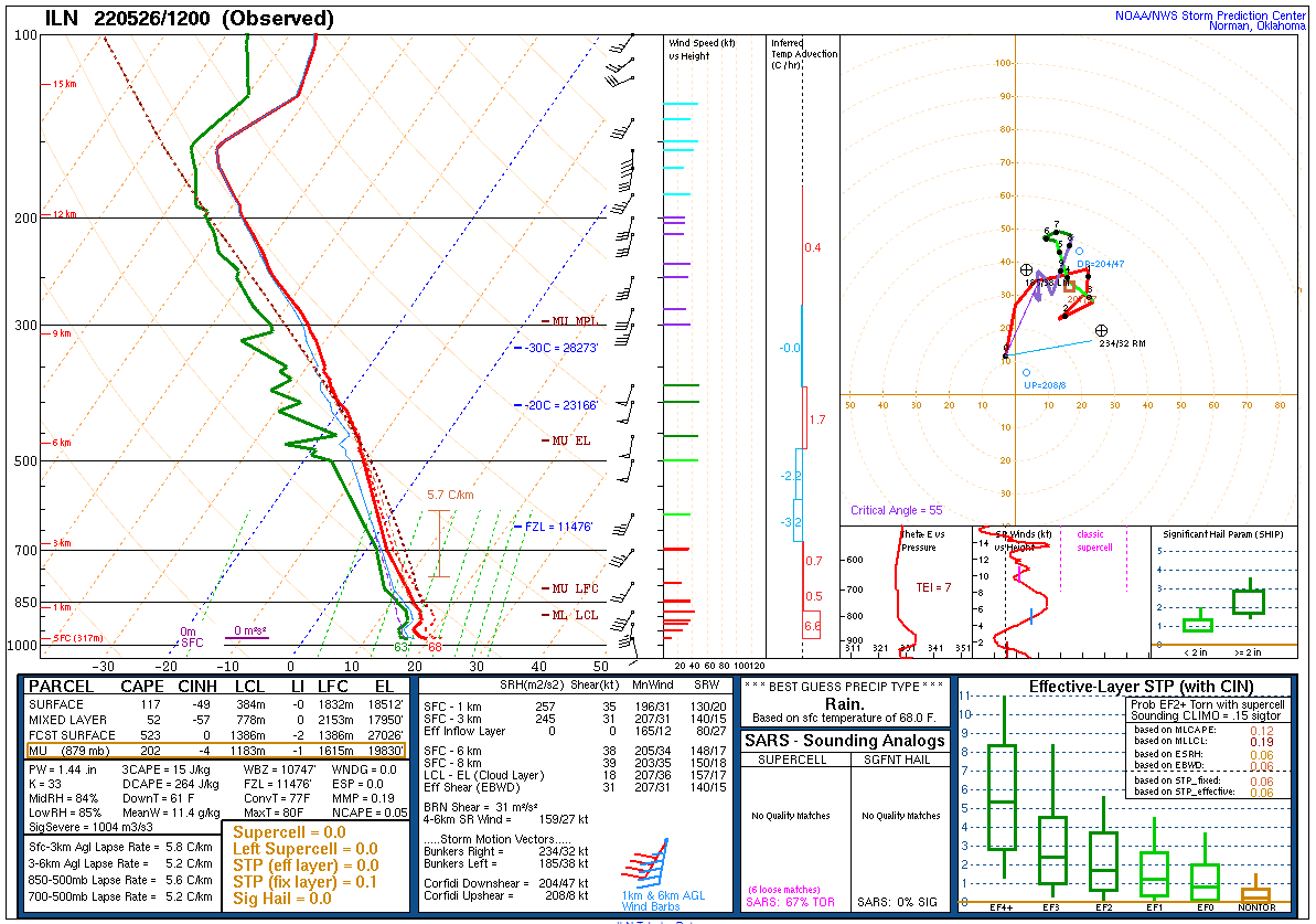
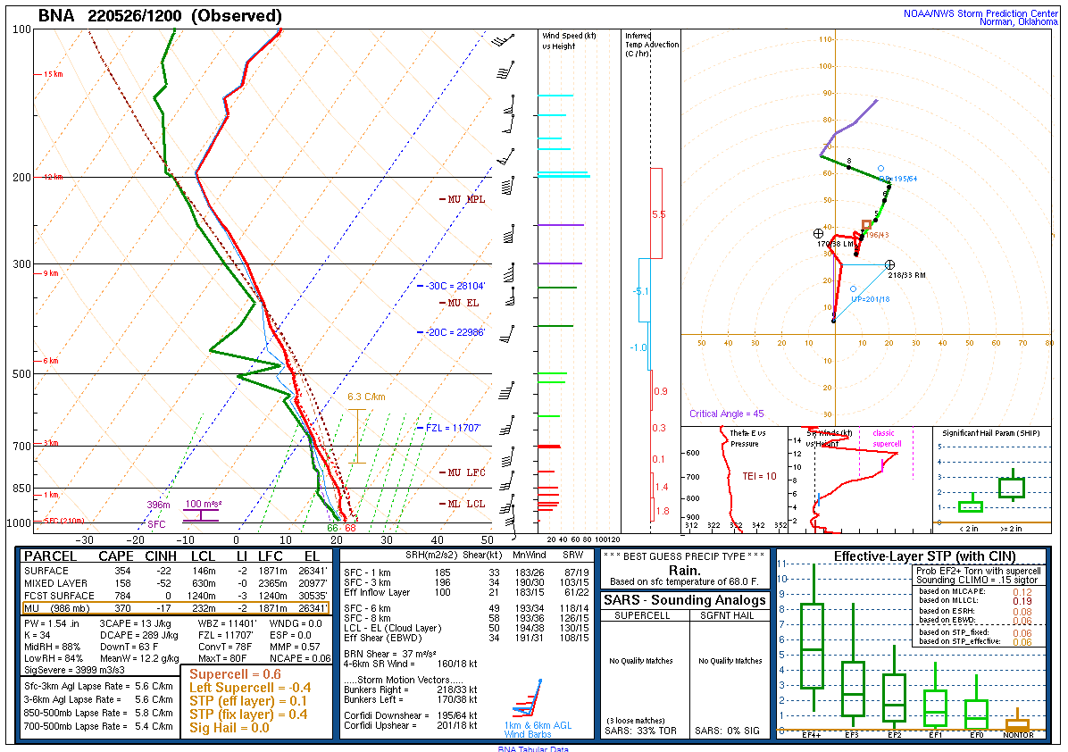
| Figure 7: 26.12z Sounding from ILN | Figure 8: 26.12z Sounding from BNA | Figure 9: 26.18z Sounding from ILN |
 |
Media use of NWS Web News Stories is encouraged! Please acknowledge the NWS as the source of any news information accessed from this site. |
|


 Weather Story
 Weather Map
 Local Radar