 |
 |
 |
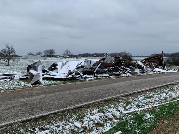
January 1: Eight tornadoes, of EF0 and EF1 strength, swept from Logan County to Madison County in central Kentucky. The EF1 tornadoes that struck Logan, Taylor, and Madison counties were the strongest tornadoes of 2022 in central Kentucky (110 mph winds). Two to four inches of rain drenched the region.
January 6: A cold front and upper level disturbance brought locally heavy snow to the Ohio Valley. A band of 6-10 inches stretched from Elizabethtown to Lexington, Richmond, and Liberty. Separately, five to six inches was measured from Russellville to Burkesville.
February 3-4: Significant freezing rain and sleet accumulations caused travel impacts and power outages. Southern Indiana received a quarter inch of ice, followed by sleet and then snow.
February 17: A cold front brought the wettest day of the year to many locations. A few trees were blown down as well. Blue Grass Field in Lexington recorded its strongest wind gust of 2022: 58 mph. Bowling Green also had its strongest gust of the year, 55 mph.
February 22: A thunderstorm produced a wind gust estimated at 90 mph just west of Scottsville in Allen County. A small building was blown down and a car was displaced about forty feet. It was the only instance of severe weather in the area that day.
March 12: Louisville, Lexington, Bowling Green, and Frankfort all set records for cold daily maximum temperature with highs of only 24 to 30 degrees. This was just a week after temperatures in the 70s.
March 18: Between 8pm and midnight five small tornadoes touched down southwest and northwest of Louisville. A wind gust to 68 mph buffeted Louisville International Airport and was the airport's strongest measured gust of 2022.
March 31: Four minutes after midnight a line of showers produced a 56 mph wind gust at Frankfort, which was the capital's strongest wind gust of the year.
April 12: A 41-year-old male disregarded warning signs and barricades and attempted to navigate a low water crossing through the West Fork of Drake's Creek in Simpson County in his Ford pick-up. The vehicle was swept away and the man's body was found a mile downstream the following day.
April 13: Nine brief tornadoes formed from LaRue County to Shelby County. An EF1 twister struck the south edge of Louisville, missing the National Weather Service office by just over a mile, though the office did experience 72mph winds and some minor damage.
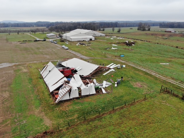
May 18: A macroburst caused significant wind damage in southern Marion County with estimated peak winds of 97 mph. Ping pong ball sized hail also fell during the downburst and caused significant siding damage.
May 19: Severe storms formed along a stationary front and produced many reports of large hail. Hail the size of baseballs fell near Berry in Harrison County, Kentucky, and in the Chilesburg area of Fayette County. This was the largest hail reported in the middle Ohio Valley in 2022.
May 20: Louisville tied their all-time record warm daily low temperature for the month of May, with a low of only 77°. The high that day in Louisville was a record 91°.
May 26: Severe thunderstorms impacted portions of central Kentucky. A concentrated area of damage occurred in Adair County where a microburst with winds up to 85mph downed many trees.
June 13: Heat and humidity combined to push heat index readings over 110°. Dew points reached the lower 80s. Louisville, Lexington, Bowling Green, and Frankfort all set records for warm daily low temperature with lows of 75° to 79°.
June 14: Bowling Green and Louisville set a new record for warm daily low temperature in the month of June with a low of only 81° at Bowling Green and 83° at Louisville. Louisville, Bowling Green, and Lexington all recorded their warmest June 14 on record.
June 15: Louisville, Lexington, Bowling Green, and Frankfort all set records for warm daily low temperature with lows of 74° to 80°.
June 16: Louisville, Lexington, Bowling Green, and Frankfort all set records for warm daily low temperature with lows of 77° to 82°. Louisville stayed at or above 80° for a record 120 consecutive hours.
July 12: Summer drought peaked. Severe drought was reported between Leitchfield and Hodgenville. Moderate drought spread from Springfield and Taylorsville westward to Tell City and Jasper.
July 20: Heat index readings reached 110 degrees.
August 6: Bowling Green set their all-time record warm daily low temperature of 81°.
September 3: A storm over Switzerland County, Indiana produced more than nine inches of rain. Run-off from this storm flowed into neighboring Jefferson County and caused Brushy Creek to rapidly rise and leave its banks. Northeast of Manville the flash flood swept away a barn and home. A 64-year-old resident of the home was caught in the floodwaters and perished; her body was found five miles downstream by family members. Comparatively little rain fell at the site of the disaster, on the order of 2-3 inches. Also on this date, a home was swept off its foundation due to flash flooding along Dutch Fork in Shelby County. In Franklin County flash flooding on North Benson Creek stripped the pavement from Stockton Road and washed a pick-up truck into a tree.
October 18: Flurries were seen in Louisville and Lexington, which was very unusual for so early in the season.
November 8: Peak of the fall drought. Severe drought covered most of central Kentucky, from Hartford and Morgantown through Carlisle and Richmond. Moderate drought covered the rest of the region. There were many burn bans in effect, pastures and farm ponds got very dry, and wildfires became a problem.
November 12: About 1-3 inches of snow fell on southern Indiana, with a couple reports around 4 inches in Floyd County.
November 29: Late-season severe storms developed over central Kentucky and produced large hail. Ping pong ball sized hail was reported in Bardstown.
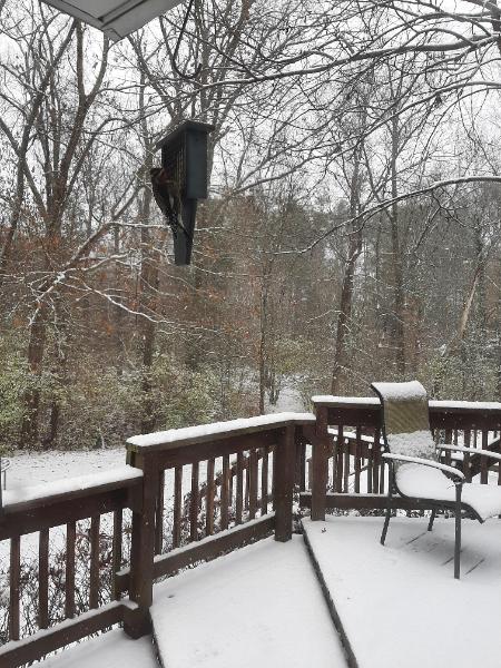
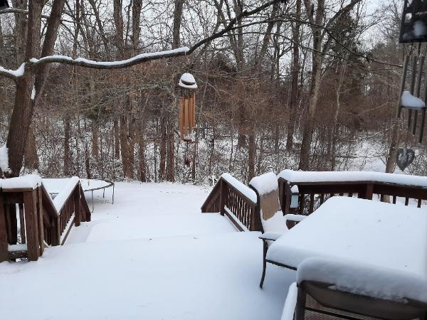
December 22-23: A highly unusual cold front brought an Arctic blast into the Ohio Valley (and much of the central and eastern U.S., all the way to the Gulf of Mexico). Temperatures crashed over 50 degrees in 12 hours, bottoming out below zero on the morning of the 23rd. Gusty winds resulted in wind chills of 30 degrees below zero. One to three inches of snow accompanied the frigid air, with a few spots from Salem, Indiana to Frankfort, Kentucky reporting 4-5".
| Bowling Green | Frankfort | Lexington | Louisville Ali | Louisville Bowman | |
| Highest Temperature | 101° July 5 and July 6 | 98° July 5 and July 6 | 98° June 22 and July 6 | 101° July 5 | 98° June 22, July 5, July 6 |
| Lowest Temperature | -3° December 23 | -6° December 23 | -5° December 23 | -5° December 23 | -7° December 23 |
| Daily Average Temperature Most Above Normal | +29° January 1 | +24° January 1 | +23° January 1 | +23° January 1 and March 6 | +24° January 1 and March 6 |
| Daily Average Temperature Most Below Normal | -37° December 23 | -32° December 23 | -30° December 23 | -37° December 23 | -37° December 23 |
| Wettest Day | 3.39" June 6 | 2.41" February 17 | 2.79" February 17 | 2.31" February 17 | 2.32" February 17 |
| Snowiest Day | 6.3" January 6 | 9.9" January 6 | 3.3" January 28 | ||
| Deepest Snow Cover | 6" January 7 | 8" January 7 | 3" January 29 | ||
| Fastest Wind Gust | 55 mph February 17 | 56 mph March 31 | 58 mph February 17 | 68 mph March 18 | 68 mph March 30 |
Kentucky Derby weather, May 7: High 64°, low 53°, 0.03" calendar day precipitation, no precipitation in the afternoon or evening, cloudy skies.
(All data here are considered preliminary. For official final data, contact the National Centers for Environmental Information.)
| Bowling Green | |||||
| Average Temperature | Departure from Normal | Precipitation | Departure from Normal | Snow | |
| January | 34.0° | -3.2° | 5.52" | +1.88" | 10.3" |
| February | 40.6° | -0.5° | 6.10" | +2.03" | 0.1" |
| Winter | 41.8° | +2.2° | 15.27" | +3.21" | 10.4" |
| March | 51.7° | +2.5° | 2.96" | -1.58" | 5.1" |
| April | 57.5° | -1.5° | 4.51" | -0.30" | 0 |
| May | 70.5° | +2.5° | 3.93" | -1.10" | 0 |
| Spring | 59.9° | +1.2° | 11.40" | -2.98" | 5.1" |
| June | 77.7° | +1.6° | 3.40" | -1.11" | 0 |
| July | 82.4° | +2.7° | 5.87" | +1.59" | 0 |
| August | 78.8° | +0.3° | 0.96" | -2.93" | 0 |
| Summer | 79.6° | +1.5° | 10.23" | -2.45" | 0 |
| September | 71.5° | +0.1° | 2.25" | -1.39" | 0 |
| October | 58.2° | -1.8° | 1.21" | -2.42" | 0 |
| November | 49.3° | +0.9° | 2.88" | -0.85" | T |
| Autumn | 59.7° | -0.2° | 6.34" | -4.66" | T |
| December | 40.5° | 0° | 3.28" | -1.07" | 2.5" |
| ANNUAL | 59.4° | +0.3° | 42.87" | -7.25" | 18.0" |
| Frankfort | ||||
| Average Temperature | Departure from Normal | Precipitation | Departure from Normal | |
| January | 30.6° | -3.5° | 4.01" | +0.74" |
| February | 38.4° | +0.6° | 7.29" | +3.89" |
| Winter | 38.8° | +2.2° | 15.81" | +5.37" |
| March | 48.6° | +2.4° | 3.42" | -1.30" |
| April | 54.4° | -2.3° | 3.77" | -0.78" |
| May | 68.1° | +2.63° | 5.36" | +0.26" |
| Spring | 57.0° | +0.9° | 12.55" | -1.82" |
| June | 74.6° | +0.9° | 2.86" | -1.48" |
| July | 78.5° | +1.3° | 5.54" | +0.85" |
| August | 75.6° | -0.5° | 4.44" | +1.29" |
| Summer | 76.2° | +0.5° | 12.84" | +0.66" |
| September | 68.5° | -0.7° | 3.09" | -0.26" |
| October | 54.9° | -2.7° | 1.08" | -2.56" |
| November | 46.4° | +0.3° | 1.90" | -1.46" |
| Autumn | 56.6° | -1.0° | 6.07" | -4.28" |
| December | 37.3° | -0.8° | 3.18" | -0.59" |
| ANNUAL | 56.3° | -0.2° | 45.94" | -1.40" |
| Lexington | ||||||
| Average Temperature | Departure from Normal | Precipitation | Departure from Normal | Snow | Departure from Normal | |
| January | 28.7° | -5.2° | 5.25" | +1.83" | 17.1" | +12.4" |
| February | 37.9° | +0.4° | 7.69" | +4.05" | 1.3" | -3.2" |
| Winter | 37.7° | +1.3° | 17.53" | +6.27" | 18.4" | +7.3" |
| March | 48.5° | +2.6° | 4.27" | -0.21" | 5.5" | +2.7" |
| April | 55.1° | -1.1° | 3.71" | -0.71" | T | -0.2 |
| May | 68.7° | +3.3° | 3.84" | -1.60" | 0 | 0 |
| Spring | 57.4° | +1.6° | 11.82" | -2.52" | 5.5" | +2.5" |
| June | 75.9° | +2.6° | 2.10" | -2.86" | 0 | 0 |
| July | 79.4° | +2.7° | 6.46" | +1.34" | 0 | 0 |
| August | 76.3° | +0.6° | 4.27" | +0.56" | 0 | 0 |
| Summer | 77.2° | +2.0° | 12.83" | -0.96" | 0 | 0 |
| September | 69.1° | 0° | 1.50" | -1.92" | 0 | 0 |
| October | 56.8° | -1.0° | 0.96" | -2.70" | T | +T |
| November | 47.7° | +1.6° | 2.10" | -1.27" | 0.3" | -0.1" |
| Autumn | 57.9° | +0.2° | 4.56" | -5.89" | 0.3" | -0.1" |
| December | 38.7° | +0.9° | 3.46" | -0.74" | 1.9" | 0" |
| ANNUAL | 56.9° | +0.6° | 45.61" | -4.23" | 26.1" | +11.6" |
10th warmest year on record
| Louisville Ali | ||||||
| Average Temperature | Departure from Normal | Precipitation | Departure from Normal | Snow | Departure from Normal | |
| January | 32.5° | -3.2° | 4.49" | +1.10" | 6.4" | +1.9" |
| February | 39.6° | +0.1° | 6.74" | +3.33" | 1.6" | -2.5" |
| Winter | 40.7° | +2.5° | 14.99" | +4.06" | 8.0" | -2.8" |
| March | 51.7° | +3.3° | 2.37" | -2.23" | 1.5" | -0.6" |
| April | 57.1° | -1.9° | 4.44" | -0.36" | T | -0.1" |
| May | 70.9° | +2.6° | 3.23" | -1.95" | 0 | 0 |
| Spring | 59.9° | +1.3° | 10.04" | -4.54" | 1.5" | -0.7" |
| June | 78.2° | +1.8° | 2.77" | -1.50" | 0 | 0 |
| July | 82.0° | +2.1° | 5.71" | +1.66" | 0 | 0 |
| August | 79.1° | +0.2° | 4.69" | +0.98" | 0 | 0 |
| Summer | 79.8° | +1.4° | 13.17" | +1.14" | 0 | 0 |
| September | 72.0° | 0° | 2.04" | -1.62" | 0 | 0 |
| October | 58.8° | -1.5° | 1.54" | -2.18" | T | -0.1" |
| November | 49.2° | +0.7° | 1.74" | -1.68" | 1.5" | +1.2" |
| Autumn | 60.0° | -0.3° | 5.32" | -5.48" | 1.5" | +1.1" |
| December | 39.4° | -0.2° | 3.28" | -0.85" | 3.2" | +1.0" |
| ANNUAL | 59.2° | +0.3° | 43.04" | -5.03" | 14.2" | +0.8" |
9th warmest year on record
| Louisville Bowman | ||||
| Average Temperature | Departure from Normal | Precipitation | Departure from Normal | |
| January | 31.7° | -3.3° | 4.01" | +0.73" |
| February | 38.8° | +0.1° | 6.81" | +3.54" |
| Winter | 39.7° | +2.3° | 14.63" | +4.20" |
| March | 50.2° | +2.8° | 2.44" | -1.93" |
| April | 55.6° | -2.5° | 4.36" | -0.33" |
| May | 69.6° | +2.4° | 3.73" | -1.43" |
| Spring | 58.5° | +0.9° | 10.53" | -3.69" |
| June | 76.2° | +0.8° | 2.96" | -1.72" |
| July | 80.2° | +1.6° | 6.96" | +2.40" |
| August | 77.6° | 0° | 2.59" | -0.94" |
| Summer | 78.0° | +0.8° | 12.51" | -0.26" |
| September | 70.5° | +0.1° | 1.33" | -2.28" |
| October | 56.7° | -2.1° | 1.46" | -2.19" |
| November | 46.7° | -0.5° | 1.41" | -2.03" |
| Autumn | 58.0° | -0.8° | 4.20" | -6.50" |
| December | 37.4° | -1.4° | 3.25" | -0.63" |
| ANNUAL | 57.6° | -0.2° | 41.31" | -6.81" |
 |
 |
 |
 |
||||
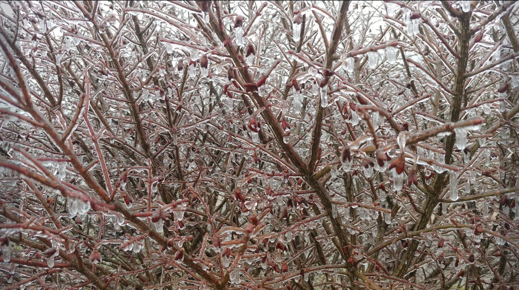
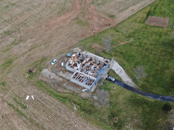
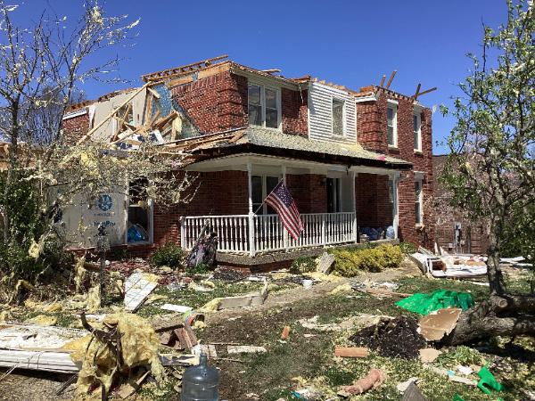
| Tornado damage coated with snow in Logan County after the January 1 outbreak | Drone footage of tornado damage in Barren County January 1 | Ice in Edmonson County February 24. Photo courtesy Johnny Merideth | Tornado damage in Hardin County March 18 | ||||
 |
 |
 |
 |
||||
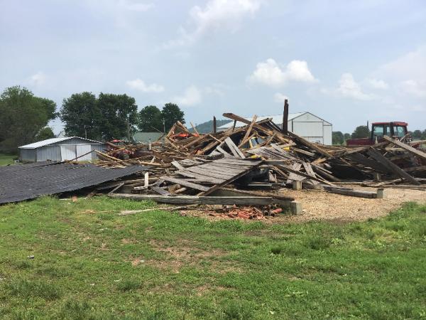
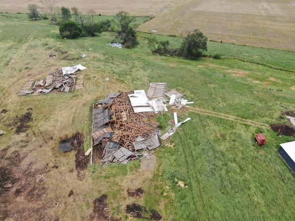
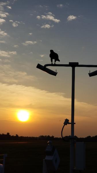
| Tornado damage on Bohannon Station Road in Louisville April 13 | Downburst wind damage in Marion County May 18 | Drone footage of wind damage in Marion County May 18 | Bird resting on weather equipment at Bowman Field in Louisville July 6 | ||||
 |
 |
 |
 |
||||
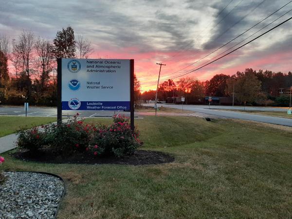
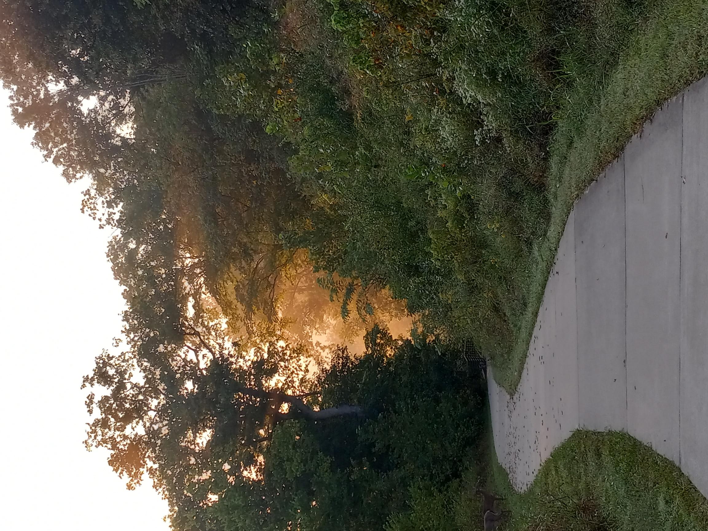
| Near Seatonville in Jefferson County, KY September 16 | Turkey Run Park in Louisville October 6 | Sunrise at the NWS office October 28. Photo courtesy Ryan Sharp | Early season snow in Oldham County November 12. Photo courtesy Ryan Sharp | ||||
 |
 |
 |
|||||
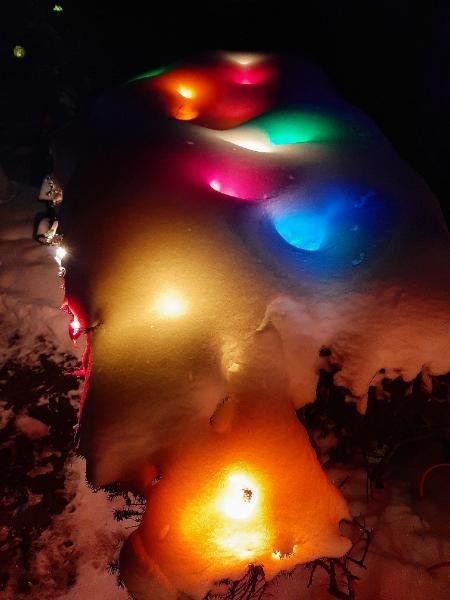
| Frost flower near Woodbury, KY November 15. Photo courtesy Amy Tichenor Smith | Snow with the Arctic blast of December 23. Photo courtesy Ryan Sharp | Central Kentucky gets a white Christmas! Photo courtesy Ryan Sharp | |||||

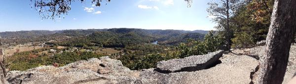
View from the Pinnacles in Berea College Forest October 10. Photo courtesy Ryan Sharp


 Weather Story
 Weather Map
 Local Radar