Overview
A line of storms moved into southern Indiana and northern Kentucky on Sunday morning May 7, 2023. As the line of storms approached the Ohio River, several hook echoes developed on the leading edge and interacted with storm outflow to create brief spin-up tornadoes. Overall, six tornadoes occurred, 5 of which happened in a 10 to 15 minute span. Each tornado was only on the ground for 1 to 3 minutes before lifting.
Confirmed tornadoes - subject to change after damage survey is completed
| Tornado #1 | 2 mi NNW of Georgetown, IN | 8:42 AM EDT |
| Tornado #2 | 1 mi ESE of Georgetown, IN | 8:46 AM EDT |
| Tornado #3 | 3 mi ENE of Floyds Knobs, IN (IU Southeast) | 8:48 AM EDT |
| Tornado #4 | Edwardsville, IN | 8:52 AM EDT |
| Tornado #5 | Southern Floyd Co, IN - Lake Dreamland, KY | 8:57 AM EDT |
| Tornado #6 | Shelbyville, KY | 9:25 AM EDT |
Tornadoes
|
Tornado #1 - 2 NNW Georgetown, IN
Track Map 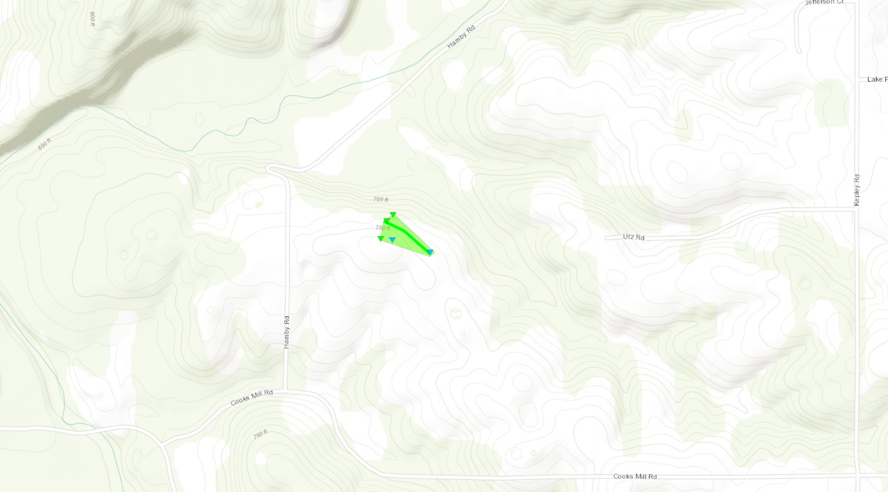 
|
||||||||||||||||
|
||||||||||||||||
|
Tornado #2 - 1 ESE Georgetown, IN
Track Map 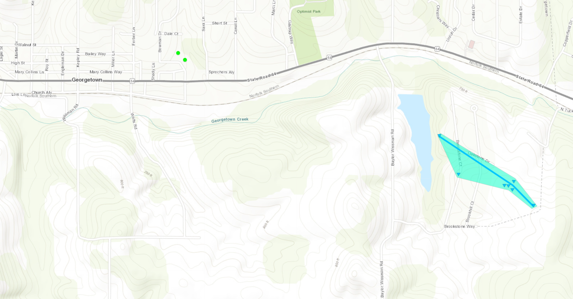
|
||||||||||||||||
|
||||||||||||||||
|
Tornado #3 - 3 ENE Floyds Knob, IN
Track Map 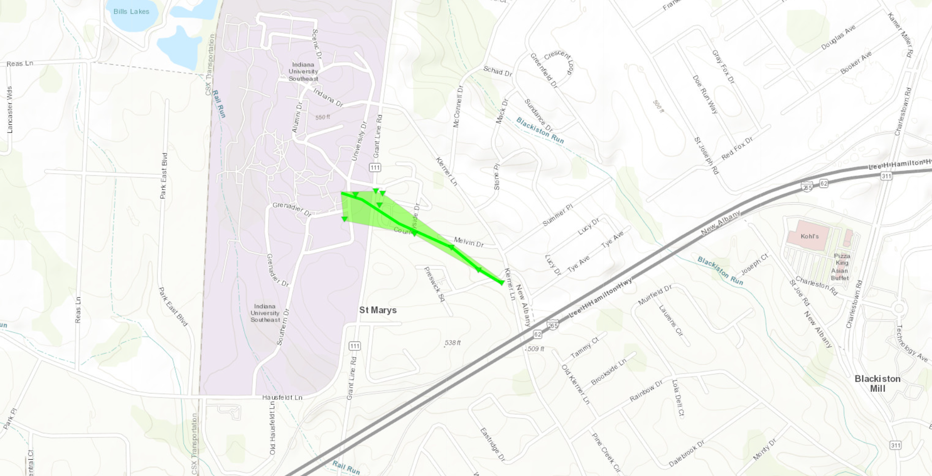
|
||||||||||||||||
|
||||||||||||||||
|
Tornado #4 - Edwardsville, IN
Track Map 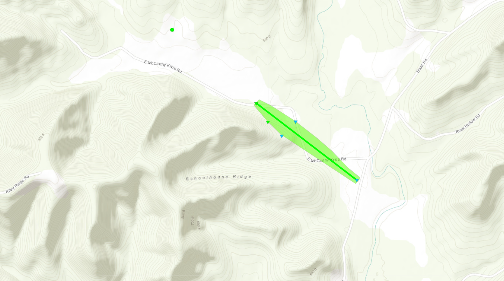
|
||||||||||||||||
|
||||||||||||||||
|
Tornado #5 - Lake Dreamland, KY
Track Map 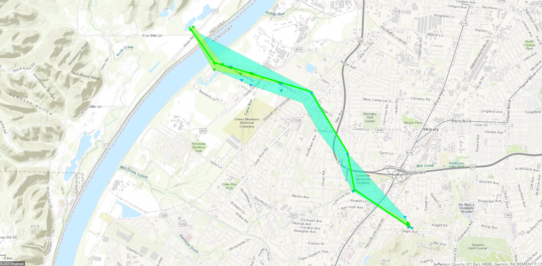
|
||||||||||||||||
|
||||||||||||||||
|
Tornado #6 - Shelbyville, KY
Track Map 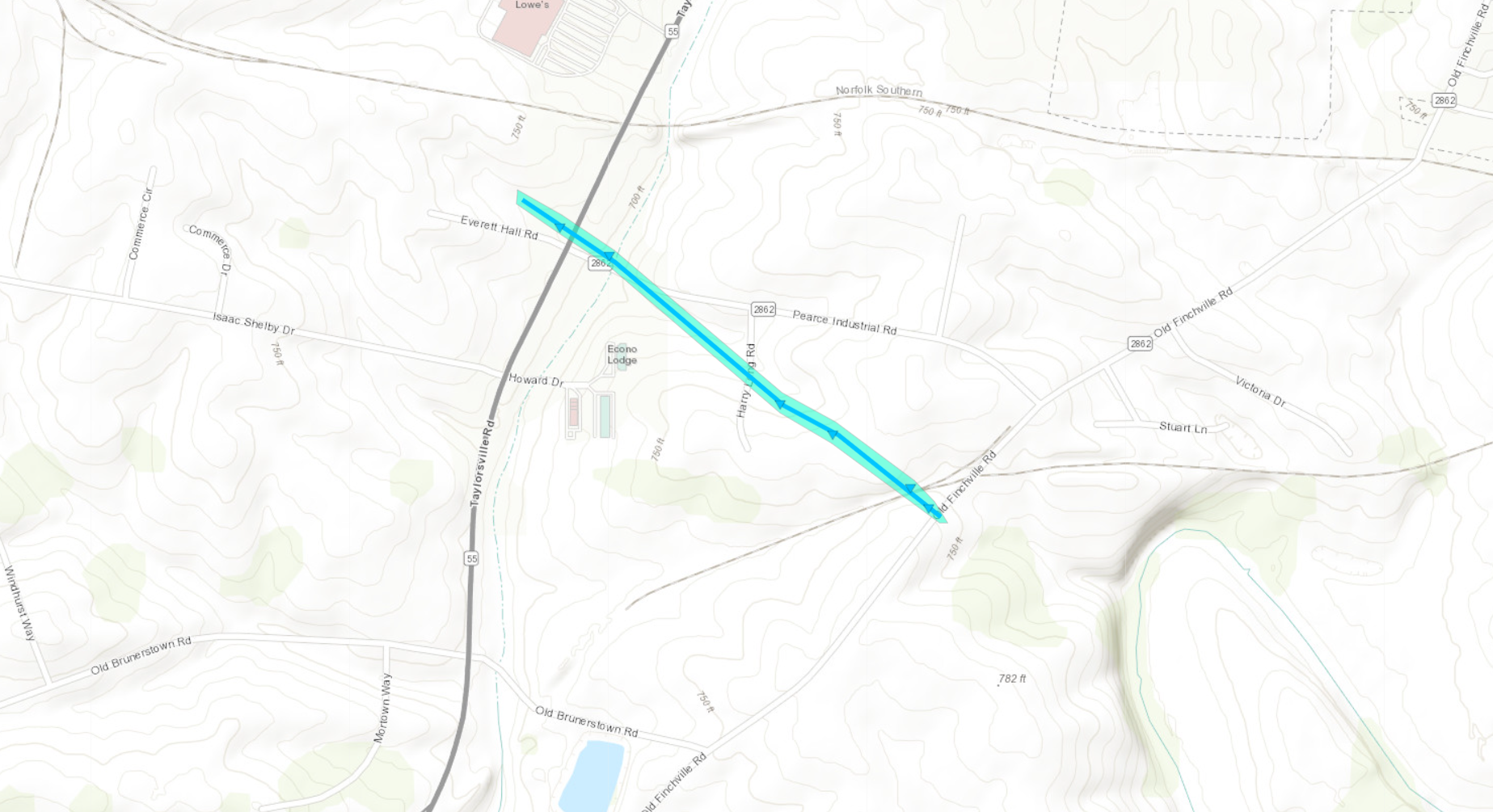
|
||||||||||||||||
|
||||||||||||||||
The Enhanced Fujita (EF) Scale classifies tornadoes into the following categories:
| EF0 Weak 65-85 mph |
EF1 Moderate 86-110 mph |
EF2 Significant 111-135 mph |
EF3 Severe 136-165 mph |
EF4 Extreme 166-200 mph |
EF5 Catastrophic 200+ mph |
 |
|||||
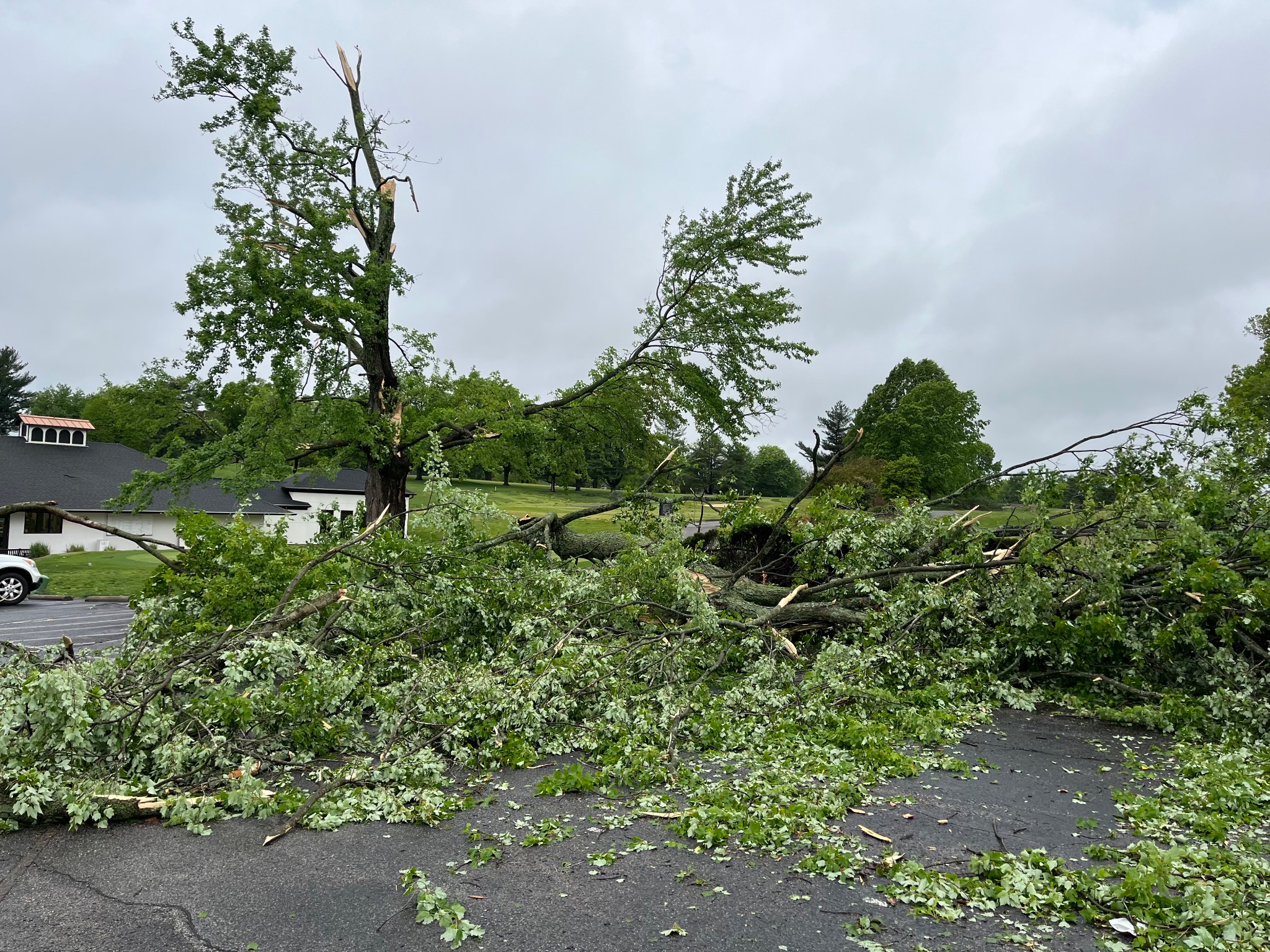
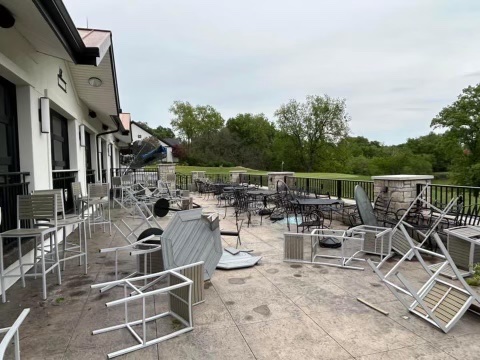
Wind:
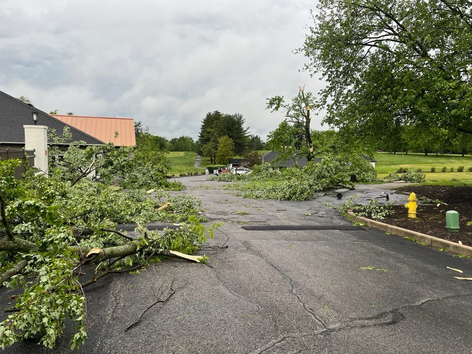
The National Weather Service completed a survey of storm damage received at Wildwood Country Club in the Fern Creek neighborhood of Louisville. Extensive tree damage was observed on the golf course. The damage direction was consistent with straight line wind damage, with winds between 90 and 100 mph.
 |
 |
 |
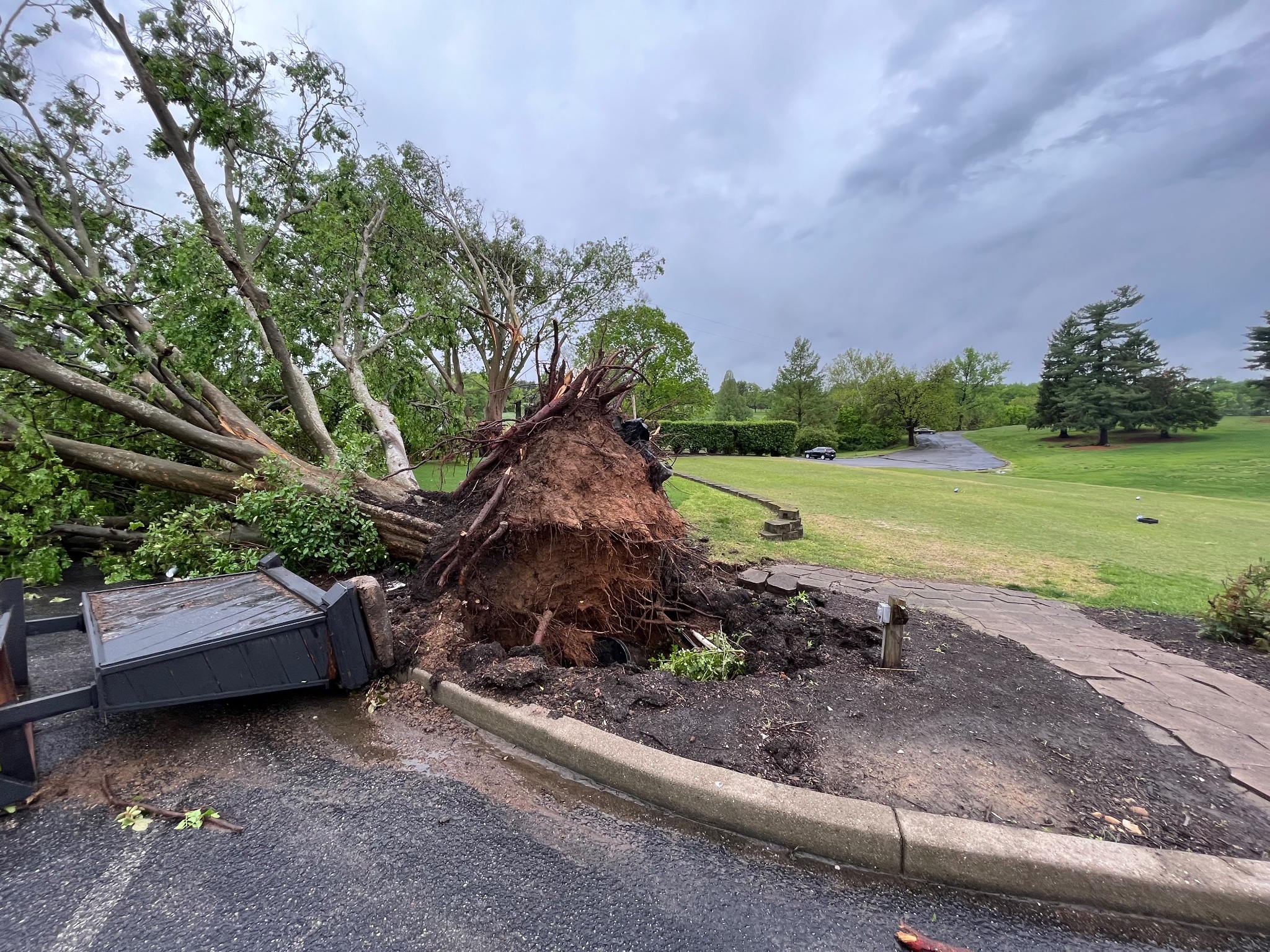 |
| Courtesy of NWS Storm Survey | Courtesy of NWS Storm Survey | Courtesy of NWS Storm Survey | Courtesy of NWS Storm Survey |
Radar
 |
 |
 |
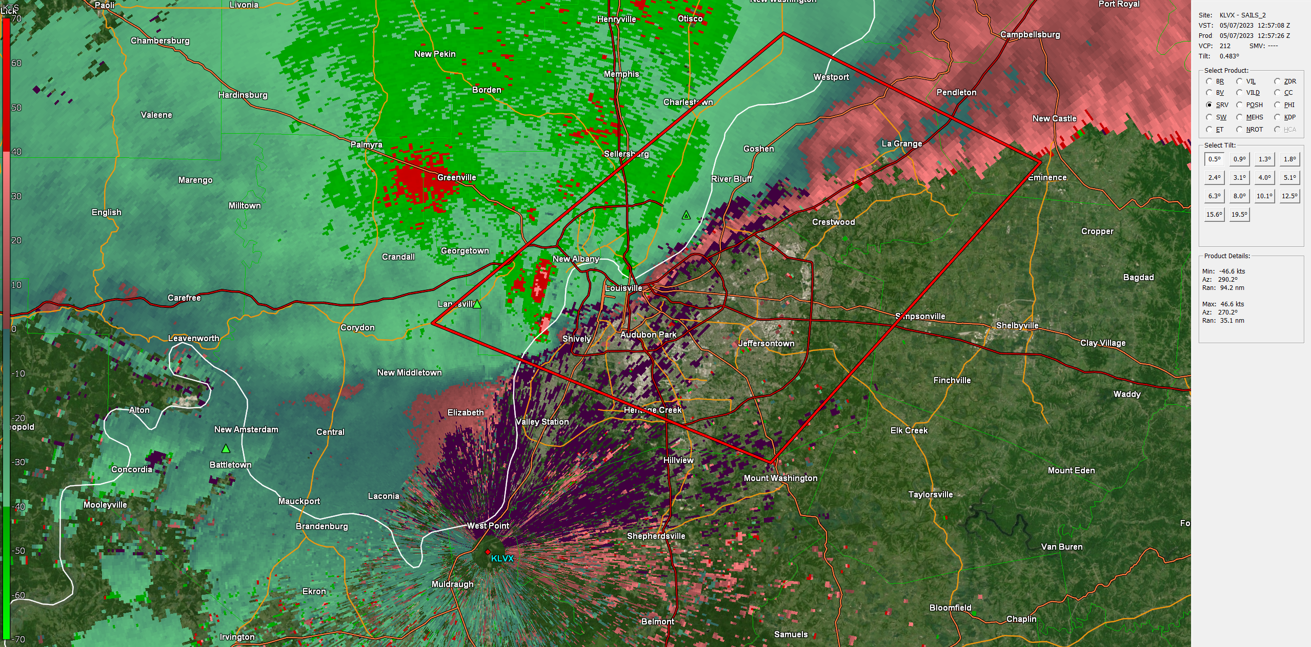 |
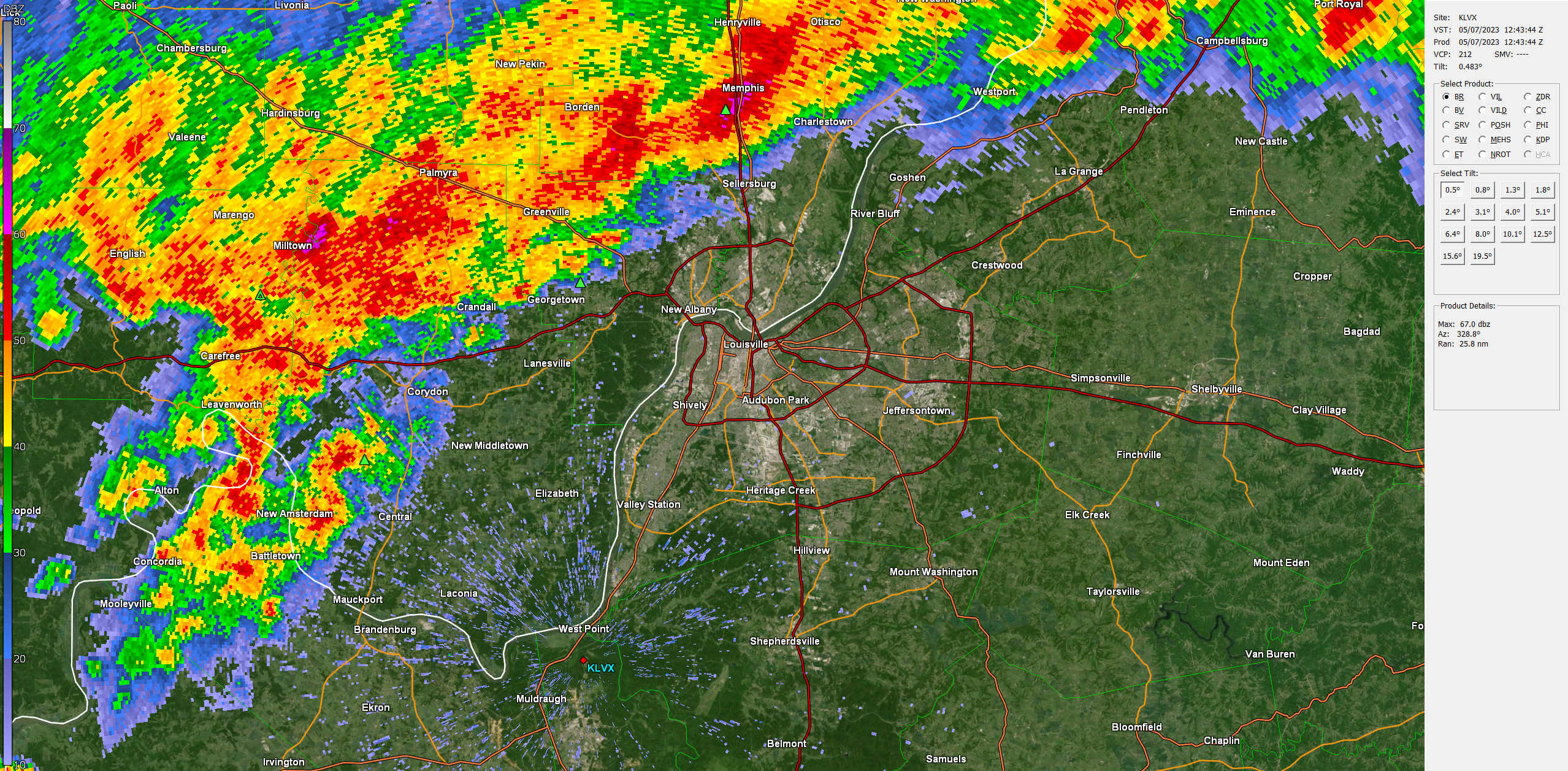
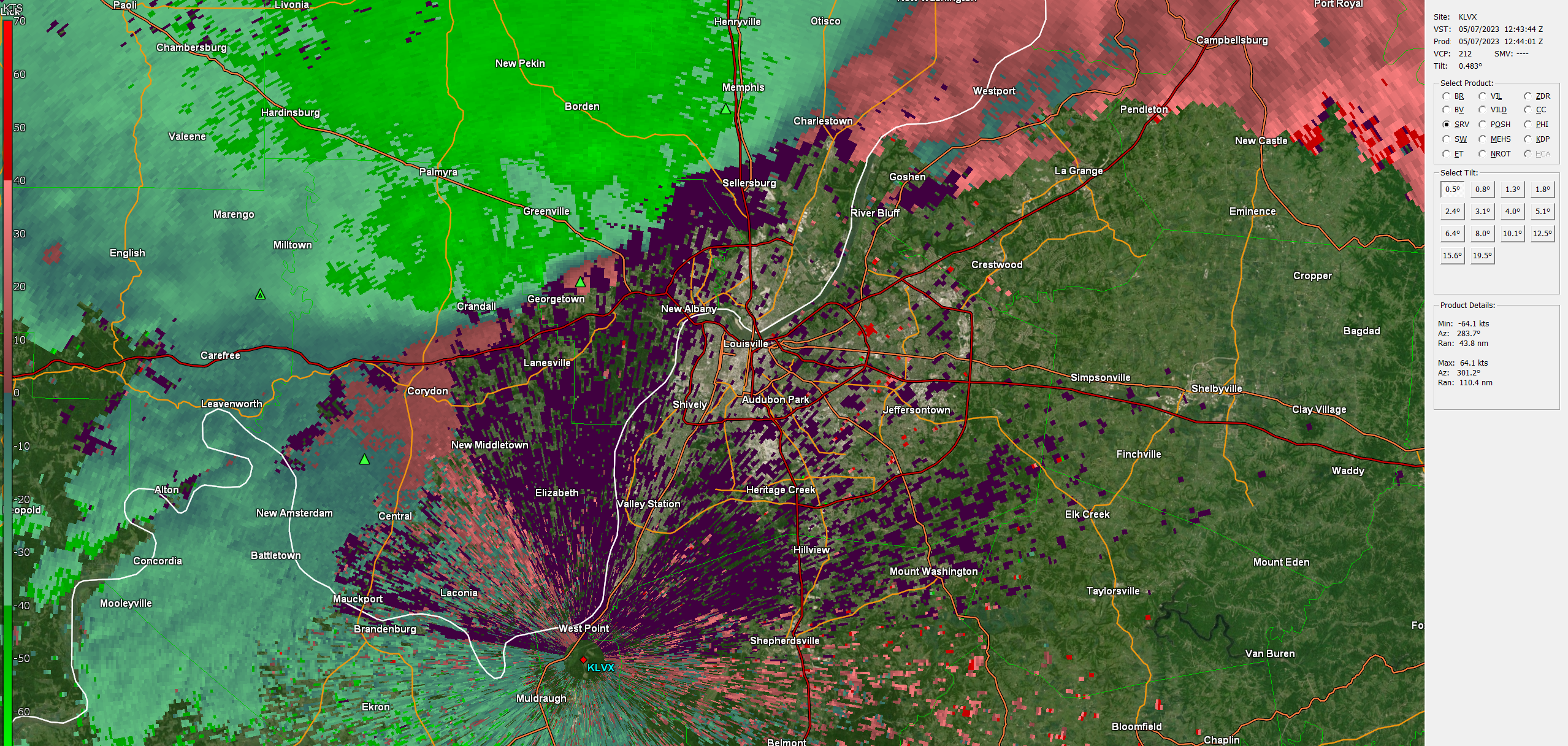
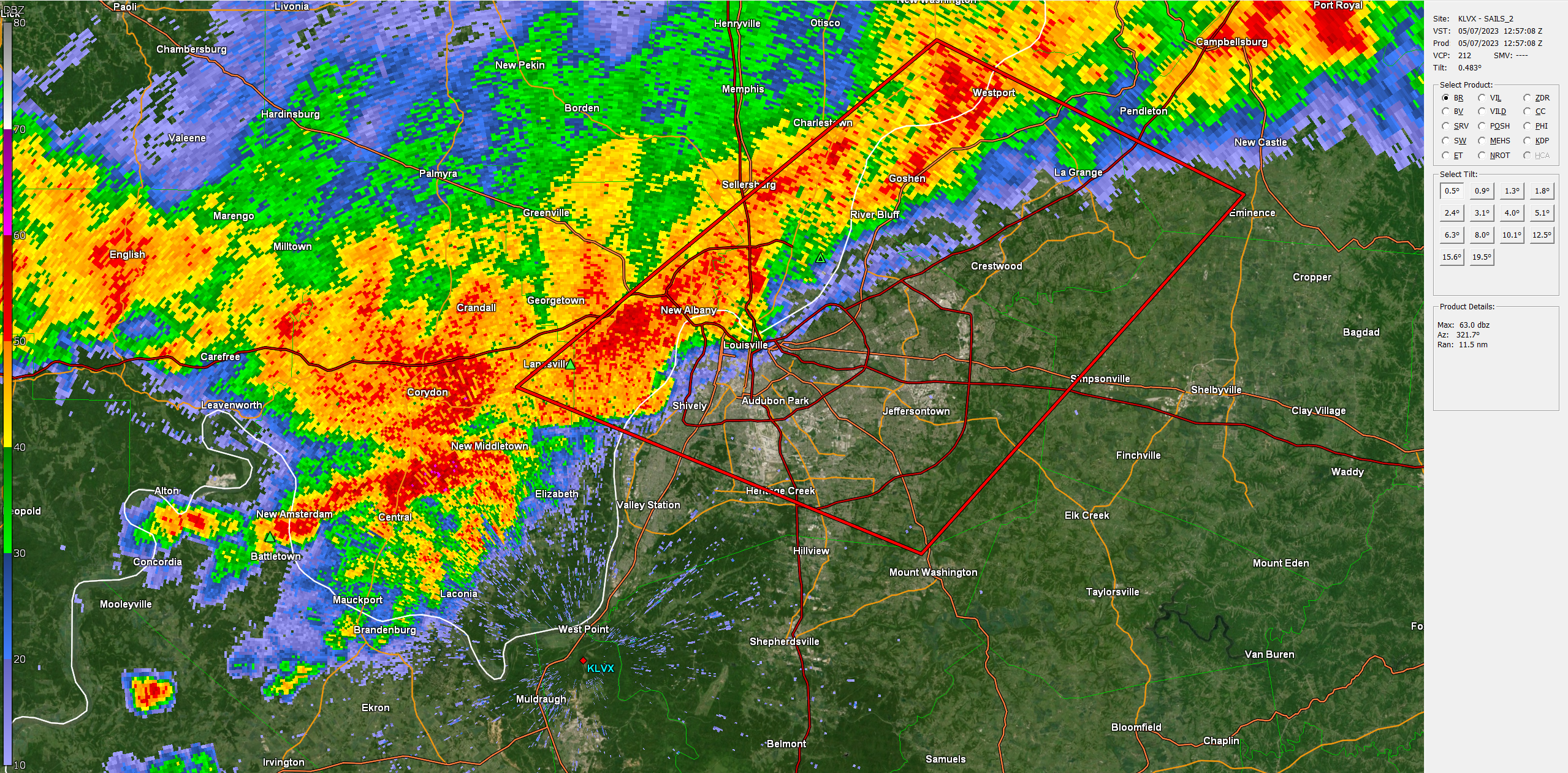
| KLVX Radar Reflectivity at 8:43 AM EDT | KLVX Radar Storm Relative Velocity at 8:44 AM EDT | KLVX Radar Reflectivity at 8:57 AM EDT | KLVX Radar Storm Relative Velocity at 8:57 AM EDT |
Storm Reports
..TIME... ...EVENT... ...CITY LOCATION... ...LAT.LON...
..DATE... ....MAG.... ..COUNTY LOCATION..ST.. ...SOURCE....
..REMARKS..
0821 AM Tstm Wnd Dmg 1 E Haysville 38.48N 86.90W
05/07/2023 Dubois IN Emergency Mngr
Hayesville Fire Department responding to
help clear a couple of trees that fell near
the 400 block of East State Road 56.
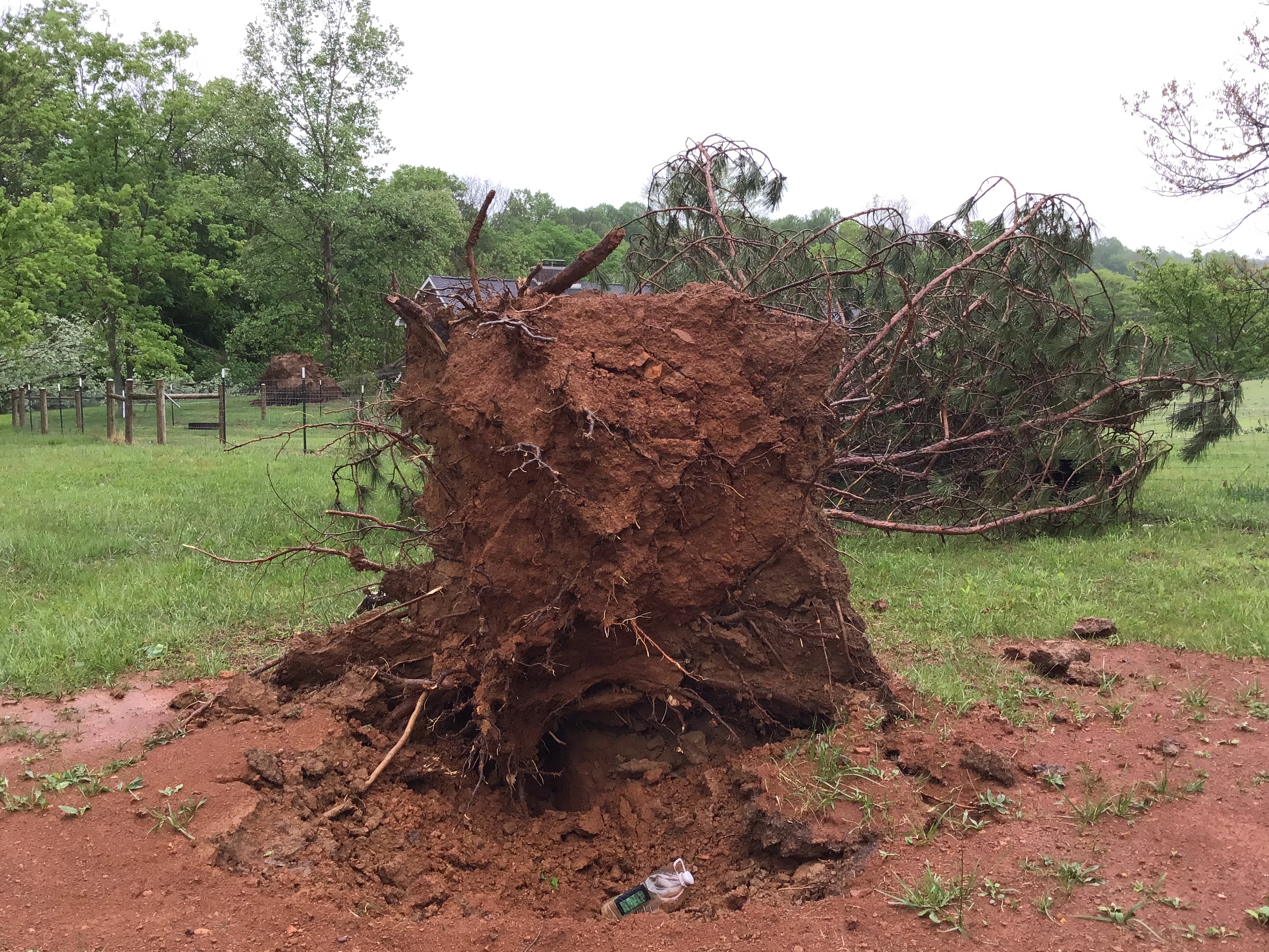
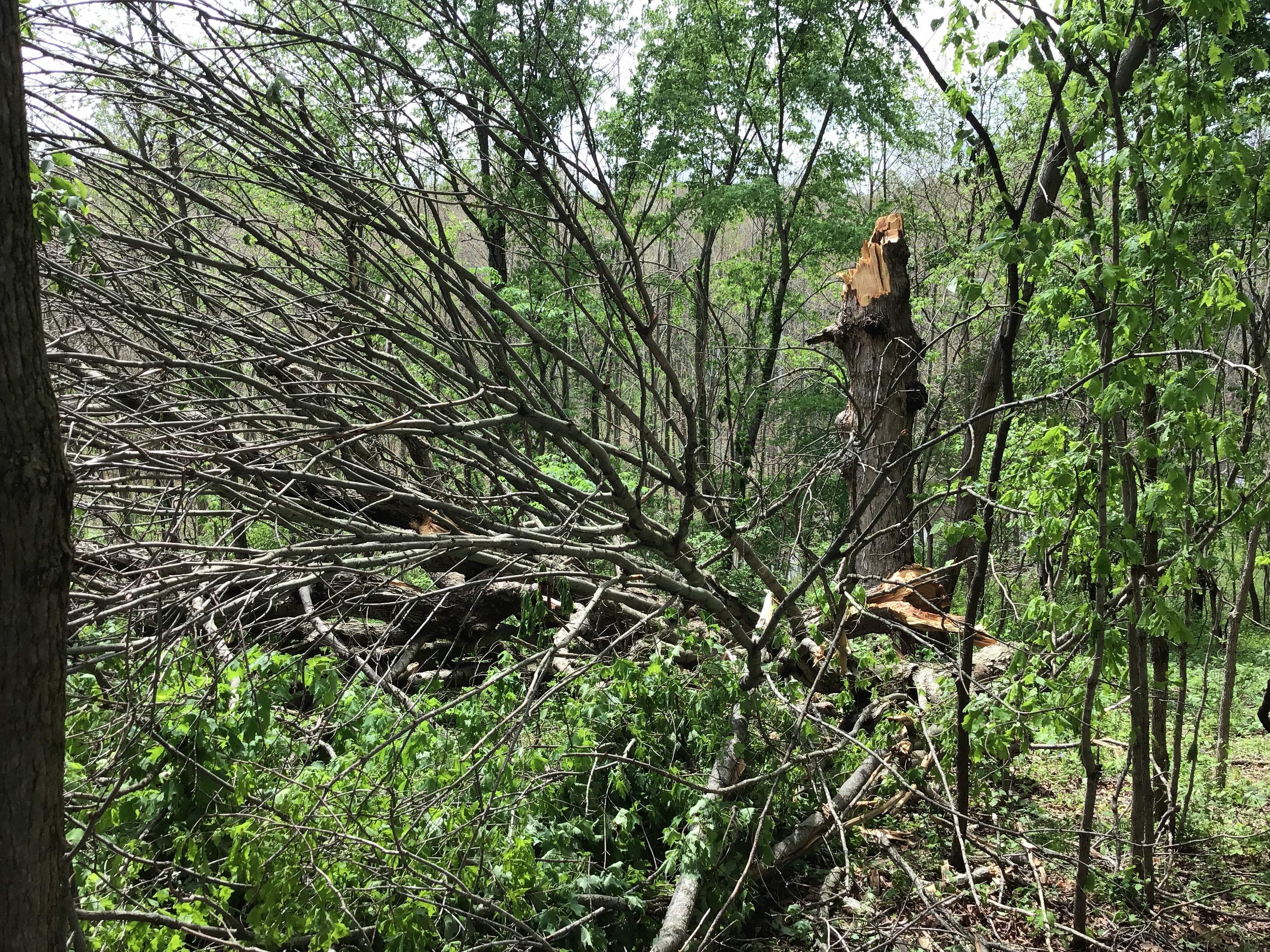
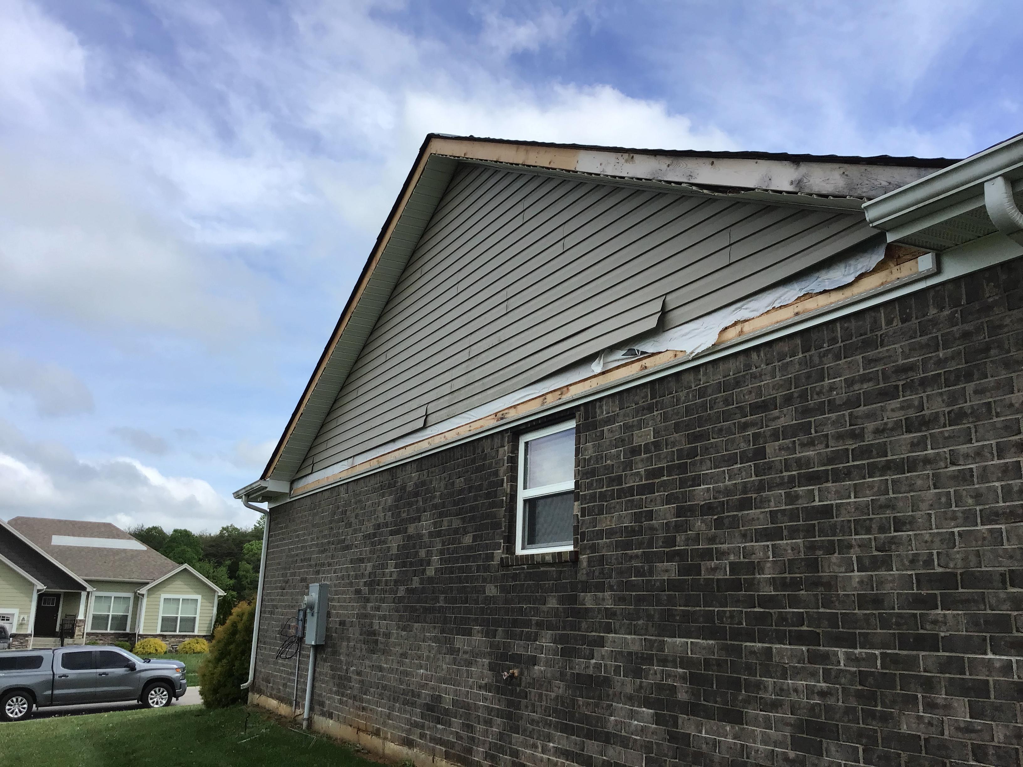
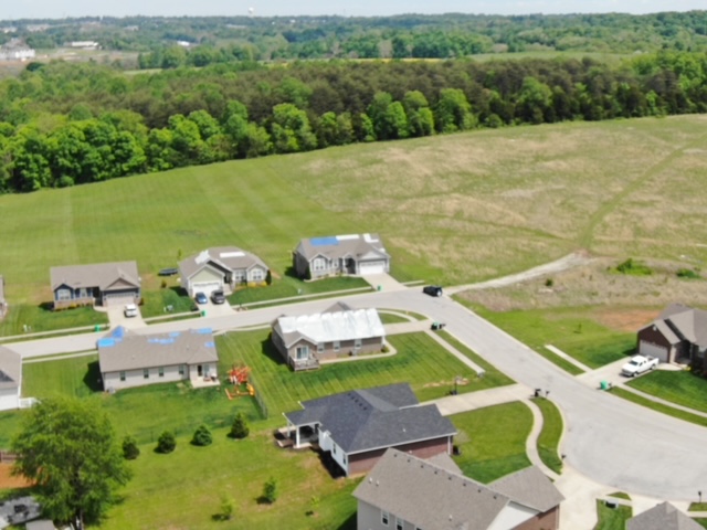
0842 AM Tornado 2 NW Georgetown 38.32N 85.99W
05/07/2023 Floyd IN NWS Storm Survey
All of the damage was off of Hamby Rd, on
the northwest side of Georgetown, Indiana.
At 3424 Hamby Rd, several trees were snapped
and uprooted. Trees were facing from the
east northeast to a southeasterly direction.
Of particular note was a large, healthy red
oak tree that was uprooted with a
significant root ball, which hit the far
corner of the neighbors house, doing
structural damage to the roof and gutters.
The vast majority of the damage was to the
trees, and just off the ground. The tornado
topped a few trees at the edge of their
property by the forested area, before
lifting.
0846 AM Tornado 1 E Georgetown 38.29N 85.95W
05/07/2023 Floyd IN NWS Storm Survey
The tornado first touched down on the
northwest side of the Brookside subdivision,
just east of Georgetown Lake where two older
trees were twisted. Most of the damage was
to a dozen or so homes that received
shingle, soffit, gutter, and fascia harm.
The tornado lifted in a wooded area just
east of Zachary Trail, before Interstate 64.
The tornado was rated EF-0 with peak winds
of 80 mph.
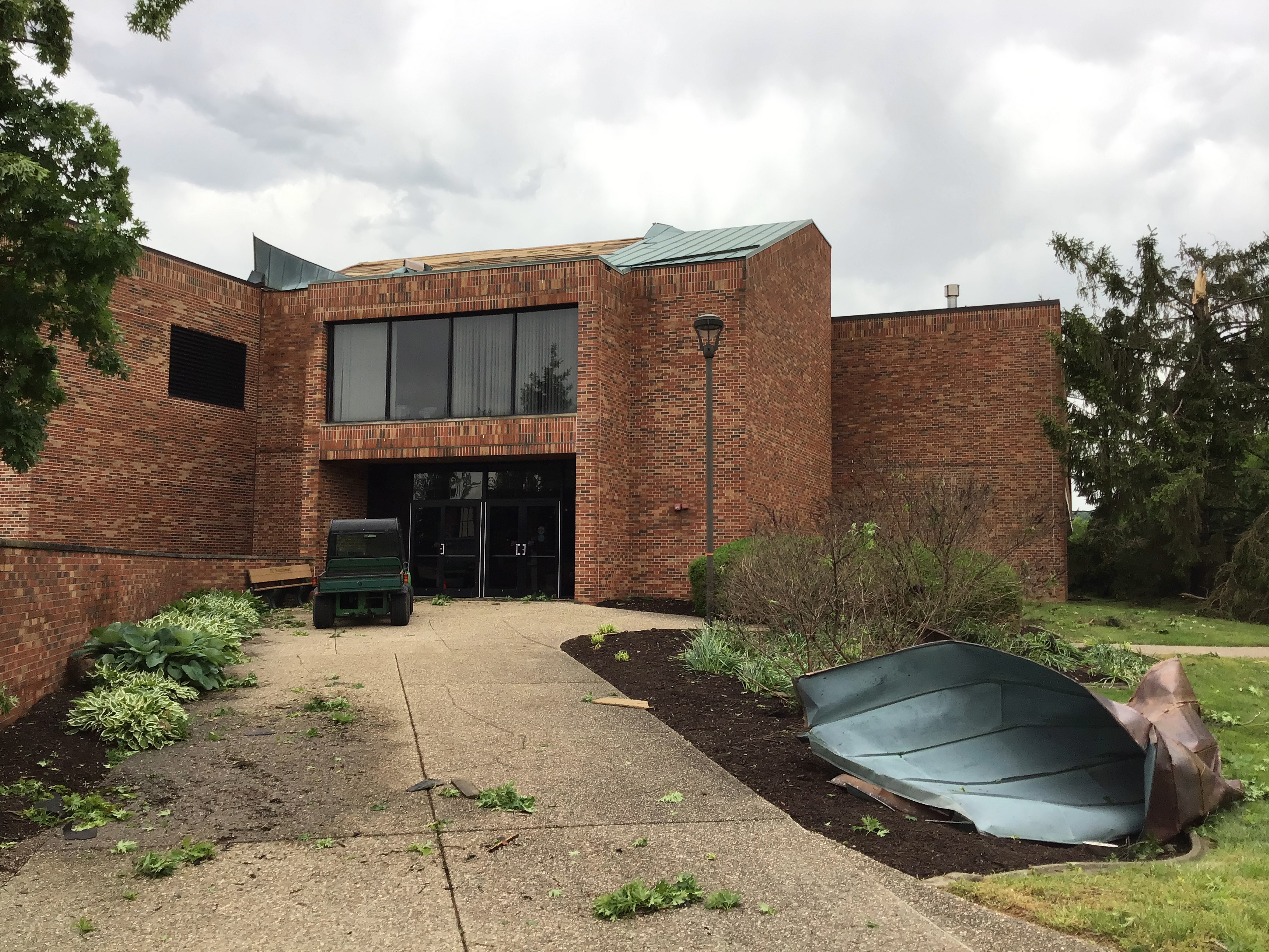
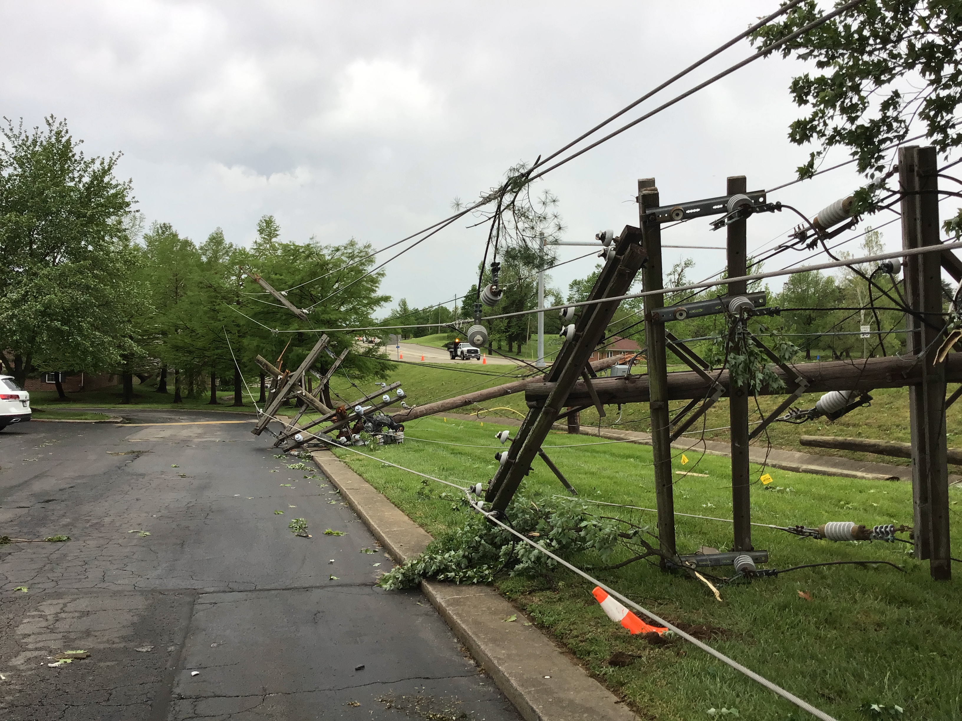
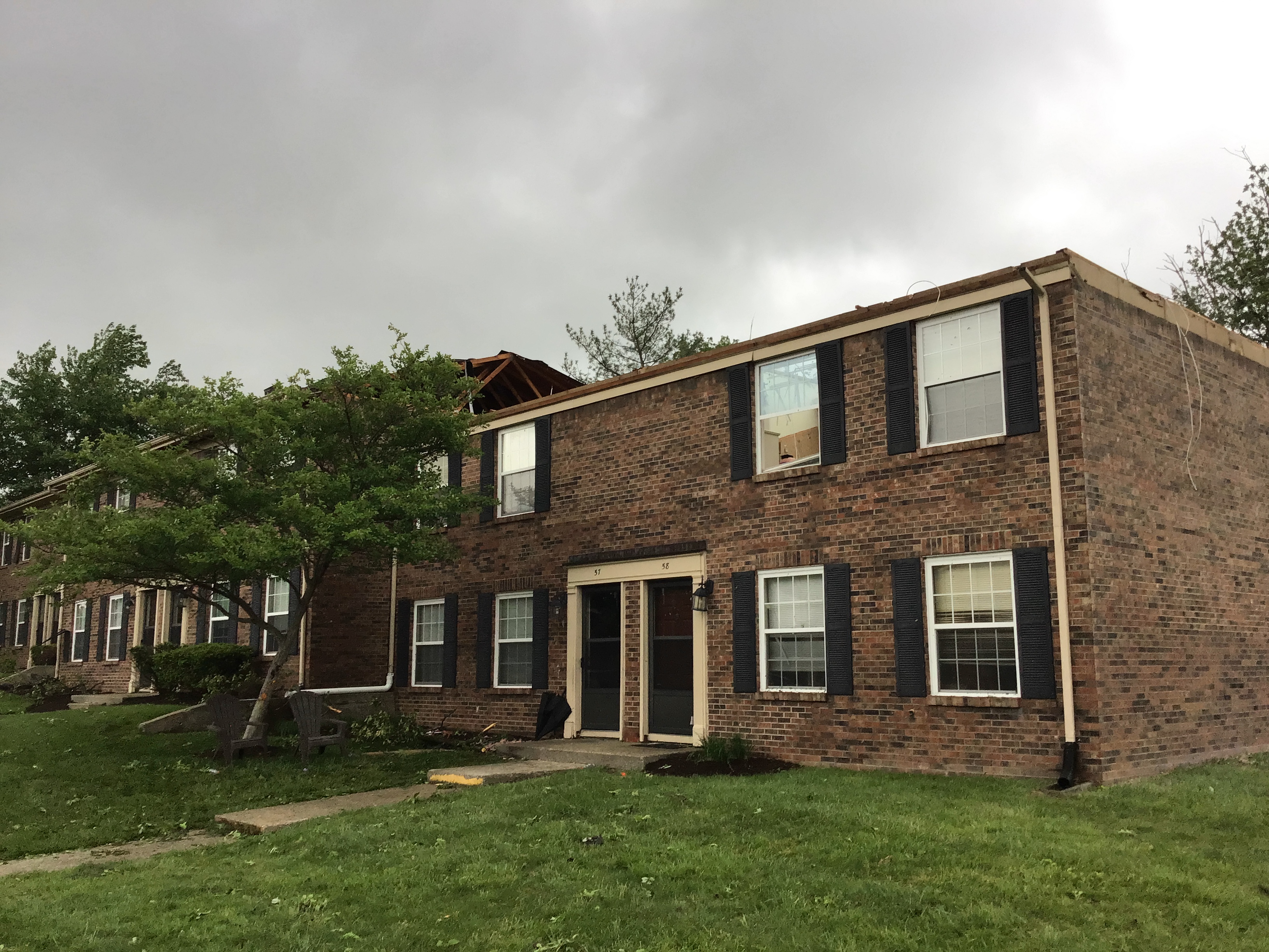
0848 AM Tornado 3 N New Albany 38.34N 85.82W
05/07/2023 Floyd IN NWS Storm Survey
*** 2 INJ ***
NWS Storm Survey confirmed an EF-1 tornado
touched down near the Natural Science and
Nursing building on the campus of Indiana
University Southeast. There was roof and
siding damage to the building and trees
between the parking lot and Grenadier Drive,
facing east, north, and northwest. Power
poles were snapped along Highway 111 (Grant
Line Rd). Apartments along Countryside Drive
had shingle, gutter and downspout damage.
However, one of the apartments had a large
section of its roof torn off with debris
being thrown in all directions. Two people
in the apartment building were injured with
head lacerations. Shingles were thrown
several hundred yards. Trees were uprooted,
snapped and twisted along Countryside Dr and
Melvyn Drive. Trees were facing from the
northwest to the southeasterly direction.
Wind speeds in this area were 100 mph with a
width of 125 yards. One house on Melvyn
Drive had no damage except for a piece of
gutter that was thrown as a missile in a
northerly direction through a window into
their living room. One outbuilding was
thrown to the south, while another
outbuilding was thrown to the north, three
houses apart. Powerlines were snapped, and
one large piece of roofing material from the
apartment was impaled into the ground. There
was numerous wooden and metal fence damage
between Melvyn Dr and Preswick Square. A
very big healthy oak tree was uprooted and
was facing east northeasterly direction.
Wind damage in this area was EF1, 105 miles
per hour with a width of 100 yards.
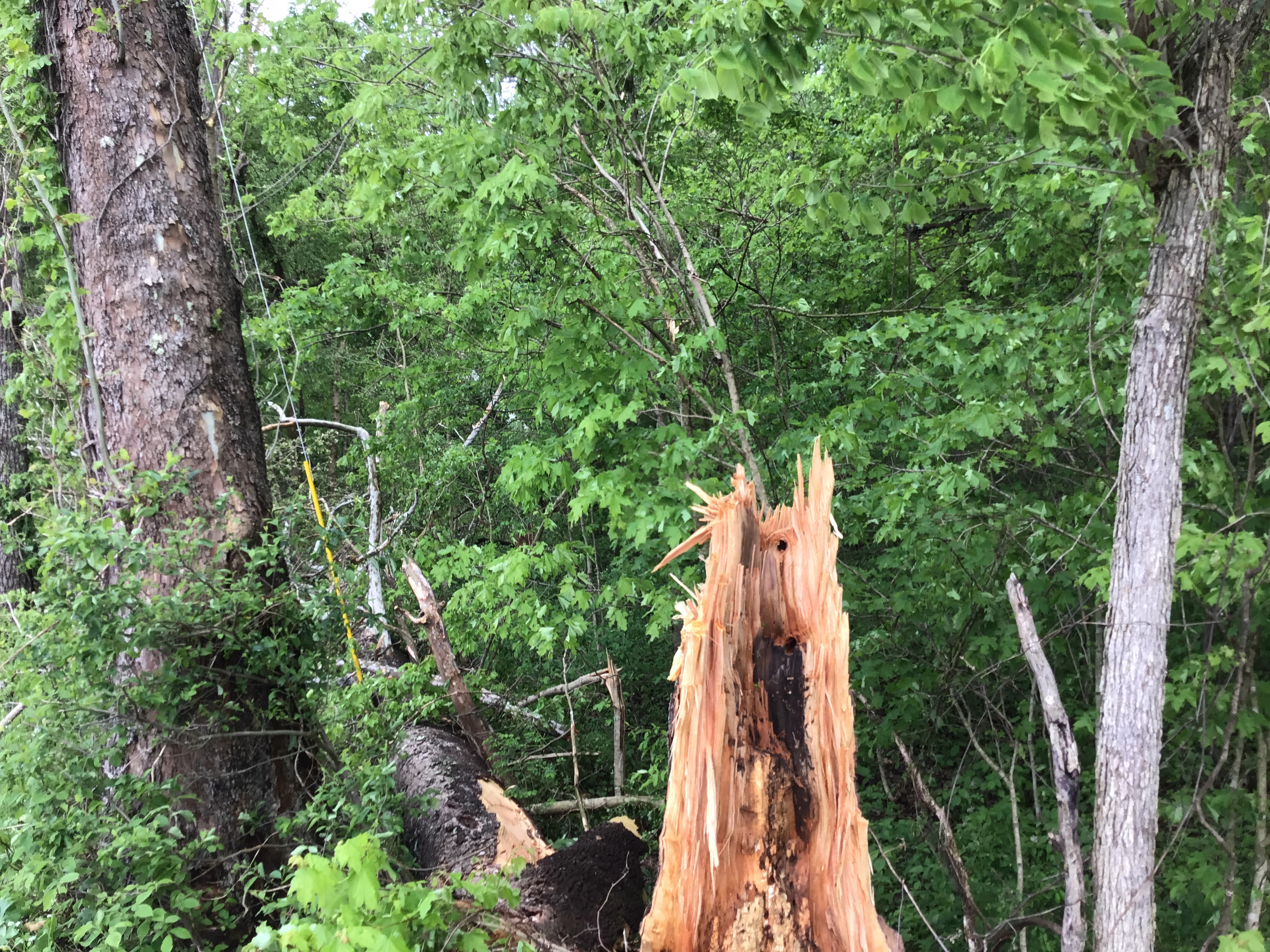
0852 AM Tornado 3 S Edwardsville 38.25N 85.90W
05/07/2023 Floyd IN NWS Storm Survey
Widespread tornado tree damage on the west
side of McCarthy Knob Rd and up the hill.
There were softwood and hardwood trees
twisted, snapped, topped, and uprooted for
almost a half mile, ending near the
intersection of Budd Rd. One house had a
tree on the back of the house along with
some gutter and fascia damage. There were
several power lines down and two power poles
pushed over. Estimated peak winds were 90
mph.
0857 AM Tornado 4 NE Bridgeport 38.22N 85.87W
05/07/2023 Floyd IN NWS Storm Survey
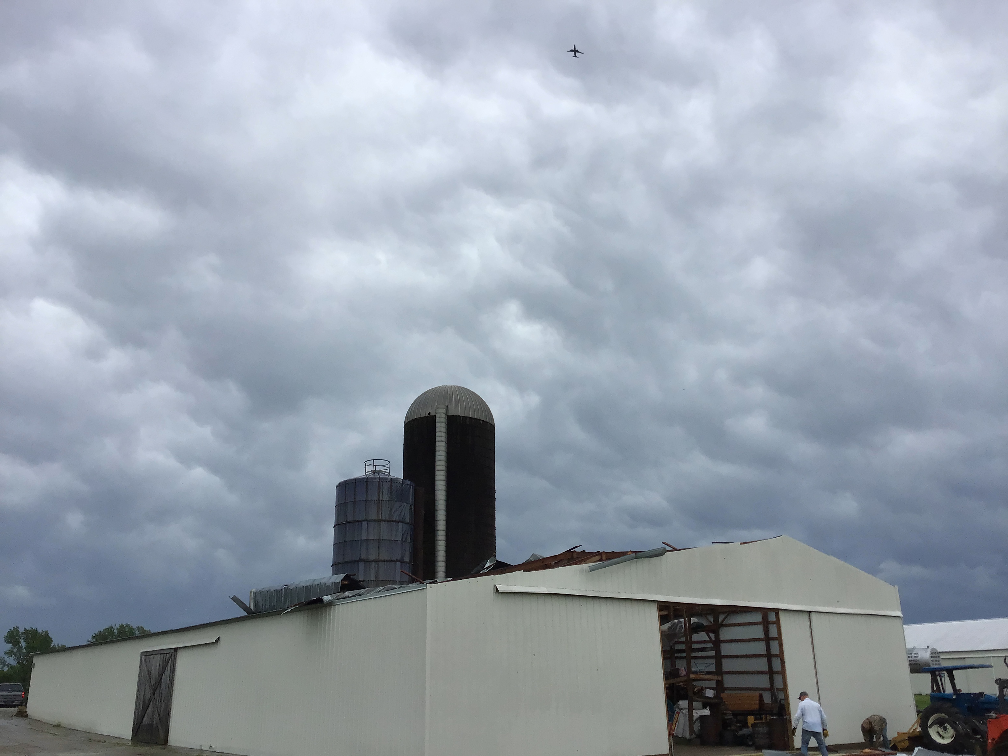
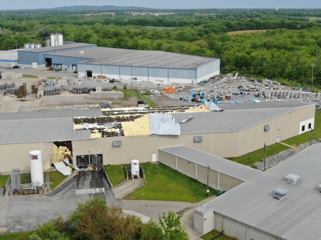
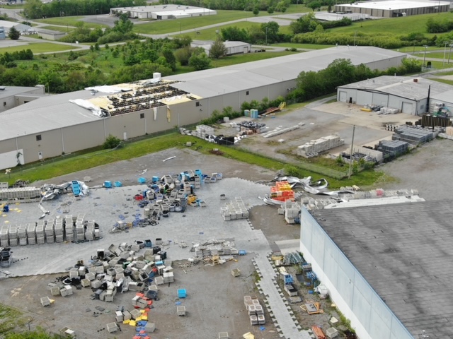
An EF1 tornado touched down near The
Sporting Club at the Farm on State Road 111.
Two large barns had significant roof damage
and there was shingle and soffit damage to a
large well-built house. A 110-pound storm
cellar door was sucked out and thrown almost
100 yards to the east. There were three
trees uprooted and facing from north to an
easterly direction. The tornado continued
along Five Mile Lane and River Road in Floyd
County where shingles were lost on a
residence and a barn garage received
significant roof damage. The tornado then
crossed the Ohio River into Kentucky in the
Lake Dreamland area of West Louisville.
Significant tree damage was noted along
River Front Drive and continued along Kale
Dreamland Rd. The tornado continued through
homes along Kendall Lane west of 31W. Trees
were snapped on the east side of the Hunters
Trace neighborhood. Significant tree damage
was observed along Malcolm Rd just north of
Gagel Ave.
0843 AM Tstm Wnd Dmg 2 NW Georgetown 38.32N 85.99W
05/07/2023 Floyd IN Public
Multiple trees downed along Hamby Road.
0846 AM Tstm Wnd Dmg 2 SSW Saint Joseph 38.36N 85.84W
05/07/2023 Floyd IN NWS Storm Survey
One softwood tree was uprooted, and a
mid-size older outbuilding had a section of
its roof blown off. The roof was blown
approximately 50 yards downwind. A storm
survey estimated peak winds of 75 mph.
0852 AM Tstm Wnd Dmg 2 NNE New Albany 38.34N 85.82W
05/07/2023 Floyd IN Public
McDonalds sign had a couple panels blown
out. Multiple trees damaged in the area as
well.
0852 AM Tstm Wnd Dmg 3 NNE New Albany 38.34N 85.82W
05/07/2023 Floyd IN Emergency Mngr
Damage to Carriage House apartment
buildings, including a roof being blown off.
At least 4 telephone poles have been
snapped. Currently an active scene.
Utilities are being turned off to the
apartments.
0852 AM Tstm Wnd Dmg 3 NNE New Albany 38.34N 85.82W
05/07/2023 Floyd IN Broadcast Media
Multiple trees are down near Grant Line Road
across from IUS.
0901 AM Tstm Wnd Dmg 4 NE Bridgeport 38.22N 85.87W
05/07/2023 Floyd IN Trained Spotter
The Shooting Club at the Farm had wind
damage to a structure, including a roof
blown off, and tree damage.
0848 AM Tstm Wnd Dmg New Salisbury 38.32N 86.10W
05/07/2023 Harrison IN Trained Spotter
Power is out and a tree is down across State
Road 64 near New Salisbury.
0946 AM Hail Lawrenceburg 38.04N 84.90W
05/07/2023 M1.00 inch Anderson KY Public
Quarter sized hail reported via social media
video.
0914 AM Tstm Wnd Dmg 2 SE Brooks 38.05N 85.70W
05/07/2023 Bullitt KY Public
Social media post about a tree down on road
near Calvary Church.
1026 AM Tstm Wnd Dmg 5 NNE Winchester 38.06N 84.14W
05/07/2023 Clark KY 911 Call Center
Trees down along Gay Evans Road. Time
estimated by radar.
1010 AM Tstm Wnd Gst 6 W Lexington 38.04N 84.60W
05/07/2023 M60 MPH Fayette KY ASOS
0903 AM Tstm Wnd Dmg 3 SE Louisville 38.23N 85.72W
05/07/2023 Jefferson KY Emergency Mngr
Tree down blocking Eastern Pkwy at Barret
Ave. Time estimated from radar.
0913 AM Tstm Wnd Dmg 4 SSW Saint Matthews 38.20N 85.66W
05/07/2023 Jefferson KY Broadcast Media
Power lines down off of Old Shepherdsville
Road near Hikes Lane.
0214 PM Tstm Wnd Dmg 7 S Spa 36.87N 87.02W
05/07/2023 Logan KY 911 Call Center
Tree down over the road on Highland Lick Rd
near Gordonsville Rd. Time estimated from
radar.
0224 PM Tstm Wnd Dmg 4 NE Russellville 36.88N 86.85W
05/07/2023 Logan KY 911 Call Center
Multiple trees down near Morgantown road
outside of Russellville. Time estimated by
radar.
0237 PM Tstm Wnd Dmg 3 ENE Olmstead 36.77N 86.96W
05/07/2023 Logan KY Public
tree down at intersection of watermelon road
and dawson road.
0543 PM Tstm Wnd Dmg 1 WSW Olmstead 36.75N 87.03W
05/07/2023 Logan KY 911 Call Center
Tree down over the road at 600 Paul Young
Rd. Time estimated from radar.
0546 PM Tstm Wnd Dmg 2 ESE Olmstead 36.74N 86.99W
05/07/2023 Logan KY 911 Call Center
Tree down over the road at 180 Lickskillet
Rd. Time estimated from radar.
0909 AM Tstm Wnd Dmg 1 WSW Buckner 38.38N 85.44W
05/07/2023 Oldham KY Broadcast Media
Tree reported down in Buckner.
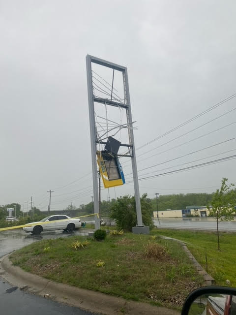
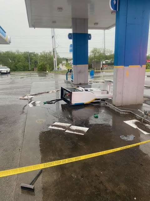
0926 AM Tornado 2 WSW Shelbyville 38.20N 85.27W
05/07/2023 Shelby KY NWS Storm Survey
Damage was done to the Valero Gas Station
along Taylorsville Rd as well as the Black
and Decker Warehouse off of Harry Long Road.
Based on videos and damage to the
structures, the tornado was determined to be
EF0 with max winds of 75 mph. More details
can be found in the PNS.
0926 AM Tstm Wnd Dmg 2 WSW Shelbyville 38.20N 85.27W
05/07/2023 Shelby KY NWS Storm Survey
Damage to a gas station with some of the
sign damage noted downwind on Pearce
Industrial Rd. Also significant roof damage
at the Black and Decker plant off of Harry
Long Rd. All of the debris from the roof was
blown to the east. No twisting noted in the
Black and Decker roof structure, with no
tree damage noted in the area.
0931 AM Tstm Wnd Dmg 2 SW Shelbyville 38.20N 85.26W
05/07/2023 Shelby KY 911 Call Center
Reports of multiple buildings with damage,
including a Macro Plastics building that has
lost a roof. The Valero gas station in the
area has lost its sign and a gas pump.
0619 PM Tstm Wnd Dmg Franklin 36.72N 86.58W
05/07/2023 Simpson KY 911 Call Center
Several trees and power lines down in the
Franklin area. Time estimated from radar.
Environment
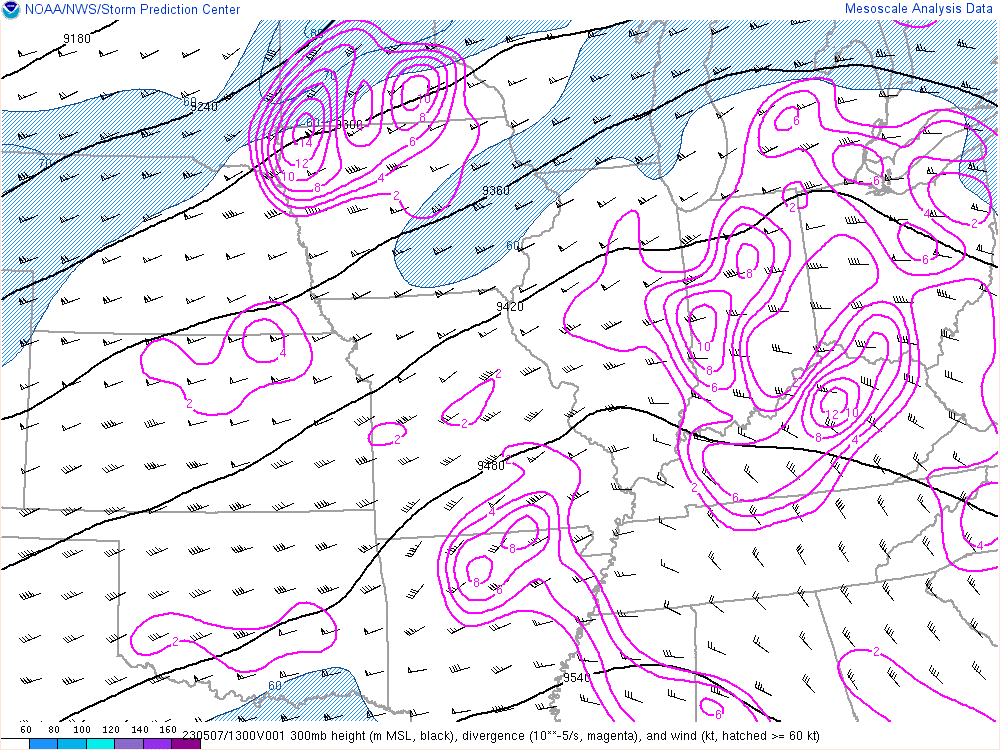 |
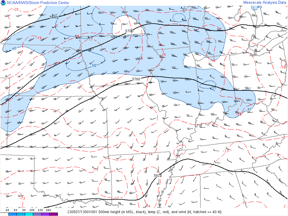 |
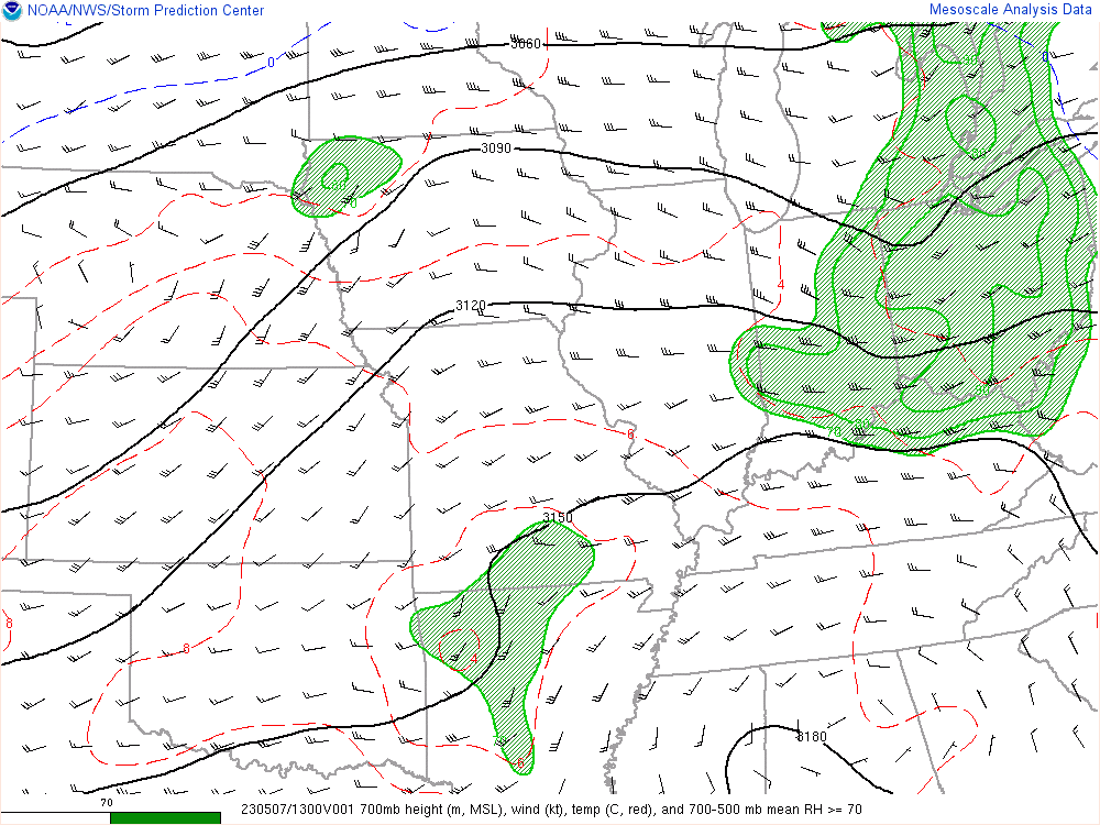 |
| Figure 1: 300mb Analysis | Figure 2: 500mb Analysis | Figure 3: 700mb Analysis |
 |
.gif) |
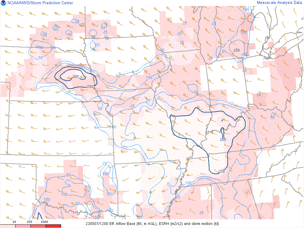 |
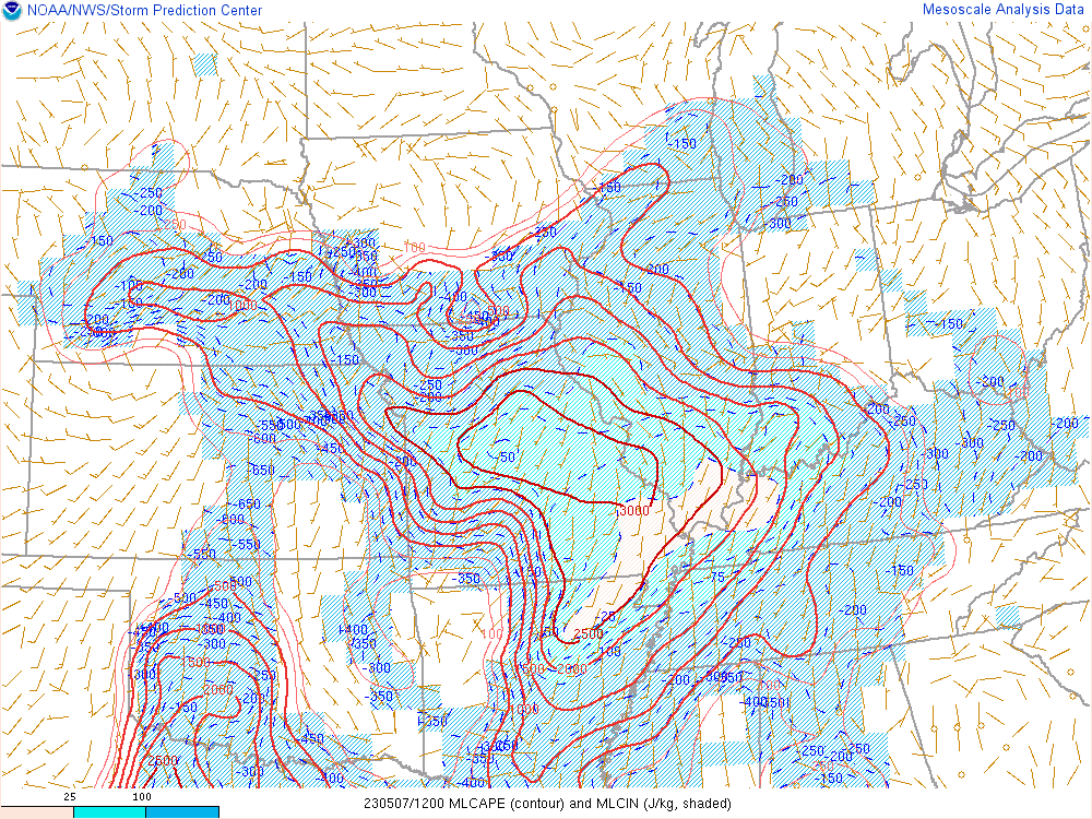
| Figure 4: Mixed-Layer CAPE Analysis | Figure 5: Effective Bulk Shear | Figure 6: Effective Storm Relative Helicity |
 |
 |
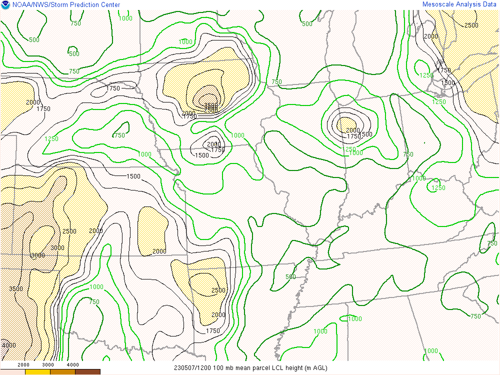 |
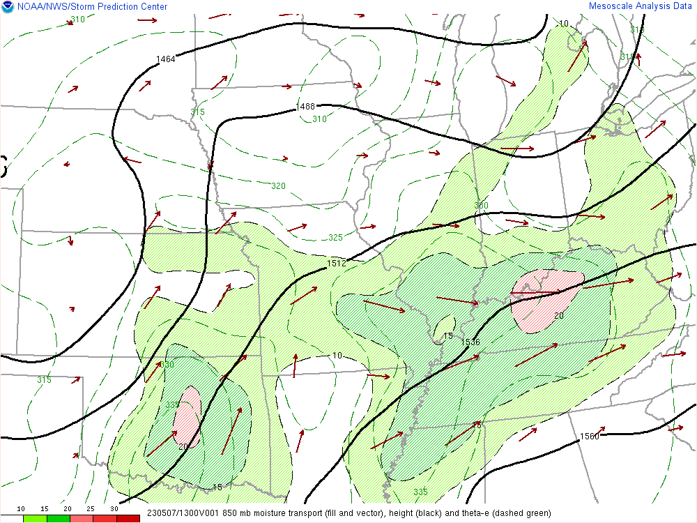
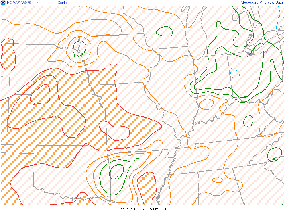
| Figure 7: 850mb Moisture Transport | Figure 8: Mid-level Lapse Rates | Figure 9: LCL Analysis |
 |
Media use of NWS Web News Stories is encouraged! Please acknowledge the NWS as the source of any news information accessed from this site. |
|


 Weather Story
 Weather Map
 Local Radar