Overview
|
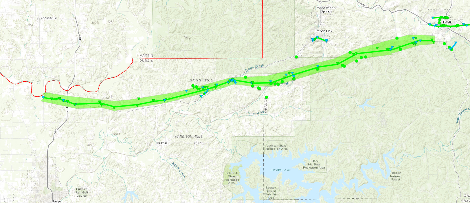
Overnight severe storms produced hail, damaging winds, and tornadoes early Monday morning August 7th, 2023. A total of six tornadoes, one microburst and several instances of straight-line wind damage resulted. A long track tornado traveled 25.89 miles through Dubois and Orange Counties, breaking the record for the longest known tornado track for the month of August within the NWS Louisville Warning Area. The previous record was: August 14, 2002 F1 tornado in Jefferson County, Indiana that went from 0.1 SW of Deputy to 3.9 NE of Deputy. Path was 4 miles long. Estimated wind speeds of 100 mph. |
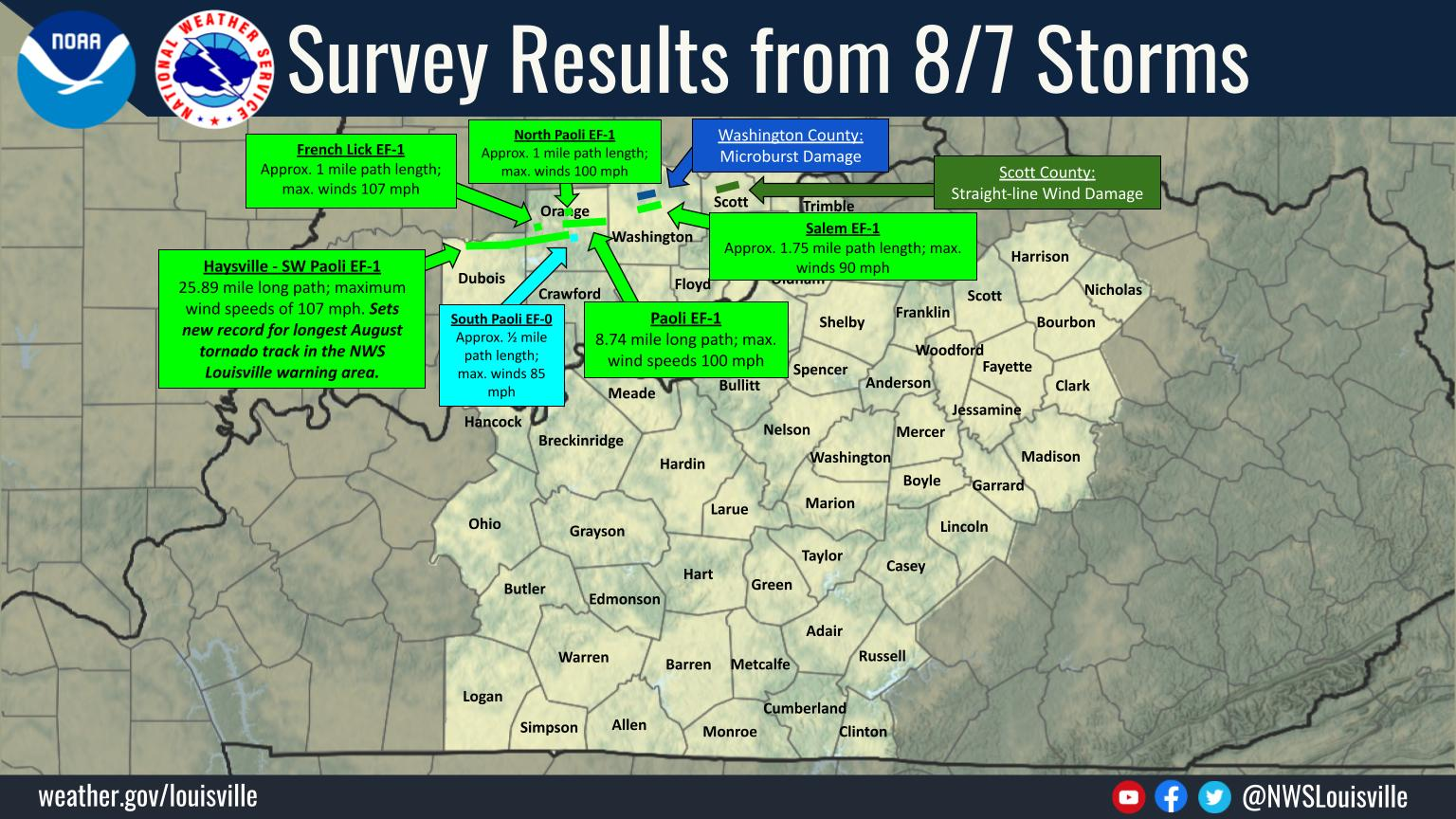 Final Damage Survey Results |
 |
 |
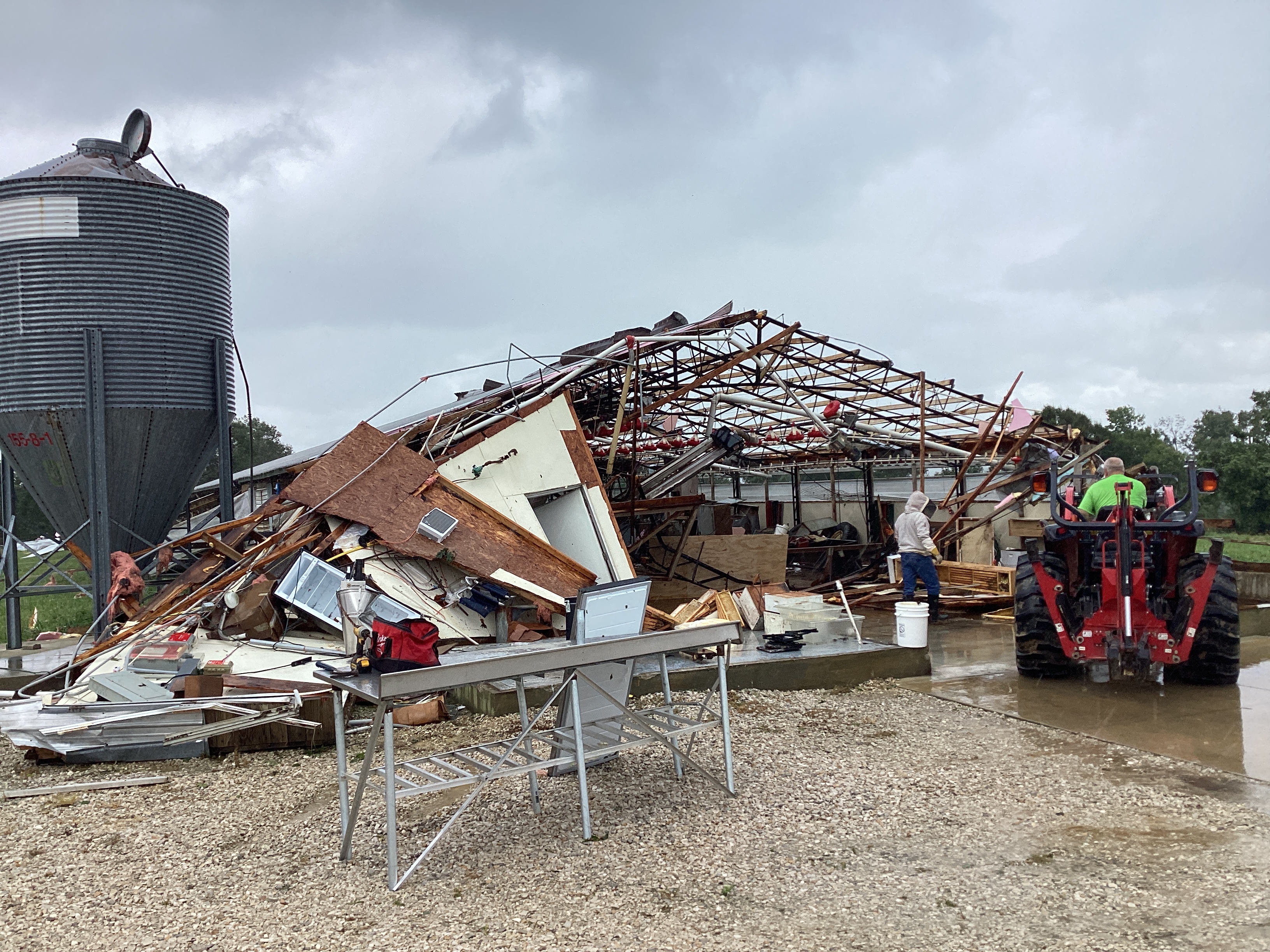 |
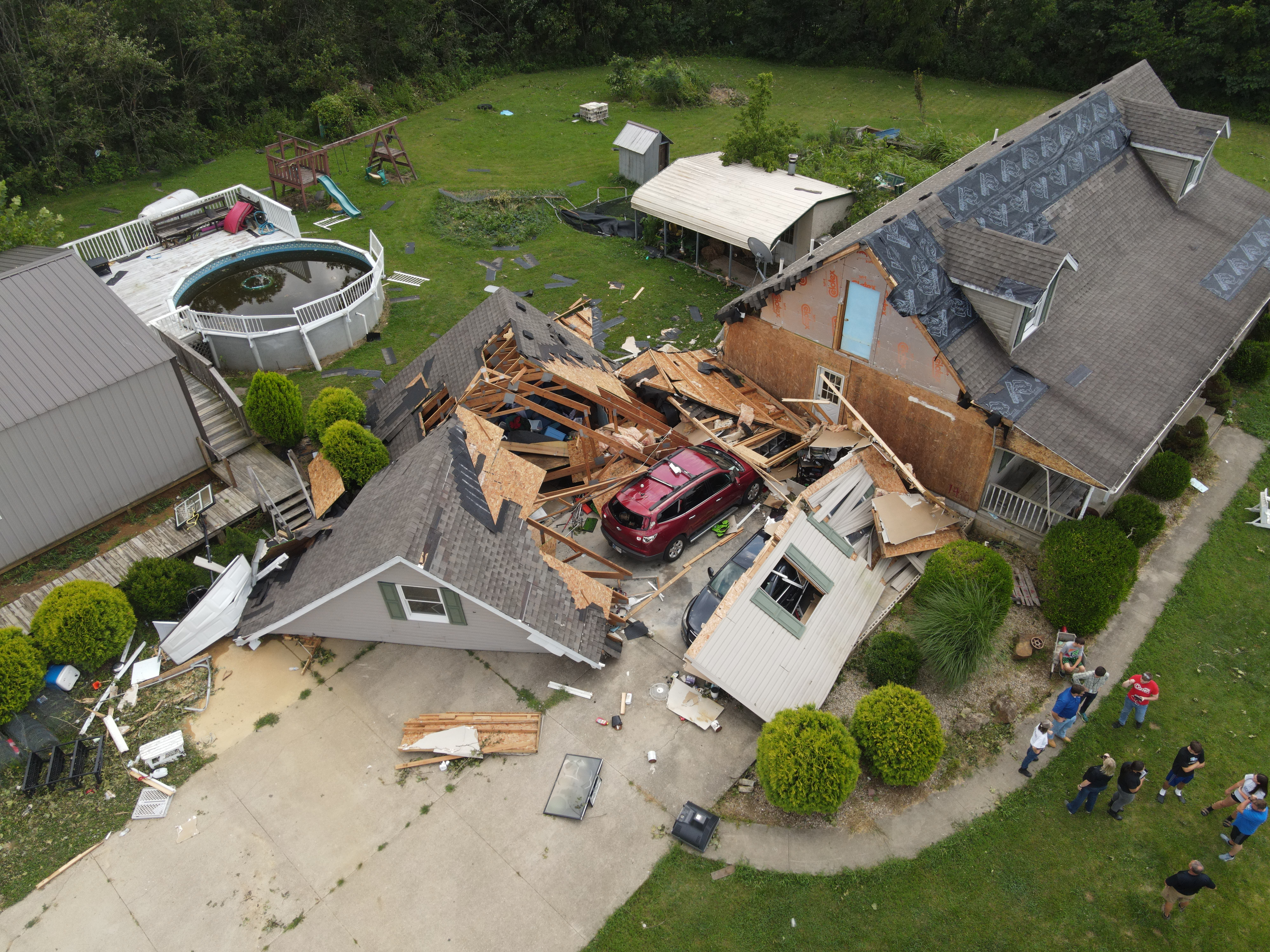
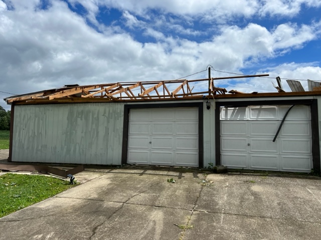
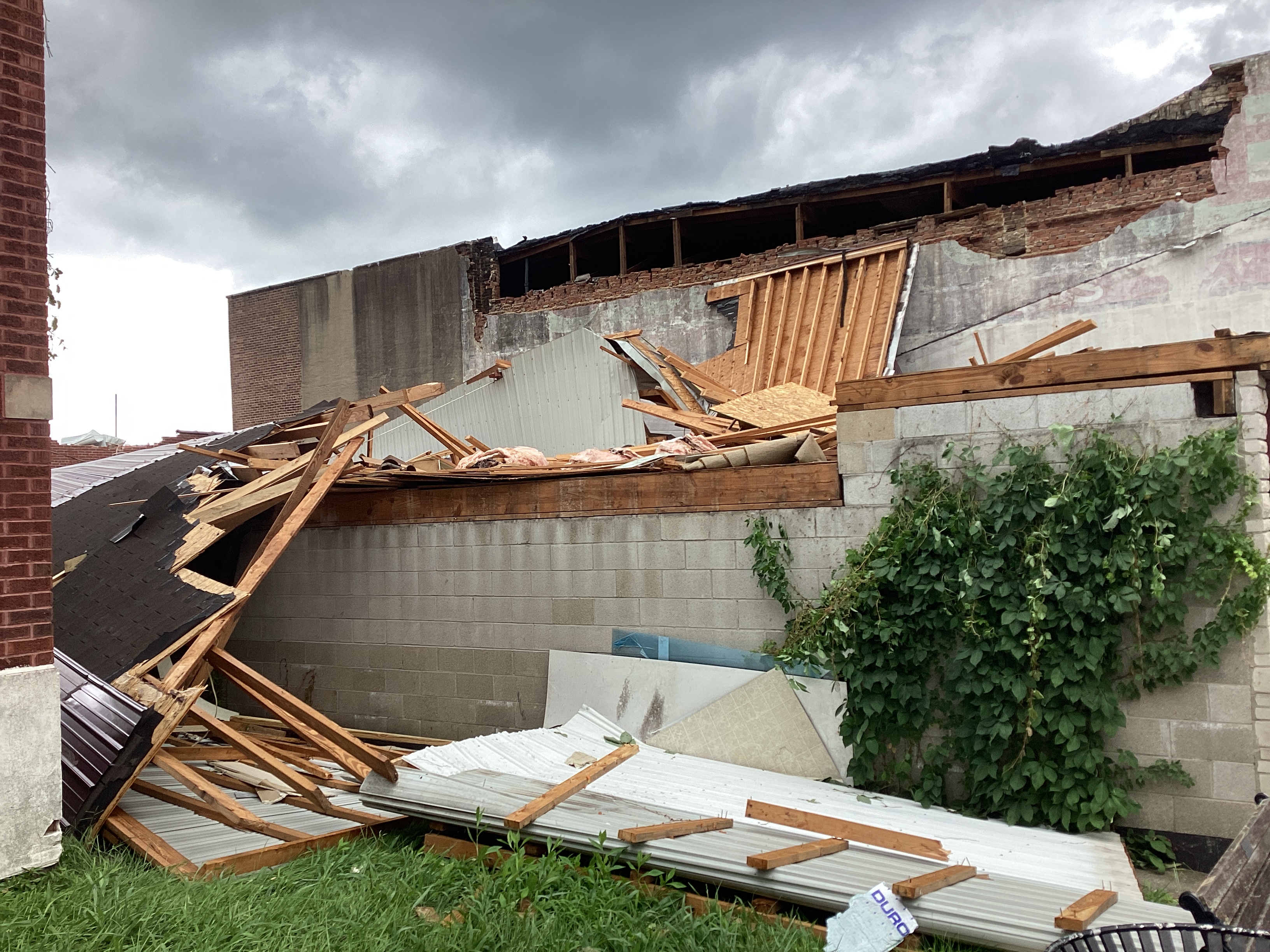
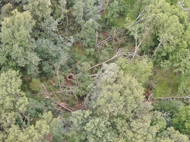
| Dubois County, IN Tornado Damage | Dubois County, IN Tornado Damage | Dubois County, IN Tornado Damage |
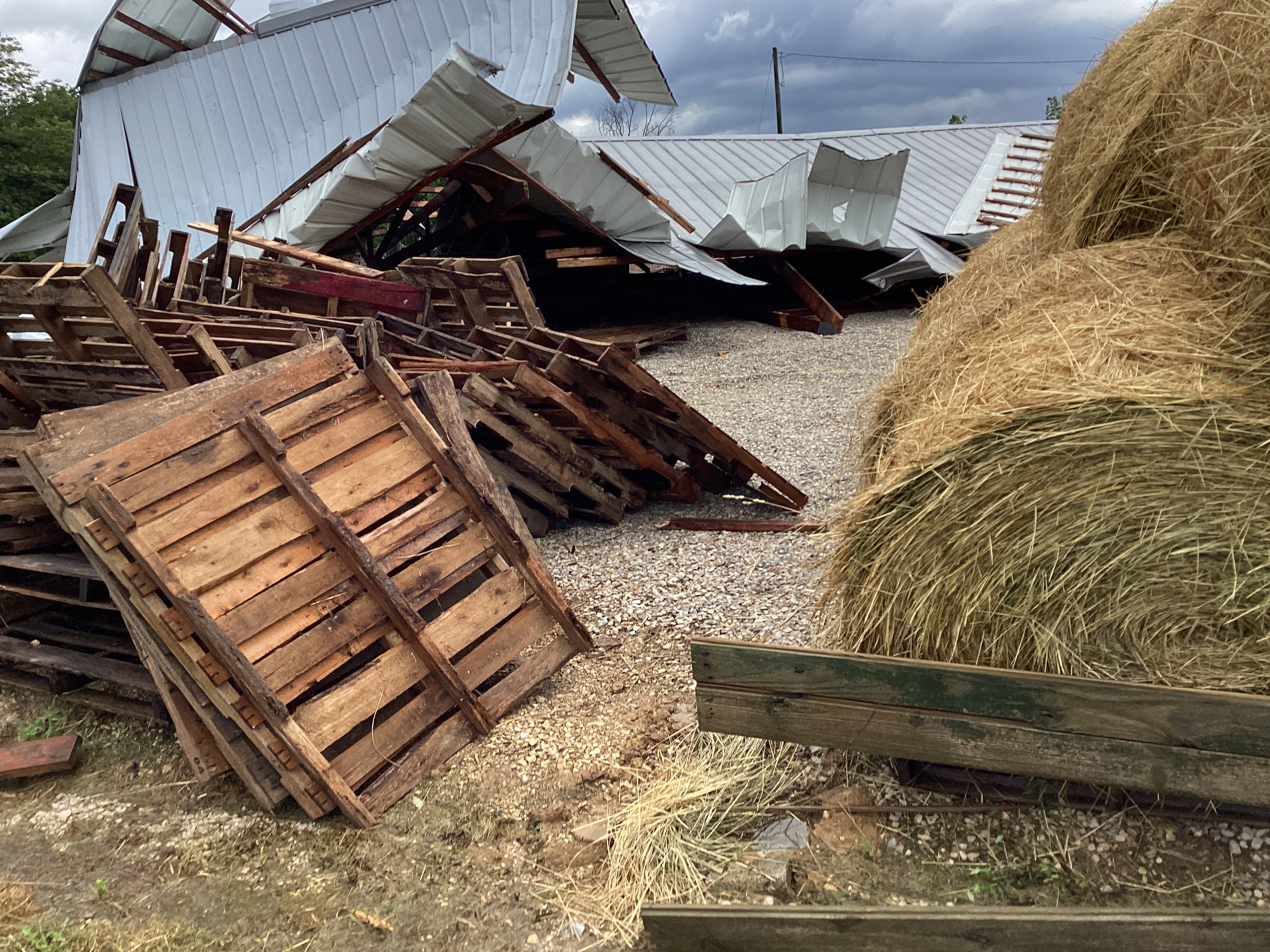
Tornadoes
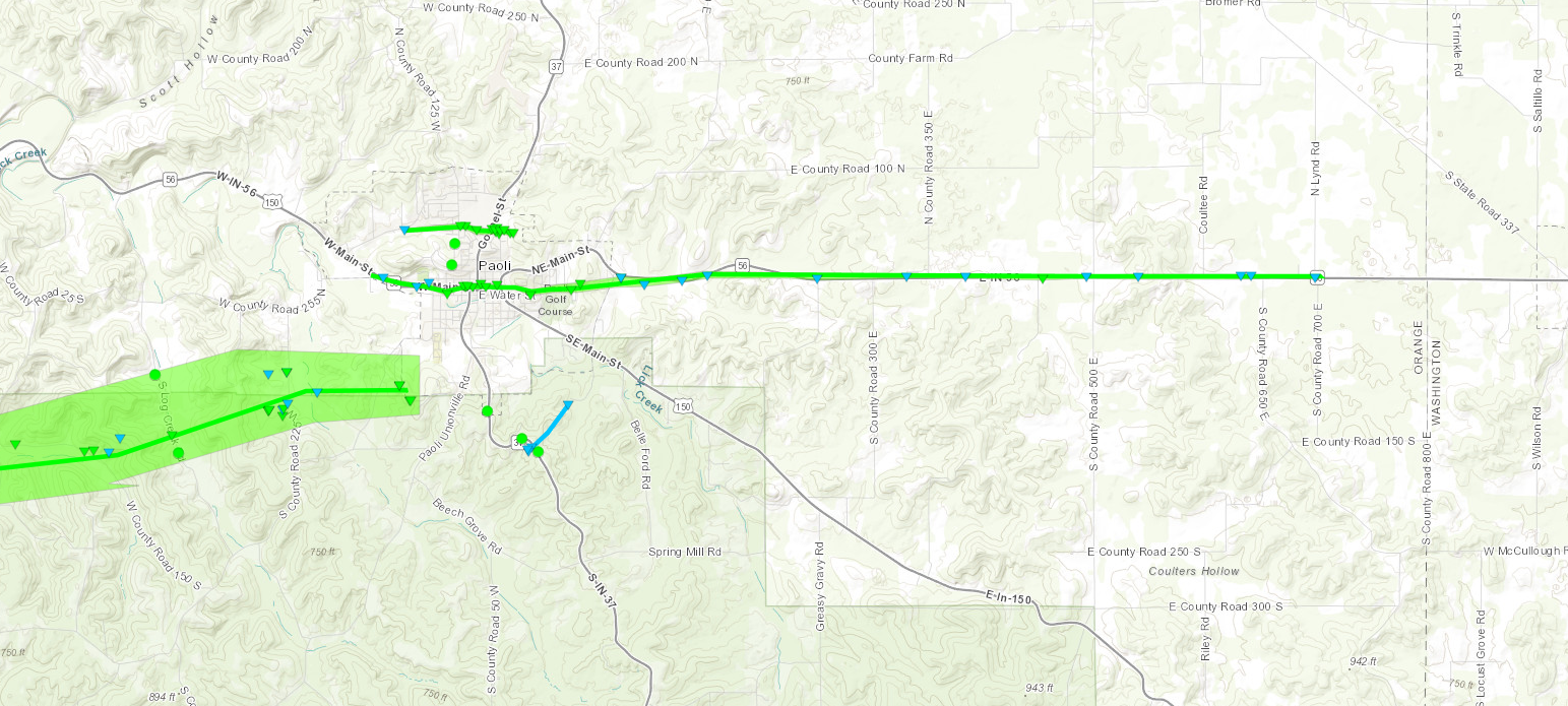
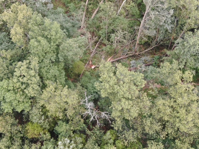
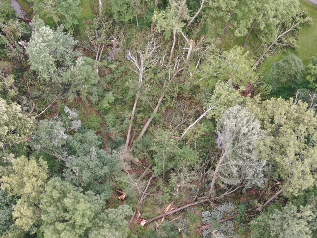
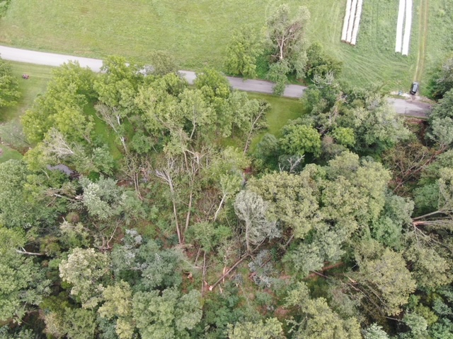
Interactive Damage Survey Map - Zoom in and click the points to see damage information and pictures. All damage points are preliminary at this time. Performance of this map may be slow due to heavy internet traffic. **Zoom in to see very small, brief tornadoes.**

|
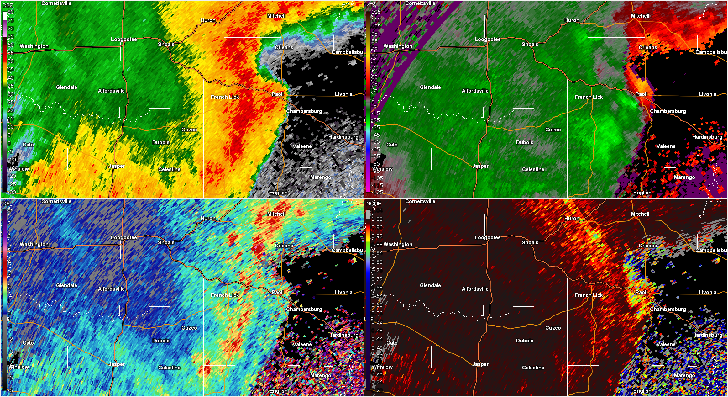
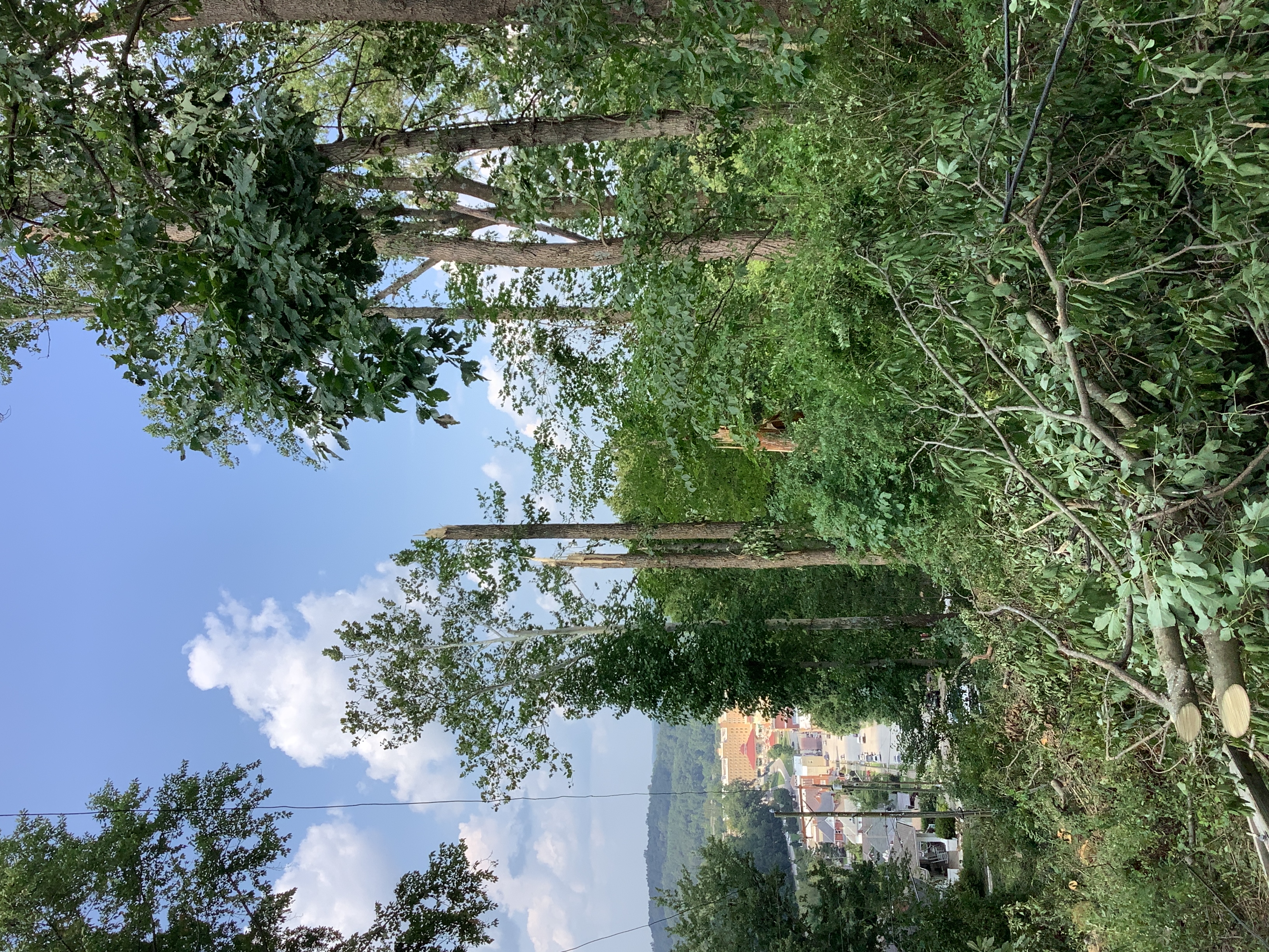
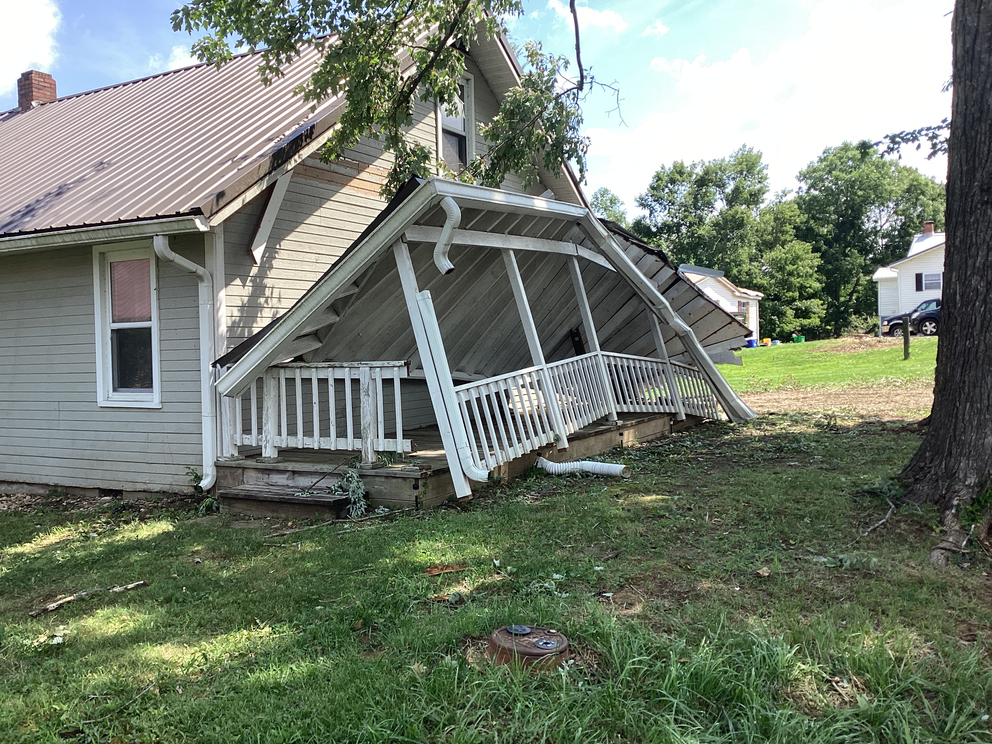
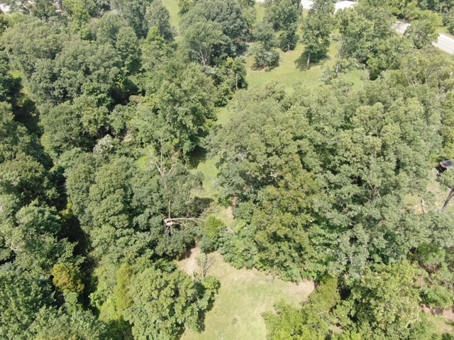
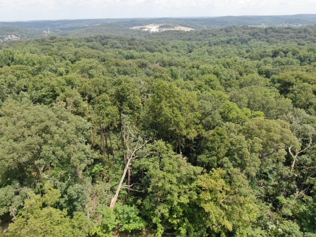
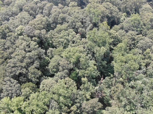
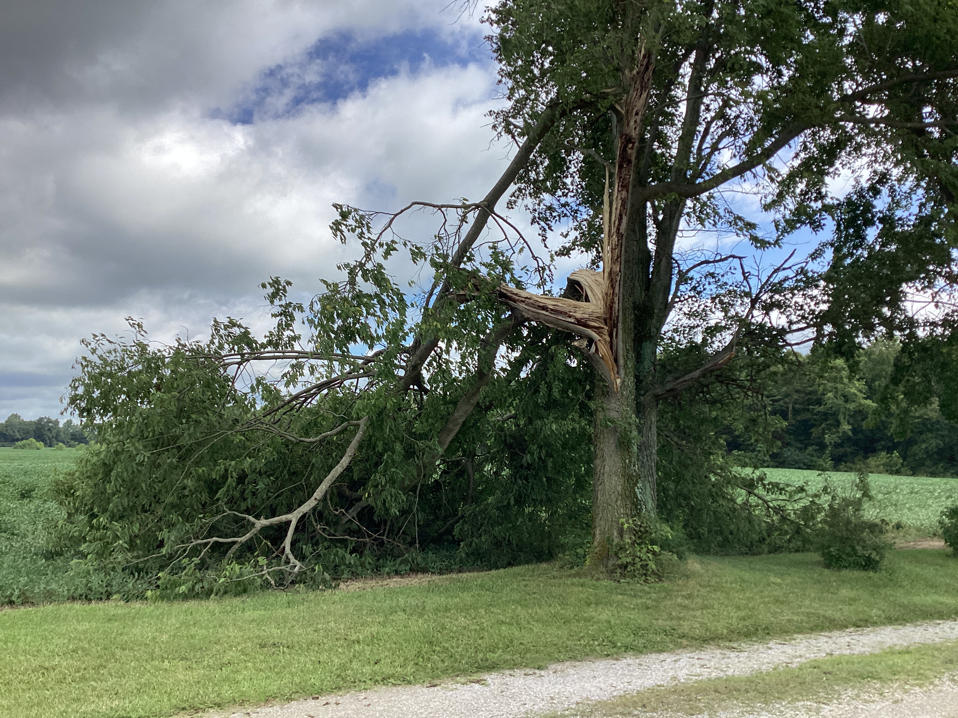
Haysville-Paoli Tornado
|
||||||||||||||||
|
||||||||||||||||
|
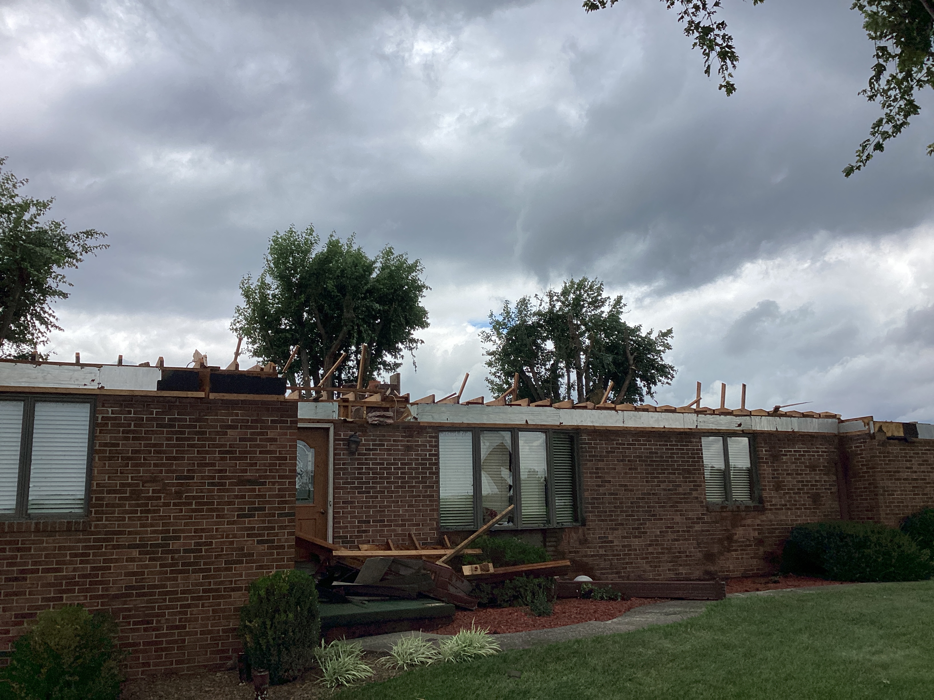
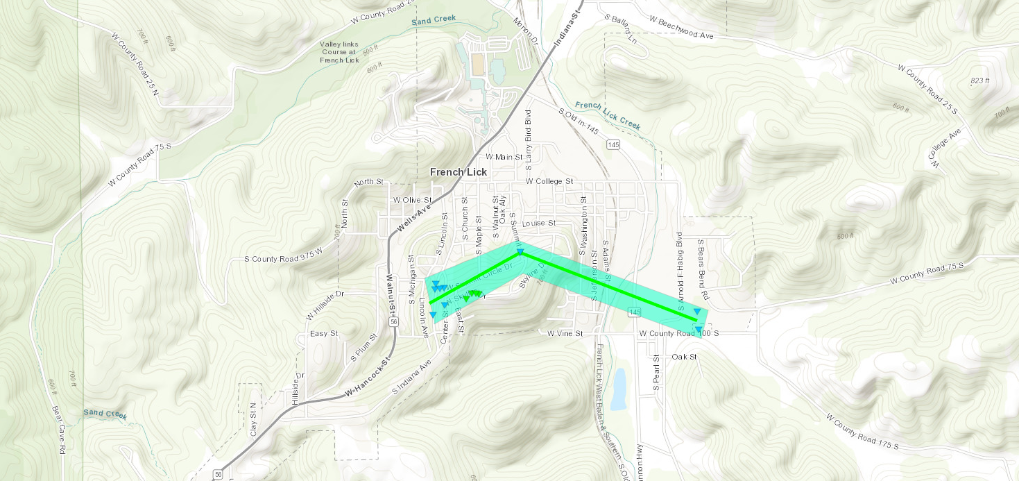
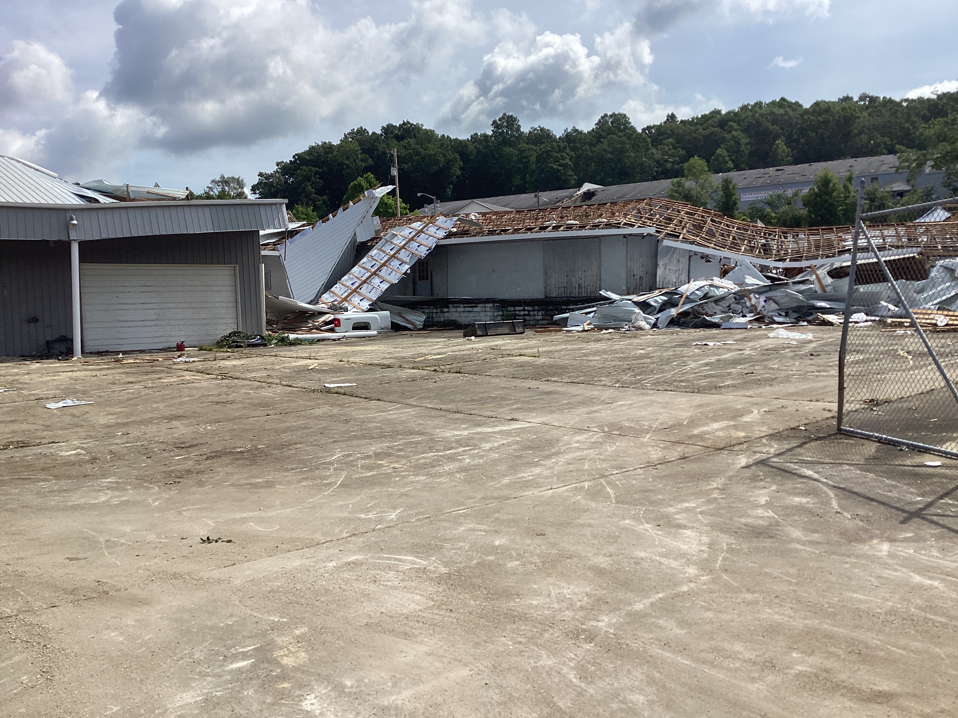
French Lick Tornado
|
||||||||||||||||
|
||||||||||||||||
|
North Paoli Tornado
|
||||||||||||||||
|
||||||||||||||||
|
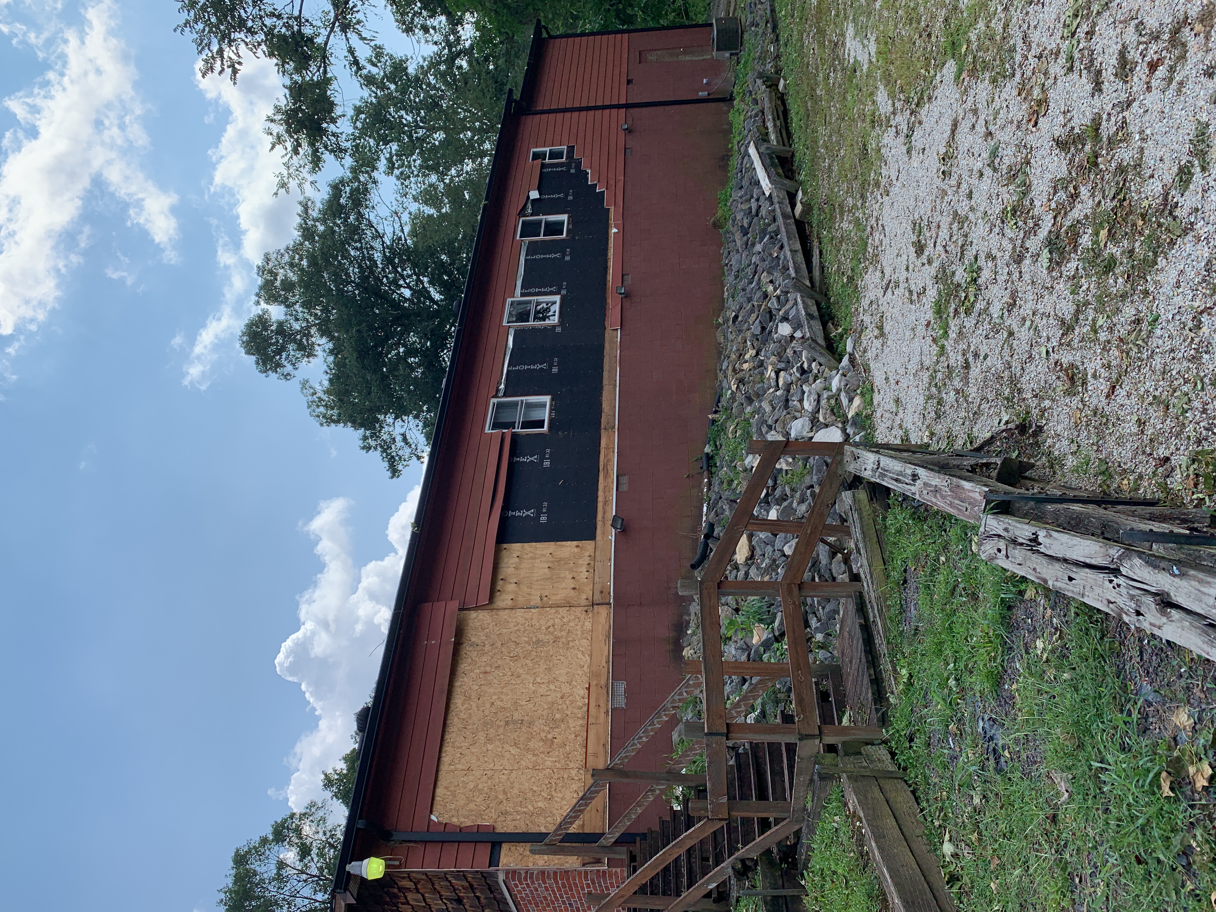
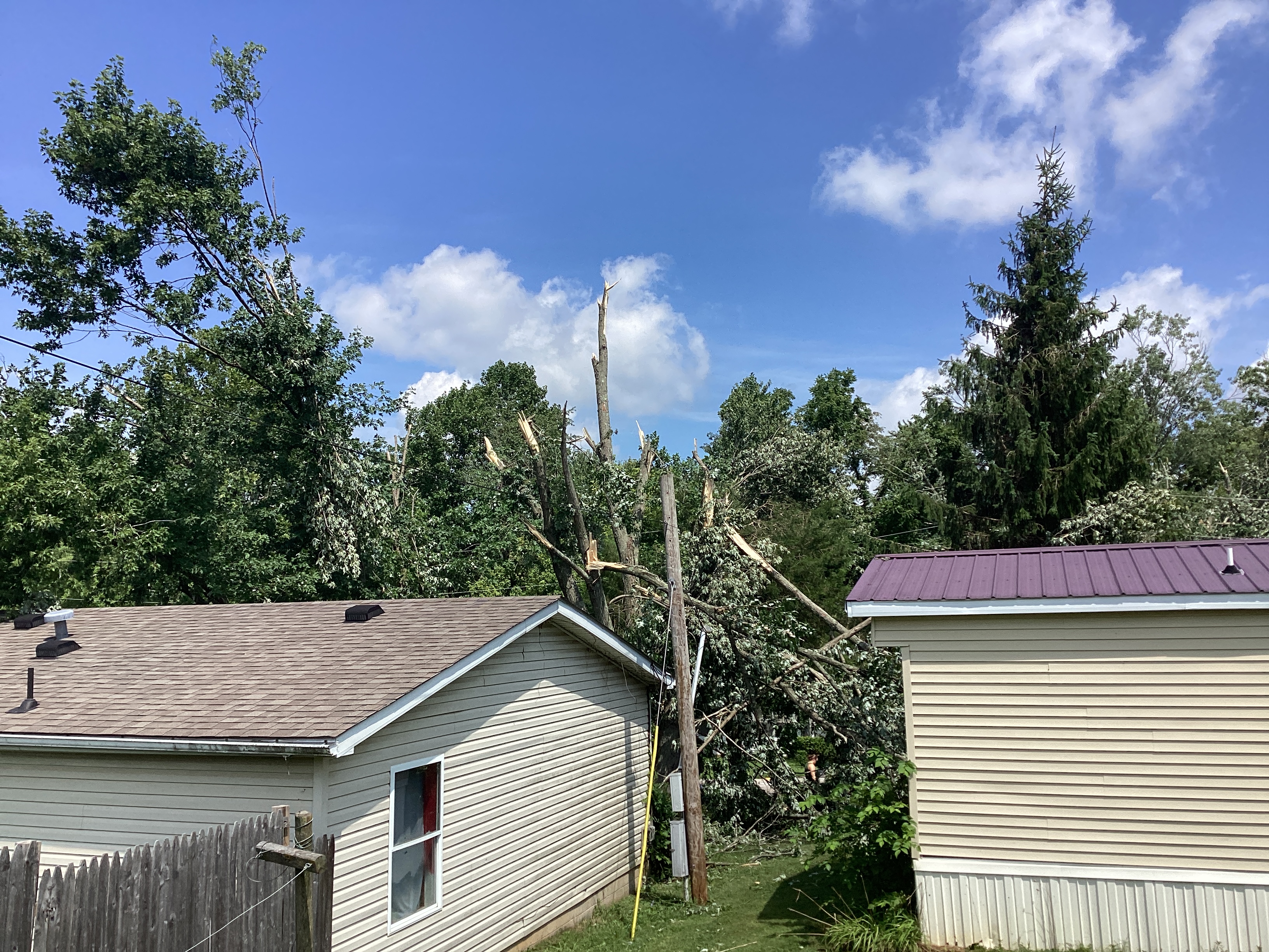
South Paoli Tornado
|
||||||||||||||||
|
||||||||||||||||
|
Paoli - East of Paoli Tornado
|
||||||||||||||||
|
||||||||||||||||
|
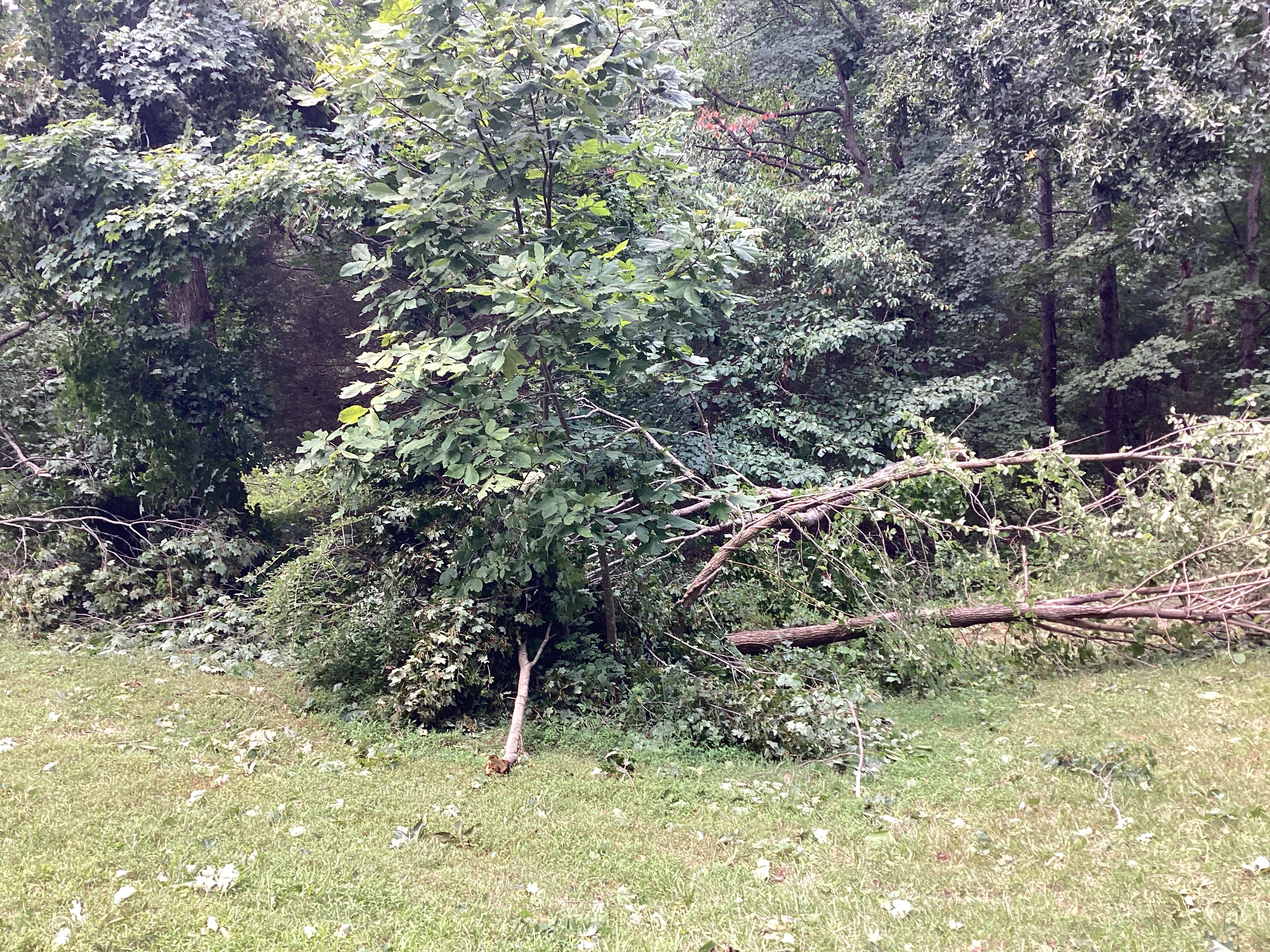
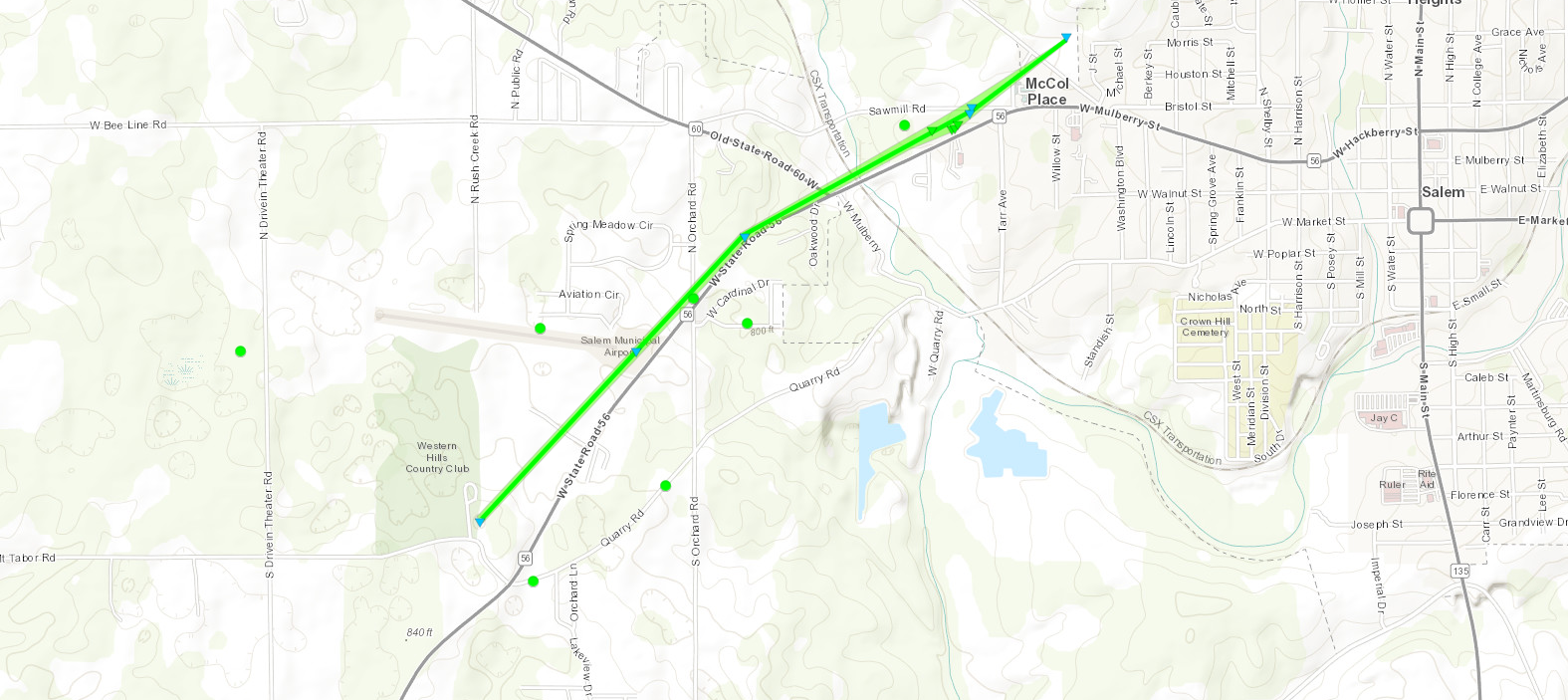
Salem Tornado
|
||||||||||||||||
|
||||||||||||||||
The Enhanced Fujita (EF) Scale classifies tornadoes into the following categories:
| EF0 Weak 65-85 mph |
EF1 Moderate 86-110 mph |
EF2 Significant 111-135 mph |
EF3 Severe 136-165 mph |
EF4 Extreme 166-200 mph |
EF5 Catastrophic 200+ mph |
 |
|||||
Wind
|
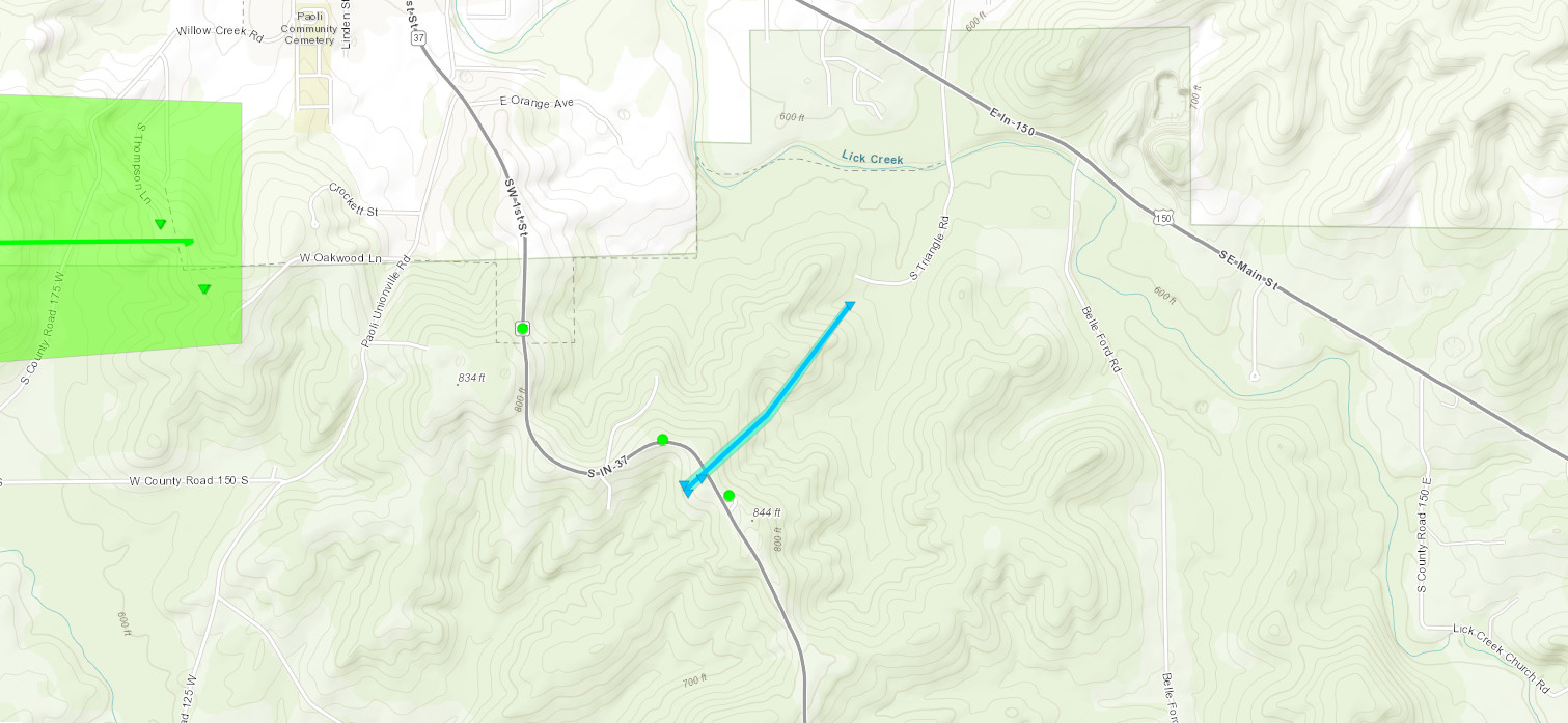
Washington County
Track Map 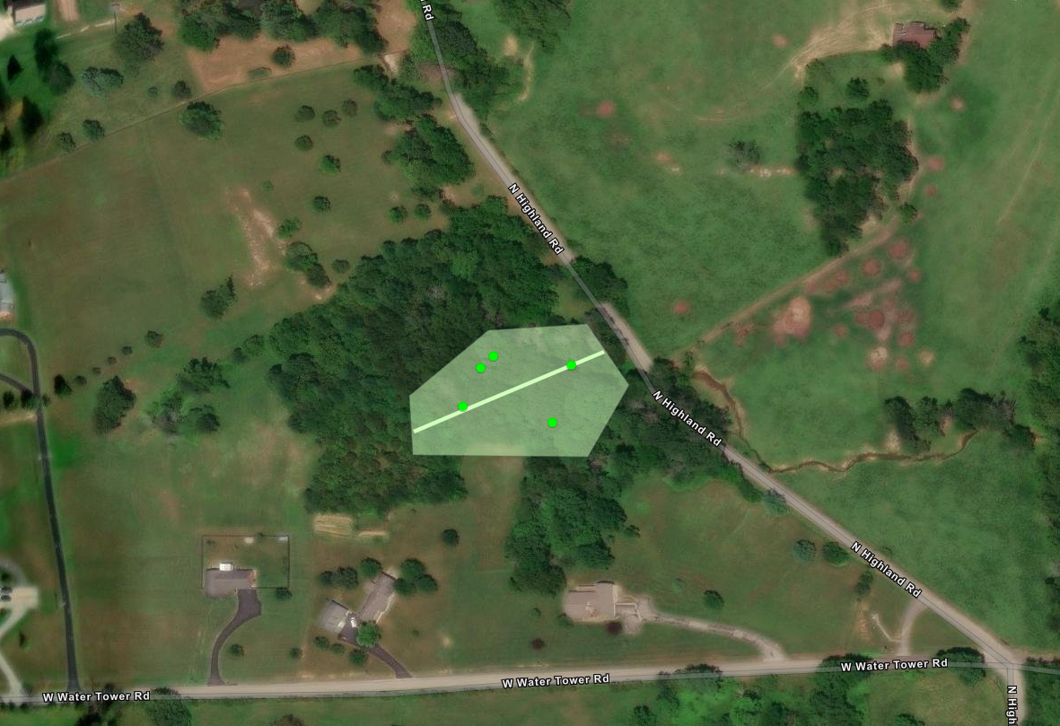
|
||||||||||||||
|
||||||||||||||
|
Scottsburg Straight-Line Winds
Track Map 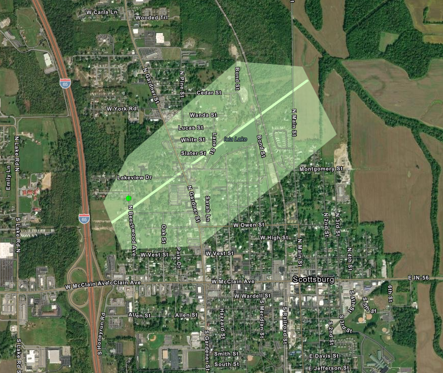
|
||||||||||||||
|
||||||||||||||
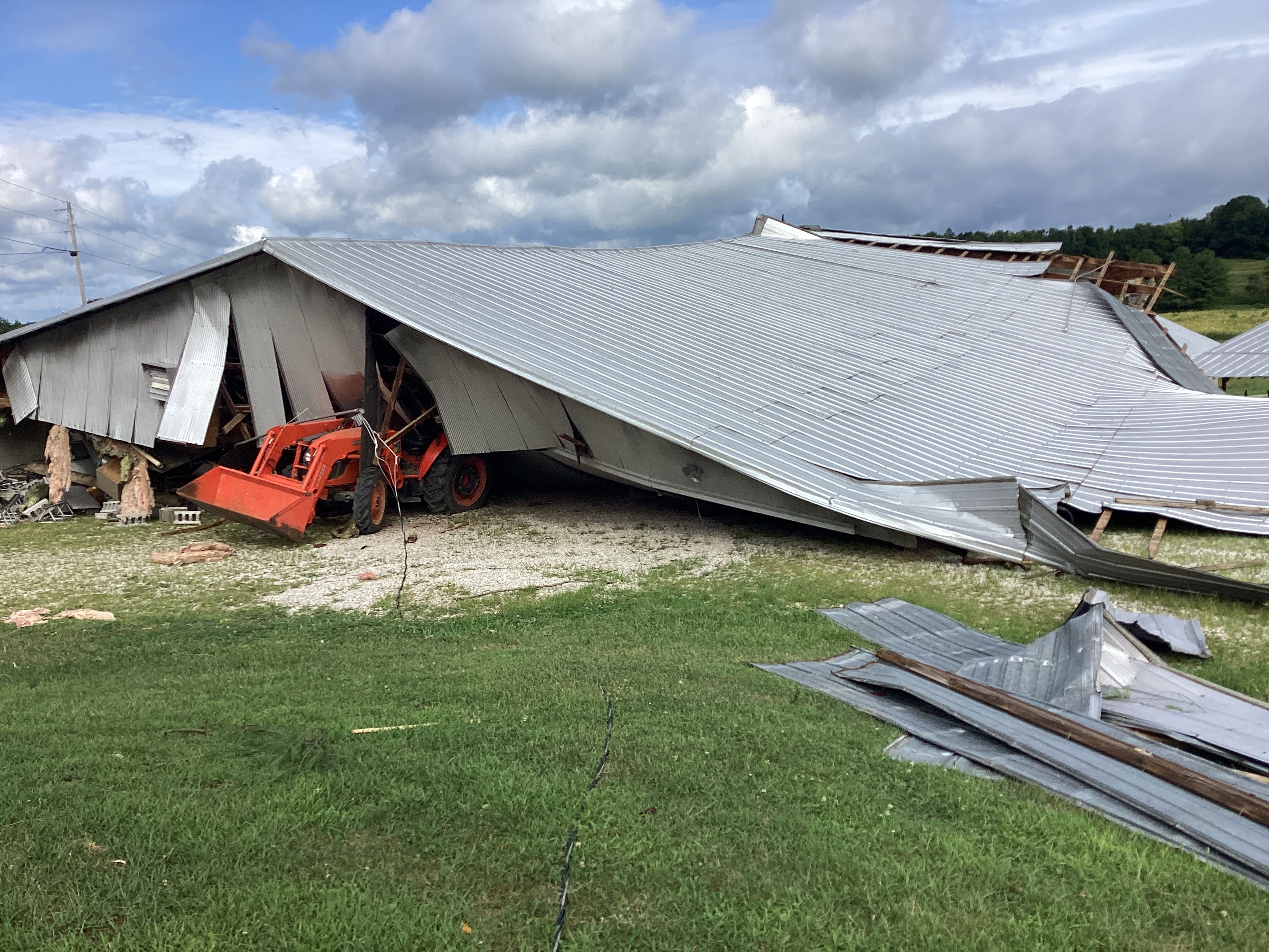
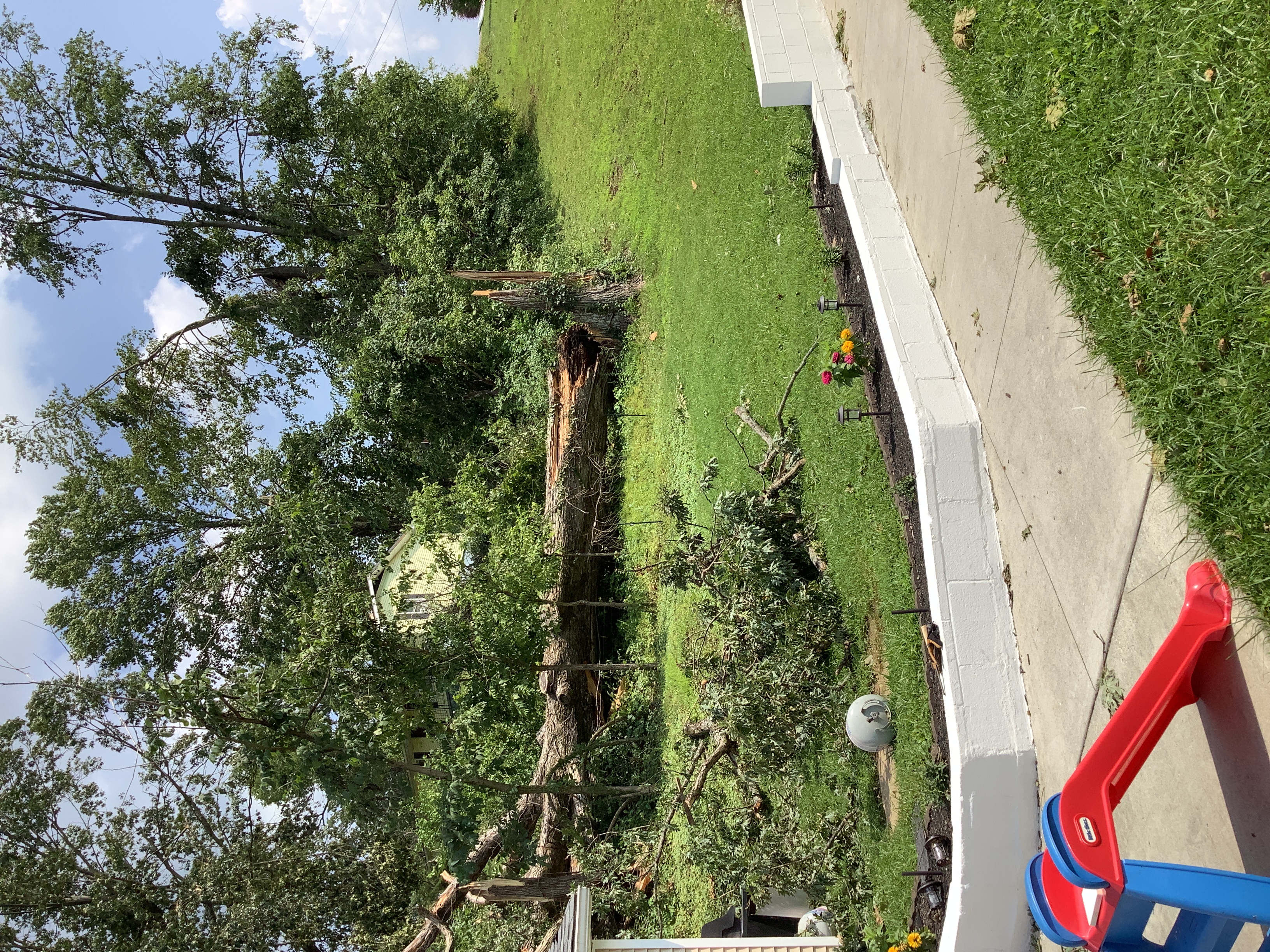
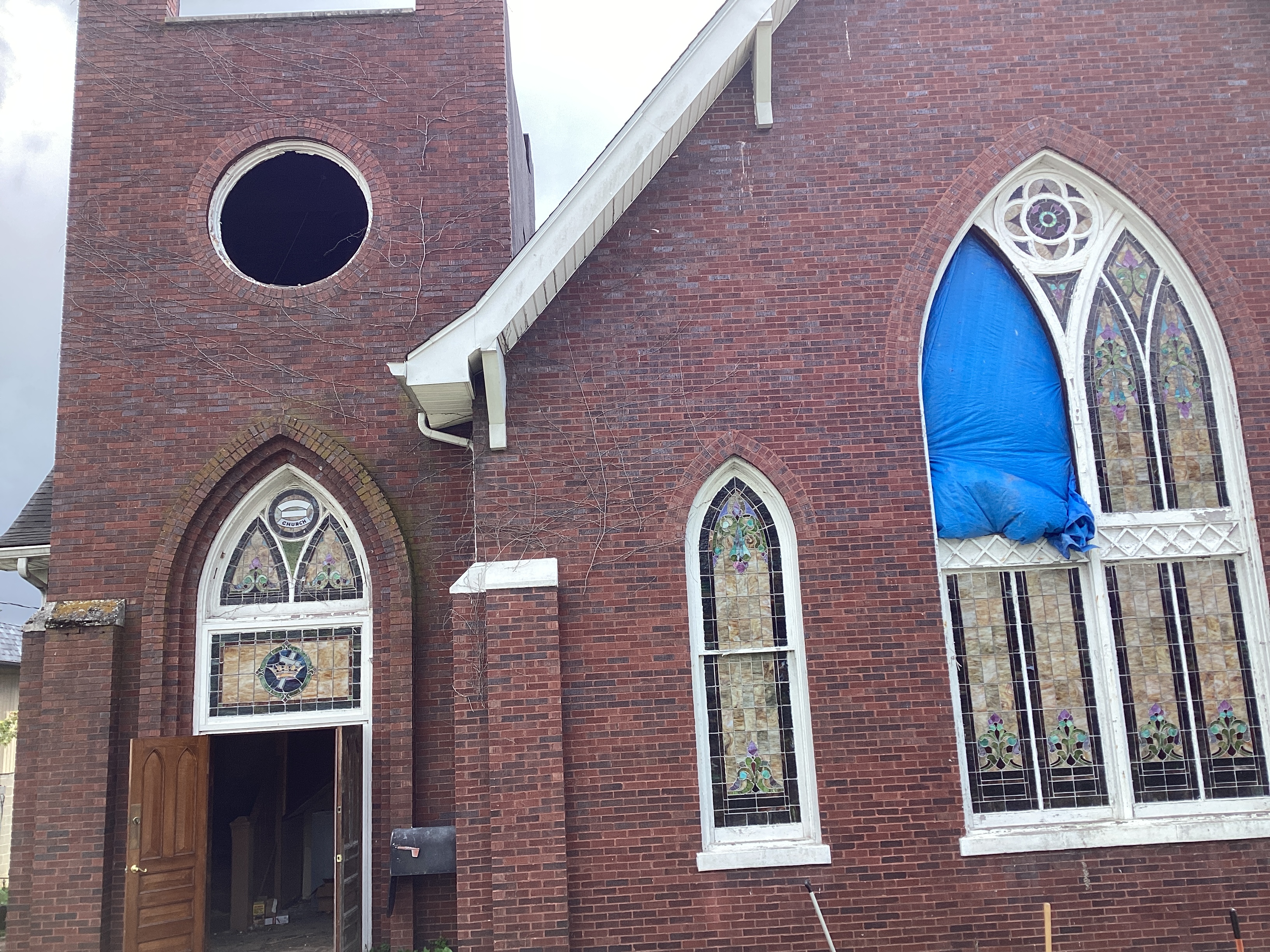
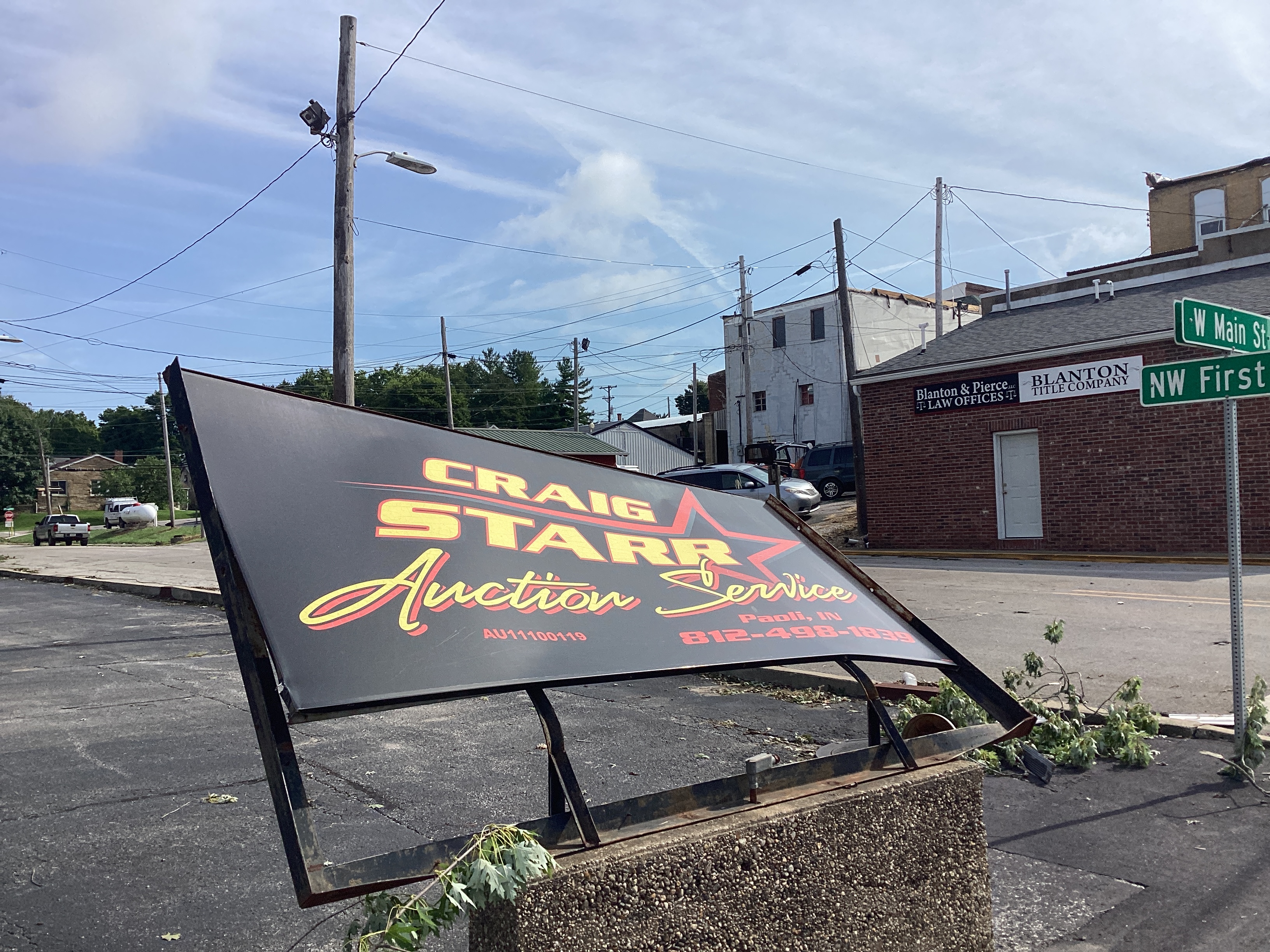
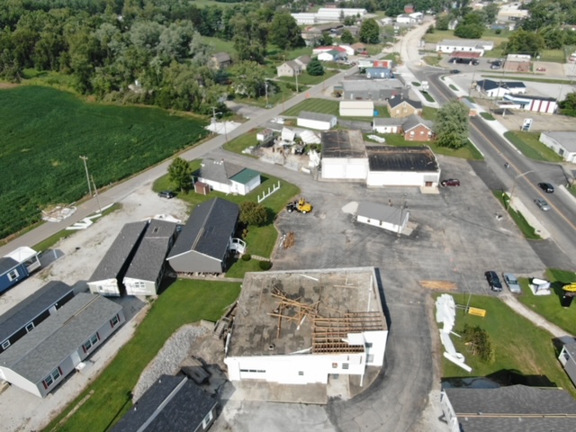
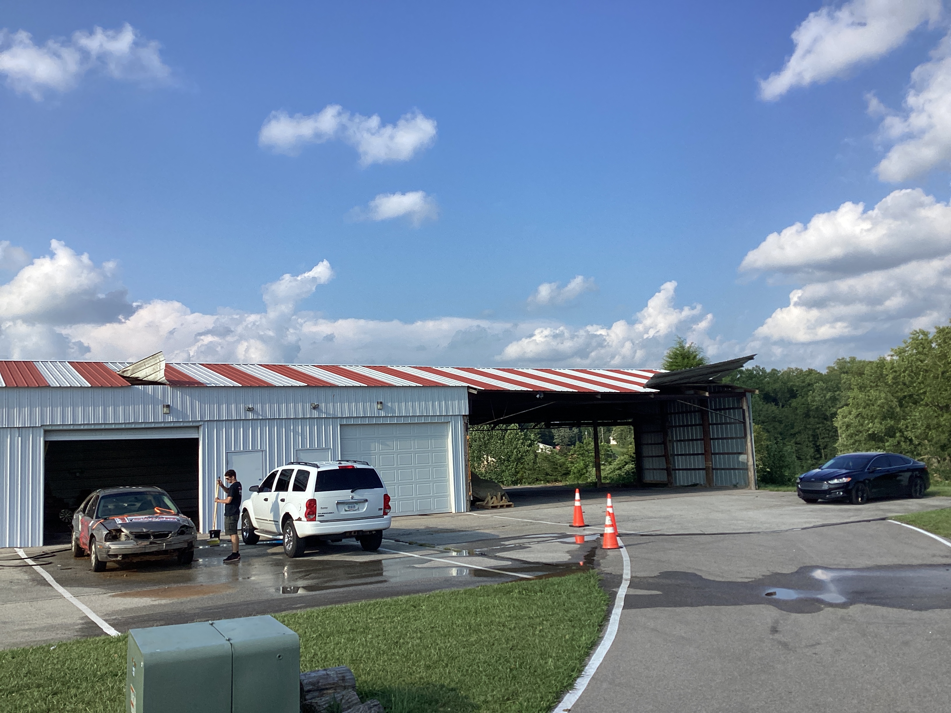
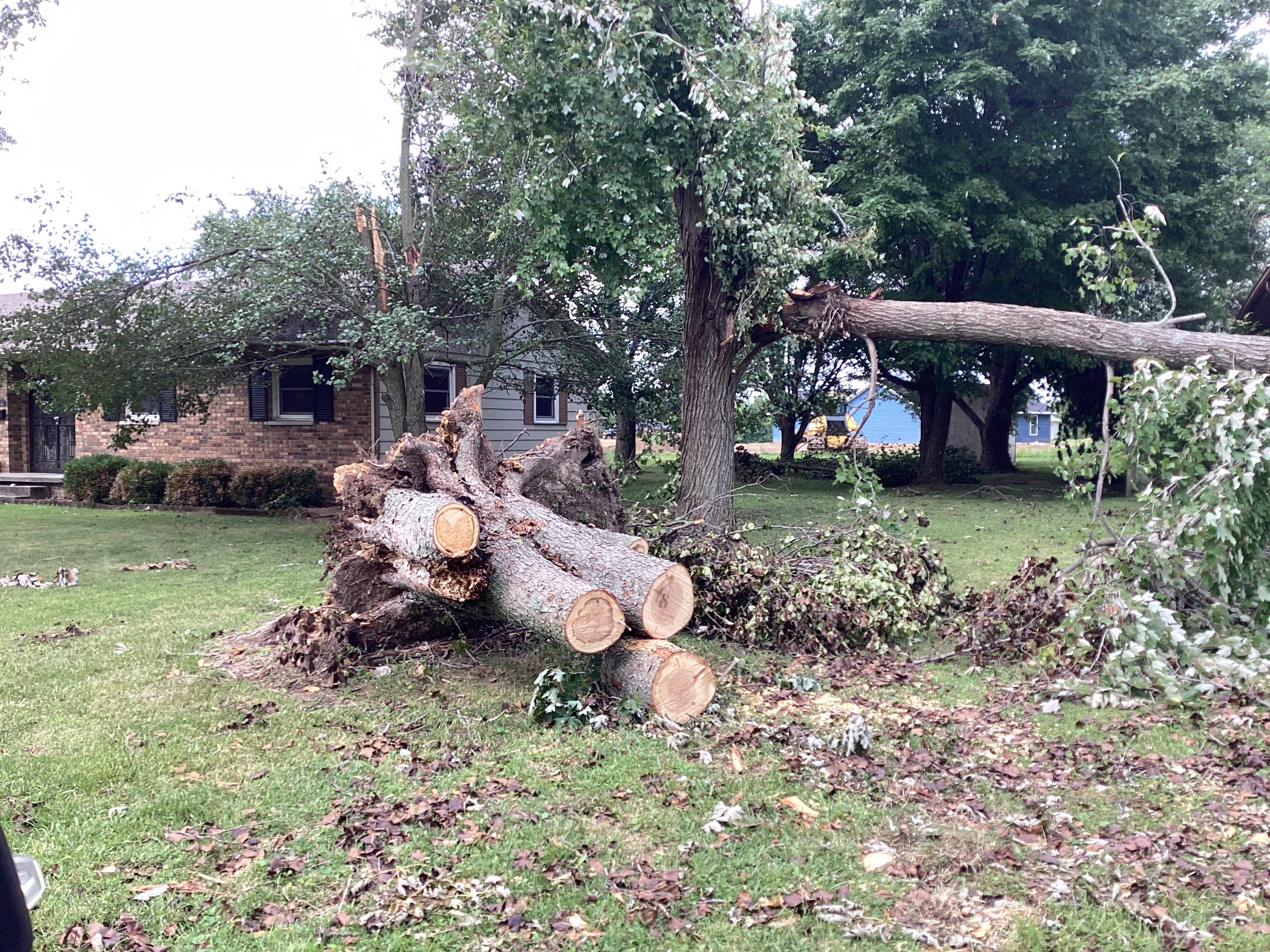
Tornado damage in downtown Paoli, IN.
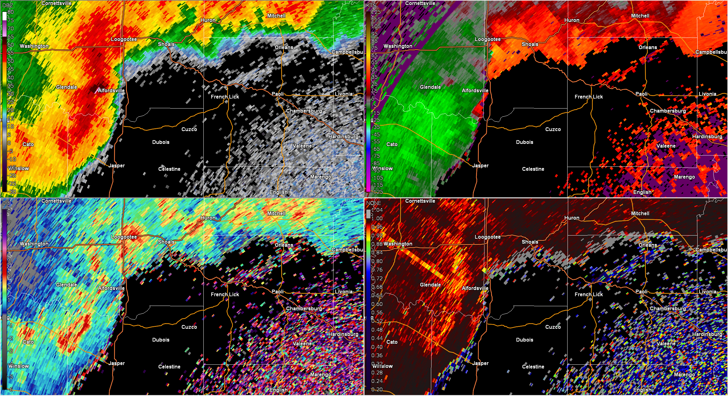
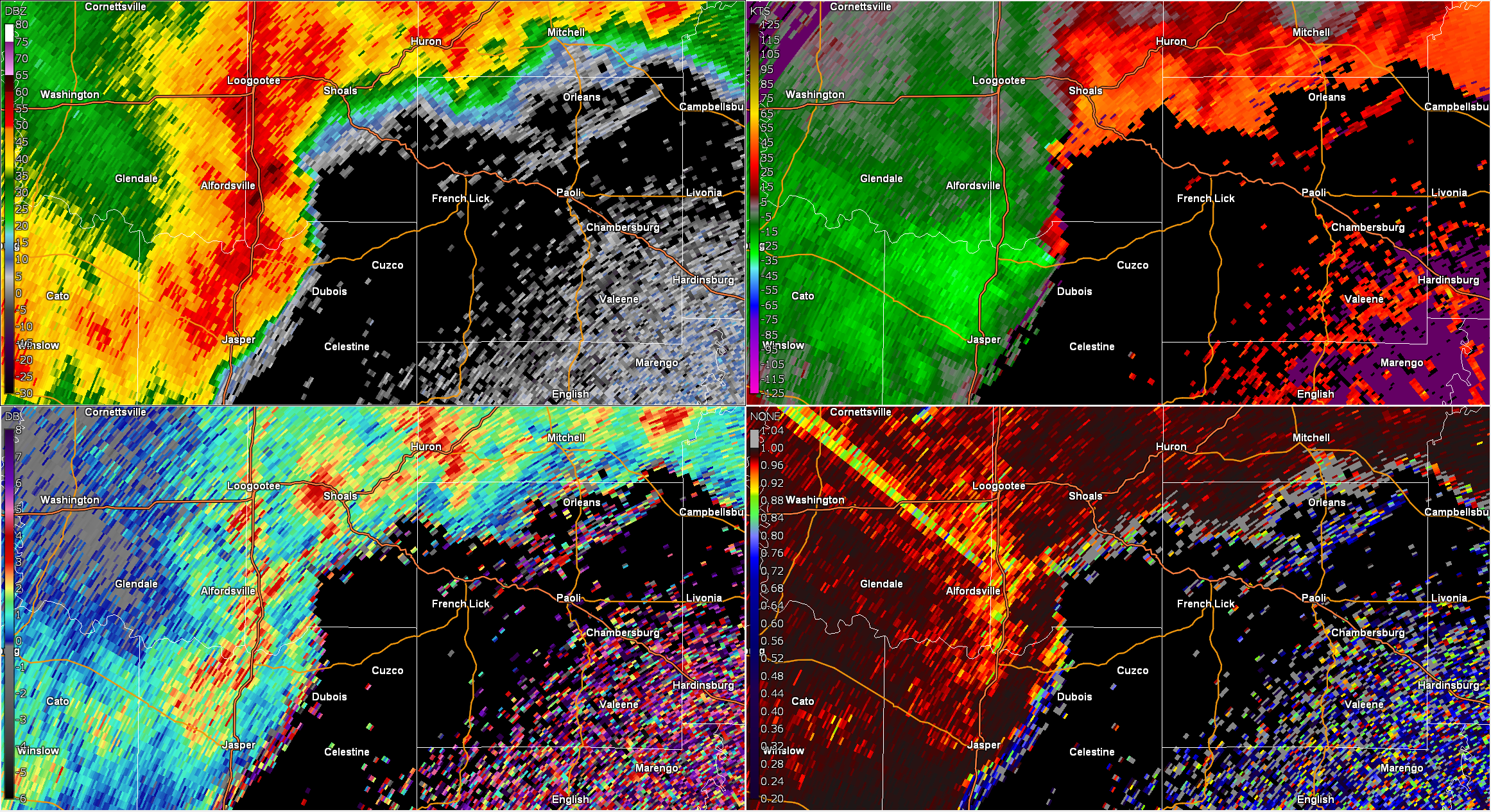
Radar
 |
 |
 |
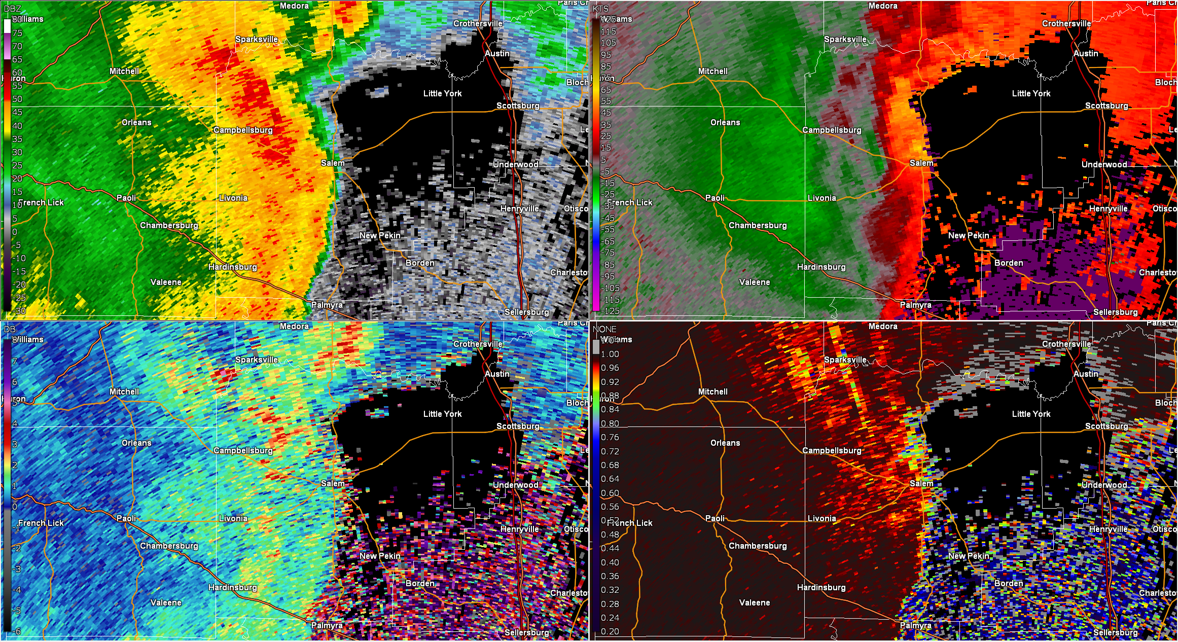 |
| QLCS in Central Dubois County, IN | QLCS in Eastern Dubois County, IN | QLCS in Central Orange County, IN | QLCS in Central Washington County, IN |
Storm Reports
Preliminary Local Storm Report...Summary
National Weather Service Louisville KY

..TIME...   ...EVENT...      ...CITY LOCATION...     ...LAT.LON...
..DATE...   ....MAG....      ..COUNTY LOCATION..ST.. ...SOURCE....
            ..REMARKS..
1224 AM     Tornado          1 WNW Haysville         38.49N 86.94W
08/07/2023                   Dubois             IN   NWS Storm Survey

            NWS Damage Survey confirms an EF1 tornado
            with 107 mph winds and 25.89 miles long and
            200 yards wide occurred west of Haysville,
            IN.
1233 AM     Tstm Wnd Dmg     Haysville               38.48N 86.91W
08/07/2023                   Dubois             IN   Emergency Mngr

            Trees down on State Road 56.

1233 AM     Tstm Wnd Dmg     Haysville               38.49N 86.91W
08/07/2023                   Dubois             IN   Emergency Mngr

            Considerable tree damage. Near Haysville.

1233 AM     Tstm Wnd Dmg     4 WNW Celestine         38.41N 86.85W
08/07/2023                   Dubois             IN   Emergency Mngr

            Structural damage to a home.

1234 AM     Tstm Wnd Dmg     2 E Kellerville         38.48N 86.80W
08/07/2023                   Dubois             IN   Emergency Mngr

            Tree fallen on roof of home.

1236 AM     Tstm Wnd Dmg     2 NNW Jasper            38.43N 86.95W
08/07/2023                   Dubois             IN   Emergency Mngr

            Fallen trees on road.

1236 AM     Tstm Wnd Dmg     2 NNW Jasper            38.42N 86.95W
08/07/2023                   Dubois             IN   Emergency Mngr

            Tress fallen on road.

1236 AM     Tstm Wnd Dmg     1 NNE Jasper            38.40N 86.93W
08/07/2023                   Dubois             IN   Public

            Damage to street lights.

1243 AM     Tstm Wnd Dmg     2 ESE Haysville         38.47N 86.89W
08/07/2023                   Dubois             IN   Emergency Mngr

            Tree down on mobile home.

1245 AM     Tstm Wnd Dmg     French Lick             38.55N 86.62W
08/07/2023                   Orange             IN   Public

            Trees fallen on road and vehicles.
1245 AM     Tornado          French Lick             38.54N 86.62W
08/07/2023                   Orange             IN   NWS Storm Survey

            NWS Damage Survey confirms an EF1 tornado
            with 107 mph winds and 0.98 miles long and
            40 yards wide occurred south of French Lick.
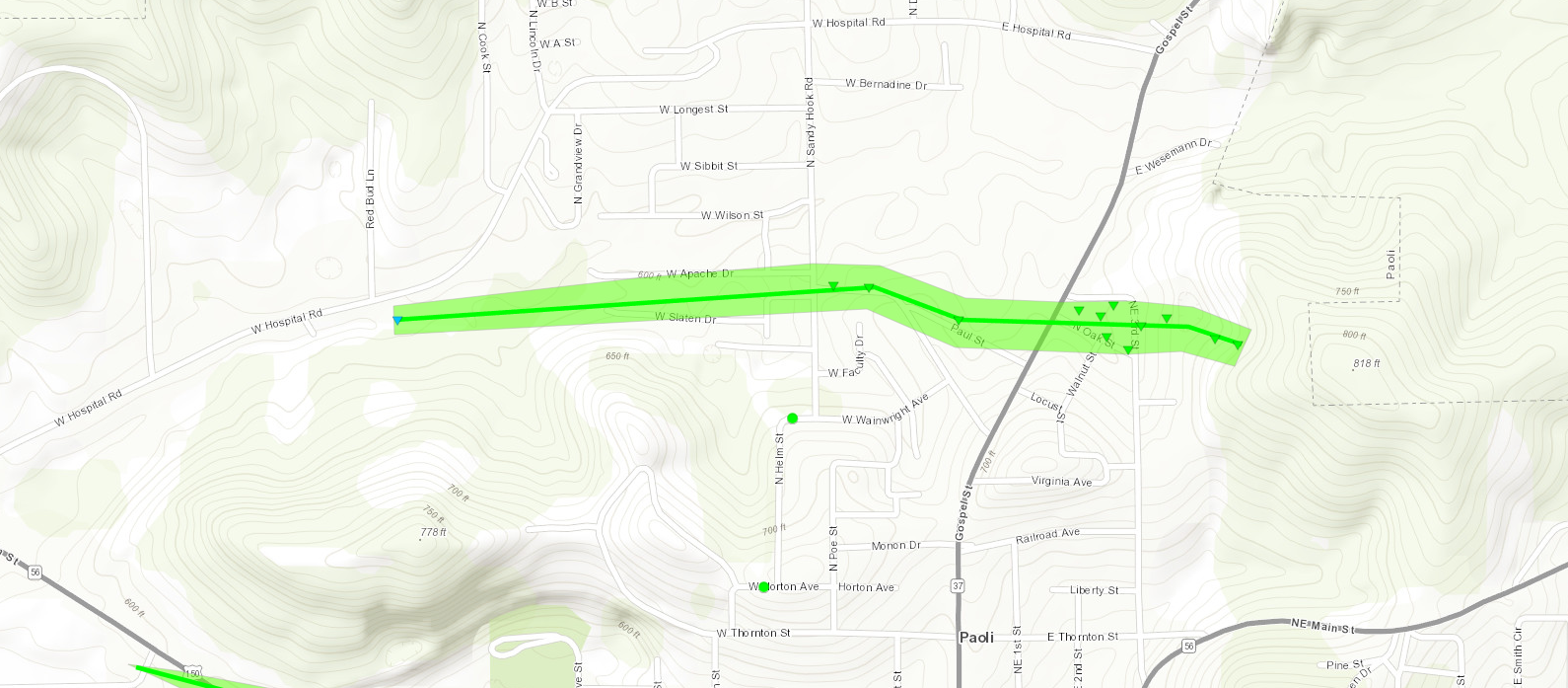
1253 AM     Tornado          1 WNW Paoli             38.56N 86.48W
08/07/2023                   Orange             IN   NWS Storm Survey

            NWS Damage Survey confirms an EF1 tornado
            with 100 mph winds and 1 mile long and 110
            yards wide occurred on the north side of
            Paoli IN.
1253 AM     Tornado          1 SSW Paoli             38.54N 86.48W
08/07/2023                   Orange             IN   NWS Storm Survey

            NWS Damage Survey confirms EF1 tornado with
            107 mph winds and 25.89 miles long and 200
            yards wide, southwest of Paoli. This is the
            endpoint of the tornado.
1253 AM     Tornado          1 W Paoli               38.56N 86.49W
08/07/2023                   Orange             IN   NWS Storm Survey

            NWS Storm Damage survey confirms an EF1
            tornado with estimated peak winds of 100 mph
            and a path length of 8.74 miles. The tornado
            touched down just west of downtown Paoli
            continuing east along Indiana State Road 56
            before lifting 1 mile from the Washington
            County line.
1253 AM     Tornado          2 SSE Paoli             38.54N 86.46W
08/07/2023                   Orange             IN   NWS Storm Survey

            NWS Damage Survey confirms an EF0 tornado
            with 85 mph winds and 0.5 mile long and 60
            yards wide occurred southeast of Paoli IN.
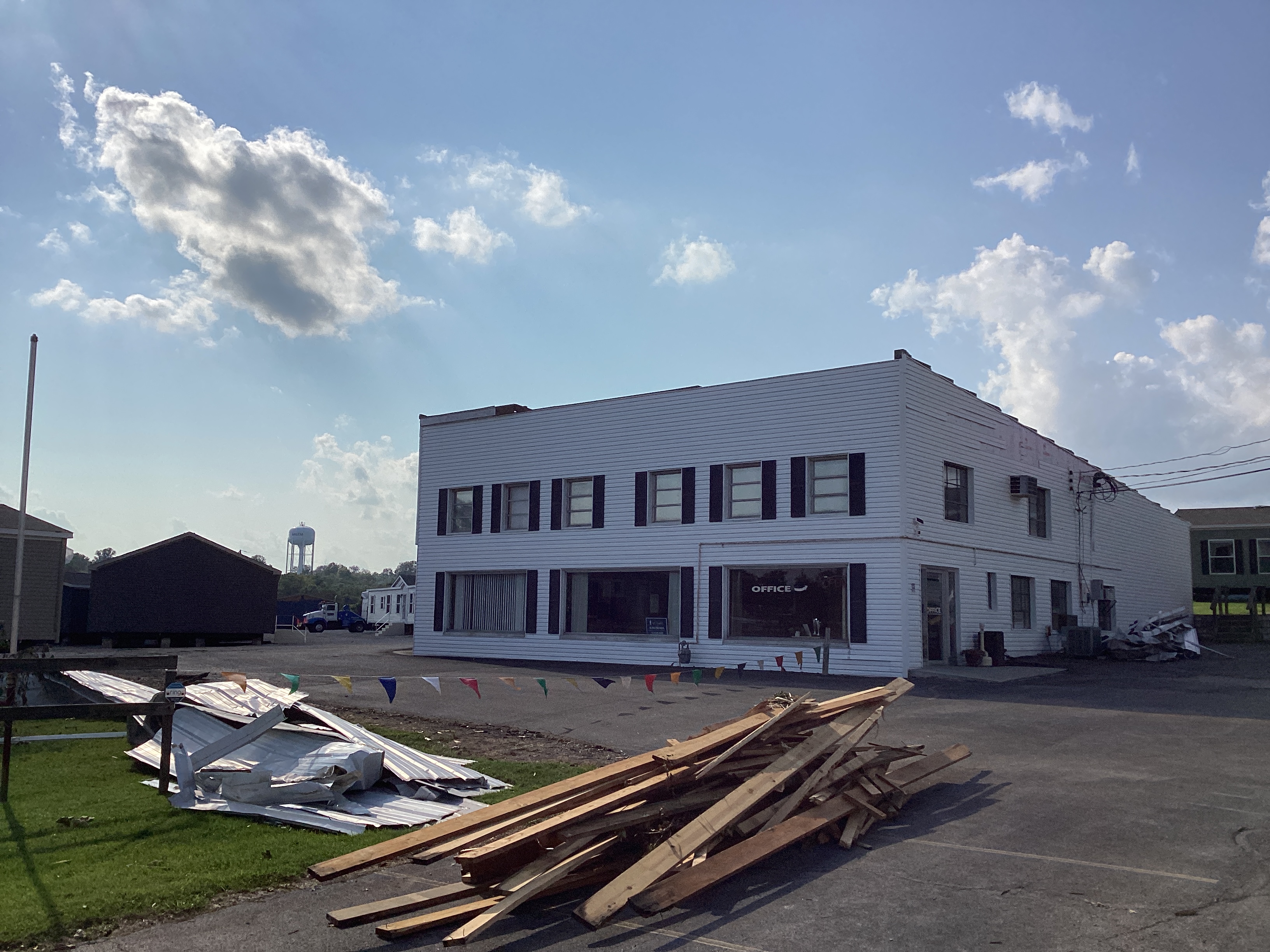
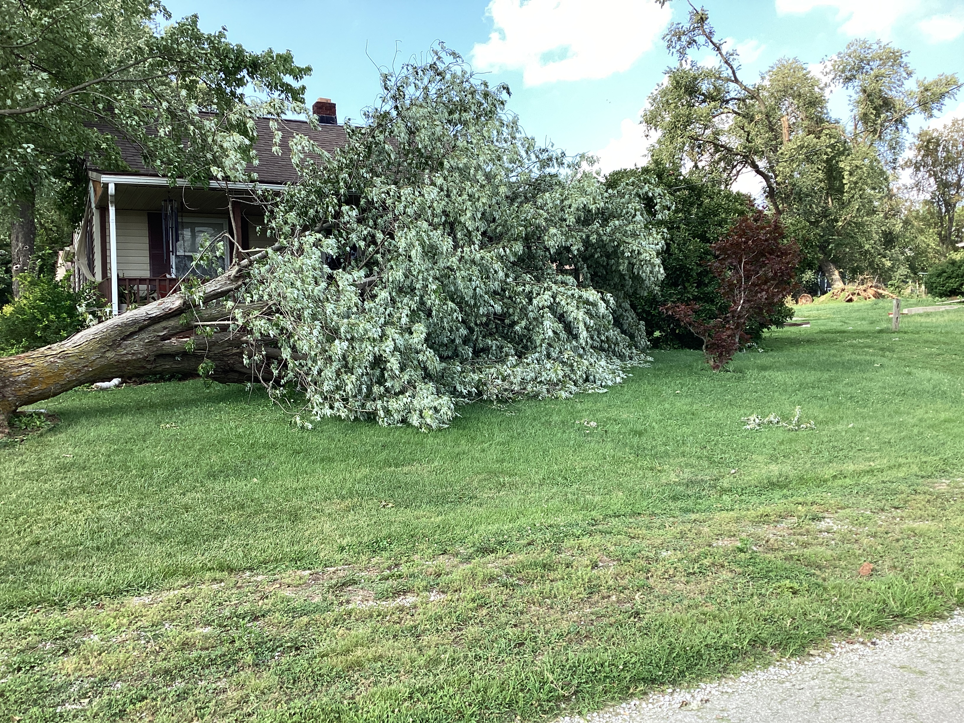
1254 AM     Tstm Wnd Dmg     Paoli                   38.56N 86.47W
08/07/2023                   Orange             IN   911 Call Center

            Roof damage to homes and apartments and
            trees on roofs and roads.

0101 AM     Tstm Wnd Dmg     Livonia                 38.56N 86.27W
08/07/2023                   Washington         IN   Public

            Roof damage and tree damage in Livonia.

0112 AM     Tstm Wnd Dmg     1 WNW Hardinsburg       38.46N 86.28W
08/07/2023                   Washington         IN   911 Call Center

            Trees down over road.
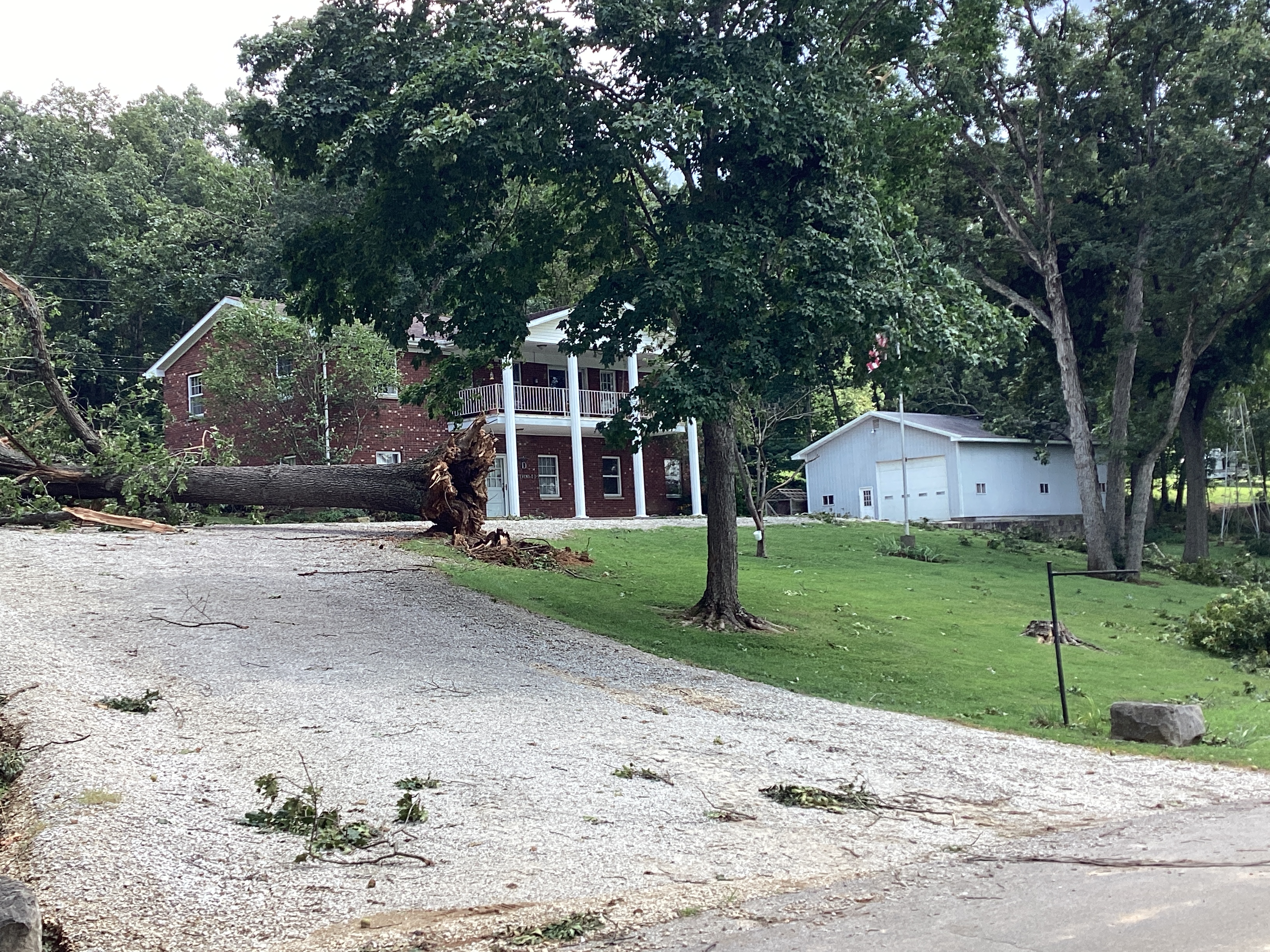
0113 AM     Tornado          2 WSW Salem             38.60N 86.14W
08/07/2023                   Washington         IN   NWS Storm Survey

            NWS Damage Survey confirms an EF1 tornado
            with 90 mph winds and 1.8 mile long and 60
            yards wide occurred west of Salem, IN.
0114 AM     Tstm Wnd Dmg     2 WNW Salem             38.61N 86.14W
08/07/2023                   Washington         IN   911 Call Center

            Corrects previous tstm wnd dmg report from 2
            WNW Salem. Fallen trees on roads, vehicles
            an and homes. Damage to power lines and
            roofs.

0114 AM     Tstm Wnd Dmg     1 WNW Salem             38.61N 86.11W
08/07/2023                   Washington         IN   911 Call Center

            Corrects previous tstm wnd dmg report from 1
            WNW Salem. Fallen trees on on vehicles and
            on road. Fallen power lines. Fallen trees on
            homes. Damage to houses.

0118 AM     Tstm Wnd Dmg     Fredericksburg          38.43N 86.20W
08/07/2023                   Washington         IN   911 Call Center

            Tree down on road.
0126 AM     Tstm Wnd Dmg     2 W Starlight           38.42N 85.93W
08/07/2023                   Clark              IN   Public

            Trees snapped roughly 15 feet up on the
            north side of Louis Smith Rd. Time estimated
            from witness and corroborated with radar.
0130 AM     Tstm Wnd Dmg     1 E Memphis             38.48N 85.75W
08/07/2023                   Clark              IN   Emergency Mngr

            Multiple trees and power lines down along
            Hansberry Road, Treloar Road, and
            Charlestown-Memphis Road.

0130 AM     Tstm Wnd Dmg     1 E Memphis             38.48N 85.75W
08/07/2023                   Clark              IN   Emergency Mngr

            Multiple fallen trees and tree limbs on
            road. One home reported damage.

0136 AM     Tstm Wnd Dmg     Austin                  38.74N 85.82W
08/07/2023                   Scott              IN   911 Call Center

            Tree down over road in Austin.

0137 AM     Tstm Wnd Dmg     1 E Scottsburg          38.69N 85.77W
08/07/2023                   Scott              IN   911 Call Center

            Many trees down in Scottsburg.

0137 AM     Tstm Wnd Dmg     Scottsburg              38.69N 85.78W
08/07/2023                   Scott              IN   911 Call Center

            Tree fell on a house in Scottsburg.

0138 AM     Tstm Wnd Dmg     1 SW Speed              38.41N 85.76W
08/07/2023                   Clark              IN   Emergency Mngr

            Fallen tree on house.

0138 AM     Tstm Wnd Dmg     Charlestown             38.46N 85.67W
08/07/2023                   Clark              IN   Emergency Mngr

            Fallen tree on home.

0148 AM     Tstm Wnd Dmg     1 WNW Lexington         38.65N 85.63W
08/07/2023                   Scott              IN   911 Call Center

            Tree down over road.

0148 AM     Tstm Wnd Dmg     1 NNW New Albany        38.32N 85.83W
08/07/2023                   Floyd              IN   Broadcast Media

            Tree down on home.

0205 AM     Tstm Wnd Dmg     2 ESE Louisville        38.24N 85.73W
08/07/2023                   Jefferson          KY   911 Call Center

            Tree down over road.
0259 AM     Tstm Wnd Dmg     2 SW New Albany         38.28N 85.85W
08/07/2023                   Floyd              IN   Public

            A few residents called about widespread tree
            damage in the Silver Hills subdivision.
            Timing based on when power went out for this
            storm as multiple storms crossed that area
            overnight. Emergency Manager indicated
            damage was from straight lined winds.
0358 AM     Tstm Wnd Dmg     3 N Pilot Knob          38.32N 86.34W
08/07/2023                   Crawford           IN   Emergency Mngr

            8 to 10 large trees knocked down on East
            Administrative Rd near the intersection with
            South Jenkins Rd. A few trees fell on a
            trailer and cars.

0421 AM     Tstm Wnd Dmg     1 SSE Pewee Valley      38.29N 85.48W
08/07/2023                   Jefferson          KY   Public

            Two large trees down resulting in vehicle
            and fence damage.
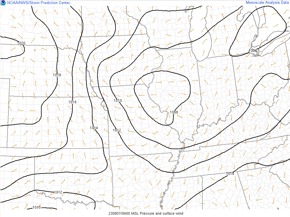
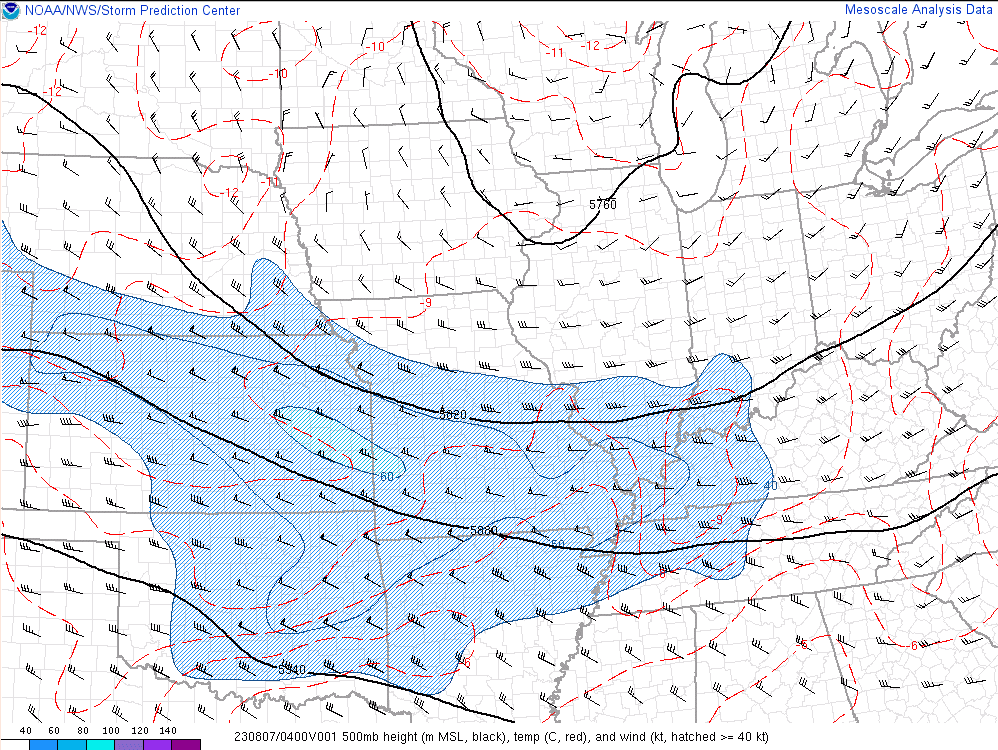
Environment - All Images Valid at 04Z (Midnight EDT) 08/07/23
Synoptic Fields
 |
 |
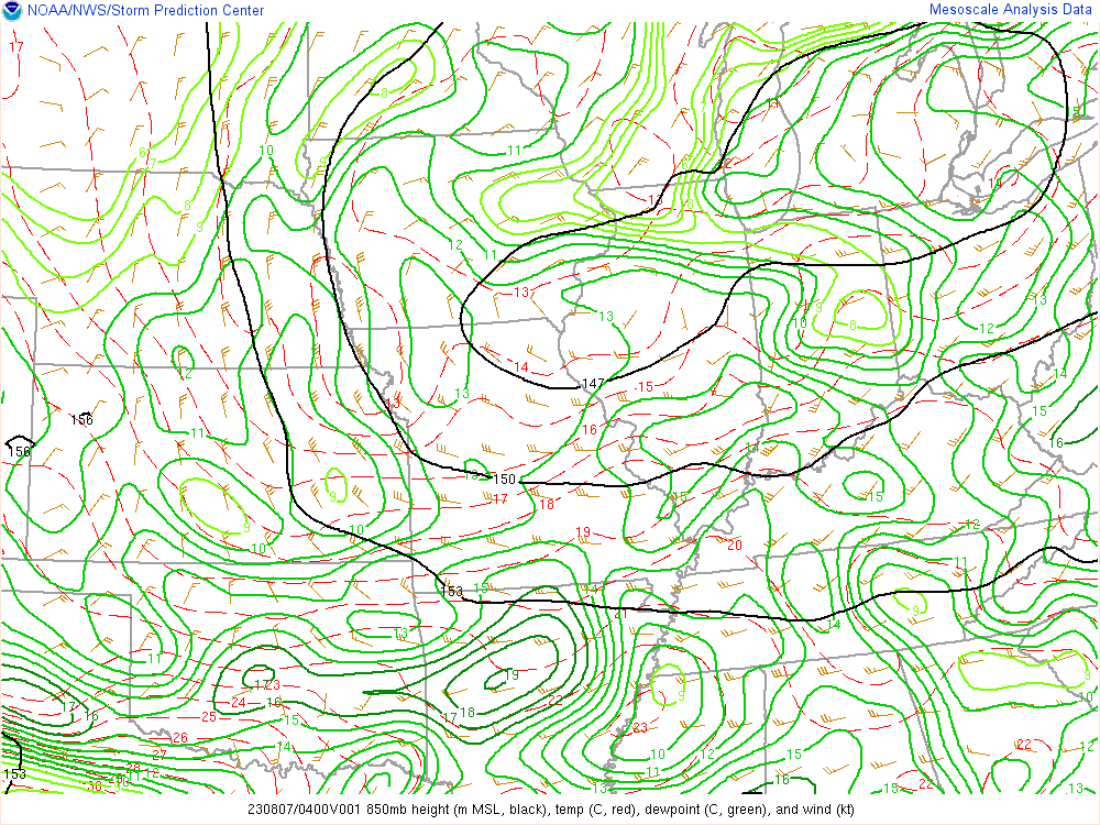 |
| Mean Sea-Level Pressure | 500 mb Heights, Winds, and Temperatures | 850 mb Heights, Winds, Temperatures, and Dewpoint Temperatures |
Thermodynamic Variables
 |
 |
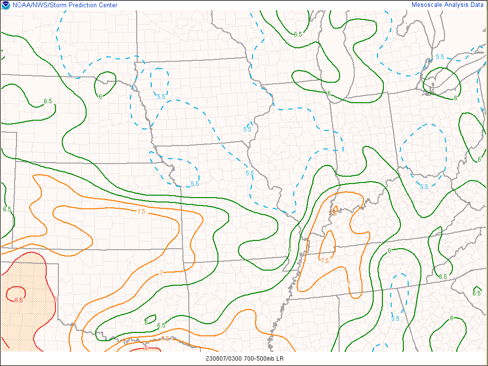 |
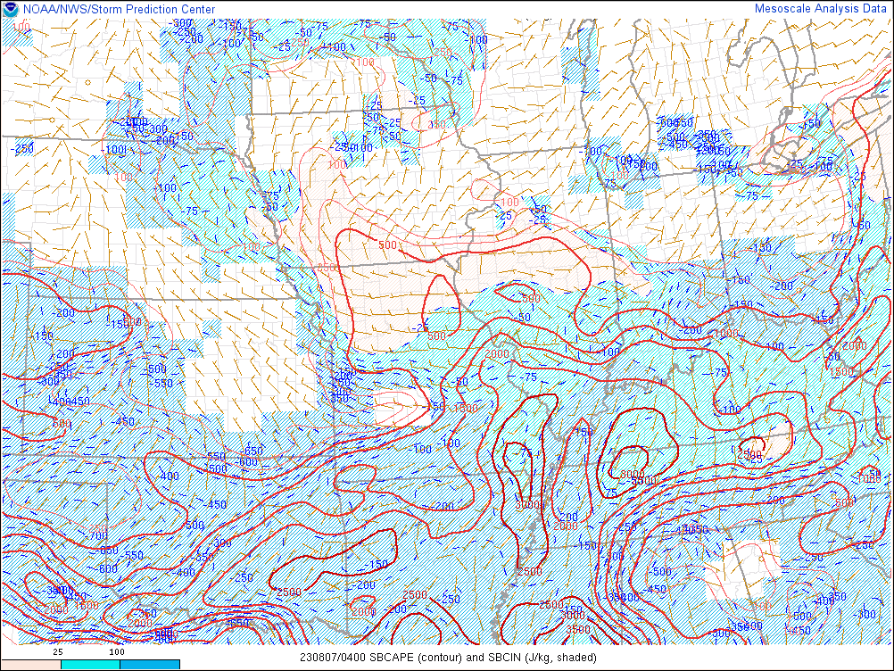
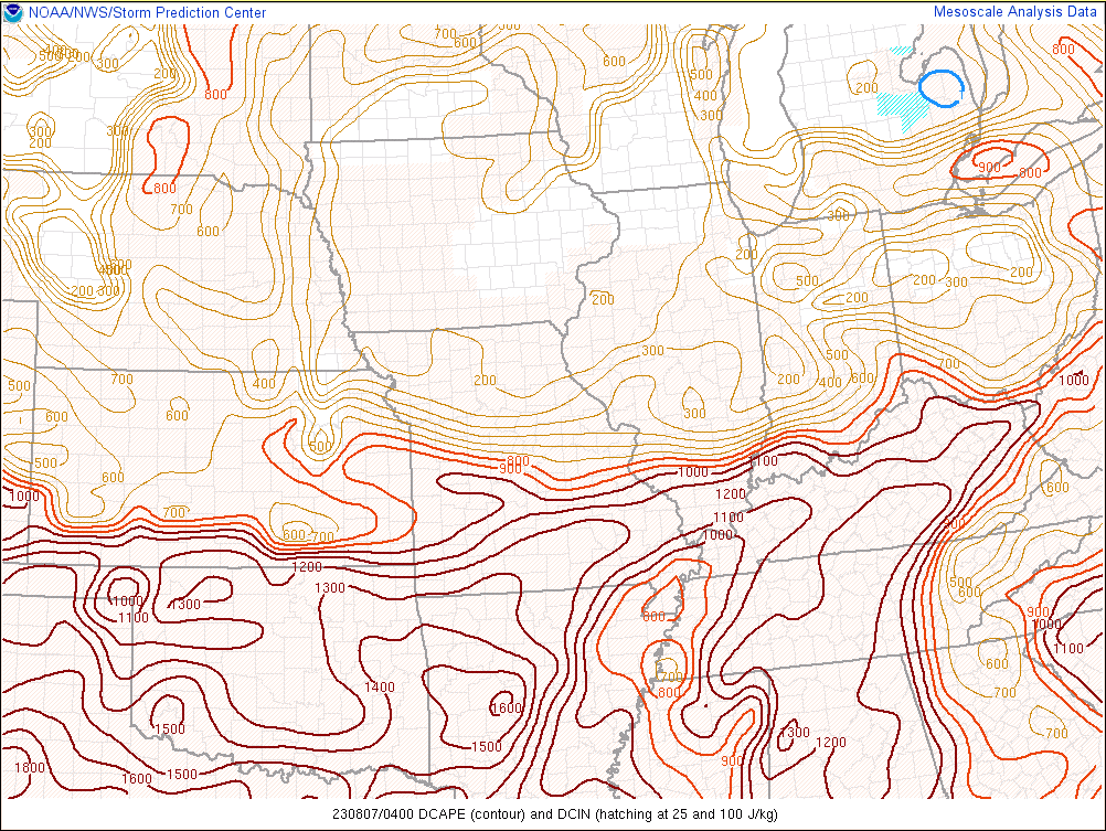
| Surface Based Convective Available Potential Energy (SBCAPE) and Convective Inhibition (SBCIN) | Downdraft CAPE | Mid-level (700-500 mb) Lapse Rates |
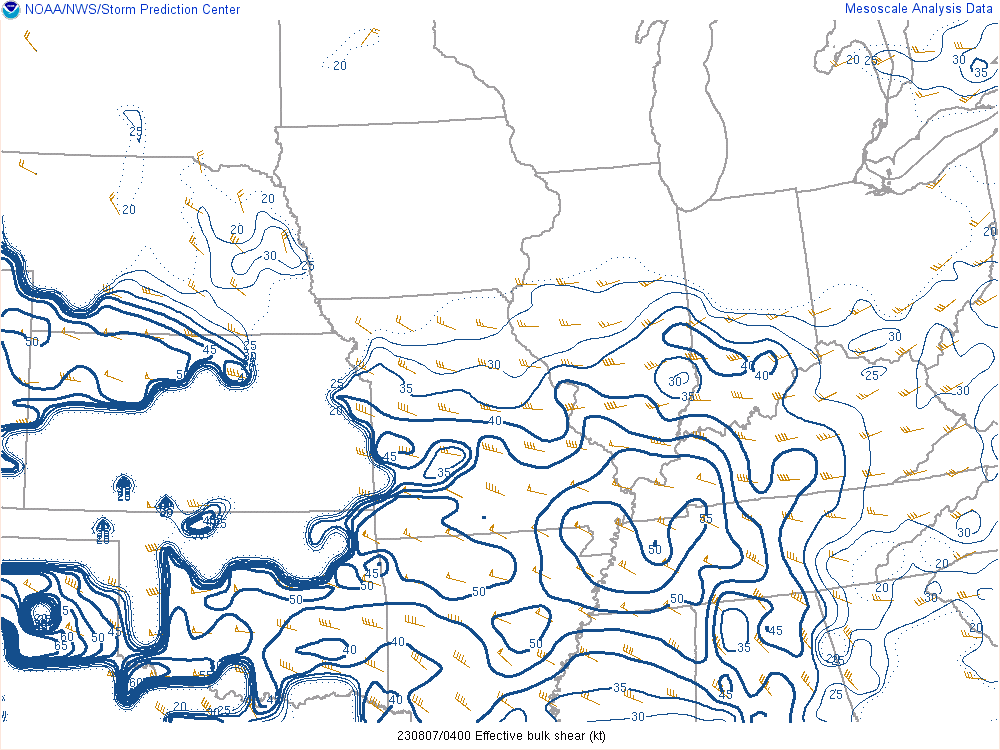
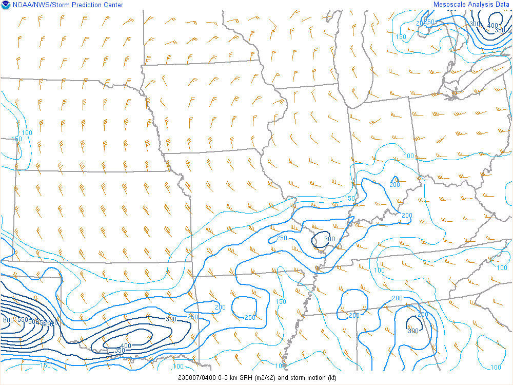
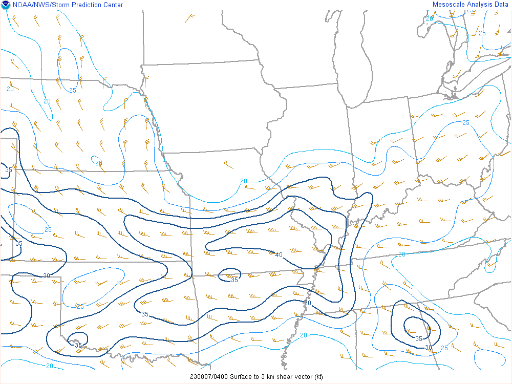
Wind Shear and Other Severe Parameters
 |
 |
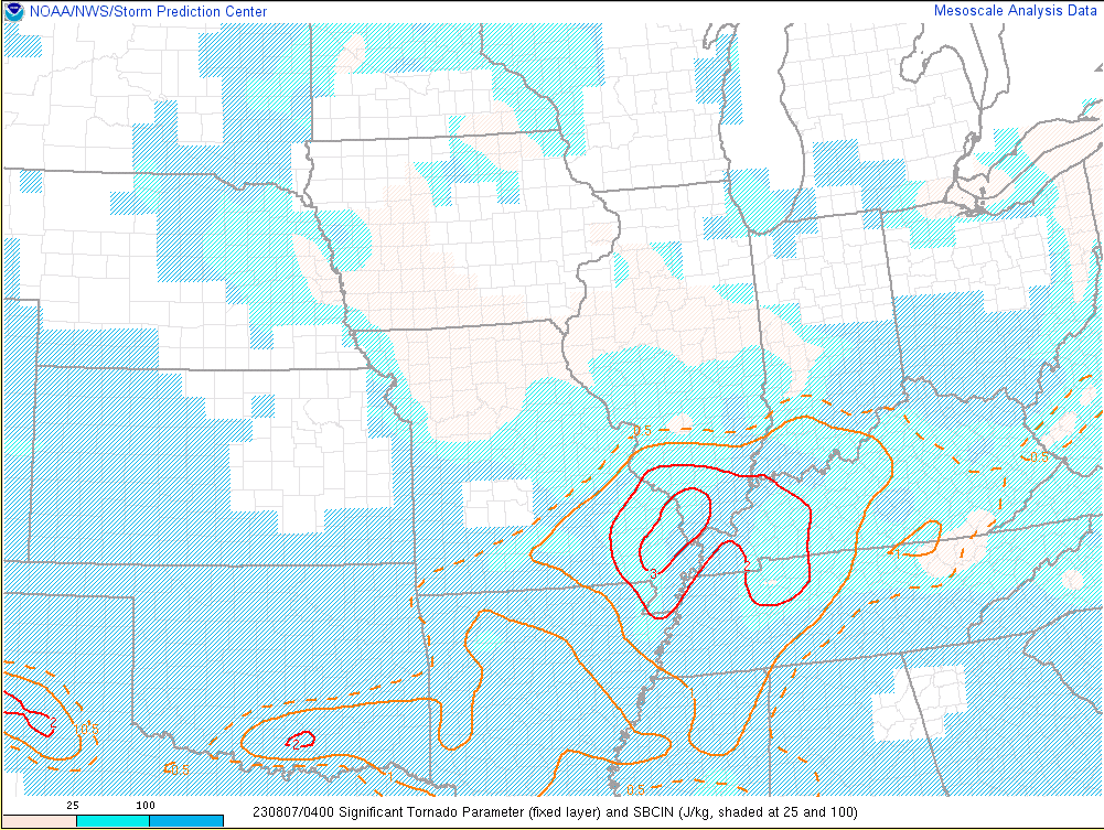 |
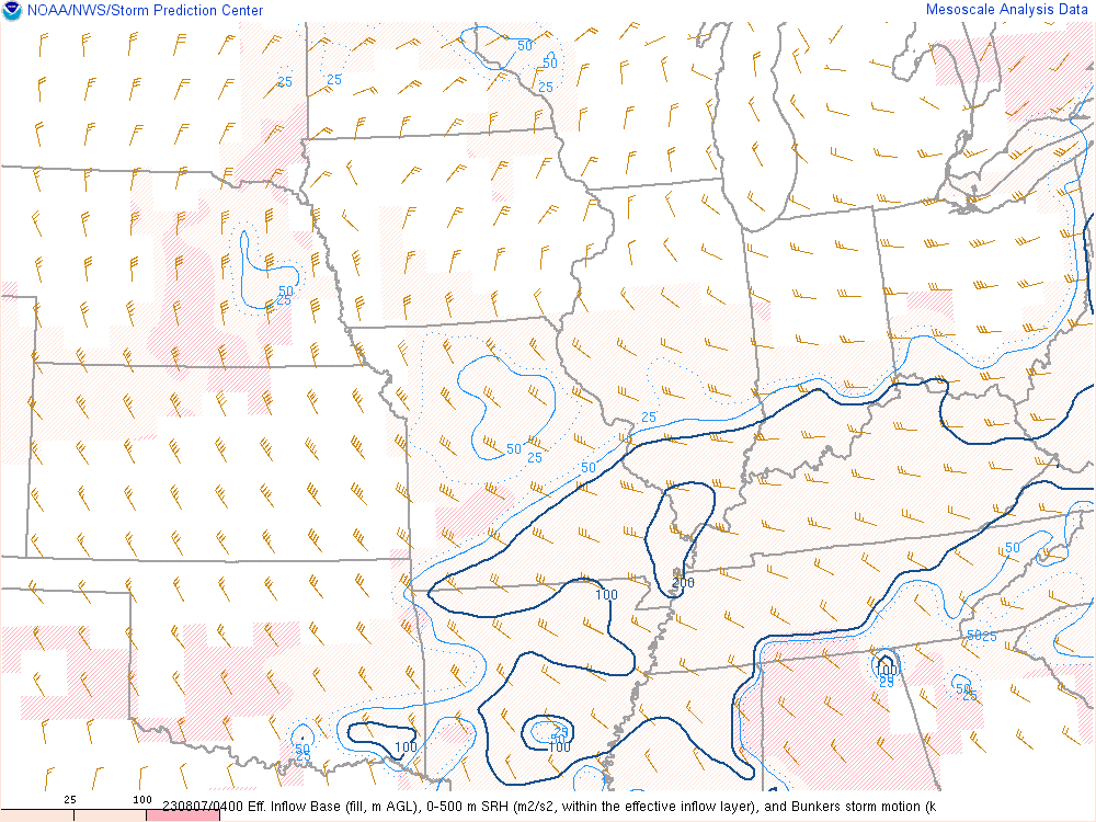
| Effective Bulk Shear | 0-3 km Storm Relative Helicity (SRH) | Significant Tornado Parameter (STP) |
 |
 |
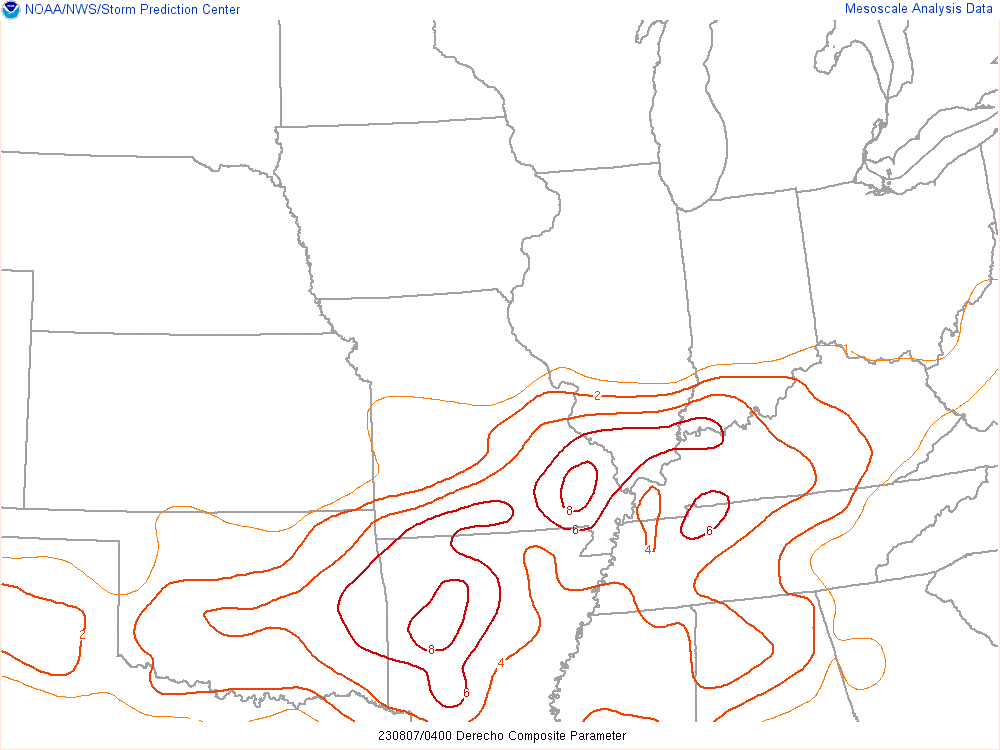 |
| 0-3 km Bulk Wind Shear | 0-500 m Storm Relative Helicity (SRH) | Derecho Composite Parameter (DCP) |
 |
Media use of NWS Web News Stories is encouraged! Please acknowledge the NWS as the source of any news information accessed from this site. |
|


 Weather Story
 Weather Map
 Local Radar