
Multiple clipper systems will bring cold temperatures and enhance lake-effect snow downwind of the Great Lakes. An arctic blast will bring frigid temperatures accompanied with gusty winds that may lead to dangerous wind chills beginning in the Northern Plains Thursday before expanding to the South and East. An expansive winter storm will start Friday in the Southern Rockies/Plains and Mid-South. Read More >
Overview
|
On the night of March 30th, 2025 and the early morning of March 31st, 2025, a strong QLCS moved through the Ohio Valley bringing widespread wind damage, hail, and multiple tornadoes. |
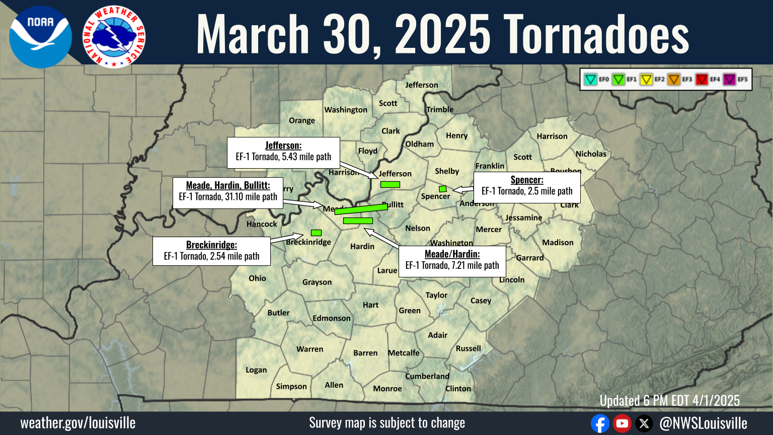 Map of all tornado paths from the March 30, 2025 event. |
Tornadoes:
|
Tornado - Harned, Kentucky
Track Map 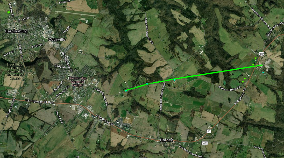 
Downloadable KMZ File |
||||||||||||||||
|
Tornado - Midway/Doe Valley, Kentucky
Track Map 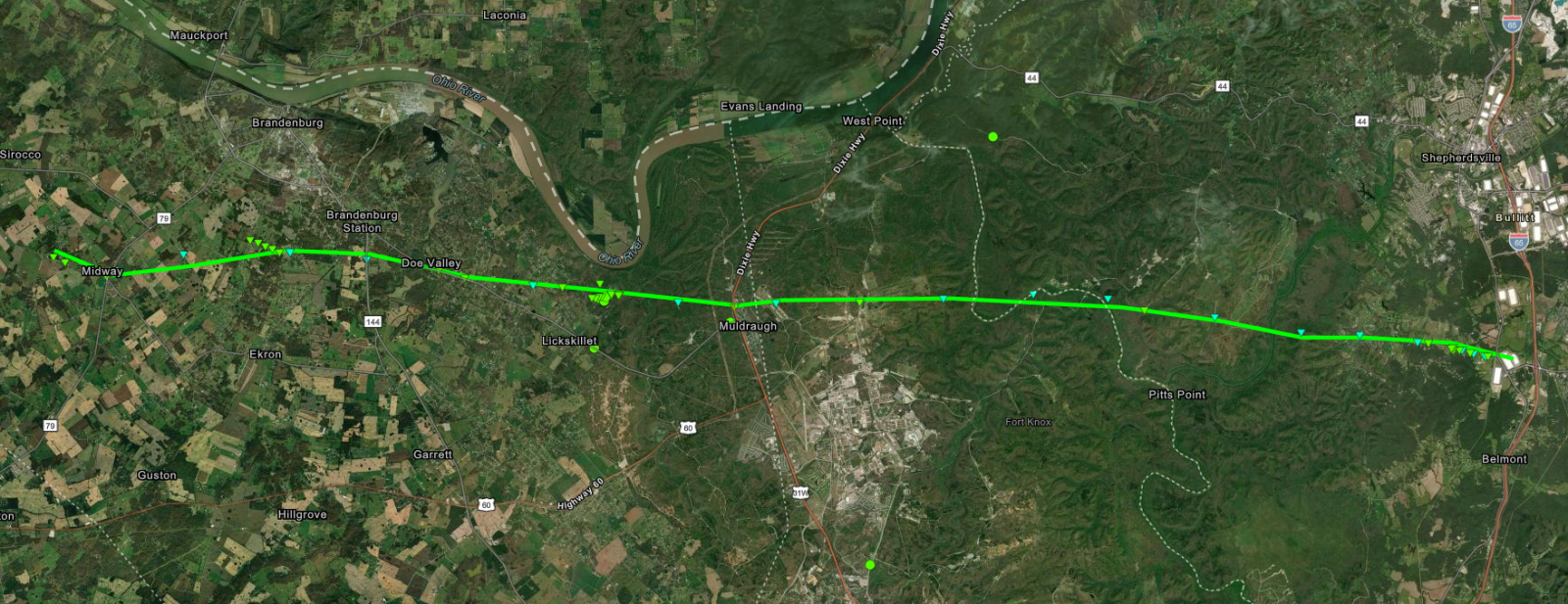 
Downloadable KMZ File |
||||||||||||||||
|
Tornado - Radcliff, Kentucky
|
||||||||||||||||
|
Tornado - Fairdale, Kentucky
Track Map 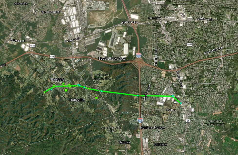 
Downloadable KMZ File |
||||||||||||||||
|
Tornado - Mt. Eden, Kentucky
Track Map 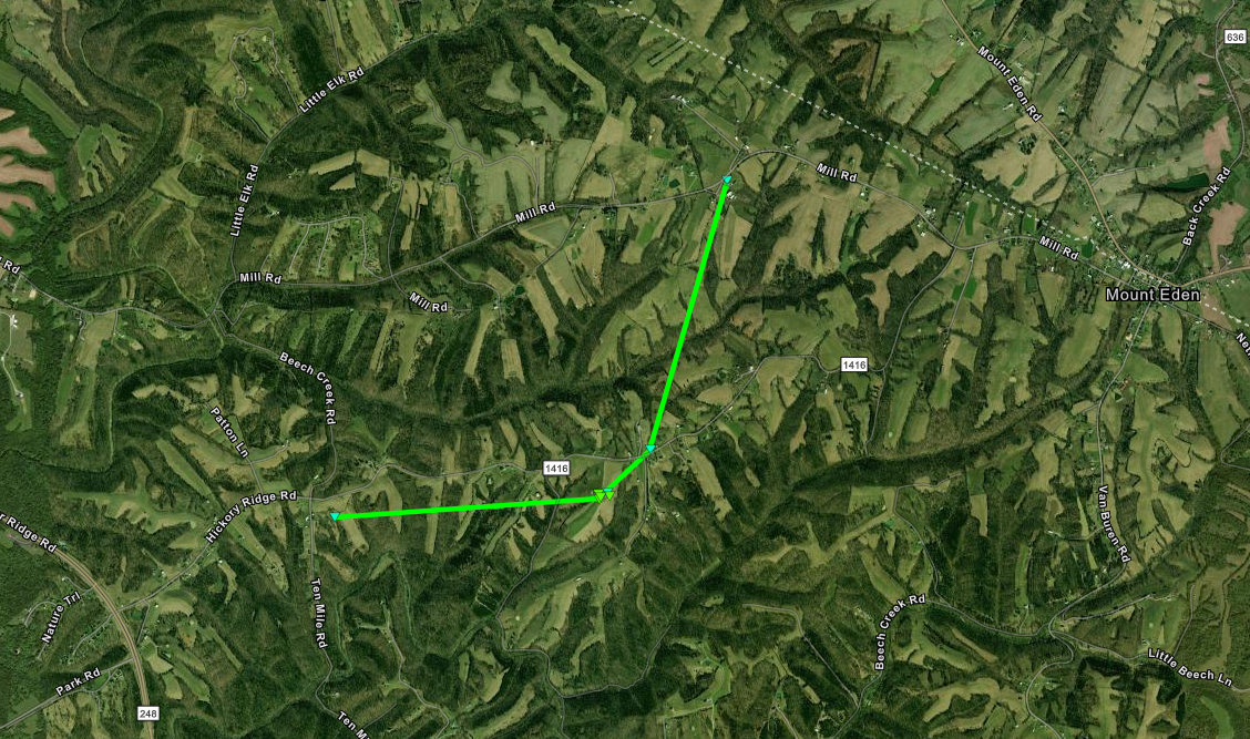 
Downloadable KMZ File |
||||||||||||||||
The Enhanced Fujita (EF) Scale classifies tornadoes into the following categories:
| EF0 Weak 65-85 mph |
EF1 Moderate 86-110 mph |
EF2 Significant 111-135 mph |
EF3 Severe 136-165 mph |
EF4 Extreme 166-200 mph |
EF5 Catastrophic 200+ mph |
 |
|||||
Photos & Video
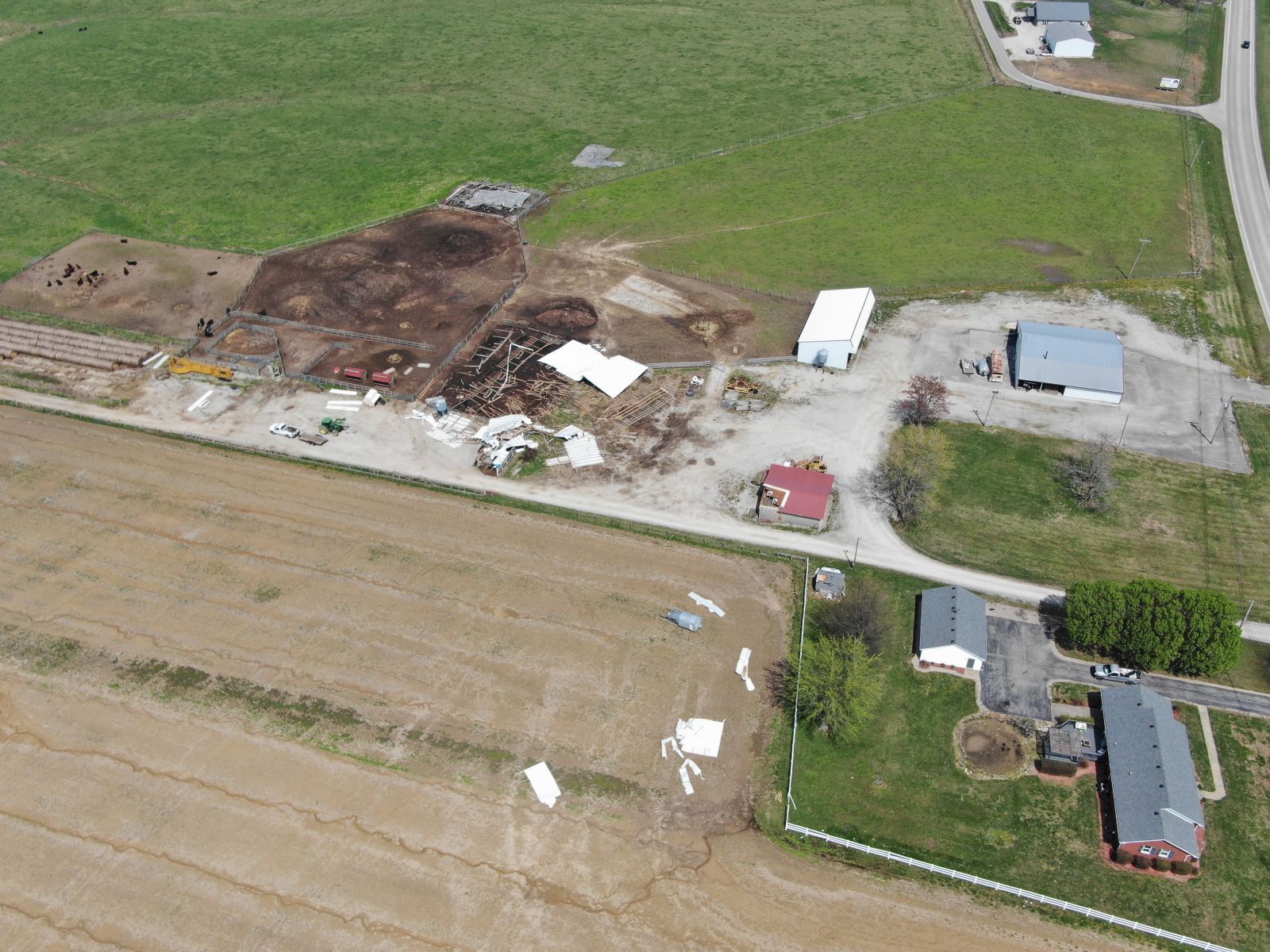 |
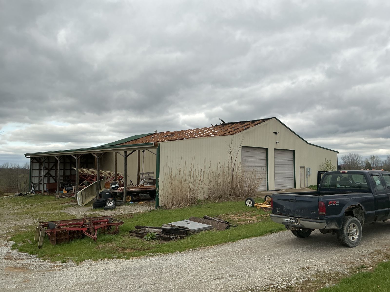 |
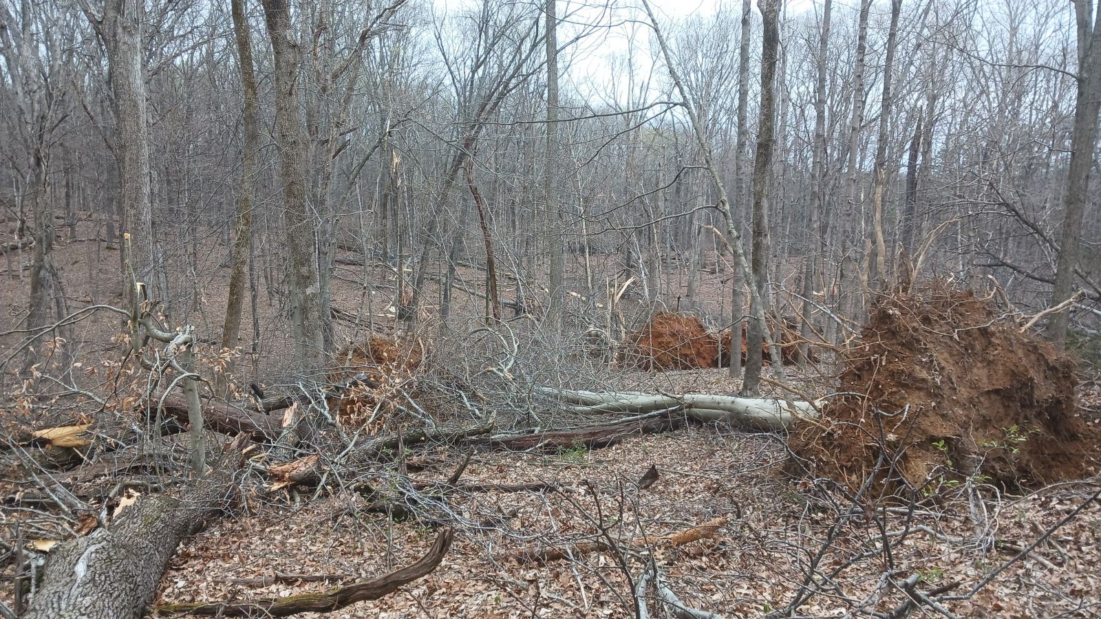 |
 |
| Tornado damage in Harned, KY (Breckinridge County) | Damage to a barn in Mt Eden, KY (Spencer County) | Tornado damage to trees in Doe Valley, KY (Meade County) | Damage to a building in Radcliff, KY (Hardin County) |
Environment
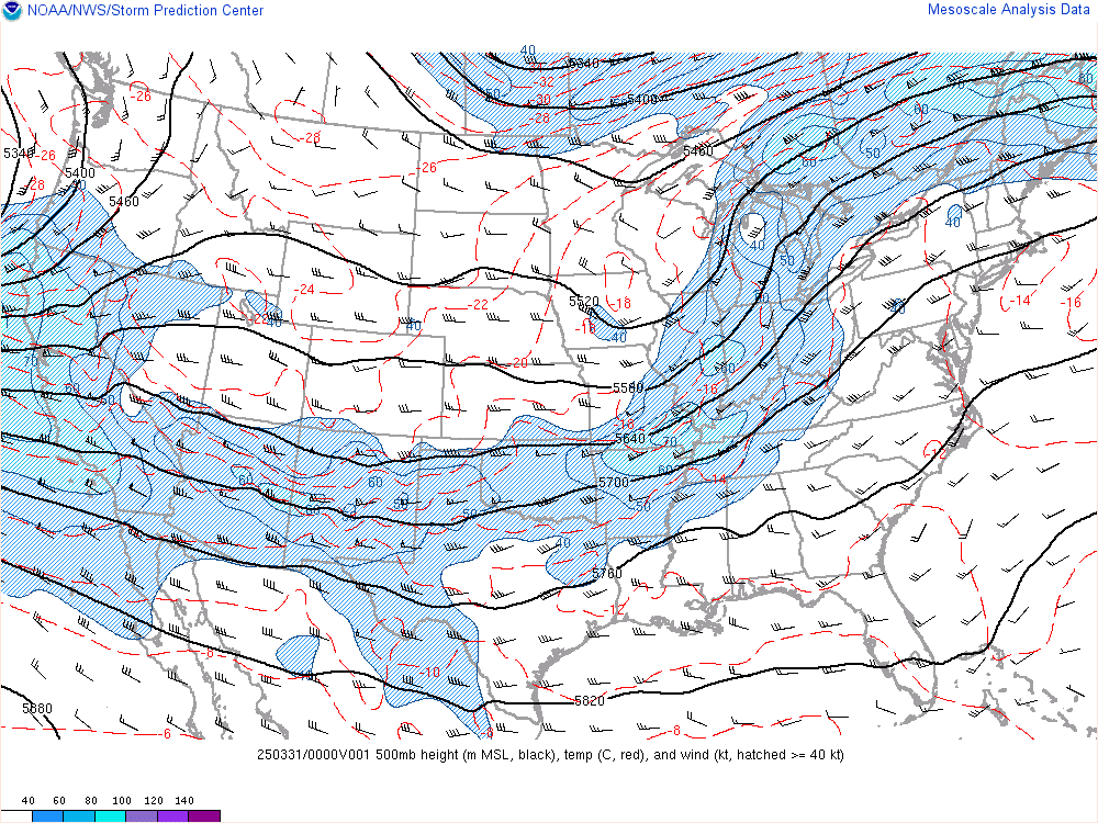
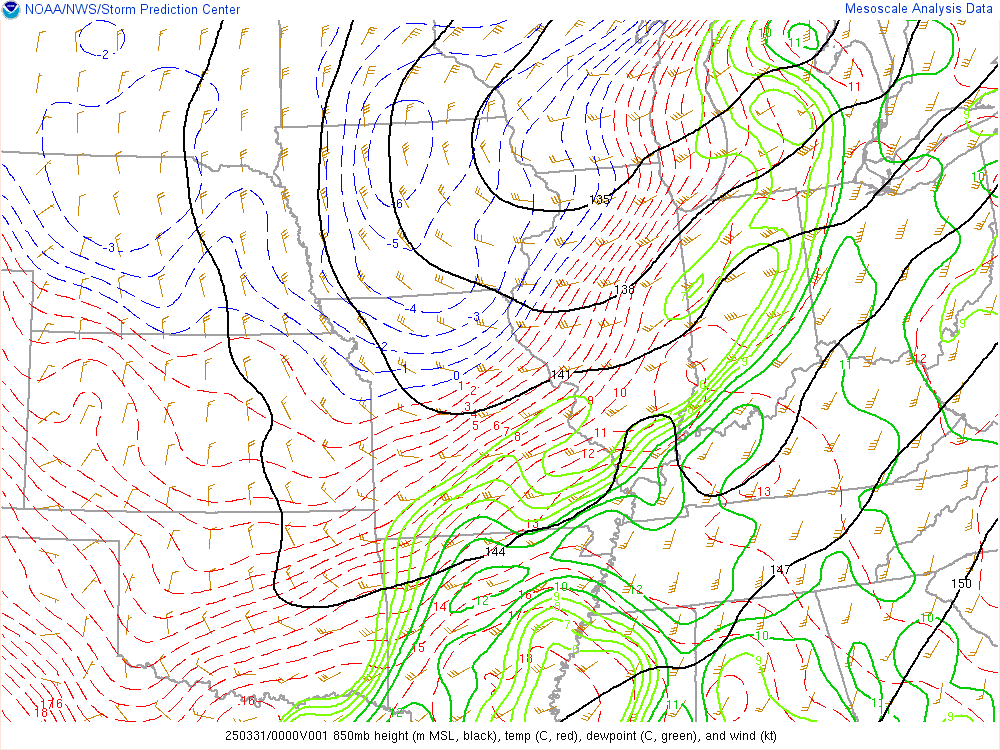
An upper-level shortwave trough moved across the mid-Mississippi and Ohio Valley during the evening hours on March 30th. A 35-40 kt southwesterly low-level jet provided sufficient shear for severe storms, while a warm and humid environment ahead of a cold front provided the necessary fuel.
 |
 |
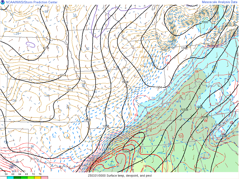 |
| Figure 1: 500 mb Heights and Winds at 8 PM EDT 03/30 | Figure 2: 850 mb Heights and Winds at 8 PM EDT 03/30 | Figure 3: Surface Temperatures, Dewpoints, and Mean Sea Level Pressure at 8 PM EDT 03/30 |
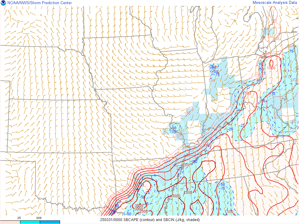
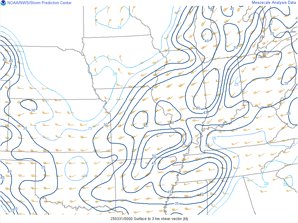
Surface-based instability between 1000-2000 J/kg ahead of the cold front provided ample fuel for thunderstorms. Moderate to strong low-to-mid level flow resulted in enough vertical wind shear for storms to become strong and severe. One key parameter was the 0-3 km bulk shear vector, which was oriented from west-southwest to east-northwest around 35 kt in the vicinity of the tornadic portion of the line. Where the line was oriented more north-south, this shear vector was more favorable for mesovortex genesis, which was between downtown Louisville and the Western Kentucky Parkway.
 |
 |
 |
| Figure 4: Surface-based CAPE at 9 PM EDT 03/30 | Figure 5: 0-3 km Bulk Shear at 9 PM EDT 03/30 | Figure 6: 0-1 km Storm-Relative Helicity at 9 PM EDT 03/30 |
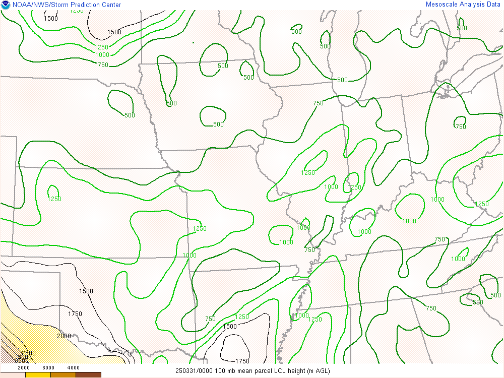
Note the corridor of significant tornado parameter values greater than 1 just ahead of the tornadic portion of the QLCS. LCL heights were not particularly low (between 750-1000 m), but were sufficient to sustain tornadic potential for a few hours on the evening of March 30th.
 |
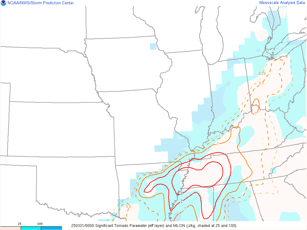 |
| Figure 7: Lifting Condensation Level Heights at 9 PM EDT 03/30 | Figure 8: Significant Tornado Parameter at 9 PM EDT 03/30 |
 |
Media use of NWS Web News Stories is encouraged! Please acknowledge the NWS as the source of any news information accessed from this site. |
 |