
Life-threatening and locally catastrophic flash and urban flooding is expected across portions of south-central Texas through early Friday, with significant river flooding and rapid rises on small streams, arroyos, and typically dry washes expected. A significant heat wave continues for the Rockies, Northern Plains, and Great Lakes into the Mid-Atlantic, peaking in intensity through midweek. Read More >
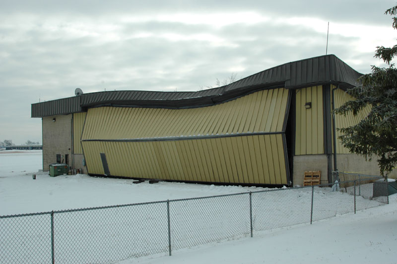
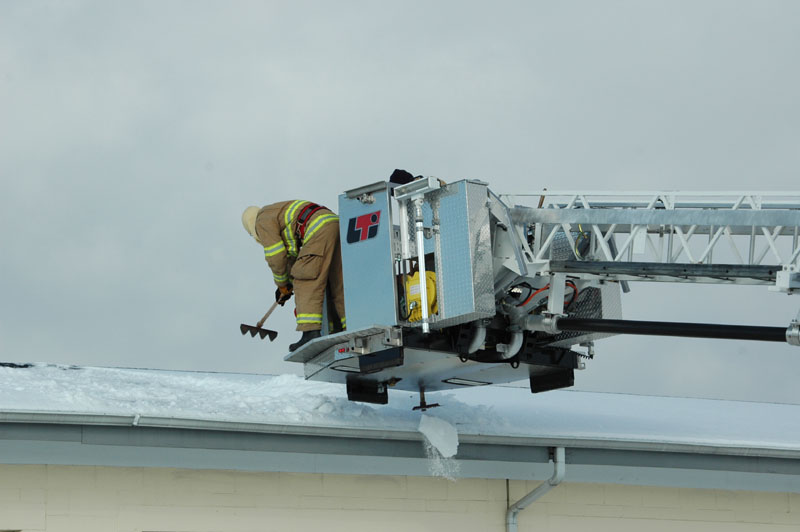
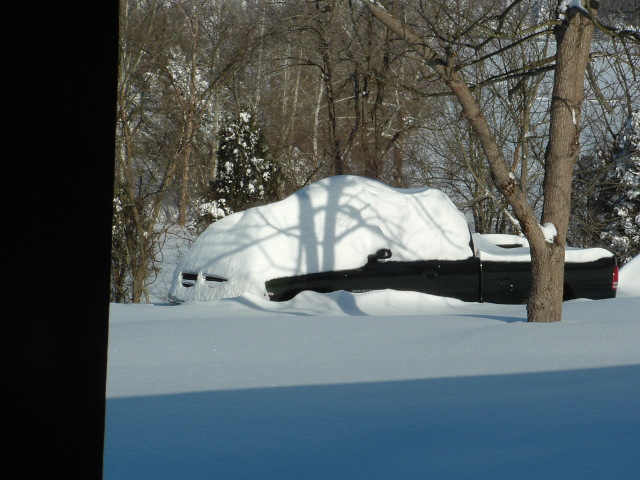
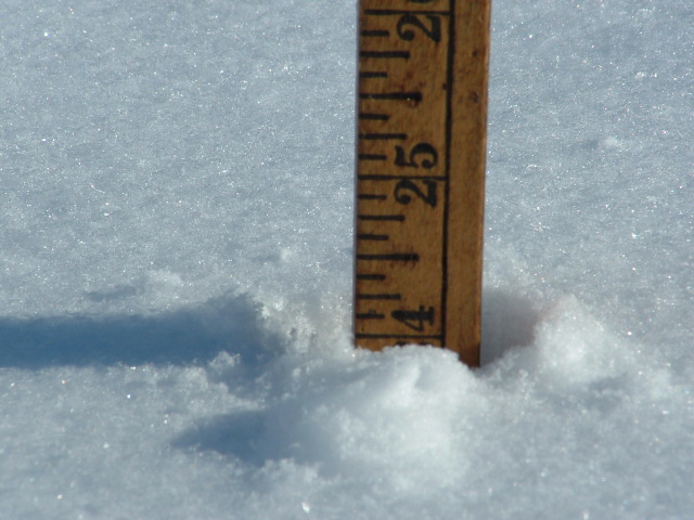
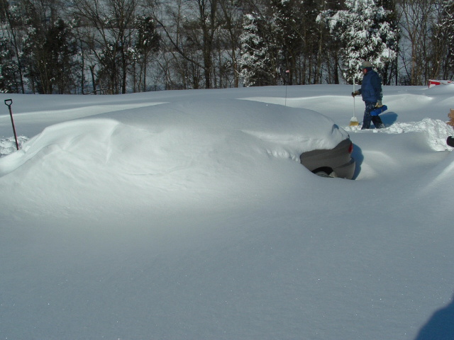
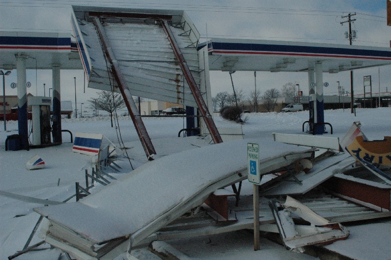
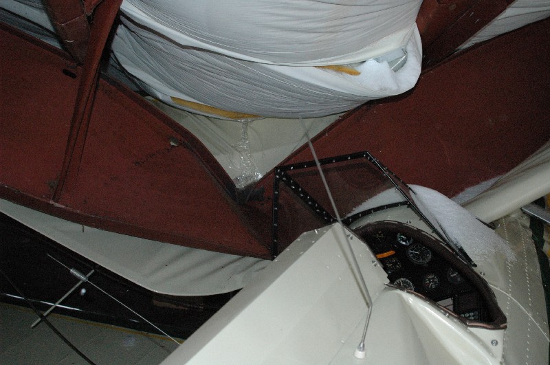
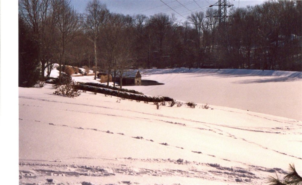
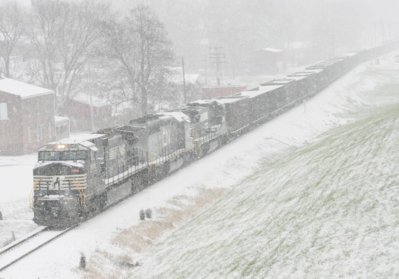
A historic and major winter storm affected much of the Ohio Valley from the 22nd into the 23rd of December 2004. Two bursts of heavy snow, separated by a few hours, brought over two feet of snow across several counties north of the Ohio River in southern Indiana. Interstates 64 and 65 across southern Indiana were closed for a number of hours during this storm. Snow totals of 30 inches or more were measured across portions of Washington, Jefferson, and Scott counties. Further south, an amazing 6 inches of sleet fell in one location across Henry County. Significant sleet accumulations also fell on the Louisville metro area. Thundersnow and thundersleet were observed during this event, with snowfall rates approaching 4 inches per hour in some southern Indiana locations. Across central Kentucky, freezing rain brought up to an inch and a half of ice across an area from Bowling Green through Nelson County. Ice accumulations caused considerable tree and some structural roof damage in Hardin and Nelson counties.
You can view a 3 hour duration radar loop during the evening of 22 December...pretty much the peak of the event. Click here to view...however note that the file is 3 MB large any may take a few moments to download over slower Internet connections. You can see the persistent banding which lead to large snow and sleet totals. A couple strikes of cloud to ground lightning were also seen, indicating the thundersleet or thundersnow.
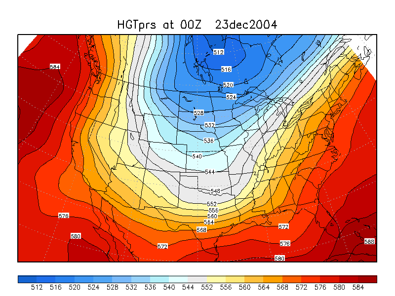 A large scale 500 MB trough over much of North America provided an environment favorable to ascent over the Ohio River Valley. This analysis was valid at 00 UTC on 23 December 2004 (7 PM EST 22 December).
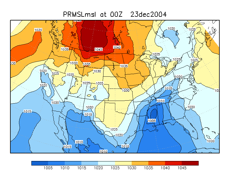 A relatively weak surface low was located over the Gulf Coast states, allowing moist air to flow northward into the Ohio Valley. This clearly shows you that it does not take a deep cyclone to create significant winter storms in this part of the country. This analysis was also valid at 00 UTC on 23 December 2004 (7 PM EST 22 December).
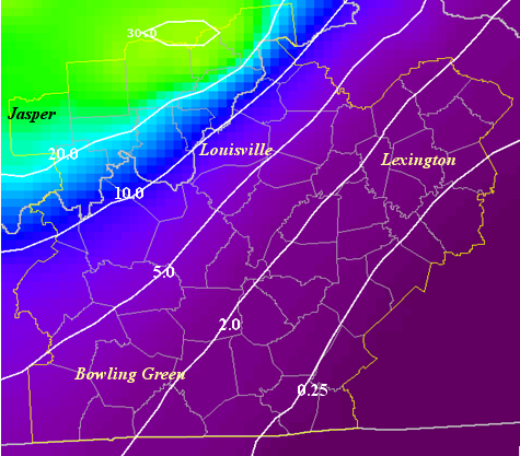 This map shows an approximate analysis of snow and/or ice accumulations, in inches, across the NWS Louisville area of responsibility.
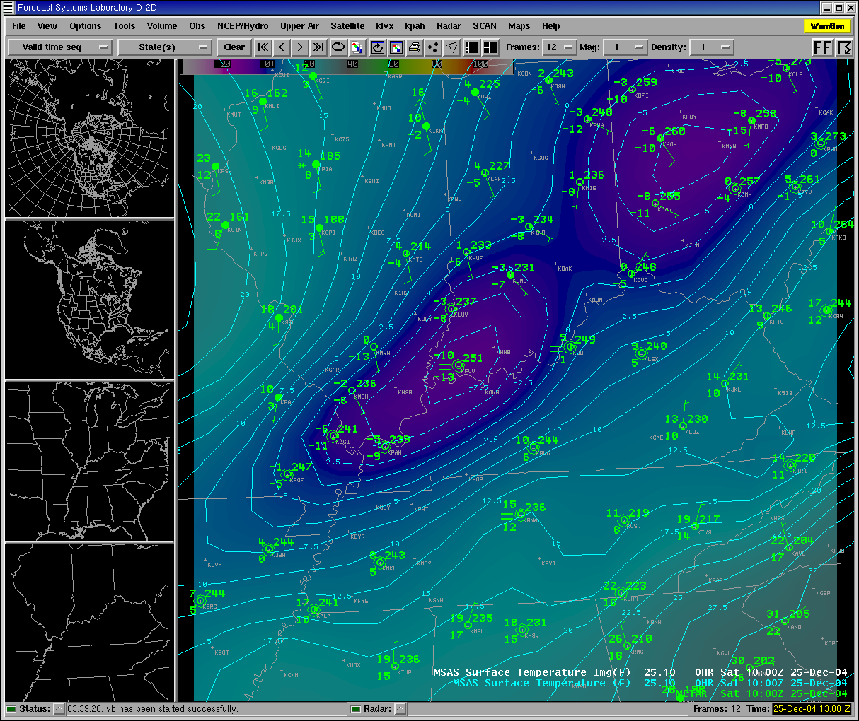 A surface temperature analysis early Christmas morning (a couple days after the winter storm). The deepest snowpack is well correlated with the coldest temperatures that morning. It took nearly a week after the snowstorm for the deepest snows to melt completely.
|
Here is a county-by-county listing of snow, sleet, and ice totals from the event:
THE FOLLOWING ARE COUNTY-BY-COUNTY *MAXIMUM* PRECIPITATION TOTALS
GATHERED FROM LAW ENFORCEMENT AGENCIES, STORM SPOTTERS,
COOPERATIVE OBSERVERS, AND OFFICIAL REPORTING STATIONS.
.SOUTHERN INDIANA...
COUNTY               SNOWFALL               COMMENTS
------------------------------------------------------------------
DUBOIS               20 INCHES              4 FOOT DRIFTS
PERRY                20 INCHES
ORANGE               30 INCHES         EST BY TRAINED SPOTTER
CRAWFORD             23 INCHES              5 FOOT DRIFTS
HARRISON             20 INCHES
WASHINGTON           32 INCHES              5 FOOT DRIFTS
FLOYD                14 INCHES
CLARK                15 INCHES
SCOTT                29 INCHES

JEFFERSON            17 INCHES              EASTERN PART OF THE COUNTY
JEFFERSON            30 INCHES              FAR WESTERN PART OF COUNTY
.NORTH CENTRAL KENTUCKY...
COUNTY               ACCUMULATIONS          COMMENTS
-----------------------------------------------------------------
HANCOCK              17-19 INCHES           5 FOOT DRIFTS
BRECKINRIDGE         15+ INCHES
MEADE                10+ INCHES
BULLITT              4-6 INCHES
SPENCER              4-5 INCHES
JEFFERSON            9 INCHES           OFFICIAL FROM SDF (LOU ITNL)
OLDHAM               9 INCHES
HARDIN               3-4 INCHES SLEET WITH 1 INCH OF ICE
NELSON               1 INCH OF ICE WITH 2 INCHES OF SNOW/SLEET ON TOP
WASHINGTON           1/4 TO 1/2 INCH ICE WITH A LITTLE SNOW
TRIMBLE              12 INCHES              2 FOOT DRIFTS
SHELBY               5.5 INCHES             INCLUDES 3.5 INCHES SLEET
HENRY                9 INCHES               INCLUDES 6 INCHES SLEET
.SOUTH CENTRAL KENTUCKY...
COUNTY               ACCUMULATIONS          COMMENTS
------------------------------------------------------------------
OHIO                 8 INCHES               MORE IN THE NORTHERN PART
                                            OF THE COUNTY
BUTLER               3-4 INCHES OF A SLEET/SNOW MIXTURE
GRAYSON              6 INCHES OF SLEET AND SNOW
CUMBERLAND           2/10 INCH OF ICE
.EAST CENTRAL KENTUCKY...
COUNTY               ACCUMULATIONS          COMMENTS
------------------------------------------------------------------
FRANKLIN             1/4 TO 1/2 INCH ICE, 1 INCH SLEET AND SNOW
WOODFORD             1/4 INCH ICE
SCOTT                1/2+ INCH ICE, WITH SOME SLEET AND SNOW
FAYETTE              1/4 INCH ICE
JESSAMINE            1/4 INCH ICE
GARRARD              1/4 INCH ICE
MADISON              1/4 INCH ICE NEAR WESTERN BORDER, LOWER AMOUNTS
                     ELSEWHERE
CLARK                LIGHT GLAZE OF ICE
BOURBON              1/4 INCH ICE
HARRISON             1/2+ INCH ICE
NICHOLAS             LIGHT GLAZE OF ICE
MERCER               1/2+ INCH ICE
Here is a listing of the low temperatures observed the morning of December 25th:
...ACROSS SOUTH CENTRAL INDIANA...
LEAVENWORTH     MINUS  7
   SCOTTSBURG      MINUS 19
   TELL CITY       PLUS   5
   HUNTINGBURG     MINUS 13

   PATOKA LAKE     MINUS  7
...ACROSS NORTH CENTRAL...SOUTH CENTRAL AND EAST CENTRAL KENTUCKY...
LOUISVILLE NATIONAL WEATHER SERVICE OFFICE          0
   LOUISVILLE INTERNATIONAL AIRPORT              PLUS  2
   LOUISVILLE BOWMAN FIELD                       PLUS  2
   FRANKFORT                                     PLUS  3
   BOWLING GREEN                                 PLUS  9
   COVINGTON                                    MINUS  2
   WOODBURY                                      PLUS  4
   ROCHESTER FERRY                              MINUS  3
   HERRINGTON LAKE                               PLUS 11
   MARROWBONE                                    PLUS  9
   BARREN RIVER LAKE                             PLUS 10
   GREEN RIVER LAKE                              PLUS 14
   NOLIN RIVER LAKE                              PLUS  4
   ROUGH RIVER LAKE                             MINUS  4
   FORT KNOX                                    MINUS  2
   LEXINGTON                                     PLUS  8


 Weather Story
 Weather Map
 Local Radar
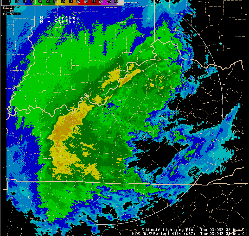