On April 16, 1998, a supercell thunderstorm moved from northern Logan County through central parts of Warren, Barren, and Metcalfe counties, and then into western Adair County. This unforgettable storm caused catastrophic baseball size hail, spawned a few tornadoes, and produced copious amounts of rainfall in a short time period that resulted in significant flooding issues.
The storm resulted in significant damage to multiple counties and communities across south central Kentucky. Total damage surmounted to over $500 million. Unfortunately, three people were killed during the severe weather event.
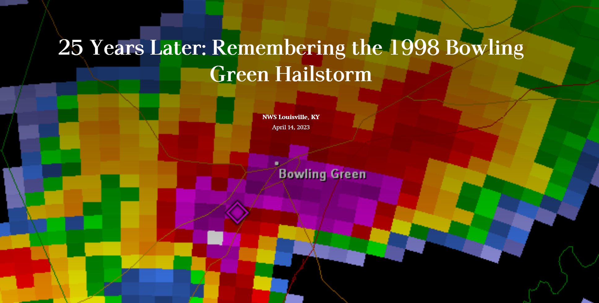
.png)
Radar image shows the hail core right over Bowling Green on April 16, 1998.
The video below features the stories from that day from former WKU students Brian Goode (WAVE3 - Louisville, KY), Jude Redfield (WDRB - Louisville, KY), and Ryan Vaughan (KAIT8 - Jonesboro, AR), as well as retired Chief Meteorologist Chris Allen (WBKO - Bowling Green, KY).
The weather pattern on April 16, 1998 was characterized by a low pressure system centered over northern Indiana, with a cold front that extended to the southwest into western Kentucky and Tennessee. Very warm, moist, and unstable air was located ahead of the cold front, and a strong jet stream stretched from Oklahoma to Michigan.
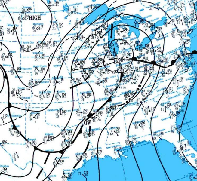
Surface weather map on April 16, 1998.
Hailstorm
As the supercell thunderstorm moved over central Warren county, it dropped baseball size hail over Bowling Green. Significant damage was done to a large portion of the city, including $10 million worth of damage to Greenwood Mall, cars totaled at all area car dealerships, and roof and water damage to Bowling Green High School. There was also major damage to over 4000 homes and businesses just in Warren County.
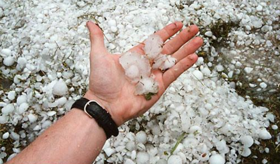
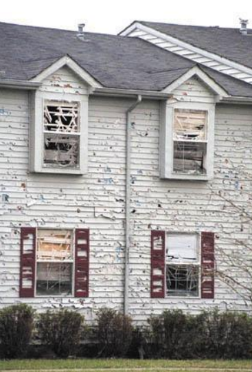
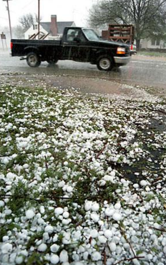
Baseball size hail damaged thousands of vehicles and buildings across Bowling Green.
Photos: Joe Imel/Bowling Green Daily News
Flooding
Immediately following the hailstorm, Western Kentucky University was pounded by 5 to 5.5 inches of rain in a three-hour period. This resulted in major flooding because the ground was already saturated due to previous rainfall that week.
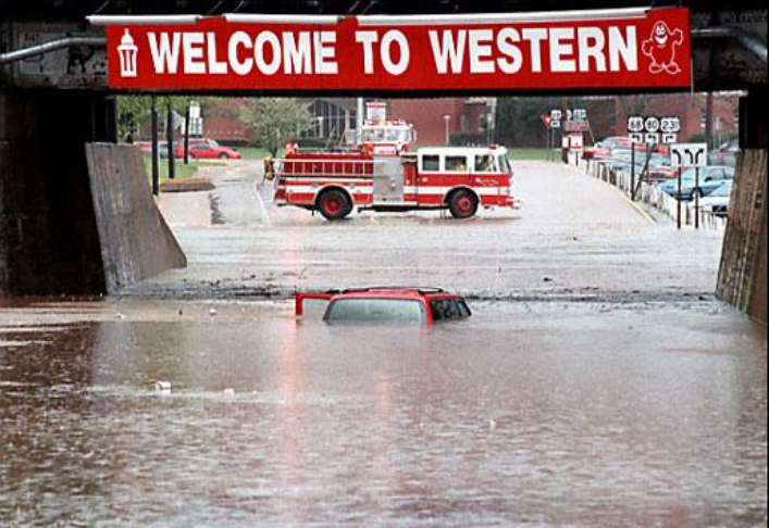
Flooding on Russellville Rd near WKU Campus. Photo: Joe Imel/Bowling Green Daily News.
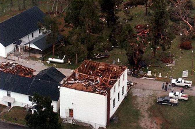
Tornadoes
Three tornadoes occurred as the supercell tracked across south-central Kentucky.
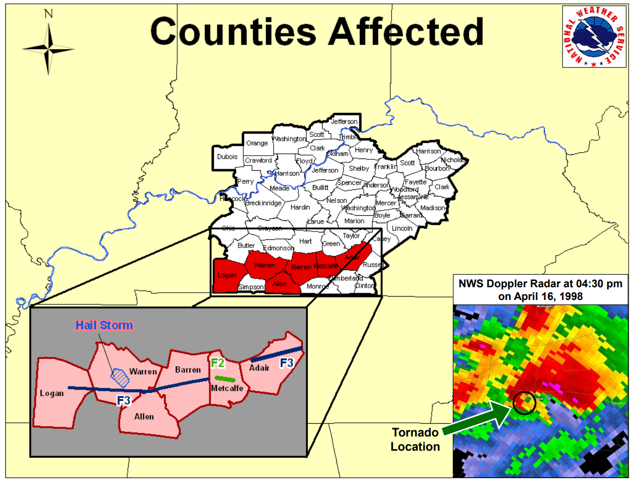
F3 Tornado: Logan, Warren, Allen, and Barren Counties
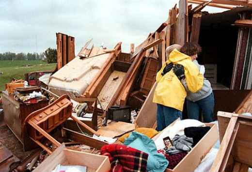
Tornado damage in rural Warren County. Photo: Joe Imel/Bowling Green Daily News
F2 Tornado: Metcalfe County
F3 Tornado: Adair County
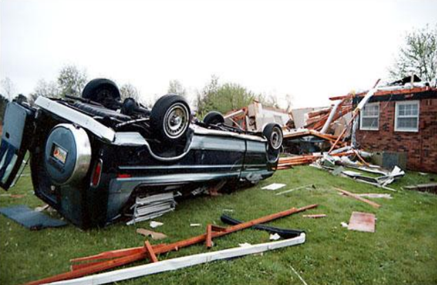
Additional tornado damage from April 16, 1998 (locations unknown). Photo: Joe Imel/Bowling Green Daily News
The National Weather Service in Louisville would like to thank Brian Goode, Jude Redfield, Chris Allen, and Ryan Vaughan for sharing their stories with us about April 16, 1998. We would also like to thank Joe Imel and the Bowling Green Daily News for their photos of the event. If you have photos from the event, please feel free to share them with us by emailing them to nws.louisville@noaa.gov.


 Weather Story
 Weather Map
 Local Radar