
Heavy rain and widely scattered severe storms are expected over portions of the central and southern Plains into the Ohio Valley. Unseasonable warmth will continue for a few more days across the Midwest, Southeast, and Mid-Atlantic where several daily record highs could fall. Read More >
Overview
|
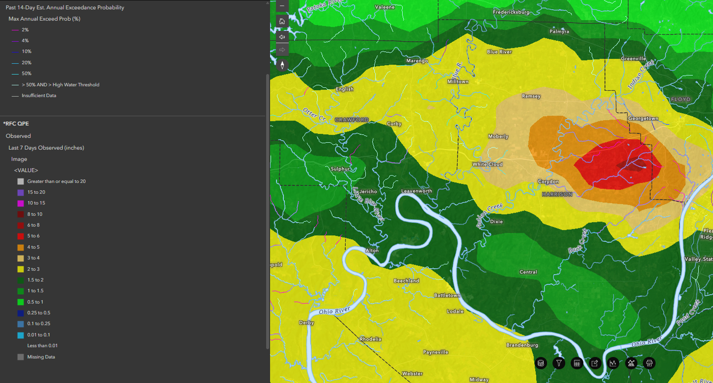
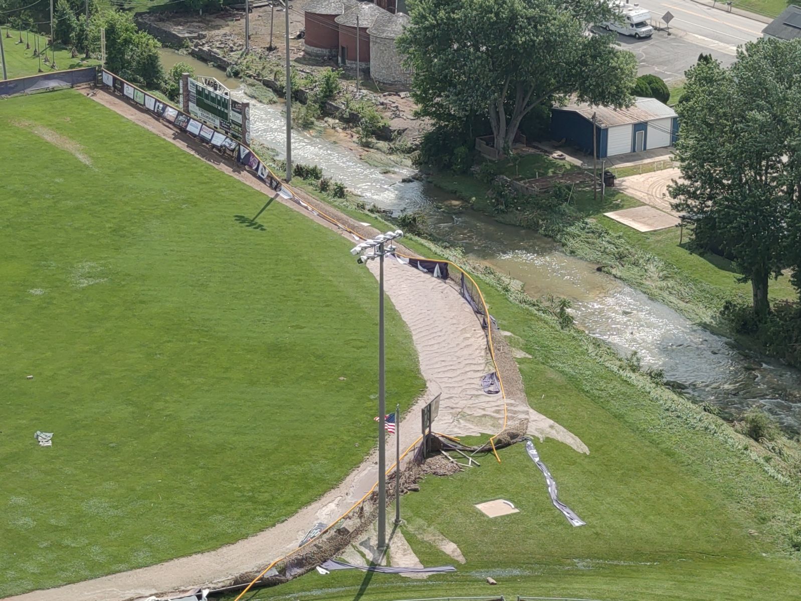
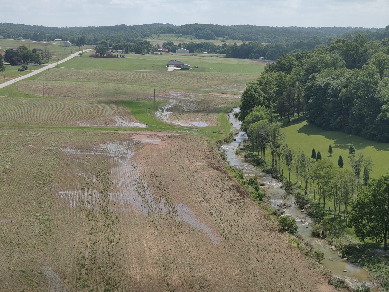
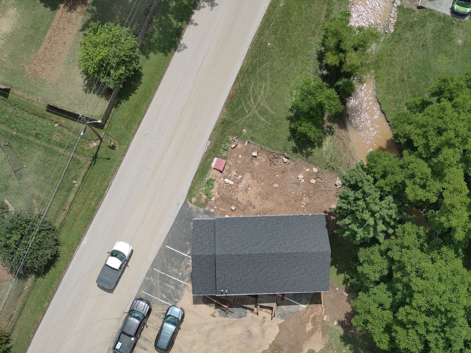
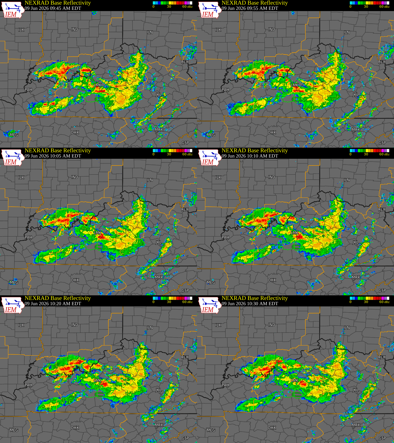
On the morning of Tuesday June 9th, 2026, an MCS moved across Kentucky, priming the region with widespread 1-1.5 inch rainfall accumulations with some localized reports of 4-5 inches. A secondary band of convection then moved from Evansville and across the Louisville Metro and into the Bluegrass which resulted in another 1-3 inches of rainfall across the area. The highest rainfall totals of 6-8 inches were reported in Lanesville, Indiana where significant flash flooding was observed. Several flash flood warnings were issued throughout the event. Special thanks to the U.S. Coast Guard Ohio Valley Sector that assisted the flood survey by capturing drone footage of the damage. |
 |
Flooding
Flash Flooding

 |
 |
 |
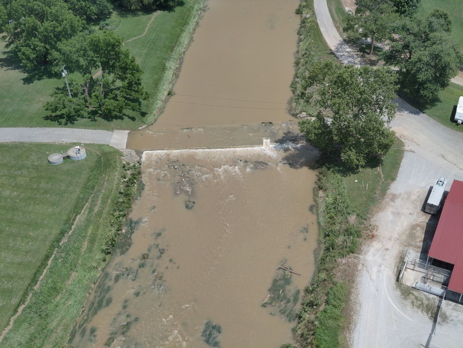 |
| Courtesy of USCG Ohio Valley Sector | Courtesy of USCG Ohio Valley Sector | Courtesy of USCG Ohio Valley Sector | Courtesy of USCG Ohio Valley Sector |
Radar
 |
Photos & Video
Drone Video Courtesy of U.S. Coast Guard Ohio Valley Sector
 |
 |
 |
 |
| Lanesville Junior-Senior High School Track Flood Damage | Lanesville Baseball Field Flood Damage | Lanesville Junior-High School Flood Damage | Aerial shot of Lanesville |
 |
 |
 |
 |
| Aerial shot of Lanesville | Aerial shot of Lanesville | Corydon Flooding | Corydon Flooding |
Environment
Synoptic Environment - 12Z Tuesday, June 9, 2026
 |
 |
 |
| Figure 1: Surface Analysis 12Z | Figure 2: 850 mb UA Obs, Heights, Temps, Tds | Figure 3: 300 mb UA Obs and Isotachs |
Near-storm environment 12Z Tuesday, June 9, 2026
 |
 |
 |
| Figure 4: 925 mb Moisture Transport, Height, and Theta-e | Figure 5: 850 mb Moisture Transport, Height, and Theta-e | Figure 6: Precipitation Potential Placement |
 |
 |
 |
| Figure 7: MUCAPE, MUCLIN, and Effective Bulk Shear | Figure 8: SBCAPE and SBCIN | Figure 9: Precipitable Water |
 |
Media use of NWS Web News Stories is encouraged! Please acknowledge the NWS as the source of any news information accessed from this site. |
|




 Weather Story
 Weather Map
 Local Radar
 Follow us on X
 Follow us on Facebook
 Follow us on YouTube
 LMK RSS Feed