Overview
|
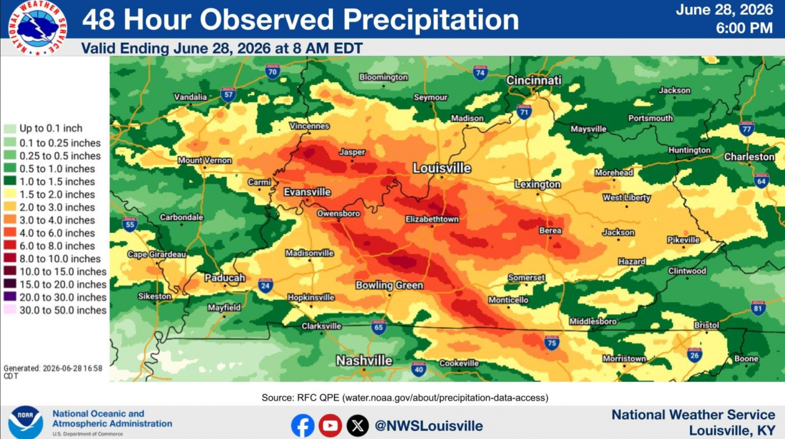
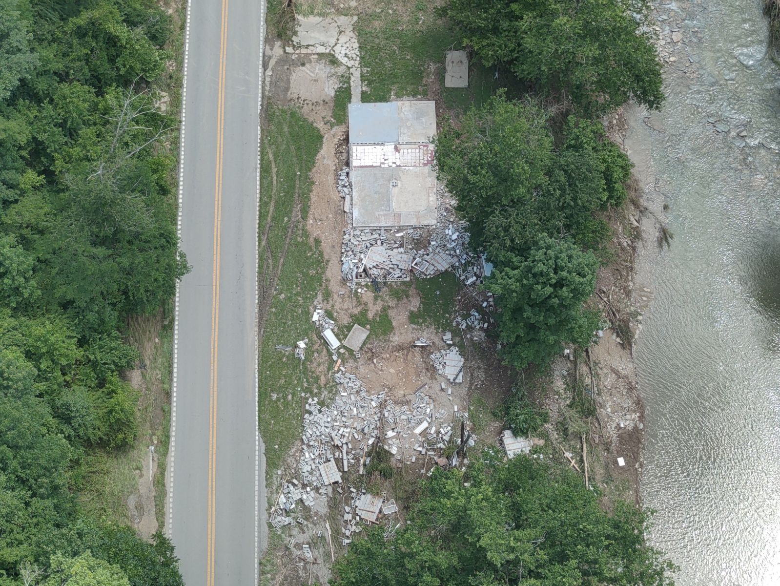
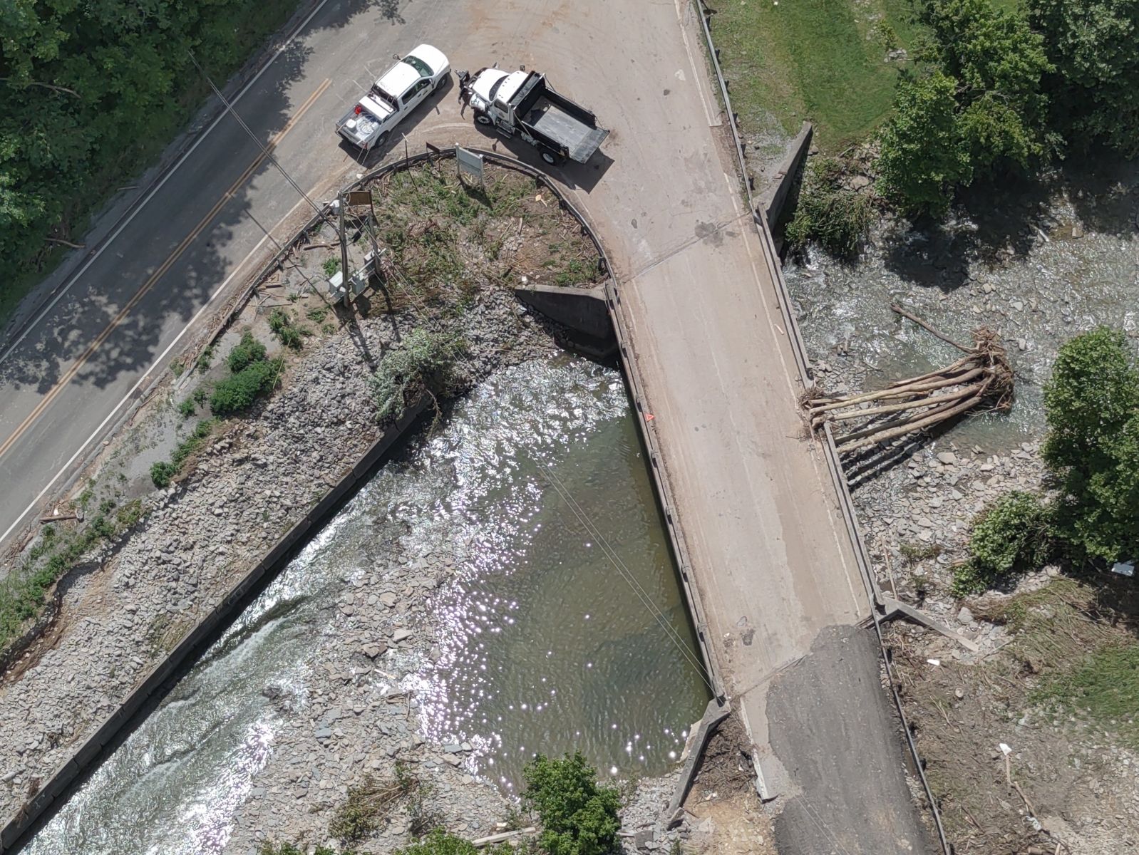
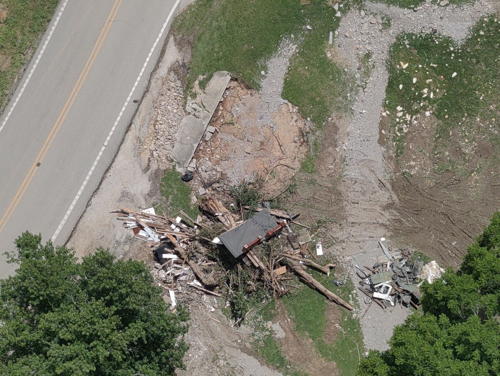
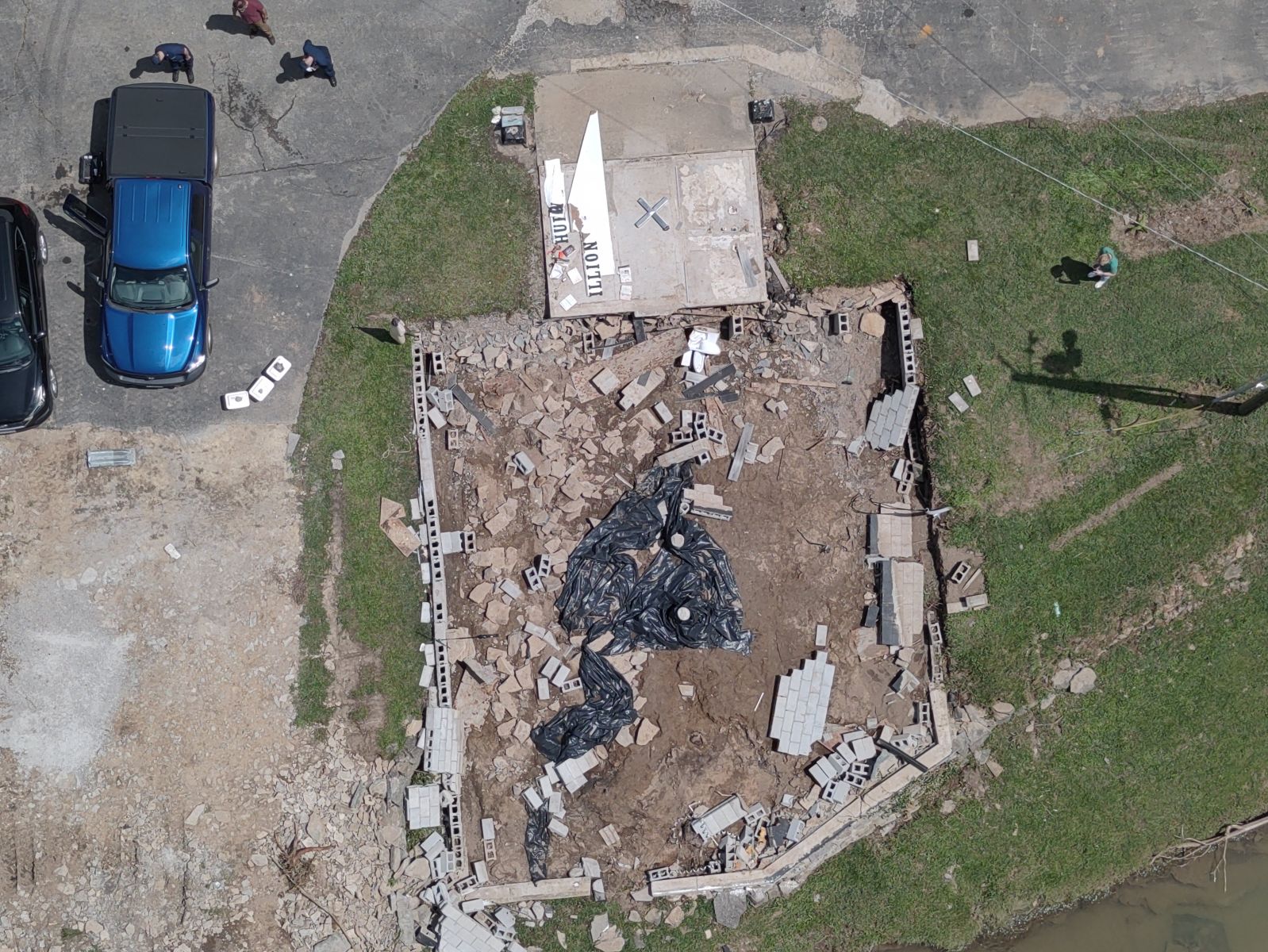
Multiple rounds of storms occurred June 26-28th, 2026 resulting in significant flash flooding over southern Indiana and central Kentucky as well as an EF-0 tornado. Several flash flood warnings were issued over the 2 day period with Considerable Flash Flooding in multiple locations and even Flash Flood Emergencies in some areas. Rainfall totals for the weekend ended up in an area wide 2-4 inches with swaths of 6-10+ inches!! Unfortunately 3 fatalities were confirmed due to flooding in Madison County, KY, and 1 fatality indirectly related to the flooding occurred on Floyds Fork in Jefferson County, KY. Kentucky Governor Andy Beshear declared a statewide state of emergency on June 27, 2026, due to severe flash flooding. By June 28, 2026, at least 18 counties and cities had issued local emergency declarations. The 13 affected counties include: Bullitt, Clinton, Cumberland, Garrard, Grayson, Jackson, Jessamine, Madison, Meade, Mercer, Metcalfe, Spencer, and Wayne. Additionally, the following cities formally declared local emergencies: Albany, Brandenburg, Burkesville, McKee, Muldraugh, and Richmond. Special thanks to the U.S. Coast Guard Ohio Valley Sector that assisted the flood survey by capturing drone footage of the damage. |
 |
Flooding
Flash Flooding

 |
 |
 |
 |
| Courtesy of USCG Ohio Valley Sector | Courtesy of USCG Ohio Valley Sector | Courtesy of USCG Ohio Valley Sector | Courtesy of USCG Ohio Valley Sector |
Hydrographs
 |
 |
 |
 |
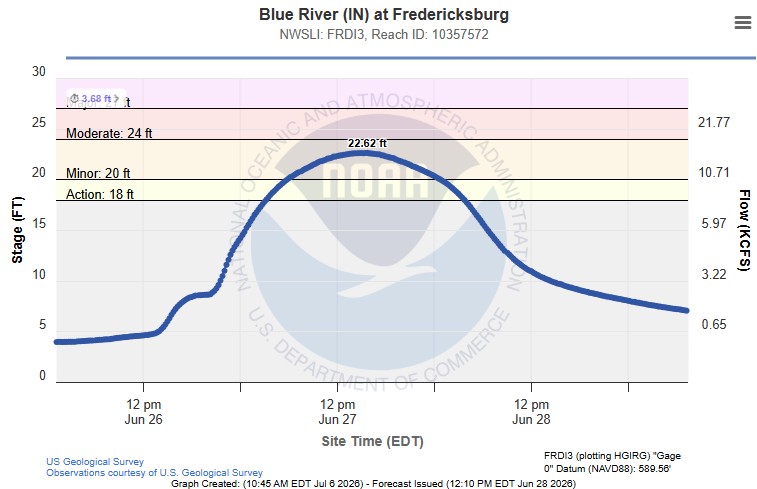
| Blue River at Fredericksburg (IN) | Rolling Fork near Boston | Rough River near Dundee | Cumberland River at Burkesville |
 |
 |
 |
 |
| Green River at Munfordville | Green River near Mammoth Cave | Green River at Woodbury | Green River at Rochester |
Tornadoes
Select a tornado from the table to zoom into the track and view more information. The default table view is limited to 8 tracks, but can be scrolled by a mouse wheel or dynamically expanded. Additionally, the table can fill the entire window by clicking the small circular expanding arrow icon at the very top right of the table and returned to its original size by clicking the button again. The side information panel that opens over the map can be closed using the "X" on the upper right corner of the pop-up. Zoom into the map and click damage points to see detailed information and pictures from the surveys.
|
NOTE: times shown below are local to your device's time zone. |

The Enhanced Fujita (EF) Scale classifies tornadoes into the following categories:
| EF0 Weak 65-85 mph |
EF1 Moderate 86-110 mph |
EF2 Significant 111-135 mph |
EF3 Severe 136-165 mph |
EF4 Extreme 166-200 mph |
EF5 Catastrophic 200+ mph |
 |
|||||
| Tornadoes that fail to impact any ratable damage indicators on the EF-Scale are rated EF-Unknown (EF-U) | |||||
Radar

Photos & Video
Bullitt County
 |
 |
 |
| Lake at Bullitt County Rod & Gun Club Courtesy of Courier Journal |
I-61 N cut off south of Shepherdsville Courtesy of Courier Journal |
Pumpkin Rd cut off south of Shepherdsville Courtesy of Courier Journal |
Clinton County
 |
 |
 |
 |
| Albany, KY Courtesy of Leslie Smith-Cash (Facebook) |
Albany, KY Courtesy of Leslie Smith-Cash (Facebook) |
Albany, KY Courtesy of Leslie Smith-Cash (Facebook) |
Albany, KY Courtesy of Leslie Smith-Cash (Facebook) |
Cumberland County
 |
 |
 |
|
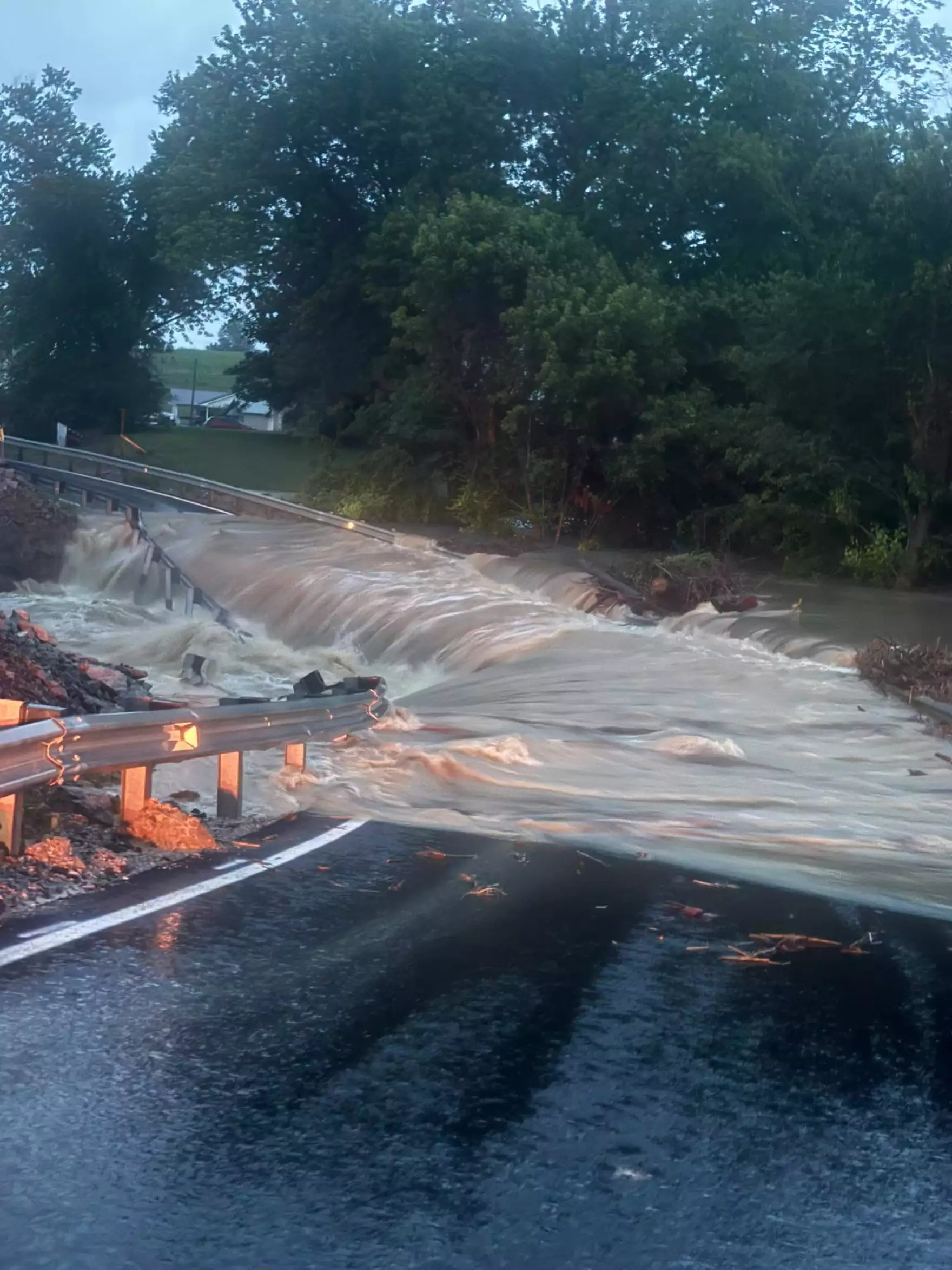
| Highway 90 at Allen's Creek Bridge Courtesy of Cumberland County EMA |
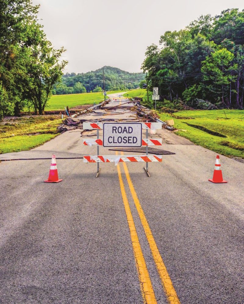
Cumberland County Flooding Courtesy of Judge Luke King |
Little Renox Bridge washed out. Courtesy of Cumberland County News |
Cumberland County Mesonet Camera Courtesy of KY Mesonet |
Garrard County
 |
 |
 |
|
| Garrard County Flooding Courtesy of Garrard County EMA |
Garrard County Flooding Courtesy of Garrard County EMA |
Garrard County Flooding Courtesy of Garrard County EMA |
Garrard County Flooding Courtesy of Garrard County EMA |
Grayson County
Courtesy of Caneyville Fire Department
 |
 |
| Cook Rd Courtesy of Dustin Knight |
Cook Rd Courtesy of Dustin Knight |
Jessamine County
 |
 |
 |
 |
| Jessamine County Flooding Courtesy of Jessamine County EMA |
Jessamine County Flooding Courtesy of Jessamine County EMA |
Jessamine County Flooding Courtesy of Jessamine County EMA |
Jessamine County Flooding Courtesy of Jessamine County EMA |
Madison County
Drone Video Courtesy of U.S. Coast Guard Ohio Valley Sector
 |
 |
 |
.JPG) |
| Million Church swept off its foundation Courtesy of Courier Journal |
Million Church swept off its foundation Courtesy of Courier Journal |
Armitage Dr Courtesy of Jennifer Bell |
Tates Creek Courtesy of U.S. Coast Guard Ohio Valley Sector |
Meade County
 |
 |
 |
 |
| Buttermilk Falls Courtesy of Meade County EMA |
Buttermilk Falls Courtesy of Meade County EMA |
Otter Creek Campground Courtesy of Meade County EMA |
Otter Creek Campground Courtesy of Meade County EMA |
Mercer County
 |
 |
 |
 |
| Oregon Rd Courtesy of Tammy Cox Miller (Facebook) |
Sparrow Lane/ Dry Branch Courtesy of Nick Mullins (Facebook) |
Cummins Ferry Courtesy of Angie Stratton Patton (Facebook) |
Robb Road near McAfee Courtesy of Sean Steele (Facebook) |
Metcalfe County
 |
 |
 |
 |
| Edmonton, KY Courtesy of Edmonton Herald-News |
Edmonton, KY Courtesy of Edmonton Herald-News |
Ferris Creek Rd Courtesy of Chrystal D Hurt (Facebook) |
Edmonton, KY Courtesy of Eliza Thompson (Facebook) |
Spencer County
 |
 |
 |
 |
| Salt River at Bloomfied Rd/East River Rd in Taylorsville, KY Courtesy of Amber Phillips |
Plum Ridge Rd in Taylorsville, KY Courtesy of Spencer County EMA |
Roberts Rd Courtesy of Spencer County EMA |
Taylorsville, KY Courtesy of Spencer County EMA |
Environment
Synoptic Environment - 0Z Saturday, Jun 27, 2026
 |
 |
 |
| Figure 1: Surface Analysis | Figure 2: 850 mb UA Obs, Heights, Temps, Tds | Figure 3: 250 mb UA Obs and Isotachs |
Near-storm Environment - 0Z Saturday, Jun 27, 2026
 |
 |
 |
| Figure 4: 850 mb Moisture Transport, Height and Theta-e | Figure 5: Precipitable Water | Figure 6: Precipitation Potential Placement |
 |
 |
 |
| Figure 7: MUCAPE, MUCIN and Effective Bulk Shear | Figure 8: SBCAPE and SBCIN | Figure 9: BNA Skew-T |
 |
Media use of NWS Web News Stories is encouraged! Please acknowledge the NWS as the source of any news information accessed from this site. |
|




 Weather Story
 Weather Map
 Local Radar
 Follow us on X
 Follow us on Facebook
 Follow us on YouTube
 LMK RSS Feed