A large, long-duration winter storm is expected to bring widespread heavy snow, sleet, and freezing rain from the Southern Rockies/Plains into the Mid-South beginning Friday, spreading eastward to the Mid-Atlantic and New England this weekend. An Arctic front will bring frigid temperatures and gusty winds that will lead to dangerous wind chills from the Northern Plains and Upper Midwest. Read More >
Louisville, KY
Weather Forecast Office
 |
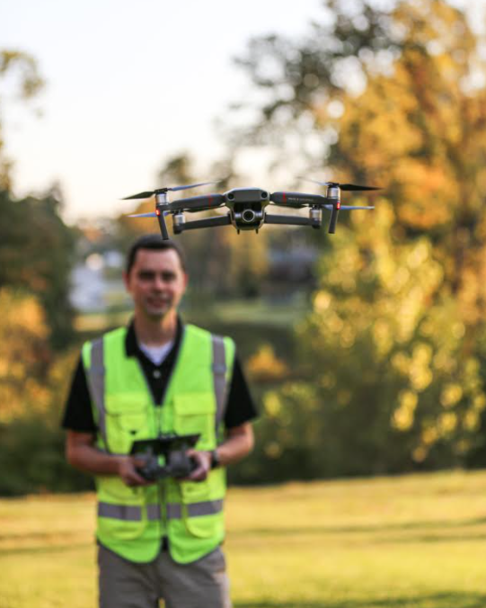
Future river flood and storm damage surveys will look a little different going forward with the National Weather Service (NWS) in Louisville, Kentucky, starting this fall! Dan McKemy, a meteorologist for NWS Louisville, submitted a grant earlier this year to obtain approval and funding for the use of UAS (Unmanned Aircraft Systems), or drones, in river flood and storm damage surveys. The grant was approved and funded by NOAA, and over the last several months, the office has acquired drones and trained personnel to begin using them. Late last month, Dan McKemy and Brian Schoettmer (NWS Louisville Meteorologist) visited the Parklands in Louisville, Kentucky, to conduct a mock river survey with the drones. The mock river survey was a success and showed just how valuable aerial photography can be in a river survey! An interactive map of the survey is available at the bottom of this page for viewing. We want to pass along our thanks to the Parklands Staff for granting us permission to fly on their land! NWS Louisville will be using drones on future river flood and storm damage surveys from this point forward. For river flooding specifically, the aerial imagery will allow the NWS to create maps that will be useful to our partners to help predict future flooding as well as anticipating impacts the river flooding may cause. For storm damage surveys, the aerial imagery will help speed up the survey process, as well as helping to confirm whether damage was tornadic vs straight line wind. Expect to see future maps and imagery from us in the future after flooding and severe events! |
Current Hazards
Hazardous Weather Outlook
Storm Prediction Center
Submit a Storm Report
Advisory/Warning Criteria
Radar
Fort Knox
Evansville
Fort Campbell
Nashville
Jackson
Wilmington
Latest Forecasts
El Nino and La Nina
Climate Prediction
Central U.S. Weather Stories
1-Stop Winter Forecast
Aviation
Spot Request
Air Quality
Fire Weather
Recreation Forecasts
1-Stop Drought
Event Ready
1-Stop Severe Forecast
Past Weather
Climate Graphs
1-Stop Climate
CoCoRaHS
Local Climate Pages
Tornado History
Past Derby/Oaks/Thunder Weather
Football Weather
Local Information
About the NWS
Forecast Discussion
Items of Interest
Spotter Training
Regional Weather Map
Decision Support Page
Text Products
Science and Technology
Outreach
LMK Warning Area
About Our Office
Station History
Hazardous Weather Outlook
Local Climate Page
Tornado Machine Plans
Weather Enterprise Resources
US Dept of Commerce
National Oceanic and Atmospheric Administration
National Weather Service
Louisville, KY
6201 Theiler Lane
Louisville, KY 40229-1476
502-969-8842
Comments? Questions? Please Contact Us.


 Weather Story
 Weather Map
 Local Radar