
Dangerous heat persists across the Desert Southwest through this weekend and across the Southern Plains and Lower Mississippi Valley through at least the middle of next week. Numerous daily record high temperatures are expected through at least Tuesday for much of Texas and Oklahoma as well as portions of Louisiana, New Mexico, and Arizona. Read More >
Overview
|
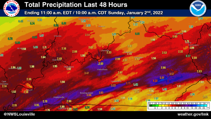
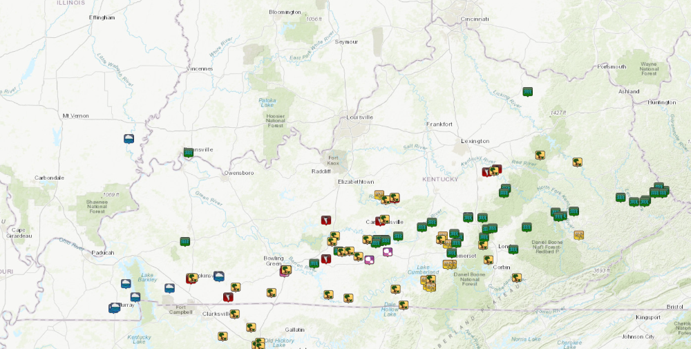
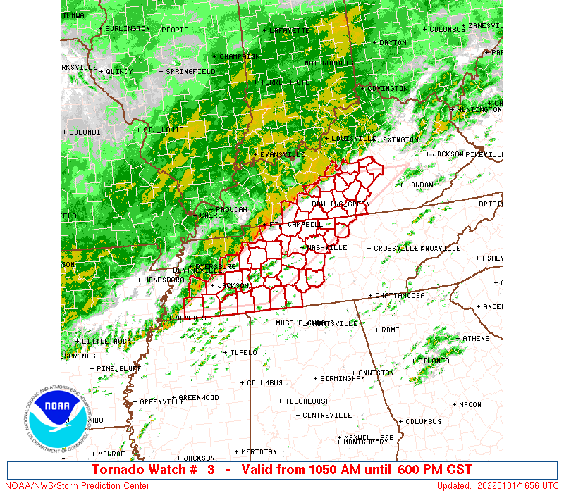
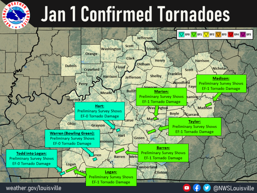
During New Year's Eve into New Year's Day, active weather was observed across Kentucky as several waves of low pressure moved along a frontal boundary that was stalled out across the region. This resulted in multiple rounds of widespread precipitation, and rainfall amounts of 2 to 4 inches with locally higher amounts were observed across the area. As the boundary lifted north as a warm front New Year's Day, strong to severe storms were able to develop within the warm sector ahead of an approaching cold front, with multiple tornadoes and scattered straight-line wind damage being observed.
The map to the right gives the most recent depiction of damage paths.
|
|
Tornadoes:
Interactive Damage Survey Map - Zoom in and click the points to see damage information and pictures. All damage points are preliminary at this time. Performance of this map may be slow due to heavy internet traffic.

|
Tornado #1- Olmstead, KY
Track Map 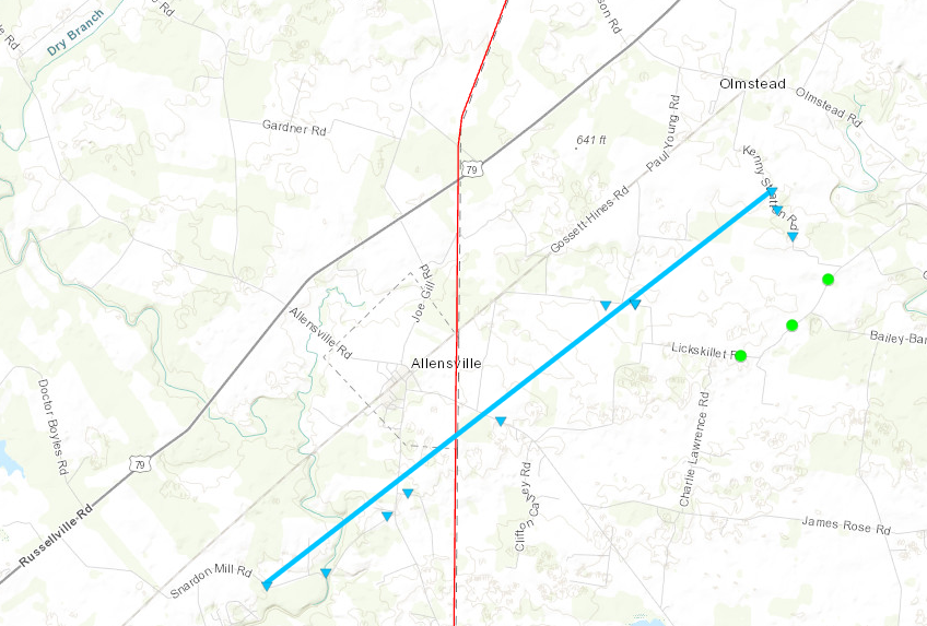
|
||||||||||||||||
|
Tornado #2 - Olmstead/Russellville, KY
Track Map 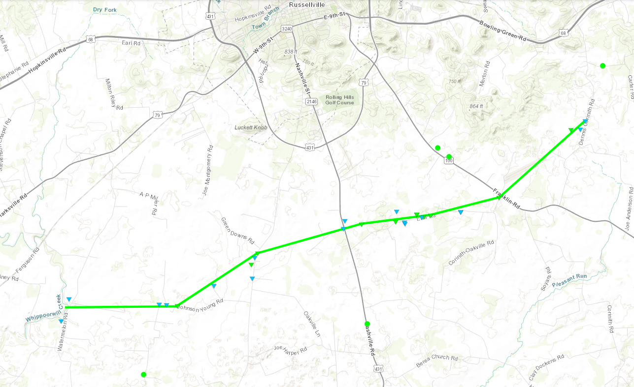
|
||||||||||||||||
|
Tornado - Bowling Green, KY
Track Map 
|
||||||||||||||||
|
Tornado - Priceville, KY
Track Map 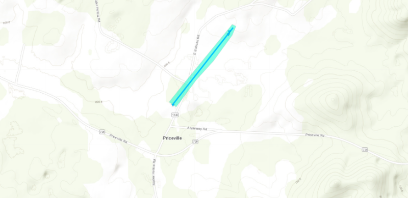
|
||||||||||||||||
|
Tornado - Carden to Hiseville, KY
Track Map 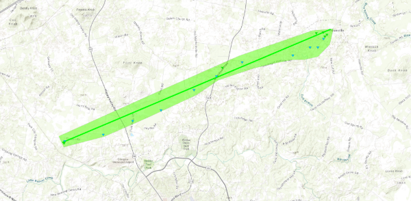
|
||||||||||||||||
|
Tornado - North of Campbellsville, KY
Track Map 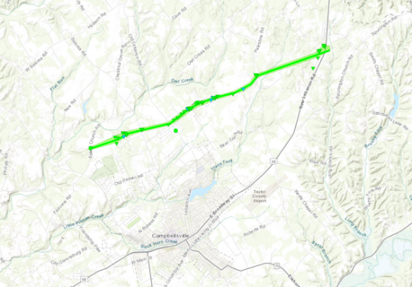
|
||||||||||||||||
|
Tornado - Lebanon, KY
Track Map 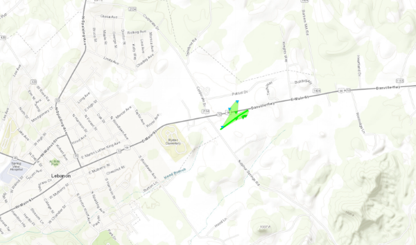
|
||||||||||||||||
|
Tornado - Union City, KY
Track Map 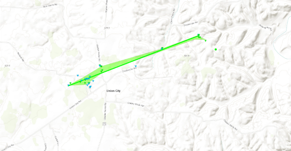
|
||||||||||||||||
|
Straight Line Winds - Thurlow
Track Map 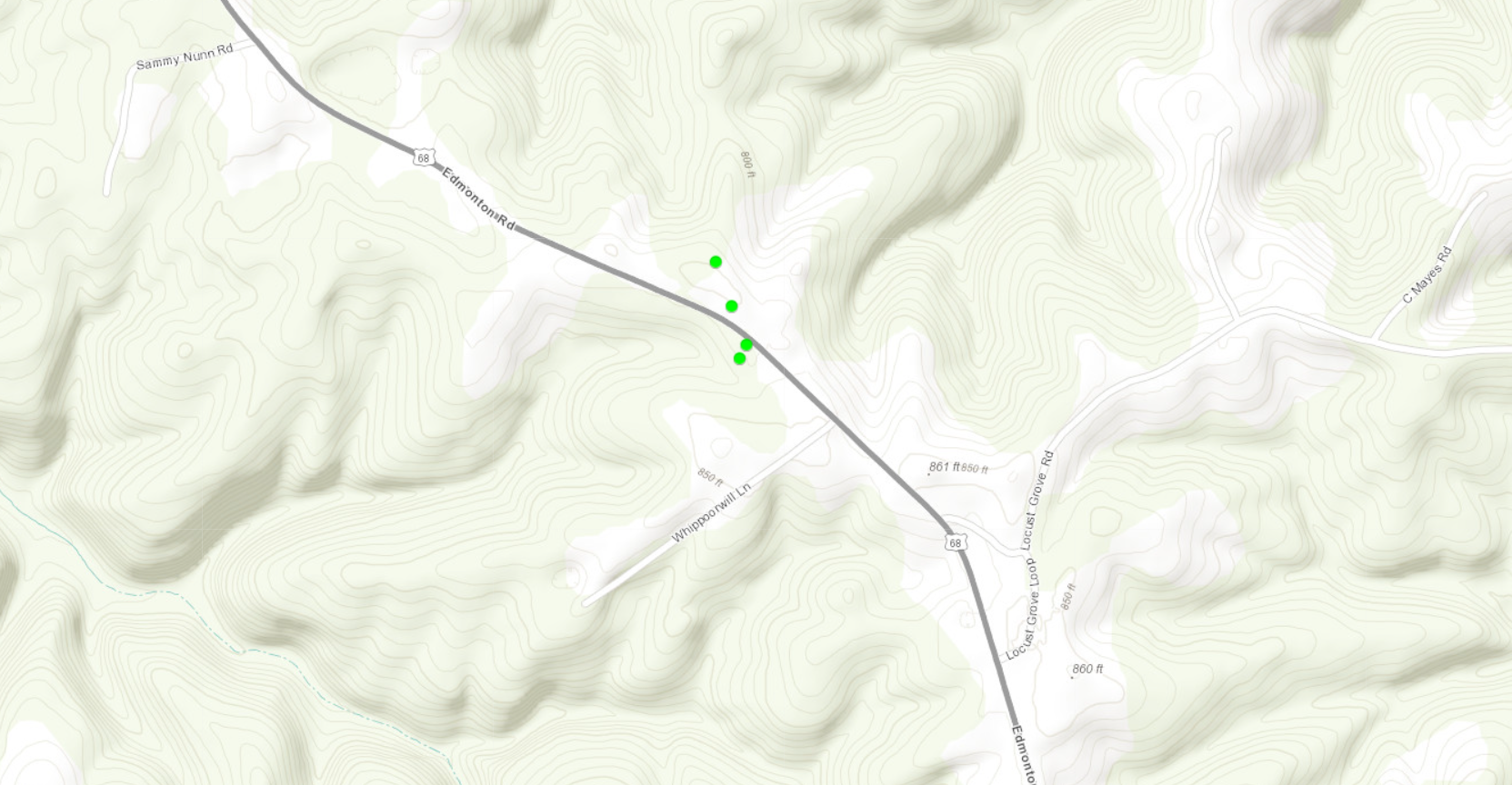
|
||||||||||||||||
The Enhanced Fujita (EF) Scale classifies tornadoes into the following categories:
| EF0 Weak 65-85 mph |
EF1 Moderate 86-110 mph |
EF2 Significant 111-135 mph |
EF3 Severe 136-165 mph |
EF4 Extreme 166-200 mph |
EF5 Catastrophic 200+ mph |
 |
|||||
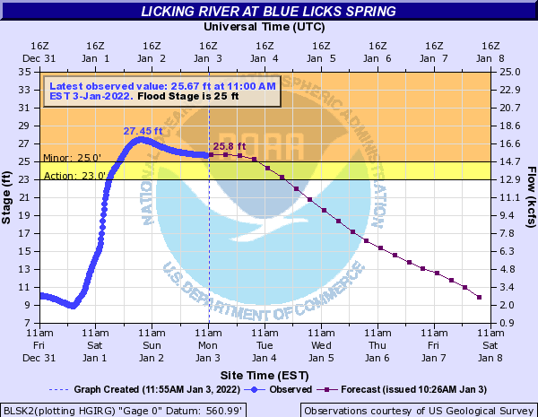
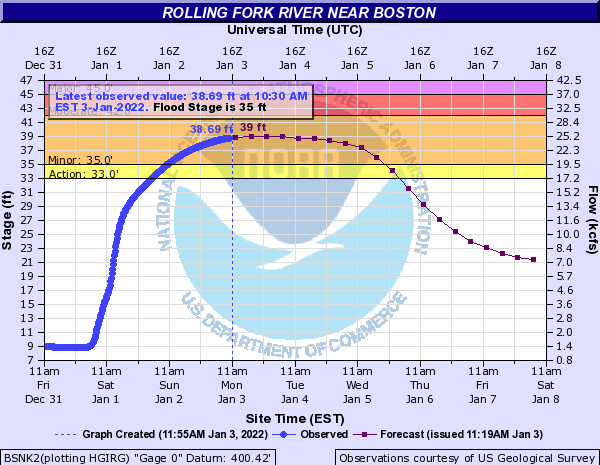
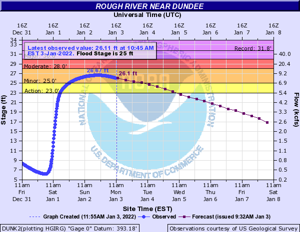
Flooding
Total Rainfall Accumulation
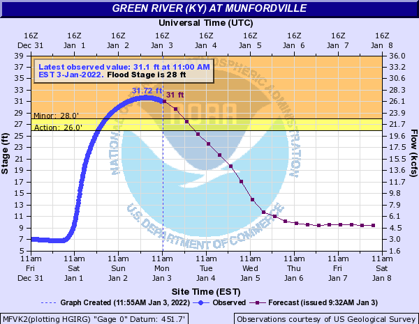
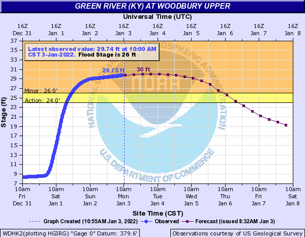
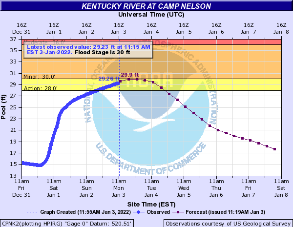
Hydrographs
 |
 |
 |
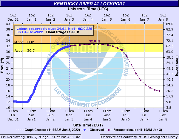 |
| Green River at Munfordville, KY | Green River at Woodbury, KY | Kentucky River at Camp Nelson | Kentucky River at Lockport |
 |
 |
 |
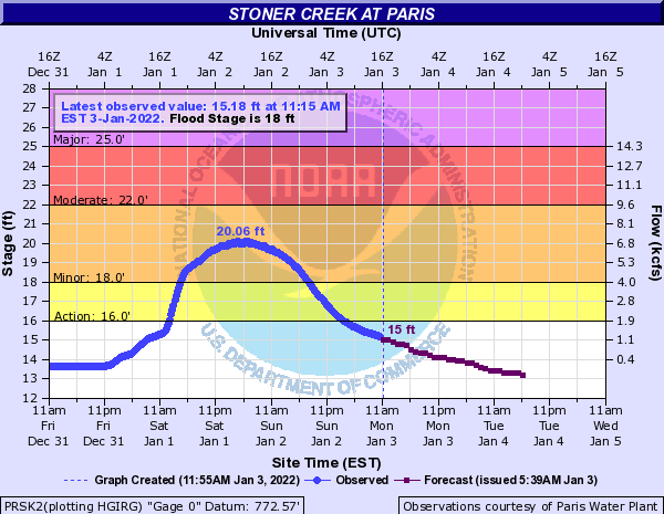 |
| Licking River at Blue Licks Spring | Rolling Fork River at Boston, KY | Rough River at Dundee | Stoner Creek at Paris, KY |
Photos & Video
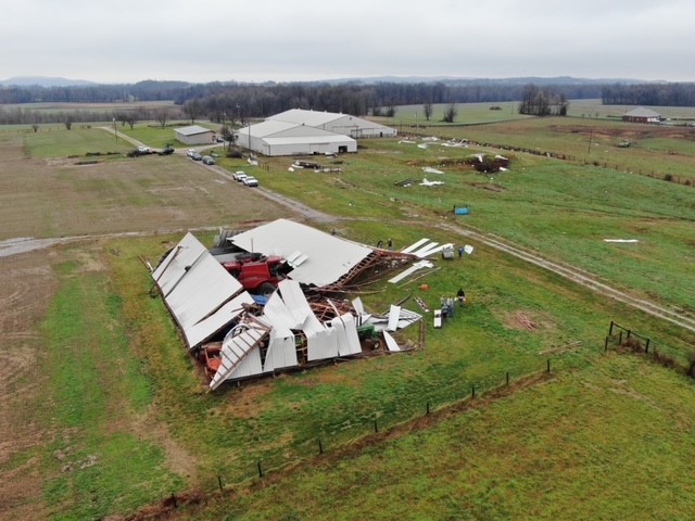
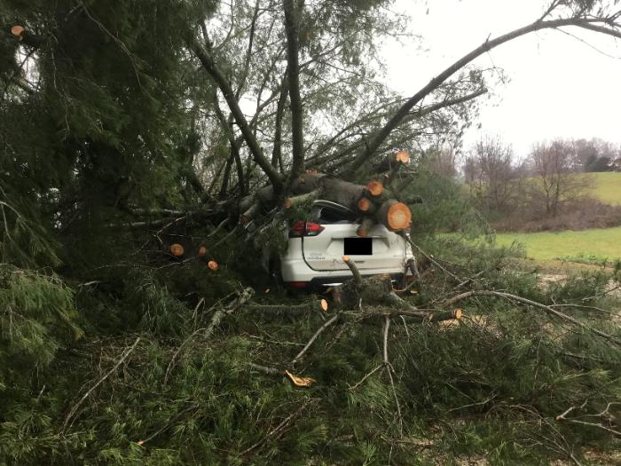
Barren County
 |
 |
 |
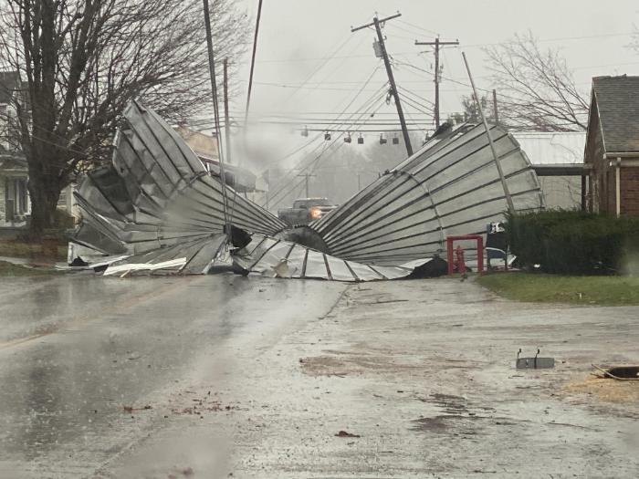 |
| Courtesy of NWS Storm Survey | Courtesy of NWS Storm Survey | Courtesy of NWS Storm Survey | Courtesy of John Humphress |
Drone footage of EF-1 Tornado Damage near Glasgow, KY
Hart County
 |
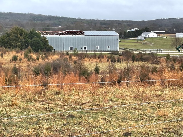 |
||
| Courtesy of NWS Storm Survey | Courtesy of NWS Storm Survey |
Logan County
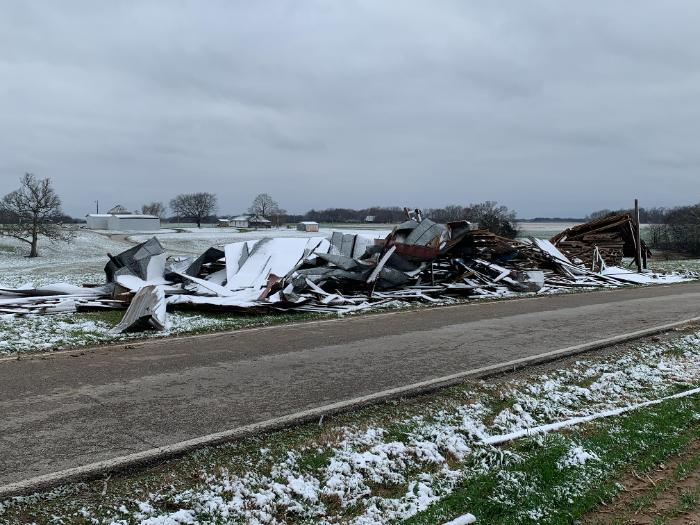 |
|||
| Courtesy of NWS Storm Survey |
Madison County
 |
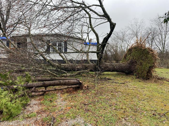 |
 |
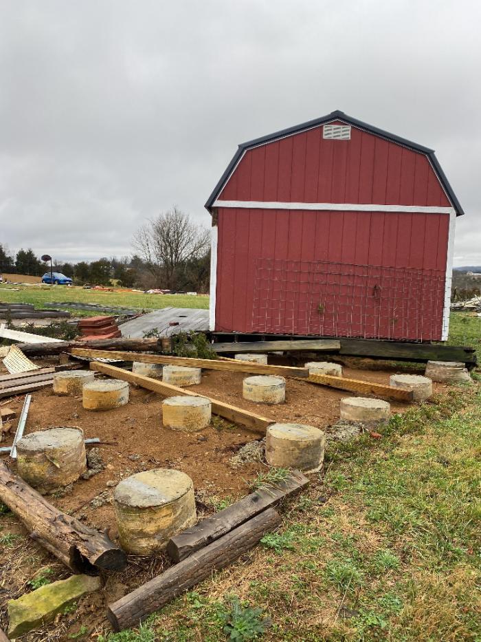 |
| Courtesy of NWS Storm Survey | Courtesy of NWS Storm Survey | Courtesy of NWS Storm Survey | Courtesy of NWS Storm Survey |
Marion County
 |
 |
 |
|
| Courtesy of EM Laurie Heckel | Courtesy of NWS Storm Survey | Courtesy of NWS Storm Survey |
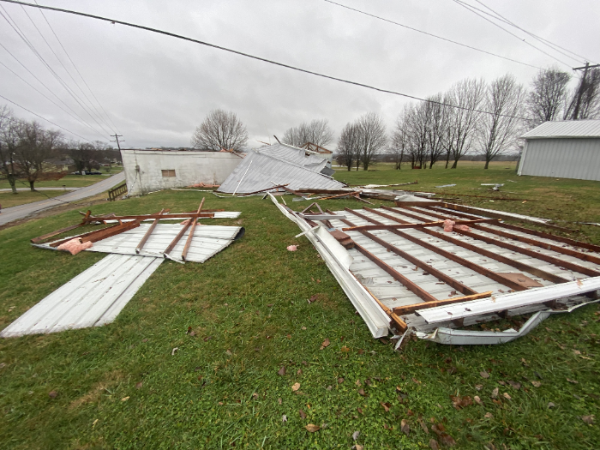
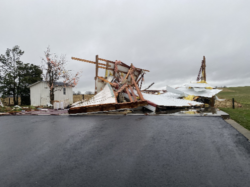
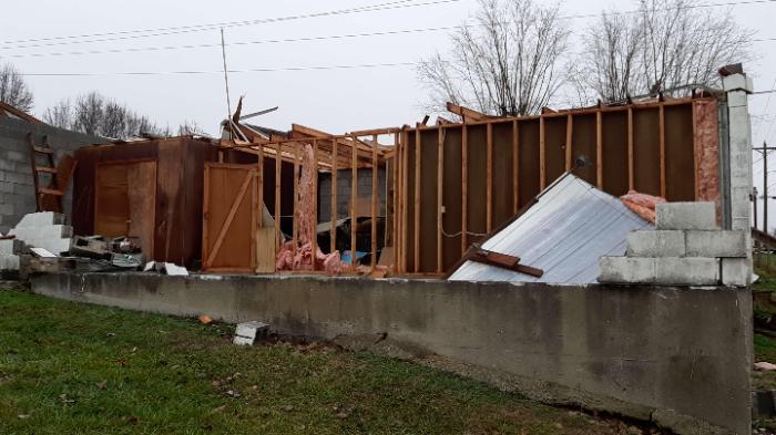
Taylor County
 |
 |
 |
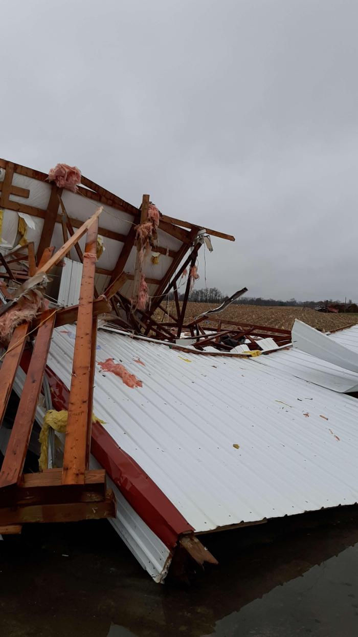 |
| Courtesy of John Humphress | Courtesy of John Humphress | Courtesy of NWS Storm Survey | Courtesy of NWS Storm Survey |
 |
 |
 |
 |
| Courtesy of NWS Storm Survey | Courtesy of NWS Storm Survey | Courtesy of NWS Storm Survey | Courtesy of NWS Storm Survey |
Warren County
 |
 |
 |
|
| Courtesy of NWS Storm Survey | Courtesy of NWS Storm Survey | Courtesy of NWS Storm Survey |
Radar
 |
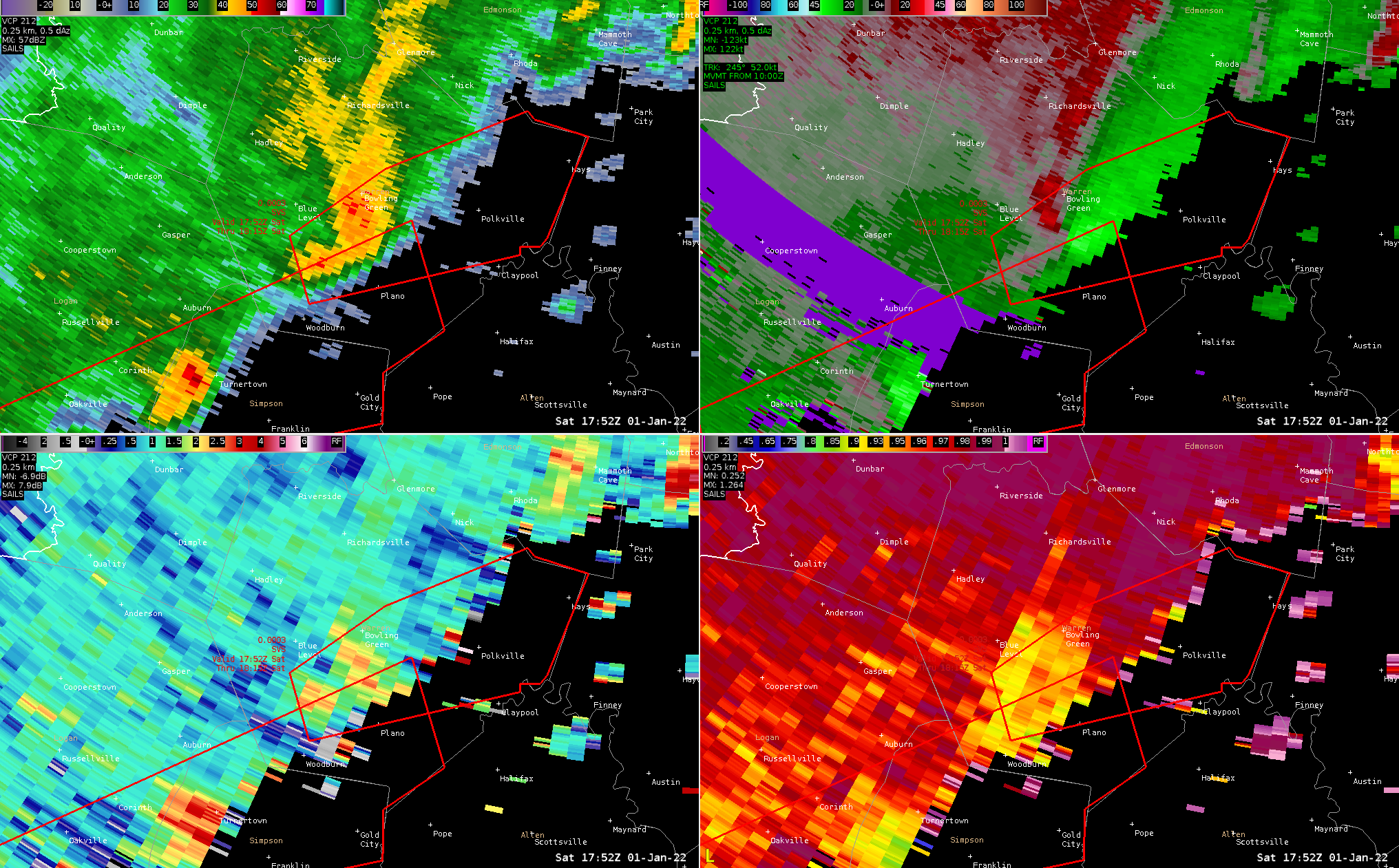 |
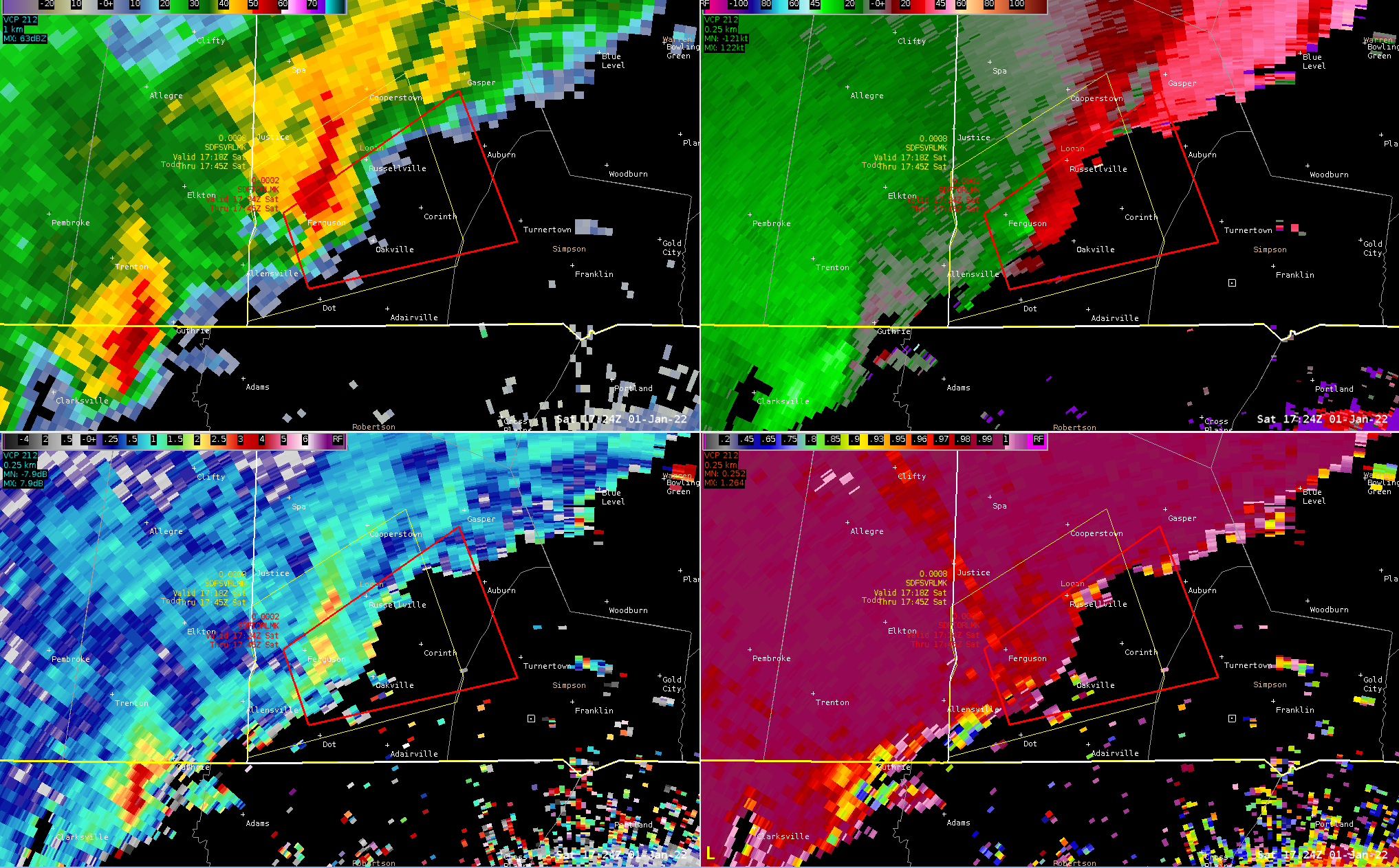
| Logan County Tornado: Shortly after tornado formed, strong circulation is evident just southeast of Ferguson, KY. This tornado continued on for 11 miles. | Bowling Green Tornado: Rotational couplet visible as a tornado briefly touched down just south of Bowling Green, KY. |
 |
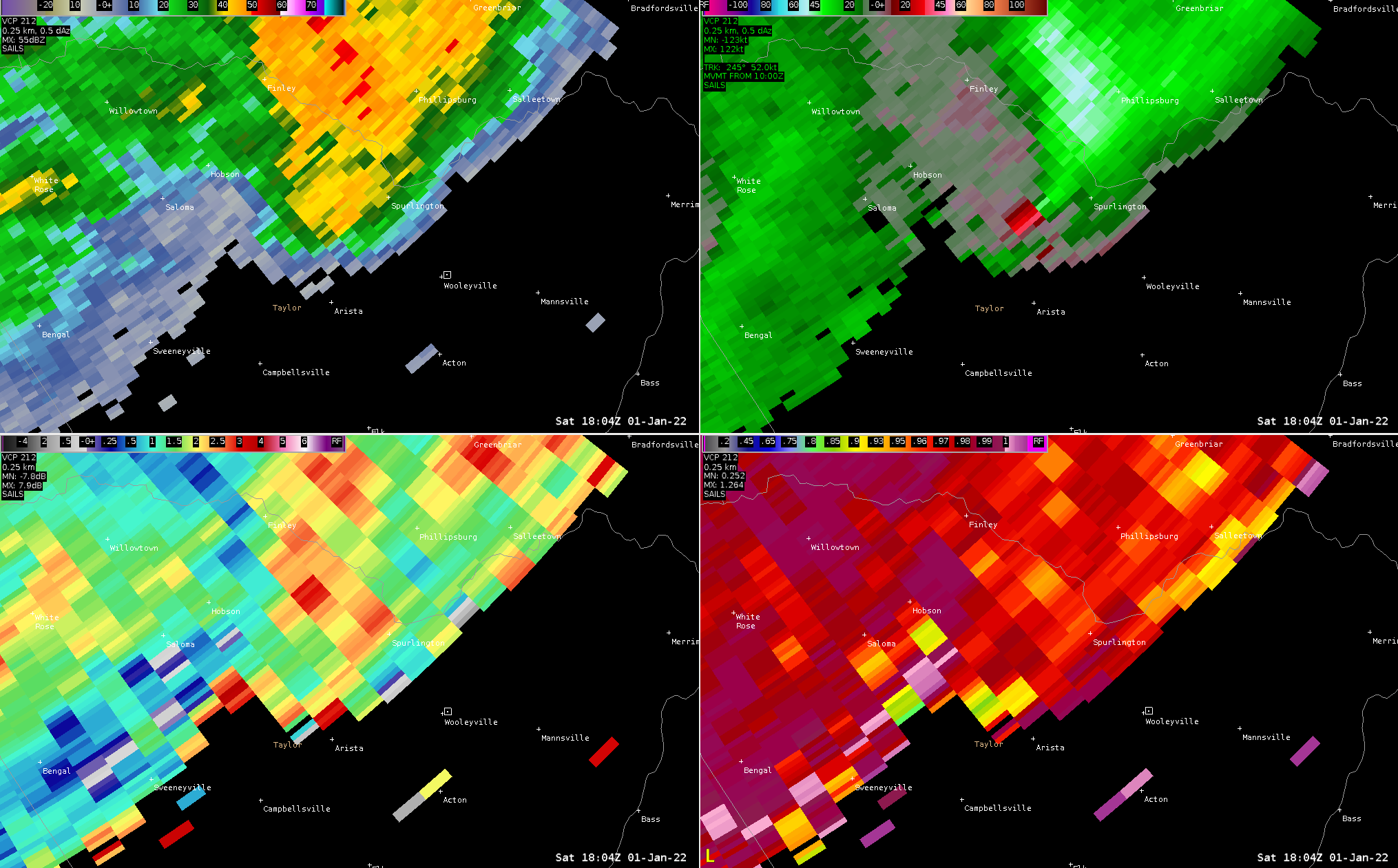 |
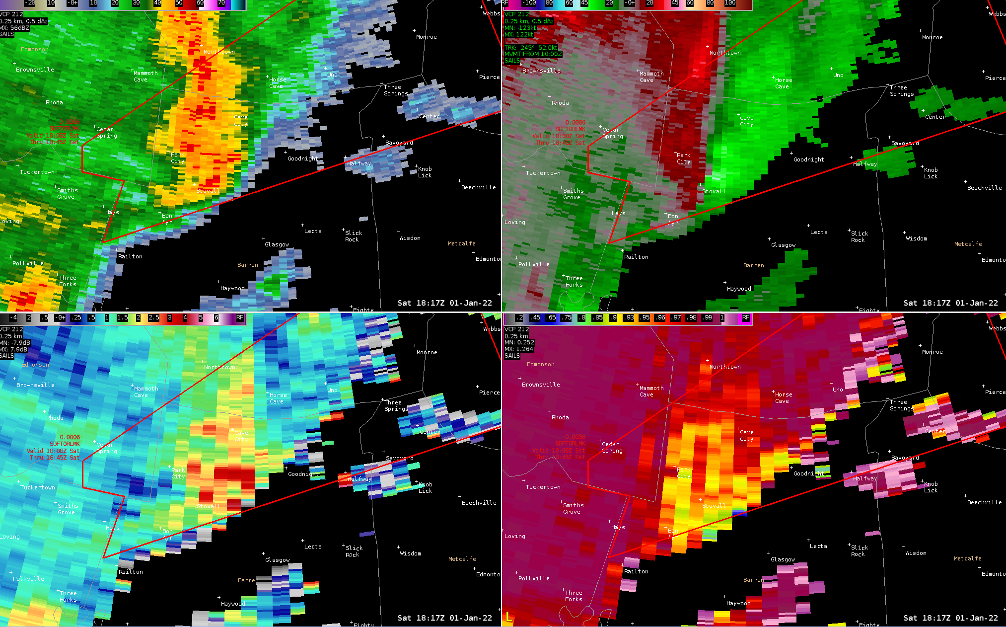
| Barren County Tornado: A broad area of circulation is noted as a tornado developed near Carden, KY and then continued on for 10.6 miles to Hiseville, KY. | Taylor County Tornado: Tight circulation visible as tornado passed just north of Campbellsville, KY. |
Storm Reports
PRELIMINARY LOCAL STORM REPORT...SUMMARY
NATIONAL WEATHER SERVICE LOUISVILLE KY

..TIME...   ...EVENT...      ...CITY LOCATION...     ...LAT.LON...
..DATE...   ....MAG....      ..COUNTY LOCATION..ST.. ...SOURCE....
            ..REMARKS..

0518 AM     Flash Flood      5 W Cane Valley         37.19N 85.40W
01/01/2022                   Green              KY   911 Call Center

            Green County Dispatch reported a second
            vehicle drove into high water near KY-1913
            and Coburg Road. 1 person was rescued down
            stream after holding on to a tree in swift
            water. Injuries are unknown at this time.
            This water rescue is separate from the
            ongoing water rescue, but is in the same
            area.

0518 AM     Flash Flood      4 W Cane Valley         37.19N 85.40W
01/01/2022                   Green              KY   911 Call Center

            Green County Dispatch reported ongoing water
            rescue near KY-1913 and Coburg Road. A
            vehicle is located in high water, with three
            people on top of vehicle. Multiple
            departments on scene attempting water
            rescue. Dispatch received first call for
            water rescue around 5:18 AM eastern time.

0520 AM     Hail             3 ENE Rich Pond         36.92N 86.45W
01/01/2022  E1.00 inch       Warren             KY   Trained Spotter

            Delayed Report. Nickel to quarter sized hail
            reported on Twitter.

0520 AM     Flash Flood      2 NW Cane Valley        37.21N 85.34W
01/01/2022                   Taylor             KY   911 Call Center

            Delayed Report. Taylor County Dispatch
            reported two vehicles drove into high water
            on North Coburg Rd.

0600 AM     Flash Flood      2 SSE Hays              37.00N 86.12W
01/01/2022                   Barren             KY   Law Enforcement

            minor flooding at howser road and merry oaks
            railton road.

0600 AM     Flash Flood      2 WNW Hiseville         37.11N 85.85W
01/01/2022                   Barren             KY   Law Enforcement

            minor flooding along ky 70 in spots that
            flood easily.

0610 AM     Flash Flood      5 SE Greensburg         37.21N 85.42W
01/01/2022                   Green              KY   Law Enforcement

            water over the roadway on ky 565 at
            haskingsville rd...may need to be closed
            soon.

0610 AM     Flash Flood      5 ENE Exie              37.18N 85.44W
01/01/2022                   Green              KY   Law Enforcement

            water over ky 61...may need to be closed
            soon.

0617 AM     Hail             4 ENE Gascon            37.03N 85.51W
01/01/2022  E1.50 inch       Adair              KY   Storm Chaser


0620 AM     Flash Flood      Knifely                 37.24N 85.19W
01/01/2022                   Adair              KY   Law Enforcement

            Flooding in Knifely...road closures may soon
            be needed.

0620 AM     Flash Flood      2 NW Cane Valley        37.20N 85.33W
01/01/2022                   Adair              KY   Law Enforcement

            Flooding in Coburg...road closures may soon
            be needed.

0629 AM     Hail             Columbia                37.10N 85.31W
01/01/2022  M1.25 inch       Adair              KY   Broadcast Media

            Viewer reported half dollar hail in
            Columbia. Time estimated from radar.

1152 AM     Tornado          1 NNW Priceville        37.38N 85.99W
01/01/2022                   Hart               KY   NWS Storm Survey

            NWS Storm Survey team determined an EF-0
            tornado with 80 MPH winds impacted portions
            of Hart County on January 1, 2022. The
            tornado was 0.4 miles in length, was on the
            ground for 1 minute, and was 50 yards in
            maximum width. Please see the associated PNS
            for more details about this tornado.

1220 PM     Tstm Wnd Dmg     3 NNE Olmstead          36.79N 86.99W
01/01/2022                   Logan              KY   Trained Spotter

            Trained spotter reported a tornado that did
            damage to a grain silo near Highway 79 and
            1151.

1221 PM     Tstm Wnd Gst     2 ESE Saint Francis     37.60N 85.40W
01/01/2022  M65 MPH          Marion             KY   Mesonet

            Delayed Report Kentucky Mesonet station near
            Loretto. Gusts measured in 5-minute
            increments and time estimated based on that
            and radar observations. There was some
            damage to nearby barns on Spencer-Hamilton
            Rd.

1242 PM     Tstm Wnd Dmg     2 SSE Saint Mary        37.56N 85.33W
01/01/2022                   Marion             KY   Emergency Mngr

            Large section of roof off horse barn on
            Windy Lane.

1249 PM     Tstm Wnd Dmg     1 ENE Lebanon           37.58N 85.23W
01/01/2022                   Marion             KY   Emergency Mngr

            Roof and structural damage at industrial
            facility.

1249 PM     Tornado          1 ENE Lebanon           37.57N 85.23W
01/01/2022                   Marion             KY   NWS Storm Survey

            A very brief EF-1 tornado with a couple of
            small tight vortices dropped down in the
            vicinity of the Kentucky Cooperage. Refer to
            the public information statement for more
            details.

1252 PM     Tstm Wnd Dmg     2 SSE Bowling Green     36.94N 86.42W
01/01/2022                   Warren             KY   Public

            Social media shows video of multiple snapped
            mature pine trees and damage to one of the
            buildings at Aston Parc Apartments.

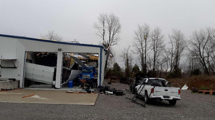
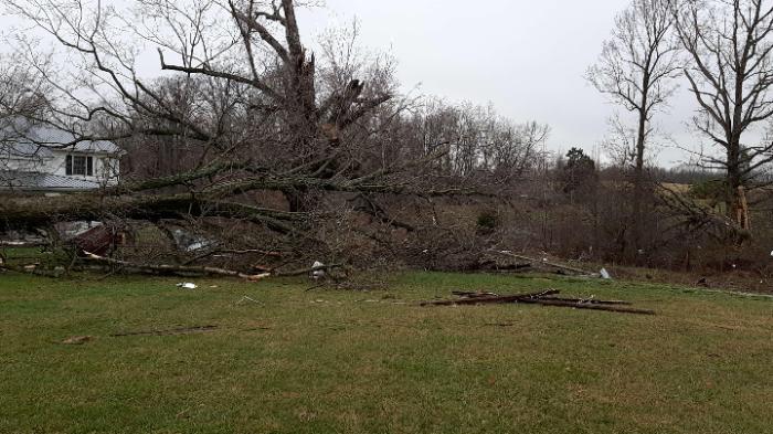
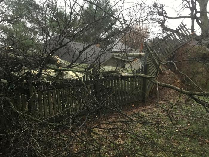
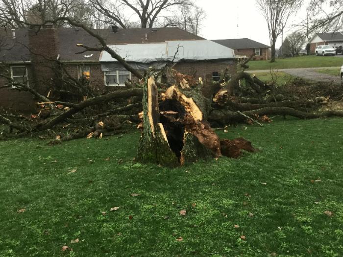
1252 PM     Tornado          2 S Bowling Green       36.94N 86.44W
01/01/2022                   Warren             KY   NWS Storm Survey

            NWS Storm Survey team determined an EF-0
            tornado with 85 MPH winds impacted portions
            of Warren County on January 1, 2022. The
            tornado was 0.4 miles in length, was on the
            ground for 1 minute, and was 75 yards in
            maximum width. Please see the associated PNS
            for more details about this tornado.

1252 PM     Tstm Wnd Dmg     2 SSE Bowling Green     36.94N 86.43W
01/01/2022                   Warren             KY   Public

            Video on social media showed a Kroger with
            roof damage and a damaged fence at the back
            of the parking lot.

1258 PM     Tstm Wnd Dmg     1 NW Franklin           36.74N 86.59W
01/01/2022                   Simpson            KY   Emergency Mngr

            Simpson County Emergency Managment reported
            damage near the intersection of Morgantown
            Road and Winston Lane. Some trees were
            uprooted or large branches snapped. Shingle
            and antenna damage occurred to some homes.
            Winds were estimated at 65 to 70 mph.

0100 PM     Tornado          3 NW Campbellsville     37.37N 85.39W
01/01/2022                   Taylor             KY   NWS Storm Survey

            EF-1 tornado with peak winds of 110 mph.
            Length was 6.25 miles and maximum width of
            350 yards. Refer to public information
            statement for more details.

0104 PM     Tstm Wnd Dmg     2 SE Hobson             37.39N 85.34W
01/01/2022                   Taylor             KY   Emergency Mngr

            Several structures, power poles, and trees
            damaged. Mutual aid is responding.

0117 PM     Tornado          4 E Bon Ayr             37.04N 85.99W
01/01/2022                   Barren             KY   NWS Storm Survey

            NWS Storm Survey team determined an EF-1
            tornado with 95 MPH winds impacted portions
            of Barren County on January 1, 2022. The
            tornado was 10.6 miles in length, was on the
            ground for 12 minutes, and was 150 yards in
            maximum width. Please see the associated PNS
            for more details about this tornado.

0117 PM     Tornado          4 E Bon Ayr             37.04N 85.99W
01/01/2022                   Barren             KY   NWS Storm Survey

            NWS Storm Survey team determined an EF-1
            tornado with 95 MPH winds impacted portions
            of Barren County on January 1, 2022. The
            tornado was 10.6 miles in length and 150
            yards in maximum width. Please see the
            associated PNS for more details about this
            tornado.

0123 PM     Tstm Wnd Dmg     1 NE Rowletts           37.24N 85.89W
01/01/2022                   Hart               KY   NWS Employee

            Numerous trees down in Rowletts.

0123 PM     Tstm Wnd Dmg     1 NNW Horse Cave        37.19N 85.92W
01/01/2022                   Hart               KY   NWS Employee

            Garage damage and numerous trees down along
            HWY 218.

0127 PM     Tstm Wnd Dmg     Hiseville               37.10N 85.81W
01/01/2022                   Barren             KY   Storm Chaser

            In Hinesville, a large metal silo roof is
            sitting in the middle of the street on power
            lines. Several trees and barns have been
            damaged in the area.

0130 PM     Flash Flood      Liberty                 37.32N 84.93W
01/01/2022                   Casey              KY   Fire Dept/Rescue

            Casey County Water Rescue is currently
            working 2 water rescues. Widespread flooding
            in Liberty and Yosemite. 127 is closed in
            Liberty.

0130 PM     Flash Flood      1 NNW Middleburg        37.36N 84.82W
01/01/2022                   Casey              KY   Fire Dept/Rescue

            198 is closed in Middleburg.

0132 PM     Tstm Wnd Dmg     3 WNW Knob Lick         37.11N 85.73W
01/01/2022                   Metcalfe           KY   Emergency Mngr

            A barn roof was blown off and approximately
            7 windows were blown out of a house.

0143 PM     Tstm Wnd Dmg     3 N Exie                37.21N 85.53W
01/01/2022                   Green              KY   NWS Storm Survey

            An NWS Damage survey confirmed that 70 mph
            straight line winds caused damage in the
            Thurlow community. The Public Information
            Statement for this survey will contain more
            information.

0147 PM     Tstm Wnd Dmg     3 SSW Sulphur Well      37.06N 85.63W
01/01/2022                   Metcalfe           KY   Emergency Mngr

            A couple of barn roofs were blown off and
            the downstream debris broke out some windows
            in a home. Winds estimated 70 to 75 mph.
            Time estimated from radar.

0149 PM     Tornado          4 SE Redhouse           37.80N 84.21W
01/01/2022                   Madison            KY   NWS Storm Survey

            Tornado touched down a half mile west of
            Union City and tracked ENE for 1.7 miles,
            with a path width of 125 yards. Hundreds of
            trees uprooted or snapped, and multiple
            outbuildings destroyed. Several homes
            sustained roof, siding, and window damage.
            Maximum wind speeds estimated at 110 mph.

0208 PM     Tstm Wnd Dmg     5 N Bybee               37.81N 84.13W
01/01/2022                   Madison            KY   Public

            Damage to roof of barn on College Hill Road.

0211 PM     Tstm Wnd Dmg     Fountain Run            36.72N 85.96W
01/01/2022                   Monroe             KY   911 Call Center

            Delayed report. Monroe County dispatch
            reported trees and power lines down. Time
            estimated from radar.

0211 PM     Tstm Wnd Dmg     3 WSW Tompkinsville     36.69N 85.74W
01/01/2022                   Monroe             KY   911 Call Center

            Delayed report. Monroe county dispatch
            reported trees and power lines down. Time
            estimated from radar.

0306 PM     Tstm Wnd Dmg     7 NW Albany             36.77N 85.22W
01/01/2022                   Clinton            KY   911 Call Center

            Trees down along Highway 90 near Ida.

0330 PM     Tstm Wnd Dmg     2 W Static              36.63N 85.13W
01/01/2022                   Clinton            KY   911 Call Center

            One tree had to be removed from Huntersville
            Road, and one tree had to be removed from
            Old 70.

&&

$$
Environment
 |
 |
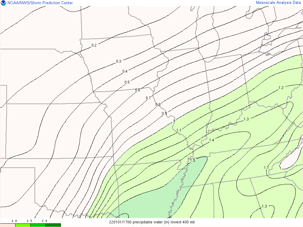 |
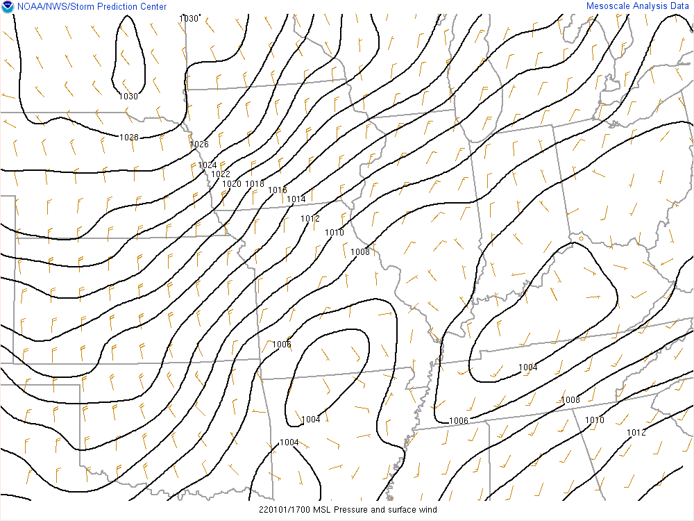
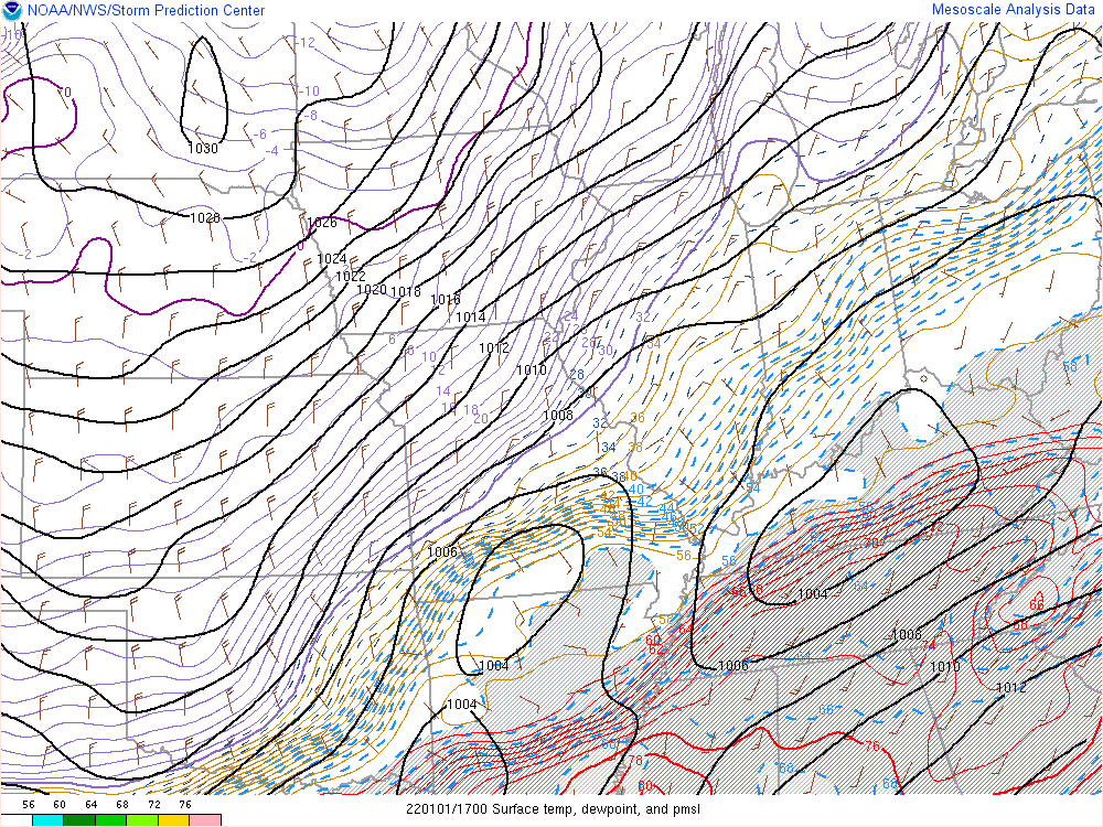
| Surface Chart: Contours and surface winds show NE-SW oriented cold front pushing through KY. | Surface Temperature, Dew Point, & MSLP: Red contours and shading depict warm, moist air flowing over southern KY ahead of the cold front. Sharp drop-off in moisture noted across central KY behind the front. | Precipitable Water: This is a measure of atmospheric moisture, and on this map we can see the highest moisture is over southwestern KY. |
 |
 |
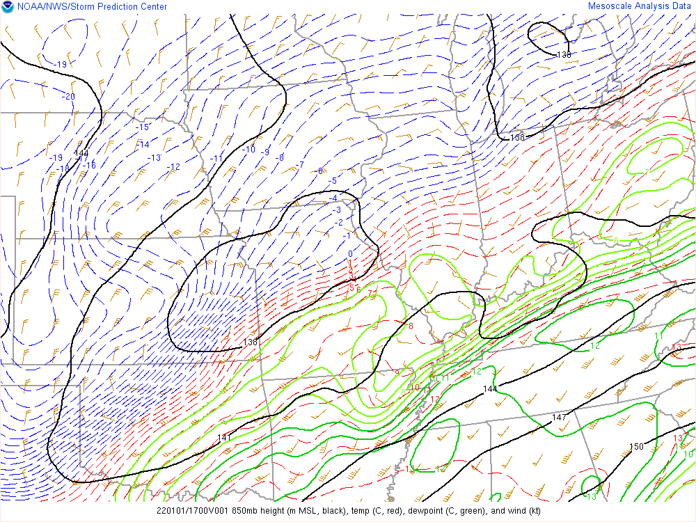 |
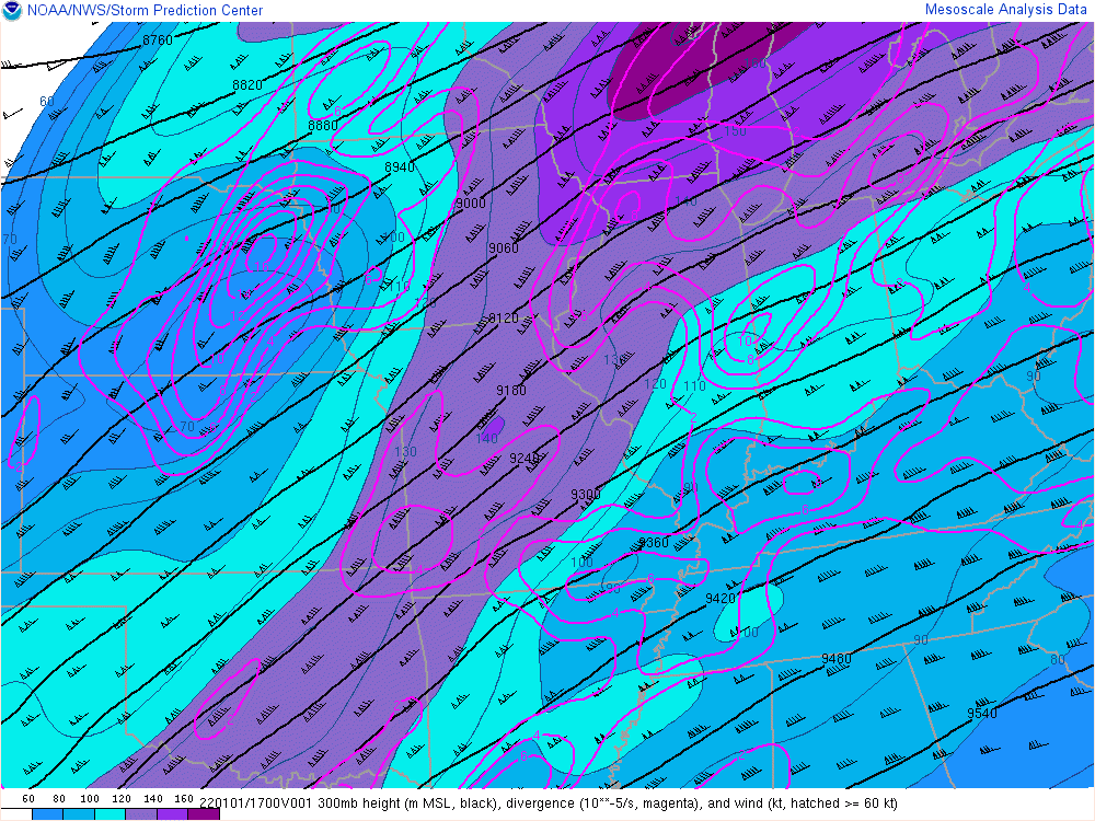
| 300 mb Chart: A powerful upper jet shown from the southern Plains to the Great Lakes, with speeds topping 140 kts over MO. | 500 mb Chart: Strong winds noted over KY, with the mid-level jet around 90 kts. | 850 mb Chart: Green contours show rich moisture, wind barbs depict 55 - 60 kt winds from TN into southern KY. |
 |
 |
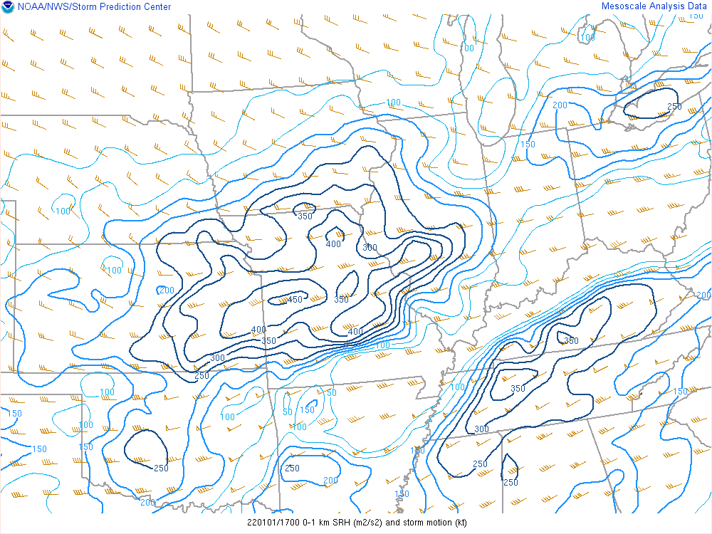 |
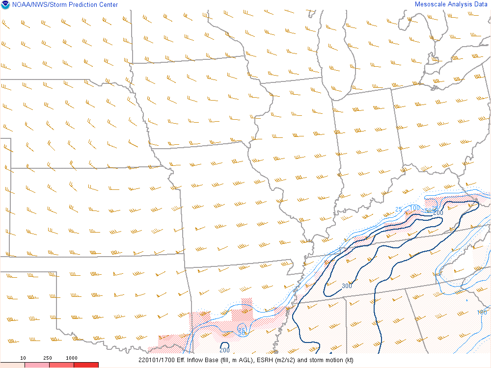
| Effective Bulk Shear: Values greater than 40 kts are favorable for tornadoes. This map shows values between 60 - 80 kts across southern KY. | Effective Storm Relative Helicity: Values greater than 150 m2/s2 are significant. This map shows values between 200 - 300 m2/s2 over southern KY. | 0-1 km Storm Relative Helicity: Values greater than 100 m2/s2 are significant for the possibility of tornadoes. This map shows values between 250 - 350 m2/s2. |
 |
 |
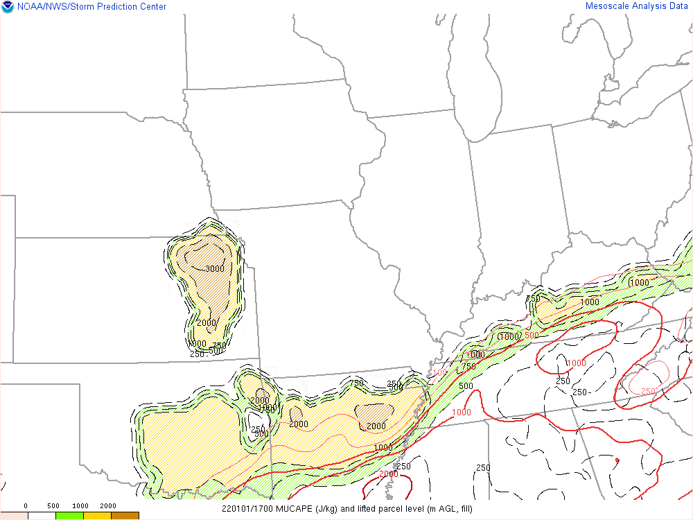 |
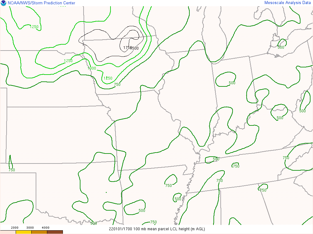
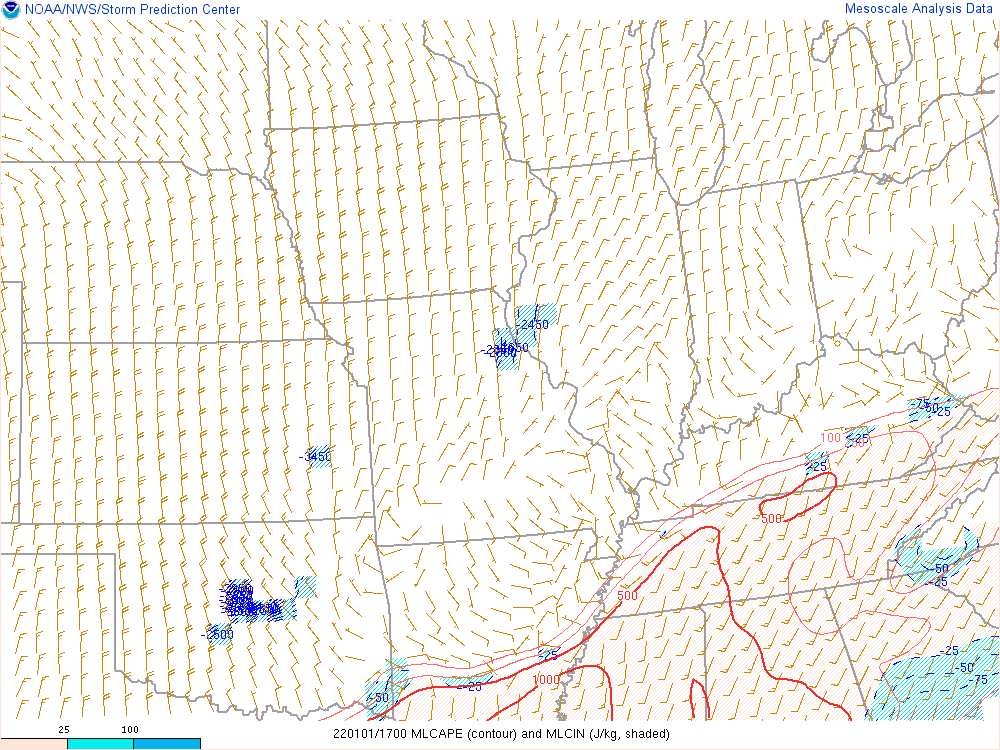
| Lifted Condensation Level: Values below 1000 m are favorable for tornadoes. Values here are around 500 m. | Mixed Layer CAPE: Modest instability is noted across southern KY with MLCAPE values between 250 - 500 J/kg. | Most Unstable CAPE: Narrow corridor of MUCAPE values between 500 - 1000 J/kg are quite high for early January. |
 |
 |
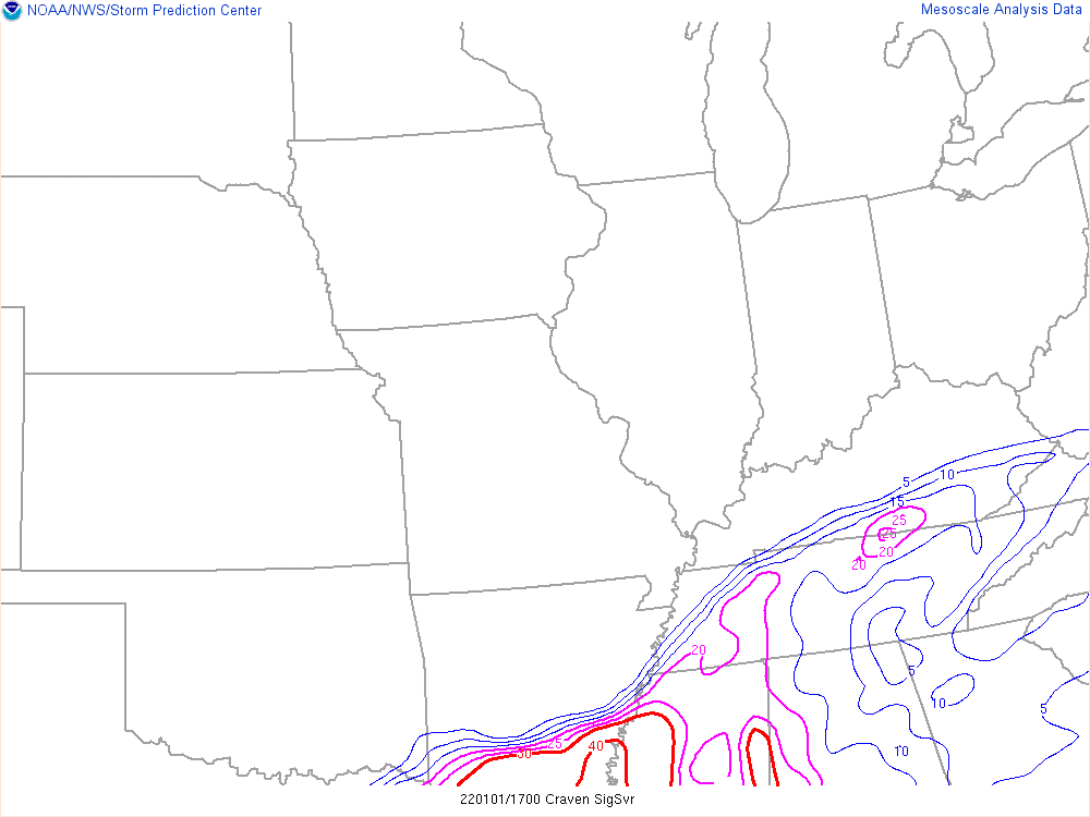 |
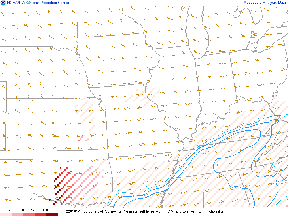
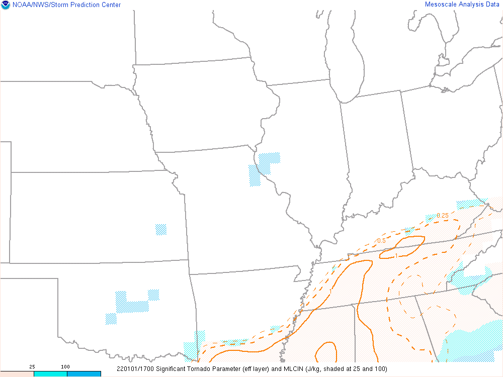
| Supercell Composite Parameter: Values greater than 1 are significant. This analysis shows values of up to 4 over southern KY. | Significant Tornado Parameter (Effective Layer): STP values between 0.5 - 1 indicate increased potential for tornadoes. | Craven Brooks Significant Severe Parameter: Values above 20,000 m3/s3 indicate increased potential for significant severe events. Here we see small area above 20,000 m3/s3. |
Additional Information
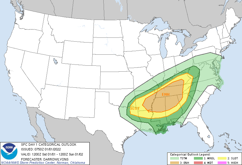
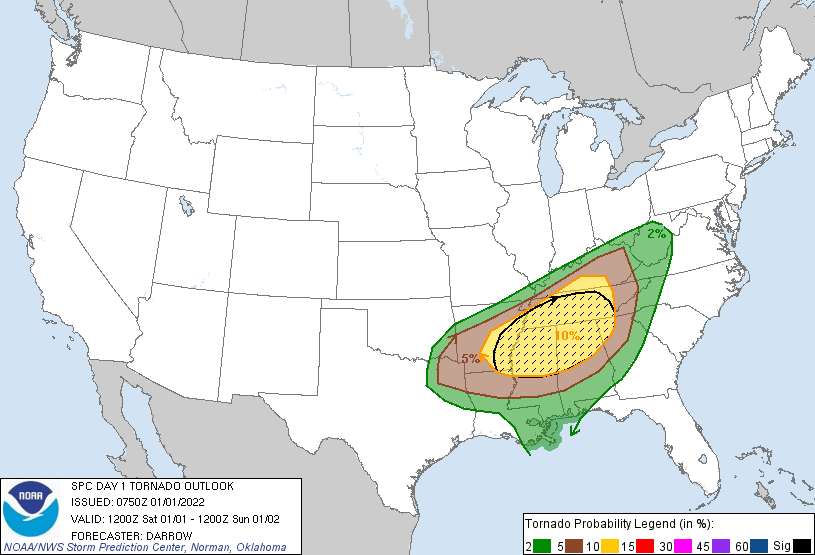
The Forecast
 |
 |
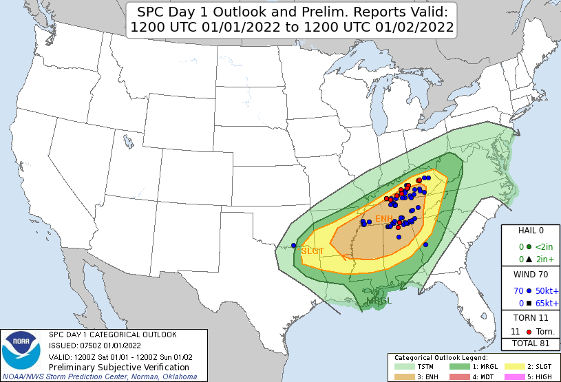 |
| SPC Day 1 Categorical Outlook | SPC Day 1 Tornado Outlook | SPC Day 1 Outlook Verification |
 |
||
| Tornado Watch 003 |
 |
Media use of NWS Web News Stories is encouraged! Please acknowledge the NWS as the source of any news information accessed from this site. |
|



 Weather Story
 Weather Map
 Local Radar
 Follow us on X
 Follow us on Facebook
 Follow us on YouTube
 LMK RSS Feed