Overview
|
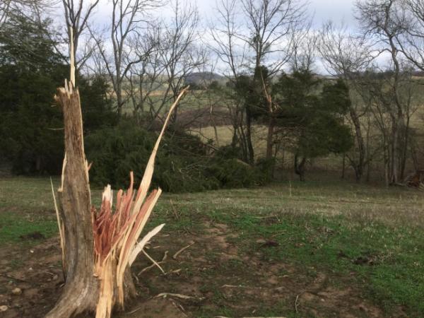
A powerful storm system brought widespread and locally heavy rain to the area, along with damaging gradient and thunderstorm winds throughout the day on Saturday January 11, 2020. At one point on Saturday afternoon, there were more than 43000 power outages across the region. Widespread 40-60 MPH winds occurred across the region in and outside of storms, and through several waves during the day. This page is under construction, so check back periodically as content is added. |
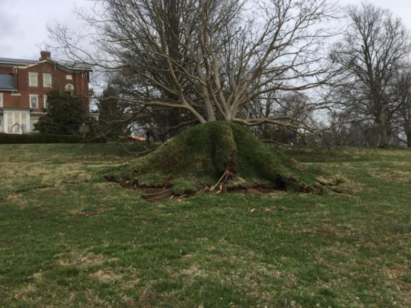
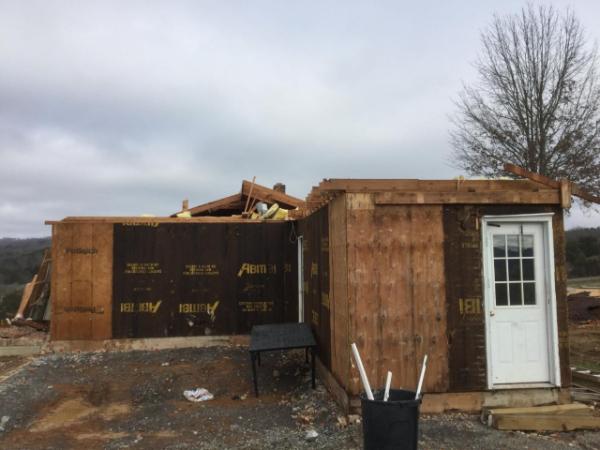
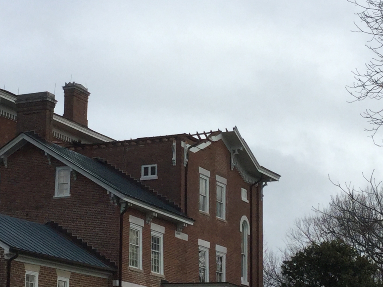 Straight-line wind damage at White Hall just northwest of Richmond, KY |
.png) |
 |
 |
.jpg) |
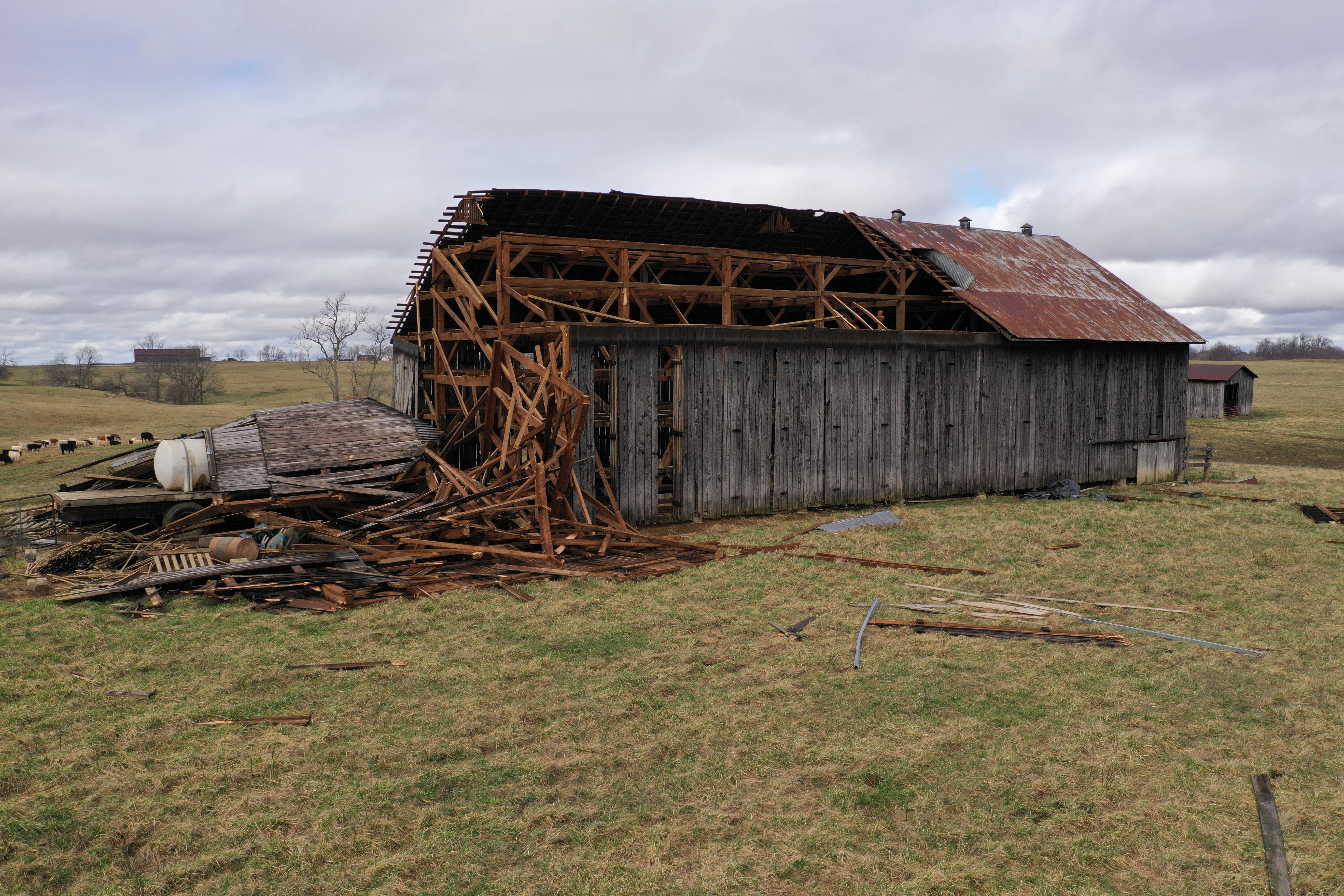
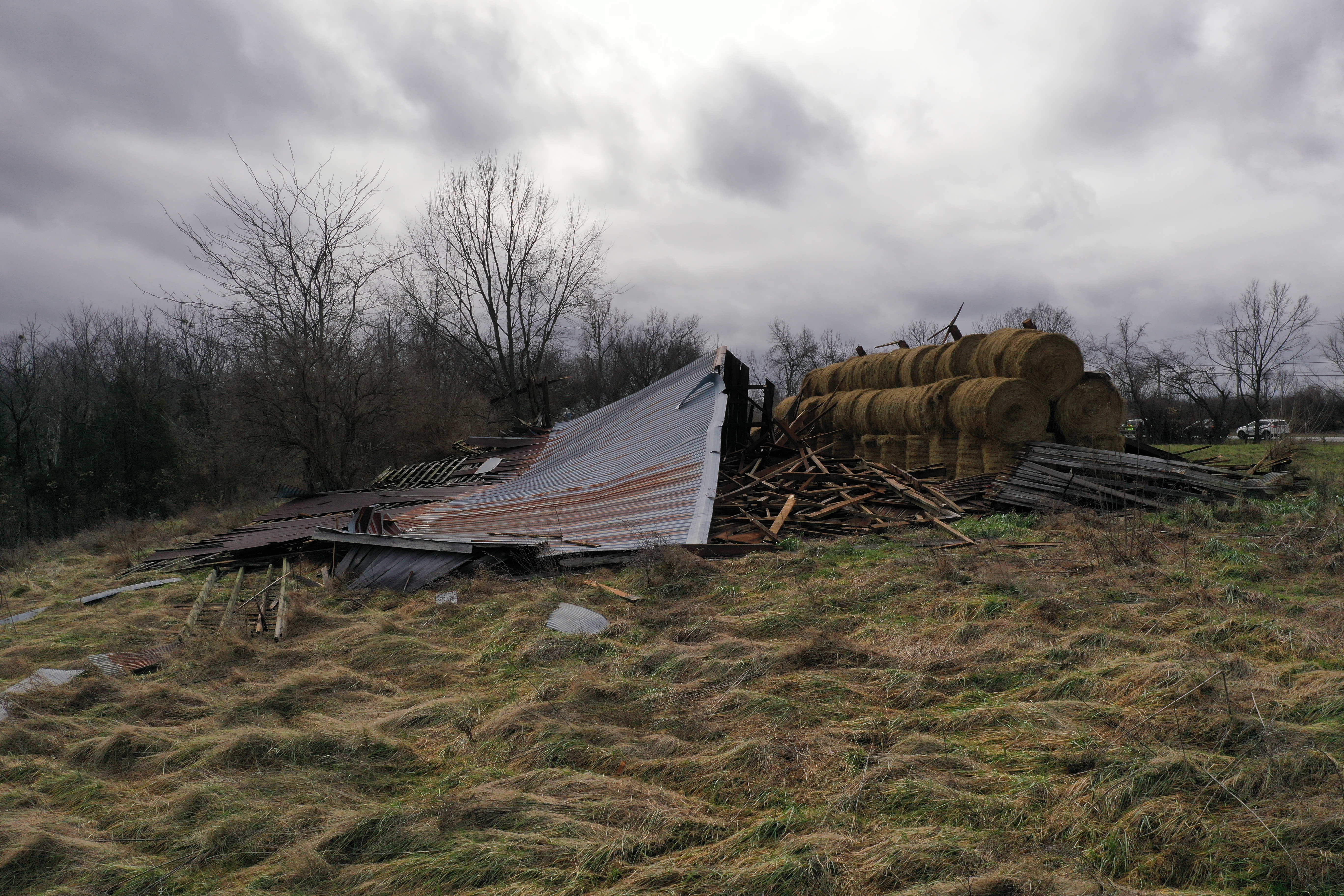
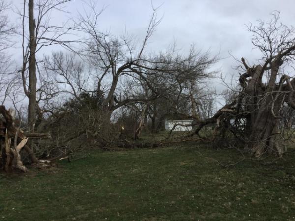
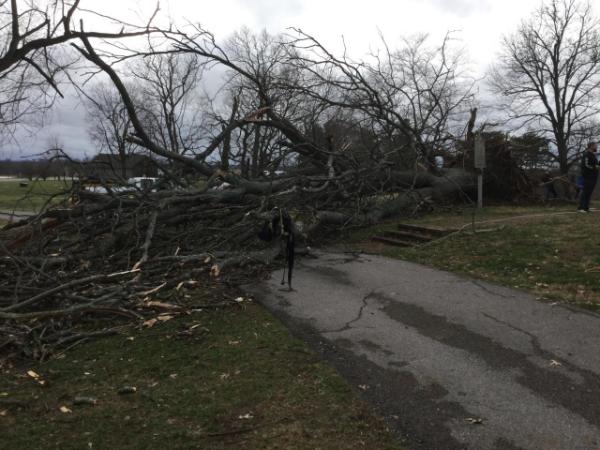
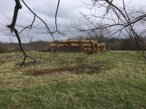
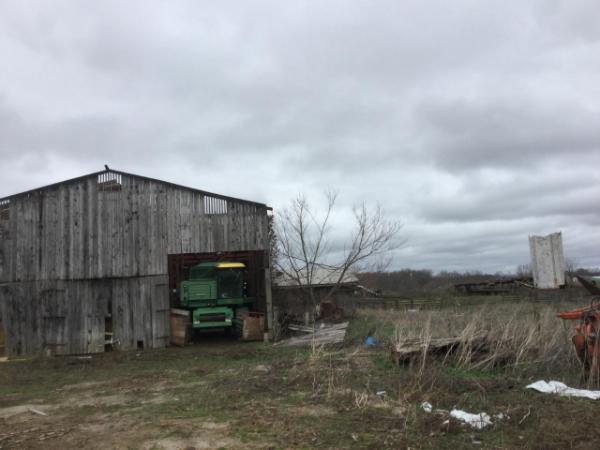
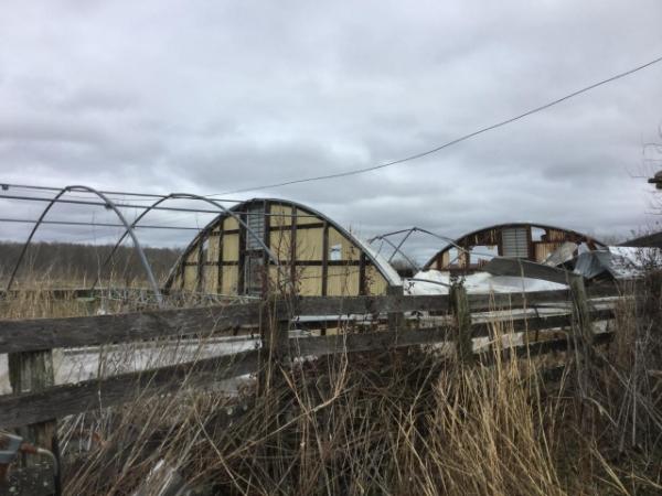
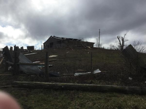
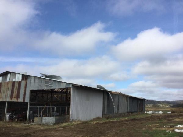
| Widespread 40-60 MPH winds occurred across the region in and outside of storms and through several waves during the day. | A damaged barn roof in Madison County | A collapsed barn in Madison County | A moblle home was overturned by 80 mph winds in eastern Madison County. 3 minor injuries occurred. |
Wind:
|
|
||||||||||
|
||||||||||
|
Straight Line Winds - 5 E Richmond, KY
Track Map 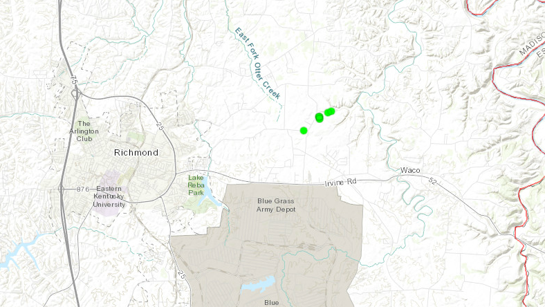 
|
||||||||||||||||
|
Straight Line Winds - 9 NW Richmond, KY
Track Map 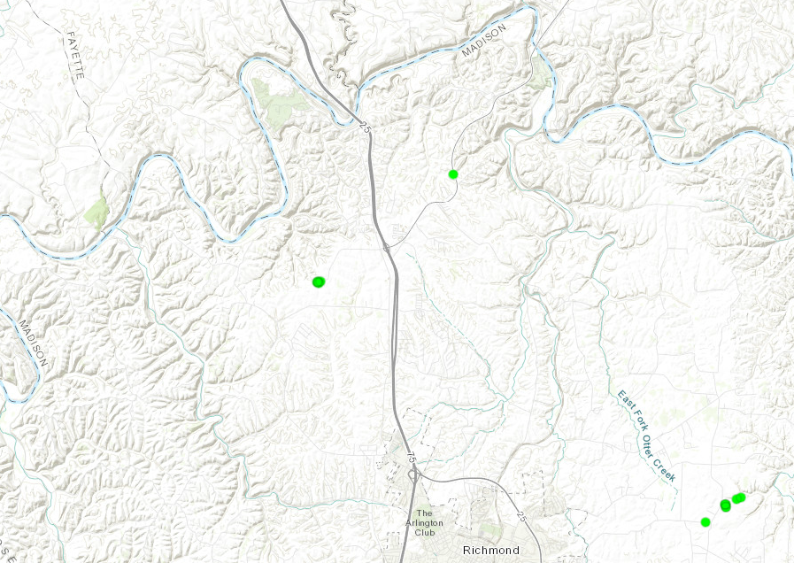
|
||||||||||||||||
|
Straight Line Winds - Center Point, KY
Track Map 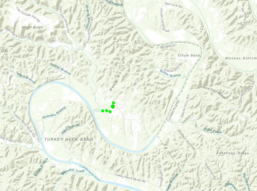
|
||||||||||||||||
Photos
 |
 |
 |
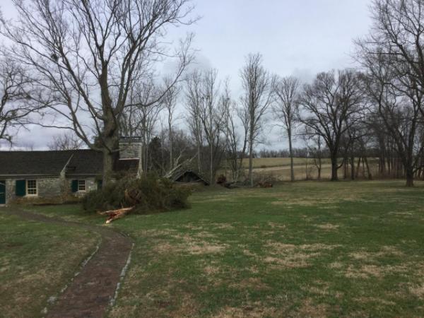 |
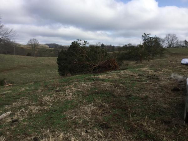
| Madison County | Madison County | Straight-line wind damage at White Hall just northwest of Richmond, KY | Madison County |
 |
 |
 |
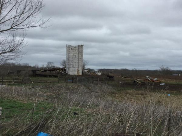 |
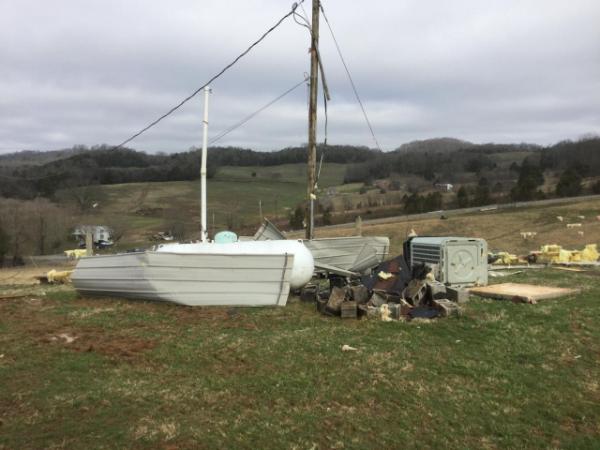
| Madison County | Madison County | Madison County | A silo was sheared off in eastern Madison county by 80 mph winds. NWS Damage Survey |
 |
 |
 |
 |
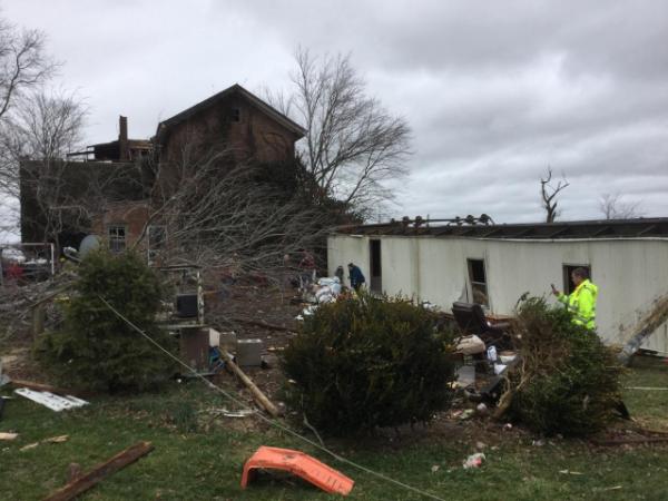
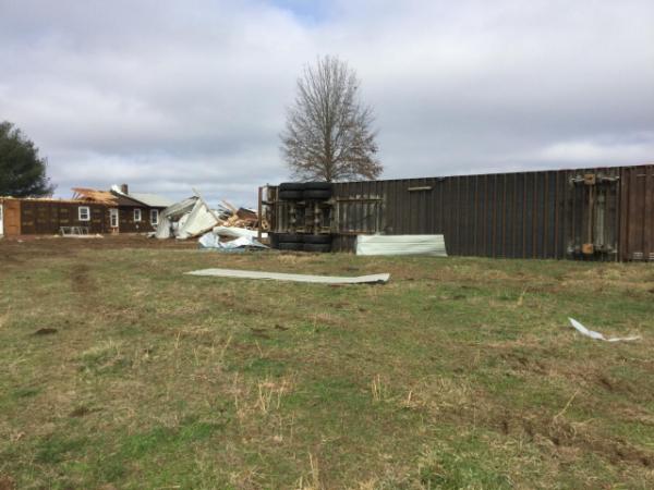
| A moblle home was overturned by 80 mph winds in eastern Madison county. 3 minor injuries occurred. | A damaged barn roof in Madison County | Madison County | Another large barn suffers heavy damage in eastern Madison County. NWS Damage Survey |
 |
 |
 |
 |
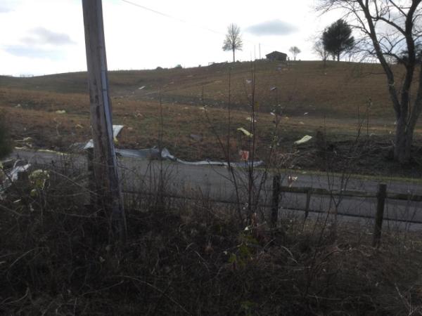
| Monroe County | Monroe County | Monroe County | Monroe County |
 |
 |
 |
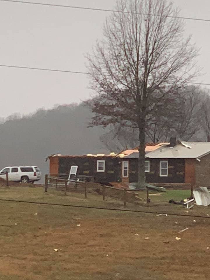 |
| Monroe County | Monroe County | Monroe County | A home lost most of it's roof in NE Monroe County Photo Credit: Emily Stinson |
Radar
Storm Reports
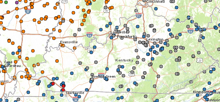
Map showing where hazardous weather was reported. The blue circles in central Kentucky and southern Indiana represented thunderstorm wind gusts or damage. The gray circles represent wind gusts or damage that occurred outside of any thunderstorms. PRELIMINARY LOCAL STORM REPORT...SUMMARY NATIONAL WEATHER SERVICE LOUISVILLE KY 426 AM EST MON JAN 13 2020 ..TIME... ...EVENT... ...CITY LOCATION... ...LAT.LON... ..DATE... ....MAG.... ..COUNTY LOCATION..ST.. ...SOURCE.... ..REMARKS.. 0940 PM NON-TSTM WND GST 8 N CYNTHIANA 38.51N 84.30W 01/11/2020 M52 MPH HARRISON KY MESONET THE KENTUCKY MESONET STATION IN HARRISON COUNTY MEASURED 52 MPH. 0930 PM NON-TSTM WND GST 3 NW WINCHESTER 38.02N 84.20W 01/11/2020 M56 MPH CLARK KY MESONET THE KENTUCKY MESONET SITE IN CLARK COUNTY MEASURED 56 MPH. 0930 PM NON-TSTM WND GST 8 E RICHMOND 37.73N 84.13W 01/11/2020 M57 MPH MADISON KY MESONET THE KENTUCKY MESONET STATION IN MADISON COUNTY MEASURED 57 MPH. 0915 PM NON-TSTM WND GST 1 WNW BURKESVILLE 36.80N 85.38W 01/11/2020 M50 MPH CUMBERLAND KY MESONET MEASURED AT 6.1 M HEIGHT AT ALPINE RAWS SITE. 0915 PM NON-TSTM WND GST 7 S LEXINGTON 37.97N 84.53W 01/11/2020 M50 MPH FAYETTE KY MESONET THE KENTUCKY MESONET STATION IN FAYETTE COUNTY MEASURED 50 MPH. 0909 PM NON-TSTM WND GST 6 W LEXINGTON 38.04N 84.61W 01/11/2020 M61 MPH FAYETTE KY ASOS 0900 PM NON-TSTM WND GST 7 S FRANKFORT 38.12N 84.89W 01/11/2020 M50 MPH FRANKLIN KY MESONET THE KENTUCKY MESONET STATION IN FRANKLIN COUNTY MEASURED 50 MPH. 0900 PM NON-TSTM WND GST 4 NE STANFORD 37.55N 84.60W 01/11/2020 M50 MPH LINCOLN KY MESONET THE KENTUCKY MESONET STATION IN LINCOLN COUNTY MEASURED 50 MPH. 0850 PM NON-TSTM WND GST 3 SW DANVILLE 37.62N 84.80W 01/11/2020 M56 MPH BOYLE KY MESONET THE KENTUCKY MESONET SITE IN DANVILLE MEASURED A 56 MPH GUST. 0845 PM NON-TSTM WND GST 2 SSE EMINENCE 38.34N 85.16W 01/11/2020 M55 MPH SHELBY KY MESONET THE KENTUCKY MESONET SITE CROP IN SHELBY COUNTY MEASURED 55 MPH. 0841 PM NON-TSTM WND GST LIBERTY 37.32N 84.94W 01/11/2020 M51 MPH CASEY KY AMATEUR RADIO MEASURED AT PRIVATE WEATHER STATION. 0830 PM NON-TSTM WND GST CRESTWOOD 38.34N 85.48W 01/11/2020 M55 MPH OLDHAM KY PUBLIC MEASURED AT A PRIVATE WEATHER STATION. 0825 PM NON-TSTM WND GST 3 WNW FINCHVILLE 38.17N 85.37W 01/11/2020 M52 MPH SHELBY KY MESONET THE KENTUCKY MESONET SITE FCHV IN SHELBY COUNTY MEASURED 52 MPH. 0810 PM NON-TSTM WND GST 2 SW SAINT MATTHEWS 38.23N 85.66W 01/11/2020 M51 MPH JEFFERSON KY ASOS 0808 PM NON-TSTM WND GST 4 NW OKOLONA 38.18N 85.74W 01/11/2020 M59 MPH JEFFERSON KY ASOS KSDF ASOS MEASURED A 59 MPH WIND GUST AT 808 PM EST. 0805 PM NON-TSTM WND GST 4 N BLACK GNAT 37.36N 85.46W 01/11/2020 M51 MPH TAYLOR KY MESONET MEASURED AT THE TAYLOR COUNTY KENTUCKY MESONET STATION. 0803 PM NON-TSTM WND DMG 6 E EXIE 37.18N 85.43W 01/11/2020 GREEN KY EMERGENCY MNGR EM REPORTED BARN COMPLETELY DESTROYED NEAR RUSSELL CREEK ROAD IN GREEN COUNTY. TIME ESTIMATED. 0739 PM NON-TSTM WND DMG 1 SE GLASGOW 36.99N 85.91W 01/11/2020 BARREN KY TRAINED SPOTTER LARGE TREE WAS DOWN BLOCKING SOUTH MORGAN ST. BEST ESTIMATE IS THAT THIS TREE CAME DOWN WITH THE SECOND SURGE OF WIND IN THE LATE AFTERNOON. USED TIME FROM NEARBY WEATHERSTEM STATION, WHICH PEAKED AT 48 MPH. THE KGLW AWOS HAD A GUST TO 51 MPH. 0702 PM NON-TSTM WND GST 1 NNW BOWLING GREEN 36.99N 86.45W 01/11/2020 M58 MPH WARREN KY MESONET MEASURED AT THE WEATHER STEM STATION AT THE CHAOS LAB. 0700 PM TSTM WND GST 3 NE RICH POND 36.93N 86.47W 01/11/2020 M56 MPH WARREN KY MESONET MEASURED AT THE FARM KENTUCKY MESONET SITE. 0445 PM NON-TSTM WND DMG VERSAILLES 38.05N 84.73W 01/11/2020 WOODFORD KY EMERGENCY MNGR MULTIPLE TREES DOWN AROUND THE COUNTY. 0136 PM TSTM WND DMG 3 NW WACO 37.77N 84.19W 01/11/2020 MADISON KY NWS STORM SURVEY *** 3 INJ *** AN NWS DAMAGE SURVEY CONCLUDED THAT STRAIGHT LINE WINDS CAUSED THE DAMAGE TO SEVERAL STRUCTURES ALONG CONCORD AND CHARLIE NORRIS ROADS. MAXIMUM WINDS WERE DETERMINED TO BE 80 MPH OVER AN AREA THAT STRECTCHED FOR ABOUT 1 MILE. INCLUDED IN THE DAMAGE WAS AN UNANCHORED MOBILE HOME THAT WAS ROLLED OVER. 3 MINOR INJURIES OCCURRED. IN ADDITION, A SILO WAS SHEARED OFF, LARGE TREES WERE DOWNED, AND A LARGE SECTION OF A BARN ROOF WERE REMOVED. 0136 PM TSTM WND DMG 4 NW WACO 37.78N 84.20W 01/11/2020 MADISON KY BROADCAST MEDIA *** 1 INJ *** A MOBILE HOME WAS FLIPPED OVER ON CHARLIE NORRIS ROAD. TWO OCCUPANTS WERE INSIDE WITH 1 PERSON RECEIVING MINOR INJURIES. 0135 PM TSTM WND GST RUCKERVILLE 37.94N 84.10W 01/11/2020 M51 MPH CLARK KY AMATEUR RADIO 0135 PM TSTM WND DMG BEREA 37.58N 84.28W 01/11/2020 MADISON KY AMATEUR RADIO AMATEUR RADIO REPORTED A TREE DOWN AND DEBRIS IN THE ROAD AT OLD US HIGHWAY 25 AND HIGHWAY 1016 IN BEREA. 0129 PM TSTM WND DMG 2 NNW FORD 37.91N 84.27W 01/11/2020 CLARK KY BROADCAST MEDIA BROADCAST MEDIA REPORTS PICTURES OF BARNS FLATTENED IN THE BOONESBORO AREA. 0125 PM TSTM WND DMG 2 W GEORGETOWN 38.21N 84.59W 01/11/2020 SCOTT KY PUBLIC REPORT FROM MPING: 1-INCH TREE LIMBS BROKEN; SHINGLES BLOWN OFF. 0125 PM TSTM WND DMG 3 NNW KIRKSVILLE 37.71N 84.44W 01/11/2020 MADISON KY BROADCAST MEDIA A LARGE BARD SUFFERED SIGNIFICANT DAMAGE ON POOSEY RIDGE ROAD. 0124 PM TSTM WND DMG 5 W REDHOUSE 37.83N 84.35W 01/11/2020 MADISON KY BROADCAST MEDIA RELAYED REPORT FROM EKU ABOUT DAMAGE AT WHITE HALL...SIGNIFICANT ROOF DAMAGE. ALSO HAD SEVERAL TREES BLOWN DOWN AT EKU CAMPUS AND SOME PROPERTY DAMAGE THERE AS WELL. 1245 PM TSTM WND DMG ALBANY 36.69N 85.14W 01/11/2020 CLINTON KY EMERGENCY MNGR EM REPORTED SEVERAL TREES AND POWER LINES DOWN. ALSO REPORTED BARN DAMAGE AND ROOF DAMAGE. CALLED 911 DISPATCH TO CONFIRM TIME OF REPORTS. 1245 PM NON-TSTM WND DMG 2 N COLVILLE 38.39N 84.21W 01/11/2020 HARRISON KY EMERGENCY MNGR REPORTS OF TREES DOWN. 1245 PM NON-TSTM WND DMG COLVILLE 38.37N 84.21W 01/11/2020 HARRISON KY EMERGENCY MNGR REPORTS OF TREES DOWN. 1201 PM TSTM WND DMG TOMPKINSVILLE 36.70N 85.69W 01/11/2020 MONROE KY BROADCAST MEDIA BROADCAST MEDIA RELAYED A PUBLIC PICTURE OF SEVERE ROOF DAMAGE TO A HOME NEAR TOMPKINSVILLE. 1200 PM NON-TSTM WND DMG 1 W DUNNVILLE 37.20N 85.01W 01/11/2020 CASEY KY BROADCAST MEDIA BROADCAST MEDIA REPORTED BARN DAMAGE OFF RIVER ROAD IN DUNNVILLE. NEARBY KY MESONET SITES REPORTED 47 MPH GUST. TIME ESTIMATED. 1200 PM TSTM WND DMG CAMPBELLSVILLE 37.35N 85.35W 01/11/2020 TAYLOR KY 911 CALL CENTER REPORT FROM DISPATCHER OF NUMEROUS TREES & LIMBS DOWN ACROSS THE COUNTY. 1155 AM NON-TSTM WND GST 3 SE BERRY 38.50N 84.35W 01/11/2020 M56 MPH HARRISON KY MESONET MEASURED AT THE HARRISON COUNTY KENTUCKY MESONET STATION. 1155 AM NON-TSTM WND GST 2 NE NEWTOWN 38.23N 84.43W 01/11/2020 M55 MPH SCOTT KY AWOS 1154 AM NON-TSTM WND GST 6 W LEXINGTON 38.03N 84.61W 01/11/2020 M57 MPH FAYETTE KY ASOS 1153 AM NON-TSTM WND GST 2 WSW FRANKFORT 38.18N 84.90W 01/11/2020 M51 MPH FRANKLIN KY AWOS 1145 AM TSTM WND DMG GREENSBURG 37.26N 85.50W 01/11/2020 GREEN KY 911 CALL CENTER REPORT FROM DISPATCHER OF NUMEROUS TREES DOWN ACROSS THE COUNTY. 1136 AM TSTM WND DMG MUNFORDVILLE 37.29N 85.90W 01/11/2020 HART KY 911 CALL CENTER POWER LINES DOWN AND NUMEROUS REPORTS OF TREES DOWN ACROSS HART COUNTY... 1135 AM TSTM WND GST 3 NW GLASGOW 37.03N 85.96W 01/11/2020 M50 MPH BARREN KY ASOS GLASGOW MUNICIPAL AIRPORT REPORTED GUST OF 50 MPH. 1135 AM TSTM WND GST 3 NW GLASGOW 37.03N 85.95W 01/11/2020 M58 MPH BARREN KY AWOS 1130 AM NON-TSTM WND GST 3 W BURKESVILLE 36.79N 85.42W 01/11/2020 M49 MPH CUMBERLAND KY MESONET . 1125 AM NON-TSTM WND DMG 2 ENE LEXINGTON 38.05N 84.47W 01/11/2020 FAYETTE KY BROADCAST MEDIA REPORT OF A FALLEN TREE ALONG MARCELLUS DRIVE. PULLED DOWN A POWER LINE AND THERE WAS A SMALL FIRE WITH A NEARBY TREE. 1120 AM TSTM WND DMG GLASGOW 37.00N 85.92W 01/11/2020 BARREN KY 911 CALL CENTER REPORTS OF NUMEROUS TREES DOWN ACROSS WESTERN AND CENTRAL BARREN COUNTY IN PARK CITY, GLASGOW AND BON AYR.... 1120 AM NON-TSTM WND GST 2 WNW OXFORD 38.28N 84.57W 01/11/2020 M51 MPH SCOTT KY AMATEUR RADIO MEASURED AT PRIVATE WEATHER STATION. 1112 AM TSTM WND DMG 1 SW OWEN 38.46N 85.54W 01/11/2020 CLARK IN EMERGENCY MNGR TREE IN ROADWAY NEAR INTERSECTION OF BULL CREEK ROAD AND BLUE RIDGE ROAD. TIME ESTIMATED BASED ON RADAR. 1112 AM NON-TSTM WND DMG NEW CASTLE 38.43N 85.17W 01/11/2020 HENRY KY 911 CALL CENTER TREE DOWN OSAGE CT. 1109 AM NON-TSTM WND DMG 2 NNE SULPHUR 38.51N 85.25W 01/11/2020 HENRY KY 911 CALL CENTER TREE DOWN FALLING TIMBER RD. 1106 AM NON-TSTM WND DMG 1 SE GOSHEN 38.40N 85.58W 01/11/2020 OLDHAM KY PUBLIC WIRES DOWN FROM TREE AT US 42 AND BELKNAP FARM RD IN GOSHEN. 1055 AM NON-TSTM WND GST 6 NNW SPEARS 37.95N 84.50W 01/11/2020 M53 MPH FAYETTE KY MESONET 1054 AM TSTM WND DMG 1 S UNDERWOOD 38.57N 85.78W 01/11/2020 CLARK IN EMERGENCY MNGR TREE IN ROADWAY AT 10500 BLOCK OF W BROWNSTOWN RD. TIME ESTIMATED FROM RADAR. 1054 AM NON-TSTM WND GST 6 W LEXINGTON 38.04N 84.60W 01/11/2020 M55 MPH FAYETTE KY ASOS WIND GUST OF 55 MPH AT LEXINGTON BLUEGRASS AIRPORT. 1052 AM NON-TSTM WND DMG 1 S GREENSBURG 37.24N 85.50W 01/11/2020 GREEN KY 911 CALL CENTER ROOF DAMAGED TO DONS LUMBER PRO HARDWARE. 1050 AM TSTM WND DMG 1 WSW SAINT MATTHEWS 38.25N 85.65W 01/11/2020 JEFFERSON KY EMERGENCY MNGR EM REPORTED TREE FALLEN, TRAPPING TWO PEOPLE IN ST. MATTHEWS. EXACT LOCATION UNKNOWN. ESTIMATED WIND GUSTS OF 50 MPH. 1049 AM TSTM WND GST 4 NW OKOLONA 38.18N 85.74W 01/11/2020 M52 MPH JEFFERSON KY ASOS LOUISVILLE INTERNATIONAL AIRPORT THUNDERSTORM WIND GUST OF 52 MPH. 1041 AM TSTM WND DMG 2 E DAISY HILL 38.50N 85.89W 01/11/2020 CLARK IN EMERGENCY MNGR TREE IN ROADWAY IN THE 25100 BLOCK OF JACKSON ROAD. TIME ESTIMATED BASED ON RADAR. 1029 AM TSTM WND DMG 1 S PALMYRA 38.40N 86.11W 01/11/2020 HARRISON IN EMERGENCY MNGR SEVERAL TREES DOWN ON VARIOUS COUNTY ROADS... 1010 AM NON-TSTM WND GST 6 W LEXINGTON 38.03N 84.61W 01/11/2020 M54 MPH FAYETTE KY ASOS 1000 AM TSTM WND DMG 1 S WELCHS CREEK 37.34N 86.56W 01/11/2020 BUTLER KY PUBLIC REPORT FROM MPING: TREES UPROOTED. TIME OF DAMAGE ESTIMATED BASED ON RADAR DATA. REPORT CAME IN AT 1042 AM. 1000 AM TSTM WND DMG 2 NNW WEBSTER 37.91N 86.34W 01/11/2020 BRECKINRIDGE KY EMERGENCY MNGR EM REPORTED METAL BLOCKING ROADWAY OF THE 4300 BLOCK OF HWY 477 IN BRECKINRIDGE COUNTY, KY. TIME ESTIMATED. 1000 AM TSTM WND GST 1 SSW HARDINSBURG 37.76N 86.46W 01/11/2020 M61 MPH BRECKINRIDGE KY MESONET . 1000 AM TSTM WND GST 3 ENE PROVIDENCE 36.69N 86.62W 01/11/2020 E51 MPH SIMPSON KY MESONET . 0956 AM NON-TSTM WND DMG CAMPBELLSVILLE 37.35N 85.35W 01/11/2020 TAYLOR KY EMERGENCY MNGR EM REPORTED DAMAGE NEAR HIGH STREET AND NORTH CENTRAL AVENUE IN CAMPBELLSVILLE. REPORT INDICATED TREE, POWER POLE, AND POWER LINES DOWN. TIME ESTIMATED. 0948 AM TSTM WND GST 4 NW OKOLONA 38.18N 85.74W 01/11/2020 M52 MPH JEFFERSON KY ASOS CORRECTS PREVIOUS NON-TSTM WND GST REPORT FROM 4 NW OKOLONA. 0945 AM TSTM WND DMG 3 ENE ABERDEEN 37.27N 86.64W 01/11/2020 BUTLER KY LAW ENFORCEMENT TREE DOWN AT THE 3000 BLOCK OF BROWNSVILLE RD. TIME ESTIMATED FROM RADAR. 0940 AM TSTM WND GST LEITCHFIELD 37.48N 86.29W 01/11/2020 M53 MPH GRAYSON KY MESONET CORRECTS PREVIOUS NON-TSTM WND GST REPORT FROM LEITCHFIELD. 0930 AM NON-TSTM WND DMG HUSTONVILLE 37.47N 84.82W 01/11/2020 LINCOLN KY 911 CALL CENTER REPORT OF OLD SCHOOL HOUSE BUILDING HAD ROOF PEELED OFF. 0929 AM NON-TSTM WND GST 1 WNW BOWLING GREEN 36.98N 86.46W 01/11/2020 M63 MPH WARREN KY MESONET MEASURED AT THE WEATHER STEM SITE AT HOUCHEN STADIUM. 0910 AM NON-TSTM WND DMG 2 NE BOWLING GREEN 36.99N 86.42W 01/11/2020 WARREN KY PUBLIC SOCIAL MEDIA POST SHOWS PICTURES OF TREE DAMAGE NEAR CEMETERY. PICTURES WERE POSTED AT 8:10 AM CST. 0900 AM NON-TSTM WND GST 1 ESE SHAKERTOWN 37.81N 84.85W 01/11/2020 M50 MPH MERCER KY MESONET 0837 AM NON-TSTM WND DMG 4 ENE RICHARDSVILLE 37.12N 86.42W 01/11/2020 WARREN KY PUBLIC SOCIAL MEDIA PICTURE SHOWS DAMAGE TO SHEET METAL NEAR 185 IN ANNA. PICTURE POSTED AT 7:37 AM CST. 0830 AM NON-TSTM WND GST COLUMBIA 3N 37.10N 85.31W 01/11/2020 M51 MPH ADAIR KY MESONET 0730 AM NON-TSTM WND DMG 3 SW WELCHS CREEK 37.32N 86.60W 01/11/2020 BUTLER KY EMERGENCY MNGR EM REPORTED DEAD TREE FELL ON VEHICLE AROUND 6:30 AM CST NEAR 7100 CANEYVILLE RD IN BUTLER COUNTY. NO INJURIES. 0715 AM NON-TSTM WND GST 1 SE BOWLING GREEN 36.96N 86.42W 01/11/2020 M52 MPH WARREN KY ASOS 0714 AM NON-TSTM WND GST HOLLAND 38.25N 87.04W 01/11/2020 M50 MPH DUBOIS IN PUBLIC MEASURED AT PRIVATE WEATHER STATION. 0630 AM NON-TSTM WND DMG 3 E JASPER 38.40N 86.88W 01/11/2020 DUBOIS IN 911 CALL CENTER REPORTS OF TREES DOWN IN THE IDLEWILD LAKE AREA BETWEEN 6 AND 7 AM. 0630 AM NON-TSTM WND GST 3 ENE PROVIDENCE 36.68N 86.61W 01/11/2020 M49 MPH SIMPSON KY MESONET MEASURED AT THE SIMPSON COUNTY KENTUCKY MESONET STATION. 0625 AM NON-TSTM WND GST 2 ENE HARTFORD 37.46N 86.85W 01/11/2020 M51 MPH OHIO KY MESONET MEASURED AT THE OHIO COUNTY KENTUCKY MESONET STATION.
Rain and Wind Maps
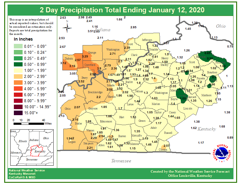
Overall, 1 to 3 inches of rainfall fell across the region, causing some minor nuisance and river flooding.
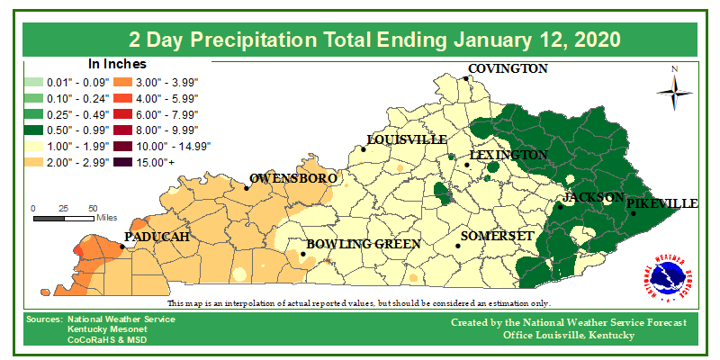
1 to 3 inches of rain fell across most of the state, although a few localized amounts over 4 inches occurred across far western KY.
Peak wind gusts through the day were mostly between 50 and 60 mph across the region. Many trees and barns were downed, along with some structural damage in spots. At one point, 43,000+ people were without power across KY Saturday afternoon.
 |
Media use of NWS Web News Stories is encouraged! Please acknowledge the NWS as the source of any news information accessed from this site. |
|


 Weather Story
 Weather Map
 Local Radar