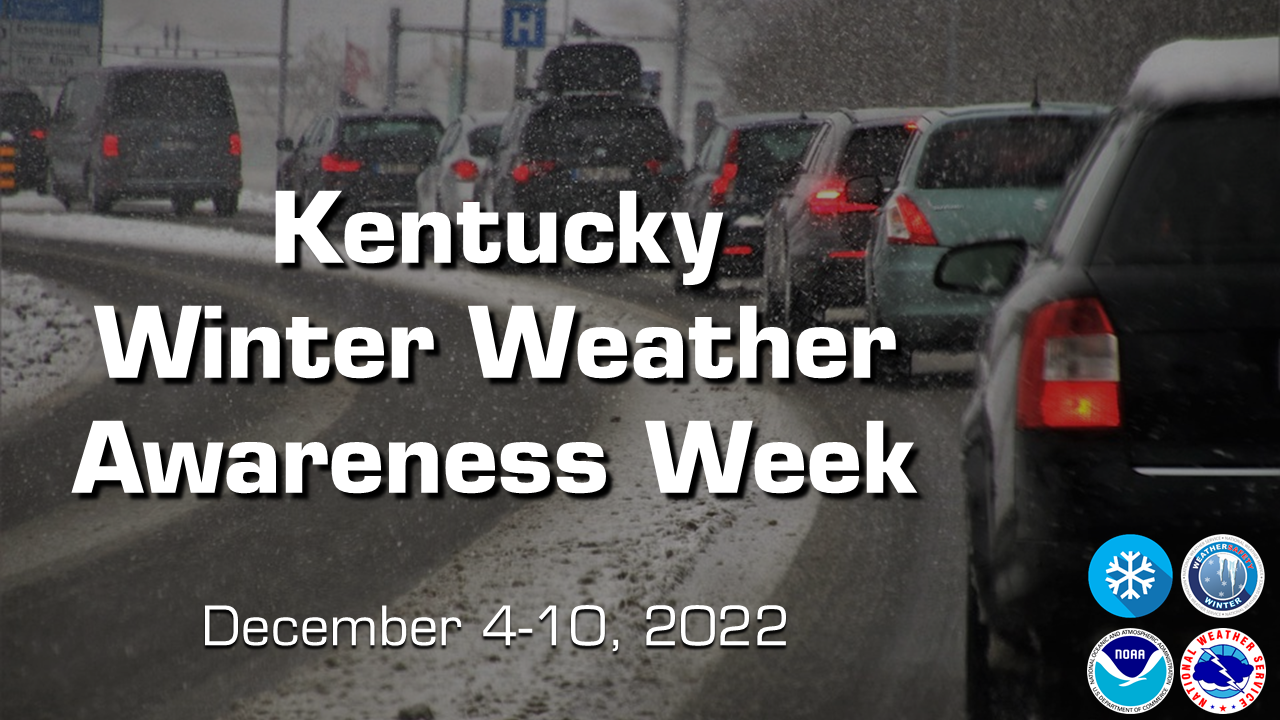
December 4-10, 2022 is Winter Weather Awareness Week in Kentucky. The winter season can bring many different hazards and impacts to the region. Winter Weather Awareness week is your reminder that you need to be Weather Ready for all types of hazards, such as winter storms, snow squalls, ice storms, heavy rain and flooding, high winds, and even severe weather. All week long, the National Weather Service office in Louisville, KY will be sharing information on how to prepare for winter, which will be viewable on our social media platforms (Facebook and Twitter). Please Share/Retweet to share this knowledge with others.
Winter Weather Headlines Issued by NWS Louisville
Winter Weather Advisory: For snow averaging between 1 inch and 4 inches within 12 hours, or a combination of impactful snow, sleet, or freezing rain within 12 hours and expected to occur in the next 2 to 3 days.
Winter Storm Watch: Any combination of snow, sleet, or freezing rain averaging 4 inches or more within 12 hours and expected to occur in the next 2 to 3 days.
Winter Storm Warning: Any combination of snow, sleet, or freezing rain averaging 4 inches or more within 12 hours and expected to occur in the next 24 to 48 hours.
Ice Storm Warning: A freezing rain event is expected in the next 24 to 48 hours that will produce ice accumulations of 1/4 of an inch or more.
Blizzard Warning: A combination of sustained winds or frequent wind gusts of at least 35 mph and visibilities of less than 1/4 of a mile due to snow and/or blowing snow for at least three straight hours. This is expected to occur in the next 24 to 48 hours.
Snow Squall Warning: Intense bursts of snow with gusty winds causing whiteout conditions.
Wind Chill Watch: Wind chill values are expected to fall to -25 degrees F or less with at least a 10 mph wind in the next two to three days.
Wind Chill Advisory: Wind chill values are expected to fall to between -10 degrees F and -24 degrees F with at least a 10 mph wind in the next 24 to 36 hours.
Wind Chill Warning: Wind chill values are expected to fall to -25 degrees F or less with at least a 10 mph wind in the next 24 to 48 hours.
Know Before You Go!
Don't let impactful weather sneak up on you. Check the latest NWS forecast for your zip code at weather.gov before you head out the door each day. Get the information you need, either in the detailed forecast that outlines the next several days, or in the hour-by-hour forecast if you need finer detailed weather information.

Winter Driving
Winter weather brings many impacts to our roadways each year, often resulting in many vehicle accidents, injuries, and fatalities. The information provided here is to help prepare you and your loved ones for the road ahead during the winter season.
According to the United States Federal Highway Administration, 29% of weather-related crashes, and 20% of weather-related fatalities occur on roads covered with snow, slush, or ice. Each year, over 1,300 people are killed, and more than 116,800 people are injured in vehicle accidents that occur on now, slush, or ice covered roads.

Each year, 15% of vehicle accidents occur during snowfall or sleet. During these accidents, nearly 900 people are killed, and nearly 76,000 people are injured.
Winter weather caused major increases to road maintenance costs. The Federal Highway Administration states that winter road maintenance accounts for roughly 20% of state DOT maintenance budgets. Both state and local agencies can spend more than $2.3 billion per year on snow and ice control operations. When snow plows are out clearing our roads, be sure to leave them plenty of space!
According to Tobin et all. 2022, approximately two-thirds (67%) of winter-weather-related fatalities occur on highways. The odds of a fatal crash occurring on a highway during winter-weather conditions is statistically significantly greater than those during nonadverse conditions.
Furthermore, nearly one-half (49%) of all winter-weather-related fatalities across the CONUS involve only a single vehicle. A slightly smaller fraction of fatalities (44%) involves two vehicles, and <8% of fatalities involve three or more vehicles.
More than one-half (56%) of winter-weather-related fatalities involve speeding, meaning that at least one driver involved in the crash was driving above the posted speed limit, or driving too fast for conditions, as indicated by law enforcement (NHTSA 2022).
The statistics above are enough to conclude that winter driving is hazardous. Slow down to keep yourself and everyone on the road safe. Remember, “Ice and snow, take it slow”.


Winter Storms
Power outages are common after a big winter storm. If you lose power, make sure to be careful when using alternative heat sources and practice portable generator safety. Once you and your family are safe, check in with others in your neighborhood to make sure they are okay.

As winter approaches, there are steps you can take to prepare your home for the cold weather ahead.

When the power goes out in winter, the cold can be deadly--but even without power, there are still ways to warm things up. Closing blinds and curtains and closing room doors can help contain heat, and stuffing towels in the cracks under doors can help keep the warmth in. Don’t forget about eating and staying hydrated - food provides energy to warm the body.


Did you know that a one or two degree temperature difference can play an important role in whether we get rain, sleet, or snow?
We work hard to provide you with the most accurate forecasts possible, and our forecasts get more precise the closer we get to a big weather event.
Winds
Strong storms with whipping winds commonly impact the U.S. during the cooler months. Each year, there are reports of trees and powerlines that have been knocked over and homes that have been damaged. Trim trees and shrubs and repair loose siding or shutters around your home well in advance of a storm. This can help reduce damage to your home.

High winds can make driving dangerous. If driving during windy conditions, slow down and keep two hands on the wheel, avoid large trucks and trailers, and watch for downed tree branches, trees and power lines. Bridges and overpasses can be particularly dangerous to drive over when it is extremely windy, so choose routes to avoid them.

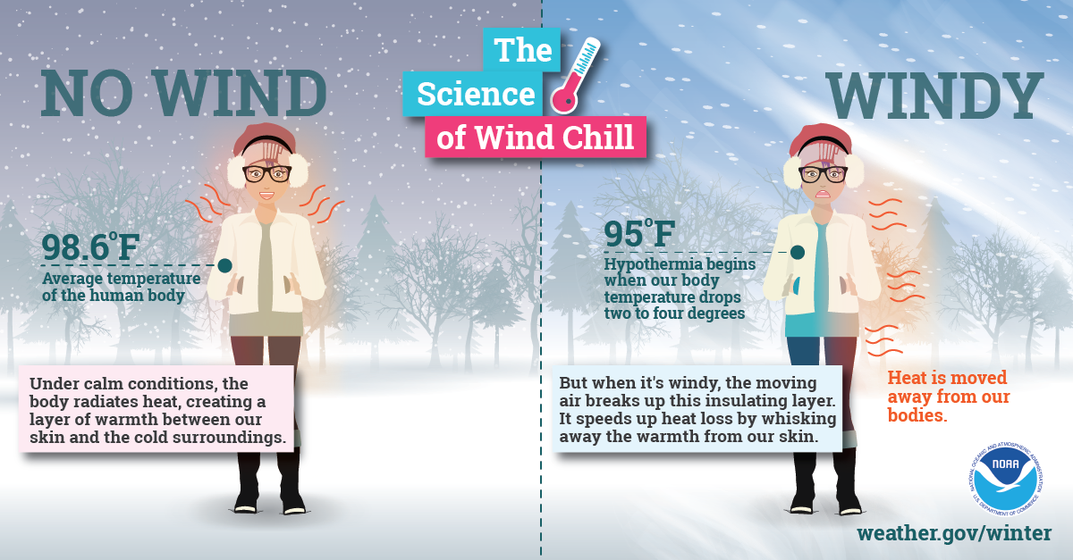
With little wind, your body is able to maintain a thin layer of warmer air between your skin and colder air surrounding you. However, higher winds can eliminate that thin layer, and your body can begin to cool at a dangerously fast rate.
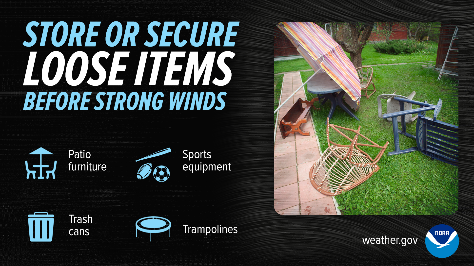
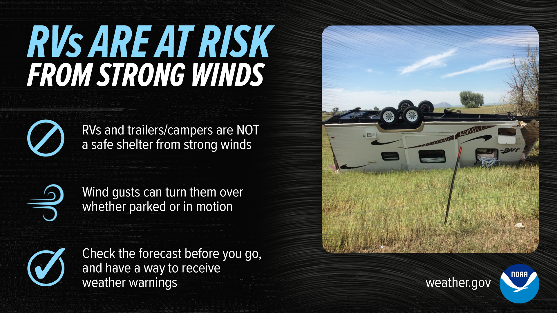
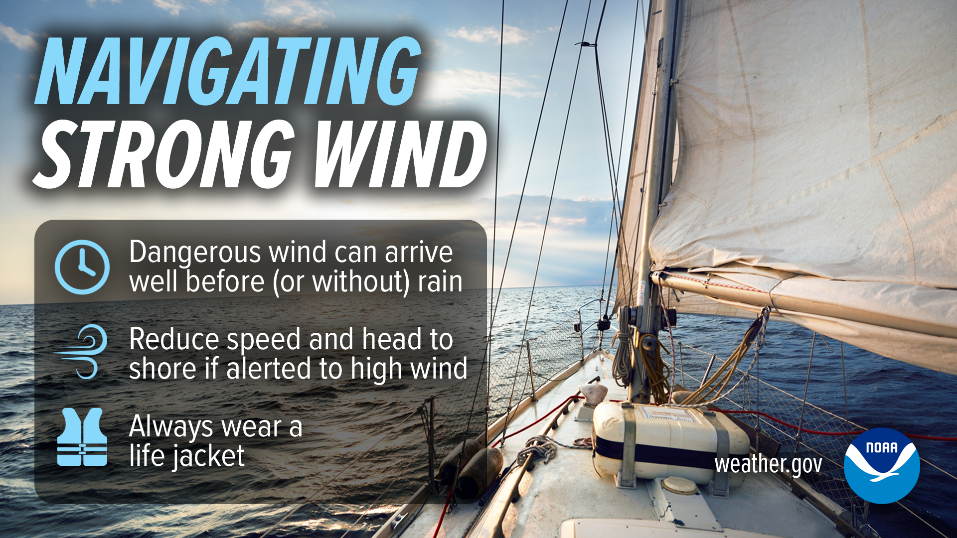
Even the most common items become dangerous objects when picked up and carried by the wind! When a High Wind Watch or a Severe Thunderstorm Watch is issued, secure outdoor items such as patio furniture, sports equipment and trash cans. Recreational vehicles and trailers/campers are NOT a safe shelter from strong winds. Wind gusts can turn them over whether parker or in motion. If high winds are forecast, consider rescheduling your trip. If caught on the road during straight line winds, slow down and keep two hands on the wheel. Wind can be dangerous for those out on the water as well, because strong winds create large waves and can damage your boat, push you off course, or even cause you to capsize. If high winds are forecast, stay off the water and stow your vessel before conditions become hazardous.
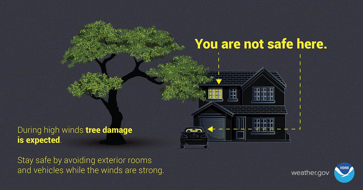
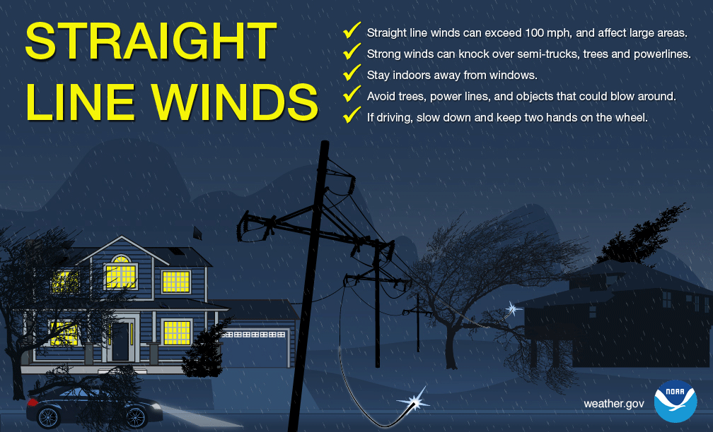
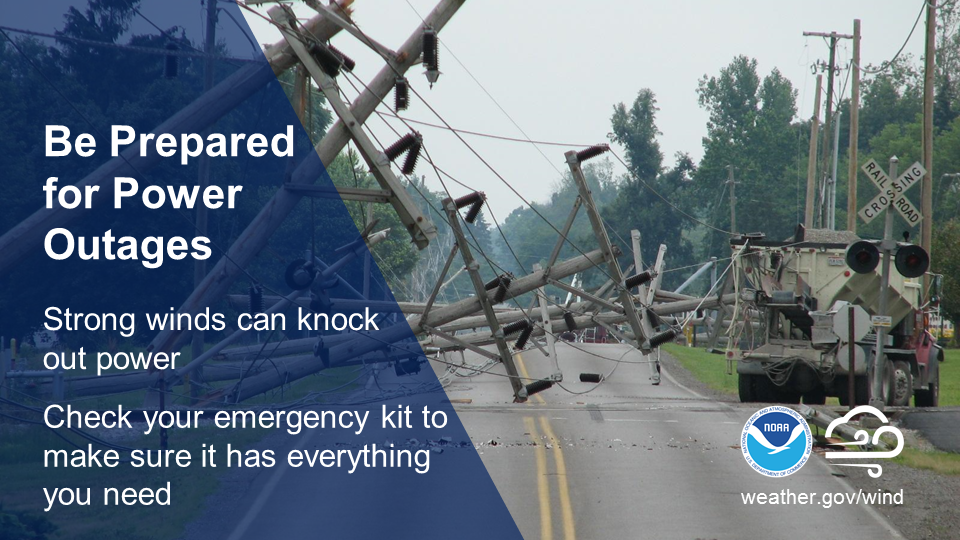
During high winds, falling trees and broken branches can become dangerous objects. Stay safe by avoiding exterior rooms and windows and by using caution when driving. Prevent damage to your property by trimming loose branches and parking away from trees. During strong thunderstorms, straight line wind speeds can exceed 100 mph and can cause damage similar to a tornado, knocking over semi-trucks, trees, and powerlines. Stay indoors and away from windows. Powerful storms can pack a windy punch. Don’t wait until you’re in the dark! Check your emergency kit now to ensure you have plenty of batteries and other essential supplies on hand.
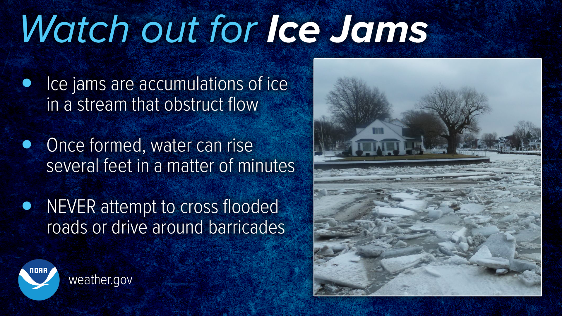
Floods
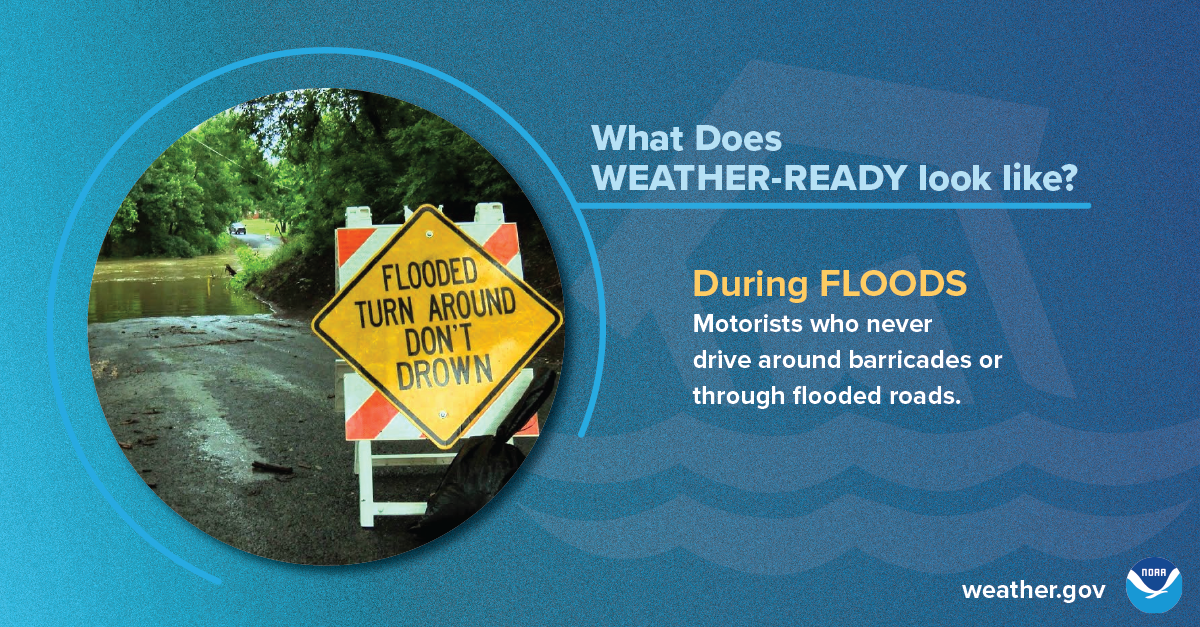
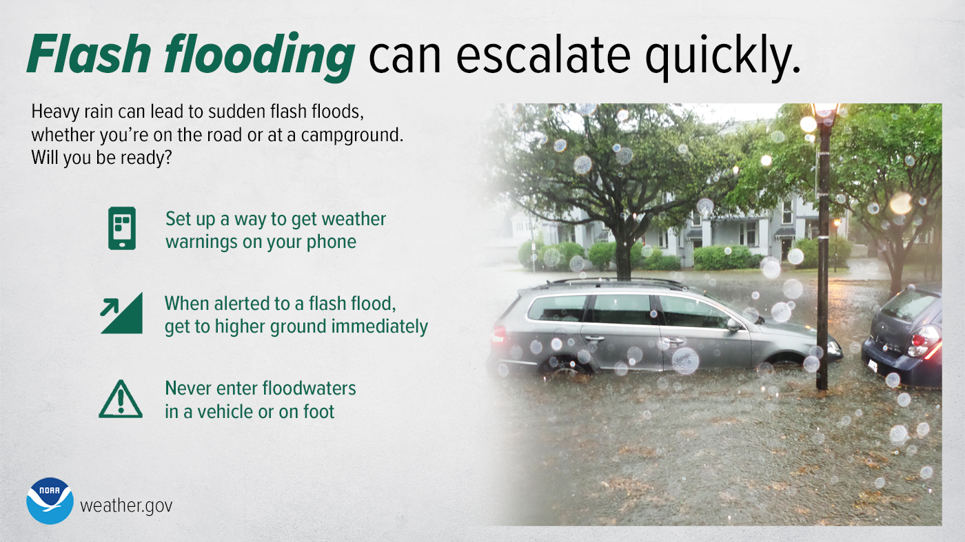
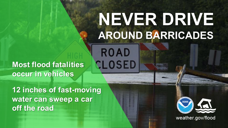
What does being Weather-Ready look like? When it comes to flood safety, it means knowing to never drive around barricades or through flooded roads, which are the cause of most flood fatalities.
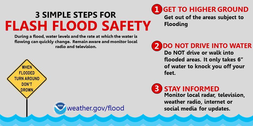
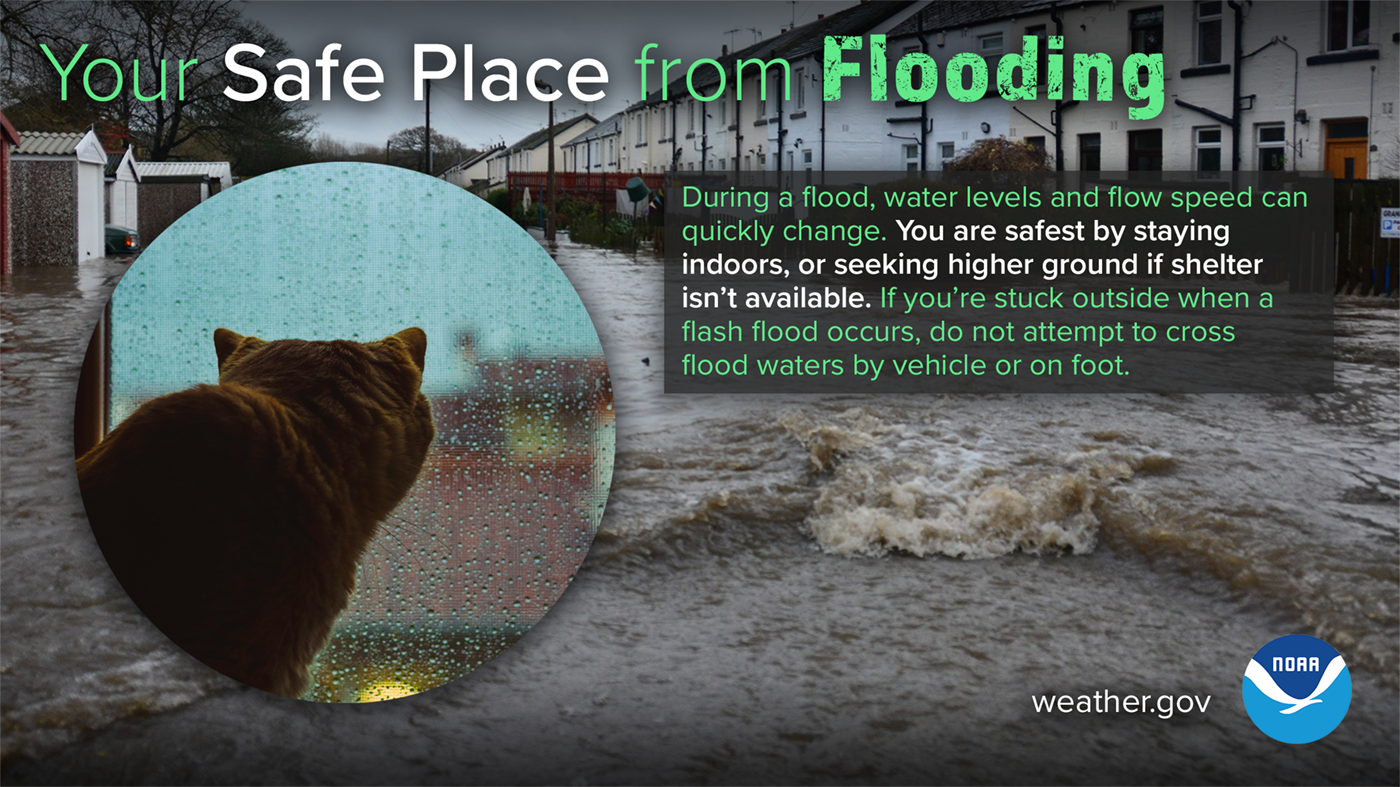
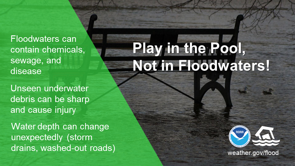
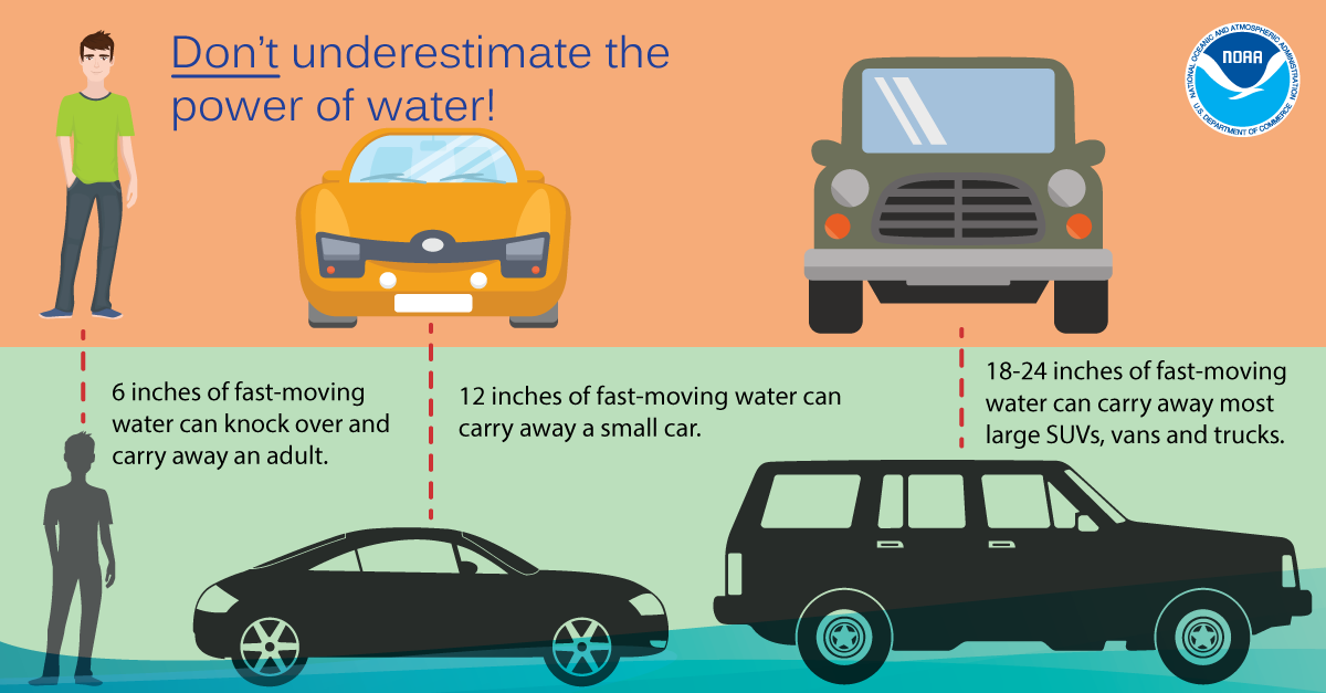
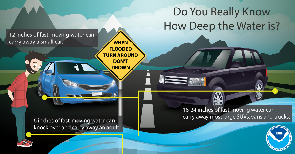
During a flood, water levels and the rate at which the water is flowing can quickly change. Get to higher ground. Do not drive or walk into water. It only takes 6 inches of water to knock you off your feet. Stay informed by monitoring local radio and television for updates.
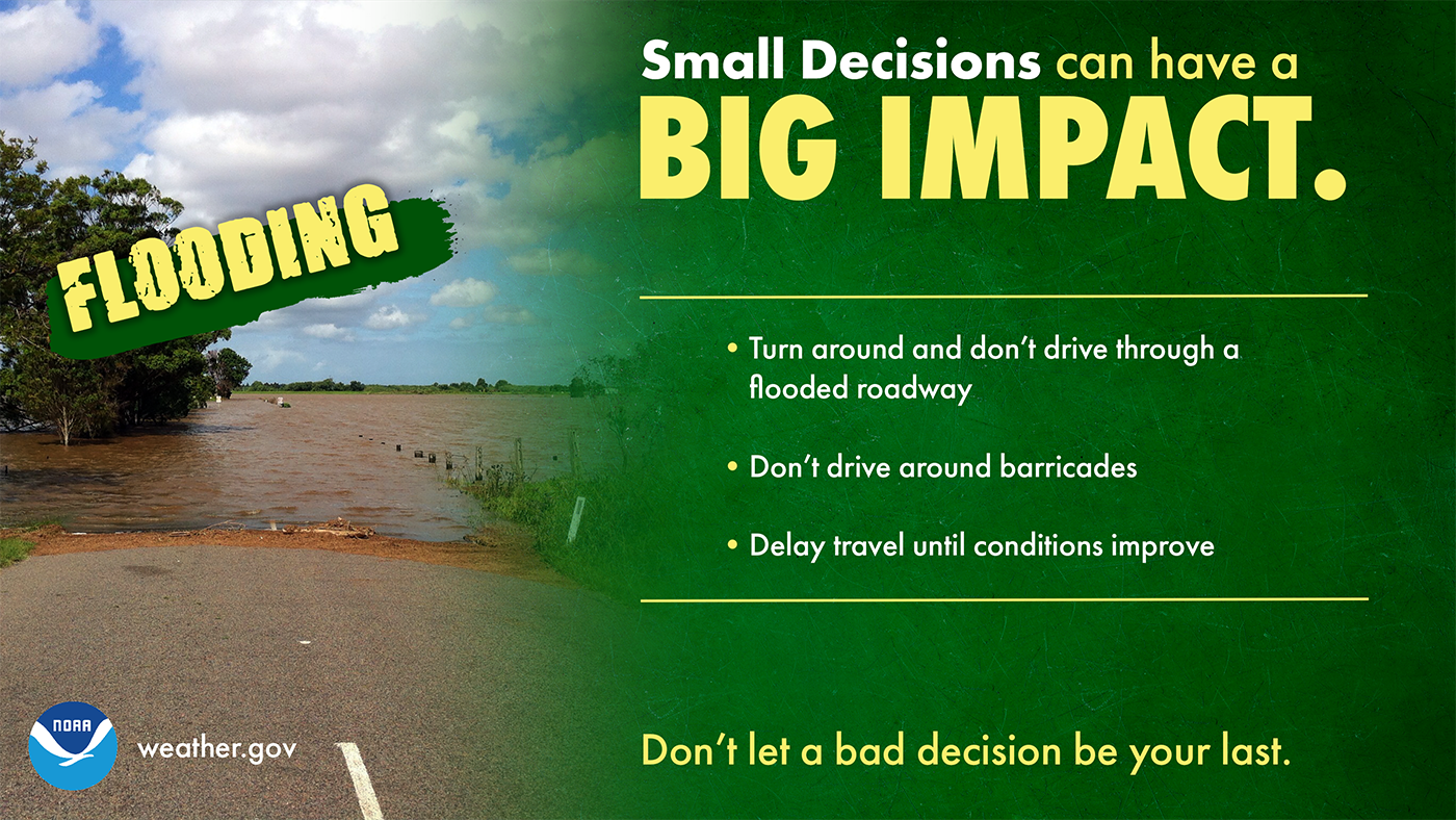
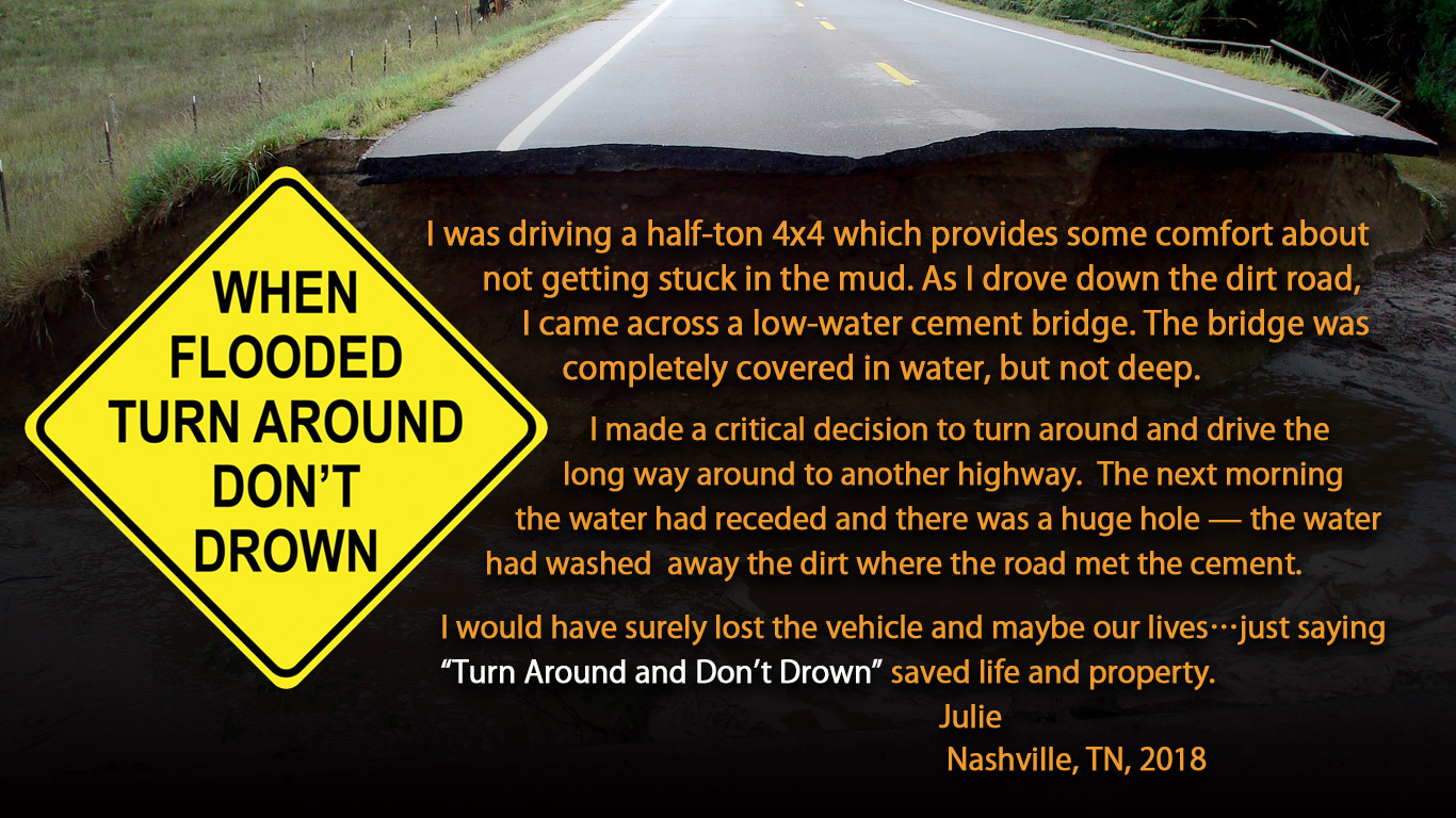
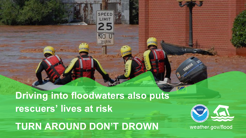
Most flood fatalities occur in vehicles, and it only takes 12 inches of water to sweep a car away. Sometimes, the difference between life and death is small decisions. During a flood, small decisions like turning around and not driving through a flooded roadway, not driving around barricades, and delaying travel until conditions improve, can make a big impact on whether you keep your car...or even your life. Turn Around, Don’t Drown.
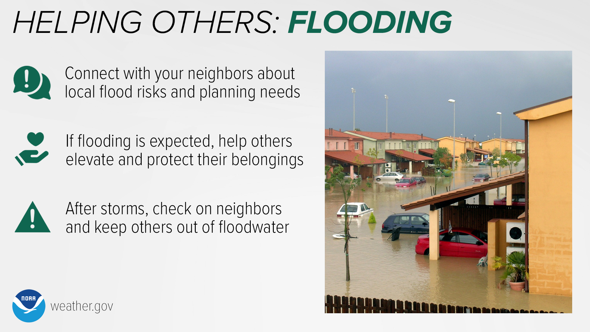
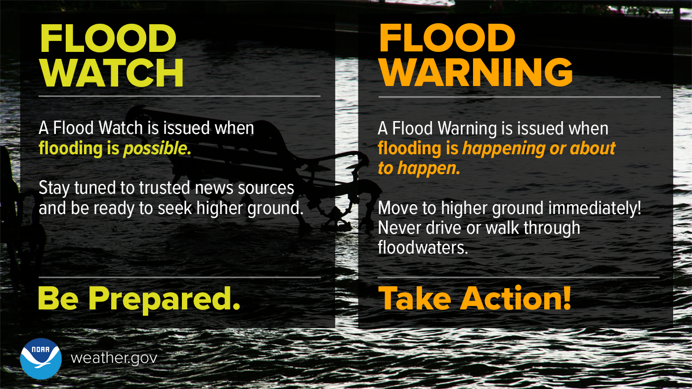
Flood events can devastate communities. Help yours be prepared and safe. A Flood WATCH means Be Prepared. A Flood WARNING means Take Action! Connect with your neighbors and discuss local flood risks and planning needs. If flooding is expected, help others elevate and protect their belongings. After the storm, check on your neighbors and keep others out of floodwater. Make sure to enable Wireless Emergency Alerts on your phone. If flooding occurs while you’re outdoors, immediately get to higher ground, and NEVER enter flood waters in a vehicle or on foot. During a flood, water levels and the rate at which water is flowing can quickly change. You are safest staying indoors, or seeking higher ground if shelter isn’t available. If you’re stuck outside when a flash flood occurs, do not attempt to cross flood waters by vehicle or on foot.
Don’t underestimate the power of water. It only takes 6 inches of fast-moving water to knock over and carry away an adult, 12 inches to carry away a small car, and 18 inches of water to sweep a larger vehicle away. It is impossible to know how deep the water is just by looking at it. More than 50% of all flood fatalities are vehicle related. NEVER drive around barricades into floodwaters! You never know if the road is even below that muddy water anymore. When you drive into floodwaters, you’re not only putting your own life at risk, but also the lives of your rescuers. It’s far better to be late and remain safe than to take a risk and possibly lose your life. Turn around, don't drown!
Fog
Fog, particularly when dense, can be hazardous to drivers, mariners and aviators. Fog contributes to numerous travel accidents every year. Restrictions in visibility resulting from fog can also impact takeoff and landing procedures and requirements for pilots, and can be the cause of weather-related aviation delays.

If you find driving in foggy conditions, keep the following safety tips in mind:


Science
Forecasting winter weather is one of the biggest challenges for meteorologist. A one degree change in temperature in the atmosphere and at the surface can mean the difference between you experiencing rain, snow, ice or a mix of all three. It is important for meteorologists to understand how these subtle changes can quickly change a weather forecast.


Severe Weather
Severe weather can happen during any month of the year across the Ohio Valley. Just because it is the winter season does not mean we do not get severe weather. Thunderstorms and squall lines can quickly turn clear skies dark. Stay Weather-Ready by having a way to get weather alerts on your phone, and stay safe by immediately going inside when the skies turn threatening. Visit weather.gov/safety/thunderstorm to learn more.

No matter the season, Wireless Emergency Alerts can save your life from severe weather. WEA are emergency messages sent by authorized government alerting authorities through your mobile carrier. America’s wireless industry is helping to build a Weather-Ready Nation through this nationwide text emergency alert system. weather.gov/wrn/wea

Did you know that the tornado sirens are only meant for outdoor warning purposes? They are not meant to be heard indoors! County warning sirens are operated by you local city or county officials, and NOT the National Weather Service!


If there is severe weather, we need your reports! Here's how you can send us reports.

How You Can Help Your Community


Accurate snow measurements are very important but taking those measurements can be difficult at times. The National Weather Service rely heavily on volunteers and the general public to provide snowfall measurements during winter weather events. We ask that you follow the procedures below as closely as possible when measuring snowfall and then forward the report on to us.


Deaf and Hard of Hearing
Winter storms can be just as hazardous as any other type of weather, and it's important to be prepared. Learn how to prepare NOW with this video in American Sign Language.
Having a plan is important in times of emergency, and this includes building an emergency preparedness kit before a disaster. Learn how with this video in American Sign Language.
With our region experiencing moderate to severe drought, burning can quickly get out of control. Wildfires quickly consume everything in their paths. Learn how to prepare NOW with this video in American Sign Language.
Severe weather can occur anytime of the year across our region. Just because it is winter does not mean you should not forget basic thunderstorm safety. This PSA for the deaf & hard of hearing community covers the basics of severe thunderstorm safety, explains Watches & Warnings, and touches on the various hazards that thunderstorms can bring.
 |
Media use of NWS Web News Stories is encouraged! Please acknowledge the NWS as the source of any news information accessed from this site. |
|


 Weather Story
 Weather Map
 Local Radar