Overview
|
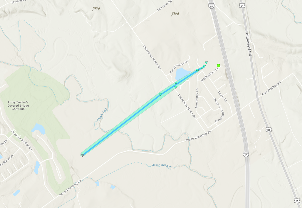
An unstable atmosphere combined with unseasonably strong wind shear allowed for isolated supercells to develop across southern Indiana on the evening of May 7, 2024. The environment was favorable for brief tornadic activity and resulted in a short-lived EF-0 tornado in Clark County, Indiana.
This webpage is under construction. Check back regularly for updates. |
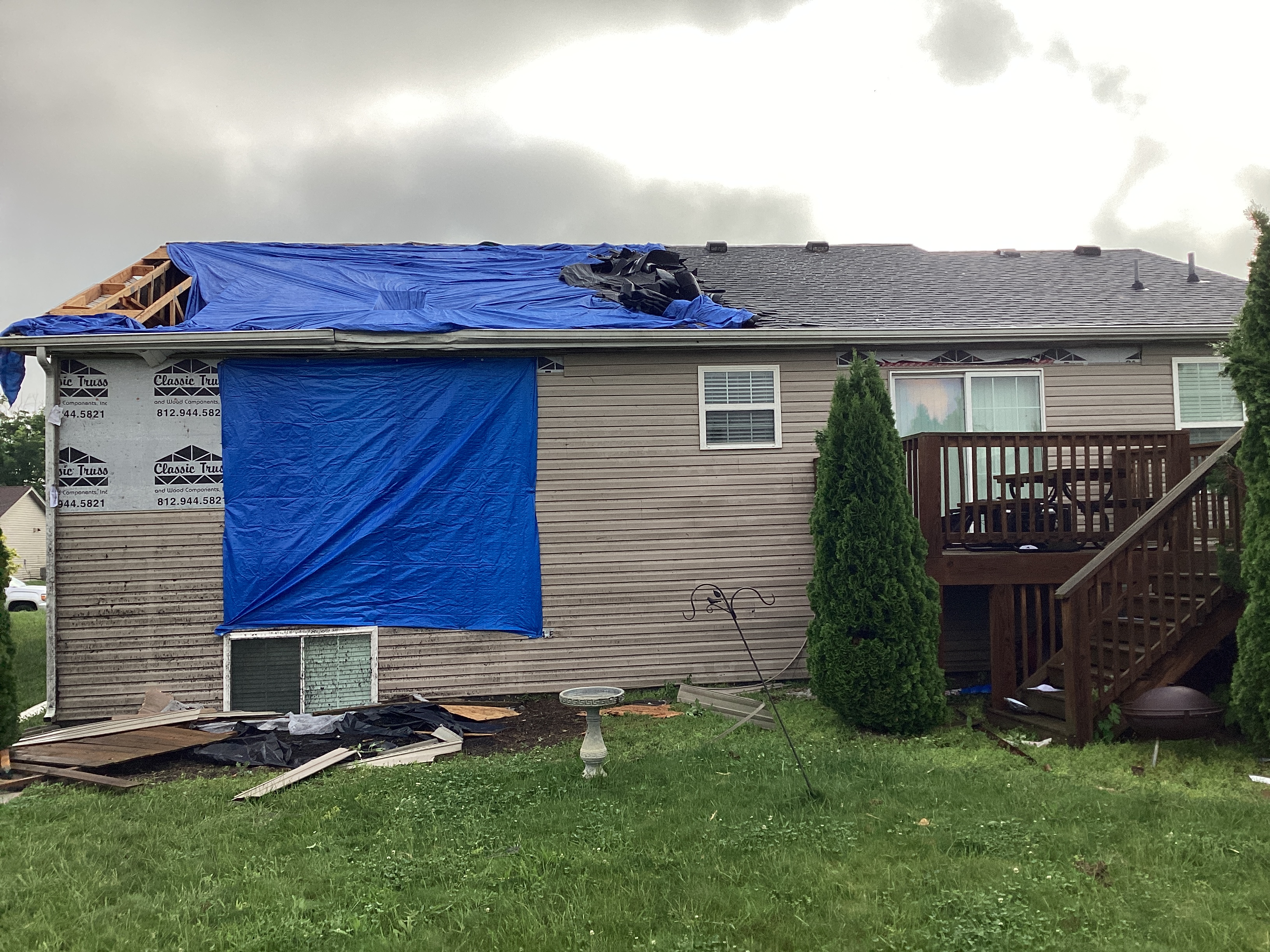 EF-0 damage to a home near Perry Crossing, IN |
Tornadoes:
|
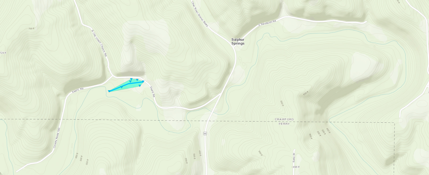
Tornado - Perry Crossing, IN
|
||||||||||||||||
|
Tornado - Sulphur Springs, IN
|
||||||||||||||||
The Enhanced Fujita (EF) Scale classifies tornadoes into the following categories:
| EF0 Weak 65-85 mph |
EF1 Moderate 86-110 mph |
EF2 Significant 111-135 mph |
EF3 Severe 136-165 mph |
EF4 Extreme 166-200 mph |
EF5 Catastrophic 200+ mph |
 |
|||||
Photos
 |
 |
 |
|
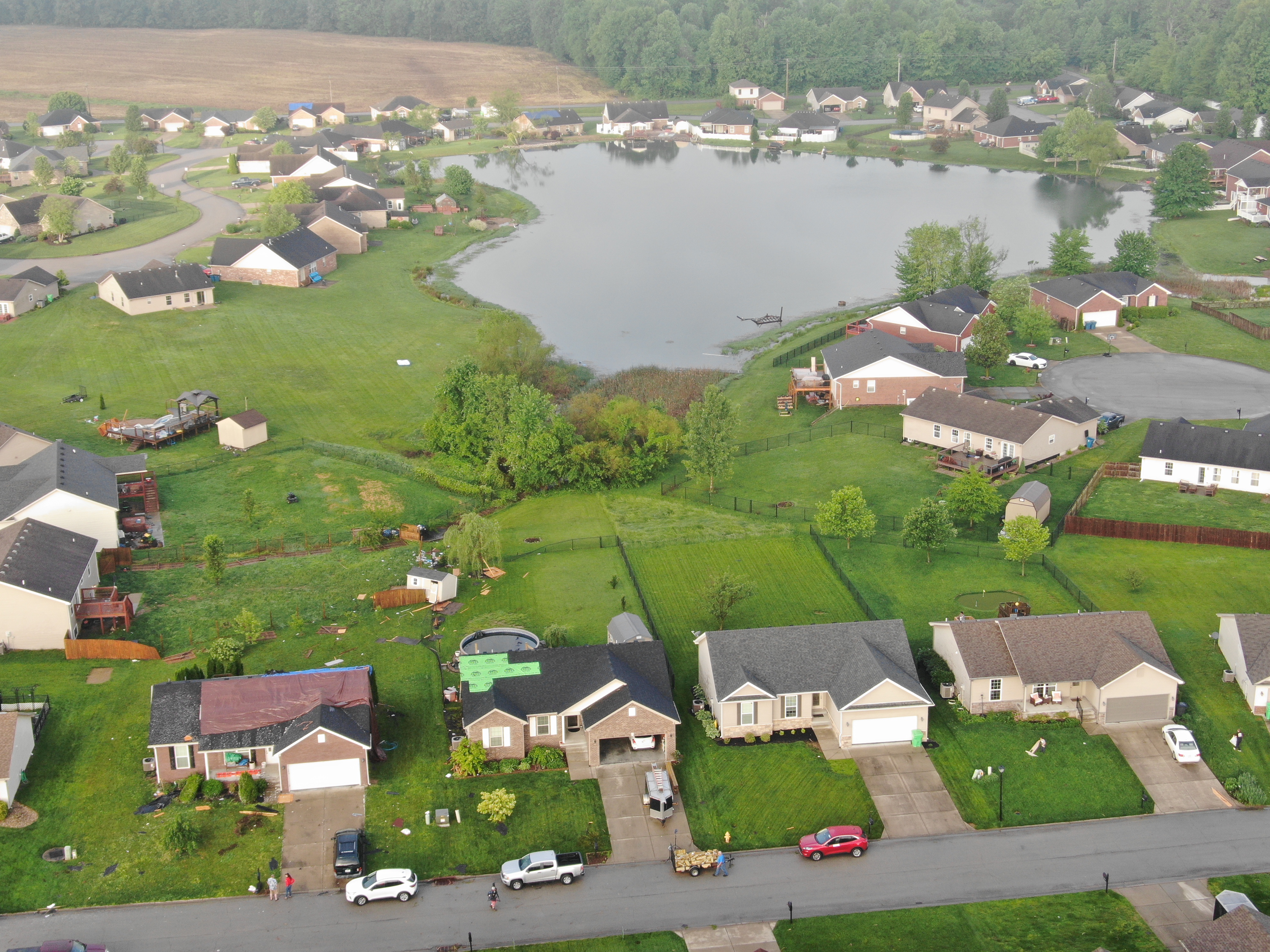
| NWS Louisville drone photo showing damage (NWS Louisville) |
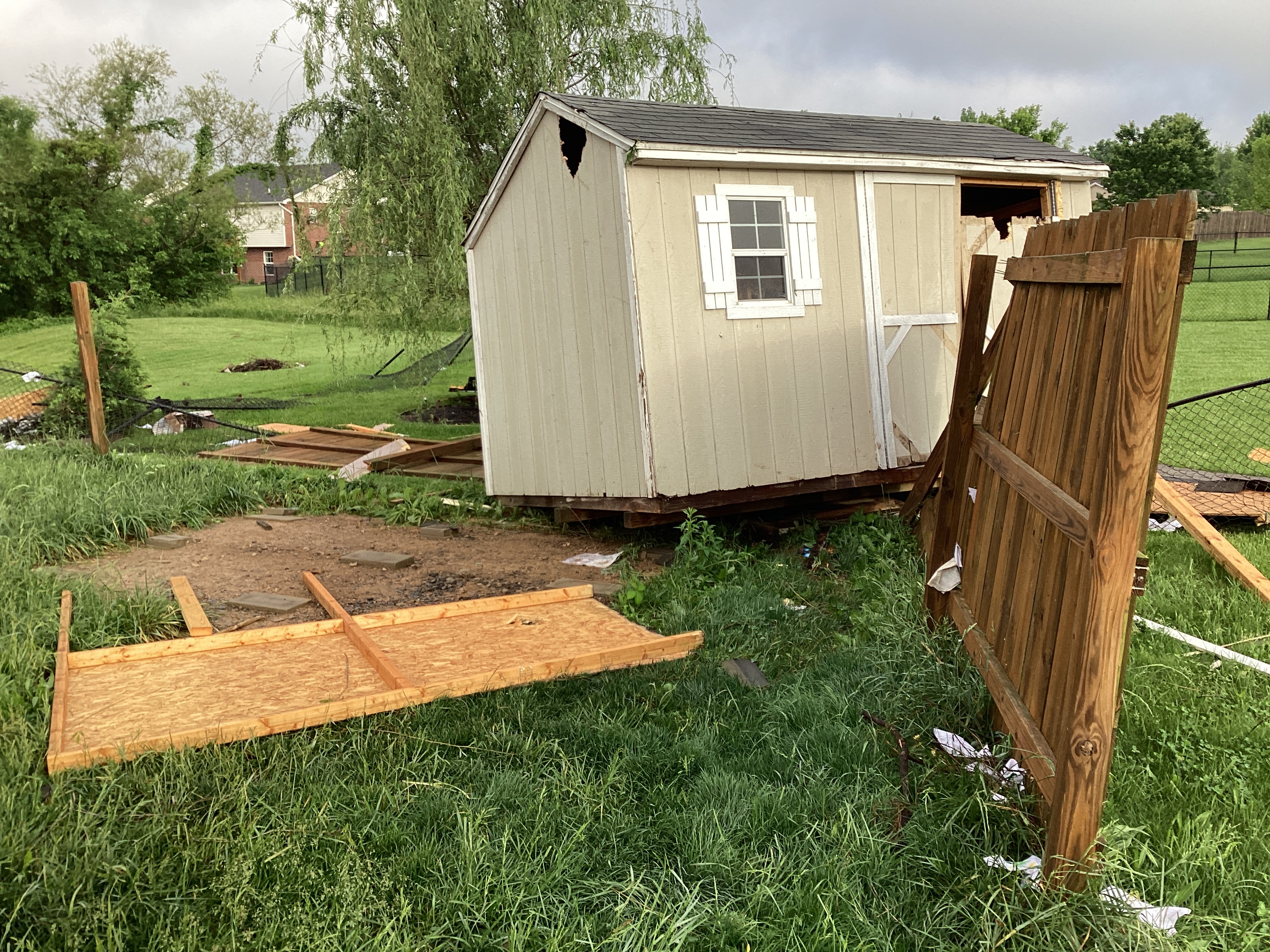
A small shed was damaged and fence was destroyed (NWS Louisville Damage Survey) |
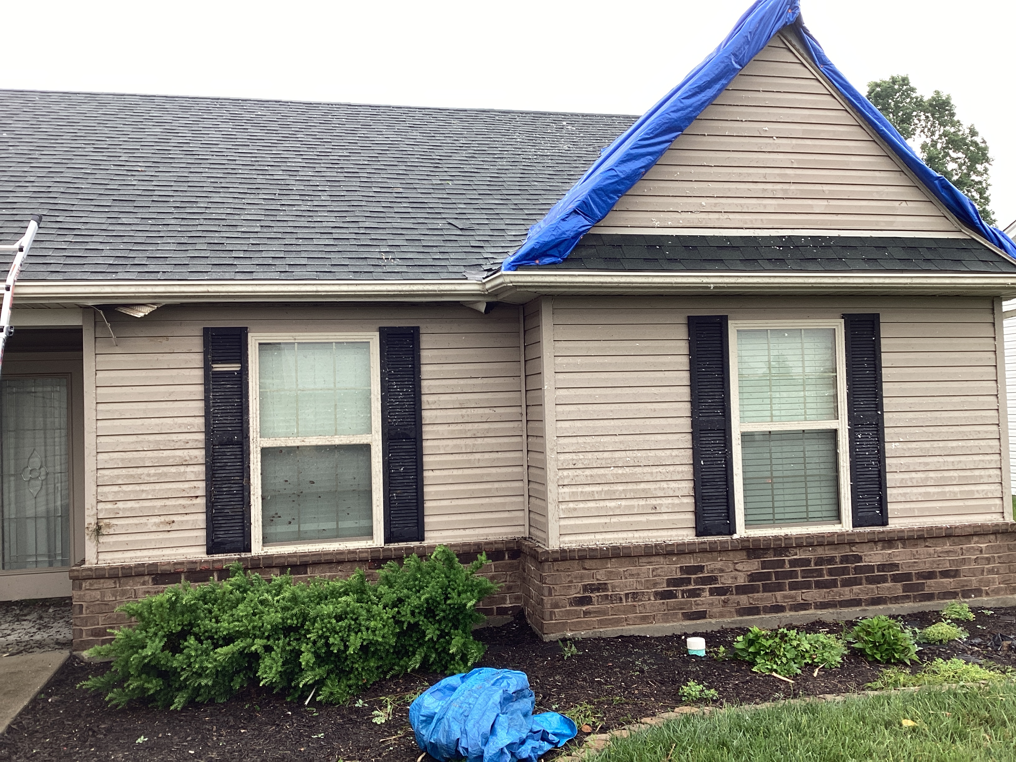
Damage to a home consistent with 80 MPH winds (NWS Louisville Damage Survey) |
Radar
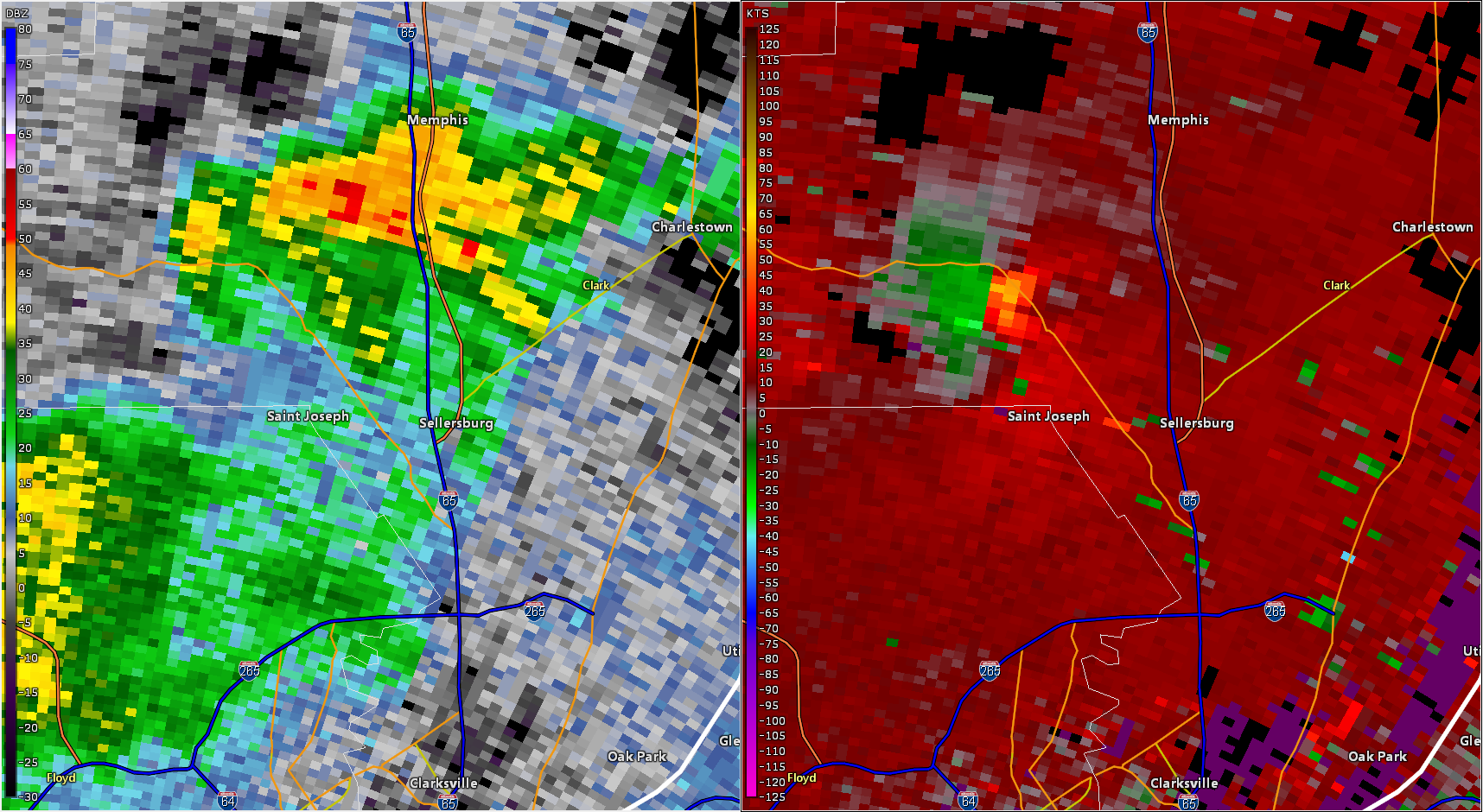 |
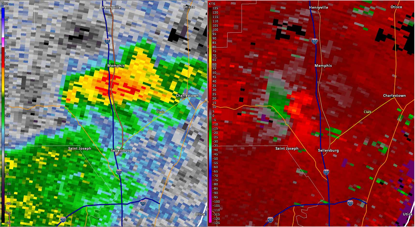 |
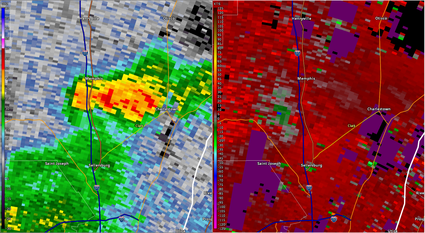 |
| KLVX Base Reflectivity (left) and Storm Relative Velocity (right) at 916 PM EDT, 7 minutes before the tornado touched down | KLVX Base Reflectivity (left) and Storm Relative Velocity (right) at 919 PM EDT, 4 minutes before the tornado touched down | KLVX Base Reflectivity (left) and Storm Relative Velocity (right) at 923 PM EDT, as the tornado touched down |
Storm Reports
Preliminary Local Storm Report
National Weather Service Louisville KY
1040 AM EDT Wed May 8 2024

..TIME...   ...EVENT...      ...CITY LOCATION...     ...LAT.LON...
..DATE...   ....MAG....      ..COUNTY LOCATION..ST.. ...SOURCE....
            ..REMARKS..

0923 PM     Tornado          1 ENE Bennettsville     38.44N 85.78W
05/07/2024                   Clark              IN   NWS Storm Survey

            The NWS in Louisville conducted a storm
            survey and found EF0 85 mph wind damage. The
            tornado was 0.41 miles long with a width of
            60 yards. For more information, please see
            the associated Public Information Statement
            survey summary.
0841 PM     Tstm Wnd Dmg     1 SW Sulphur Springs    38.21N 86.48W
05/07/2024                   Crawford           IN   Emergency Mngr

            On Old Union Church Rd just south of East
            Rainforth Rd, trees and power lines down,
            and carport blown in the road. Time
            estimated from radar.
0925 PM     Tstm Wnd Dmg     2 ENE Bennettsville     38.45N 85.76W
05/07/2024                   Clark              IN   Trained Spotter

            Trees down on US-31.
Environment
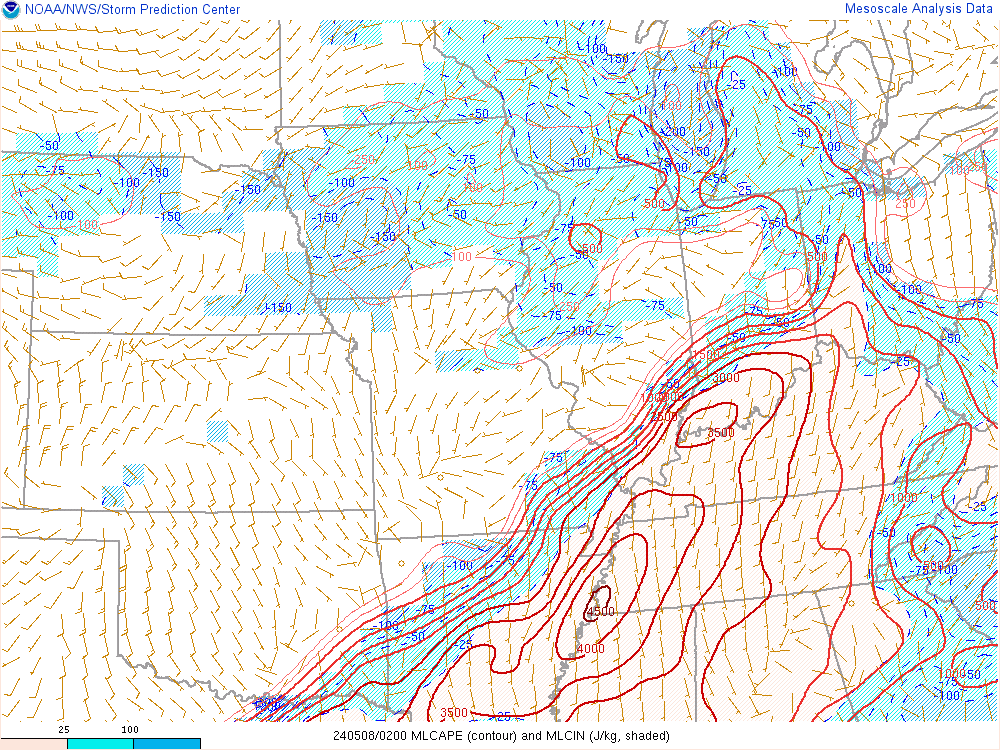 |
 |
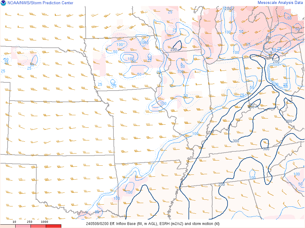 |
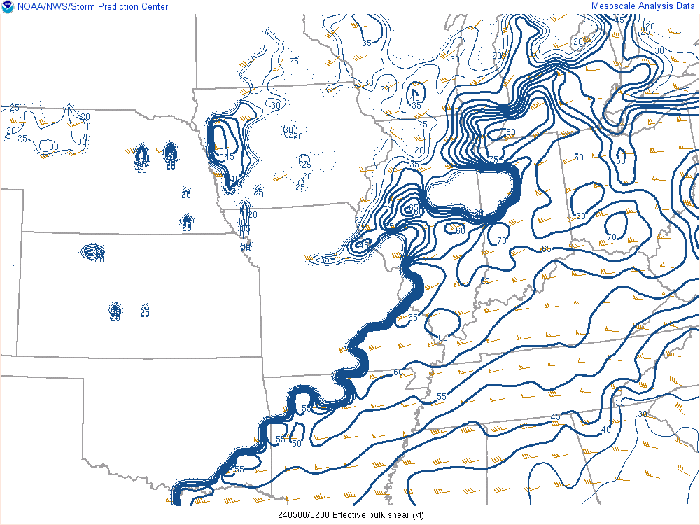
| Figure 1: Mixed Layer CAPE around the time of the tornado. Values around 3000 J/KG indicate a strongly unstable environment | Figure 2: Effective Shear around the time of the tornado | Figure 3: Effective Storm Relative Helicity around the time of the tornado. Values over 200 M2/S2 are considered favorable for tornadoes |
 |
 |
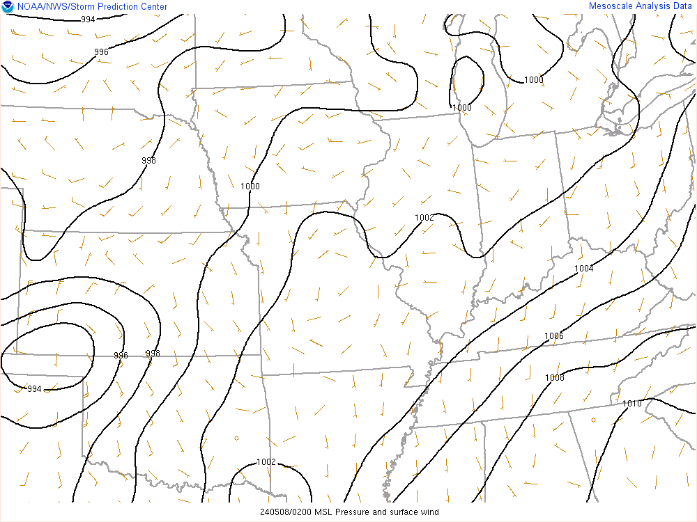 |
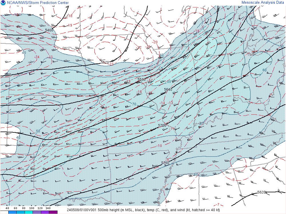
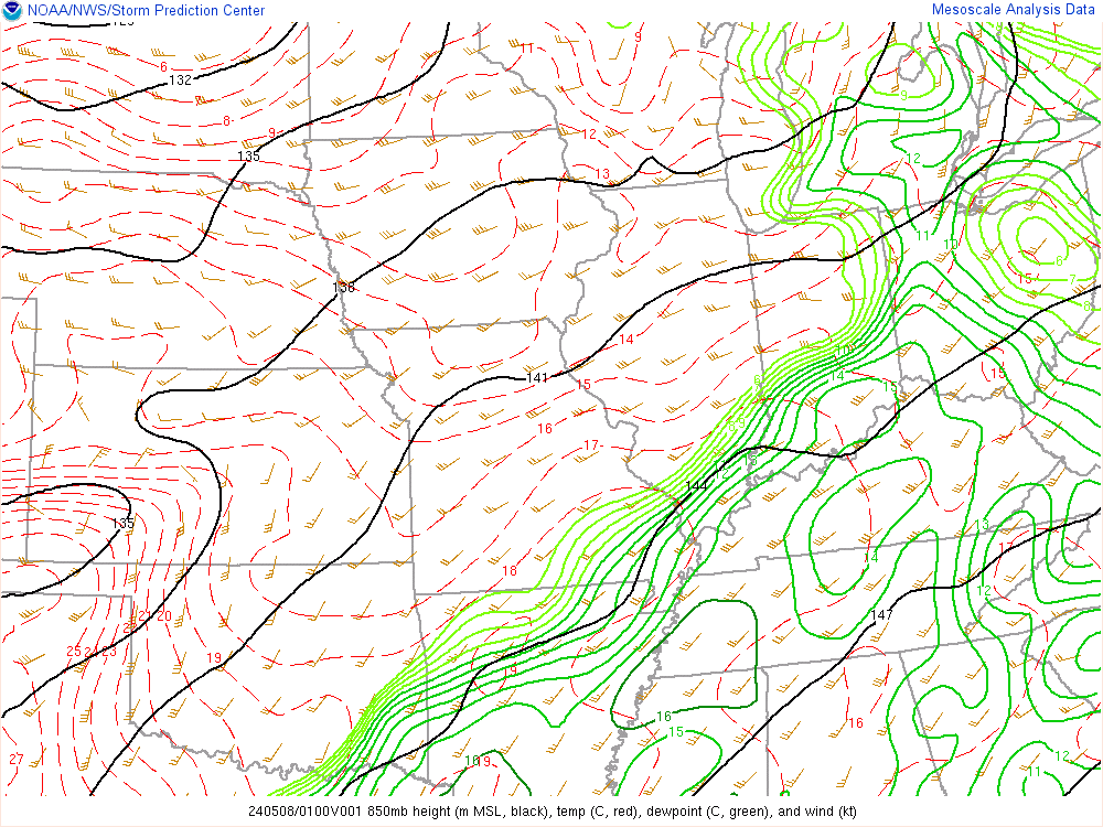
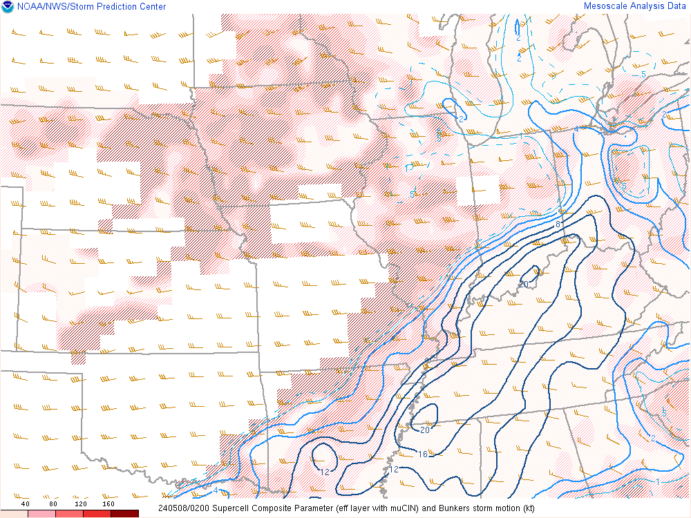
| Figure 4: 500 mb winds indicating the exit region of a strong mid level jet. This contributed strong deep layer shear, and a favorable supercell setup | Figure 5: Strong low level jetting at 850 mb was also added to strong and turning deep layer shear. | Figure 6: Surface analysis showing a frontal boundary draped near the region |
 |
 |
|
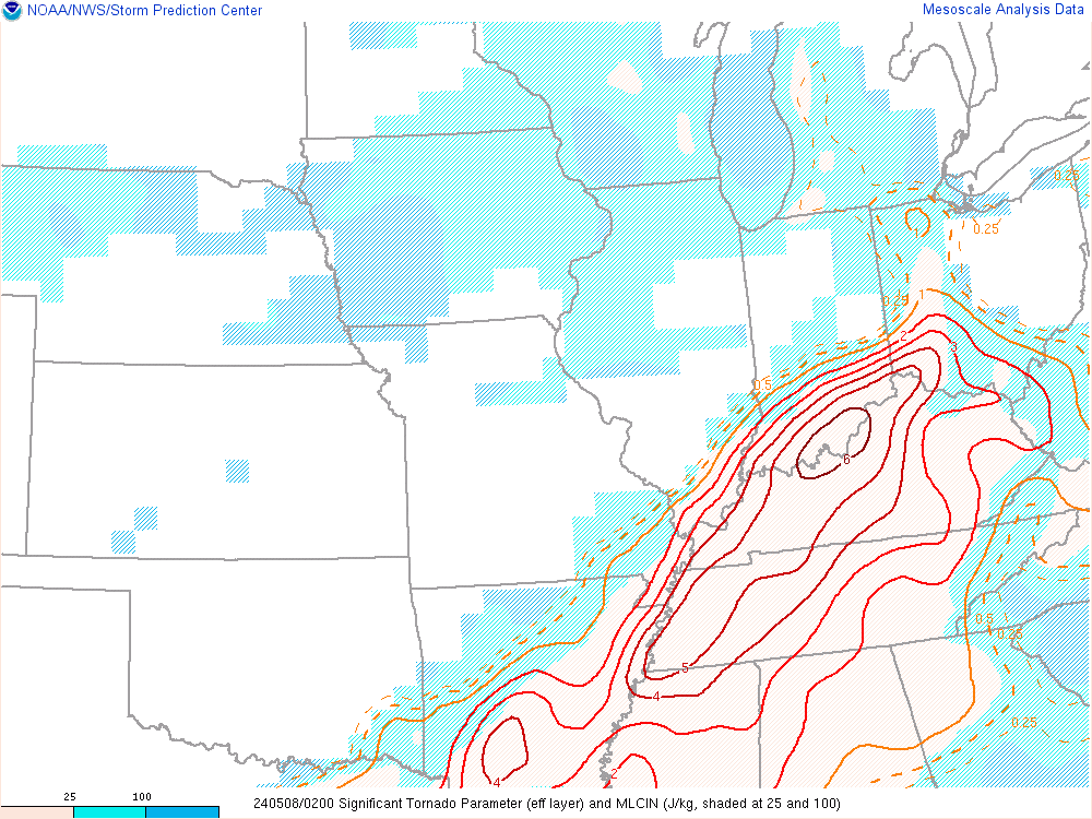
| Figure 7: Supercell Composite Parameter peaking at more than sufficient values right where tornado occurred | Figure 8: Significant Tornado Parameter signaled a very favorable environment for tornadoes |
 |
Media use of NWS Web News Stories is encouraged! Please acknowledge the NWS as the source of any news information accessed from this site. |
|




 Weather Story
 Weather Map
 Local Radar
 Follow us on X
 Follow us on Facebook
 Follow us on YouTube
 LMK RSS Feed