Overview
|
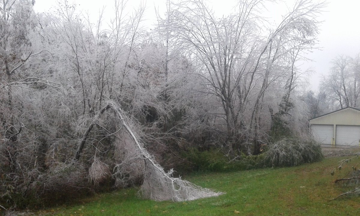
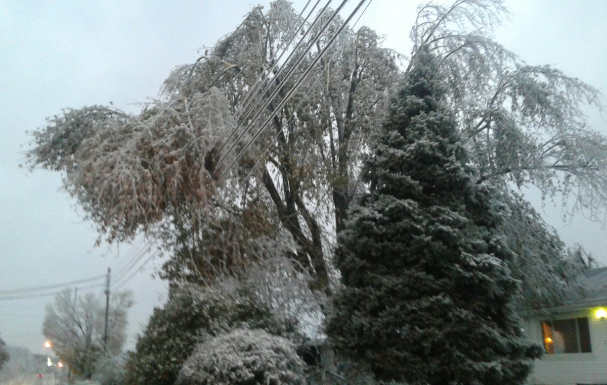
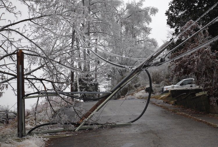
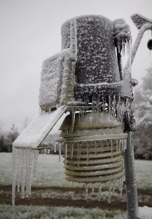
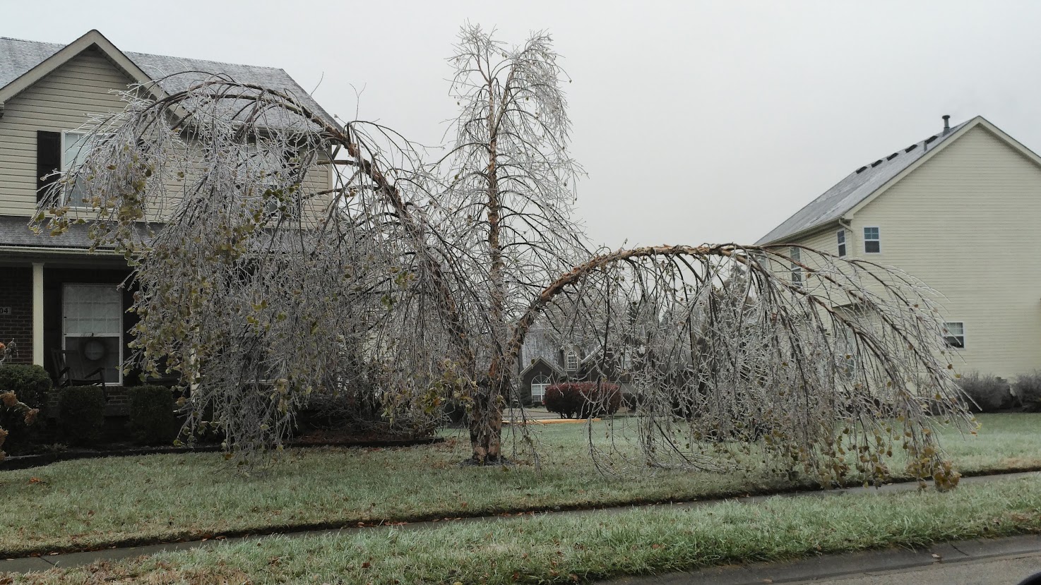
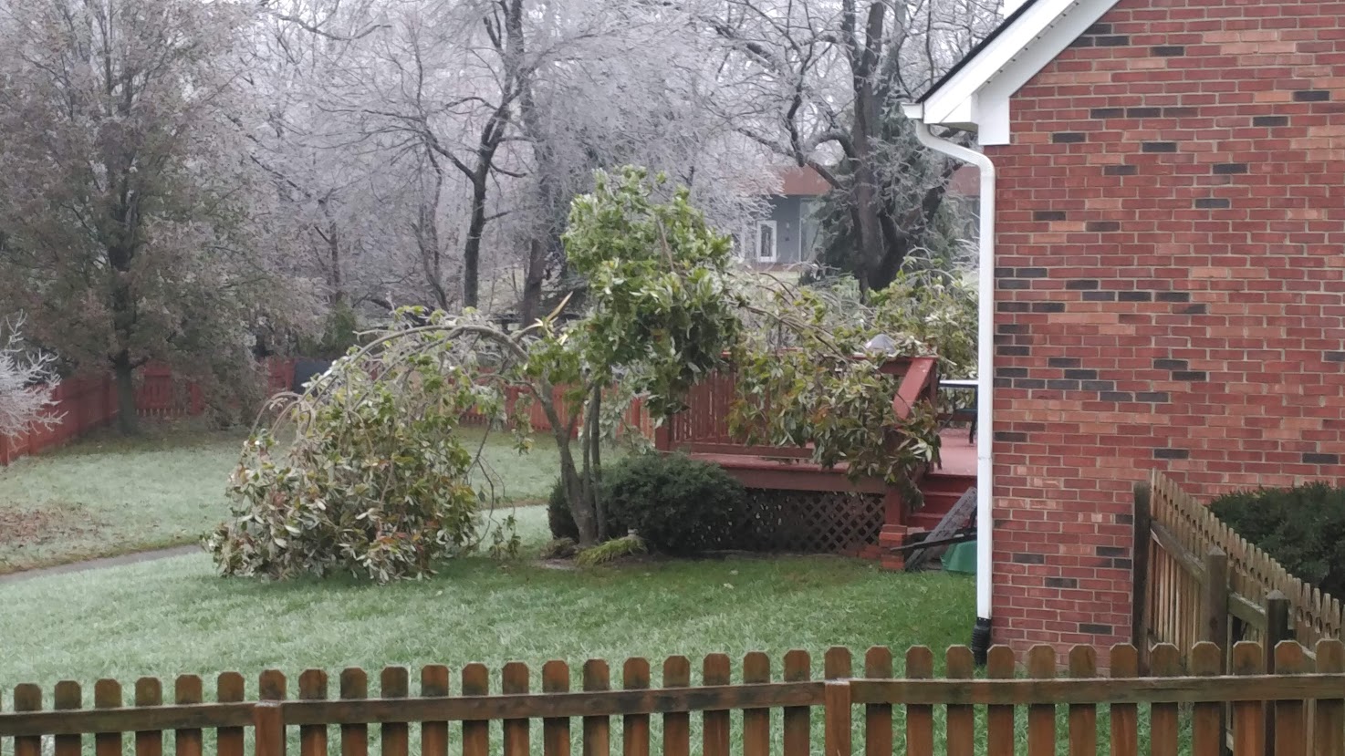
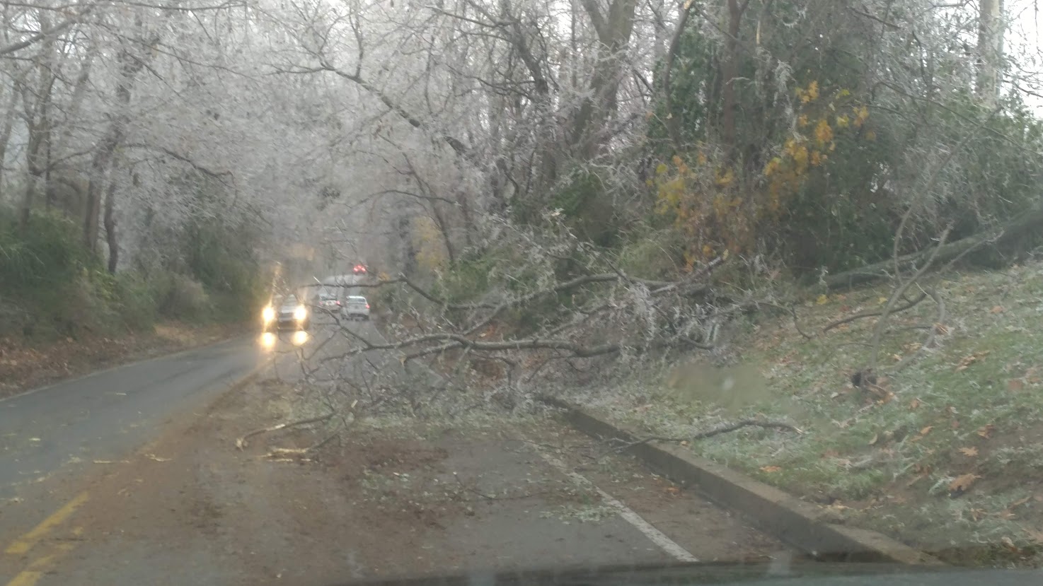
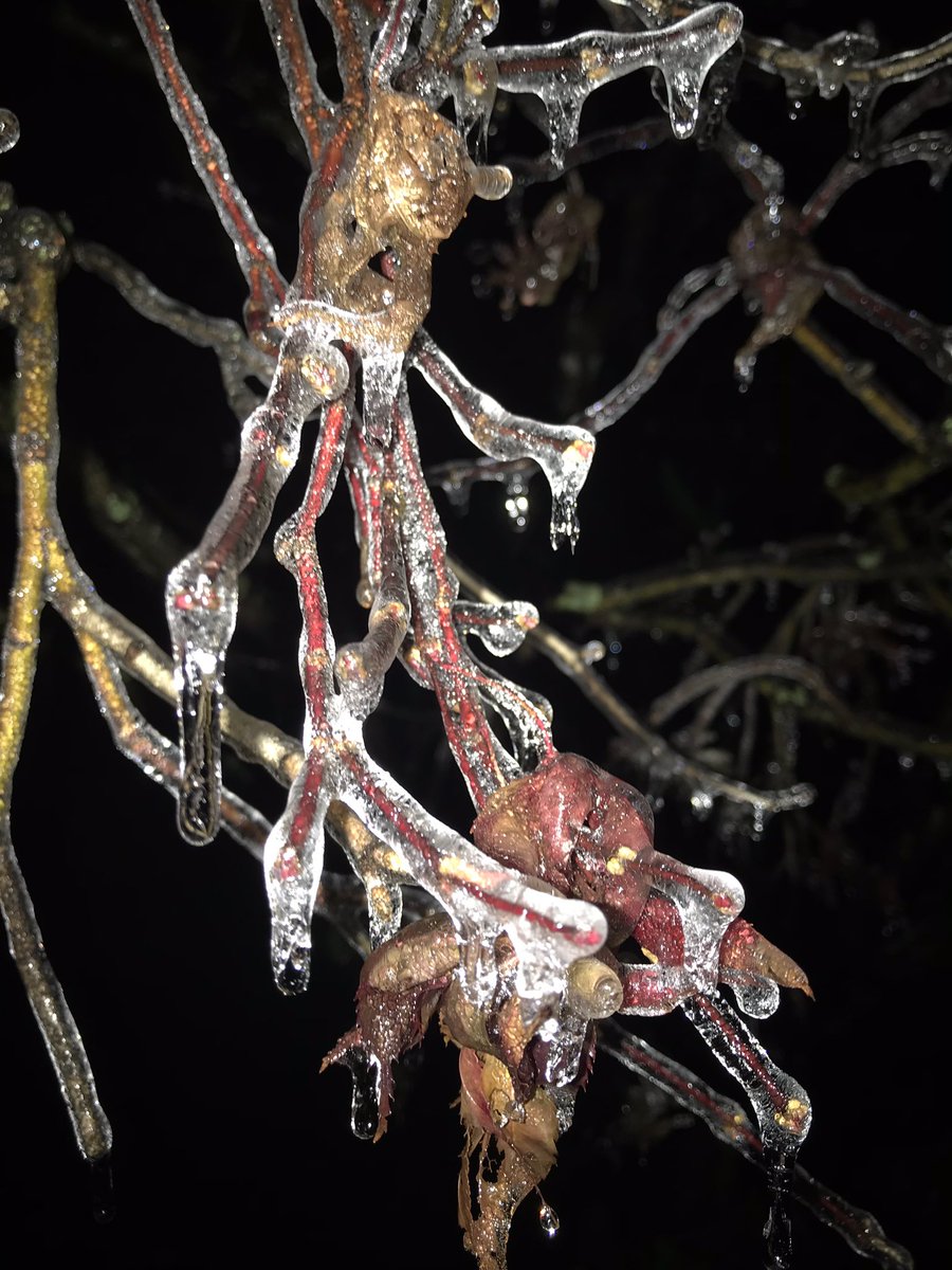
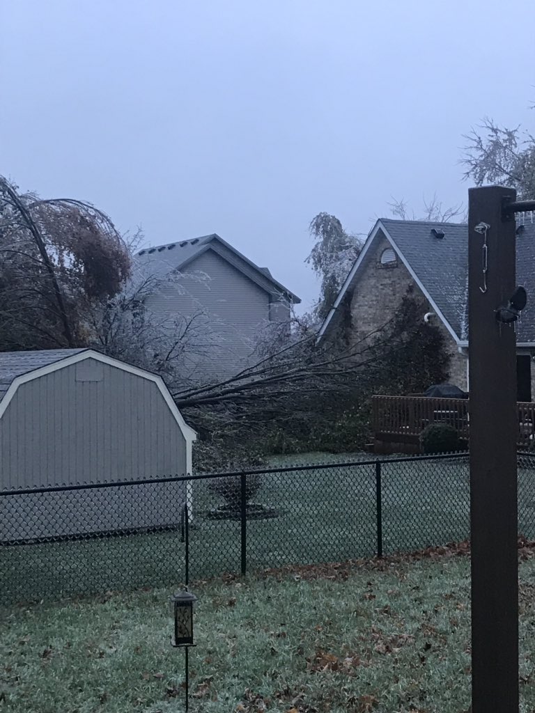
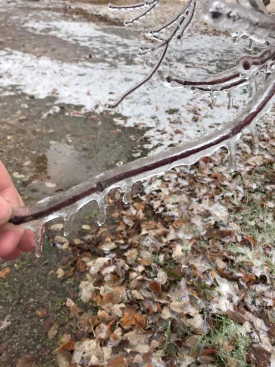
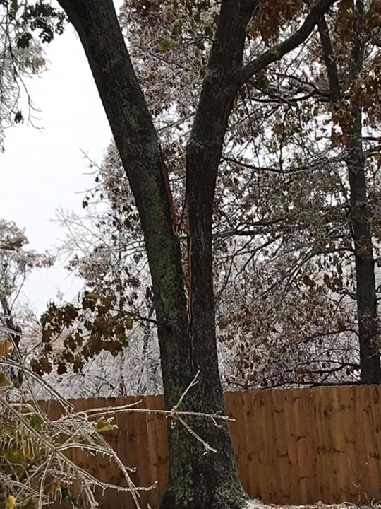
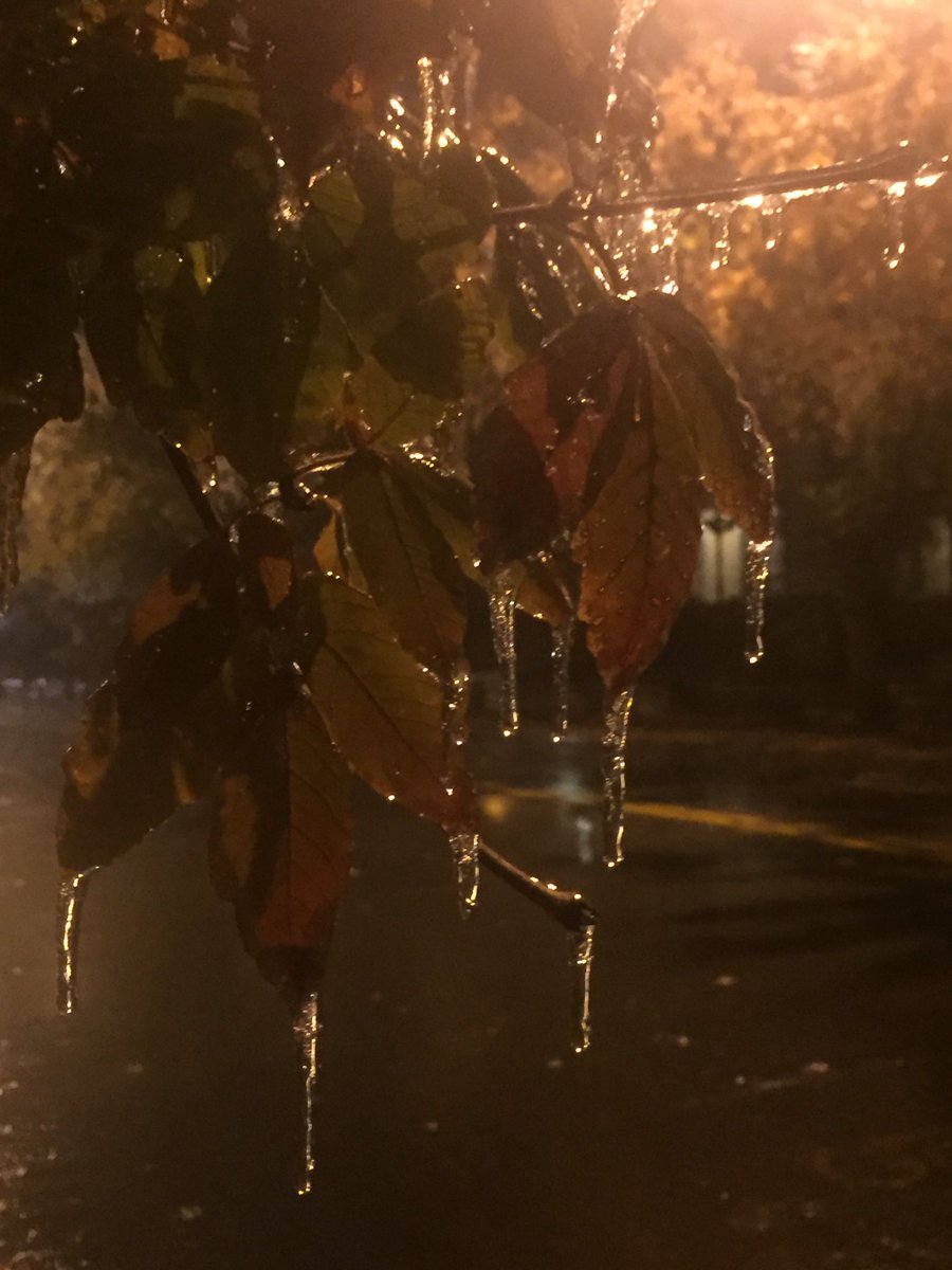
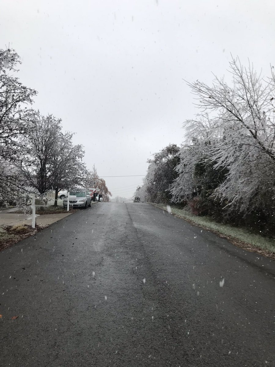
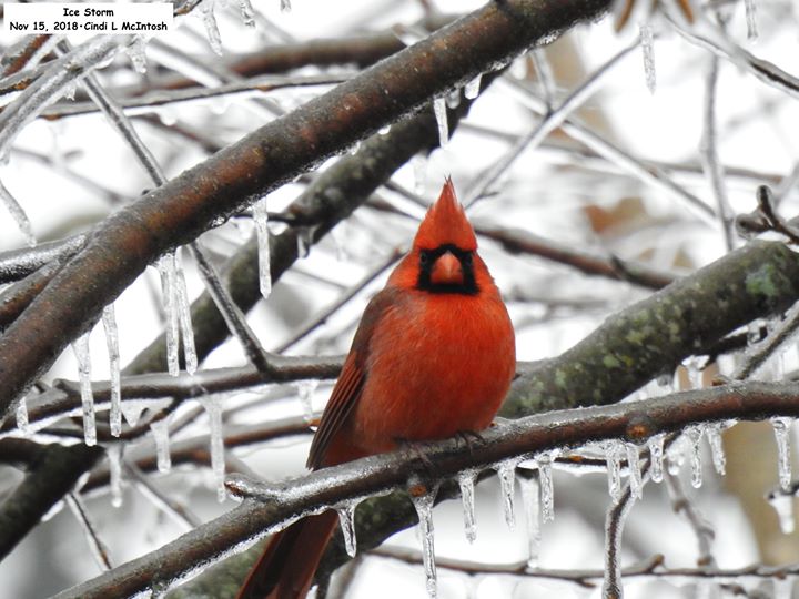
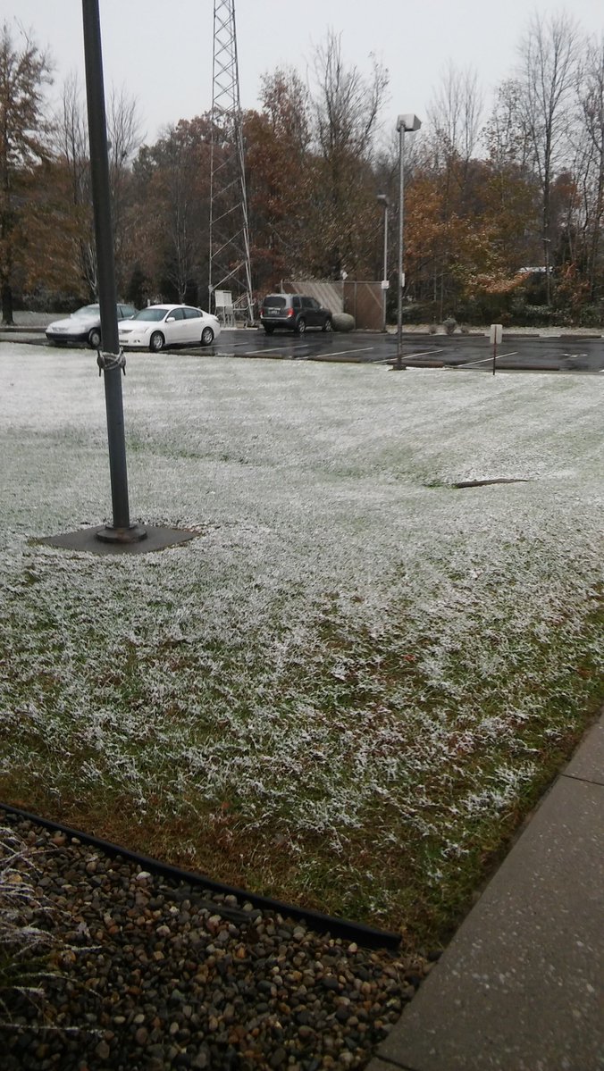
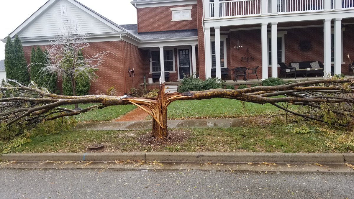
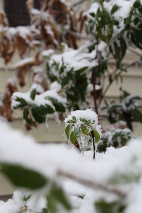
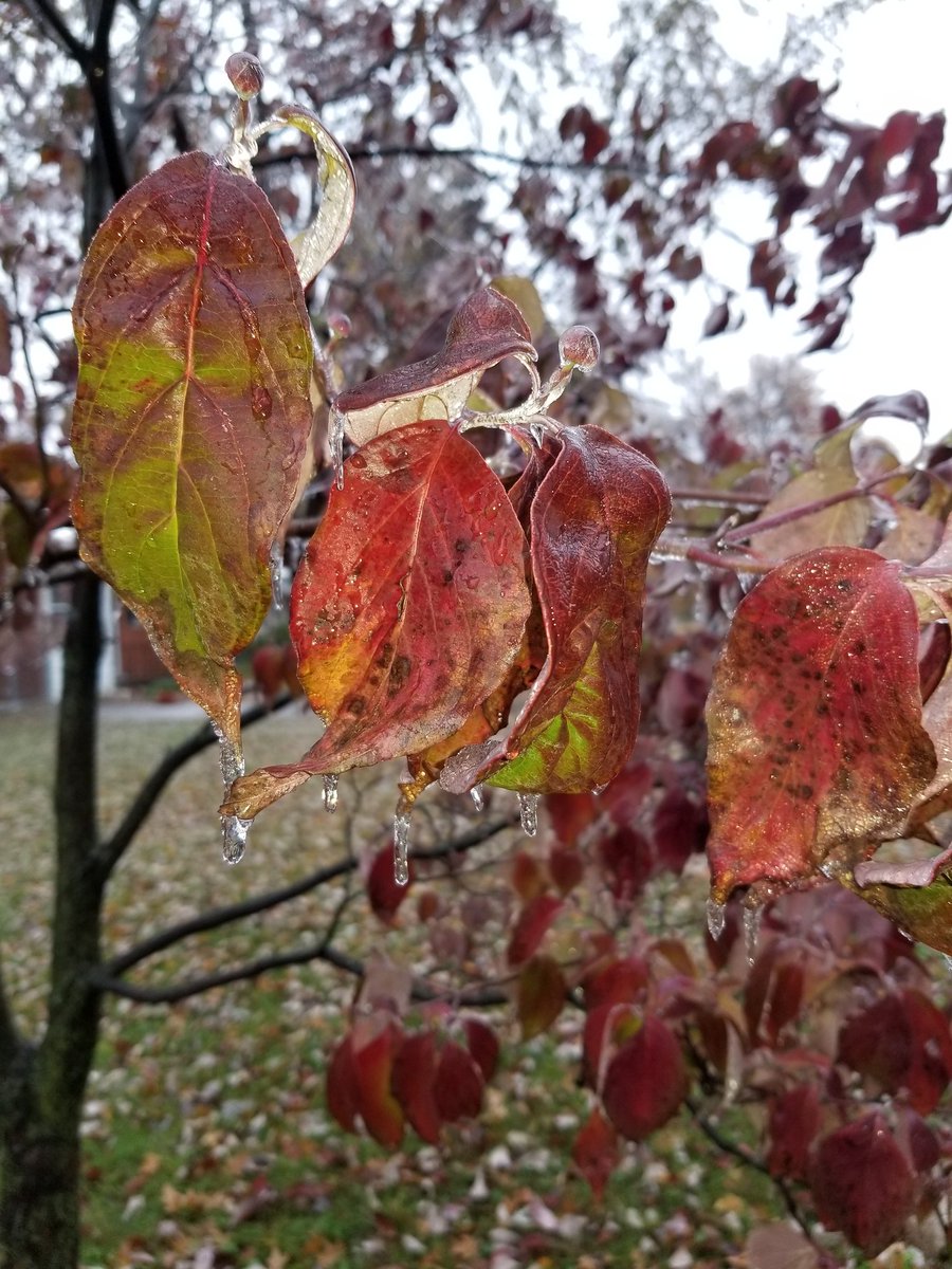
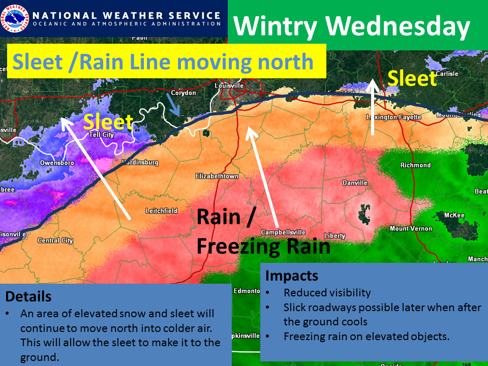
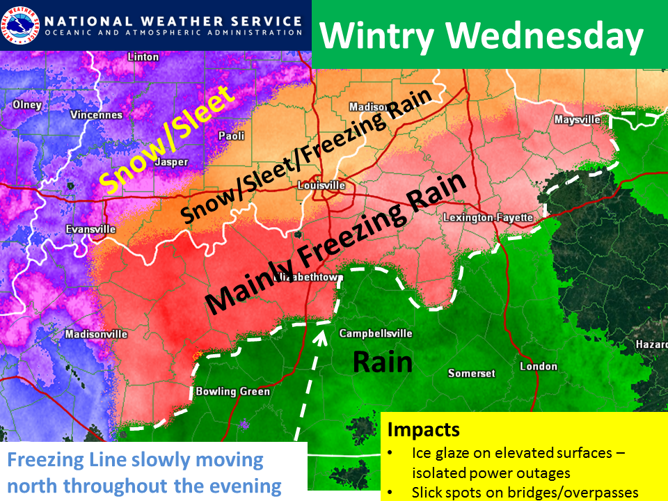
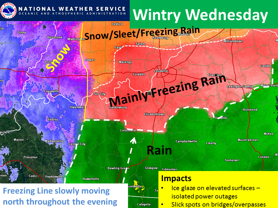
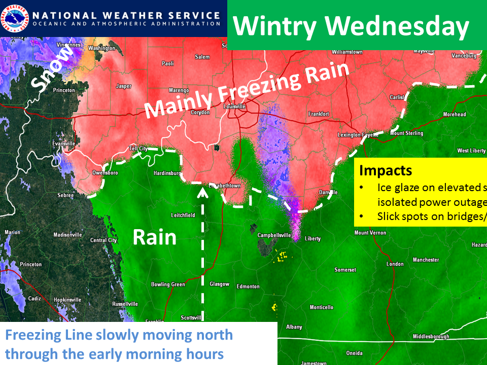
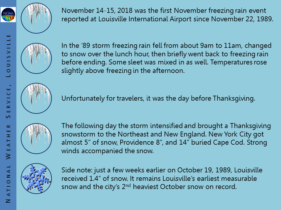
A cold airmass in place combined with an anomalous low pressure system to produce an early season freezing rain event across central Kentucky and southern Indiana. Many locations received between a tenth and a quarter of an inch of ice accumulating on trees/shrubs and other elevated surfaces. Warm ground temperatures kept most roads ice free, though some bridges had slick spots. The ice on the trees, many of which still had leaves that helped to weigh them down, caused several limbs/branches to snap and some trees to fall. There were many reports of power flashes overnight as branches hit transformers. At the peak of the event, over 100,000 customers were without power in the region.
|
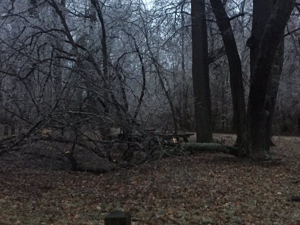
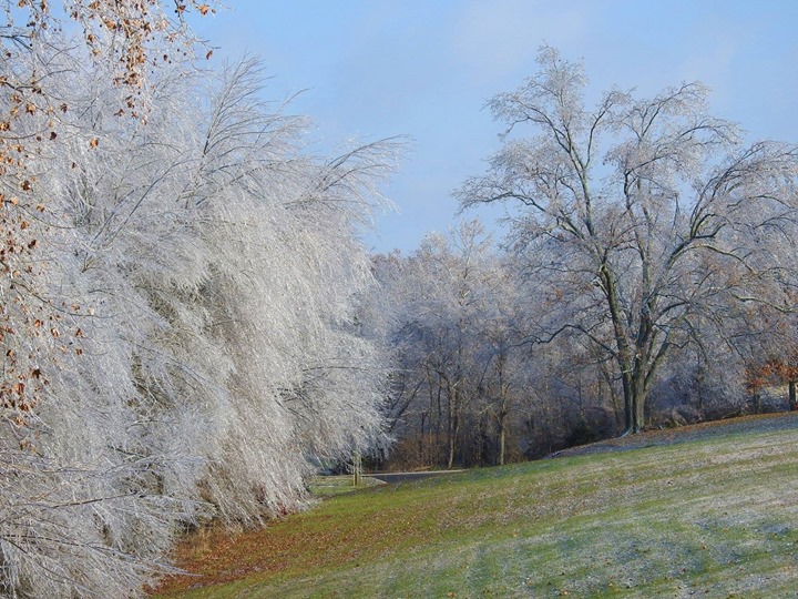
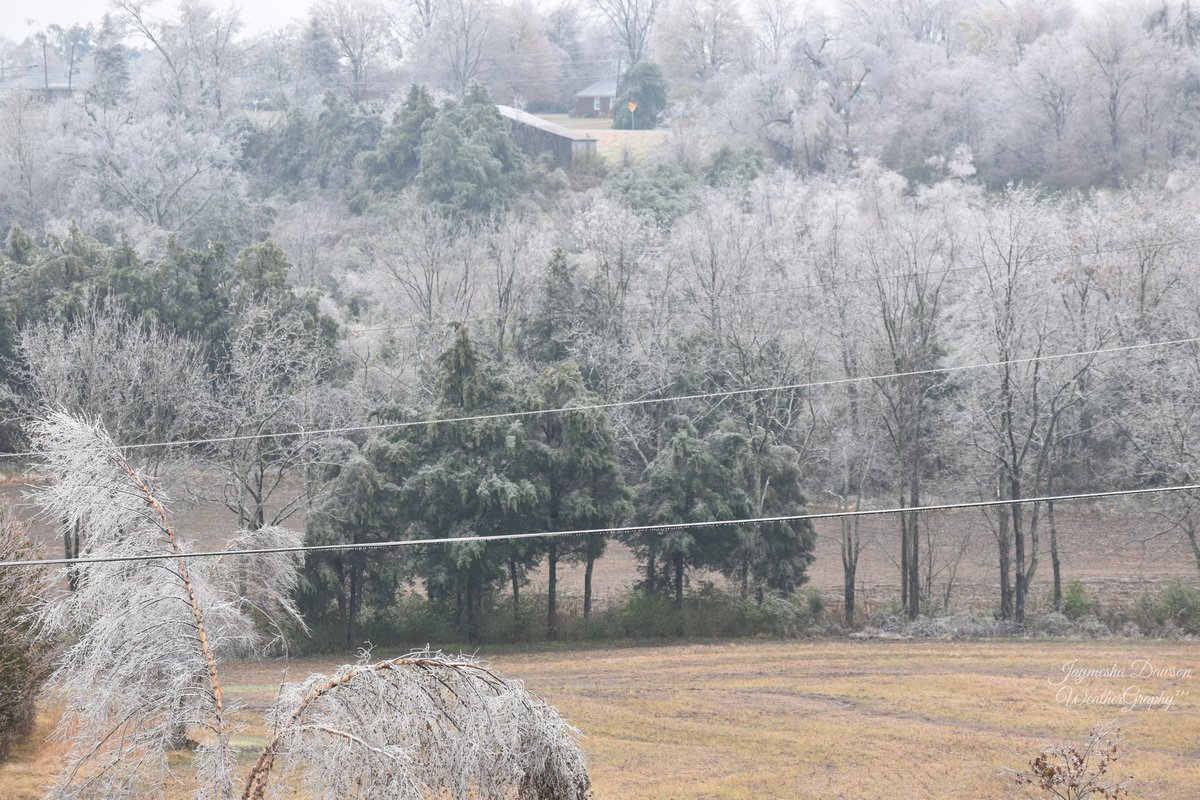 A white forest in Nelson County, KY (photo by Jaymesha Dawson) |
Snow/Ice
Storm Summary for Nov 14-15 Freezing Rain/Snow Event

...FREEZING RAIN REPORTS...

Location                     Amount    Time/Date       Lat/Lon

...Indiana...

...Crawford County...
1 S Pilot Knob               0.25 in   0752 AM 11/15   38.27N/86.35W
Pilot Knob                   0.20 in   1108 PM 11/14   38.29N/86.35W

...Orange County...
3 WNW Hardinsburg            0.20 in   0105 AM 11/15   38.48N/86.31W

...Kentucky...

...Butler County...
Morgantown                   0.25 in   1205 AM 11/15   37.22N/86.70W

...Grayson County...
Leitchfield                  0.25 in   0440 AM 11/15   37.48N/86.29W
Leitchfield                  0.16 in   1015 PM 11/14   37.48N/86.29W

...Hardin County...
2 S Vine Grove               0.25 in   0908 AM 11/15   37.79N/85.98W
Elizabethtown                0.20 in   1016 PM 11/14   37.70N/85.87W
Vine Grove                   0.06 in   1207 AM 11/15   37.81N/85.98W

...Hart County...
Munfordville                 0.25 in   0131 AM 11/15   37.28N/85.90W

...Henry County...
New Castle                   0.10 in   1120 PM 11/14   38.43N/85.17W

...Jefferson County...
1 SW Pewee Valley            0.20 in   0730 AM 11/15   38.30N/85.51W
2 SSW Highview               0.15 in   1225 AM 11/15   38.11N/85.65W
Anchorage                    0.06 in   1032 PM 11/14   38.27N/85.54W

...Ohio County...
3 NNE Beda                   0.20 in   1037 PM 11/14   37.54N/86.92W

...Scott County...
2 N Georgetown               0.10 in   0802 AM 11/15   38.23N/84.55W

...Spencer County...
1 WSW Elk Creek              0.20 in   0804 AM 11/15   38.09N/85.39W

...Taylor County...
4 ENE Hobson                 0.12 in   1126 PM 11/14   37.44N/85.30W
...SNOWFALL REPORTS...

Location                     Amount    Time/Date       Lat/Lon

...Indiana...

...Dubois County...
Jasper                       1.0 in    0402 PM 11/15   38.39N/86.94W

...Perry County...
Cannelton                    0.8 in    0344 PM 11/15   37.91N/86.74W

...Kentucky...

...Fayette County...
6 E Lexington                1.0 in    0732 PM 11/15   38.04N/84.39W
2 NNE Lexington              0.8 in    0926 PM 11/15   38.07N/84.49W
6 NNW Spears                 0.5 in    0928 PM 11/15   37.95N/84.49W
6 W Lexington                0.3 in    0728 PM 11/15   38.04N/84.60W

...Green County...
1 N Greensburg               0.3 in    0455 PM 11/15   37.26N/85.49W

...Jefferson County...
4 NW Okolona                 0.3 in    0733 PM 11/15   38.17N/85.74W
2 SSW Highview               0.2 in    0734 PM 11/15   38.11N/85.65W

...Jessamine County...
Wilmore                      0.8 in    0921 PM 11/15   37.87N/84.66W

...Madison County...
2 NW Berea                   0.8 in    0900 PM 11/15   37.60N/84.32W

...Warren County...
5 SE Plum Springs            0.2 in    0420 PM 11/15   36.97N/86.31W
Observations are collected from a variety of sources with varying
equipment and exposures. We thank all volunteer weather observers
for their dedication. Not all data listed are considered official.
Photos & Video:
Header
 |
 |
 |
 |
| NW Leitchfield, KY (Dustin Knight) |
NW Leitchfield, KY (Dustin Knight) |
Leavenworth, IN (Wade Bell) |
Leavenworth, IN (Wade Bell) |
 |
 |
 |
 |
| NE Louisville, KY (Tom Reaugh) |
NE Louisville, KY (Tom Reaugh) |
NE Louisville, KY (Tom Reaugh) |
Louisville, KY (Cooper Bennett) |
 |
 |
 |
 |
| Madison, IN (@1_Proud_Dad) |
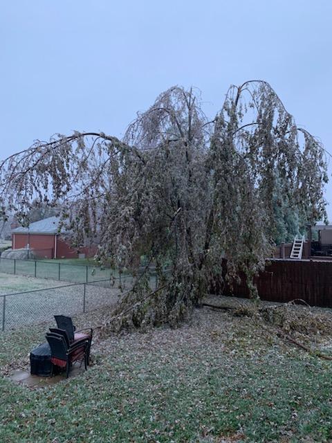
Meade County, KY (Aimee Haynes) |
Meade County, KY (Aimee Haynes) |
Louisville, KY (Alan Auglis) |
 |
 |
 |
 |
| Elizabethtown, KY (Chris Evans) |
Shelby County, KY (Cindi McIntosh) |
Casey County, KY (Jolene Blevins) |
South Louisville, KY (NWS LMK) |
 |
 |
 |
 |
| Norton Commons, Louisville, KY (Myles Oliverio) |
Clifty Falls State Park, IN (Robert Fisher) |
Breckenridge County, KY (Sarah Wallace) |
Mount Washington, KY (@Tornado_Wx15) |
 |
 |
 |
 |
| Clarksville, IN (@Whitney0520) |
Washington County, IN (Janet Paden) |
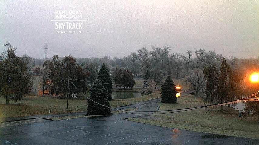
Starlight, IN (WAVE3) |
Jefferson/Shelby line, KY (Louisville Trimarc) |
Radar:
Header
 |
 |
 |
 |
| Radar at 5:30 PM 11/14 | Radar at 9:15 PM 11/14 | Radar at 11:10 PM 11/14 | Radar at 1:15 AM 11/15 |
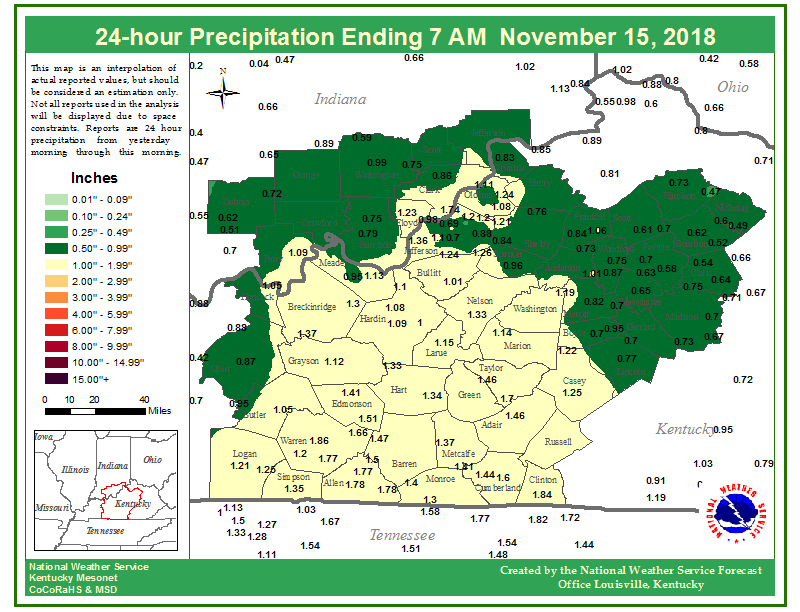
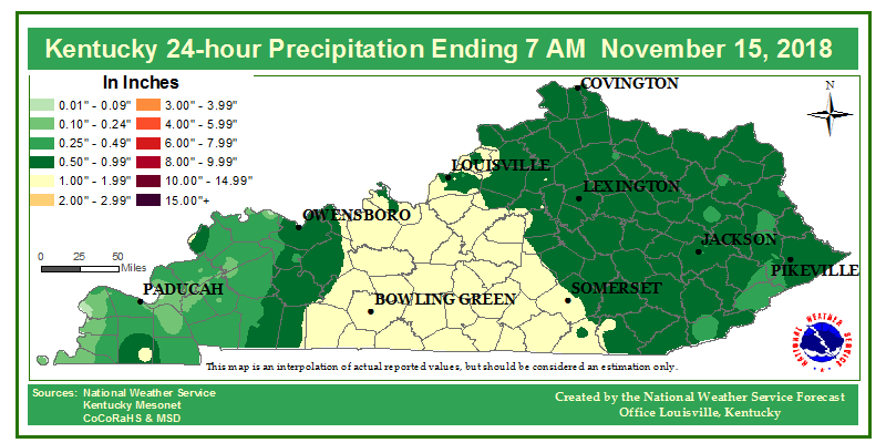
Rain Reports
 |
 |
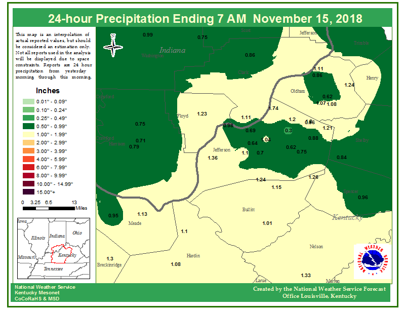 |
| 24-hour rainfall total ending at 7 AM 11/15 | 24-hour rainfall total ending at 7 AM 11/15 | 24-hour rainfall total ending at 7 AM 11/15 |
 |
Media use of NWS Web News Stories is encouraged! Please acknowledge the NWS as the source of any news information accessed from this site. |
|


 Weather Story
 Weather Map
 Local Radar