Louisville, KY
Weather Forecast Office
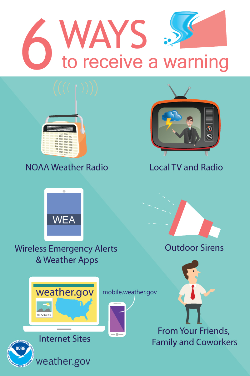
With severe storms possible starting this afternoon and into tonight, we encourage you to be Weather Ready and have multiple ways to receive warnings! Make a plan this morning and know where to seek shelter if a Severe Thunderstorm Warning or Tornado Warning is issued for your home, apartment, or workplace later today! Taking action early can help save lives!
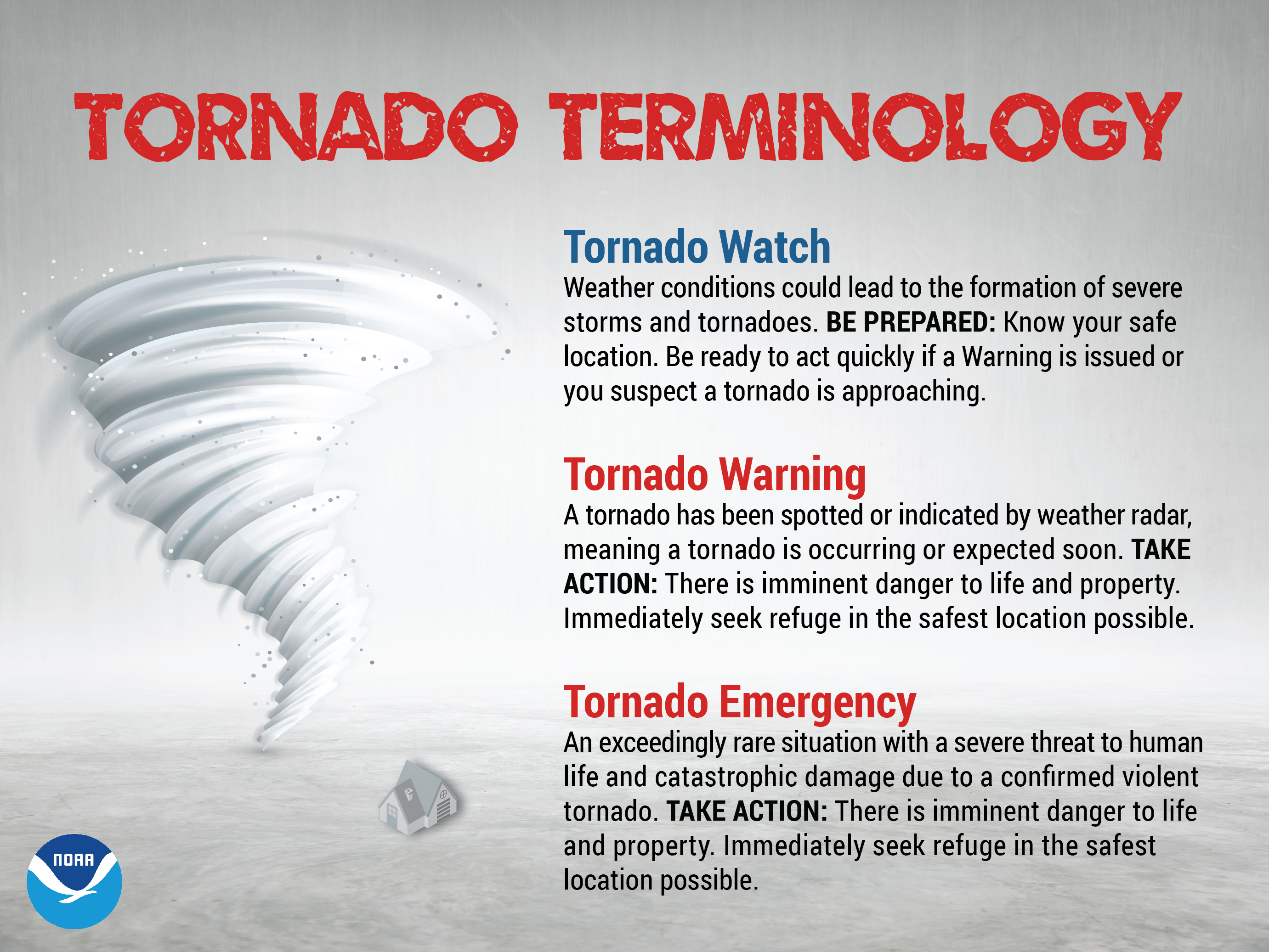
A tornado WATCH means BE PREPARED. A tornado WARNING means TAKE ACTION. If there is a tornado watch, pay extra close attention to the weather and be ready to act, because tornadoes are possible. If there is a tornado warning, find shelter immediately, and move to an interior room on the lowest floor of a sturdy building. Avoid windows and cover your head to protect yourself from flying debris.
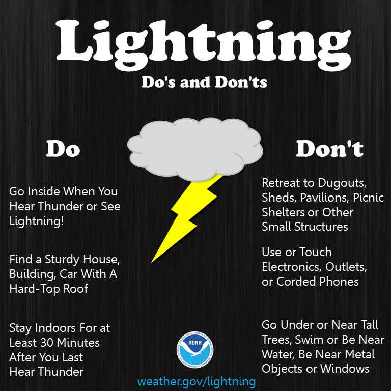
Learn what to do, and what not to do, when it comes to lightning.
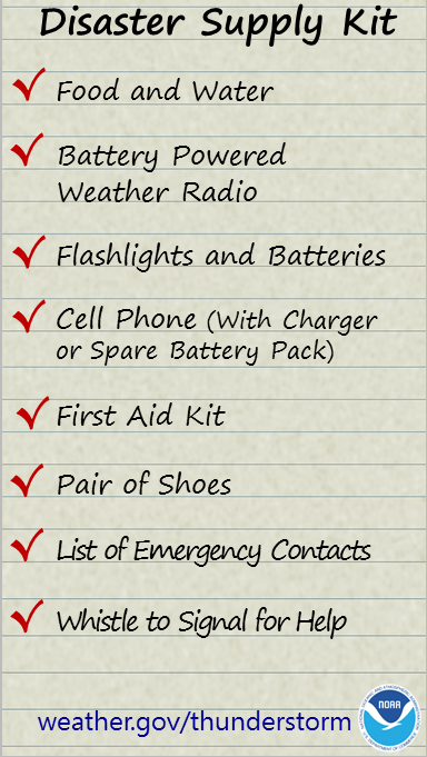
It is extremely important to have a disaster supply kit ready before severe weather strikes!
Current Hazards
Hazardous Weather Outlook
Storm Prediction Center
Submit a Storm Report
Advisory/Warning Criteria
Radar
Fort Knox
Evansville
Fort Campbell
Nashville
Jackson
Wilmington
Latest Forecasts
El Nino and La Nina
Climate Prediction
Central U.S. Weather Stories
1-Stop Winter Forecast
Aviation
IDSS Forecast Points
Air Quality
Fire Weather
Recreation Forecasts
1-Stop Drought
Event Ready
1-Stop Severe Forecast
Past Weather
Climate Graphs
1-Stop Climate
CoCoRaHS
Local Climate Pages
Tornado History
Past Derby/Oaks/Thunder Weather
Football Weather
Local Information
About the NWS
Forecast Discussion
Items of Interest
Spotter Training
Regional Weather Map
Decision Support Page
Text Products
Science and Technology
Outreach
LMK Warning Area
About Our Office
Station History
Hazardous Weather Outlook
Local Climate Page
Tornado Machine Plans
Weather Enterprise Resources
US Dept of Commerce
National Oceanic and Atmospheric Administration
National Weather Service
Louisville, KY
6201 Theiler Lane
Louisville, KY 40229-1476
502-969-8842
Comments? Questions? Please Contact Us.


 Weather Story
 Weather Map
 Local Radar