
Isaias is expected to approach the northern Gulf Coast as a strong hurricane on Friday, bringing life-threatening storm surge, damaging winds, heavy rain, and severe thunderstorms across the region and Southeast into the weekend, with risks of flooding and tornadoes. Read More >
Louisville, KY
Weather Forecast Office
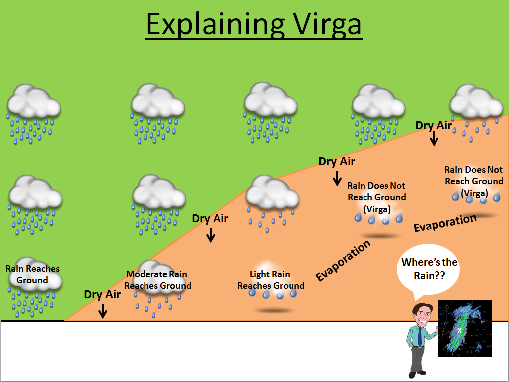
Have you ever seen a radar image that suggested it should be raining or snowing at your location, but it wasn't? The radar isn't lying, rather, the the rain or snow is not hitting the ground. If you have a dry air mass in place in the low levels, sometimes rain cannot completely penetrate that dry layer before it evaporates. Rain that doesn't make it to the ground is called virga..PNG)
Below is a graphic showing a cross section of a saturated environment with rain intersecting a dry air mass. The deeper into the dry air mass you go, the less chance the rain has of reaching the ground. The radar will still detect the rain aloft, but you may not see it at the surface. This scenario is one reason why it is hard to break drought conditions once they set in. Rain that you do get is reduced because of the dry air in place.
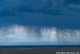
Below is an image of what virga looks like as it is falling out of clouds.
Current Hazards
Hazardous Weather Outlook
Storm Prediction Center
Submit a Storm Report
Advisory/Warning Criteria
Radar
Fort Knox
Evansville
Fort Campbell
Nashville
Jackson
Wilmington
Latest Forecasts
El Nino and La Nina
Climate Prediction
Central U.S. Weather Stories
1-Stop Winter Forecast
Aviation
IDSS Forecast Points
Air Quality
Fire Weather
Recreation Forecasts
1-Stop Drought
Event Ready
1-Stop Severe Forecast
Past Weather
Climate Graphs
1-Stop Climate
CoCoRaHS
Local Climate Pages
Tornado History
Past Derby/Oaks/Thunder Weather
Football Weather
Local Information
About the NWS
Forecast Discussion
Items of Interest
Spotter Training
Regional Weather Map
Decision Support Page
Text Products
Science and Technology
Outreach
LMK Warning Area
About Our Office
Station History
Hazardous Weather Outlook
Local Climate Page
Tornado Machine Plans
Weather Enterprise Resources

US Dept of Commerce
National Oceanic and Atmospheric Administration
National Weather Service
Louisville, KY
6201 Theiler Lane
Louisville, KY 40229-1476
502-969-8842
Comments? Questions? Please Contact Us.


 Weather Story
 Weather Map
 Local Radar
 Follow us on X
 Follow us on Facebook
 Follow us on YouTube
 LMK RSS Feed