
Life-threatening and locally catastrophic flash and urban flooding is expected across portions of south-central Texas through early Friday, with significant river flooding and rapid rises on small streams, arroyos, and typically dry washes expected. A significant heat wave continues for the Rockies, Northern Plains, and Great Lakes into the Mid-Atlantic, peaking in intensity through midweek. Read More >
Overview
|
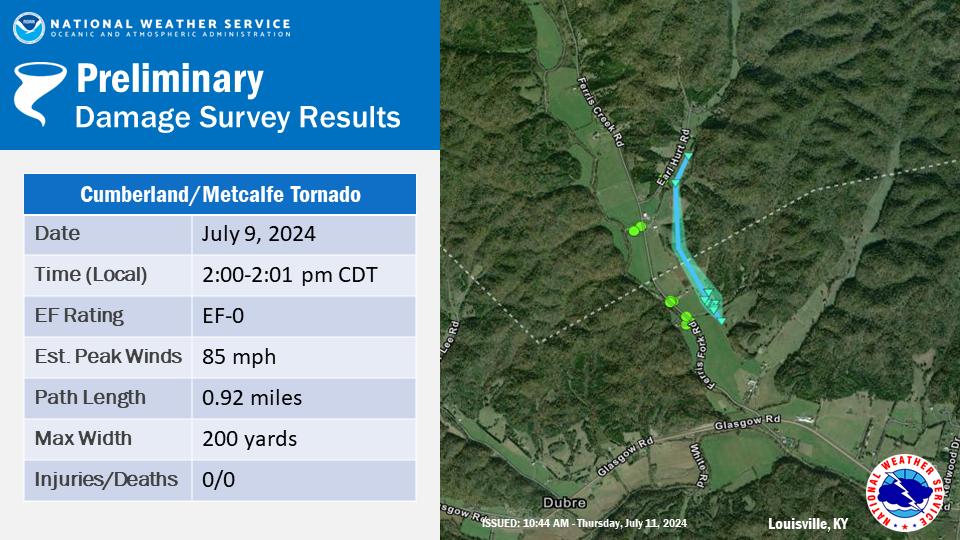
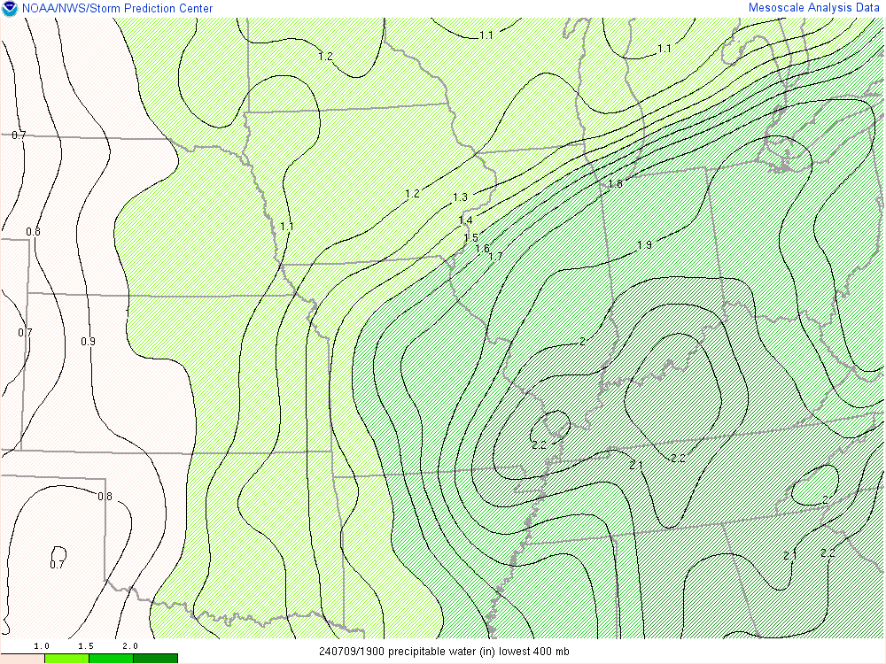
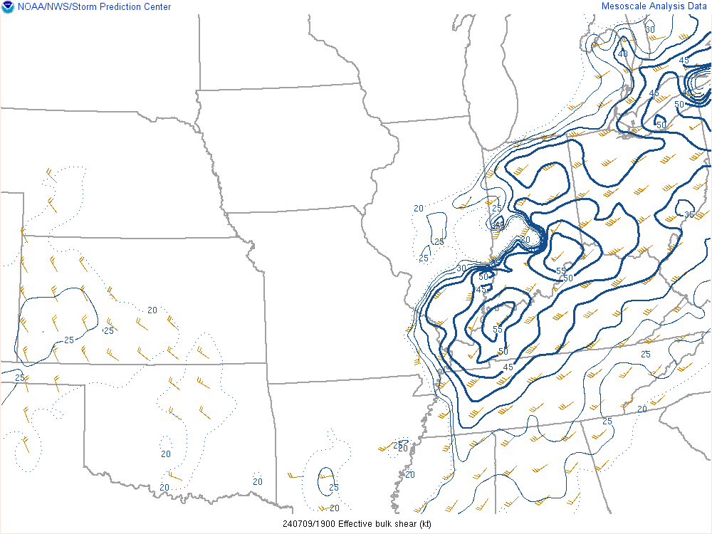
The remnants of Hurricane Beryl brought scattered thunderstorms to southern Indiana and central Kentucky on July 9, 2024. Many of the storms had rotation and produced striking wall clouds. One storm along the Cumberland/Metcalfe county line managed to spin up a very brief, weak tornado. |
 |
Tornadoes:
|
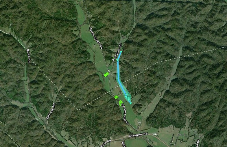
Tornado - 1 mile NNE Dubre
|
||||||||||||||||
The Enhanced Fujita (EF) Scale classifies tornadoes into the following categories:
| EF0 Weak 65-85 mph |
EF1 Moderate 86-110 mph |
EF2 Significant 111-135 mph |
EF3 Severe 136-165 mph |
EF4 Extreme 166-200 mph |
EF5 Catastrophic 200+ mph |
 |
|||||
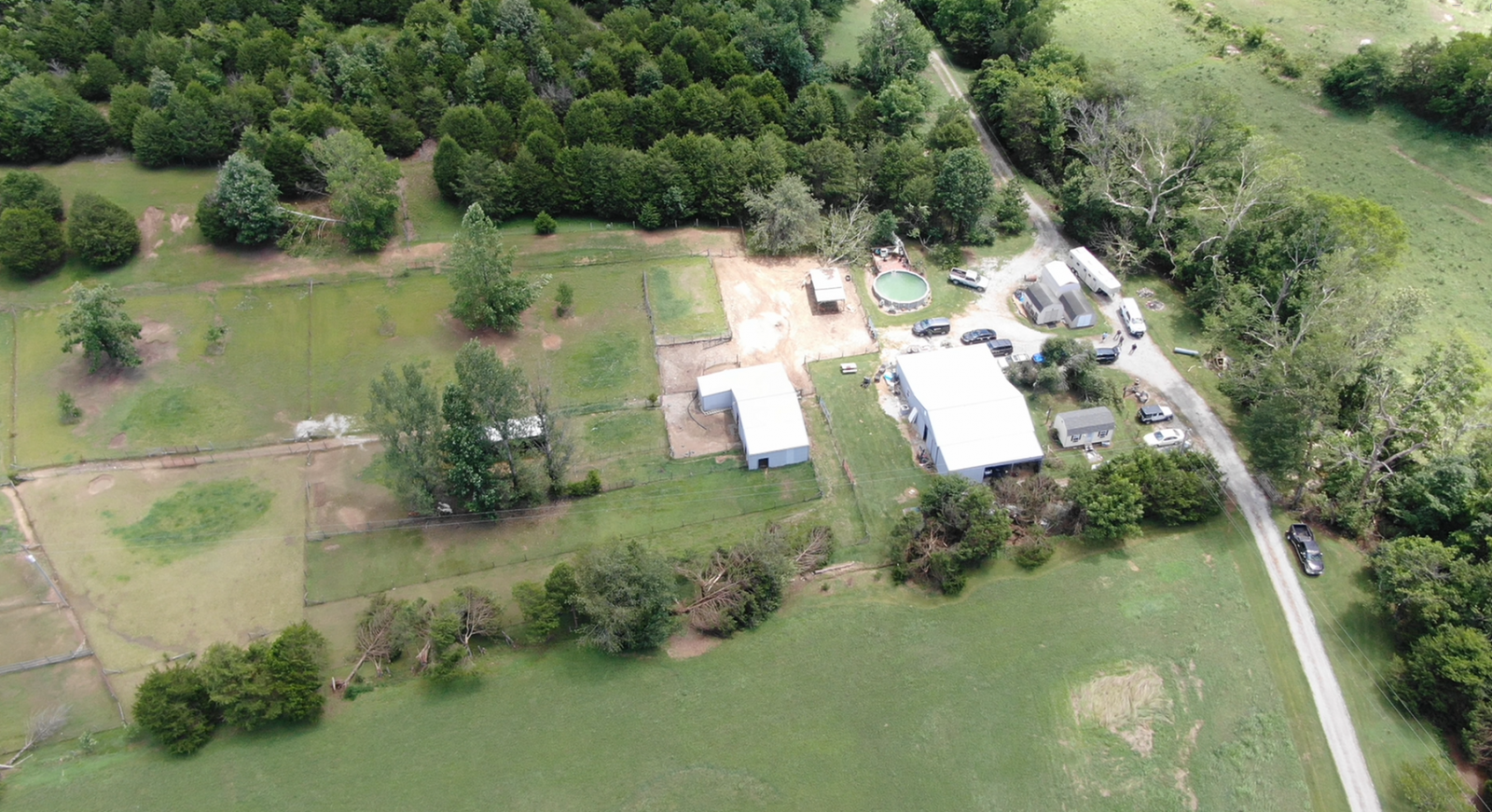
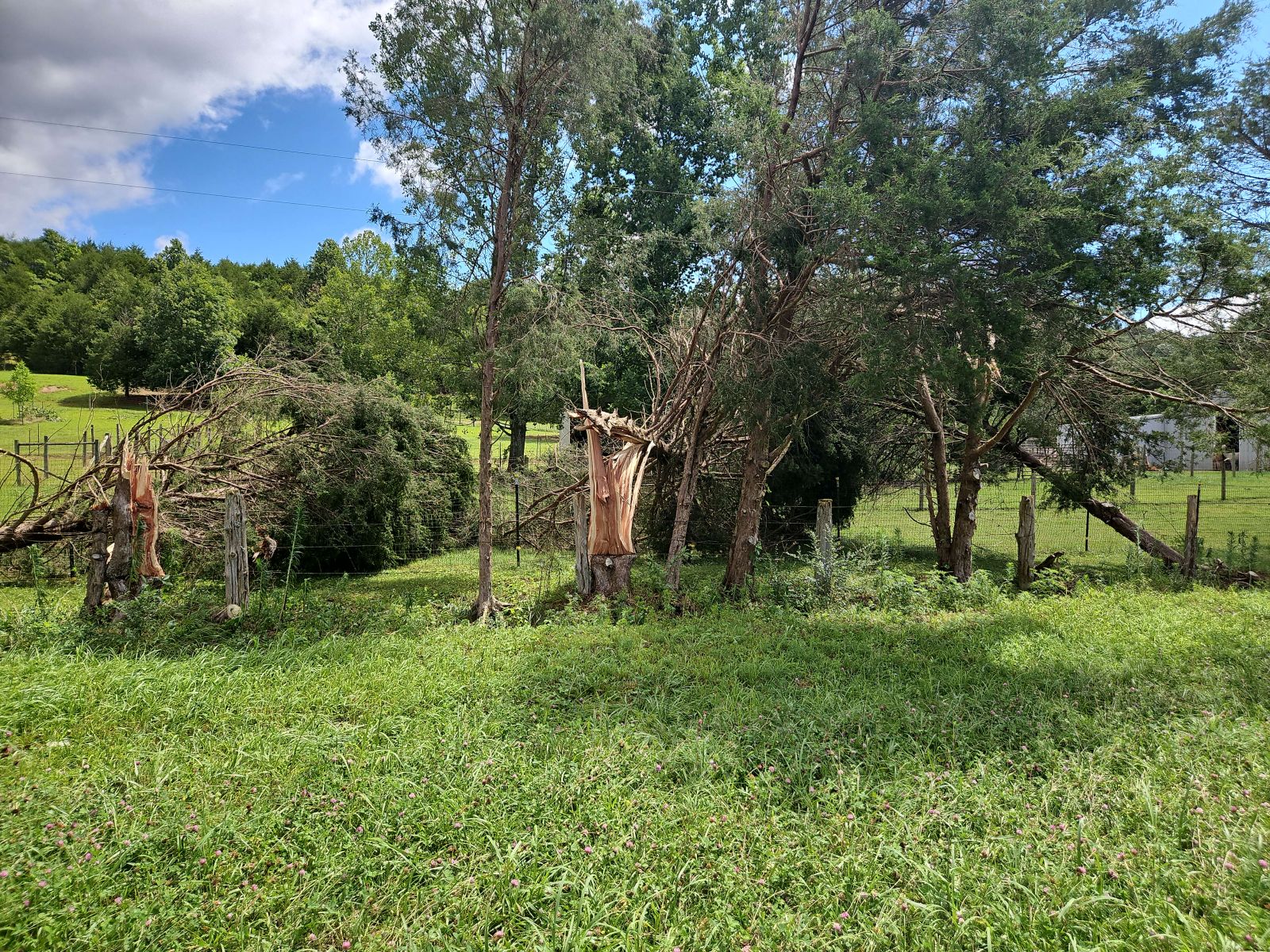
Photos & Video
 |
 |
 |
 |
| Drone image of tree damage | Tree damage | Siding damage | Tree damage |
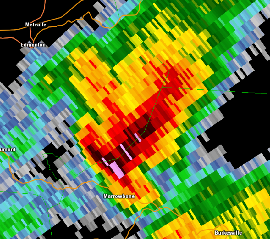
Radar
 |
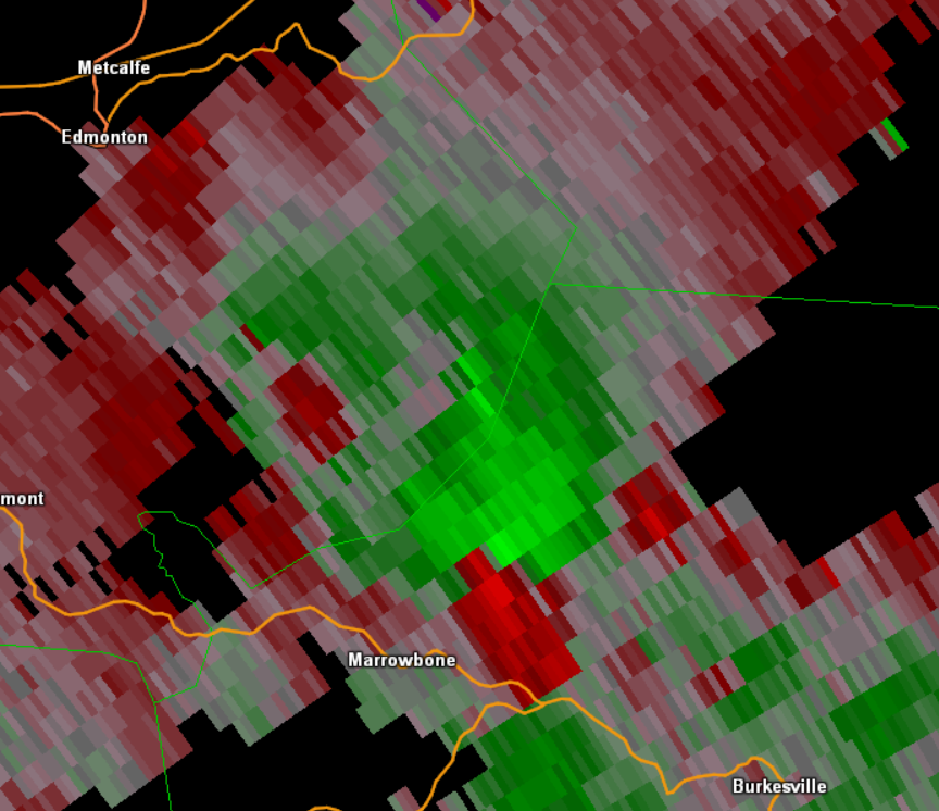 |
| Reflectivity | Storm Relative Motion |
Environment
 |
 |
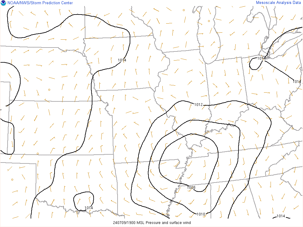 |
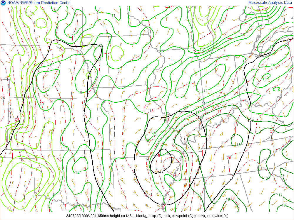
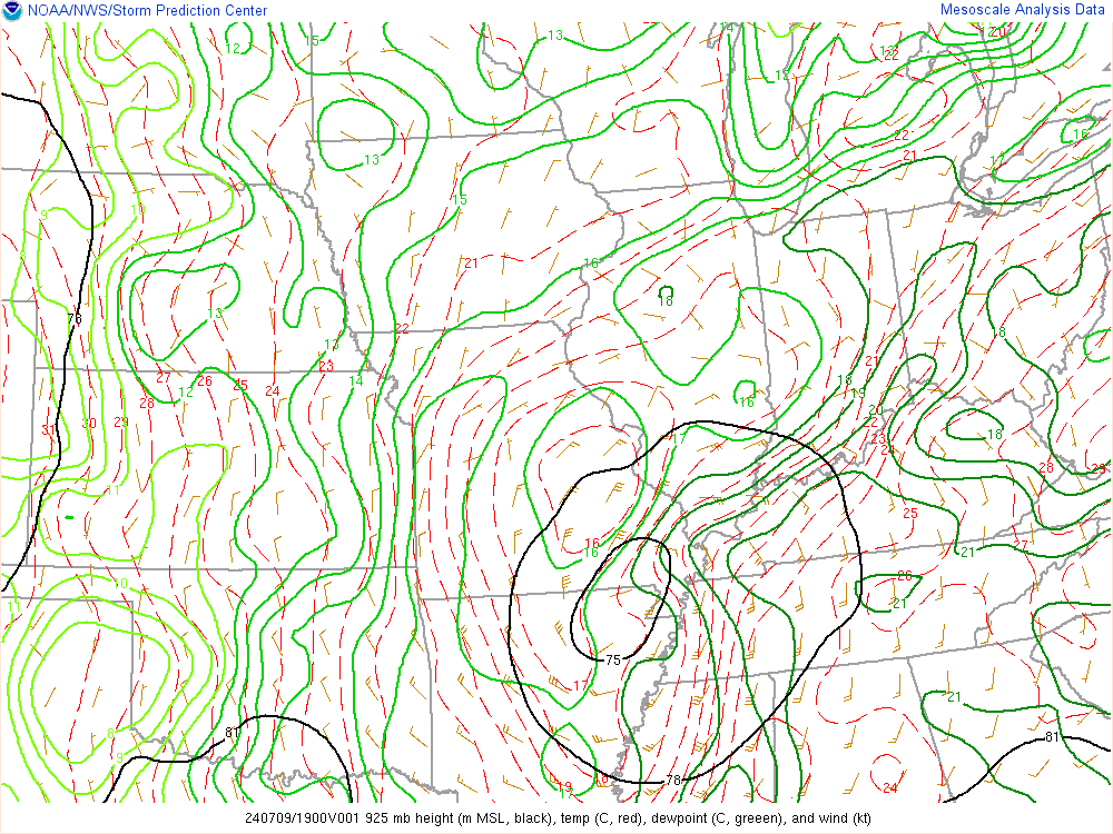
| Figure 1: 850mb | Figure 2: 925mb | Figure 3: MSLP |
 |
 |
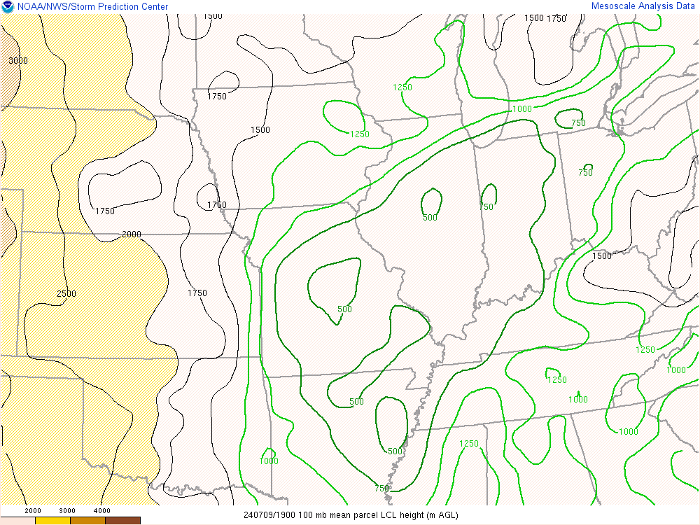 |
| Figure 4: PWAT | Figure 5: Moisture Transport | Figure 6: LCL |
 |
 |
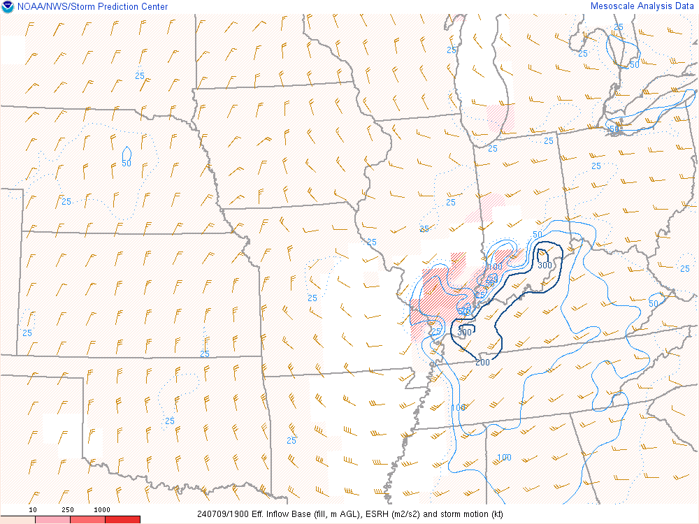 |
| Figure 7: SBCAPE | Figure 8: Effective Shear | Figure 9: Effective Helicity |
 |
Media use of NWS Web News Stories is encouraged! Please acknowledge the NWS as the source of any news information accessed from this site. |
|


 Weather Story
 Weather Map
 Local Radar