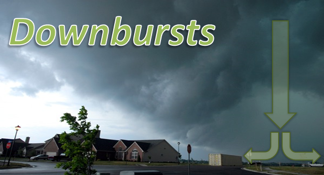
Madison County, KY. June 5, 2007. T. G. Shuck/WKYT
Downbursts are powerful winds that descend from a thunderstorm and spread out quickly once they hit the ground. These winds can easily cause damage similar to that of a EF0 (65-85mph winds) or even EF1 (86-110mph winds) tornado, and are sometimes misinterpreted as tornadoes. However, downbursts are a completely separate phenomenon, and are a common area of study by meteorologists. Fortunately, our understanding of both the formation and detection of downbursts has increased dramatically since intense study of them began in the early 1980s.
| In the initial stages of a growing thunderstorm, a powerful updraft dominates. The cloud grows vertically, and raindrops and hailstones start to form. | 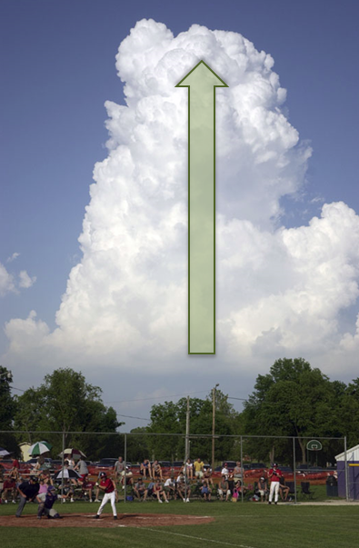
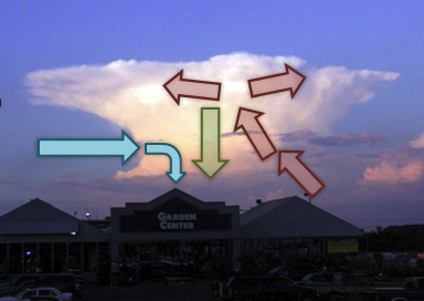
Lanesville, IN. May 29, 2006. Alan Stewart
|
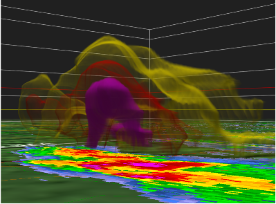
| As the storm matures, the updraft (red arrows in the image on the right) continues to feed the cloud with moist, unstable air. Raindrops and hailstones become large enough to fall to the ground (green arrow). Sometimes the updraft coming into the storm is so strong, it suspends a large amount of rain and hail in the middle and upper parts of the storm. Meanwhile, strong flow can develop on the backside of the storm and introduce drier air into the middle and lower parts of the storm (blue arrows). |
|
|
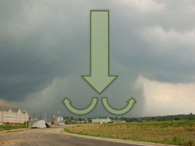
In the production of the downburst, that large core of rain and hail that the updraft had been holding in the upper parts of the storm falls rapidly towards the ground. It falls very quickly and drags a lot of air along with it, gaining speed as it plummets earthward. If the air beneath the base of the storm has low relative humidity, the downdraft's speed will increase further as some of the rain entering the dry air evaporates and cools the air, making the air "heavier." Then, if there is also a current of dry air coming into the storm aloft, cooling by evaporation can increase further and the downdraft becomes even stronger. When the downdraft hits the ground, much like a stream of water coming out of a faucet and hitting the sink, it spreads out rapidly in all directions and becomes known as a downburst. Downburst wind speeds have been known to exceed 100 mph -- as strong as a tornado! Also, from a distance downbursts can sometimes look similar to tornadoes, as seen in the image on the left below. The type of downburst we hear about most often is a "microburst," which means the damaging winds are confined to an area less than two and a half miles across. Otherwise, it's a "macroburst." |
|
|
|
|
On radar, to warn for this type of storm, meteorologists typically look for converging air streams in the middle section of the storm and a large core of precipitation being held aloft by a strong updraft. If it is felt that a storm will produce a damaging downburst, a Severe Thunderstorm Warning is issued. Normally a Tornado Warning is not issued, since a downburst is not a tornado. As a result, it is very important to take Severe Thunderstorm Warnings just as seriously as Tornado Warnings!


 Weather Story
 Weather Map
 Local Radar