February 5-6, 2008 Tornado Outbreak Radar Imagery
Click on any still radar image below for a larger image.
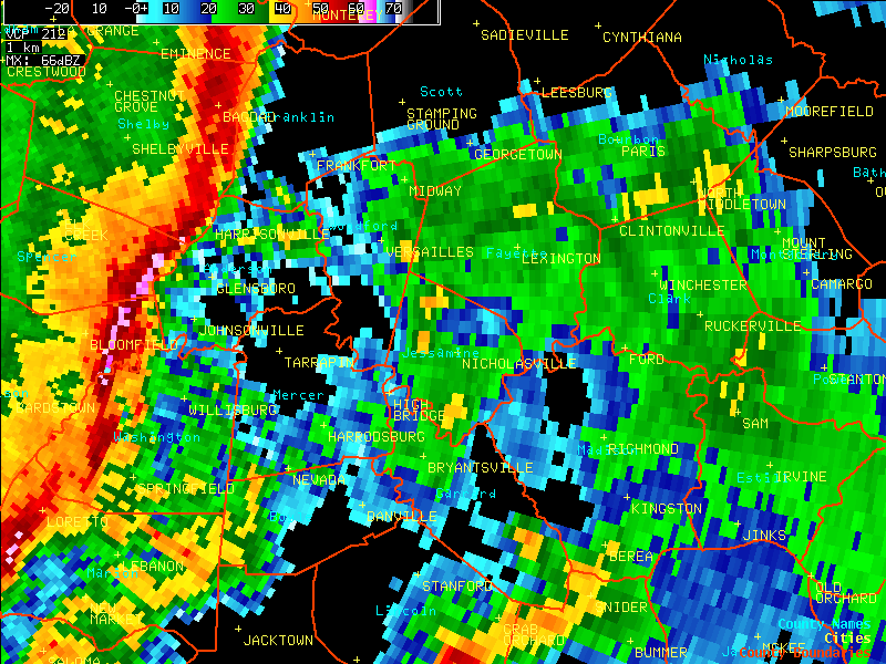
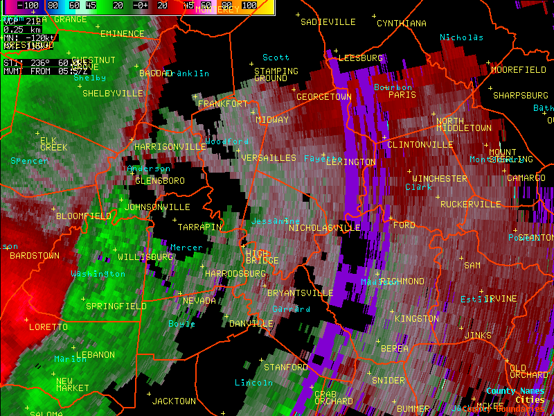
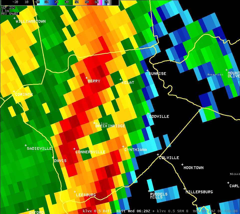
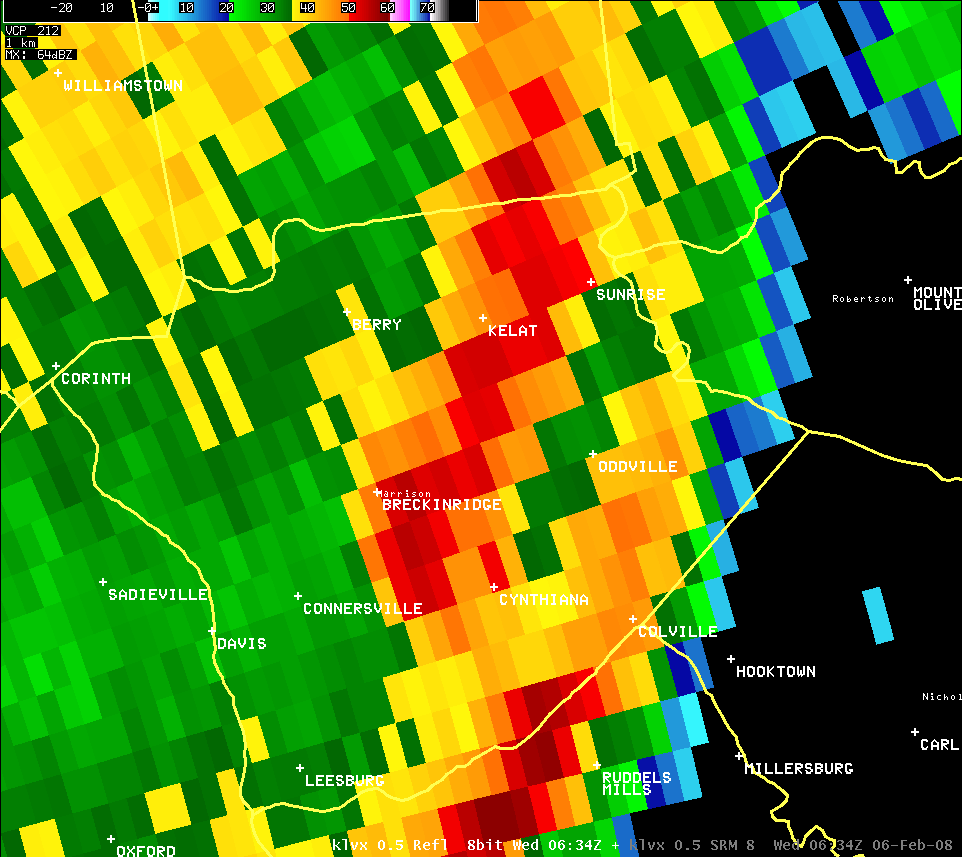
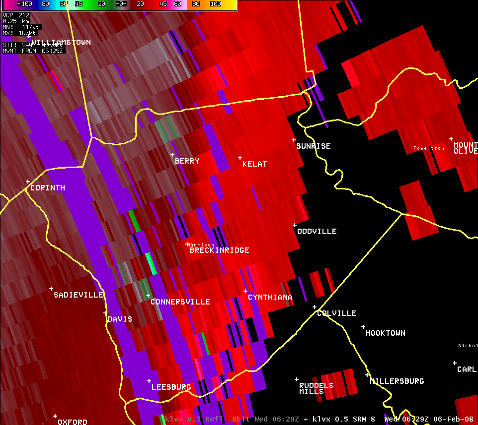
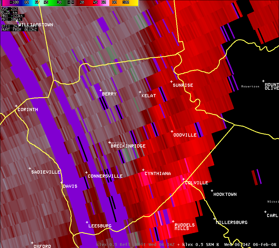
East-Central Kentucky (Reflectivity and Velocity):
| KLVX radar data showed an intense squall line, with numerous embedded bowing segments and line breaks, raced east across east-central Kentucky. Velocity data indicated a number of mesovortices (small cyclonic circulations) along the line's leading edge, which produced swaths of enhanced straight-line wind damage and several short-lived tornadoes. |
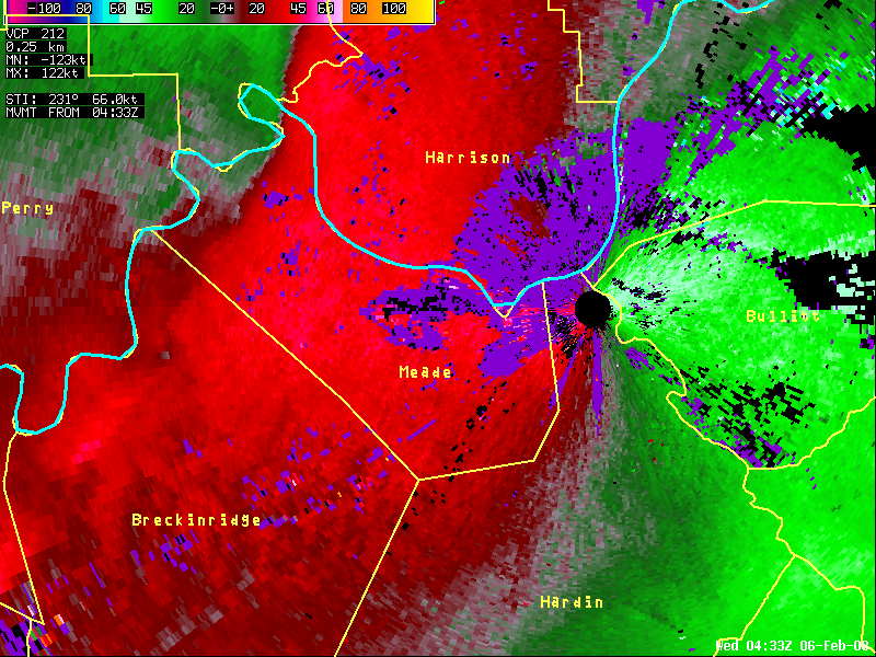
Meade County (Reflectivity and Velocity):
| KLVX reflectivity and storm-relative velocity loops of the EF1 tornado in Meade County. A bowing segment developed quickly in reflectivity, while velocity showed a mesovortex strengthen rapidly in Meade leading to the tornado, then weakened just as quickly in southern Harrison County. The reflectivity and velocity loops are not linked. |
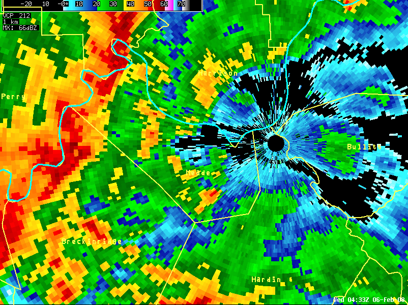
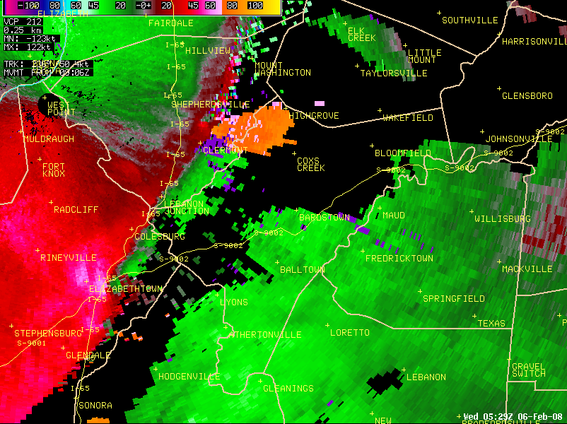
Hardin County (Reflectivity and Velocity):
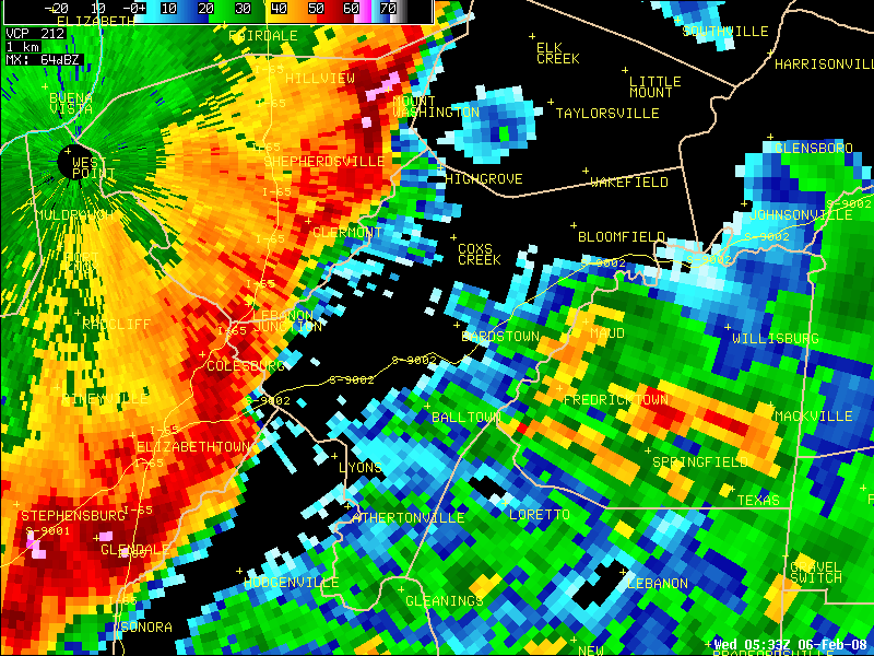
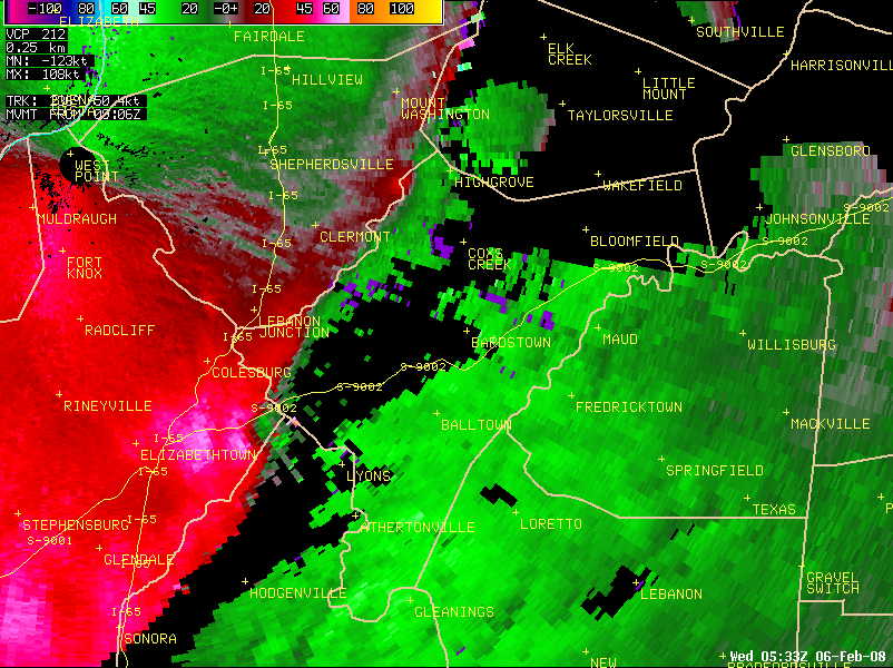
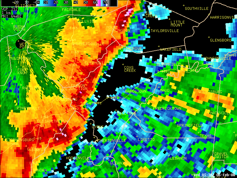
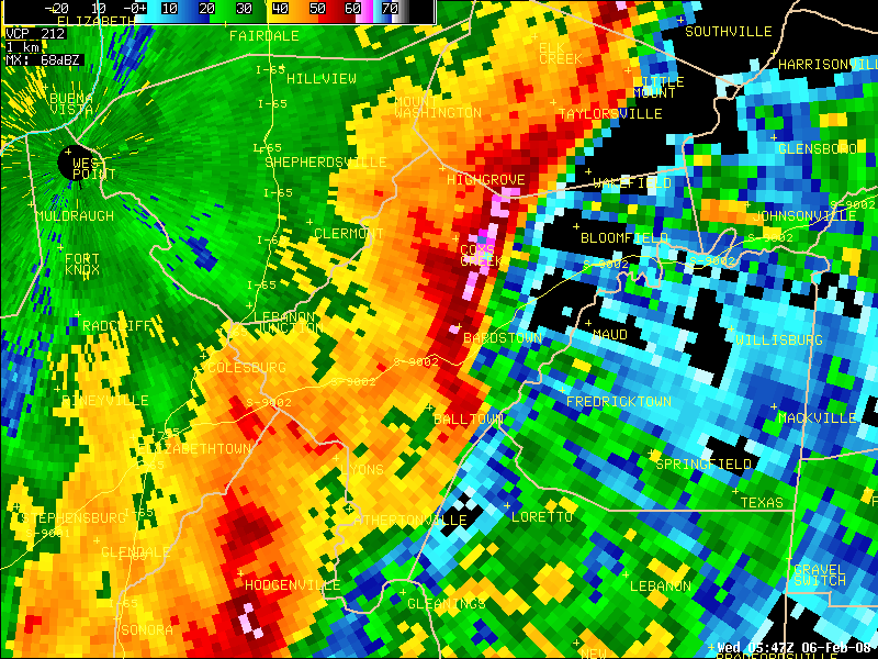
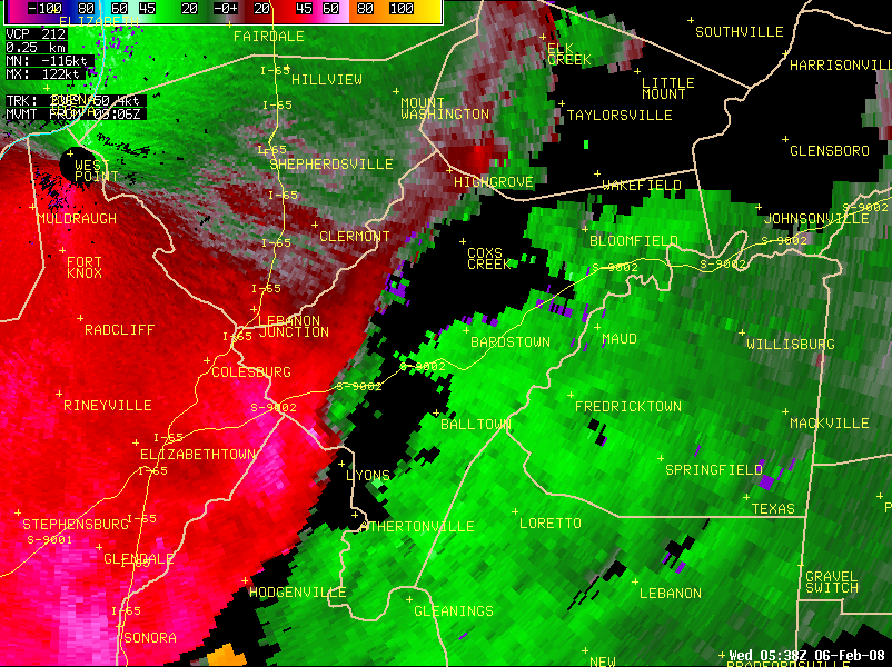
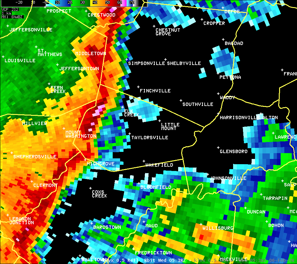
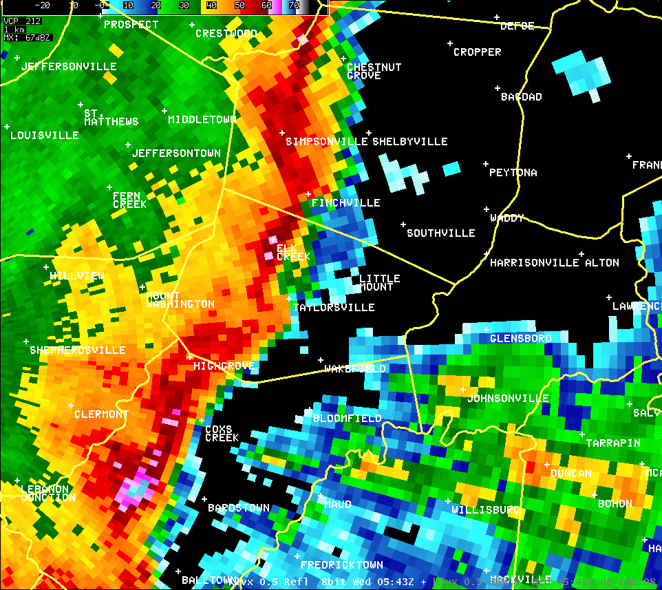
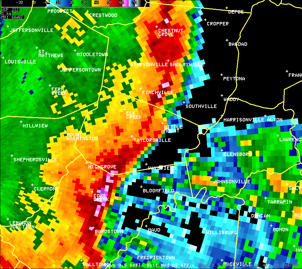
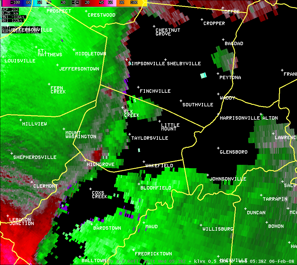
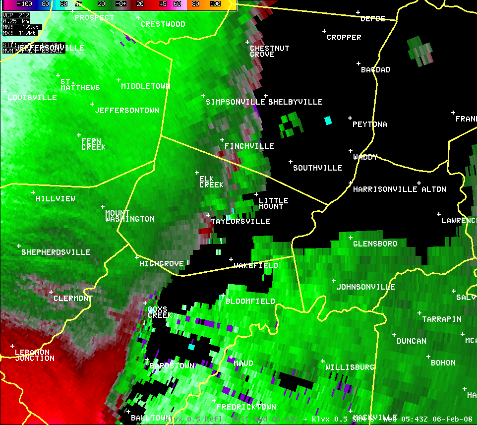
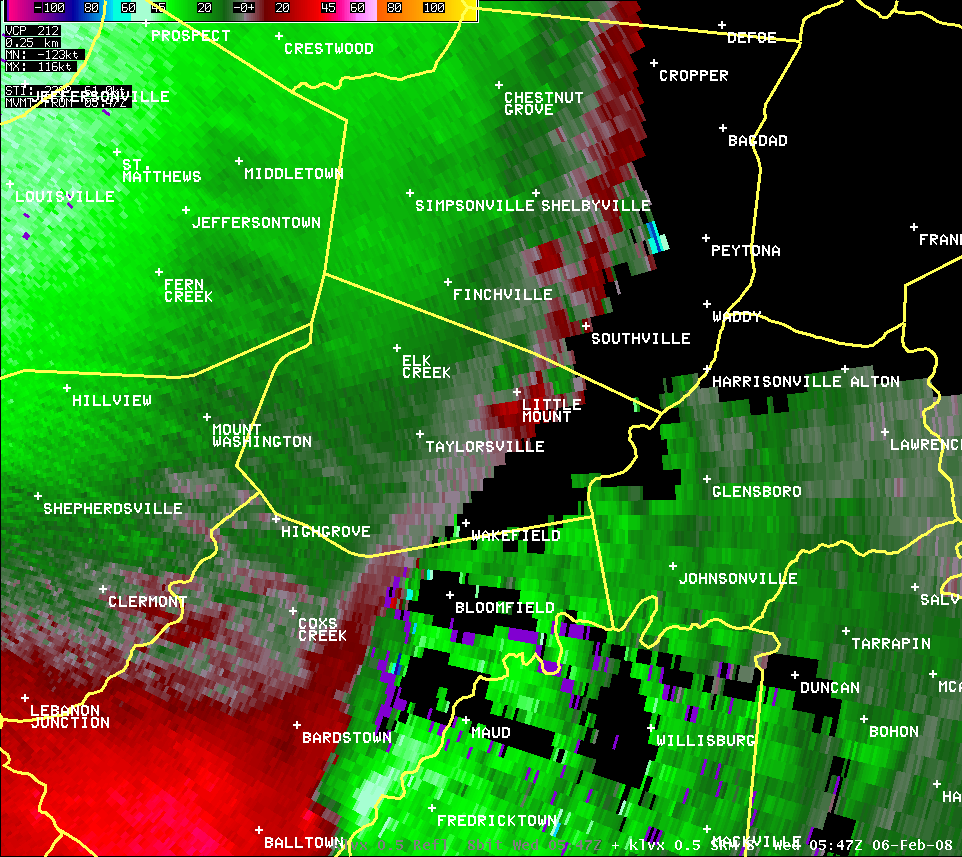
Nelson County (Reflectivity and Velocity):
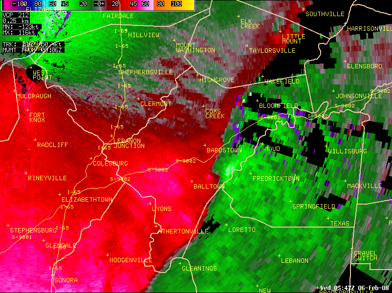
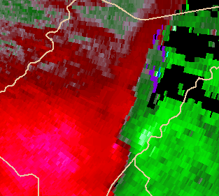
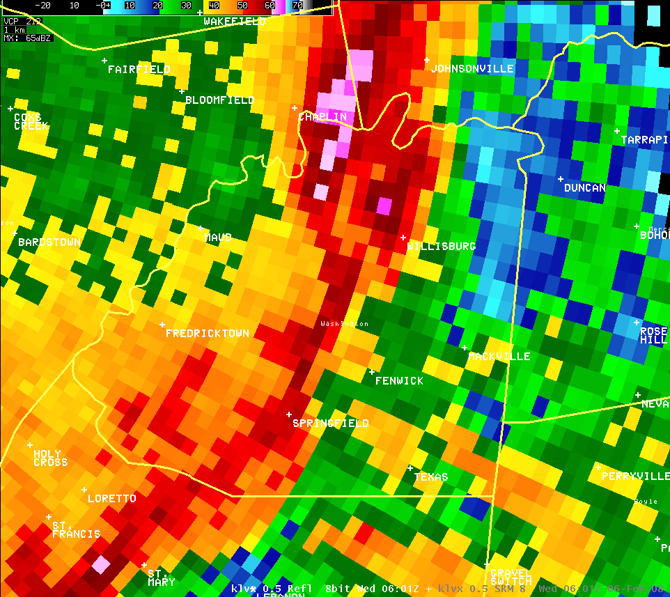
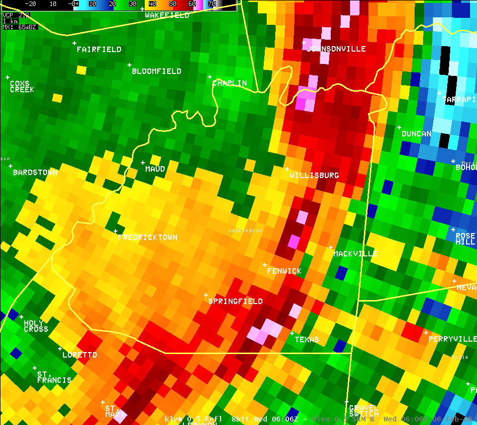
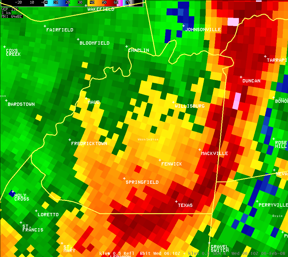
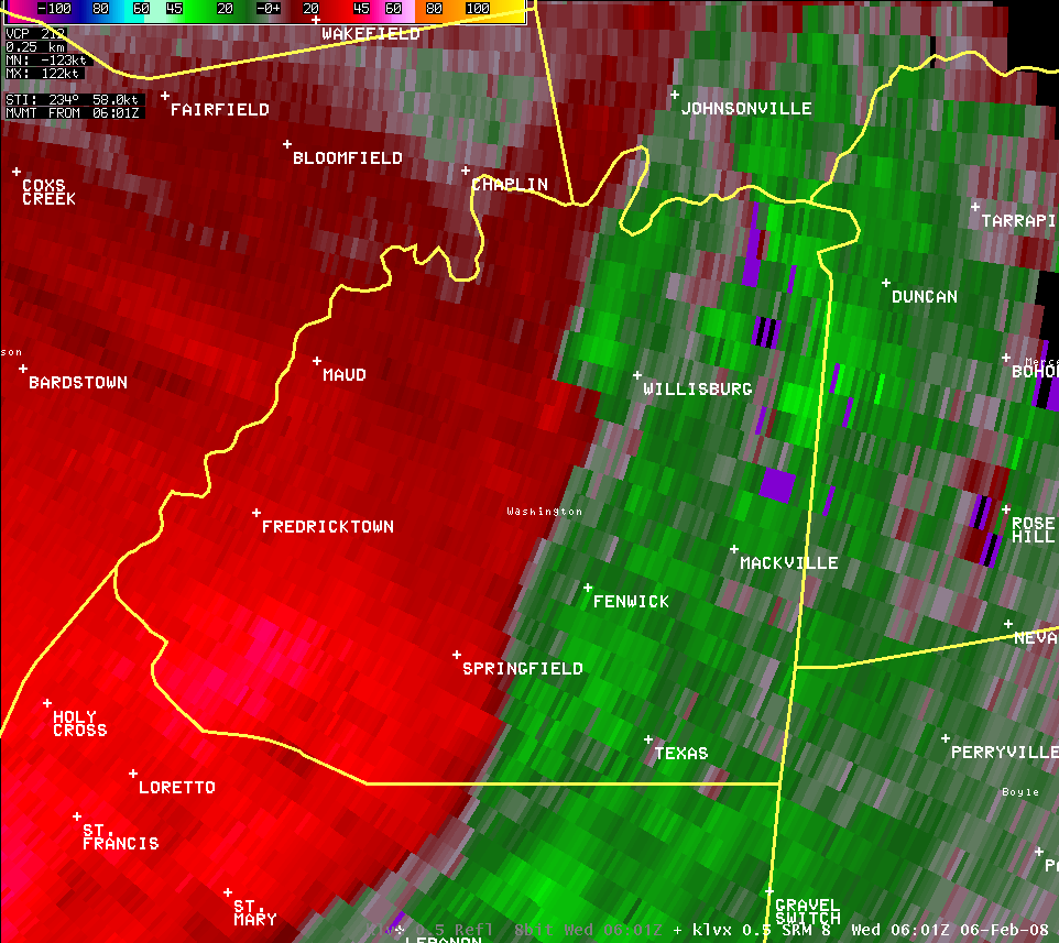
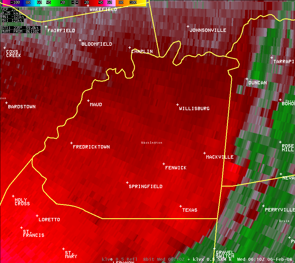
| KLVX radar loops showed a high- precipitation (HP) supercell storm structure embedded within a squall line of storms over Nelson County in central Kentucky. Note the bowing part of the HP storm with hail to its north. Velocity data showed a long-lasting mesovortex/ mesocyclone, which produced a swath of enhanced wind damage and intermittent EF0-EF1 tornadoes over central Nelson. The system produced more damage across neighboring Washington County. |
Washington County (Reflectivity and Velocity):
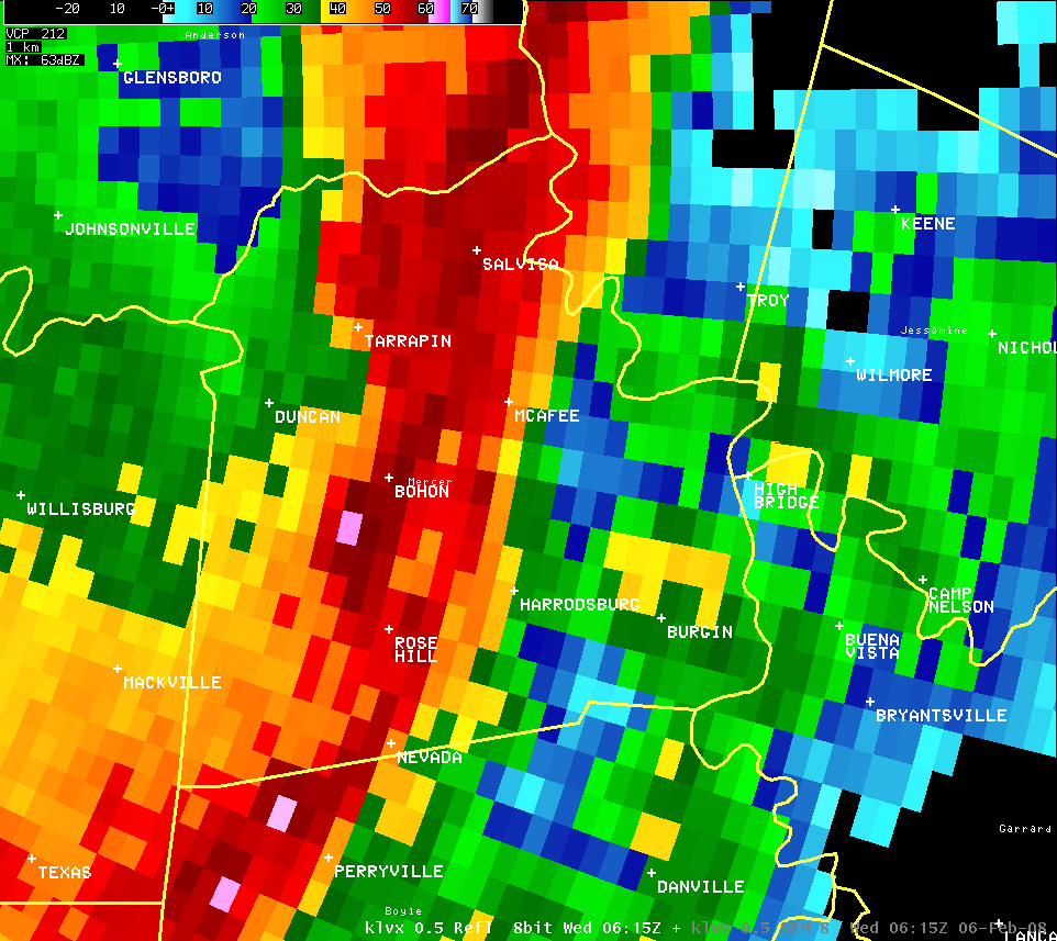
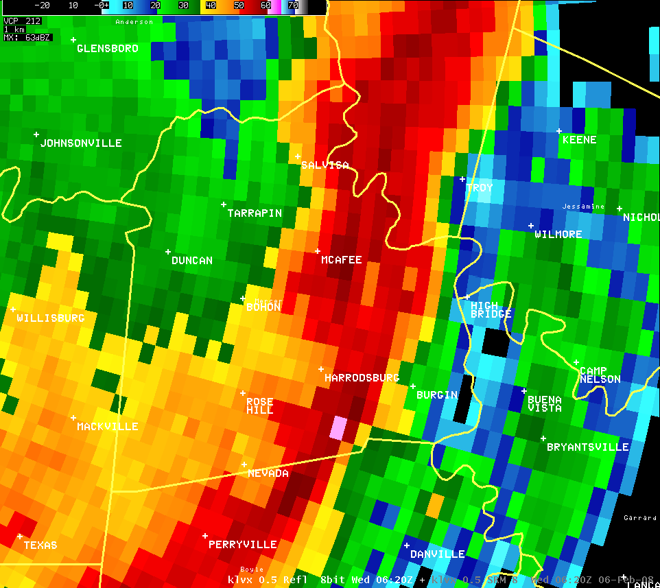
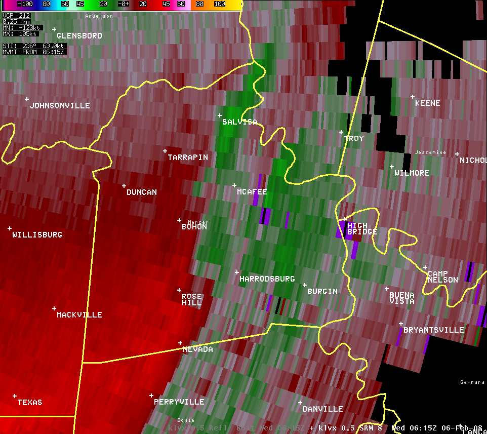
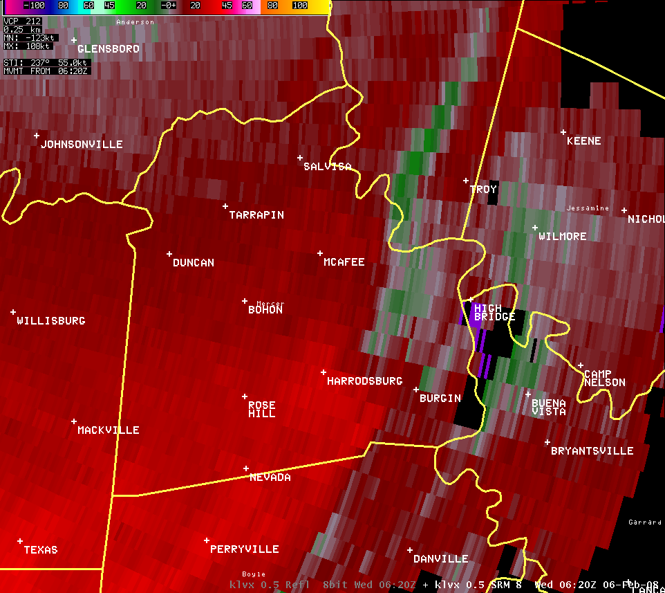
Mercer County (Reflectivity and Velocity):
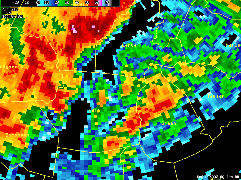
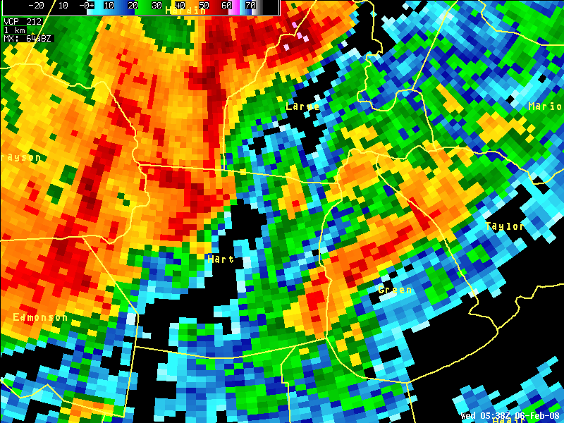
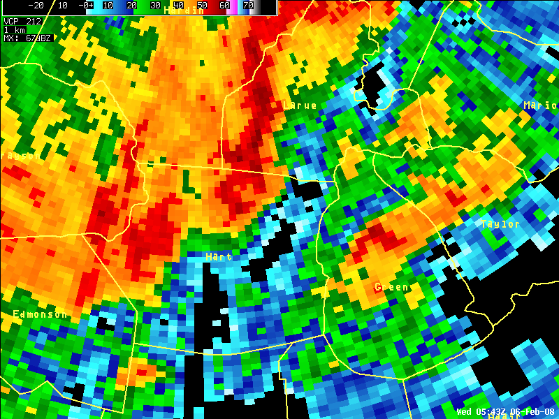
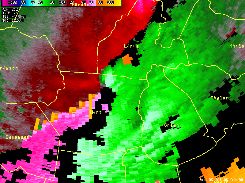
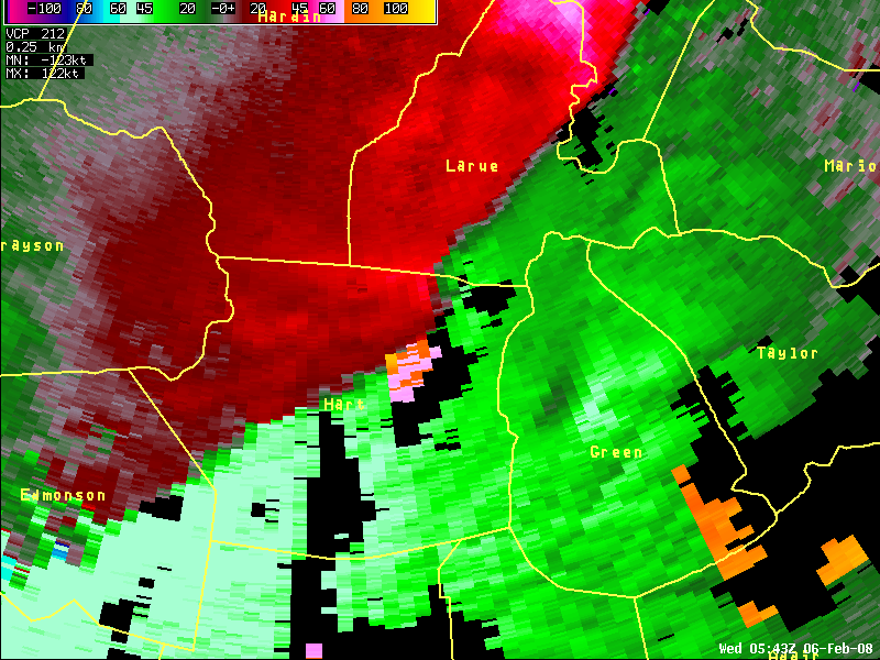
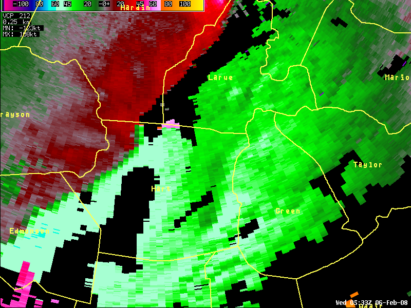
Hart County (Reflectivity and Velocity):
| KLVX radar data showed a bulging line of storms moved over northern Hart, Larue, and northern Green counties in central Kentucky. Velocity data showed a well-defined mesovortex over northern parts of Hart and Green, which produced an EF1 tornado over northern Hart County, with sporadic straight-line wind damage over other parts of these counties. |
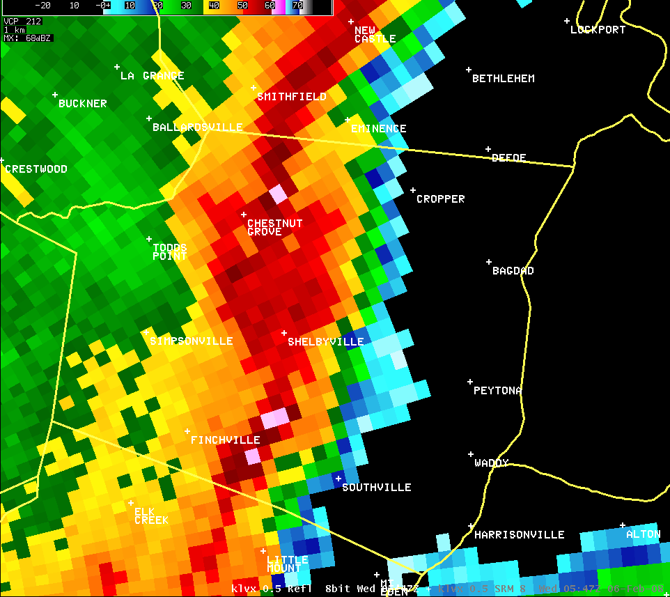
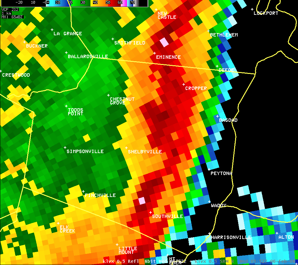
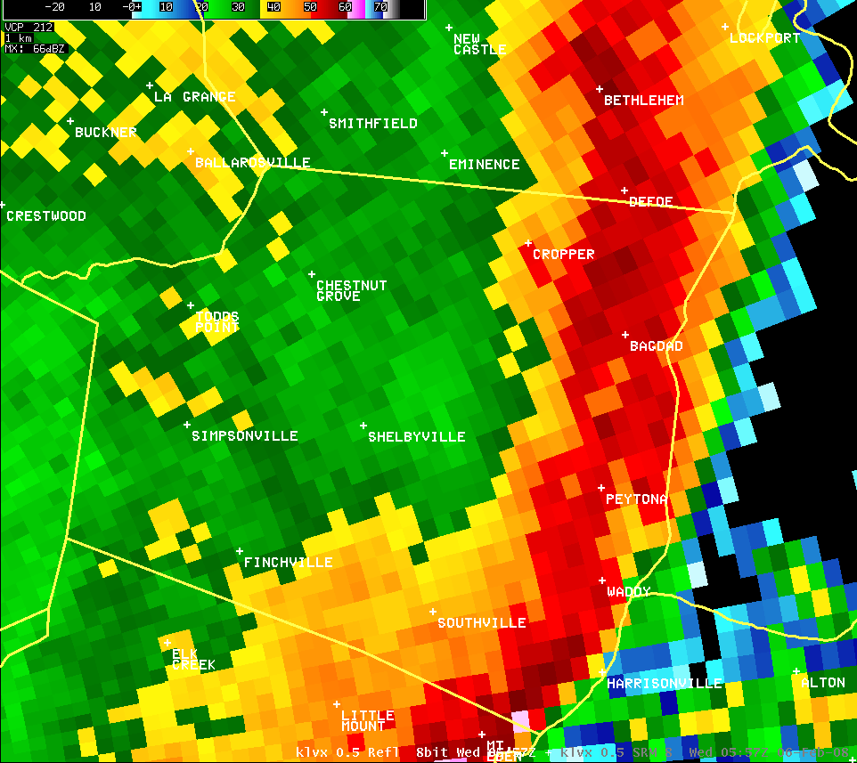
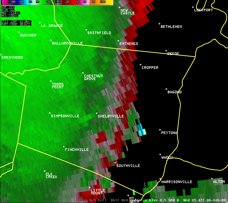
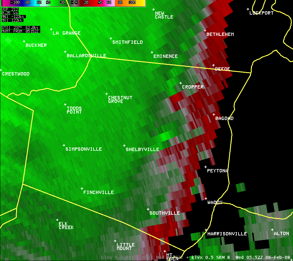
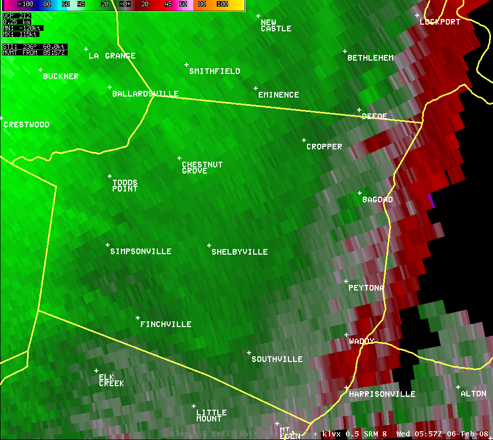
Shelby County (Reflectivity and Velocity):
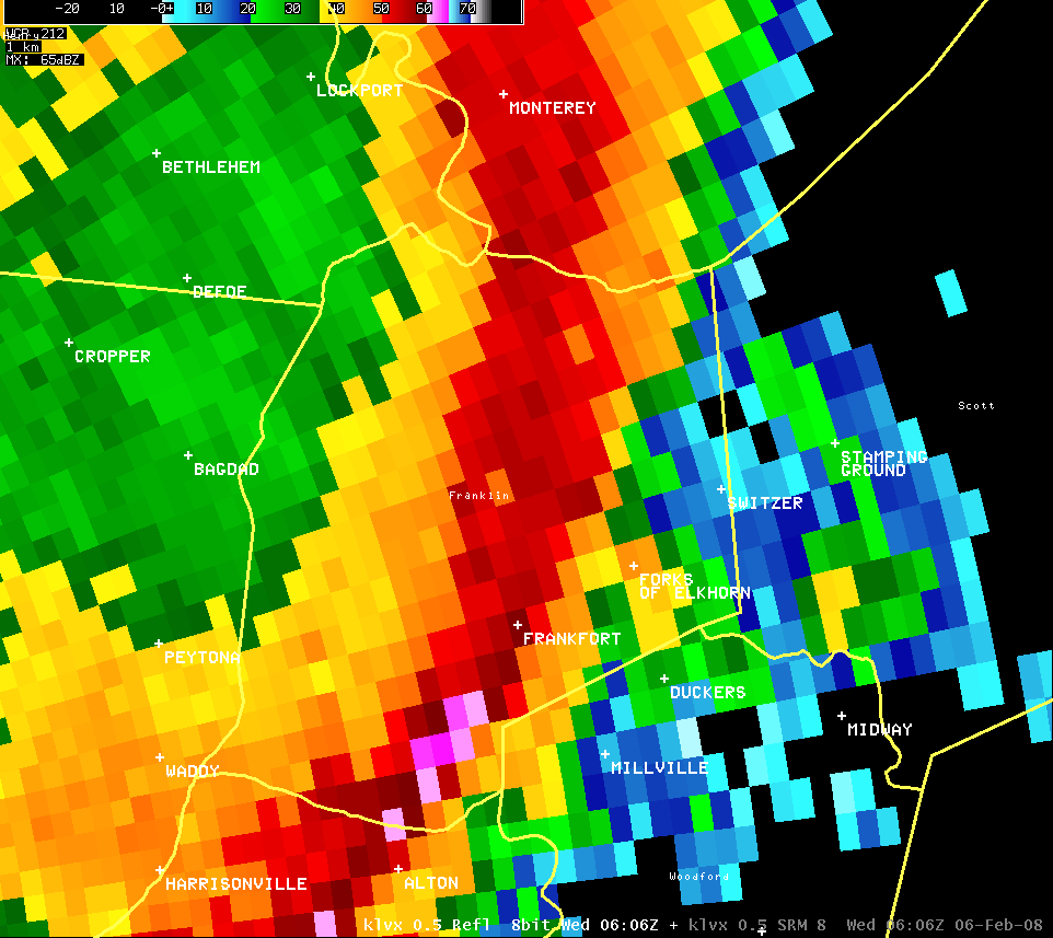
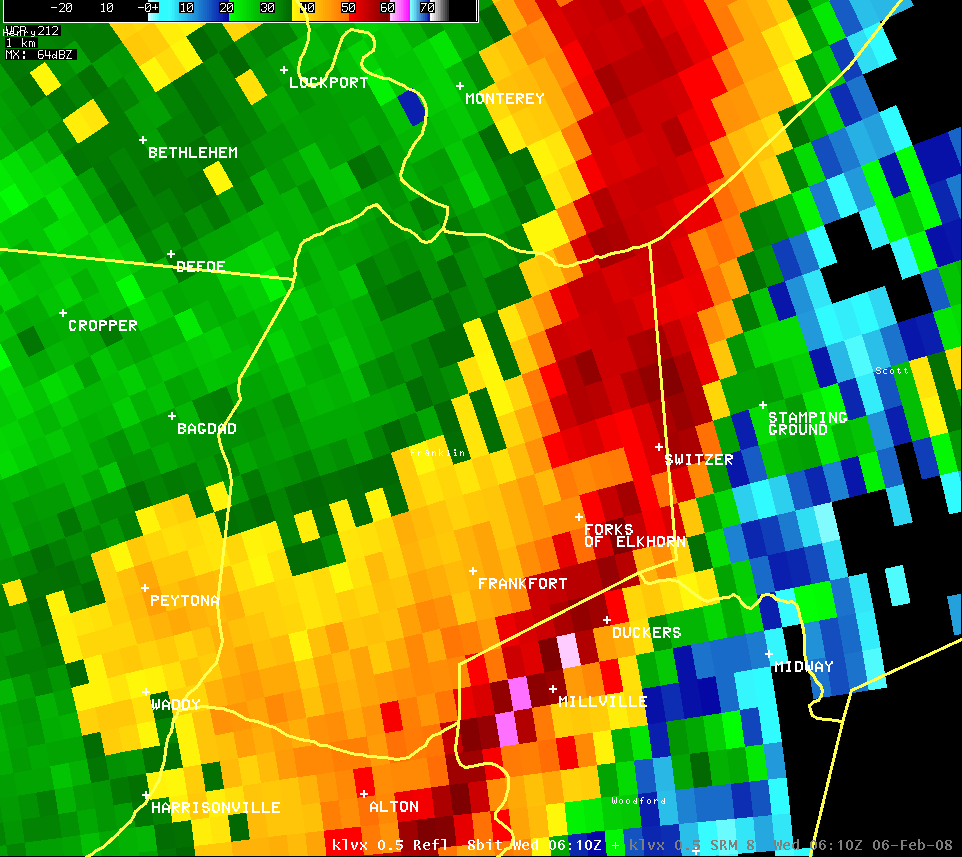
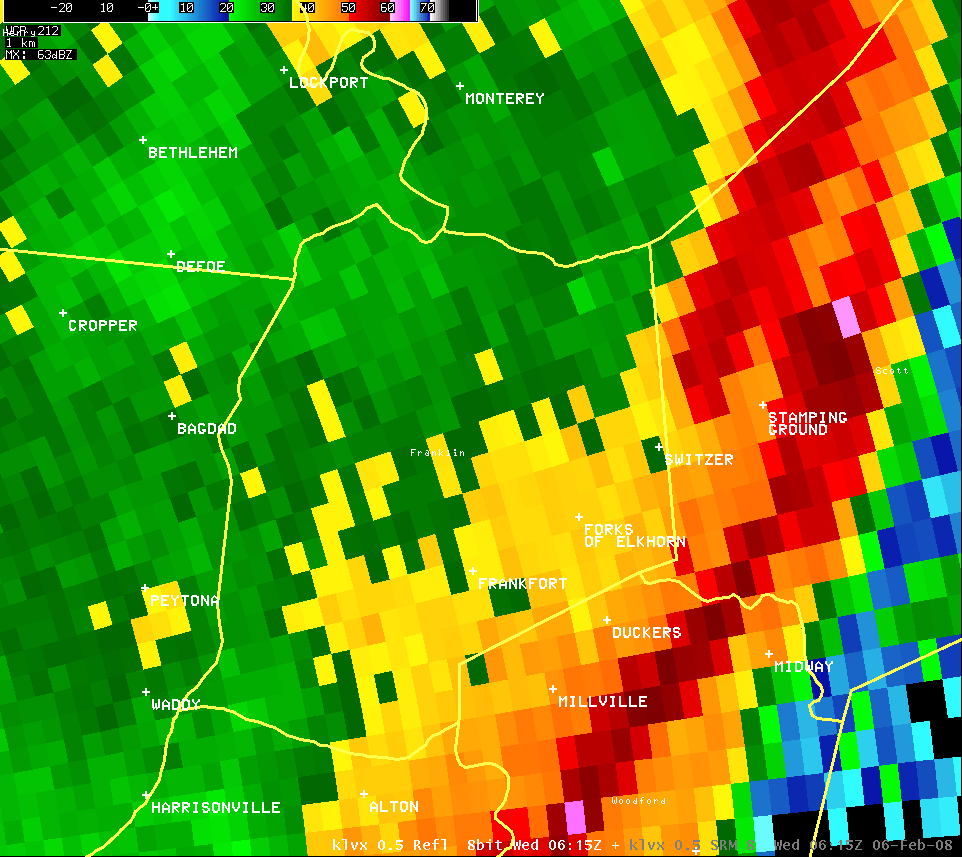
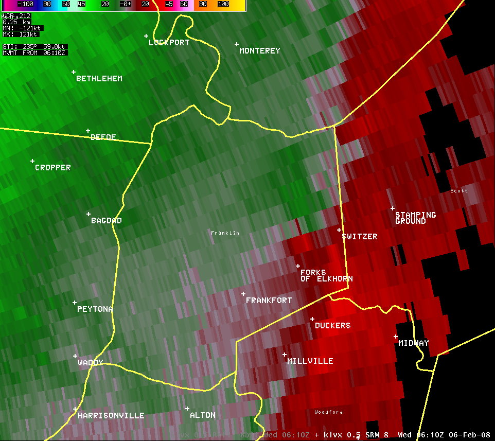
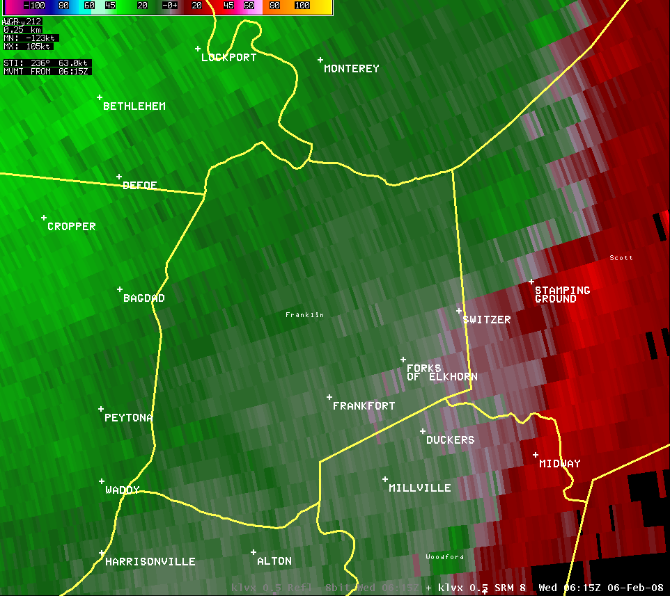
Franklin County (Reflectivity and Velocity):
Harrison County (Reflectivity and Velocity):
Spencer County (Reflectivity and Velocity):
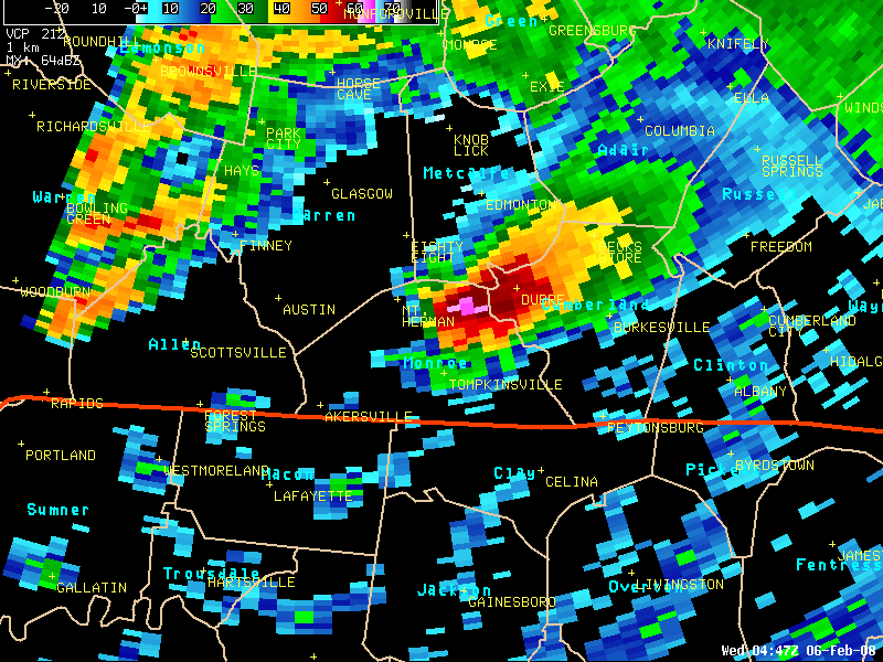
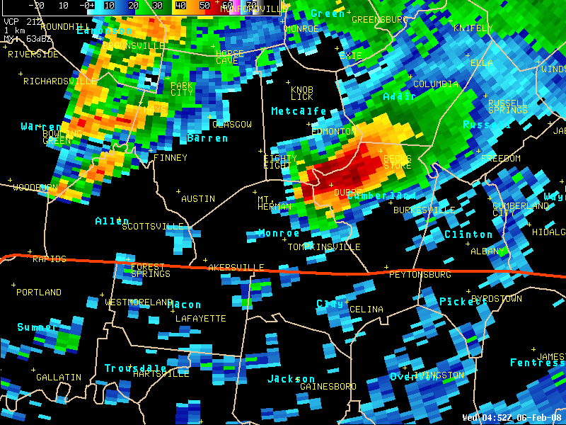
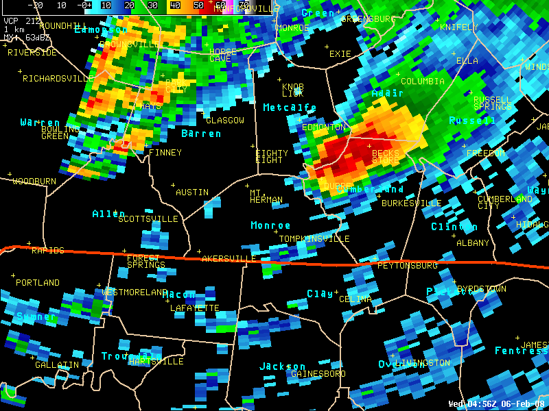
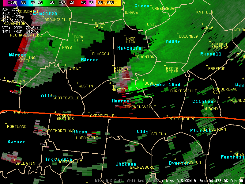
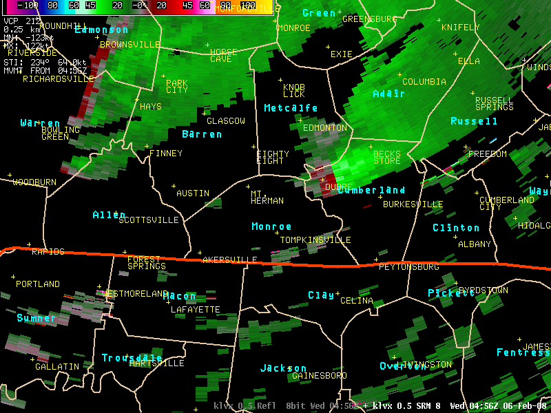
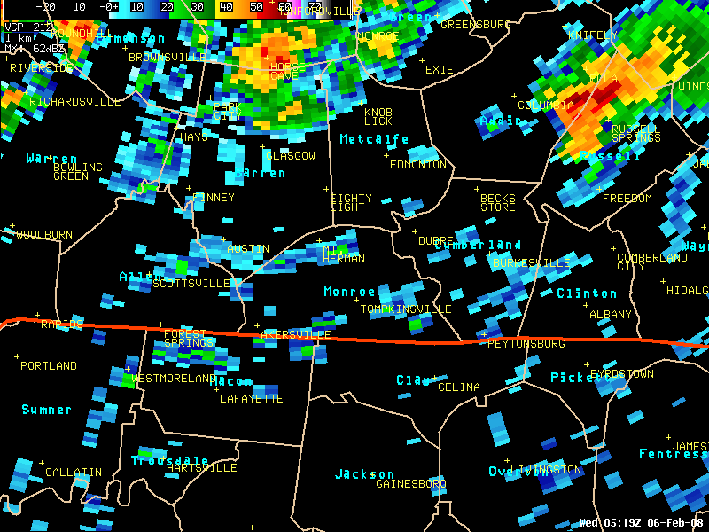
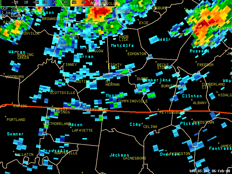
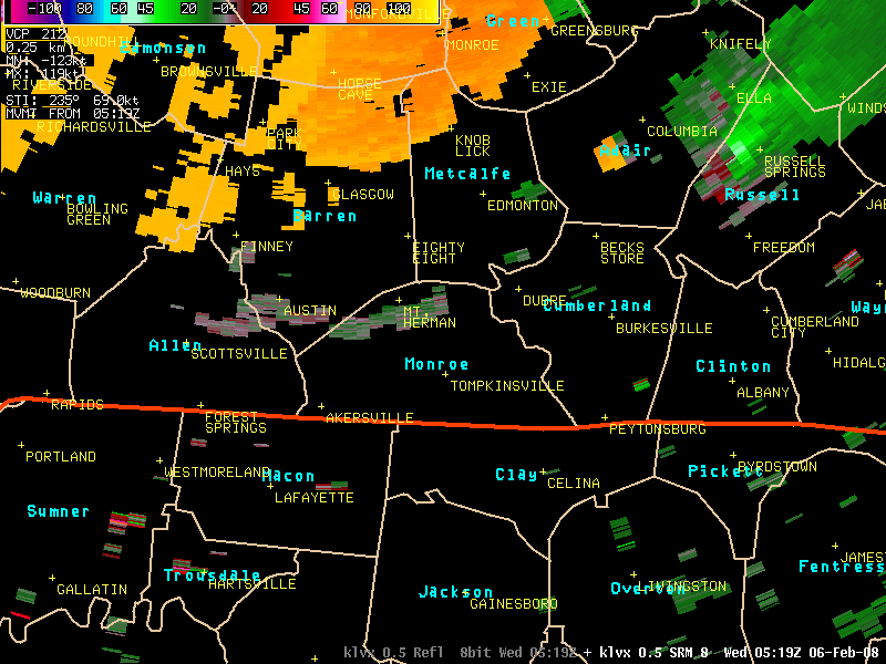
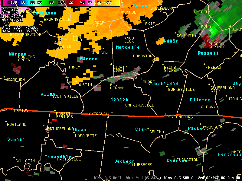
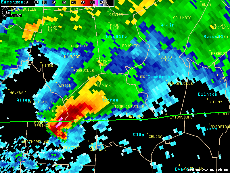
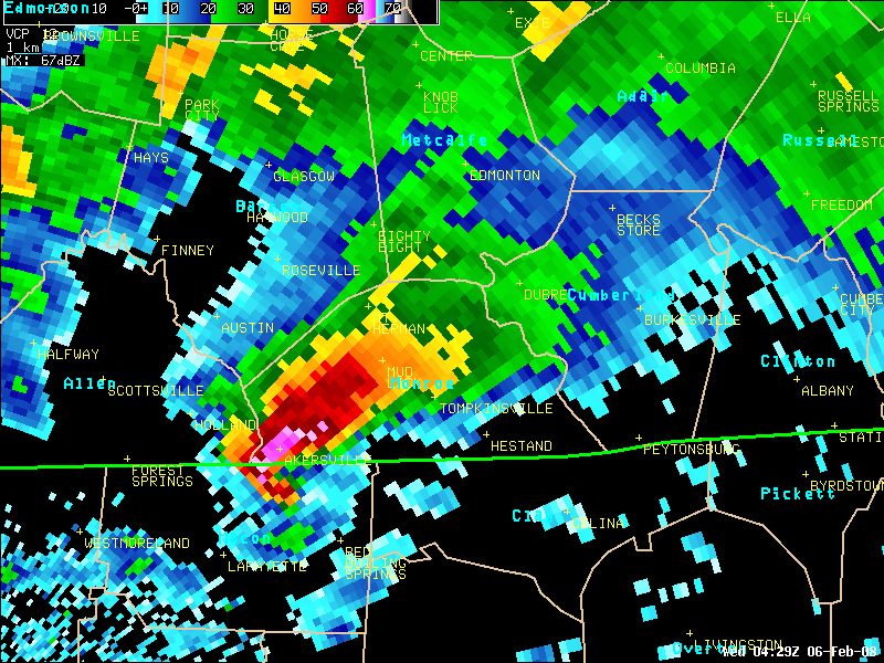
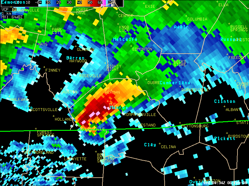
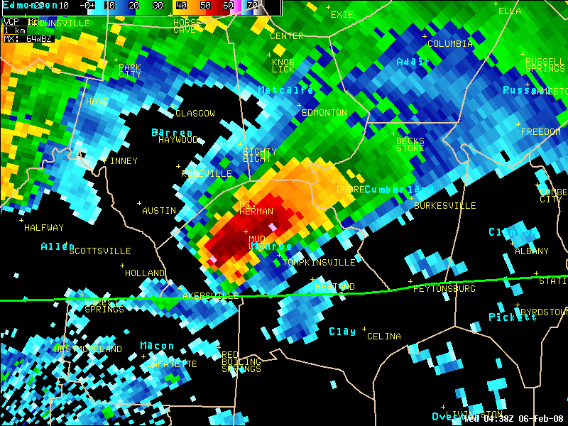
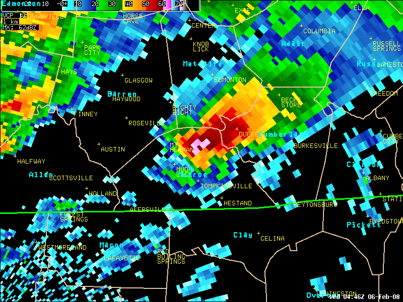
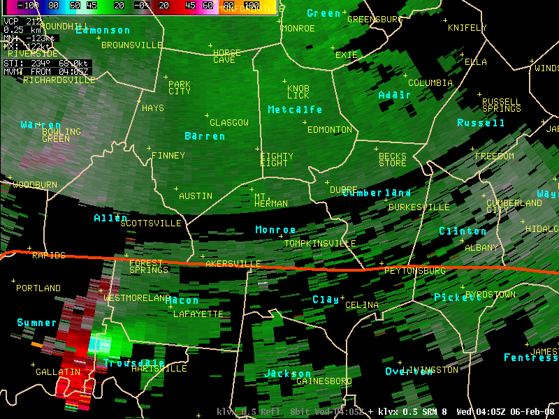
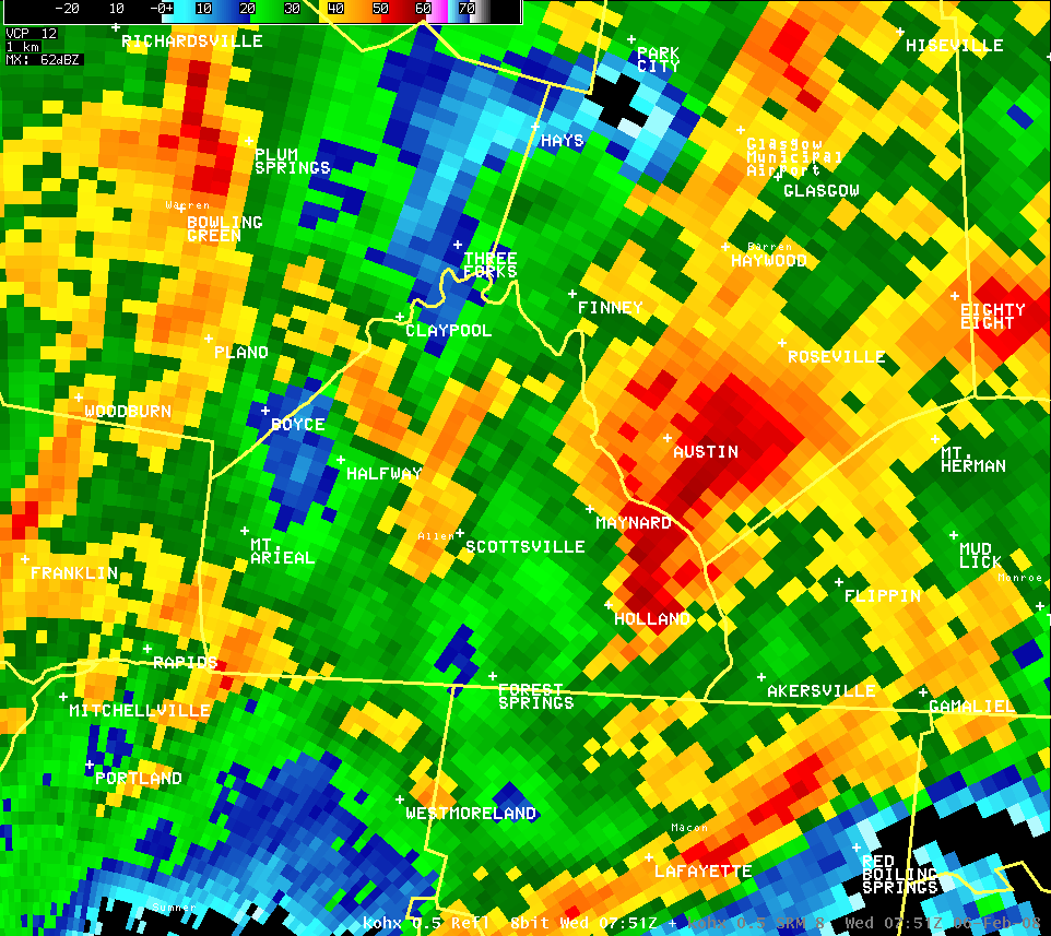
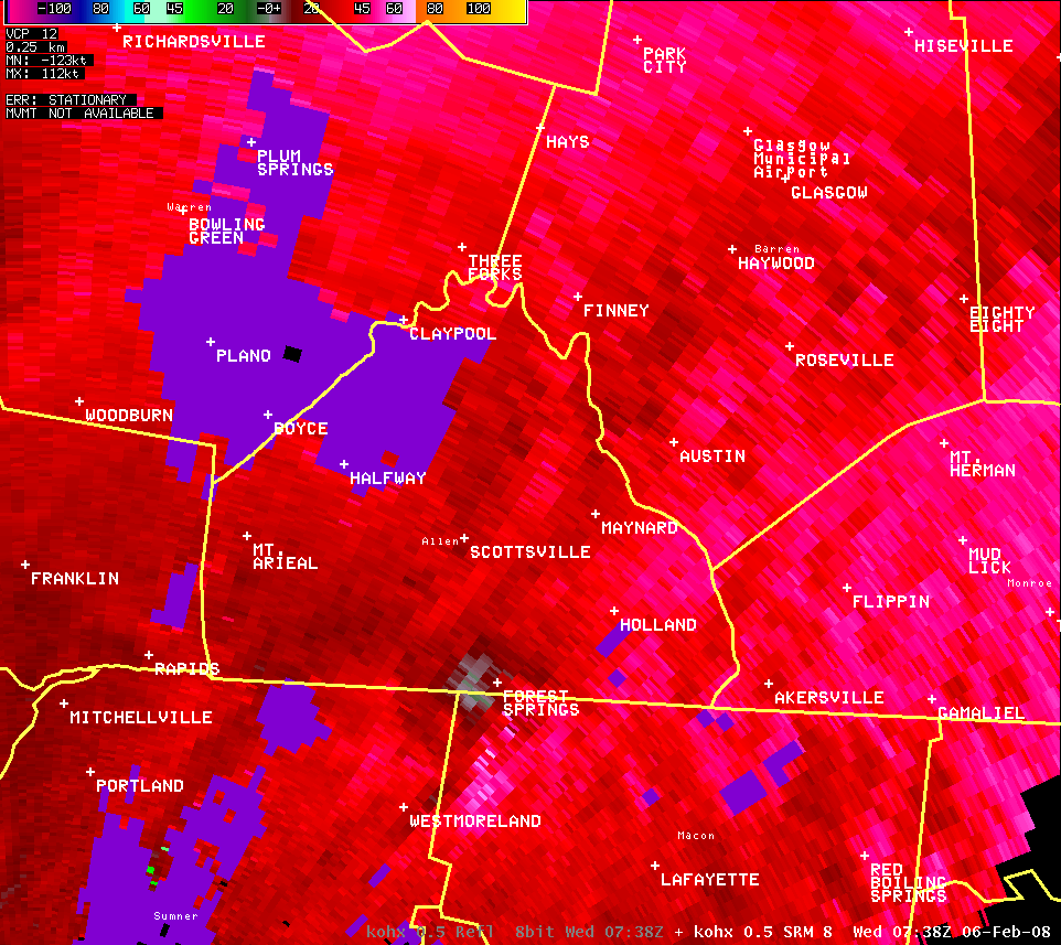
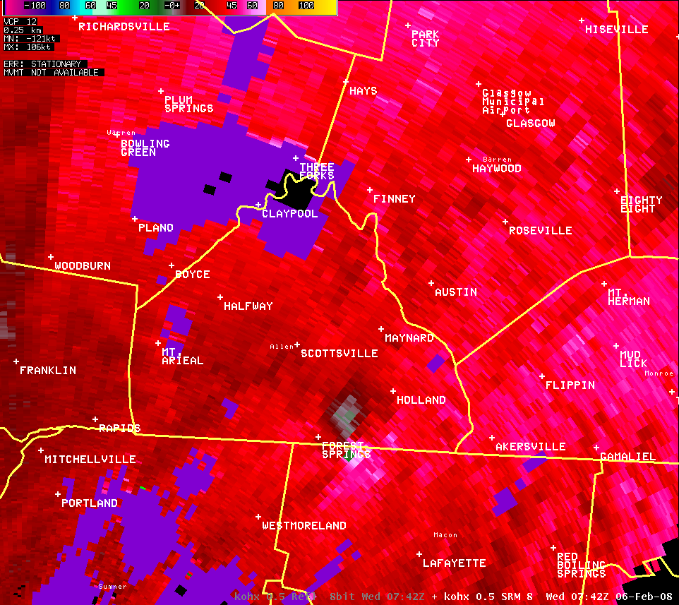
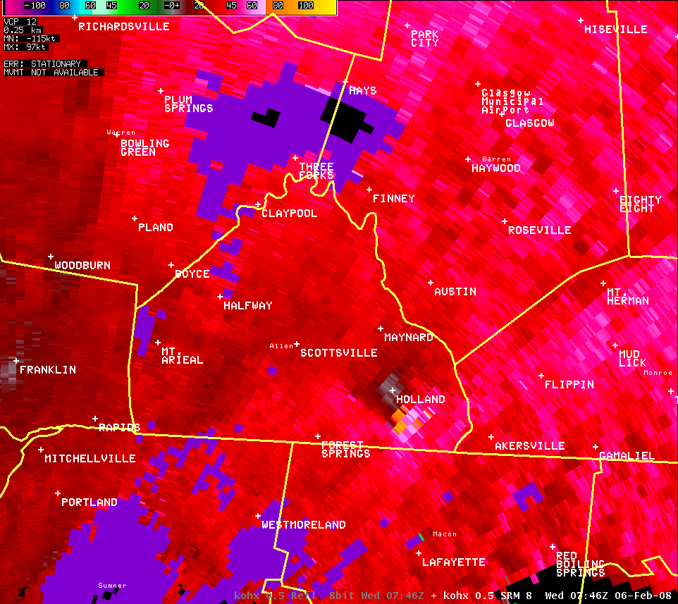
Monroe County (Reflectivity):
| KLVX reflectivity and storm-relative velocity data showed an intense supercell thunderstorm moved notheast from Tennessee into south-central Kentucky. Large hail was within the storm (pink and blue colors in reflectivity data), while velocity showed a well-defined mesocyclone that produced an EF3 tornado that moved across Monro County. |
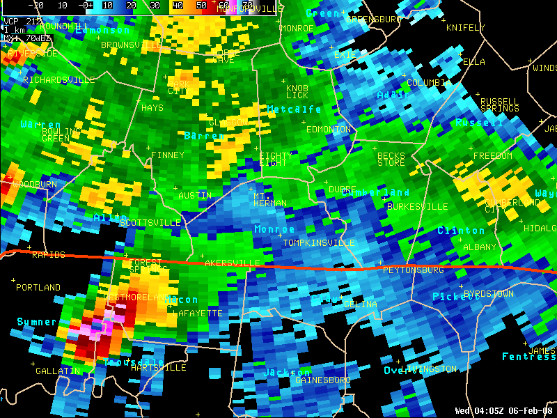
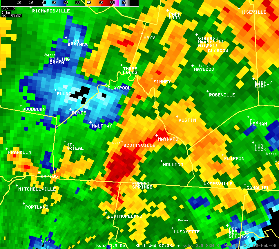
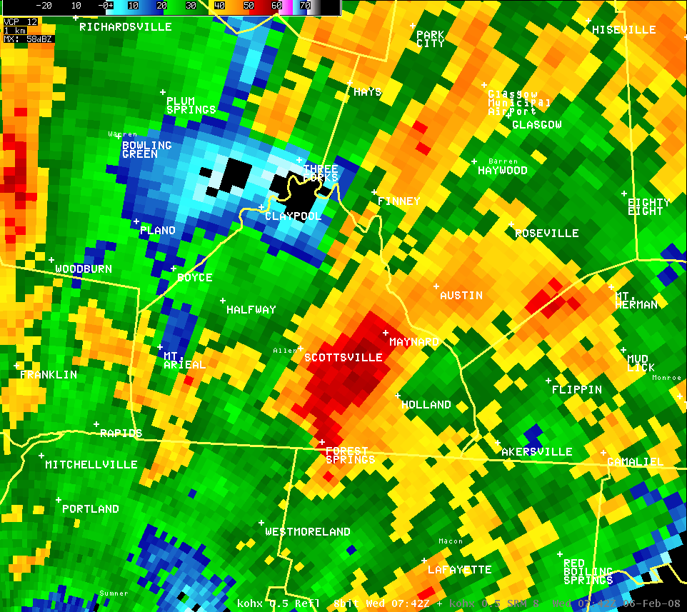
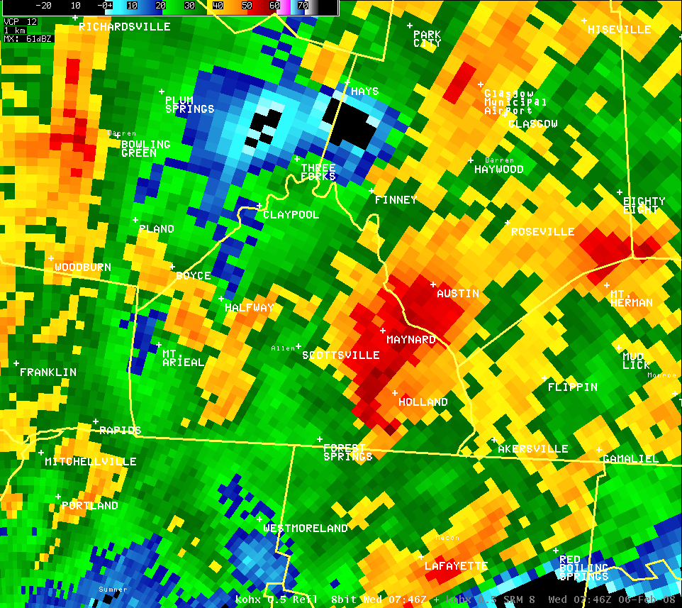
Allen County (Reflectivity and Velocity):
Click here to go to main homepage for February 5-6, 2008 severe weather event.


 Weather Story
 Weather Map
 Local Radar