Louisville, KY
Weather Forecast Office
Groundhog Day this year was cloudy and wet, and according to tradition that means we'll have an early spring. With as warm and, especially, wet as this February turned out to be, perhaps the groundhog's prediction has come true!
A slow-moving low pressure system moved through the Tennessee Valley early in the month, bringing many of us 2-4 inches of rain from the 3rd through the 5th. The storm also brought a wintry mix to the region, especially in southern Indiana. A CoCoRaHS observer northwest of Plattsburg, Indiana, reported nearly four inches of snow.
The next significant system blew through the region on the 17th, bringing generally 1 to 3 inches of rain. However, the bigger story with this event was the straight-line winds out ahead of it, gusting to 50-60mph!
Additional rains came in from the 22nd through the 25th, adding moisture to already wet ground and sending some rivers, including the Ohio at Tell City, into flood.
| Average Temperature | Departure from Normal | Precipitation | Departure from Normal | Snow | Departure from Normal | |
| Bowling Green | 40.6° | -0.5° | 6.10" | +2.03" | 0.1" | -2.8" |
| Frankfort | 38.4° | +0.6° | 7.29" | +3.89" | ||
| Lexington | 37.9° | +0.4° | 7.69" | +4.05" | 1.3" | -3.2" |
| Louisville Ali | 39.6° | +0.1° | 6.74" | +3.33" | 1.6" | -2.5" |
| Louisville Bowman | 38.8° | +0.1° | 6.81" | +3.54" |
Records
3rd: Precipitation of 1.93" at Frankfort, precipitation of 1.92" at Lexington, precipitation of 1.51" at Louisville
17th: Precipitation of 2.41" at Frankfort, precipitation of 2.31" at Louisville
5th wettest February on record at Frankfort and Lexington
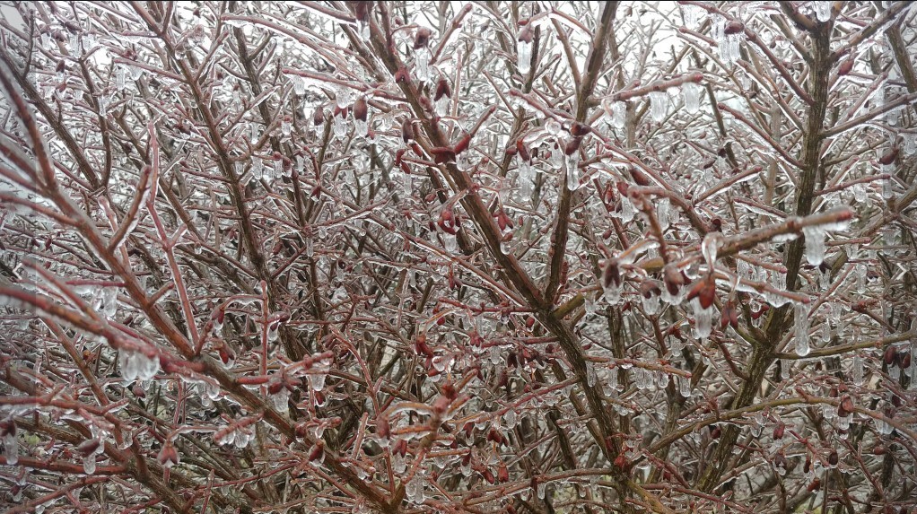
Icy conditions in Edmonson County on the 24th. Photo courtesy Johnny Merideth via Twitter
Current Hazards
Hazardous Weather Outlook
Storm Prediction Center
Submit a Storm Report
Advisory/Warning Criteria
Radar
Fort Knox
Evansville
Fort Campbell
Nashville
Jackson
Wilmington
Latest Forecasts
El Nino and La Nina
Climate Prediction
Central U.S. Weather Stories
1-Stop Winter Forecast
Aviation
IDSS Forecast Points
Air Quality
Fire Weather
Recreation Forecasts
1-Stop Drought
Event Ready
1-Stop Severe Forecast
Past Weather
Climate Graphs
1-Stop Climate
CoCoRaHS
Local Climate Pages
Tornado History
Past Derby/Oaks/Thunder Weather
Football Weather
Local Information
About the NWS
Forecast Discussion
Items of Interest
Spotter Training
Regional Weather Map
Decision Support Page
Text Products
Science and Technology
Outreach
LMK Warning Area
About Our Office
Station History
Hazardous Weather Outlook
Local Climate Page
Tornado Machine Plans
Weather Enterprise Resources
US Dept of Commerce
National Oceanic and Atmospheric Administration
National Weather Service
Louisville, KY
6201 Theiler Lane
Louisville, KY 40229-1476
502-969-8842
Comments? Questions? Please Contact Us.


 Weather Story
 Weather Map
 Local Radar