Copious amounts of rain fell on central Kentucky and extreme southern Indiana as the calendar turned from February to March back in 1997. As thunderstorms and large areas of heavy rain repeatedly moved over the same areas, impressive amounts of rainfall were recorded. The deluge resulted in record flooding along smaller streams and some of the worst flooding along the Ohio River since at least 1964, and in some places since the Great Flood of 1937. A few smaller streams set their all-time records.
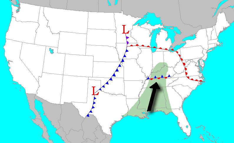 A large, powerful storm system over the Great Plains drew warm, moist air northward out of the Gulf of America (the air had 200% of the normal amount of moisture for that time of year). When this juicy air interacted with a subtle stationary front over Kentucky heavy showers and thunderstorms broke out. Because the front in Kentucky was nearly stationary, the showers and storms continued to re-generate until the larger cold front, seen here stretching from Minnesota to Texas, pushed the wet weather off to our east.
It is worth noting that in addition to incredible flooding, severe weather also broke out, with damaging tornadoes being reported from Arkansas to southern Kentucky. The flood occurred without the benefit of any melting snow, and with normal soil moisture conditions before the event began. Run-off was maximized since vegetation had not yet begun to green up. |
Click on the image for a larger version:
.png) |
Click on the picture to see a map of rainfall totals from the event (82 K). A 24-hour precipitation record for the state of Kentucky was established when 10.48" of rain fell at the National Weather Service office in Louisville. |
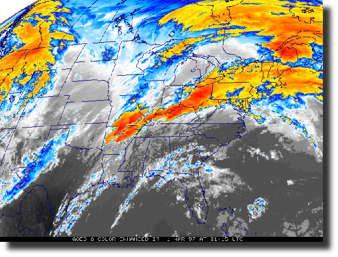 |
Infrared satellite image taken during the afternoon hours of March 1st. (Courtesy of NCDC) |
Water reached the rooftops in Boston (Nelson County).
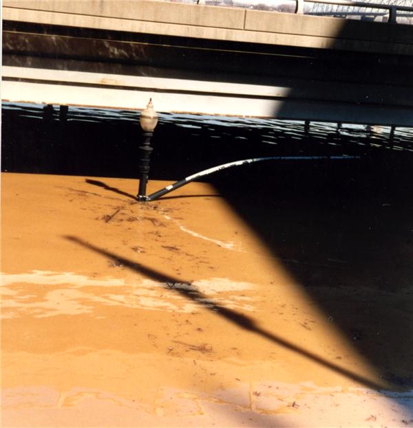
Barge traffic was halted on the Ohio River when the locks flooded.
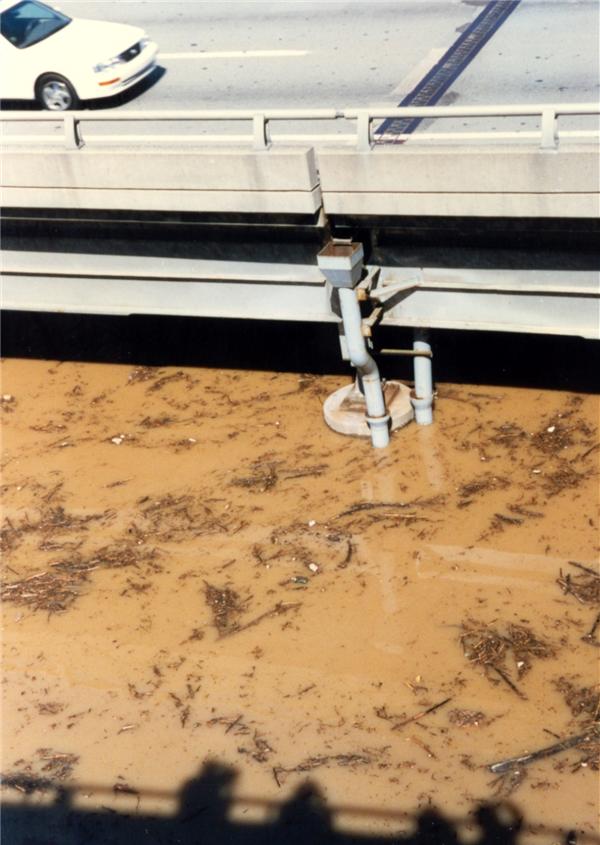
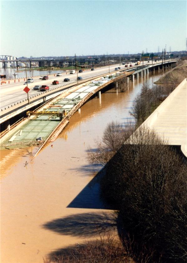
In the Louisville metro area about $200,000,000 in damage was attributed to the flooding, with 50,000 dwellings affected. Interstates 64 and 65 were closed.
92 counties in Kentucky and 14 counties in southern Indiana were declared disaster areas. Tens of thousands of people were evacuated from their homes, with total damage across the region around $400,000,000.
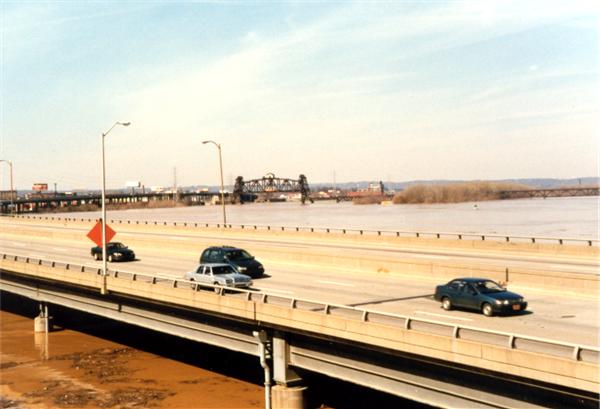
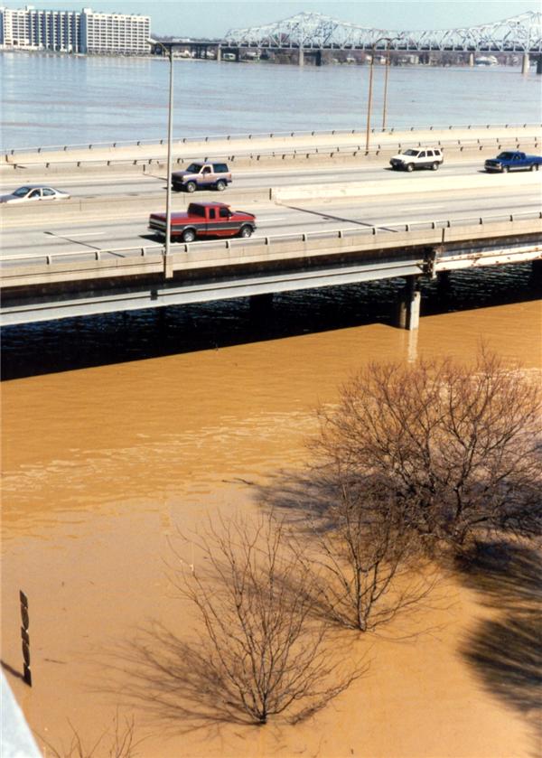
The Ohio River rose to the highest levels since March of 1964, with navigation on the river stopped completely due to the locks being flooded. Disaster declarations were made for 92 counties in Kentucky and 14 in southern Indiana due to flooding. 19 deaths occurred in Kentucky; 9 were people who attempted to cross flooded roadways.
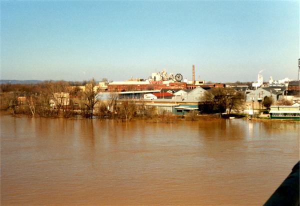
Due to backwater from the Ohio River the flooding was very prolonged. In the Licking River basin, flooding continued until the 7th, Kentucky River basin the 8th, Salt River basin until the 11th, and the Green River basin until the 18th. The middle of the Ohio River stayed above flood stage until the 16th.
| Site | Flood Stage (feet) | Above Flood Stage | Crest | |||
| From | To | Stage (feet) | Date | Time (EST) | ||
| Muscatatuck River at Deputy IN | 15 | March 1 | March 2 | 23.4 | March 2 | 8am |
| Blue River at FredericksburgIN | 20 | March 2 | March 2 | 21.5 | March 2 | 1pm |
| Stoner Creek at Paris KY | 18 | March 1 | March 3 | 30.0 | March 2 | 5am |
| South Fork Licking River at Cynthiana KY | 20 | March 1 | March 4 | 28.0 | March 2 | 6pm |
| Licking River at Blue Licks Spring KY | 25 | March 1 | March 7 | 47.6 | March 2 | 7pm |
| Kentucky River at Ford KY | 26 | March 4 | March 6 | 27.1 | March 5 | 8pm |
| Kentucky River at High Bridge KY | 30 | March 2 | March 7 | 37.4 | March 2 | 7pm |
| Kentucky River at Frankfort KY | 31 | March 2 | March 8 | 45.2 | March 3 | 1pm |
| Rolling Fork Salt River at Boston KY | 35 | March 1 | March 11 | 53.2 | March 3 | 1pm |
| Salt River at Shepherdsville KY | 32 | March 2 | March 9 | 40.9 | March 3 | 1pm |
| Russell Creek at Columbia KY | 16 | March 1 | March 2 | 18.8 | March 2 | Midnight |
| Drakes Creek at Alvaton KY | 22 | March 2 | March 4 | 29.9 | March 2 | 6pm |
| Barren River at Bowling Green KY | 28 | March 2 | March 4 | 34.9 | March 3 | 6am |
| Rough River at Dundee | 25 | March 2 | March 6 | 30.2 | March 2 | 7pm |
| Green River at Munfordville KY | 28 | March 2 | March 7 | 43.9 | March 3 | 10pm |
| Green River at Brownsville KY | 18 | March 2 | March 8 | 33.8 | March 5 | 4pm |
| Green River at Woodbury KY | 33 | March 1 | March 10 | 48.9 | March 5 | 11am |
| Green River at Rochester KY | 17 | March 2 | March 18 | 30.7 | March 7 | 10am |
| Ohio River at Clifty Creek IN | 451 | March 3 | March 11 | 460.9 | March 7 | 6am |
| Ohio River at Upper McAlpine Lock KY | 23 | March 2 | March 13 | 38.8 | March 7 | 5am |
| Ohio River at Lower McAlpine Lock KY | 55 | March 3 | March 13 | 70.6 | March 7 | 6pm |
| Ohio River at Cannelton Lock IN | 42 | March 3 | March 15 | 52.3 | March 8 | 2am |
| Ohio River at Tell City IN | 38 | March 2 | March 16 | 50.4 | March 8 | 5am |
In addition to the flooding, there was also severe weather for central Kentuckians to deal with...including tornadoes! No fewer than five tornadoes occurred in central Kentucky, with the strongest being an F2 twister in southern Monroe County. Straight-line winds blew trees and power lines down across southern Kentucky, and hail was reported in Green and Metcalfe counties.
The Louisville National Weather Service office issued 5 Tornado Warnings, 31 Severe Thunderstorm Warnings, and 235 Flash Flood Warnings between 10:58pm EST February 28 and 2:00 am March 2.
Click on the image for a larger version.
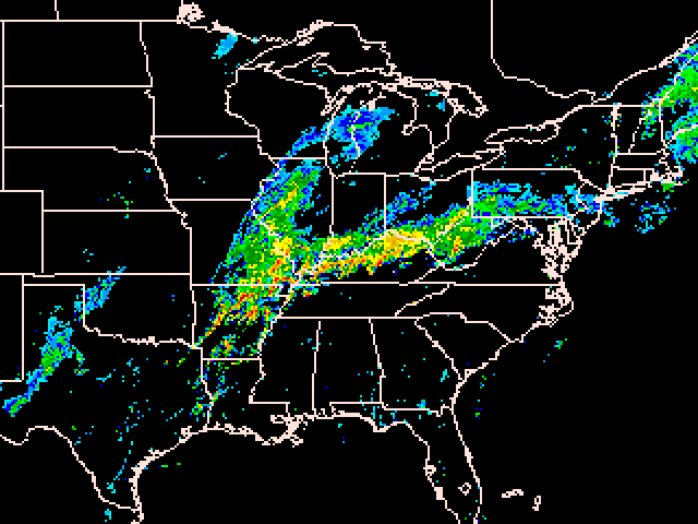 |
Regional radar picture taken during the height of the pouring rain. |
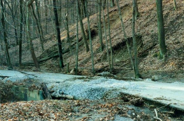 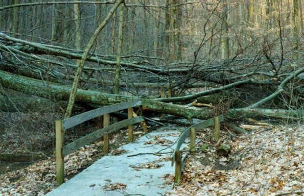 |
Water damage in Jefferson Memorial Forest. Tony Bright, Jefferson Memorial Forest employee Tony remembers that day: I woke up early to several knockouts from Fairdale Fire Department on my scanner. After listening to the runs I realized that something was not right in Fairdale with all the rescues going on. I got up about 6:45 am and proceeded to Fairdale. After I got on I-265 and crossed over the bridge at Pond Creek I knew what I was in for. I was not able to exit the freeway in Fairdale due to high water. So I decided to take back roads to the Welcome Center (Blevins Gap/Penile/Keys Ferry Road, etc.). As I came up to Keys Ferry & Mitchell Hill roads I saw a car that had been swept off into the ditch on Keys Ferry. I helped the man get out of his submerged car and realized it was one of the forest employees. He was shaken up a bit that this had happened to him. So I transported him on to the Welcome Center to warm up and calm down. The forest staff set up a command post at the Welcome Center to assess damages throughout the forest. We spent most of the day checking the park for damage and giving assessments of what occurred. The last half of the day some of us were placed on Dam Watch. With two large bodies of water within the park; we monitored the dams for any signs of a breach. We were placed on standby to forward any information on to the Fairdale Fire Department in case of a dam breach. One dam did show signs of a small breach or leak but we stayed with it until we were released around 11:30 pm that night. Many foot trails were made impassable as well as Holsclaw Hill Road & Mitchell Hill Road due to mudslides. |
 |
This picture was taken at Pinckard Baptist Church just south of Versailles, Kentucky along KY 169 at Clear Creek. The flooded creek in the picture is normally just a few feet wide and less than a foot deep. Shawn Crowe. |
 |
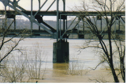
The K & I Bridge in Louisville, as seen from New Albany, Indiana. Greg Rosenberger |
 |
The Sherman Minton Bridge between Louisville and New Albany. Greg Rosenberger |
 |
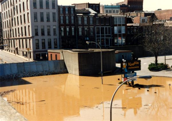
This and the following twelve photographs were taken in Louisville and sent to us by Judy Webber. This first photo shows the intersection of Fourth Street and River Road. |
 |
Fourth Street at River Road at the Galt House. |
 |
Fourth Street at River Road. |
 |
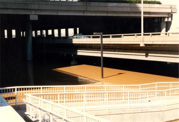
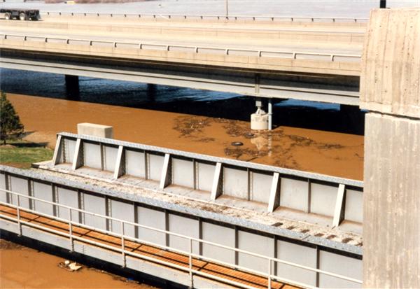
Interstate 64 over River Road at Fourth Street. |
 |
Flood gate at the Belvedere. |
 |
At the Kentucky Center for the Arts garage. |
 |
From the Waterfront Development Office building. |
 |
From the Clark Memorial Bridge. |
 |
From the Clark Memorial Bridge. |
 |
The Colgate Plant in Clarksville from the Clark Memorial Bridge. |
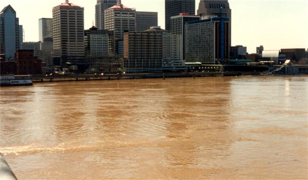 |
Downtown Louisville from the Clark Memorial Bridge. |
 |
Louisville waterfront from the Clark Memorial Bridge. |


 Weather Story
 Weather Map
 Local Radar