Louisville, KY
Weather Forecast Office
This was a very warm and wet month for the Ohio Valley. The warmth culminated on the 10th-11th with daily average temperatures nearly 30 degrees warmer than normal as we basked in afternoon temperatures in the 70s. A cold front swept through the region on the morning of the 11th accompanied by a squall line that produced 70 mph winds in a few spots.
There was one cold snap during the month from the 17th to the 22nd. Temperatures dipped into the teens on the 19th and 20th.
There was almost no snow in January, similar to December 2019.
| Average Temperature | Departure from Normal | Precipitation | Departure from Normal | Snow | Departure from Normal | |
| Bowling Green | 42.6° | +6.9° | 4.76" | +1.15" | T | -3.3" |
| Frankfort | 40.2° | +7.6° | 3.90" | +0.64" | ||
| Lexington | 41.5° | +8.6° | 3.61" | +0.41" | T | -3.9" |
| Louisville Bowman | 41.2° | +6.7° | 3.85" | +0.47" | ||
| Louisville Ali | 41.7° | +6.8° | 4.05" | +0.81" | 0.2 | -3.5" |
Records
10th: Warm low of 59° at Bowling Green, high of 68° at Frankfort, high of 67° at Lexington, warm low of 57° at Lexington, high of 67° at Louisville, warm low of 58° at Louisville
11th: High of 72° at Bowling Green, precipitation of 1.77" at Bowling Green, high of 73° at Frankfort, high of 75° at Lexington, high of 70° at Louisville
15th: High of 72° at Bowling Green, high of 69° at Lexington
7th warmest January on record at Lexington and Louisville
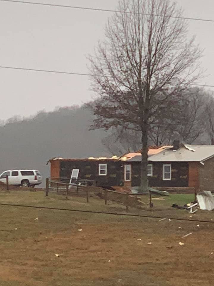
Wind damage in Monroe County on the 11th. Photo courtesy Emily Stinson
Current Hazards
Hazardous Weather Outlook
Storm Prediction Center
Submit a Storm Report
Advisory/Warning Criteria
Radar
Fort Knox
Evansville
Fort Campbell
Nashville
Jackson
Wilmington
Latest Forecasts
El Nino and La Nina
Climate Prediction
Central U.S. Weather Stories
1-Stop Winter Forecast
Aviation
IDSS Forecast Points
Air Quality
Fire Weather
Recreation Forecasts
1-Stop Drought
Event Ready
1-Stop Severe Forecast
Past Weather
Climate Graphs
1-Stop Climate
CoCoRaHS
Local Climate Pages
Tornado History
Past Derby/Oaks/Thunder Weather
Football Weather
Local Information
About the NWS
Forecast Discussion
Items of Interest
Spotter Training
Regional Weather Map
Decision Support Page
Text Products
Science and Technology
Outreach
LMK Warning Area
About Our Office
Station History
Hazardous Weather Outlook
Local Climate Page
Tornado Machine Plans
Weather Enterprise Resources
US Dept of Commerce
National Oceanic and Atmospheric Administration
National Weather Service
Louisville, KY
6201 Theiler Lane
Louisville, KY 40229-1476
502-969-8842
Comments? Questions? Please Contact Us.


 Weather Story
 Weather Map
 Local Radar