The entire Ohio Valley experienced near or slightly below normal temperatures in July. In central Kentucky, this was the first time since 2015 that any of the five climate sites (in the table below) experienced a cooler than normal July. The 3rd was the coolest day of the month and was part of a beautiful Independence Day weekend.
The warmest spell of the month came on the 25th-26th with temperatures peaking in the low-mid 90s. The mercury also attained those levels on the 29th, and on that day they were accompanied by oppressive dew points in the mid-upper 70s throughout the region.
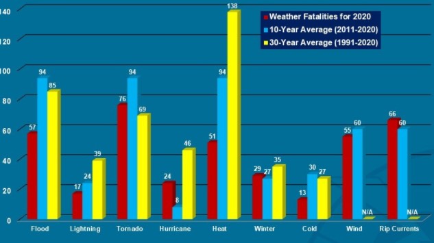
Severe weather occurred on several days of the month, all in the form of locally damaging wind gusts. No severe hail (1" diameter or larger) or tornadoes were reported. Unfortunately there was one fatality when thunderstorms with torrential rains moved slowly over Nicholas County on the night of the 29th-30th. Around 1am a mobile home was washed from its foundation and the 66-year-old resident was later found deceased about 600 feet from her home. It is a sober reminder that flooding is one of the worst weather-related killers in the United States (as shown by the yellow columns on the graph below), and is particularly dangerous at night. In 2019 Kentucky suffered the third highest total number of flood fatalities of any state in the nation (only Missouri and Texas had more).
| Average Temperature | Departure from Normal | Precipitation | Departure from Normal | |
| Bowling Green | 79.1° | -0.6° | 4.99" | +0.71" |
| Frankfort | 76.2° | -1.0° | 5.88" | +1.19" |
| Lexington | 74.6° | -2.1° | 4.82" | -0.30" |
| Louisville Ali | 79.7° | -0.2° | 5.16" | +1.11" |
| Louisville Bowman | 78.3° | -0.3° | 3.60" | -0.96" |
Records
1st: Rainfall of 2.46" at Lexington, rainfall of 2.92" at Louisville
3rd: Low of 53° at Lexington
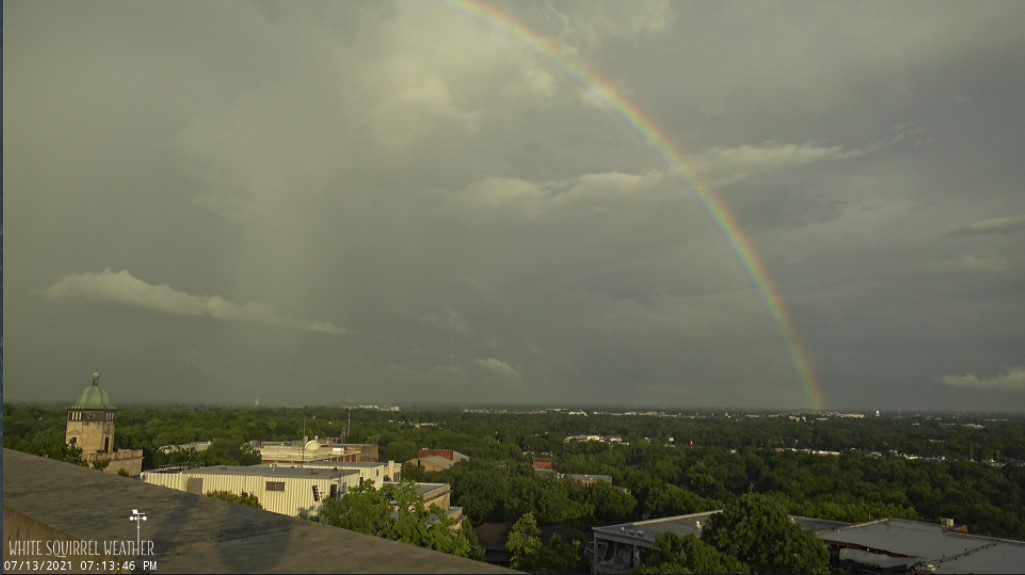
Rainbow caught on the White Squirrel Weather Cam in Bowling Green on the 13th.


 Weather Story
 Weather Map
 Local Radar