Louisville, KY
Weather Forecast Office
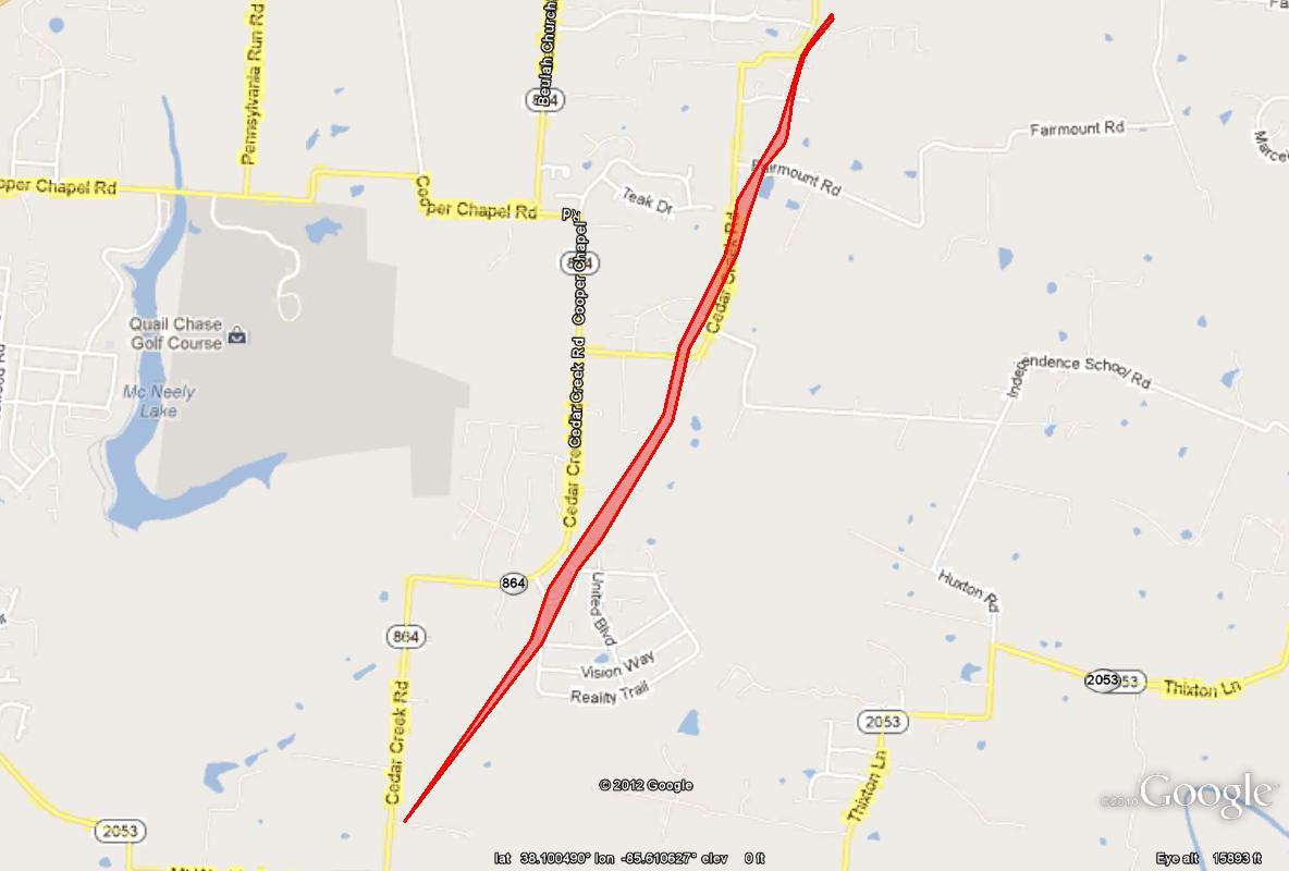
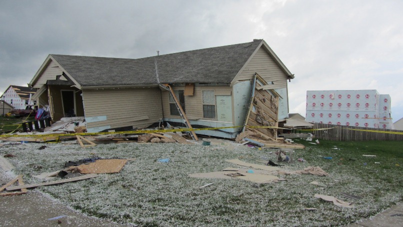
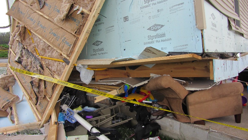
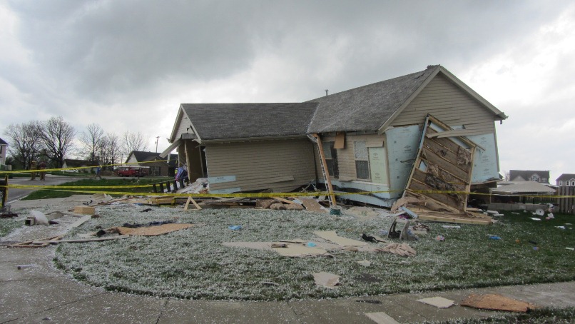
A tornado touched down in southern Jefferson County on the afternoon of March 23, 2012:
EF Scale: EF1
Max Wind speed: 110 mph
Max Path width: 70 yards (40-50 yards for most of its path)
Path length: 2.5 miles
Start: Just north of the intersection of Cedar Creek Road and Mount Washington Road
End: Just northeast of the intersection of Cedar Creek Road and Long Rifle Lane
(These locations are about 13 miles southeast of downtown Louisville.)
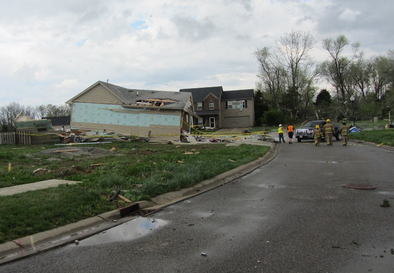
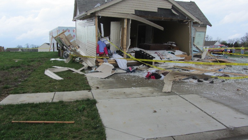
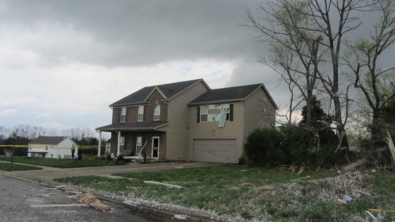
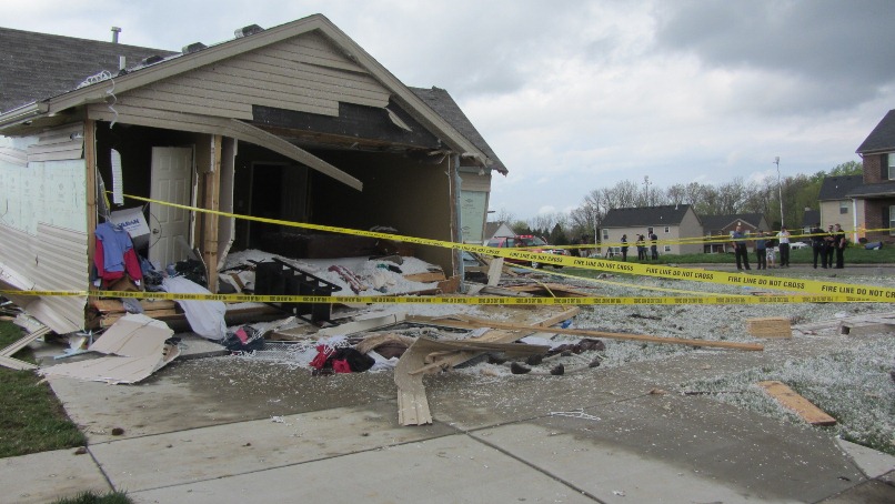
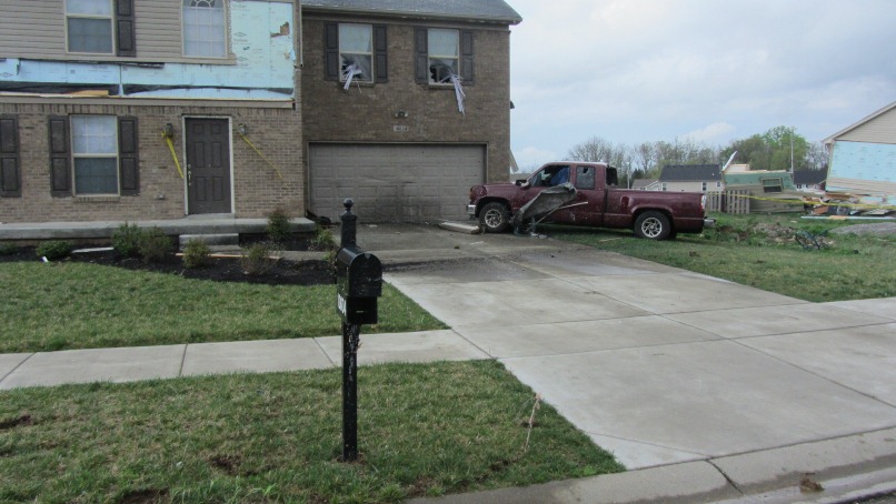
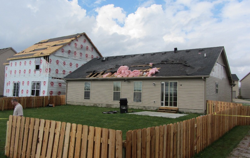
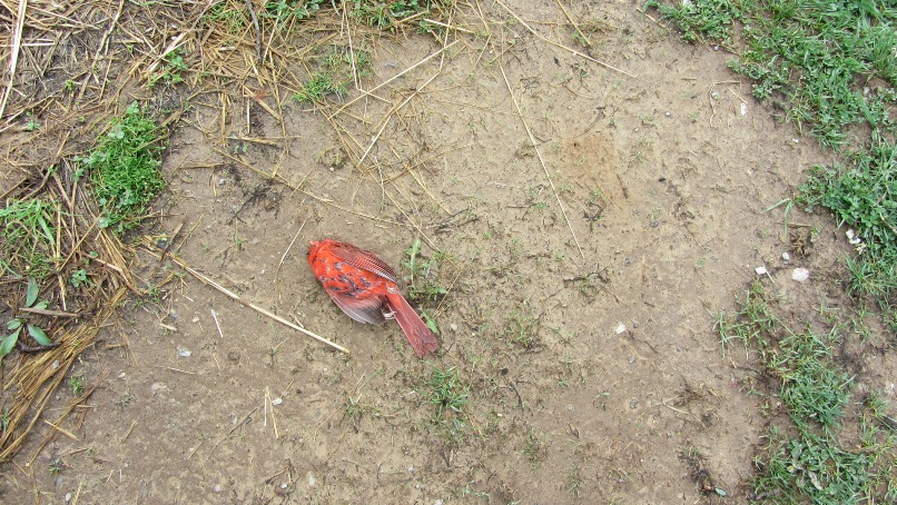
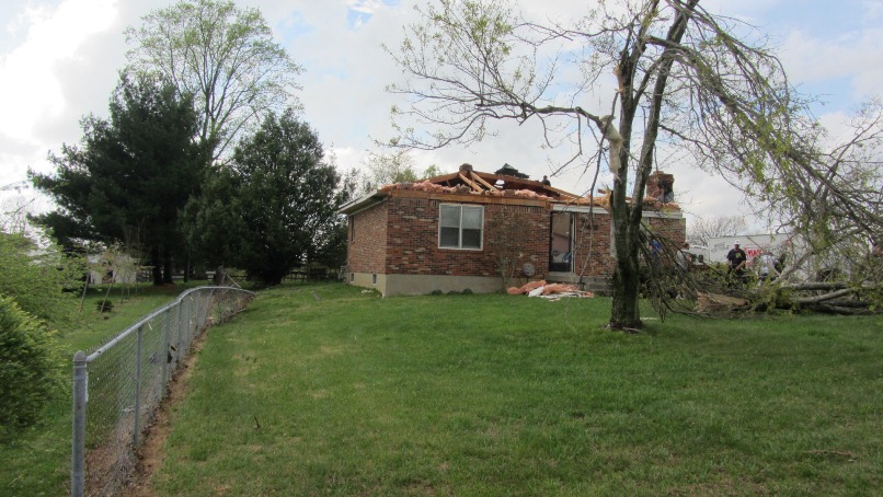
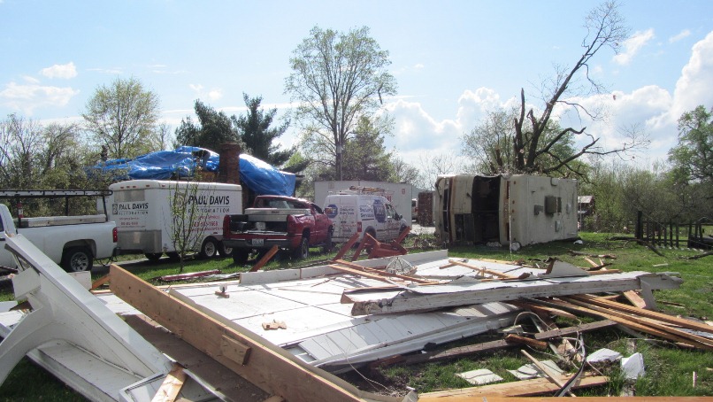
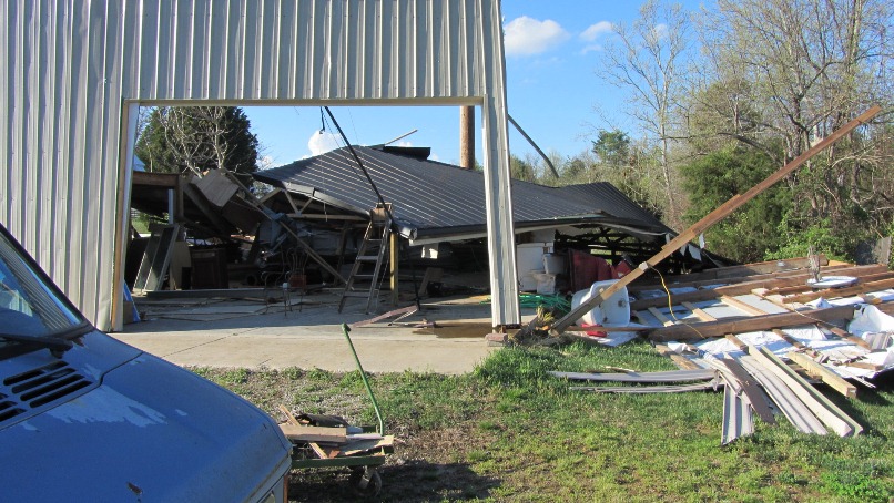
Tree, fence, and minor structural damage was done by this small tornado. The most significant damage was to a home that was destroyed on Brook Chase Court just off of Cedar Creek Road.
Track Map:
In the images below, click on an image for a larger version.
From near the intersection of Cedar Creek Road and Independence School Road:
 |
 |
 |
 |
 |
 |
 |
 |
 |
 |
 |
 |
 |
 |
 |
 |
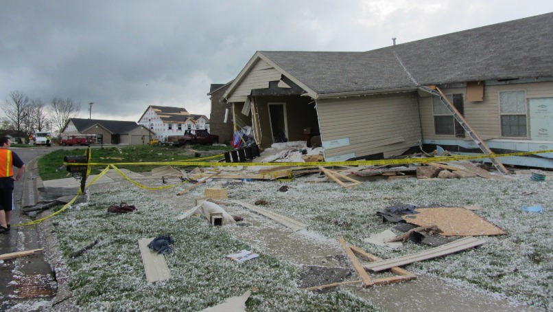
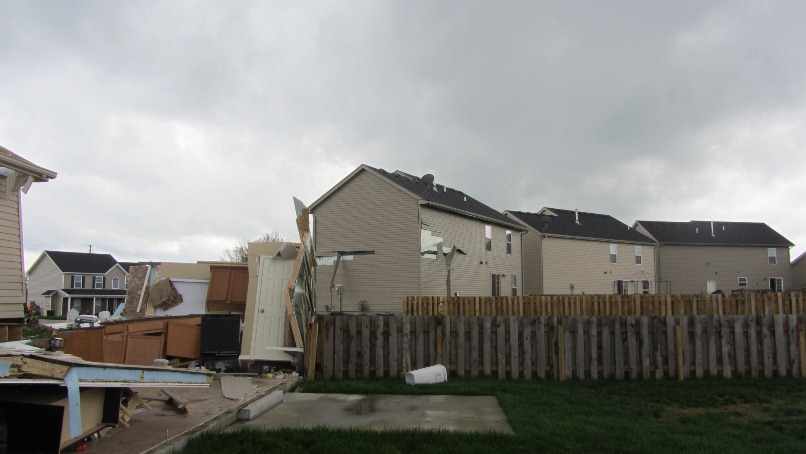
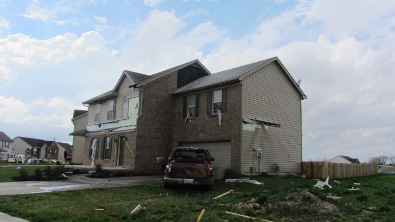
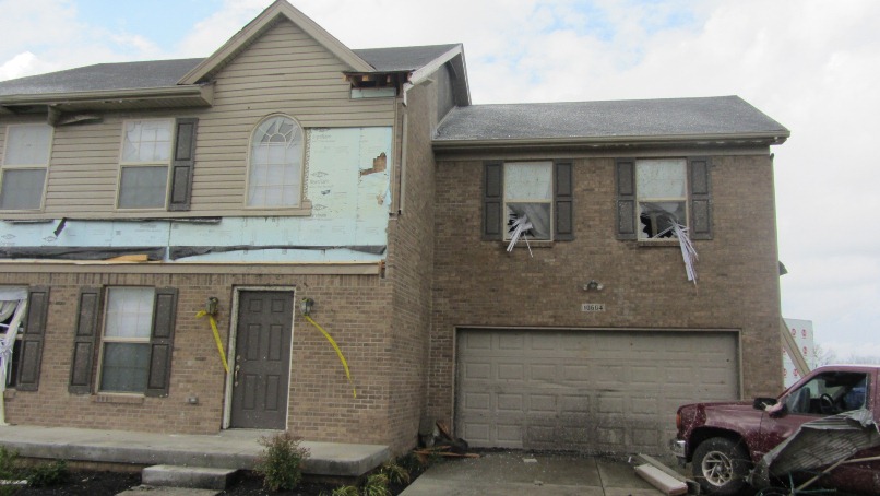
The final damage, near the intersection of Cedar Creek Road and Long Rifle Lane:
 |
Current Hazards
Hazardous Weather Outlook
Storm Prediction Center
Submit a Storm Report
Advisory/Warning Criteria
Radar
Fort Knox
Evansville
Fort Campbell
Nashville
Jackson
Wilmington
Latest Forecasts
El Nino and La Nina
Climate Prediction
Central U.S. Weather Stories
1-Stop Winter Forecast
Aviation
IDSS Forecast Points
Air Quality
Fire Weather
Recreation Forecasts
1-Stop Drought
Event Ready
1-Stop Severe Forecast
Past Weather
Climate Graphs
1-Stop Climate
CoCoRaHS
Local Climate Pages
Tornado History
Past Derby/Oaks/Thunder Weather
Football Weather
Local Information
About the NWS
Forecast Discussion
Items of Interest
Spotter Training
Regional Weather Map
Decision Support Page
Text Products
Science and Technology
Outreach
LMK Warning Area
About Our Office
Station History
Hazardous Weather Outlook
Local Climate Page
Tornado Machine Plans
Weather Enterprise Resources
US Dept of Commerce
National Oceanic and Atmospheric Administration
National Weather Service
Louisville, KY
6201 Theiler Lane
Louisville, KY 40229-1476
502-969-8842
Comments? Questions? Please Contact Us.


 Weather Story
 Weather Map
 Local Radar