Louisville, KY
Weather Forecast Office
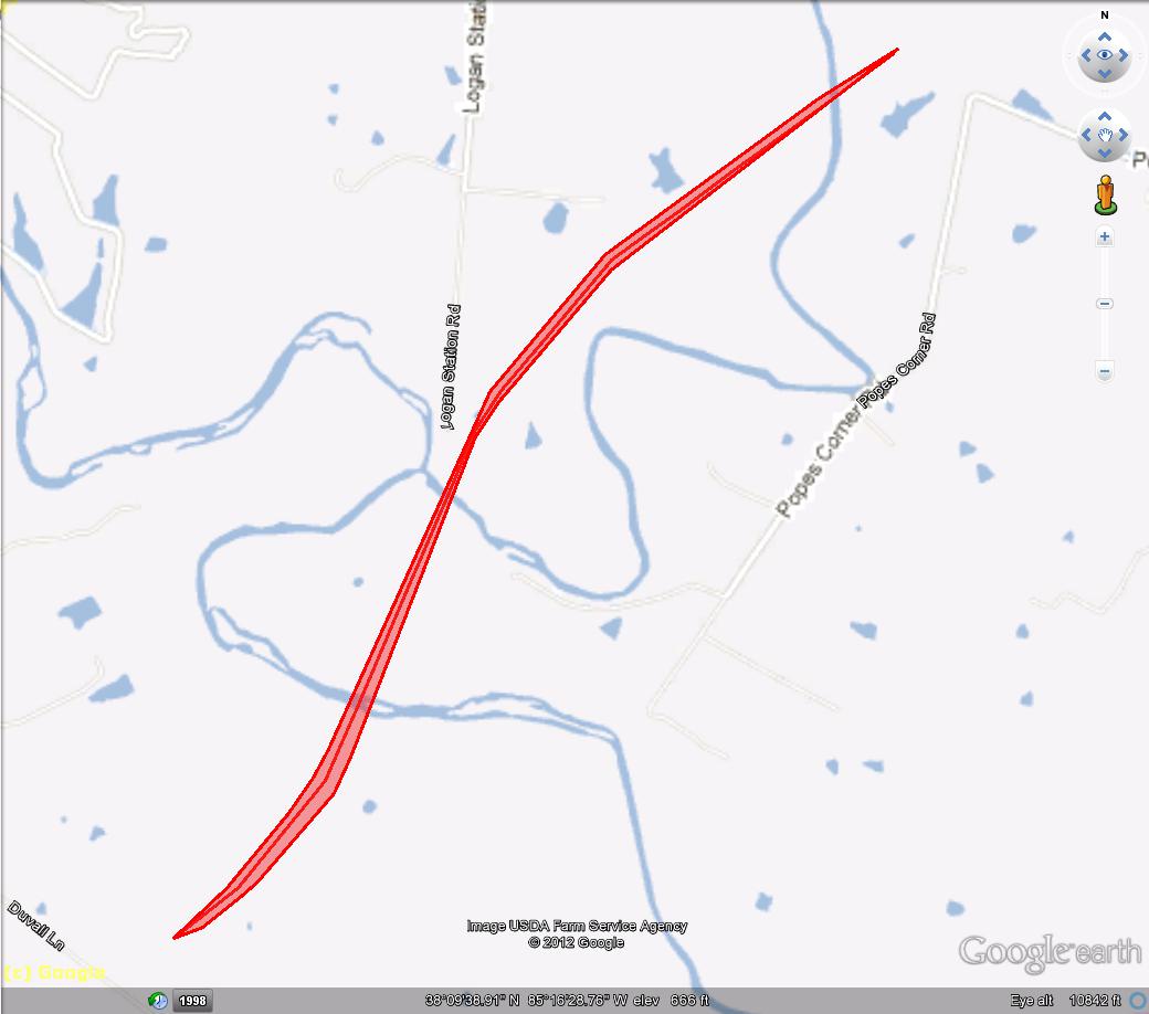
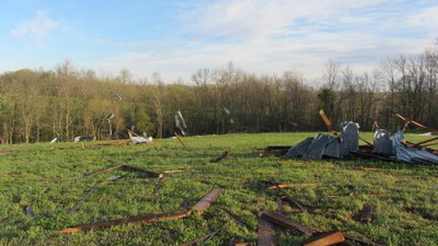
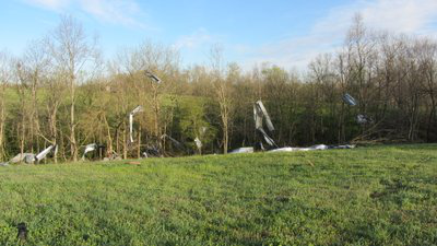
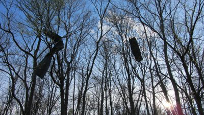
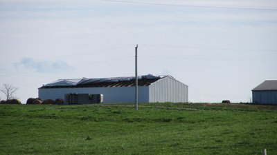
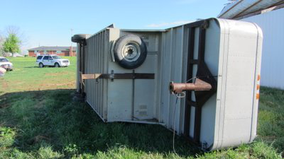
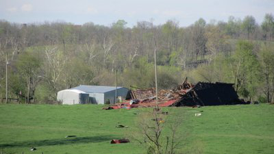
A tornado, witnessed by at least three people, touched down in Shelby County on the afternoon of March 23, 2012. The storm destroyed two barns, inflicted structural damage on two others, and snapped or uprooted about two dozen trees.
Begin time: 2:28pm EDT
End time: 2:33pm EDT
Begin point: 1.4 miles east of Finchville on Duvall Lane
End point: 3 miles northeast of Finchville on Popes Corner Road
EF Scale: 1
Wind speed: 100mph
Path length: 2.25 miles
Path width: 50 yards
Injuries: 0
Fatalities: 0
 |
 |
 |
 |
 |
 |
 |
 |
Current Hazards
Hazardous Weather Outlook
Storm Prediction Center
Submit a Storm Report
Advisory/Warning Criteria
Radar
Fort Knox
Evansville
Fort Campbell
Nashville
Jackson
Wilmington
Latest Forecasts
El Nino and La Nina
Climate Prediction
Central U.S. Weather Stories
1-Stop Winter Forecast
Aviation
IDSS Forecast Points
Air Quality
Fire Weather
Recreation Forecasts
1-Stop Drought
Event Ready
1-Stop Severe Forecast
Past Weather
Climate Graphs
1-Stop Climate
CoCoRaHS
Local Climate Pages
Tornado History
Past Derby/Oaks/Thunder Weather
Football Weather
Local Information
About the NWS
Forecast Discussion
Items of Interest
Spotter Training
Regional Weather Map
Decision Support Page
Text Products
Science and Technology
Outreach
LMK Warning Area
About Our Office
Station History
Hazardous Weather Outlook
Local Climate Page
Tornado Machine Plans
Weather Enterprise Resources
US Dept of Commerce
National Oceanic and Atmospheric Administration
National Weather Service
Louisville, KY
6201 Theiler Lane
Louisville, KY 40229-1476
502-969-8842
Comments? Questions? Please Contact Us.


 Weather Story
 Weather Map
 Local Radar