Louisville, KY
Weather Forecast Office
Click on the image for a larger version:
 |
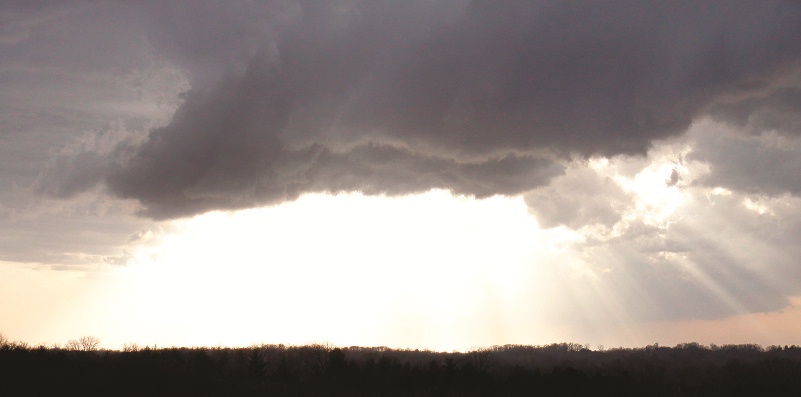
Low hanging clouds near Scottsville. |
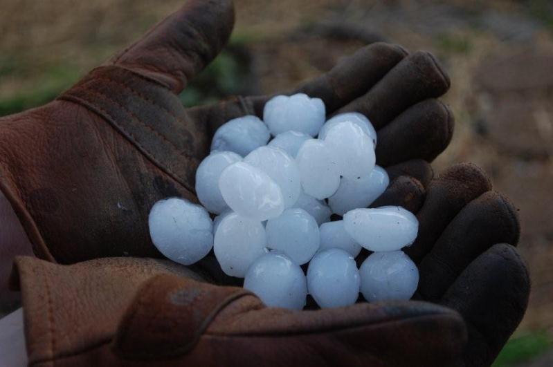 |
Hail from the storm near the Allen/Warren County line. |
 |
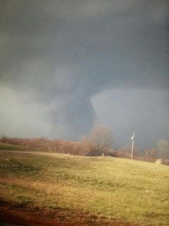
This is looking to the southwest from atop Barren River Dam at Barren River Lake on KY 252. After it passed over, a blast of wind flattened the grass on the front side of the dam and turned the lake to whitecaps on the leeward side of the dam. The blast included horizontal rain and even wind-splintered raindrops. Photo courtesy Matt Pedigo/Citizen-Times |
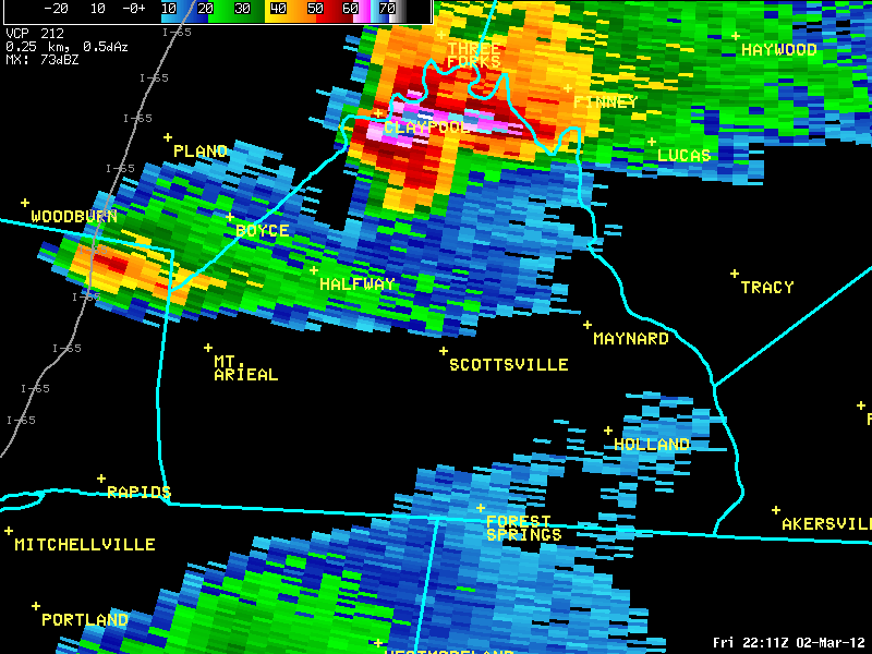
The storm seen here in this radar picture near Claypool produced a brief tornado near Alvaton, and continued to show strong rotation as it headed to the northeast across the northern tip of Allen County. The storm produced the large hail pictured above.
Current Hazards
Hazardous Weather Outlook
Storm Prediction Center
Submit a Storm Report
Advisory/Warning Criteria
Radar
Fort Knox
Evansville
Fort Campbell
Nashville
Jackson
Wilmington
Latest Forecasts
El Nino and La Nina
Climate Prediction
Central U.S. Weather Stories
1-Stop Winter Forecast
Aviation
IDSS Forecast Points
Air Quality
Fire Weather
Recreation Forecasts
1-Stop Drought
Event Ready
1-Stop Severe Forecast
Past Weather
Climate Graphs
1-Stop Climate
CoCoRaHS
Local Climate Pages
Tornado History
Past Derby/Oaks/Thunder Weather
Football Weather
Local Information
About the NWS
Forecast Discussion
Items of Interest
Spotter Training
Regional Weather Map
Decision Support Page
Text Products
Science and Technology
Outreach
LMK Warning Area
About Our Office
Station History
Hazardous Weather Outlook
Local Climate Page
Tornado Machine Plans
Weather Enterprise Resources
US Dept of Commerce
National Oceanic and Atmospheric Administration
National Weather Service
Louisville, KY
6201 Theiler Lane
Louisville, KY 40229-1476
502-969-8842
Comments? Questions? Please Contact Us.


 Weather Story
 Weather Map
 Local Radar