Louisville, KY
Weather Forecast Office
Click on an image for a larger version:
 |
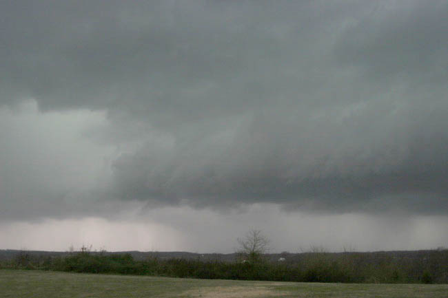
Northeast Crawford County around 2:40pm. Significant rotation was observed. Photo: Dan Crecelius |
 |
Northeast Crawford County around 2:40pm. Significant rotation was observed. Photo: Dan Crecelius |
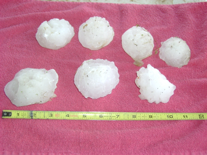 |
Hail in English. Photo: Roy Pickett |
 |
Hail in English. Photo: Roy Pickett |
 |
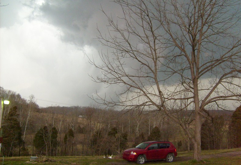
Storm gathering strength over eastern Crawford County. Photo: Wade Bell |
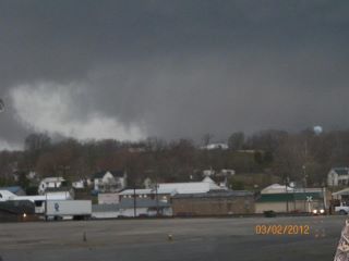 |
The storm roars into the Marengo area. Photo sent to us by WDRB. |
 |
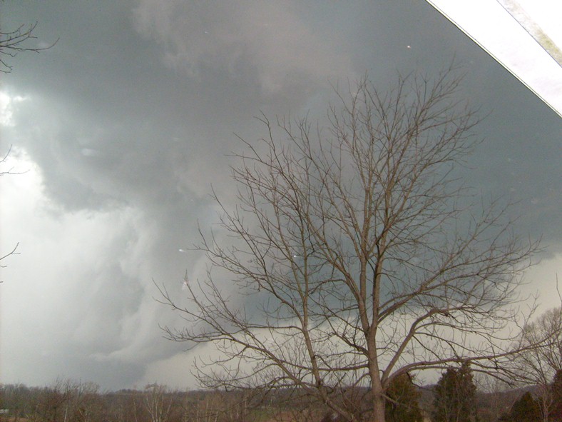
Rotating wall cloud with the second supercell, north of English. Photo: Chris Davis |
 |
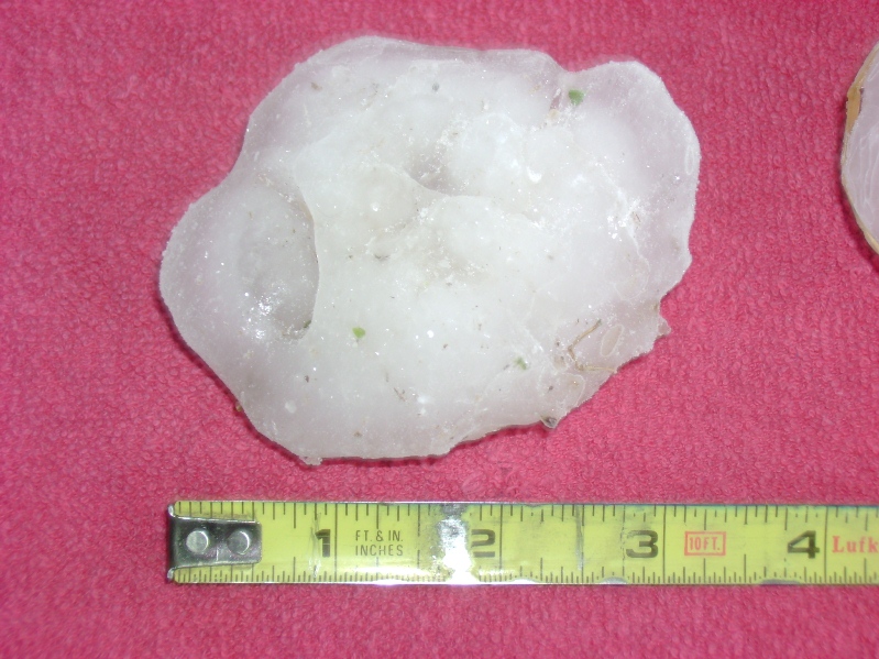
Huge hail from the second supercell, north of English. Photo: Chris Davis |
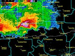
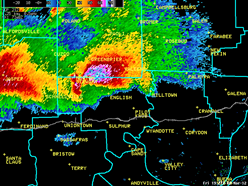
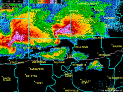
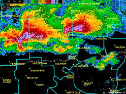
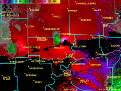
In the sequence of radar images below, you can see how quickly the storm wrapped up as it crossed northern Crawford County. The last image shows rotation within the storm west of Marengo. The rotation was very strong, and we were amazed that there was no tornado touchdown! Of course, this storm would go on to produce an EF4 tornado just one county later. (Note, too, the second super cell coming up behind it along the same path!)
 |
 |
 |
 |
 |
 |
Current Hazards
Hazardous Weather Outlook
Storm Prediction Center
Submit a Storm Report
Advisory/Warning Criteria
Radar
Fort Knox
Evansville
Fort Campbell
Nashville
Jackson
Wilmington
Latest Forecasts
El Nino and La Nina
Climate Prediction
Central U.S. Weather Stories
1-Stop Winter Forecast
Aviation
IDSS Forecast Points
Air Quality
Fire Weather
Recreation Forecasts
1-Stop Drought
Event Ready
1-Stop Severe Forecast
Past Weather
Climate Graphs
1-Stop Climate
CoCoRaHS
Local Climate Pages
Tornado History
Past Derby/Oaks/Thunder Weather
Football Weather
Local Information
About the NWS
Forecast Discussion
Items of Interest
Spotter Training
Regional Weather Map
Decision Support Page
Text Products
Science and Technology
Outreach
LMK Warning Area
About Our Office
Station History
Hazardous Weather Outlook
Local Climate Page
Tornado Machine Plans
Weather Enterprise Resources
US Dept of Commerce
National Oceanic and Atmospheric Administration
National Weather Service
Louisville, KY
6201 Theiler Lane
Louisville, KY 40229-1476
502-969-8842
Comments? Questions? Please Contact Us.


 Weather Story
 Weather Map
 Local Radar