Louisville, KY
Weather Forecast Office
A NWS storm survey team surveyed Barren, Metcalfe, Green, Adair, and Russell counties. Several pine trees were down within the hail path, but likely due to straight-line winds. Several people reported seeing a funnel cloud, including Russell County Emergency Management personnel, who chased the funnel cloud to Highway 80 toward Pulaski County. No tornado damage was found, but that area did suffer extensive large hail damage. The most significant hail damage was found in and near Columbia in Adair County. Along one stretch of roadway from the Metcalfe/Adair county line to the city of Columbia, not one vehicle was found that did not have its windshield damaged. In the city of Columbia, one house had hail break through the roof and a Wal-Mart store had 160 skylights damaged.
Click on an image for a larger version:
|
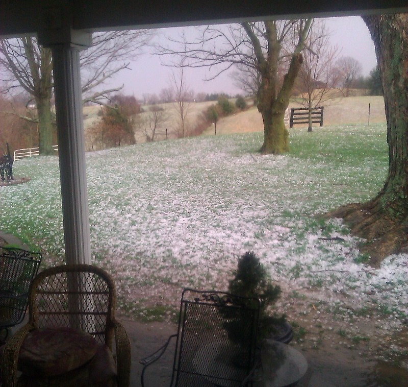
Edmonton. Photo courtesy Dean and Gina Rowe |
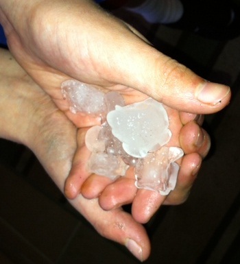
Edmonton. Photo courtesy Nate Pringle |
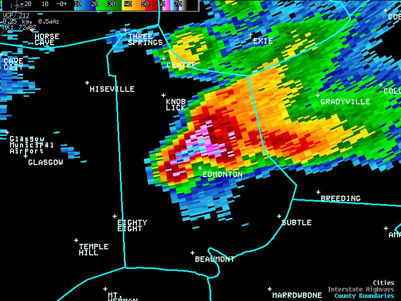
Here is a radar image of the storm as it was moving across the north side of Edmonton. Notice the hook on the southwest side of the storm! The storm was also displaying significant rotation a few thousand feet above the ground. Foruntunately the circulation didn't make it all the way to the surface, but unfortunately the hail sure did!
Current Hazards
Hazardous Weather Outlook
Storm Prediction Center
Submit a Storm Report
Advisory/Warning Criteria
Radar
Fort Knox
Evansville
Fort Campbell
Nashville
Jackson
Wilmington
Latest Forecasts
El Nino and La Nina
Climate Prediction
Central U.S. Weather Stories
1-Stop Winter Forecast
Aviation
IDSS Forecast Points
Air Quality
Fire Weather
Recreation Forecasts
1-Stop Drought
Event Ready
1-Stop Severe Forecast
Past Weather
Climate Graphs
1-Stop Climate
CoCoRaHS
Local Climate Pages
Tornado History
Past Derby/Oaks/Thunder Weather
Football Weather
Local Information
About the NWS
Forecast Discussion
Items of Interest
Spotter Training
Regional Weather Map
Decision Support Page
Text Products
Science and Technology
Outreach
LMK Warning Area
About Our Office
Station History
Hazardous Weather Outlook
Local Climate Page
Tornado Machine Plans
Weather Enterprise Resources
US Dept of Commerce
National Oceanic and Atmospheric Administration
National Weather Service
Louisville, KY
6201 Theiler Lane
Louisville, KY 40229-1476
502-969-8842
Comments? Questions? Please Contact Us.


 Weather Story
 Weather Map
 Local Radar