Louisville, KY
Weather Forecast Office
The first two weeks were unusually cool, coming in three waves as a series of Canadian high pressure centers dropped through the region. The coldest morning occurred on the 9th with sunrise temperatures mostly in the 25 to 30 degree range. The 11th was particularly chilly as well with lows in the 30s and highs only in the 50s.
Though there was scattered severe weather on six days of the month, it mostly just resulted in isolated tree damage. There was one report of severe hail during the month when 1" hailstones were seen in Scott County, Kentucky.
| Average Temperature | Departure from Normal | Precipitation | Departure from Normal | |
| Bowling Green | 65.1° | -1.3° | 3.22" | -2.22" |
| Frankfort | 62.9° | -1.0° | 6.25" | +1.54" |
| Lexington | 61.4° | -2.8° | 5.12" | +0.04" |
| Louisville Bowman | 64.1° | -2.2° | 4.83" | -0.15" |
| Louisville Ali | 65.4° | -1.7° | 5.93" | +0.82" |
Records
7th: Low of 33° at Lexington
8th: Cold high of 55° at Frankfort
9th: Low of 34° at Bowling Green, low of 28° at Frankfort, low of 29° at Lexington
11th: Low of 35° at Lexington, cold high of 51° at Lexington
12th: Low of 35° at Lexington
16th: Rainfall of 1.19" at Frankfort
24th: Warm low of 71° at Frankfort
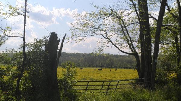
Horses enjoying pleasant May weather on the 8th in Louisville.
Current Hazards
Hazardous Weather Outlook
Storm Prediction Center
Submit a Storm Report
Advisory/Warning Criteria
Radar
Fort Knox
Evansville
Fort Campbell
Nashville
Jackson
Wilmington
Latest Forecasts
El Nino and La Nina
Climate Prediction
Central U.S. Weather Stories
1-Stop Winter Forecast
Aviation
IDSS Forecast Points
Air Quality
Fire Weather
Recreation Forecasts
1-Stop Drought
Event Ready
1-Stop Severe Forecast
Past Weather
Climate Graphs
1-Stop Climate
CoCoRaHS
Local Climate Pages
Tornado History
Past Derby/Oaks/Thunder Weather
Football Weather
Local Information
About the NWS
Forecast Discussion
Items of Interest
Spotter Training
Regional Weather Map
Decision Support Page
Text Products
Science and Technology
Outreach
LMK Warning Area
About Our Office
Station History
Hazardous Weather Outlook
Local Climate Page
Tornado Machine Plans
Weather Enterprise Resources
US Dept of Commerce
National Oceanic and Atmospheric Administration
National Weather Service
Louisville, KY
6201 Theiler Lane
Louisville, KY 40229-1476
502-969-8842
Comments? Questions? Please Contact Us.


 Weather Story
 Weather Map
 Local Radar