Louisville, KY
Weather Forecast Office
This October was warm and dry with no severe weather or flooding. Moderate drought persisted across most of southern Indiana and much of central Kentucky through the month until the last few days. Significant rains then fell on the 29th and 30th as a slow-moving frontal system drifted across the region. Two to three inches fell along the Ohio River, with over four inches in parts of western Kentucky.
Halloween was a chilly one, with widespread morning lows in the 20s putting an end to the growing season.
| Average Temperature | Departure from Normal | Precipitation | Departure from Normal | Snow | Departure from Normal | |
| Bowling Green | 60.9° | +0.9° | 2.10" | -1.53" | 0 | 0 |
| Frankfort | 58.4° | +0.8° | 2.70" | -0.94" | ||
| Lexington | 60.6° | +2.8° | 2.30" | -1.36" | T | +T |
| Louisville Ali | 61.8° | +1.5° | 2.97" | -0.75" | 0 | -0.1" |
| Louisville Bowman | 58.6° | -0.2° | 3.28" | -0.37" |
Records
27th: Warm low of 66° at Louisville
29th: Rainfall of 0.64" at Bowling Green
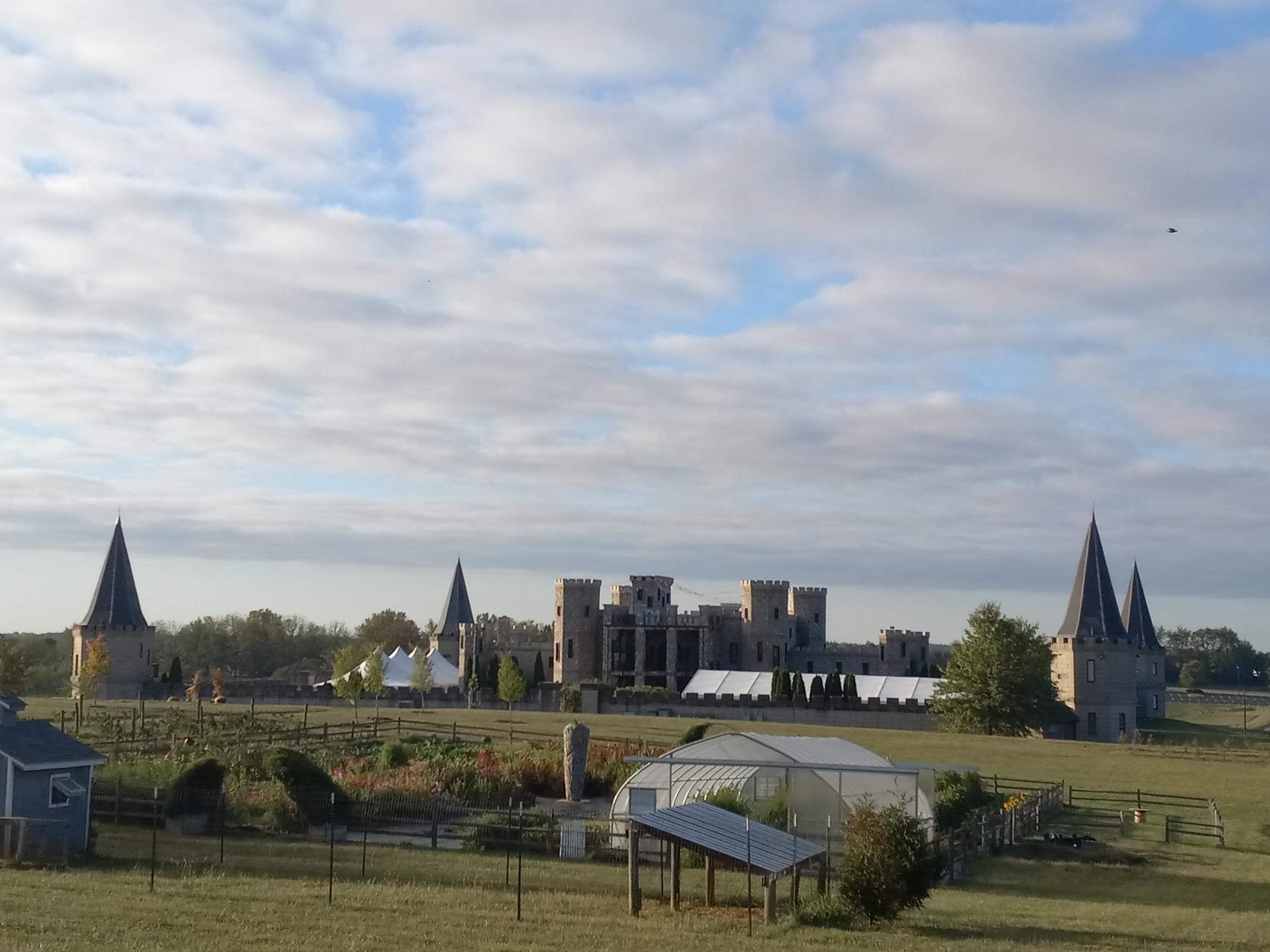
A partly cloudy sunrise over the Kentucky Castle between Versailles and Lexington on the 7th.
Current Hazards
Hazardous Weather Outlook
Storm Prediction Center
Submit a Storm Report
Advisory/Warning Criteria
Radar
Fort Knox
Evansville
Fort Campbell
Nashville
Jackson
Wilmington
Latest Forecasts
El Nino and La Nina
Climate Prediction
Central U.S. Weather Stories
1-Stop Winter Forecast
Aviation
IDSS Forecast Points
Air Quality
Fire Weather
Recreation Forecasts
1-Stop Drought
Event Ready
1-Stop Severe Forecast
Past Weather
Climate Graphs
1-Stop Climate
CoCoRaHS
Local Climate Pages
Tornado History
Past Derby/Oaks/Thunder Weather
Football Weather
Local Information
About the NWS
Forecast Discussion
Items of Interest
Spotter Training
Regional Weather Map
Decision Support Page
Text Products
Science and Technology
Outreach
LMK Warning Area
About Our Office
Station History
Hazardous Weather Outlook
Local Climate Page
Tornado Machine Plans
Weather Enterprise Resources
US Dept of Commerce
National Oceanic and Atmospheric Administration
National Weather Service
Louisville, KY
6201 Theiler Lane
Louisville, KY 40229-1476
502-969-8842
Comments? Questions? Please Contact Us.


 Weather Story
 Weather Map
 Local Radar