Overview
|
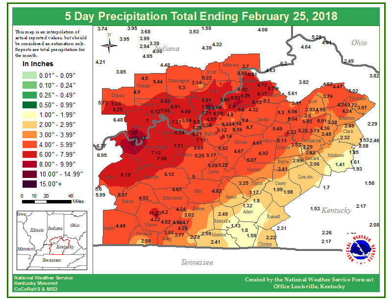
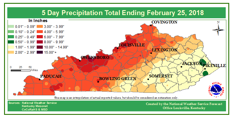
Repeated rounds of moderate to heavy rainfall across the entire Ohio River basin totaled between 8 to 9 inches along and on either side of the Ohio River from February 15 to March 1. These totals were 200 to 400% above normal values for mid to late February. The large areal extent of the excessive rainfall led to significant rises on area rivers, including the Ohio River. This was the biggest flood on the Ohio River in Louisville since March 1997. |
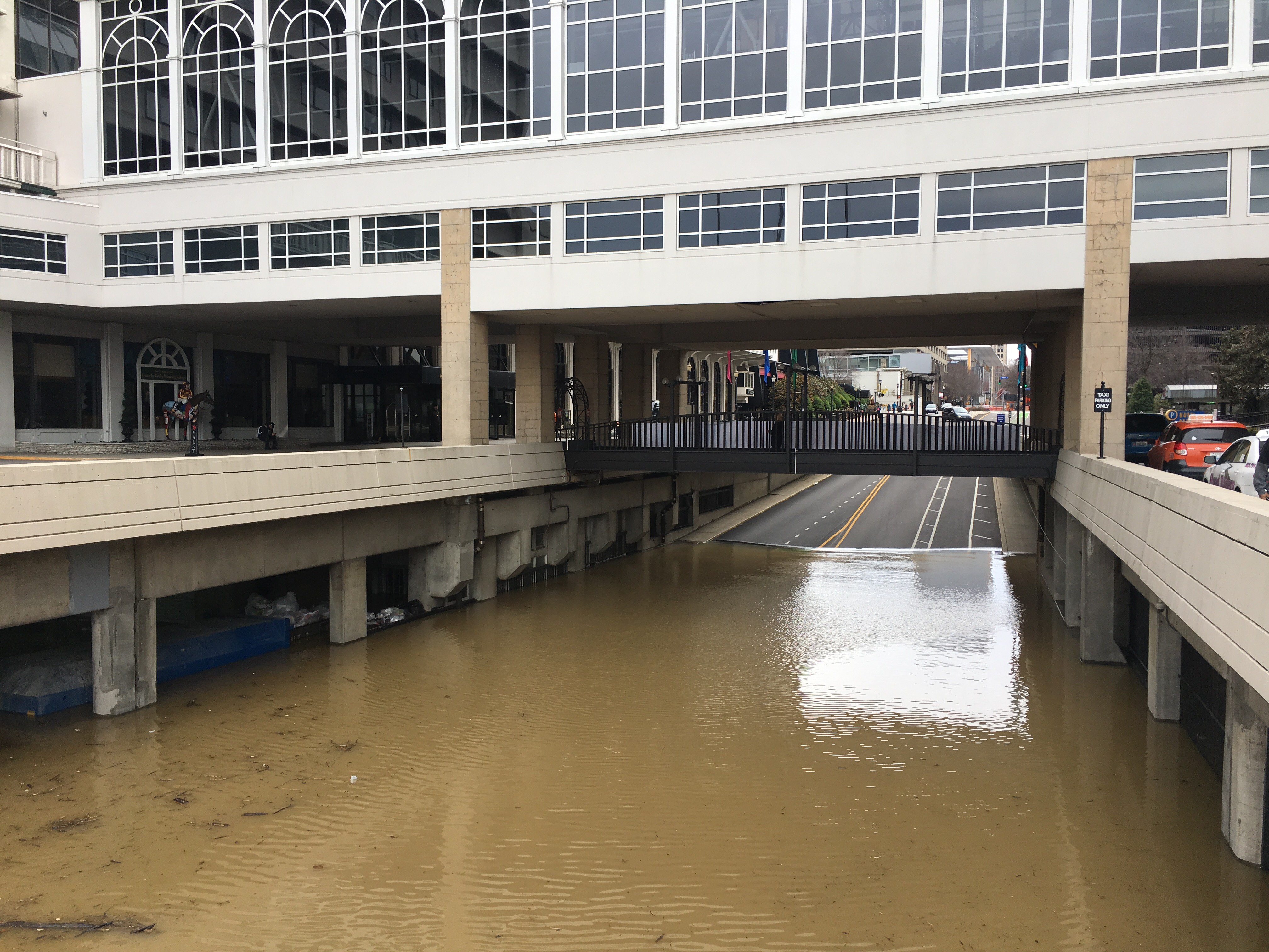
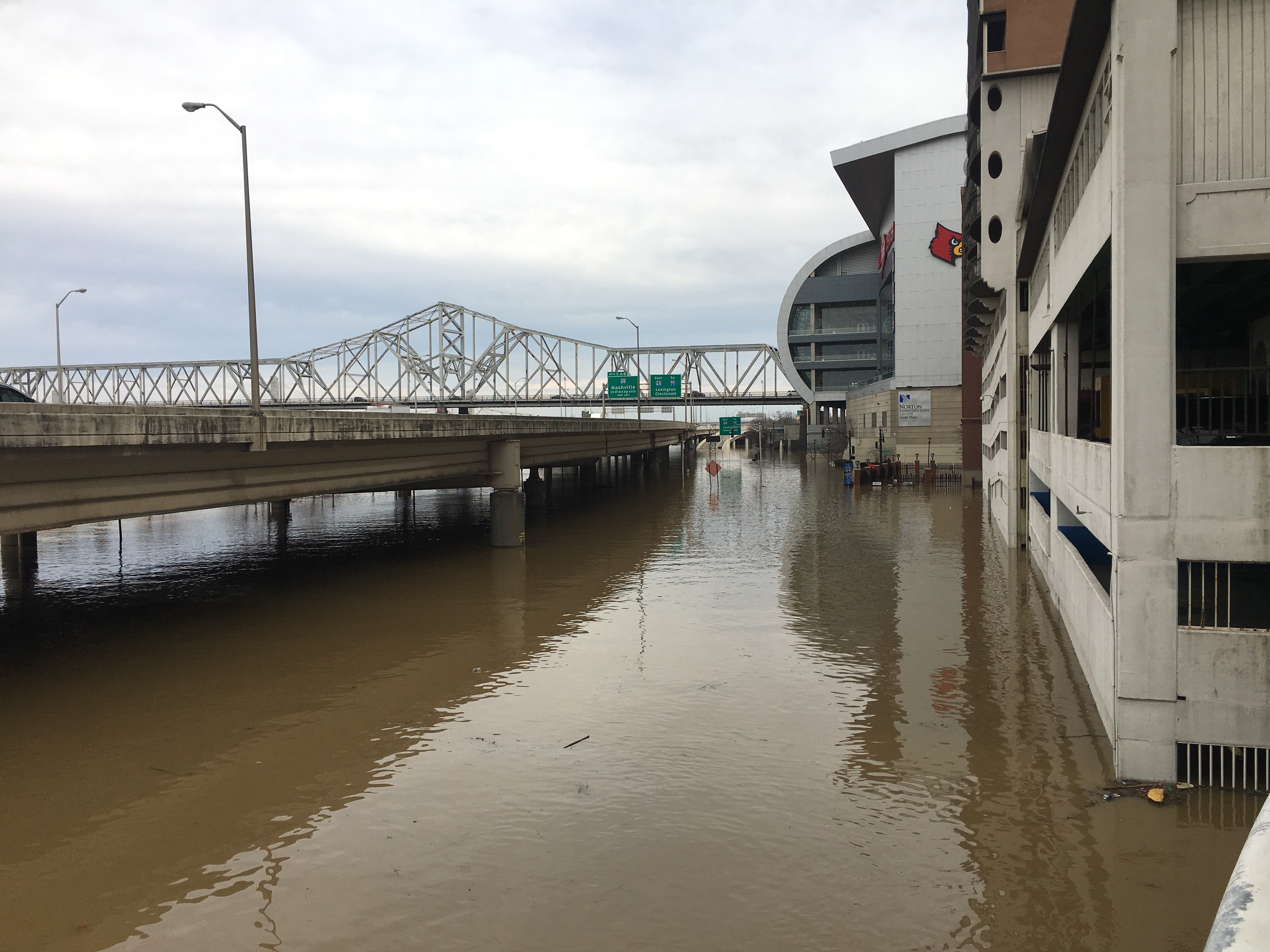 Ohio River flooding at the Galt House in downtown Louisville February 24, 2018 |
Flooding
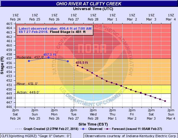
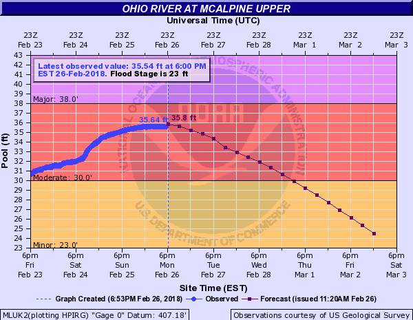
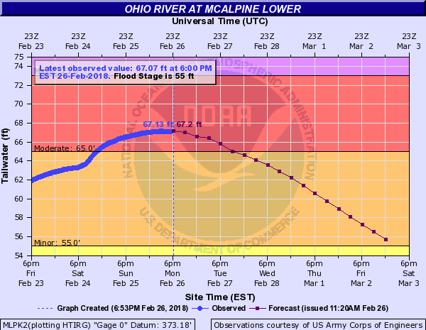
Flooding was seen at most of the river forecast sites. Moderate to major flooding was recorded on the Ohio River as well as at a few if the gauges on smaller rivers across the region. This was also a top 10 flood for multiple sites.
Hydrographs
 |
 |
 |
 |
|
Ohio River at Clifty Creek Crested at 457.3 ft. -13th highest crest on record |
Ohio River at McAlpine Upper Crested at 35.64 ft. - 10th highest crest on record |
Ohio River at McAlpine Lower Crested at 67.13 ft. - 12th highest crest on record |
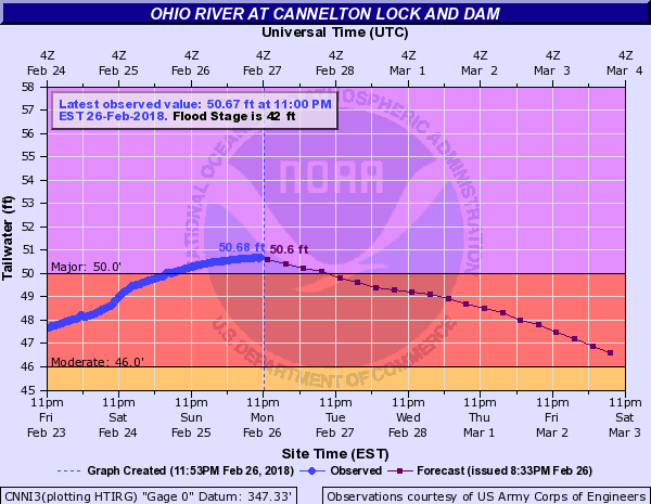
Ohio River at Cannelton Lock and Dam Crested at 50.68 feet - 7th highest crest on record |
 |
 |
 |
 |
|
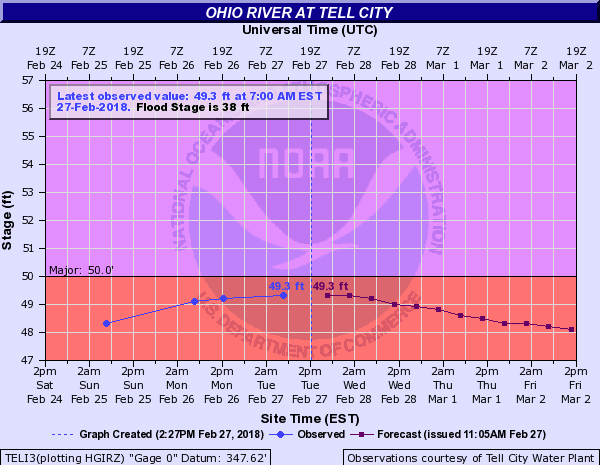
Ohio River at Tell City Crested at 49.3 ft. - 7th highest crest on record |
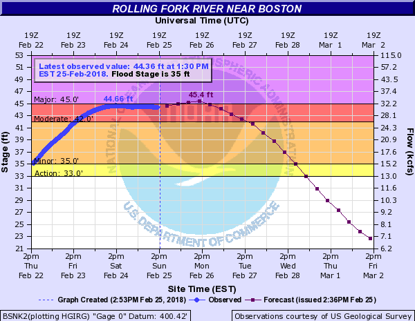
Rolling Fork River near Boston Crested at 44.66 ft. - 26th highest crest on record |
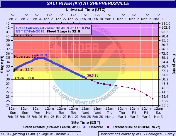
Salt River at Shepherdsville Crested at 35.01 feet - 7th highest crest on record |
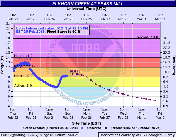
Elkhorn Creek at Peaks Mill Crested at 13.05 ft. - 18th highest crest on record |
 |
|
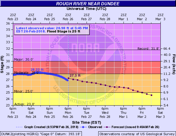
Rough River near Dundee Crested at 28.22 ft. - 26th highest crest on record |
Photos:
 |
 |
 |
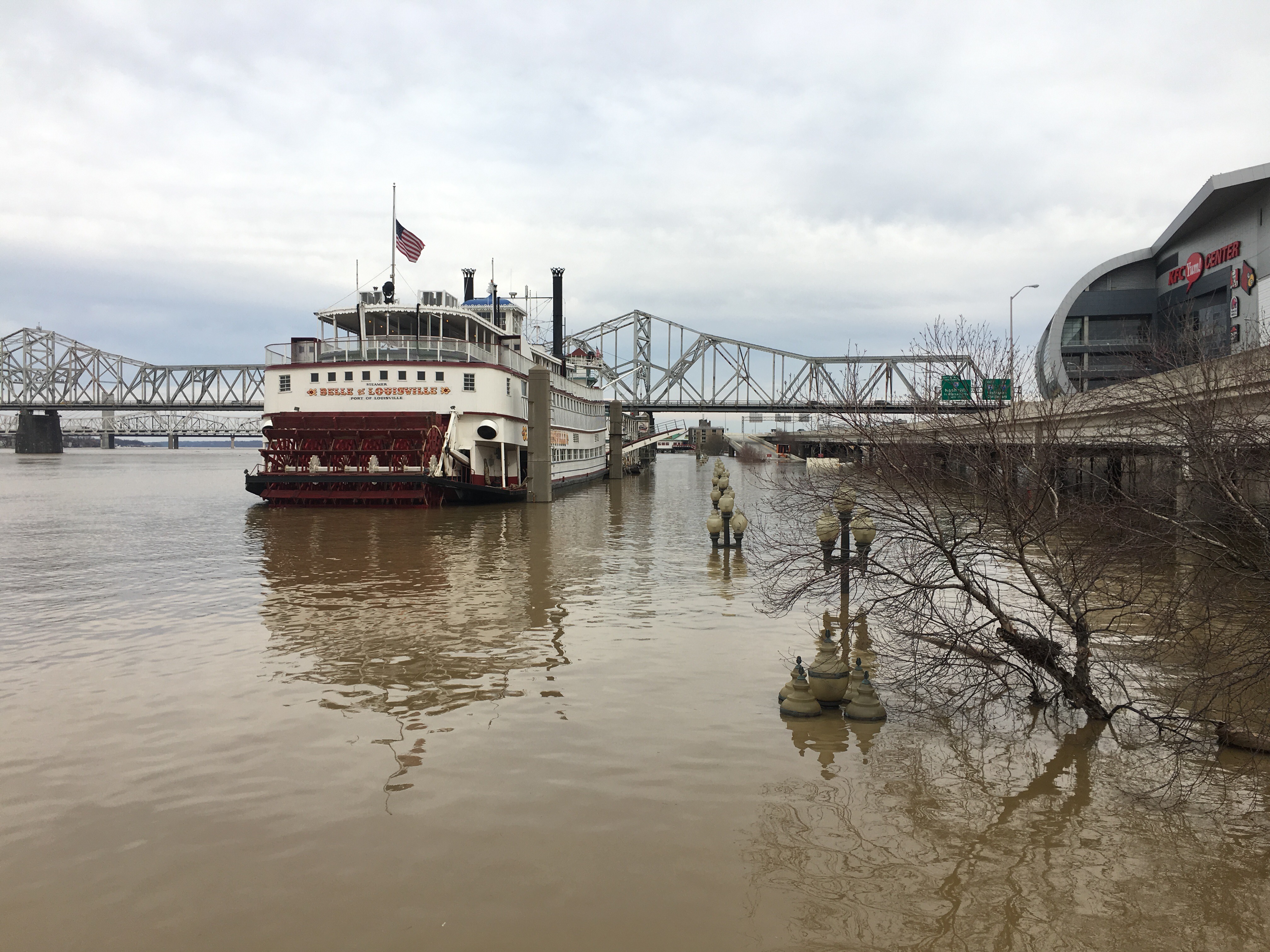 |
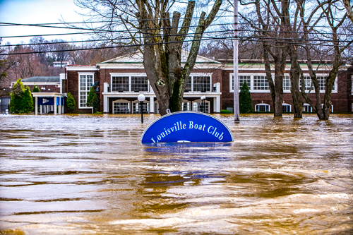
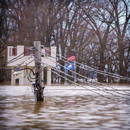
| Ohio River flooding along River Road in Louisville Feb. 25 - Photo courtesy Molly Miller | Ohio River flooding along River Road in Louisville Feb. 25 - Photo courtesy Molly Miller | Ohio River flooding along River Road in Louisville Feb. 25 - Photo courtesy Molly Miller | Flooding in downtown Louisville near the Galt House Feb. 25 |
 |
 |
 |
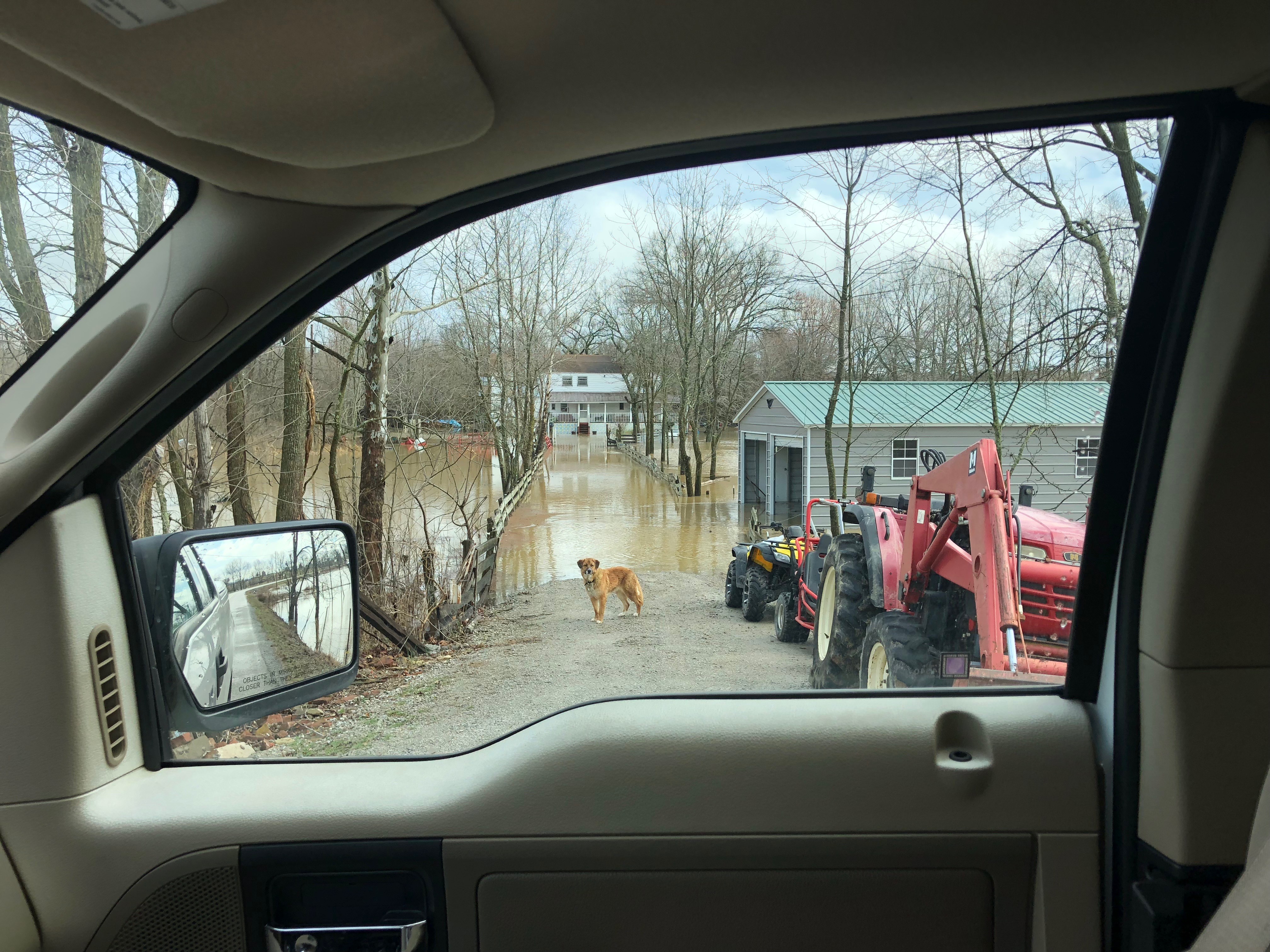 |
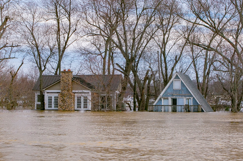
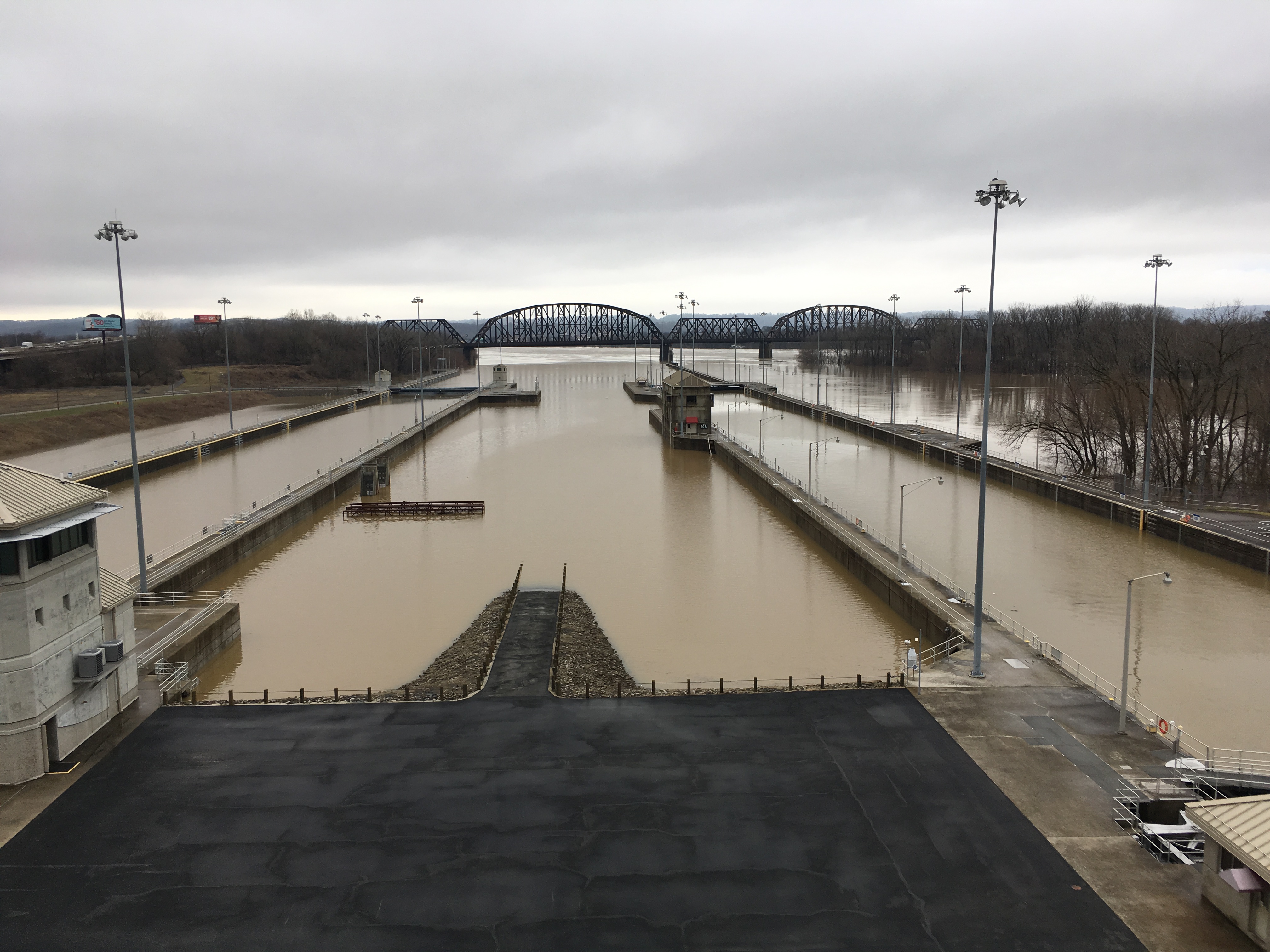
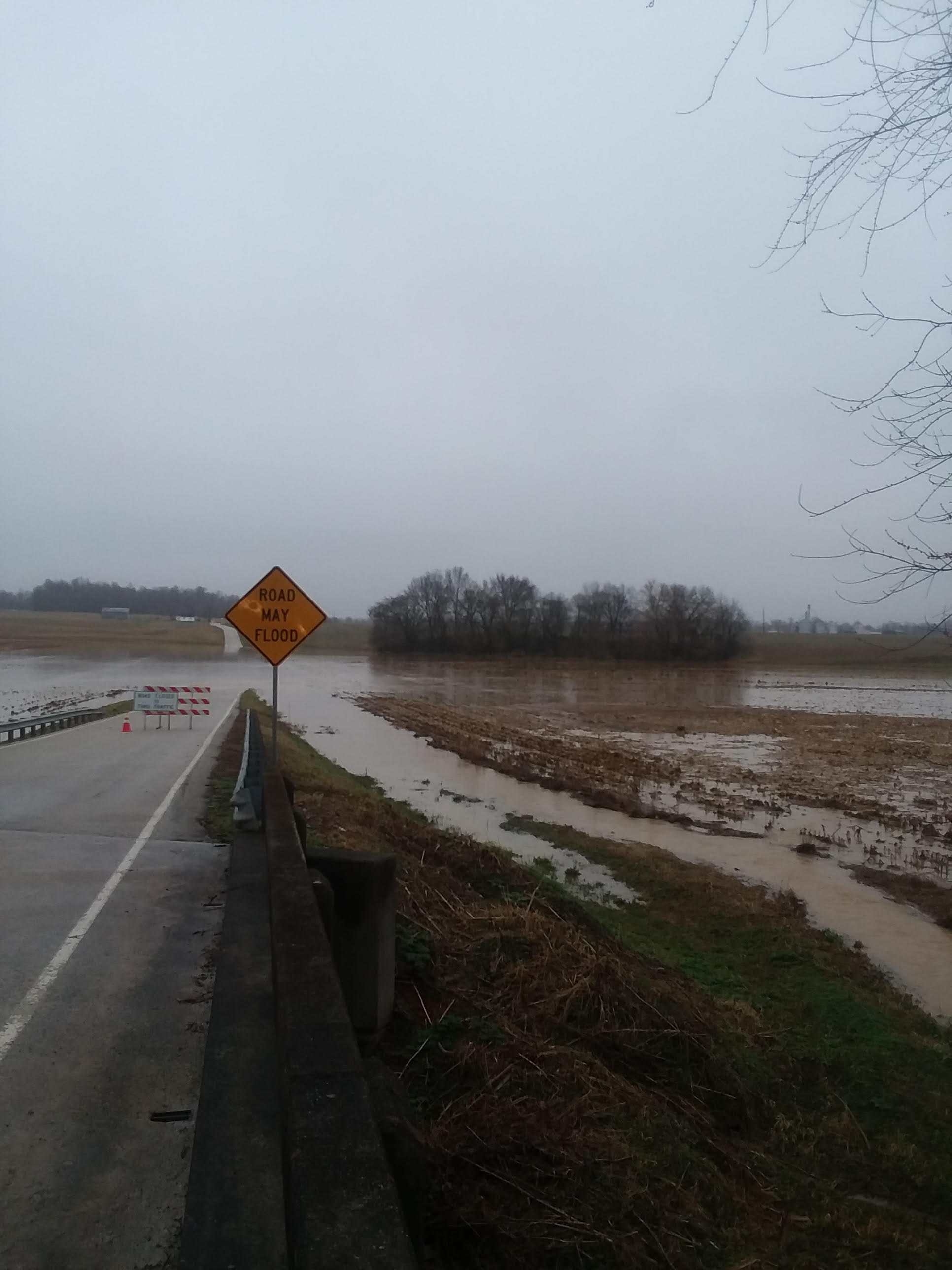
| Flooding in downtown Louisville near the Galt House Feb. 25 | McAlpine Lock Feb. 23 with the Ohio River at 30.3 feet on the McAlpine Upper gauge | Flooding in Hodgenville, KY on Feb. 23 | Flooding at Boston on the Rolling Fork River at 41.2 feet on the gauge |
Rain Reports
 |
 |
 |
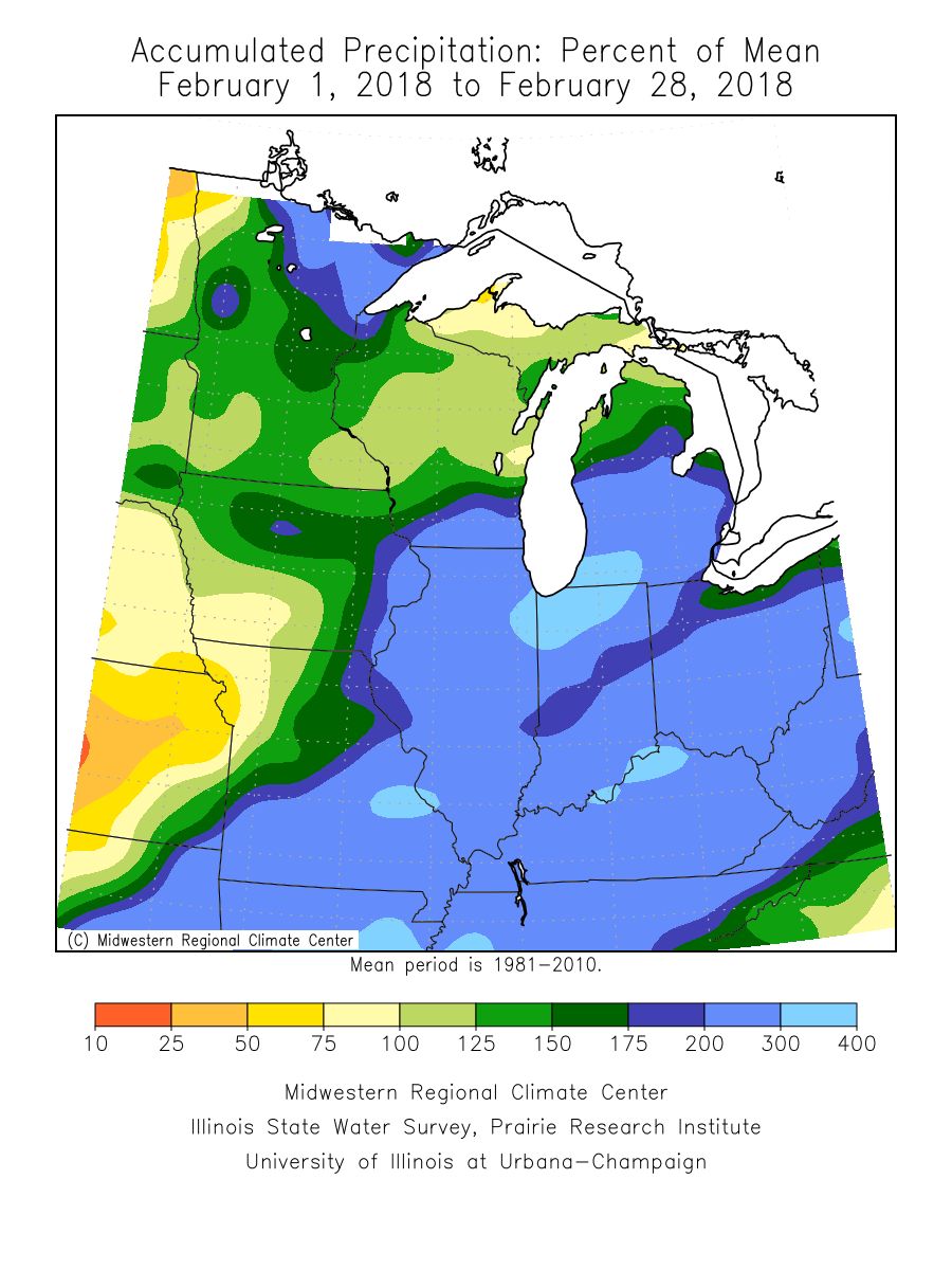 |
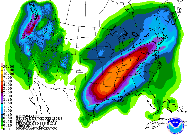
| 7 day rainfall forecast from WPC issued Wednesday, February 21 | 5 day total precipitation ending February 25 | 5 day total precipitation ending February 25 | Rainfall over much of the lower Ohio Valley was 200-300% of normal for February. |
 |
Media use of NWS Web News Stories is encouraged! Please acknowledge the NWS as the source of any news information accessed from this site. |
 |