Louisville, KY
Weather Forecast Office
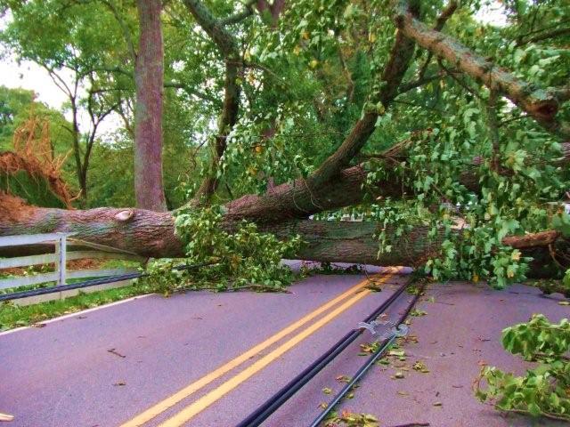
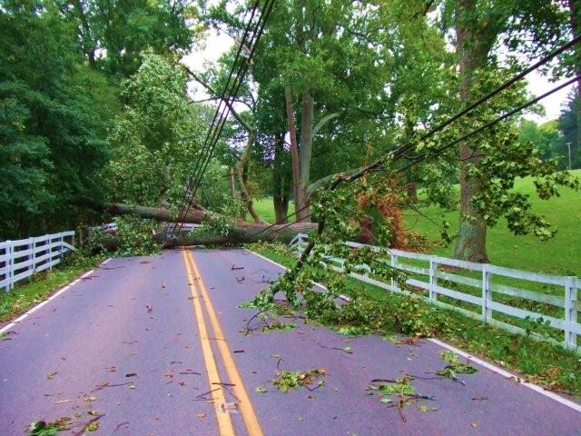
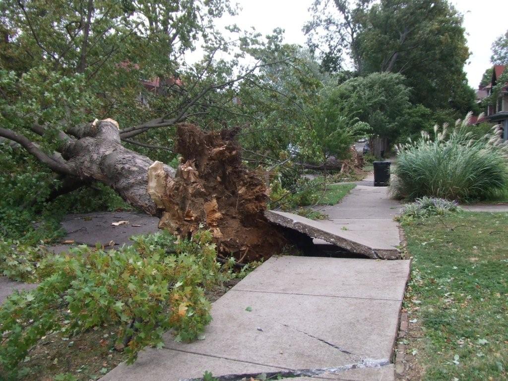
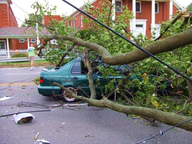
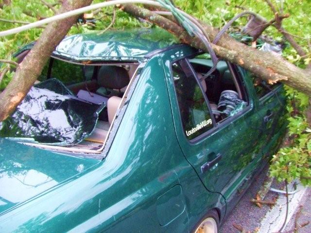
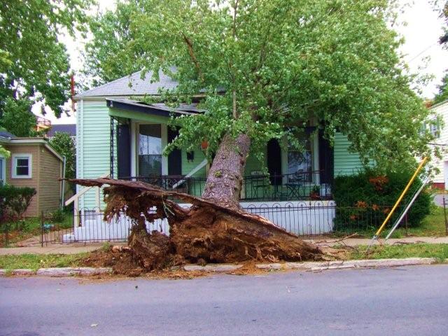
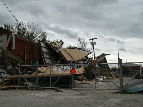
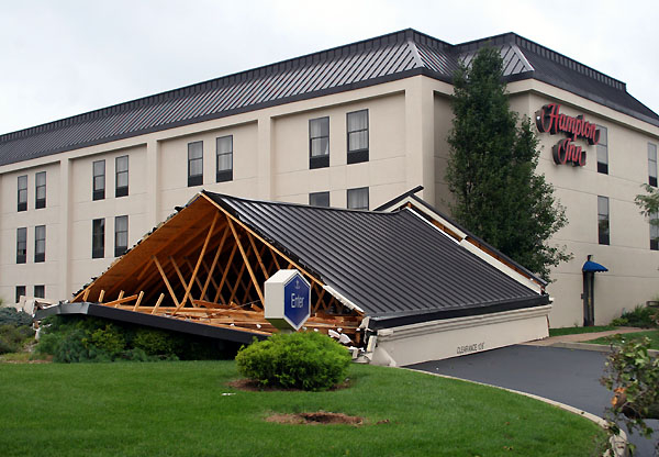
On September 14, 2008 the remnants of former Hurricane Ike moved northeastward through the Ohio Valley. Thunderstorms and breezy conditions had been expected to accompany the system's low pressure center. Instead, skies remained mostly clear and the sun was able to mix up the atmosphere and generate astounding wind gusts:
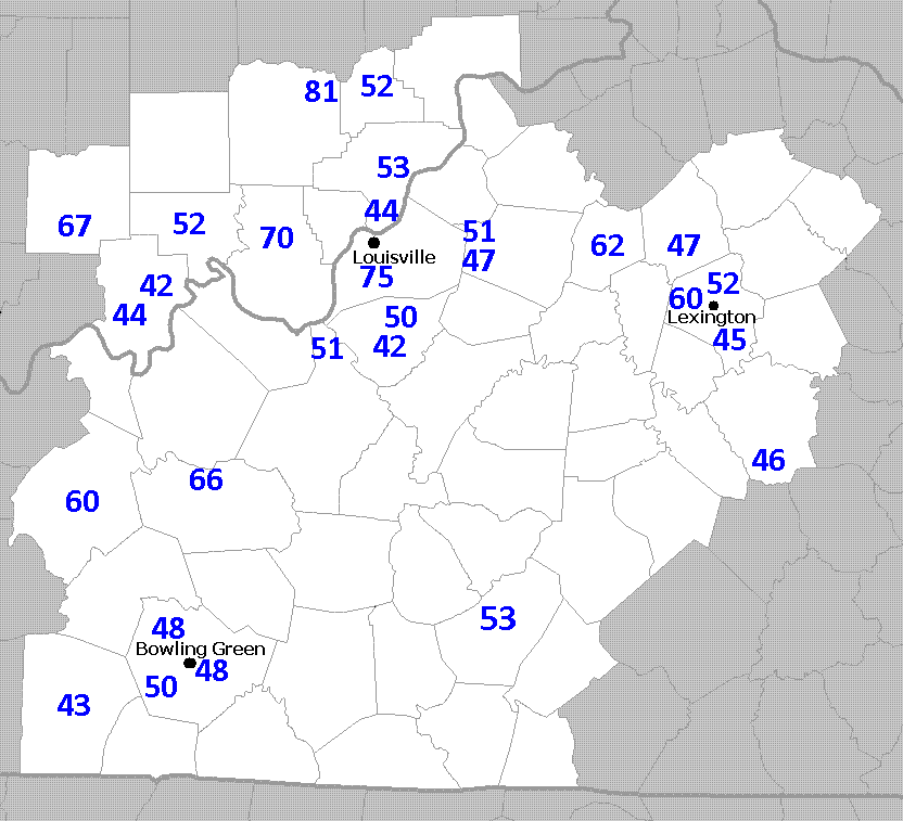
A great deal of tree damage was done, along with some light structural damage. Thousands of power lines were torn down and Louisville suffered its largest blackout in at least 30 years. Louisville International Airport was shut down and a state of emergency was declared. Sadly there were four fatalities caused by falling limbs.
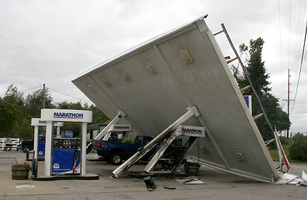
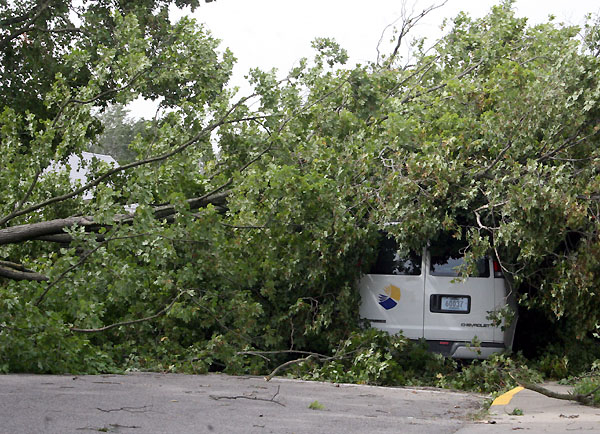
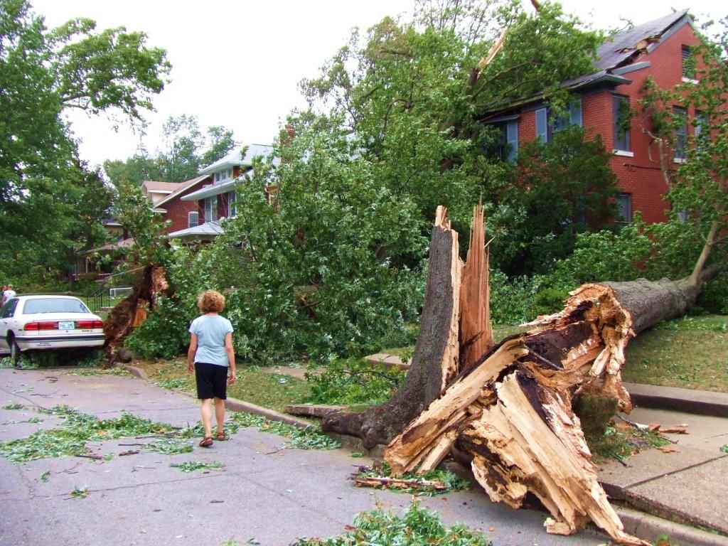
Click on the pictures below to see a larger version:
 |
 |
 |
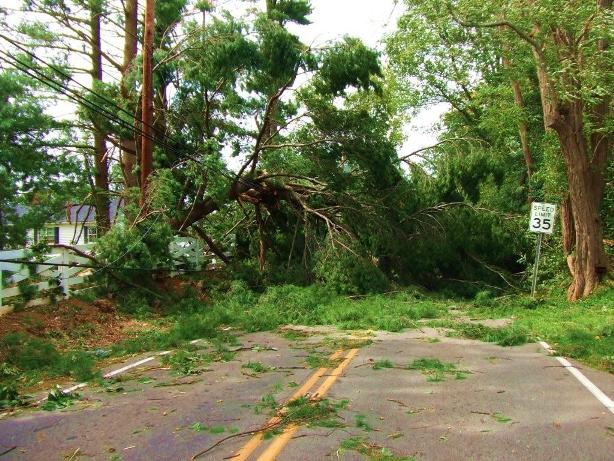 |
| Capitol Avenue, Corydon | Corydon | Bonnycastle Avenue | Wolf Pen Branch |
 |
 |
 |
 |
| Wolf Pen Branch | Wolf Pen Branch | Saratoga Avenue | Taylorsville Road |
 |
 |
 |
 |
| Taylorsville Road | Baxter Avenue | Scottsburg, Indiana | IN 135 |
Current Hazards
Hazardous Weather Outlook
Storm Prediction Center
Submit a Storm Report
Advisory/Warning Criteria
Radar
Fort Knox
Evansville
Fort Campbell
Nashville
Jackson
Wilmington
Latest Forecasts
El Nino and La Nina
Climate Prediction
Central U.S. Weather Stories
1-Stop Winter Forecast
Aviation
IDSS Forecast Points
Air Quality
Fire Weather
Recreation Forecasts
1-Stop Drought
Event Ready
1-Stop Severe Forecast
Past Weather
Climate Graphs
1-Stop Climate
CoCoRaHS
Local Climate Pages
Tornado History
Past Derby/Oaks/Thunder Weather
Football Weather
Local Information
About the NWS
Forecast Discussion
Items of Interest
Spotter Training
Regional Weather Map
Decision Support Page
Text Products
Science and Technology
Outreach
LMK Warning Area
About Our Office
Station History
Hazardous Weather Outlook
Local Climate Page
Tornado Machine Plans
Weather Enterprise Resources
US Dept of Commerce
National Oceanic and Atmospheric Administration
National Weather Service
Louisville, KY
6201 Theiler Lane
Louisville, KY 40229-1476
502-969-8842
Comments? Questions? Please Contact Us.


 Weather Story
 Weather Map
 Local Radar