
Strong to severe thunderstorms capable of producing large to very large hail, damaging wind gusts and a few strong tornadoes are likely from the Midwest to the Mid-Atlantic tonight. Moderate Risk (level 4 of 5) of severe thunderstorms is outlooked for the Midwest. A widespread heat wave will peak in the South and East on Friday, with many temperature records expected to be broken. Read More >
May 10, 1973
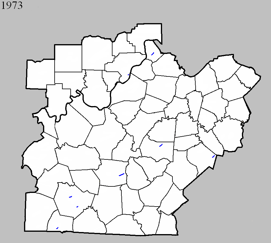
Counties: Warren
F-scale: F1
Deaths:
Injuries:
Path width:
Path length:
Time: 10:45am
Grazulis narrative:
Noted discrepancies: SPC gives a path width of 10 yards, NCDC 30 yards.
Notes: Storm Data reports damage on the north side of Bowling Green.
May 25, 1973
Counties: Marion
F-scale: F1
Deaths:
Injuries: 2
Path width:
Path length:
Time: 6:00pm
Noted discrepancies: SPC gives a path width of 10 yards, NCDC 30 yards.
Notes: Storm Data locates this tornado three miles northeast of Lebanon.
June 16, 1973
Counties: Clark IN
F-scale: F1
Deaths:
Injuries:
Path width:
Path length:
Time: 7:10pm
Noted discrepancies: Lat/lon actually places this in Oldham County. Listed in Storm Data in Clark County near New Washington. More research is needed.
June 20, 1973
Counties: Warren
F-scale: F1
Deaths:
Injuries:
Path width:
Path length:
Time: 8:00pm
Noted discrepancies: SPC gives a path width of 10 yards, NCDC 30 yards. The SPC and NCDC longitude (-88.45) for this tornado is in Marshall County. If changed to -86.45 it is in Warren County (right in Bowling Green). Storm Data reports damage on a farm just south of Bowling Green. Even if using -86.45, that would put the tornado right in the city of Bowling Green, not on a farm south of town. More research reveals that this very small tornado hit the Kenneth Hardcastle property between Hardcastle and Greenhill east-southeast of Bowling Green.
June 27, 1973
Counties: Clark IN
F-scale: F1
Deaths:
Injuries:
Path width:
Path length:
Time: 9:00am
Notes: Six homes damaged in Utica. Tornado was described as "small, yellow, and muddy looking."
June 27, 1973
Counties: Lincoln
F-scale: F1
Deaths:
Injuries:
Path width:
Path length:
Time: 1:00pm
Noted discrepancies: SPC gives a path width of 10 yards, NCDC 30 yards.
June 27, 1973
Counties: Shelby
F-scale: F1
Deaths:
Injuries:
Path width:
Path length:
Time: 1:00pm
Noted discrepancies: SPC gives a path width of 10 yards, NCDC 30 yards. The lat/lon given at SPC and NCDC for this tornado is in Nicholas County. Storm Data lists it in Shelby County. If the longitude is changed from SPC/NCDC's -84.08 to -85.08, it's in Shelby County. More research would be nice.
June 27, 1973
Counties: Hart
F-scale: F1
Deaths:
Injuries: 2
Path width:
Path length: 4 miles
Time: 3:30pm
Noted discrepancies: SPC gives a path width of 10 yards, NCDC gives 30 yards.
Narrative: Tornado touched down about a mile southwest of Canmer and moved to the east-northeast. In the Canmer area, Gilead Church (near the intersection of US 31E and Gilead Fairview Road) lost its roof, and debris from the roof was found two miles away. A house under construction collapsed and injured the man inside, while another man was pulled from the garage and rolled across the ground. Several homes lost roofs. Hopewell Cumberland Presbyterian Church was damaged. Near the end of the track along Davis Bend Road, trees were blown down and 22 barns and stables were damaged or destroyed. Marble sized hail was also reported.
July 22, 1973
Counties: Simpson
F-scale: F1
Deaths:
Injuries:
Path width:
Path length:
Time: 3:00pm
Noted discrepancies: SPC gives a path width of 10 yards, NCDC gives 30 yards.
November 25, 1973
Counties: Trimble
F-scale: F1
Deaths:
Injuries:
Path width:
Path length:
Time: 4:00am
Noted discrepancies: SPC gives a path width of 10 yards, NCDC gives 30 yards.


 Weather Story
 Weather Map
 Local Radar