Louisville, KY
Weather Forecast Office
June 30, 1977
Counties: Jefferson KY
F-scale: F0
Deaths:
Injuries:
Path width:
Path length:
Time: 6:30pm
Notes: Storm Data says this tornado struck Valley Station.
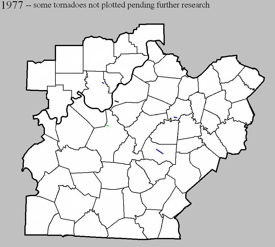
June 30, 1977
Counties: Anderson
F-scale: F1
Deaths: 0
Injuries: 0
Path width: 300 yards
Path length: 1 mile
Time: 8:00pm
Grazulis narrative: Moved east-southeast in the south part of the county. A trailer and two barns were destroyed. A house was damaged.
Noted discrepancies: SPC and NCDC list this as an F1, Grazulis ranks it as an F2. SPC and NCDC place it at 8:00pm, Grazulis and Storm Data at 10:00pm.
October 1, 1977
Counties: Harrison IN
F-scale: F1
Deaths: 1
Injuries: 1
Path width: 40 yards
Path length: 1/2 mile
Time: 7:00am
Grazulis narrative: Moved southeast, hitting a rural mobile home eight miles northeast of Corydon, blowing it apart, killing a man, and scattering debris for almost a mile. The side of a two-story home was torn off.
Noted discrepancies: SPC and NCDC list this as an F1, Grazulis says F2.
October 1, 1977
Counties: Marion
F-scale: F1
Deaths:
Injuries:
Path width:
Path length:
Time: 8:00am
Noted discrepancies: None
October 1, 1977
Counties: Fayette
F-scale: F1
Deaths:
Injuries:
Path width:
Path length:
Time: 8:00am
Noted discrepancies: SPC's beginning lat/lon is in Scott County KY. Cannot plot this tornado without further research.
October 1, 1977
Counties: Hardin
F-scale: F2
Deaths: 0
Injuries: 0
Path width: 30 yards
Path length: 2 miles
Time: 4:00pm
Grazulis narrative: A new brick home was destroyed and the neighboring home was unroofed in a brief touchdown in Radcliff.
Noted discrepancies: SPC and NCDC list this as an F2, Grazulis calls it an F3. SPC and NCDC time it at 4:00pm, Grazulis and Storm Data 6:00pm. SPC, Grazulis, and NCDC list the path width at 30 yards, Storm Data says 1 yard.
Current Hazards
Hazardous Weather Outlook
Storm Prediction Center
Submit a Storm Report
Advisory/Warning Criteria
Radar
Fort Knox
Evansville
Fort Campbell
Nashville
Jackson
Wilmington
Latest Forecasts
El Nino and La Nina
Climate Prediction
Central U.S. Weather Stories
1-Stop Winter Forecast
Aviation
IDSS Forecast Points
Air Quality
Fire Weather
Recreation Forecasts
1-Stop Drought
Event Ready
1-Stop Severe Forecast
Past Weather
Climate Graphs
1-Stop Climate
CoCoRaHS
Local Climate Pages
Tornado History
Past Derby/Oaks/Thunder Weather
Football Weather
Local Information
About the NWS
Forecast Discussion
Items of Interest
Spotter Training
Regional Weather Map
Decision Support Page
Text Products
Science and Technology
Outreach
LMK Warning Area
About Our Office
Station History
Hazardous Weather Outlook
Local Climate Page
Tornado Machine Plans
Weather Enterprise Resources
US Dept of Commerce
National Oceanic and Atmospheric Administration
National Weather Service
Louisville, KY
6201 Theiler Lane
Louisville, KY 40229-1476
502-969-8842
Comments? Questions? Please Contact Us.


 Weather Story
 Weather Map
 Local Radar