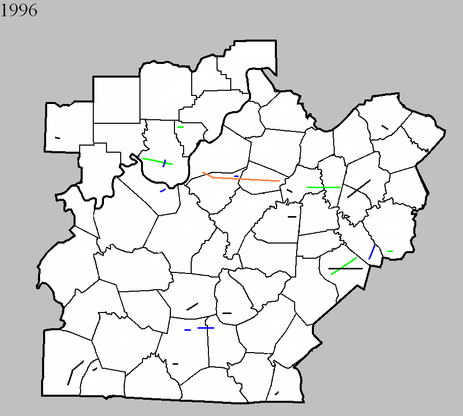
April 20, 1996
Counties: Floyd
F-scale: F2
Deaths:
Injuries:
Path width:
Path length:
Time: 12:08am
Notes: Storm Data mentions damage at the intersection of Georgetown and Greenville roads.
April 20, 1996
Counties: Bullitt
F-scale: F1
Deaths:
Injuries:
Path width:
Path length:
Time: 12:40am
Notes: Storm Data mentions damage in County Trace Estates and on Zoneton Road east of Mount Washington.
April 20, 1996
Counties: Barren
F-scale: F1
Deaths:
Injuries: 4
Path width:
Path length:
Time: 2:30am
Noted discrepancies: None
April 20, 1996
Counties: Barren, Metcalfe
F-scale: F1
Deaths:
Injuries:
Path width:
Path length:
Time: 2:34am
Notes: Storm Data mentions damage at Queens Chapel Church and on KY 314, Spillman Road, and Thurmon-Sexton Road.
April 20 1996
Counties: Green
F-scale: F0
Deaths:
Injuries:
Path width:
Path length:
Time: 2:45am
Notes: Storm Data mentions damage between US 68 and Russell Creek.
April 20, 1996
Counties: Lincoln
F-scale: F2
Deaths:
Injuries: 7
Path width:
Path length:
Time: 3:26am
Notes: Storm Data says this tornado went from near McKinney to Preachersville to near the Garrard County line, damaging the county fairgrounds and Maywood.
April 20, 1996
Counties: Garrard
F-scale: F1
Deaths: 0
Injuries: 0
Path width: 200 yards
Path length: 6 miles
Time: 4:30am to 4:40am EST
Notes: Trees were downed and a dozen barns were destroyed. One farmer lost 6 cows when a barn collapsed on them.
April 20, 1996
Counties: Madison
F-scale: F2
Deaths:
Injuries: 10
Path width:
Path length:
Time: 3:45am
Notes: Storm Data says this tornado touched down on the east side of I-75 at the KY 21 exit. Berea College was damaged.
May 5, 1996
Counties: Washington KY
F-scale: F0
Deaths:
Injuries:
Path width:
Path length:
Time: 12:35pm
Notes: Storm Data says this tornado touched down a mile east of Willisburg.
May 5, 1996
Counties: Meade
F-scale: F1
Deaths:
Injuries: 10
Path width:
Path length:
Time: 4:05pm
Notes: Storm Data says this tornado moved from just north of Ekron to three miles southeast of Brandenburg.
May 28, 1996
Counties: Harrison IN
F-scale: F2
Deaths:
Injuries:
Path width:
Path length:
Time: 3:55pm
Notes: Storm Data says this tornado passed one mile south of New Middletown.
May 28, 1996
Counties: Dubois
F-scale: F0
Deaths:
Injuries:
Path width:
Path length:
Time: 4:40pm
Notes: Storm Data says this tornado struck the south side of Huntingburg.
May 28, 1996
Counties: Jefferson KY, Bullitt, Spencer
F-scale: F4
Deaths:
Injuries: 10
Path width:
Path length:
Time: 4:40pm
Noted discrepancies: NCDC narrative does not match up with the lat/lons given for Jefferson County.
Notes: Storm Data says this tornado formed four miles northwest of Brooks...hit Holsclaw Hill Road...Top Hill Road...near the I-65 Brooks exit...Pioneer Village...Hillview...the Northfield subdivision in Mount Washington...crossed KY 55...passed one and a half miles south of Taylorsville...near Taylorsville Lake Dam...ending just east of Little Mount.
May 28, 1996
Counties: Anderson
F-scale: F0
Deaths:
Injuries:
Path width:
Path length:
Time: 5:53pm
Notes: Storm Data mentions damage two miles southwest of Glensboro.
May 28, 1996
Counties: Anderson, Woodford
F-scale: F2
Deaths:
Injuries: 1
Path width:
Path length:
Time: 6:10pm
Noted discrepancies: SPC has no entry for fatalities...NCDC lists zero...Storm Data lists one.
Notes: Storm Data says this tornado formed near Fox Creek, moving south of Lawrenceburg...along KY 513 near the intersection of the Blue Grass Parkway and US 127...Gilbert's Creek Road...and Lillards Ferry Road in Woodford County.
May 28, 1996
Counties: Barren
F-scale: F0
Deaths:
Injuries:
Path width:
Path length:
Time: 6:15pm
Notes: Storm Data places this tornado in Lucas.
May 28, 1996
Counties: Jessamine, Fayette
F-scale: F0
Deaths:
Injuries:
Path width:
Path length:
Time: 6:42pm
Noted discrepancies: None
May 28, 1996
Counties: Harrison KY
F-scale: F0
Deaths:
Injuries:
Path width:
Path length:
Time: 7:20pm
Noted discrepancies: None
May 28, 1996
Counties: Lincoln
F-scale: F0
Deaths:
Injuries:
Path width:
Path length:
Time: 8:35pm
Notes: Storm Data says this tornado moved from McKinney to Crab Orchard.
June 3, 1996
Counties: Clinton
F-scale: F0
Deaths:
Injuries:
Path width:
Path length:
Time: 8:10pm
Notes: Storm Data puts this tornado at Shipley.
July 21, 1996
Counties: Harrison IN
F-scale: F1
Deaths:
Injuries:
Path width:
Path length:
Time: 2:05pm
Notes: Storm Data puts this tornado four miles south of Corydon.
November 7, 1996
Counties: Logan
F-scale: F0
Deaths: 0
Injuries: 0
Path width: 30 yards
Path length: 10 miles (skipping)
Time: 12:35pm
Notes: This small tornado did $500,000 damage to planes at Logan County Airport. Five planes were destroyed.
November 7, 1996
Counties: Simpson
F-scale: F0
Deaths:
Injuries:
Path width:
Path length:
Time: 12:55pm
Noted discrepancies: Storm Data puts this tornado near Stowers...but can't find a Stowers on any map.
November 7, 1996
Counties: Hart
F-scale: F0
Deaths:
Injuries: 5
Path width:
Path length:
Time: 1:45pm
Notes: Storm Data mentions damage at Horse Cave and Hardyville.


 Weather Story
 Weather Map
 Local Radar