
Strong to severe thunderstorms capable of producing large to very large hail, damaging wind gusts and a few strong tornadoes are likely from the Midwest to the Mid-Atlantic tonight. Moderate Risk (level 4 of 5) of severe thunderstorms is outlooked for the Midwest. A widespread heat wave will peak in the South and East on Friday, with many temperature records expected to be broken. Read More >
January 4, 1997
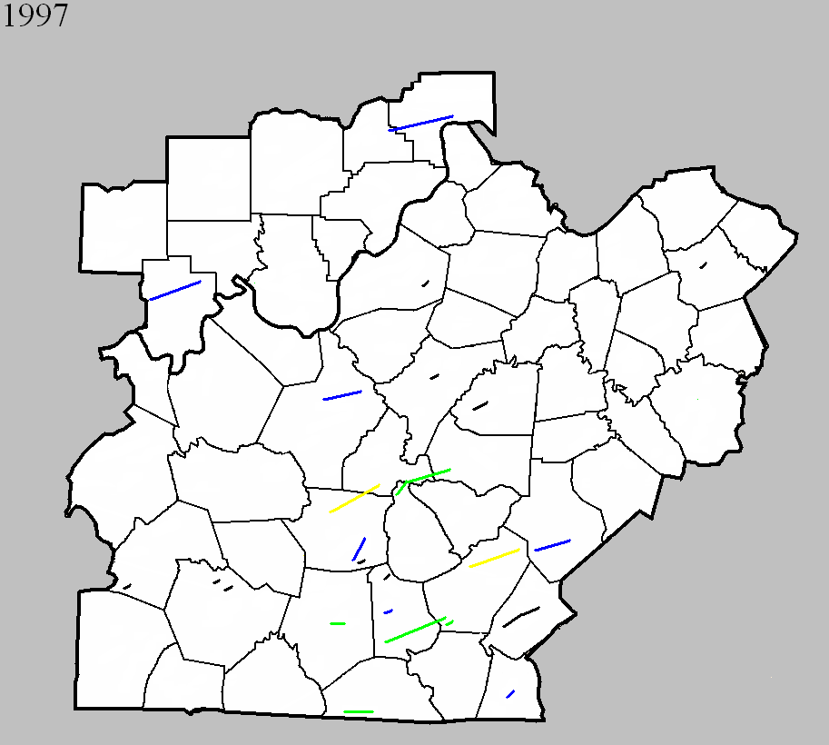
Counties: Clinton
F-scale: F1
Deaths: 1
Injuries: 2
Path width:
Path length:
Time: 10:55pm
Notes: Storm Data mentions damage on KY 1590 half a mile west of Albany.
January 24, 1997
Counties: Barren
F-scale: F2
Deaths:
Injuries: 2
Path width:
Path length:
Time: 5:40pm
Noted discrepancies: Storm Data lists this and the following tornado as one.
Notes: Storm Data says this tornado touched down south of Glasgow and did damage along KY 90.
January 24, 1997
Counties: Metcalfe
F-scale: F1
Deaths:
Injuries:
Path width:
Path length:
Time: 5:50pm
Noted discrepancies: Storm Data lists this and the previous tornado as one.
Notes: Storm Data says this tornado lifted at Wisdom.
March 1, 1997
Counties: Warren
F-scale: F0
Deaths:
Injuries:
Path width:
Path length:
Time: 4:26am
Notes: Storm Data puts this tornado on Garrett Hollow Road.
March 1, 1997
Counties: Monroe
F-scale: F2
Deaths:
Injuries:
Path width:
Path length:
Time: 4:36am
Noted discrepancies: None
March 1, 1997
Counties: Washington KY
F-scale: F0
Deaths:
Injuries:
Path width:
Path length:
Time: 11:59am
Noted discrepancies: Storm Data puts this tornado on Lincoln Park Road.
March 1, 1997
Counties: Hart
F-scale: F1
Deaths:
Injuries:
Path width:
Path length:
Time: 10:00pm
Notes: Storm Data places this tornado near Hardyville.
March 1, 1997
Counties: Metcalfe
F-scale: F0
Deaths:
Injuries:
Path width:
Path length:
Time: 11:25pm
Notes: Storm Data puts this tornado near Center.
March 28, 1997
Counties: Hardin
F-scale: F1
Deaths:
Injuries:
Path width:
Path length:
Time: 5:45pm
Noted discrepancies: Storm Data takes this tornado from Rineyville to Colesburg.
March 28, 1997
Counties: Hart, LaRue
F-scale: F3
Deaths: 1
Injuries: 15
Path width:
Path length:
Time: 6:04pm
Noted discrepancies: SPC/NCDC endpoint lat/lon for this tornado is in LaRue County, and narrative at NCDC includes LaRue County. LaRue County is also included for this tornado at the NCDC website. For this project this tornado was mapped all the way to the SPC/NCDC ending lat/lon in LaRue County. Upon further investigation it appears that this tornado was split into two at SPC. Storm Data says this twister touched down at Bonnieville in Hart County and moved to Magnolia in LaRue County before lifting. Hammonville was struck. The tornado crossed I-65 at Exit 71.
March 28, 1997
Counties: Nelson
F-scale: F0
Deaths:
Injuries:
Path width:
Path length:
Time: 6:15pm
Noted discrepancies: None
March 28, 1997
Counties: Green, LaRue, Marion
F-scale: F2
Deaths:
Injuries:
Path width:
Path length:
Time: 6:25pm
Notes: Storm Data says this tornado touched down in Creal, crossed KY 61, KY 2762, KY 210, entered LaRue County, hit Pleasant Ridge, entered Marion County, dissipating three miles west of Saint Joseph. Cannot find Creal on any map.
March 28, 1997
Counties: Adair
F-scale: F3
Deaths:
Injuries: 7
Path width:
Path length:
Time: 7:15pm
Noted discrepancies: SPC lists the beginning and ending lat/lons as 36.88/-85.72, 37.03/-85.45...NCDC has 37.18/-85.32, 37.22/-85.08. SPC lists a path length of 15 miles...NCDC says 10 miles. The lat/lons and path lengths given here are the mirror image of the lat/lons and path lengths given in the next event.
Notes: Storm Data says this tornado touched down at Cane Valley and lifted around Pellyton.
March 28, 1997
Counties: Metcalfe, Adair
F-scale: F2
Deaths: 1
Injuries: 6
Path width:
Path length:
Time: 7:15pm
Noted discrepancies: SPC has beginning and ending lat/lons as 37.18/-85.32, 37.22/-85.08...NCDC has 36.88/-85.72, 37.03/85.45. SPC has a path length of 10 miles...NCDC says 15 miles. The lat/lon issue and path length issue here are the mirror image of the lat/lon issue and path length issue of the previous tornado. End lat/lon takes this tornado into Adair County, which agrees with NCDC narrative. Will plot into Adair County. Storm Data lists this tornado as having struck both Metcalfe and Adair counties, touching down a mile west of Summer Shade at the intersection of KY 90 and Milam Clark Road, crossing KY 90 and KY 640, KY 163 south of Goodluck, lifting just north of Breeding.
March 28, 1997
Counties: Casey
F-scale: F1
Deaths:
Injuries:
Path width:
Path length:
Time: 7:40pm
Notes: Storm Data places this tornado near Riffe and along a ten mile long path from one mile northwest of Dunnville to Gilpin.
March 28, 1997
Counties: Adair
F-scale: F2
Deaths:
Injuries:
Path width:
Path length:
Time: 7:45pm
Noted discrepancies: None
March 28, 1997
Counties: Scott IN, Jefferson IN
F-scale: F1
Deaths:
Injuries:
Path width:
Path length:
Time: 7:45pm
Noted discrepancies: A straight line between the touchdown lat/lon and liftoff lat/lon would have the tornado scrape the northernmost tip of Trimble County...able to work around it though for plotting.
Notes: Storm Data says this tornado touched down just east of Blocher and traveled to the north side of Madison from Shun Pike to Audubon Pike.
March 28, 1997
Counties: Russell
F-scale: F0
Deaths:
Injuries:
Path width:
Path length:
Time: 7:50pm
Notes: Storm Data touched this tornado down near KY 55 and hits Middletown and Half Acre.
March 28, 1997
Counties: Hart
F-scale: F0
Deaths:
Injuries:
Path width:
Path length:
Time: 10:28pm
Notes: According to Storm Data this tornado touched down near Seymour.
April 30, 1997
Counties: Perry
F-scale: F1
Deaths:
Injuries:
Path width:
Path length:
Time: 8:00pm
Notes: Storm Data says the hardest hit areas were Apalona and Branchville.
June 16, 1997
Counties: Warren
F-scale: F0
Deaths:
Injuries:
Path width:
Path length:
Time: 6:21pm
Notes: Storm Data puts this tornado at Richardsville.
June 16, 1997
Counties: Bourbon
F-scale: F0
Deaths:
Injuries:
Path width:
Path length:
Time: 7:15pm
Noted discrepancies: None
June 17, 1997
Counties: Butler
F-scale: F0
Deaths:
Injuries:
Path width:
Path length:
Time: 7:25pm
Noted discrepancies: None
July 27, 1997
Counties: Jefferson KY
F-scale: F0
Deaths:
Injuries:
Path width:
Path length: 1/2 mile
Time: 7:05pm
Noted discrepancies: SPC's lat/lon do not agree with NCDC's narrative. Plotted according to NCDC's narrative. Storm Data says this tornado touched down just south of the Gene Snyder Freeway two miles south-southeast of Jeffersontown.


 Weather Story
 Weather Map
 Local Radar