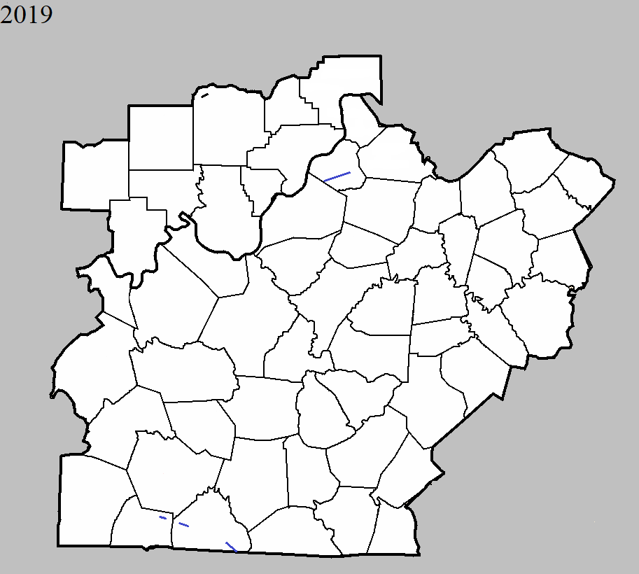
March 14, 2019
County: Washington IN
EF-Scale: EF0
Deaths: 0
Injuries: 0
Path width: 35 yards
Path length: 3 miles
Time: 2:14pm EDT
Notes: Sporadic twisting tree damage was found between Mount Carmel and McKinley towards the White River. The most significant damage was east of McKinley with several healthy trees snapped and twisted. Most of the trees were snapped halfway up indicative of a skipping weak tornado. On Christmas Tree Road a 30 x 30 barn had significant damage south of the main tree damage.
April 12, 2019
County: Oldham
EF-Scale: EF1
Deaths: 0
Injuries: 0
Path width: 300 yards
Path length: 8.3 miles
Time: 6:45am - 6:54am EDT
Notes: The tornado mostly did damage to the upper halves of several trees along its path. There were a couple of areas where it fully descended to the surface and caused more widespread damage. Along Shelburn Dr, a front porch with four columns was lifted, collapsing the columns and throwing the front half of the roof 100 yards to the northeast. The last visible damage was on Georgie Way.
June 21, 2019
County: Simpson
EF-Scale: EF1
Deaths: 0
Injuries: 0
Path width: 75 yards
Path length: 0.6 mile
Time: 7:35pm CDT
Notes: The tornado touched down near I-65 embedded in straight line winds. The tornado hit the Salem Rd area hard with extensive tree damage. A wheat field had distinct circulations quite visible.
June 21, 2019
County: Allen
EF-Scale: EF1
Deaths: 0
Injuries: 0
Path width: 125 yards
Path length: 4.6 mile
Time: 7:39pm CDT
Notes: There was significant straight line wind damage across much of the county facing an easterly and southeasterly direction. Interspersed with the straight line wind damage was at least one tornado in western Allen County north of and paralleling KY 585. The tornado touched down near the Horseshoe Ford Road and Horseshoe Bend Road intersection. There were numerous large hardwood trees split, twisted, and uprooted facing from northerly to southeasterly. Horseshoe Bend Road was closed due to trees down across the road and from flooding. Winds in this area were estimated to be between 90 and 95 mph. Further east along Mayhew Road a large, well-built barn was uplifted and removed from its foundation with several cedar and maple trees twisted and snapped. Across a farmer's field, corn was flattened and twisted in multiple directions. Large, heavy fuel tanks were rolled in two different directions on Mayhew Road. Several barns and outbuildings had roof damage as well. At the Mayhew and Pope Road intersection there was extensive softwood and hardwood tree damage, especially around the Harmony Missionary Baptist Church at 5226 Pope Road. Residents said there was a major pressure change with the tornado. There were indications there may have been more than one tornado as tree positions would go from a tornadic circulation of northeasterly to southeasterly direction and then to all straight line wind damage in an easterly wind direction, then back to a tornadic circulation in multiple directions. The width of the individual circulations varied between 75 and 125 yards with widespread straight line wind damage all around. Most of the wind damage was between 85 and 95 mph. More tree and power line damage was along KY 585 near Shores Road. The tornado dissipated halfway between the intersection of KY 585 and Shores Road and the intersection of Shirk Road and Grider Drive.
June 21, 2019
County: Allen
EF-Scale: EF1
Deaths: 0
Injuries: 0
Path width: 125 yards
Path length: 1.6 mile
Time: 8:04pm CDT
Notes: Interspersed among straight-line wind damage was a tornado that first touched down a half mile east of Amos. A family farm had numerous trees twisted, snapped, and uprooted. Several barns sustained severe structural damage to the roofs. A dozen or so portions of two-by-fours were impaled into the ground in multiple directions. Further southeast on Highland Church Road numerous trees were uprooted and snapped with trees facing from the north northeast to the southeast. The tornado continued to the Tennessee state line. At 2592 Highland Church Road (Highland General Baptist Church) there was significant brick damage on the west, south, and east sides of the church due to open vents.