Louisville, KY
Weather Forecast Office
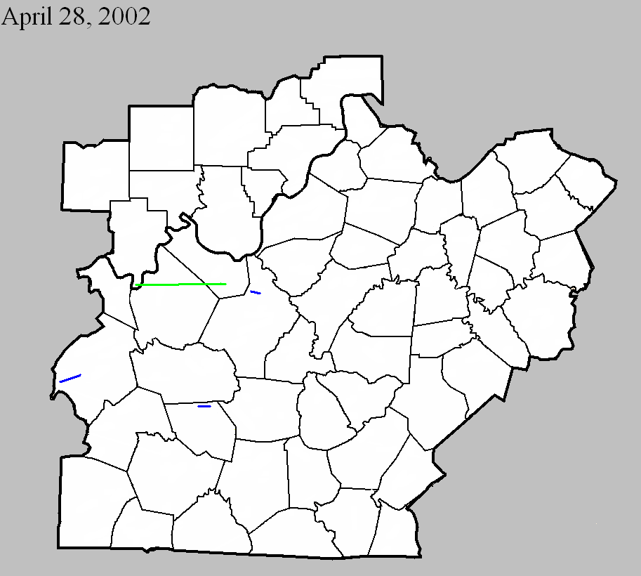
April 28, 2002
Counties: Perry, Breckinridge, Meade
F-scale: F2
Deaths:
Injuries: 7
Path width:
Path length:
Time: 2:05am
Noted discrepancies: SPC lists a path width of 50 yards, NCDC and Storm Data list 150 yards. Storm Data takes this tornado from 3/10 of a mile southwest of Tobinsport to 1.8 miles east northeast of Tobinsport. Storm Data mentions that this tornado crossed into Kentucky from Perry County...hitting Irvington, two miles east northeast of Cloverport, and two and a half miles south of Garrett.
April 28, 2002
Counties: Ohio
F-scale: F1
Deaths:
Injuries:
Path width:
Path length:
Time: 2:40am
Noted discrepancies: SPC lists a path width of 30 yards...NCDC and Storm Data say 100 yards.
Notes: Storm Data takes this tornado from five miles west of Centertown, on Shrull Lane, to Hartford.
April 28, 2002
Counties: Hardin
F-scale: F1
Deaths:
Injuries:
Path width:
Path length:
Time: 2:55am
Noted discrepancies: SPC lists a path width of 20 yards, NCDC and Storm Data says 50 yards.
Notes: Storm Data takes this tornado from two miles west of Radcliff to Radcliff.
April 28, 2002
Counties: Edmonson
F-scale: F1
Deaths:
Injuries:
Path width:
Path length:
Time: 3:35am
Noted discrepancies: SPC lists a path width of 30 yards...NCDC and Storm Data say 100 yards.
Notes: Storm Data takes this tornado from two miles east of Broadway to five miles east of Broadway.
Current Hazards
Hazardous Weather Outlook
Storm Prediction Center
Submit a Storm Report
Advisory/Warning Criteria
Radar
Fort Knox
Evansville
Fort Campbell
Nashville
Jackson
Wilmington
Latest Forecasts
El Nino and La Nina
Climate Prediction
Central U.S. Weather Stories
1-Stop Winter Forecast
Aviation
IDSS Forecast Points
Air Quality
Fire Weather
Recreation Forecasts
1-Stop Drought
Event Ready
1-Stop Severe Forecast
Past Weather
Climate Graphs
1-Stop Climate
CoCoRaHS
Local Climate Pages
Tornado History
Past Derby/Oaks/Thunder Weather
Football Weather
Local Information
About the NWS
Forecast Discussion
Items of Interest
Spotter Training
Regional Weather Map
Decision Support Page
Text Products
Science and Technology
Outreach
LMK Warning Area
About Our Office
Station History
Hazardous Weather Outlook
Local Climate Page
Tornado Machine Plans
Weather Enterprise Resources
US Dept of Commerce
National Oceanic and Atmospheric Administration
National Weather Service
Louisville, KY
6201 Theiler Lane
Louisville, KY 40229-1476
502-969-8842
Comments? Questions? Please Contact Us.


 Weather Story
 Weather Map
 Local Radar