Louisville, KY
Weather Forecast Office
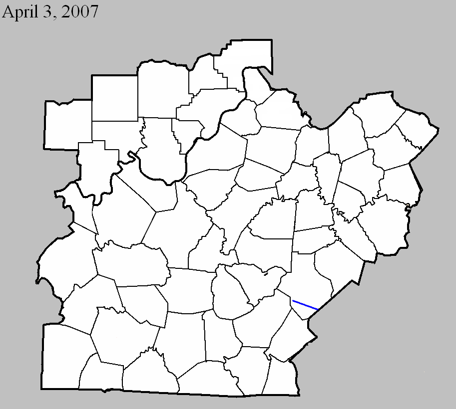
April 3, 2007
County: Taylor
EF-Scale: EF0
Deaths: 0
Injuries: 0
Path width: 25 yards
Path length: 1.3 miles (skipping)
Time: 8:01pm EDT
Notes: This small tornado first destroyed a 2-car garage 0.4 miles south of KY 744 on Smith Chapel School Road. It skipped northeast, damaging trees and two homes. It lifted just north of KY 744. Wind speeds were estimated around 85 mph.
April 3, 2007
Counties: Casey
EF-scale: EF1
Deaths: 0
Injuries: 0
Path width: 200 yards
Path length: 13 miles (skipping)
Time: 8:23pm EDT
Notes: The tornado touched down four miles northwest of Dunnville and skipped along ridgetops to the east-southeast, exiting Casey County at Mintonville. The worst damage, near the upper bound of EF1 around 105 mph, was done to a well-constructed home west of Mintonville.
Current Hazards
Hazardous Weather Outlook
Storm Prediction Center
Submit a Storm Report
Advisory/Warning Criteria
Radar
Fort Knox
Evansville
Fort Campbell
Nashville
Jackson
Wilmington
Latest Forecasts
El Nino and La Nina
Climate Prediction
Central U.S. Weather Stories
1-Stop Winter Forecast
Aviation
IDSS Forecast Points
Air Quality
Fire Weather
Recreation Forecasts
1-Stop Drought
Event Ready
1-Stop Severe Forecast
Past Weather
Climate Graphs
1-Stop Climate
CoCoRaHS
Local Climate Pages
Tornado History
Past Derby/Oaks/Thunder Weather
Football Weather
Local Information
About the NWS
Forecast Discussion
Items of Interest
Spotter Training
Regional Weather Map
Decision Support Page
Text Products
Science and Technology
Outreach
LMK Warning Area
About Our Office
Station History
Hazardous Weather Outlook
Local Climate Page
Tornado Machine Plans
Weather Enterprise Resources
US Dept of Commerce
National Oceanic and Atmospheric Administration
National Weather Service
Louisville, KY
6201 Theiler Lane
Louisville, KY 40229-1476
502-969-8842
Comments? Questions? Please Contact Us.


 Weather Story
 Weather Map
 Local Radar