Louisville, KY
Weather Forecast Office
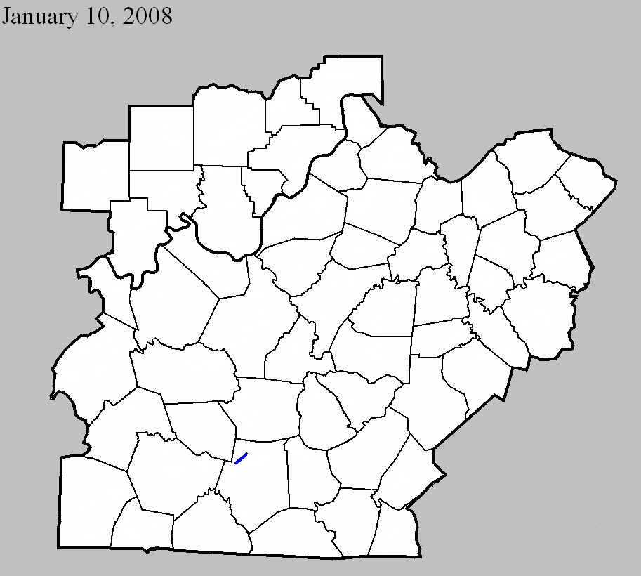
January 10, 2008
Counties: Barren
EF-scale: EF1
Deaths: 0
Injuries: 0
Path width: 350 yards
Path length: 3.1 miles
Time: 2:02pm CST to 2:06pm CST
Notes: The tornado first touched down along Millstown Road southwest of Park City. It uprooted and snapped the trunks of several large trees and did some minor roof damage to a home. The tornado was on the ground intermittently along its path to the south and east of Park City, destroying eight barns and snapping or uprooting several trees. Right before it lifted, it tore the front porch off a home and destroyed a barn.
Current Hazards
Hazardous Weather Outlook
Storm Prediction Center
Submit a Storm Report
Advisory/Warning Criteria
Radar
Fort Knox
Evansville
Fort Campbell
Nashville
Jackson
Wilmington
Latest Forecasts
El Nino and La Nina
Climate Prediction
Central U.S. Weather Stories
1-Stop Winter Forecast
Aviation
IDSS Forecast Points
Air Quality
Fire Weather
Recreation Forecasts
1-Stop Drought
Event Ready
1-Stop Severe Forecast
Past Weather
Climate Graphs
1-Stop Climate
CoCoRaHS
Local Climate Pages
Tornado History
Past Derby/Oaks/Thunder Weather
Football Weather
Local Information
About the NWS
Forecast Discussion
Items of Interest
Spotter Training
Regional Weather Map
Decision Support Page
Text Products
Science and Technology
Outreach
LMK Warning Area
About Our Office
Station History
Hazardous Weather Outlook
Local Climate Page
Tornado Machine Plans
Weather Enterprise Resources
US Dept of Commerce
National Oceanic and Atmospheric Administration
National Weather Service
Louisville, KY
6201 Theiler Lane
Louisville, KY 40229-1476
502-969-8842
Comments? Questions? Please Contact Us.


 Weather Story
 Weather Map
 Local Radar