Louisville, KY
Weather Forecast Office
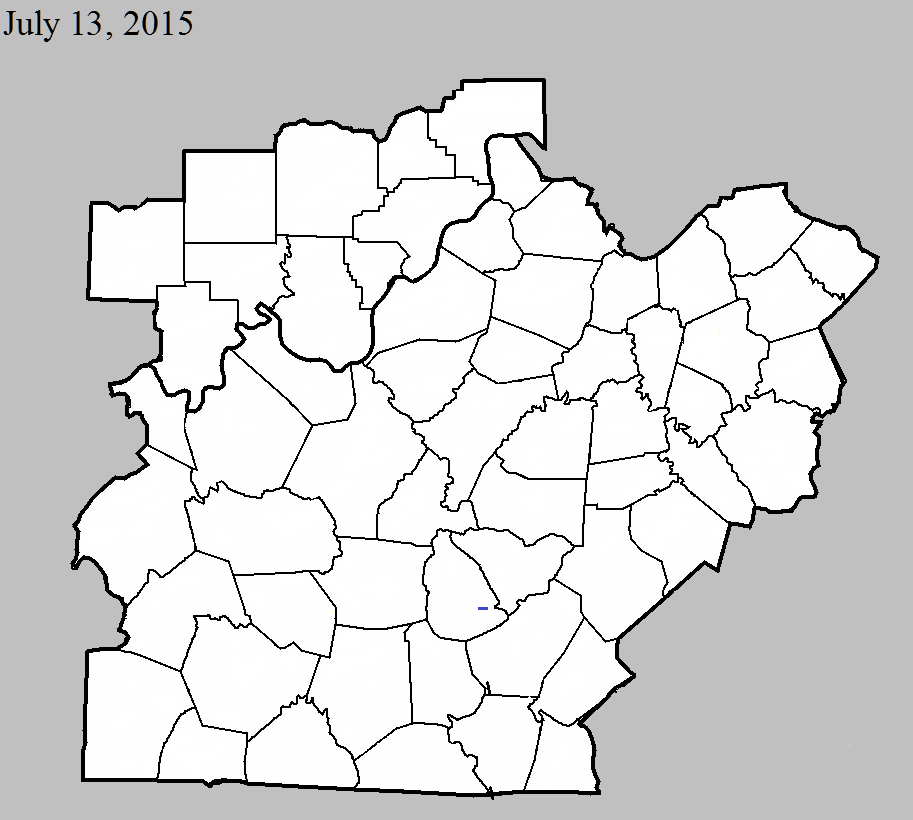
July 13, 2015
County: Green
EF-Scale: EF1
Deaths: 0
Injuries: 0
Path width: 50 yards
Path length: 1.1 miles
Time: 5:20pm - 5:22pm CDT
Notes: The highest winds with this tornado were estimated to have been 95 to 105 mph. The tornado destroyed two barns and one mobile home in addition to doing considerable roof damage to six outbuildings along Ebenezer Road and KY 61 southeast of Greensburg.
July 13, 2015
County: Adair
EF-Scale: EF0
Deaths: 0
Injuries: 0
Path width: 35 yards
Path length: 1.5 miles
Time: 5:58pm - 6:00pm CDT
Notes: This small tornado destroyed one outbuilding in addition to uprooting and snapping limbs on several trees in a very narrow path near the community of Breeding.
July 13, 2015
County: Cumberland
EF-Scale: EF0
Deaths: 0
Injuries: 0
Path width: 100 yards
Path length: 0.7 mile
Time: 6:13pm - 6:15pm CDT
Notes: This small tornado destoryed one outbuilding and tore roof panels off another before crossing the state line into the Pearidge area of Tennessee just west of Dale Hollow Lake.
Current Hazards
Hazardous Weather Outlook
Storm Prediction Center
Submit a Storm Report
Advisory/Warning Criteria
Radar
Fort Knox
Evansville
Fort Campbell
Nashville
Jackson
Wilmington
Latest Forecasts
El Nino and La Nina
Climate Prediction
Central U.S. Weather Stories
1-Stop Winter Forecast
Aviation
IDSS Forecast Points
Air Quality
Fire Weather
Recreation Forecasts
1-Stop Drought
Event Ready
1-Stop Severe Forecast
Past Weather
Climate Graphs
1-Stop Climate
CoCoRaHS
Local Climate Pages
Tornado History
Past Derby/Oaks/Thunder Weather
Football Weather
Local Information
About the NWS
Forecast Discussion
Items of Interest
Spotter Training
Regional Weather Map
Decision Support Page
Text Products
Science and Technology
Outreach
LMK Warning Area
About Our Office
Station History
Hazardous Weather Outlook
Local Climate Page
Tornado Machine Plans
Weather Enterprise Resources
US Dept of Commerce
National Oceanic and Atmospheric Administration
National Weather Service
Louisville, KY
6201 Theiler Lane
Louisville, KY 40229-1476
502-969-8842
Comments? Questions? Please Contact Us.


 Weather Story
 Weather Map
 Local Radar