Louisville, KY
Weather Forecast Office
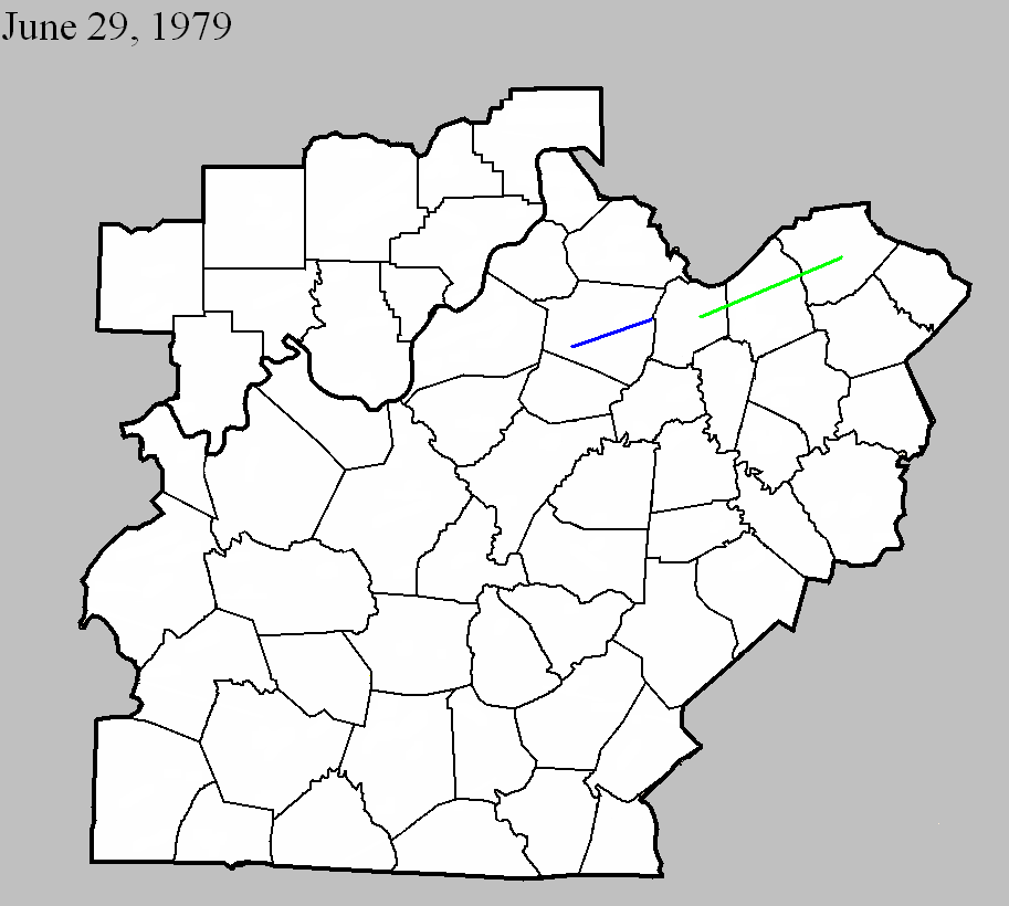
June 29, 1979
Counties: Shelby
F-scale: F1
Deaths:
Injuries:
Path width:
Path length:
Time: 5:35pm
Notes: Storm Data has this tornado touch down at Finchville and end near Bagdad.
June 29, 1979
Counties: Franklin, Scott KY, Harrison KY
F-scale: F2
Deaths:
Injuries: 7
Path width:
Path length:
Time: 6:00pm
Noted discrepancies: SPC and NCDC list this as an F2, Grazulis does not list it. NCDC's county-by-county lat/lons result in a very strange path. Will use more logical SPC lat/lons for plotting. Storm Data has this tornado touch down four miles north of Frankfort and moves it to Georgetown and near Cynthiana. Further research would be good, to confirm this tornado's track.
Current Hazards
Hazardous Weather Outlook
Storm Prediction Center
Submit a Storm Report
Advisory/Warning Criteria
Radar
Fort Knox
Evansville
Fort Campbell
Nashville
Jackson
Wilmington
Latest Forecasts
El Nino and La Nina
Climate Prediction
Central U.S. Weather Stories
1-Stop Winter Forecast
Aviation
IDSS Forecast Points
Air Quality
Fire Weather
Recreation Forecasts
1-Stop Drought
Event Ready
1-Stop Severe Forecast
Past Weather
Climate Graphs
1-Stop Climate
CoCoRaHS
Local Climate Pages
Tornado History
Past Derby/Oaks/Thunder Weather
Football Weather
Local Information
About the NWS
Forecast Discussion
Items of Interest
Spotter Training
Regional Weather Map
Decision Support Page
Text Products
Science and Technology
Outreach
LMK Warning Area
About Our Office
Station History
Hazardous Weather Outlook
Local Climate Page
Tornado Machine Plans
Weather Enterprise Resources
US Dept of Commerce
National Oceanic and Atmospheric Administration
National Weather Service
Louisville, KY
6201 Theiler Lane
Louisville, KY 40229-1476
502-969-8842
Comments? Questions? Please Contact Us.


 Weather Story
 Weather Map
 Local Radar