Louisville, KY
Weather Forecast Office
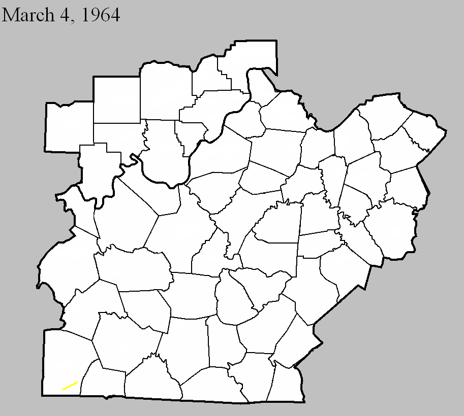
March 4, 1964
Counties: Logan
F-scale: F3
Deaths: 0
Injuries: 5
Path width: 880 yards
Path length: 7 miles
Time: 2:25pm
Grazulis narrative: Moved northeast from two miles west of Adairville to Schochoh. A home was unroofed and tenant homes and barns were destroyed. Livestock was killed and cars and farm machinery were destroyed.
Noted discrepancies: SPC and NCDC gave this an F3, Grazulis gives an F2. SPC and NCDC give a path length of 7 miles, Grazulis and Storm Data give 8 miles. SPC, Storm Data, and NCDC give a path width of 880 yards, Grazulis gives 800 yards. The touchdown lat/lon listed by NCDC and SPC is in Hickman County, and the liftoff lat/lon is in Graves County (far western Kentucky). Grazulis takes the tornado from two miles west of Adairville to Schochoh, which agrees with Storm Data.
Current Hazards
Hazardous Weather Outlook
Storm Prediction Center
Submit a Storm Report
Advisory/Warning Criteria
Radar
Fort Knox
Evansville
Fort Campbell
Nashville
Jackson
Wilmington
Latest Forecasts
El Nino and La Nina
Climate Prediction
Central U.S. Weather Stories
1-Stop Winter Forecast
Aviation
IDSS Forecast Points
Air Quality
Fire Weather
Recreation Forecasts
1-Stop Drought
Event Ready
1-Stop Severe Forecast
Past Weather
Climate Graphs
1-Stop Climate
CoCoRaHS
Local Climate Pages
Tornado History
Past Derby/Oaks/Thunder Weather
Football Weather
Local Information
About the NWS
Forecast Discussion
Items of Interest
Spotter Training
Regional Weather Map
Decision Support Page
Text Products
Science and Technology
Outreach
LMK Warning Area
About Our Office
Station History
Hazardous Weather Outlook
Local Climate Page
Tornado Machine Plans
Weather Enterprise Resources
US Dept of Commerce
National Oceanic and Atmospheric Administration
National Weather Service
Louisville, KY
6201 Theiler Lane
Louisville, KY 40229-1476
502-969-8842
Comments? Questions? Please Contact Us.


 Weather Story
 Weather Map
 Local Radar