Louisville, KY
Weather Forecast Office
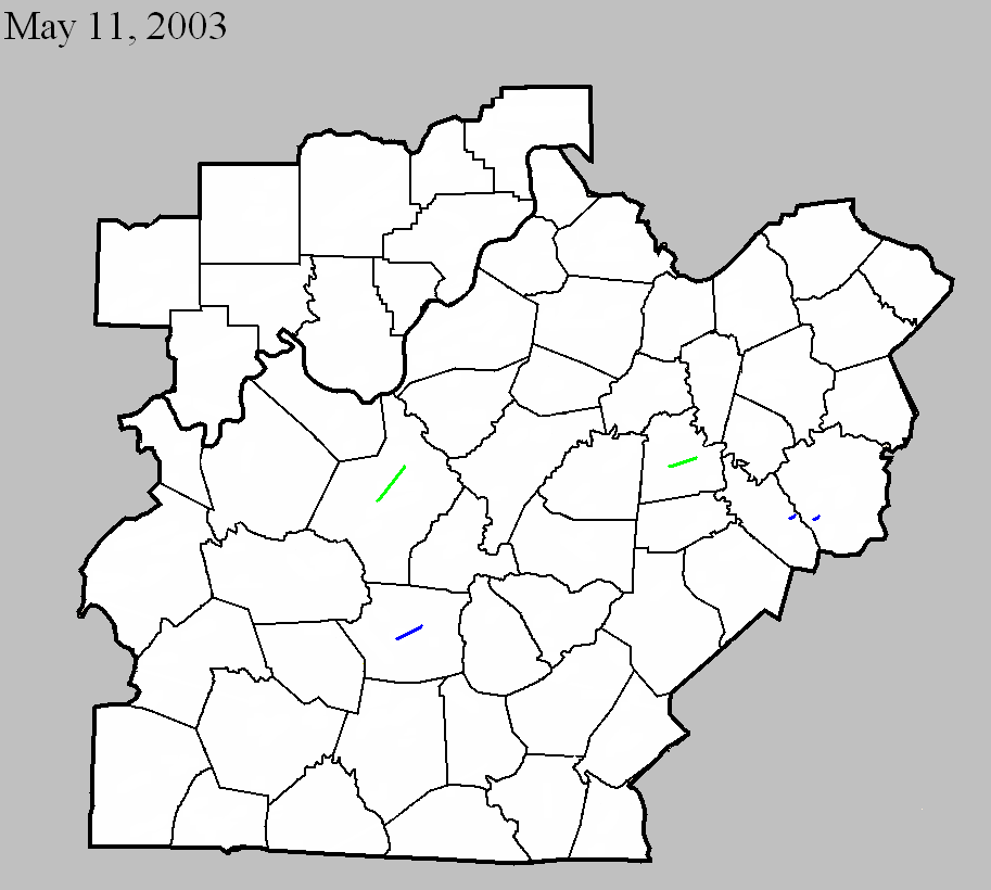
May 11, 2003
Counties: Hardin
F-scale: F2
Deaths:
Injuries: 5
Path width:
Path length:
Time: 3:10am
Notes: Storm Data says this tornado formed three and a half miles southwest of Rineyville on KY 1375, went through Rineyville, and lifted three miles northeast of Rineyville.
May 11, 2003
Counties: Hart
F-scale: F1
Deaths:
Injuries:
Path width:
Path length:
Time: 3:59am
Notes: Storm Data says this tornado touched down on Rowlette Street one mile west southwest of Munfordville and on KY 537, and moved northeast toward Glen Lily one mile east-northeast of Munfordville.
May 11, 2003
Counties: Mercer
F-scale: F2
Deaths: 1
Injuries: 8
Path width:
Path length:
Time: 4:30am
Notes: Storm Data says this tornado formed one and a half miles south southeast of Bohon and moved across Bohon Road near the Salt River, dissipating east of US 127 3.3 miles southeast of McAfee.
May 11, 2003
Counties: Garrard
F-scale: F1
Deaths:
Injuries:
Path width:
Path length:
Time: 5:55am
Notes: Storm Data says this tornado touched down about two miles northwest of Paint Lick near the Madison County line.
May 11, 2003
Counties: Madison
F-scale: F1
Deaths:
Injuries:
Path width:
Path length:
Time: 5:56am
Notes: Storm Data places this tornado two and a half miles west southwest of Happy Landing.
Current Hazards
Hazardous Weather Outlook
Storm Prediction Center
Submit a Storm Report
Advisory/Warning Criteria
Radar
Fort Knox
Evansville
Fort Campbell
Nashville
Jackson
Wilmington
Latest Forecasts
El Nino and La Nina
Climate Prediction
Central U.S. Weather Stories
1-Stop Winter Forecast
Aviation
IDSS Forecast Points
Air Quality
Fire Weather
Recreation Forecasts
1-Stop Drought
Event Ready
1-Stop Severe Forecast
Past Weather
Climate Graphs
1-Stop Climate
CoCoRaHS
Local Climate Pages
Tornado History
Past Derby/Oaks/Thunder Weather
Football Weather
Local Information
About the NWS
Forecast Discussion
Items of Interest
Spotter Training
Regional Weather Map
Decision Support Page
Text Products
Science and Technology
Outreach
LMK Warning Area
About Our Office
Station History
Hazardous Weather Outlook
Local Climate Page
Tornado Machine Plans
Weather Enterprise Resources
US Dept of Commerce
National Oceanic and Atmospheric Administration
National Weather Service
Louisville, KY
6201 Theiler Lane
Louisville, KY 40229-1476
502-969-8842
Comments? Questions? Please Contact Us.


 Weather Story
 Weather Map
 Local Radar