Louisville, KY
Weather Forecast Office
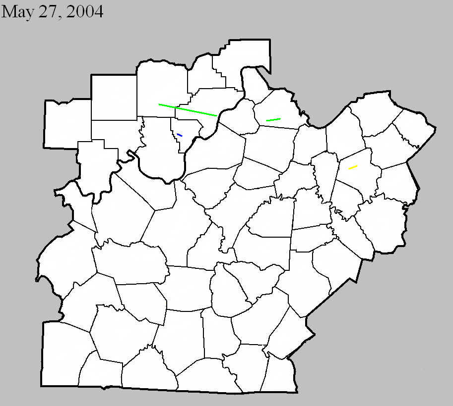
May 27, 2004
Counties: Washington IN, Clark IN
F-scale: F2
Deaths:
Injuries:
Path width:
Path length:
Time: 6:30pm
Notes: Storm Data takes this tornado from 6.3 miles south southwest of Salem, to Pekin, to 1.3 miles southeast of Pekin, to 2.7 miles northwest of Charlestown, to 3.1 miles southeast of Charlestown. Stacy Road and Bethany Road in the Charlestown area received damage.
May 27, 2004
Counties: Henry
F-scale: F2
Deaths:
Injuries: 2
Path width:
Path length:
Time: 6:50pm
Notes: Storm Data takes this tornado from one mile east of Smithfield to five miles east-northeast of Eminence. It crossed KY 55 north of Eminence. It moved between US 421 and Eminence-Point Pleasant Road. It then crossed Sweeney lane.
May 27, 2004
Counties: Floyd
F-scale: F1
Deaths:
Injuries:
Path width:
Path length:
Time: 7:55pm
Notes: Storm Data takes this tornado from half a mile north of Georgetown to 2.8 miles east southeast of Georgetown. It moved nearly parallel to IN 64. It lifted near the IN 64/I-64 interchange, near Edwardsville.
May 27, 2004
Counties: Fayette
F-scale: F3
Deaths:
Injuries: 6
Path width:
Path length:
Time: 9:15pm
Notes: Storm Data takes this tornado from 4.7 miles northeast of the Lexington airport to one and a half miles southeast of Greendale. It touched down on Buck Lane, struck KY 1978, crossed Georgetown Road, and struck near Citation Boulevard.
Current Hazards
Hazardous Weather Outlook
Storm Prediction Center
Submit a Storm Report
Advisory/Warning Criteria
Radar
Fort Knox
Evansville
Fort Campbell
Nashville
Jackson
Wilmington
Latest Forecasts
El Nino and La Nina
Climate Prediction
Central U.S. Weather Stories
1-Stop Winter Forecast
Aviation
IDSS Forecast Points
Air Quality
Fire Weather
Recreation Forecasts
1-Stop Drought
Event Ready
1-Stop Severe Forecast
Past Weather
Climate Graphs
1-Stop Climate
CoCoRaHS
Local Climate Pages
Tornado History
Past Derby/Oaks/Thunder Weather
Football Weather
Local Information
About the NWS
Forecast Discussion
Items of Interest
Spotter Training
Regional Weather Map
Decision Support Page
Text Products
Science and Technology
Outreach
LMK Warning Area
About Our Office
Station History
Hazardous Weather Outlook
Local Climate Page
Tornado Machine Plans
Weather Enterprise Resources
US Dept of Commerce
National Oceanic and Atmospheric Administration
National Weather Service
Louisville, KY
6201 Theiler Lane
Louisville, KY 40229-1476
502-969-8842
Comments? Questions? Please Contact Us.


 Weather Story
 Weather Map
 Local Radar