Louisville, KY
Weather Forecast Office
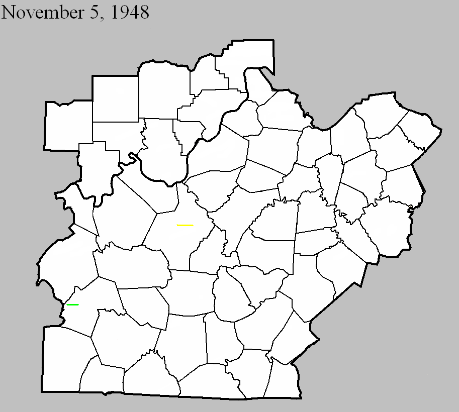
November 5, 1948
Counties: Butler
F-scale: F2
Deaths: 0
Injuries: 0
Path width:
Path length: 3 miles
Time: 4:30am
Narrative: Moved east from near Rochester, unroofing a school and destroying a gym. Farm buildings were destroyed.
November 5, 1948
Counties: Hardin
F-scale: F3
Deaths: 1
Injuries: 2
Path width: 50 yards
Path length: 6 miles
Time: 5:45am
Notes: Wind damage occurred in a five mile wide swath from Howe Valley to three miles east of Elizabethtown. Within this area of high winds, an F3 tornado swept from about two miles northwest of Cecelia to three miles east of Elizabethtown. The worst of the tornado took place at its inception on Bethlehem Academy Road, where a barn was destroyed killing a woman inside. A nearby house was lifted bodily from its foundation, power lines were torn down, and a white leghorn rooster was stripped of its feathers. Trees were blown down in Saint John. Proceeding further to the east, power lines were downed on Old Cecilia Road and a barn was destroyed on Saint John Road three miles west of Elizabethtown. The tornado then weakened considerably, and the only significant damage done in Elizabethtown was power lines getting ripped down on North Dixie Highway. Leaving town, the tornado restrengthened and demolished a barn and a nearby house, and unroofed several homes three miles from Elizabethtown on US 62, where the twister grew to a quarter mile wide. However it dissipated soon thereafter. Straight-line winds tore down trees and power poles and damaged barns at Howe Valley, Franklin Cross Roads, Cecilia, Patterson, Tabb (four miles west of Elizabethtown on US 62), Glendale, Sonora, and on Springfield Road three miles east of Elizabethtown.
Current Hazards
Hazardous Weather Outlook
Storm Prediction Center
Submit a Storm Report
Advisory/Warning Criteria
Radar
Fort Knox
Evansville
Fort Campbell
Nashville
Jackson
Wilmington
Latest Forecasts
El Nino and La Nina
Climate Prediction
Central U.S. Weather Stories
1-Stop Winter Forecast
Aviation
IDSS Forecast Points
Air Quality
Fire Weather
Recreation Forecasts
1-Stop Drought
Event Ready
1-Stop Severe Forecast
Past Weather
Climate Graphs
1-Stop Climate
CoCoRaHS
Local Climate Pages
Tornado History
Past Derby/Oaks/Thunder Weather
Football Weather
Local Information
About the NWS
Forecast Discussion
Items of Interest
Spotter Training
Regional Weather Map
Decision Support Page
Text Products
Science and Technology
Outreach
LMK Warning Area
About Our Office
Station History
Hazardous Weather Outlook
Local Climate Page
Tornado Machine Plans
Weather Enterprise Resources

US Dept of Commerce
National Oceanic and Atmospheric Administration
National Weather Service
Louisville, KY
6201 Theiler Lane
Louisville, KY 40229-1476
502-969-8842
Comments? Questions? Please Contact Us.


 Weather Story
 Weather Map
 Local Radar
 Follow us on X
 Follow us on Facebook
 Follow us on YouTube
 LMK RSS Feed