Louisville, KY
Weather Forecast Office
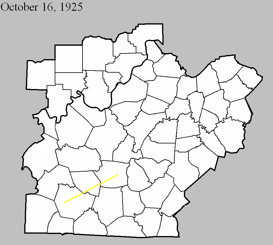
October 16, 1925
Counties: Warren, Edmonson, Hart
F-scale: F3
Deaths: 1
Injuries: 44
Path width: 300 yards
Path length: 45 miles (probably a family of tornadoes)
Time: 4:00pm
Notes: A family of tornadoes and downbursts moved from six miles west of Bowling Green to beyond Munfordville. Homes were wrecked near Kuykendall's Store west of Bowling Green and in Davenport on Barren River Pike. Three houses and four barns were blown into the Barren River at Thomas Landing, injuring ten people. A car was blown off the road, over a fence, and into a field. The vehicle landed on its tires and the driver survived, despite the top half of the car getting sheared off. Additional damage occurred in the Richardsville area. In Edmonson County, barns and a hotel were torn apart near Mammoth Cave National Park, along with the home of a cave tour guide. In Hart County the tornado and its attendant straight-line winds mowed down a path five miles wide. Three people were injured as houses were unroofed and barns destroyed. Canmer and Woodsonville were the hardest struck districts. Seven barns were blown down near Munfordville.
Current Hazards
Hazardous Weather Outlook
Storm Prediction Center
Submit a Storm Report
Advisory/Warning Criteria
Radar
Fort Knox
Evansville
Fort Campbell
Nashville
Jackson
Wilmington
Latest Forecasts
El Nino and La Nina
Climate Prediction
Central U.S. Weather Stories
1-Stop Winter Forecast
Aviation
IDSS Forecast Points
Air Quality
Fire Weather
Recreation Forecasts
1-Stop Drought
Event Ready
1-Stop Severe Forecast
Past Weather
Climate Graphs
1-Stop Climate
CoCoRaHS
Local Climate Pages
Tornado History
Past Derby/Oaks/Thunder Weather
Football Weather
Local Information
About the NWS
Forecast Discussion
Items of Interest
Spotter Training
Regional Weather Map
Decision Support Page
Text Products
Science and Technology
Outreach
LMK Warning Area
About Our Office
Station History
Hazardous Weather Outlook
Local Climate Page
Tornado Machine Plans
Weather Enterprise Resources
US Dept of Commerce
National Oceanic and Atmospheric Administration
National Weather Service
Louisville, KY
6201 Theiler Lane
Louisville, KY 40229-1476
502-969-8842
Comments? Questions? Please Contact Us.


 Weather Story
 Weather Map
 Local Radar